 (photo credit: Cherokee County Conservation)
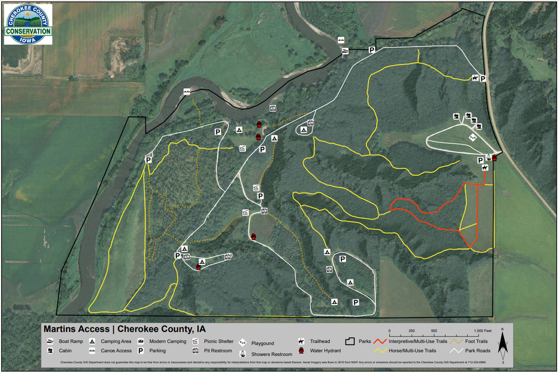
Martin's Access
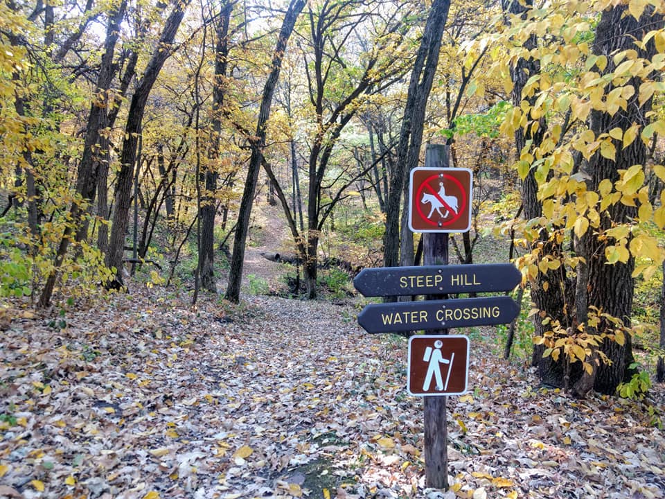
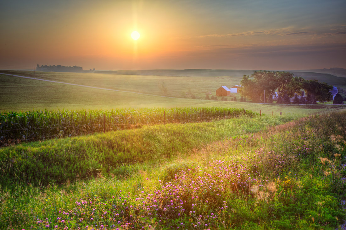
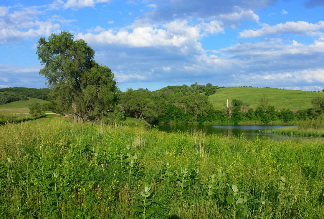
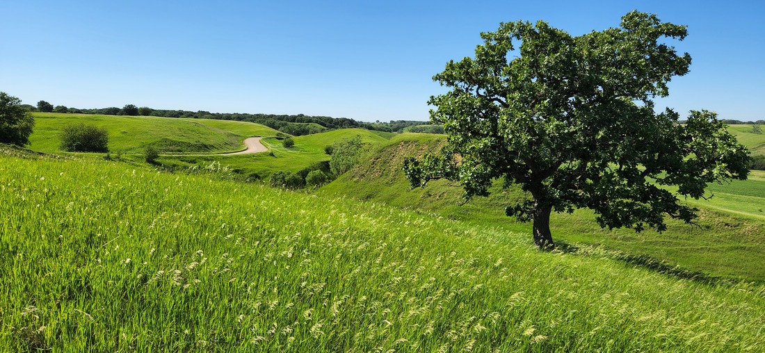
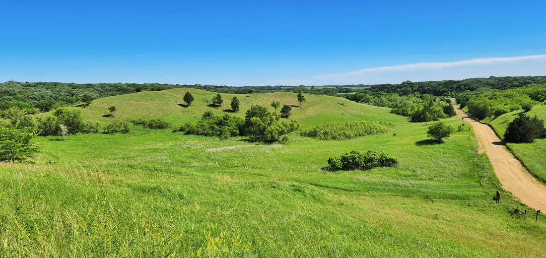
Martin Area consists of 300 acres of beautiful river valley habitat in northeastern Cherokee County, just off the Glacial Trail Scenic Byway. The trails wind through woodlands and prairies, crossing small streams, and bringing hikers and riders near to the banks of the Little Sioux River. Enjoy beautiful views and the quiet of birdsong and the wind in the trees. 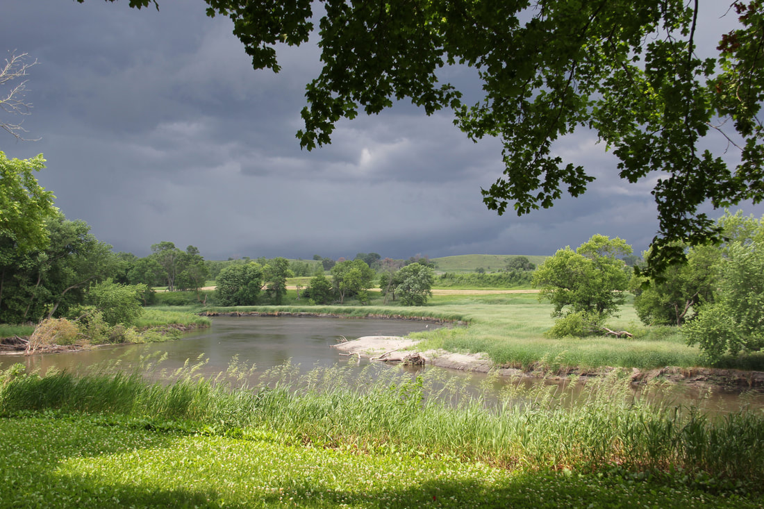 Little Sioux River from Martin's Access Silver Sioux Recreation Area
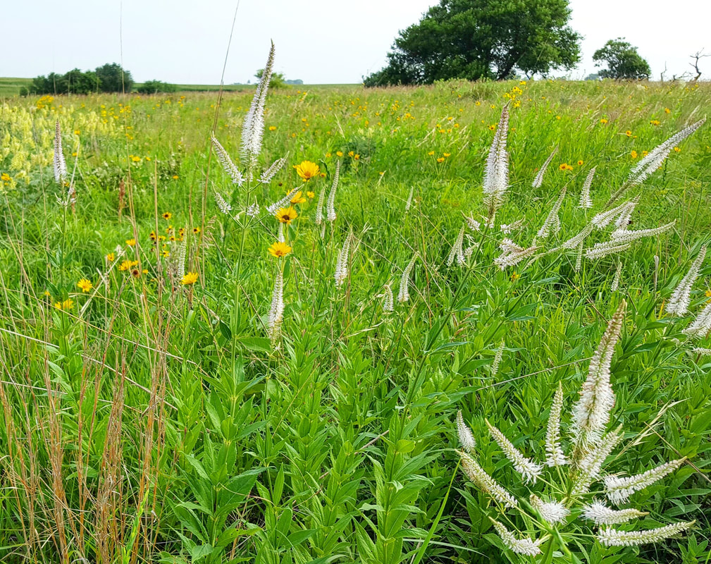
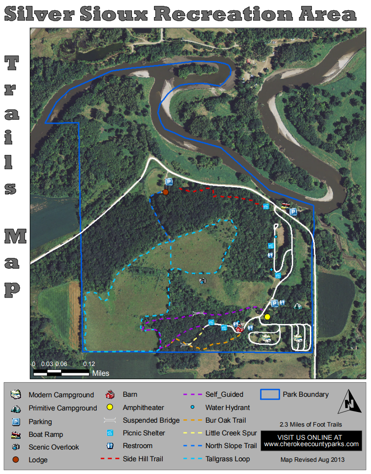
With 3 miles of trails, you can easily get enthralled within the beauty of the woodland and prairies. You will see wildlife, wildflowers, mushrooms, and more! Travel over our 2 swinging bridges and peek over the edge at the creek running below you!  Photo credit: Watchable Wildlife of Northwest Iowa River Road Conservation Area
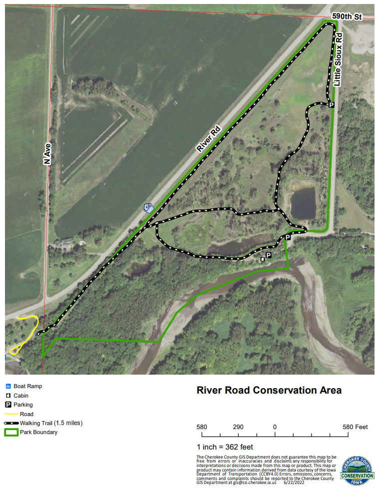
 Rental cabin at River Road Conservation Area Redtail Ridge Habitat Area
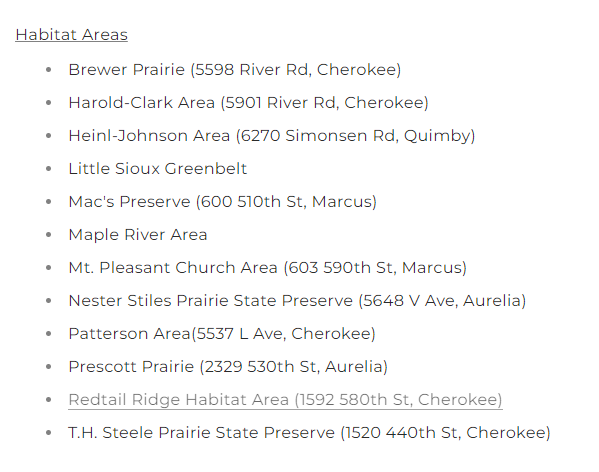
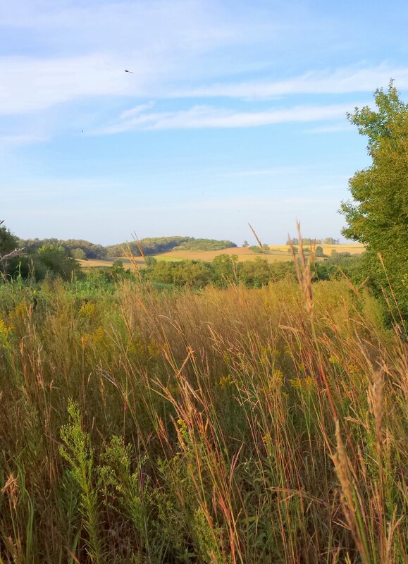
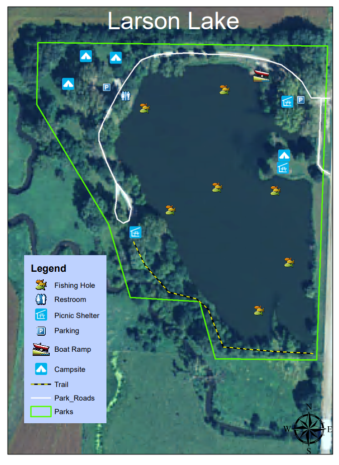
Approximately 1 mile of trails are mowed and maintained at Red Tail Ridge. The trails are popular among birdwatchers, hikers and cross-country skiers. The northern portion of the area is a former gravel pit containing small, shallow wetlands and grasslands that provide excellent pheasant hunting. The remainder of the area is flood plain timber, containing many silver maples, cottonwoods and walnut trees, and upland timber, mostly oak-hickory forest with hackberry and elm. Several small prairie and savanna remnants are found near the ridge top on the eastern boundary. Trail access is only available off of the C44 parking area. Parking is available off of C44 and 585th St. Larson Lake
  Hiking the Byways is a regular series by Golden Hills RC&D that features publicly accessible lands open to hiking on the three scenic byways in western Iowa that Golden Hills RC&D coordinates: Glacial Trail Scenic Byway, Loess Hills National Scenic Byway, and Western Skies Scenic Byway. Each Friday a blog post covers hiking areas in one county on one of the aforementioned byways. For questions about hiking on the byways, contact Seth Brooks ([email protected]).
0 Comments
 Parkway Park in Avoca When cities are being designed, one of the primary things they ensure to make space for is city parks. From small parks the size of just a couple of blocks to large ones that cover acres of land, city planners know the importance of providing green areas for people to go. National Take a Walk in the Park Day celebrates these small excursions and the differences they can make to our mental, physical, and emotional health. Walking is one of the best exercises to strengthen your heart. Daily walks help keep joints healthy, our muscles limber, and our hearts beating steadily. Getting out into nature has also been proven to have a number of therapeutic effects on those who take the time to do it. Stress levels go down, body and mind is refreshed, creativity gets inspired, and walking has even been shown to boast productivity at work.  When should you take a walk? Any time of day is great for a walk, but research has shown that walking in the morning has numerous benefits that improve your metabolism for the entire day. Where should you take a walk? Keep it simple and find the nearest park in your town or city. Taking a walk at a local park is an excellent way to clear one’s mind from the stresses of the day, re-energize, and at the same time, improve health. You don't need to go on a three-mile hike, either. 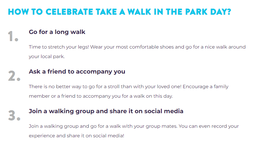 If you have got your favorite park or one close to your home, number one is easy to accomplish. Finding a friend to walk with you is a great way to keep you motivated to stick to a regular walking routine. Additionally, join a walking group to meet new people, stay motivated, and encourage others to join you. If your local community does not have a walking group, create your own! Social media is a great way to connect with locals and build your walking group. Search Google, Facebook, and other platforms to see if there is a walking group in your neighborhood, town, or county. 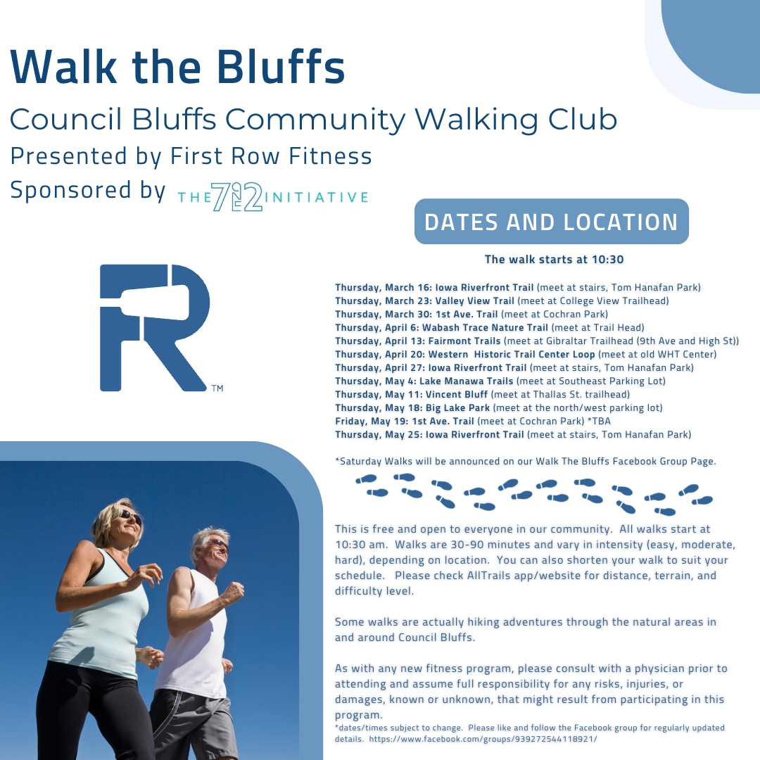 Click the image above to open the Facebook page for the Walk the Bluffs group If there isn't a group in your community, just get out and enjoy a walk to benefit your physical, emotional, and mental health. Who knows, maybe you'll meet a new friend!
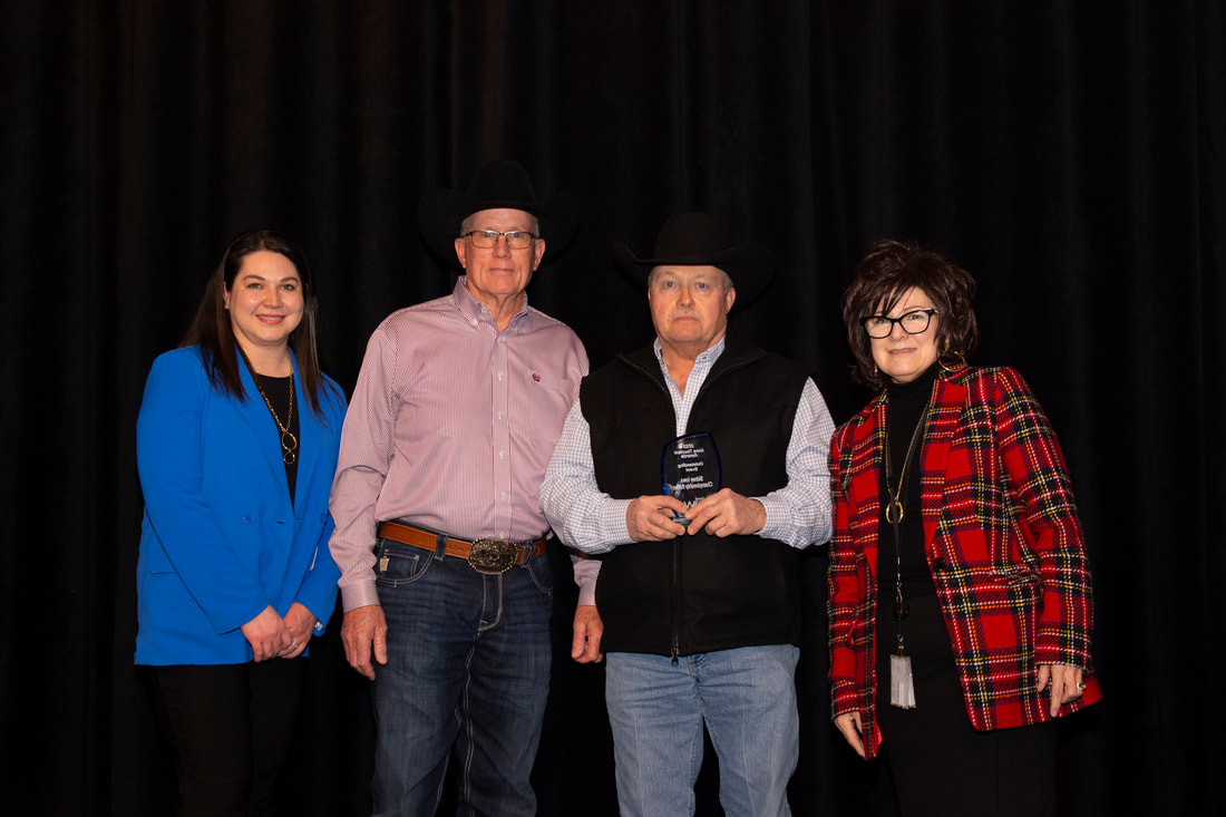 From left: Amy Ziegler, Iowa Tourism Director; Vince Hilton and David Magel, Sidney Iowa Championship Rodeo; Debi Durham, IEDA Director The award kicks off a historic year for the Sidney Iowa Championship Rodeo. In 2023, the Sidney Rodeo is gearing up to celebrate its 100th anniversary and their continued dedication to tourism in southwest Iowa makes it deserving of this award. The Sidney Iowa Championship Rodeo has been cultivating tourism in southwest Iowa since well before tourism was recognized as an official industry in the state. In 1923, the Tackett brothers returned from Wyoming and decided to entertain visitors attending the Old Soldiers Reunion in Sidney. To show them some real western action, a circle was formed with Model T cars and makeshift fencing and Henry and Earl Tackett were up and away on the fastest bad horses they could find. They received the sum of $50 and more bruises than they could count. The Sidney American Legion Post 128 quickly assumed sponsorship of this exciting sport and made it an annual event open to the public with a small grandstand and no admission charge. They went each year to South Dakota to buy bucking broncs, and bulls were bought from Texas and Mexico. Several quarter horses were owned by the Legion and kept in Sidney all year. Within five years attendance grew so much that a small admission was added, a larger grandstand built, professional cowboys began to compete, and some trick riders and animal acts were added. Early rodeos included the appearance of Indian tribesmen in full native dress, sometimes from the Rosebud Reservation in South Dakota. In 1931, lights were added to the arena to allow for the addition of night shows. After 1952, the livestock was brought in by professional contractors, who furnished top-grade stock to work at each performance.  Today, the Sidney facility boasts plenty of parking, new pens and gates, hospital facilities, concessions, covered concrete grandstands, a flea market, carnival, parade, and musical entertainment after the weekend performances. Sidney’s population of 1,070 regularly hosts 15,000 to 20,000 visitors during the five days of Sidney Iowa Rodeo. Attendance counts have been up to 38,000, which ranks in the top 12% of the nearly 650 rodeos approved by the Professional Rodeo Cowboys Association. Events are added throughout rodeo week to captivate the attention of vistitors and engage residents. The Rodeo Queen Contest, Rodeo Parade, and Rodeo Days activities on the square Specialty acts delight audiences between bucking and bull riding competition and the girls barrel racing event.
In 1996, the Sidney Rodeo was declared an official Iowa Sesquicentennial event with the Friday afternoon performance being dedicated to that celebration of 150 years of statehood. The “Iowa Voyager” trailer, containing historical Iowa memorabilia, was on display in Sidney during Rodeo week. On its 75th anniversary year, the Sidney Iowa Rodeo was selected as the 1997 PRCA National Finals, Small Outdoor Rodeo of the Year. The Sidney Rodeo was honored to be a part of the 2015 induction class for the Pro Rodeo Hall of Fame, when it was referred to as being "among the oldest and most prestigious PRCA events on the schedule." The Sidney Rodeo is located in Fremont County, the southwest cornerstone of Iowa, and anchor of the southern end of the Loess Hills National Scenic Byway. 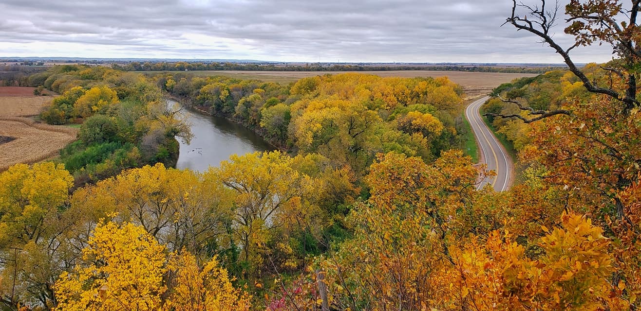
Stone State Park (photo by Lance Brisbois)
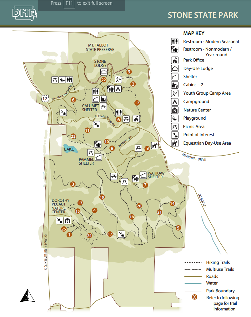
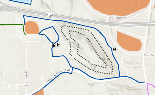
The Carolyn Benne Nature Trail details the natural history of the area on an interpretive walk through the park and features one of the best scenic views in the park. The popular Tunnel Trail gets its name from a tunnel that runs underneath the park road. Buffalo Run Trail leads to Dakota Point Overlook, aptly named with views of South Dakota to the west. Another viewpoint, Elk Point, has excellent views of the southern half of the park.
The trails in the southern half are more rugged and wild as they do not cross park roads or enter campgrounds. Perhaps the best trail in the park, Mt. Lucia, leads to a viewpoint at the southern end of Stone State Park. You can connect with trails leading to Dorothy Pecaut Nature Center at the overlook. The trails in the southern half are your best bet for a slice of woodland wander that is easily accessible due to its proximity to Sioux City and Interstate 29.
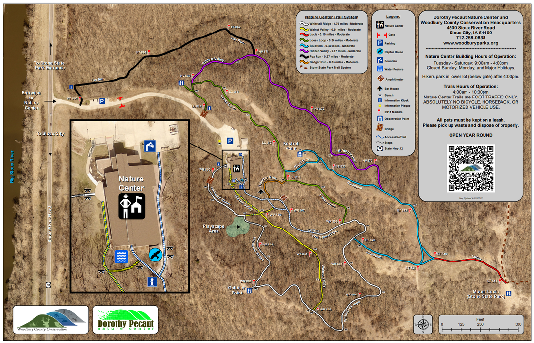
Hike a trail and let prairie grasses tickle your chin. Explore bur oak forests with 150-year old giants. Climb the ridges and imagine what Lewis and Clark might have seen. The 2.5 miles of trails explore prairie ridges and woodlands. A section of Whitetail Ridge Trail is accessible for people with mobility difficulties. Hikers park in lower lot (below gate) after 4:00pm. Trails are open year-round from 4:30 AM to 10:00 PM.
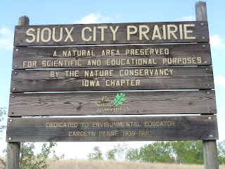
Sioux City Prairie is one of the nation’s largest native prairie tracts found in an urban setting. An area uniquely and delicately balanced between the city and the wild, it allows visitors an escape from city life by immersing themselves in a tallgrass prairie.
Sioux City Prairie is a TNC-owned 150-acre tallgrass prairie preserve. The prairie and wooded valleys of this well-drained, high-relief landscape support a variety of plants and animals typically found further west in the Great Plains. The preserve also supports a diverse population of birds and it provides critical habitat for many species of prairie butterflies.
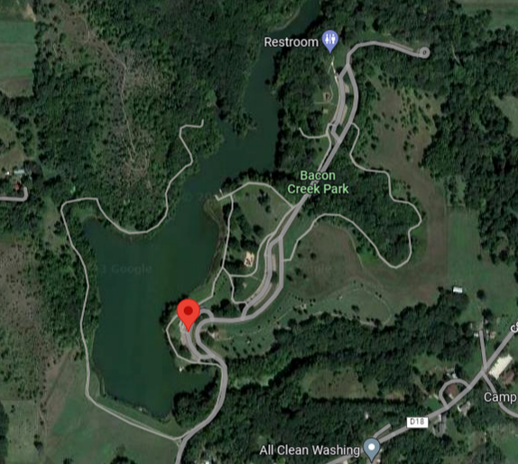
Enjoy a 2-mile trail loop that extends through Cone Park and Sertoma Park. For more trails in Sioux City visit the Parks and Recreation Trail Page, or call Parks and Recreation at (712) 279-6126. Off shoot trails offer non-paved hiking trails.
Trails of the area take the visitor through a variety of habitats. A self-guided nature trail brochure is available at the trail head. Numerous bluebird boxes have been erected in the area and visitors may catch a glimpse of the brilliant blue birds.
Park facilities are open May 1 through October 31. 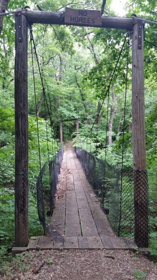
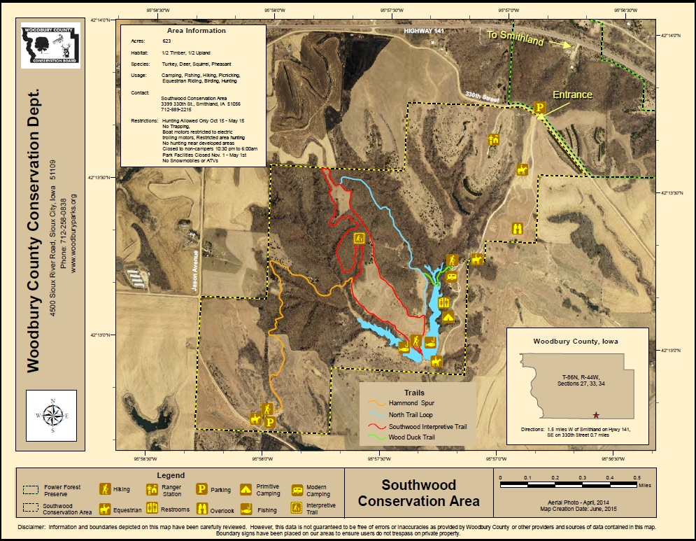
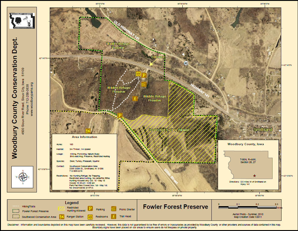
Located one-half mile west of Smithland on Hwy 141 near the Southwood Conservation Area, this 160 acre area is a perfect spot for a picnic or a walk through the woods. Park facilities are open and pressurized water systems are available May 1 through October 31.
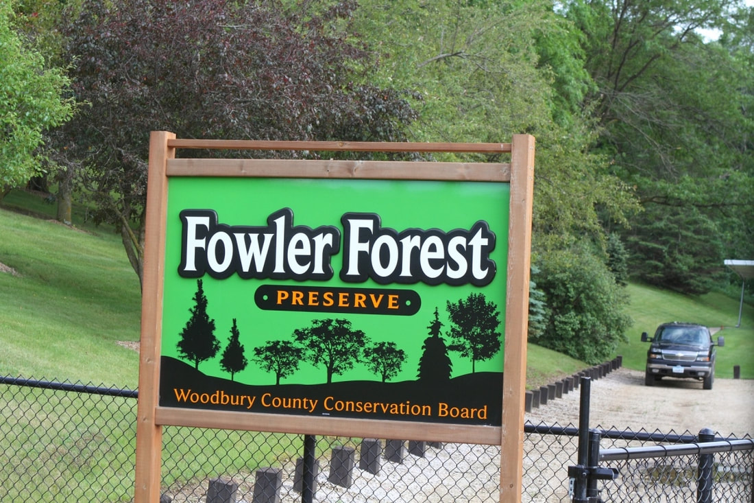
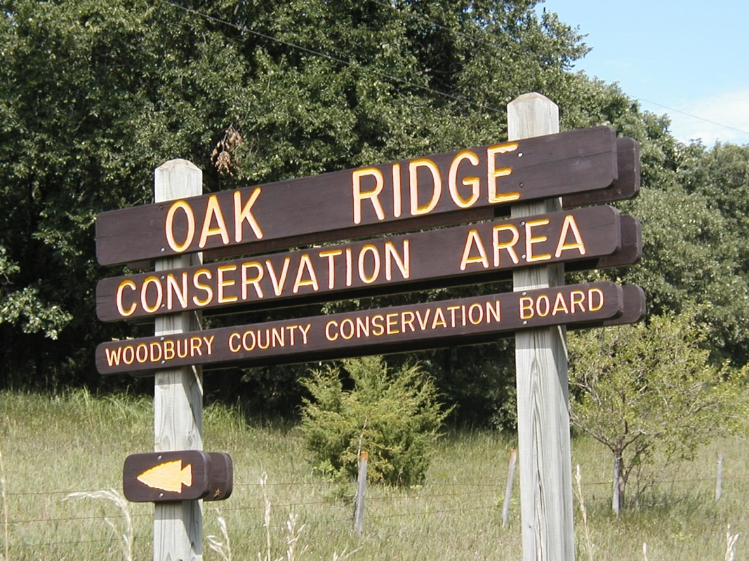
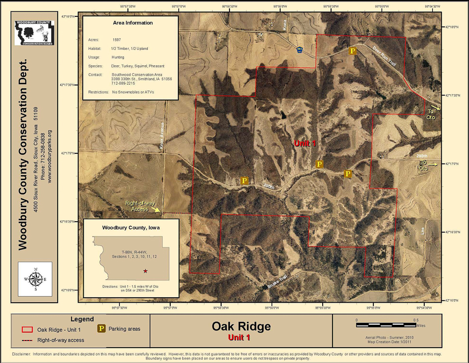
Encompassing more than 2,082 acres of public land in the hills adjacent to the Little Sioux River Valley, Oak Ridge is divided into four units with six public parking accesses between Oto and Smithland. This natural, undeveloped area is available for hiking and public hunting.
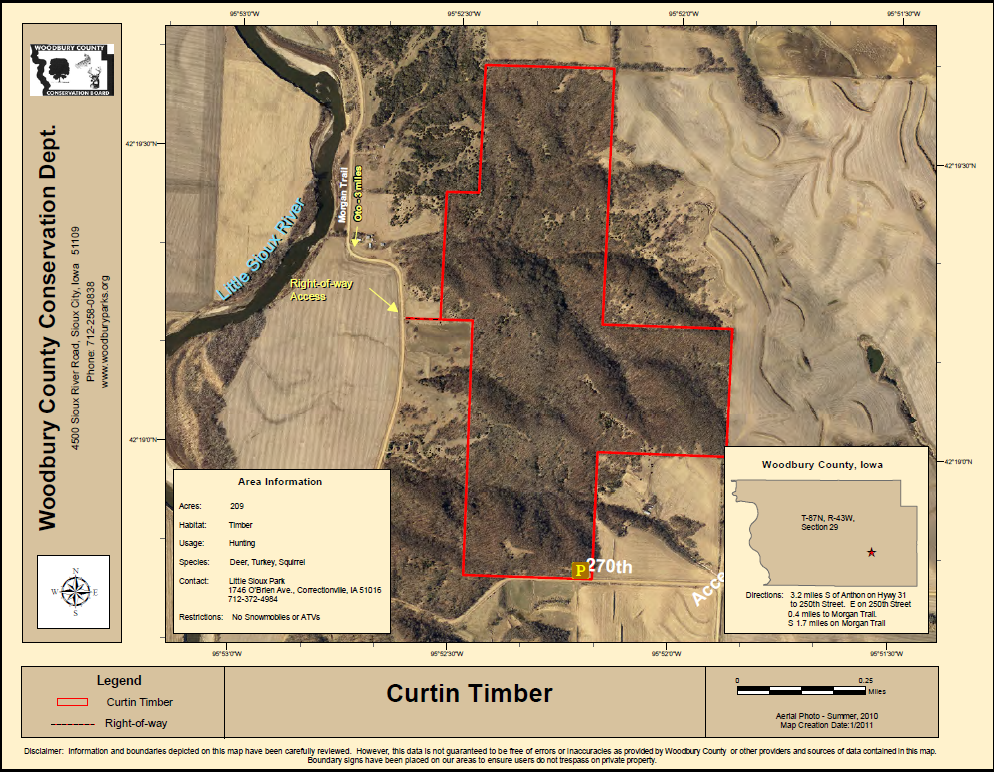
This 210-acre area is located four miles southeast of Anthon. It is an undeveloped public wildlife area for hiking and hunting. Wildlife and wildflowers are abundant.
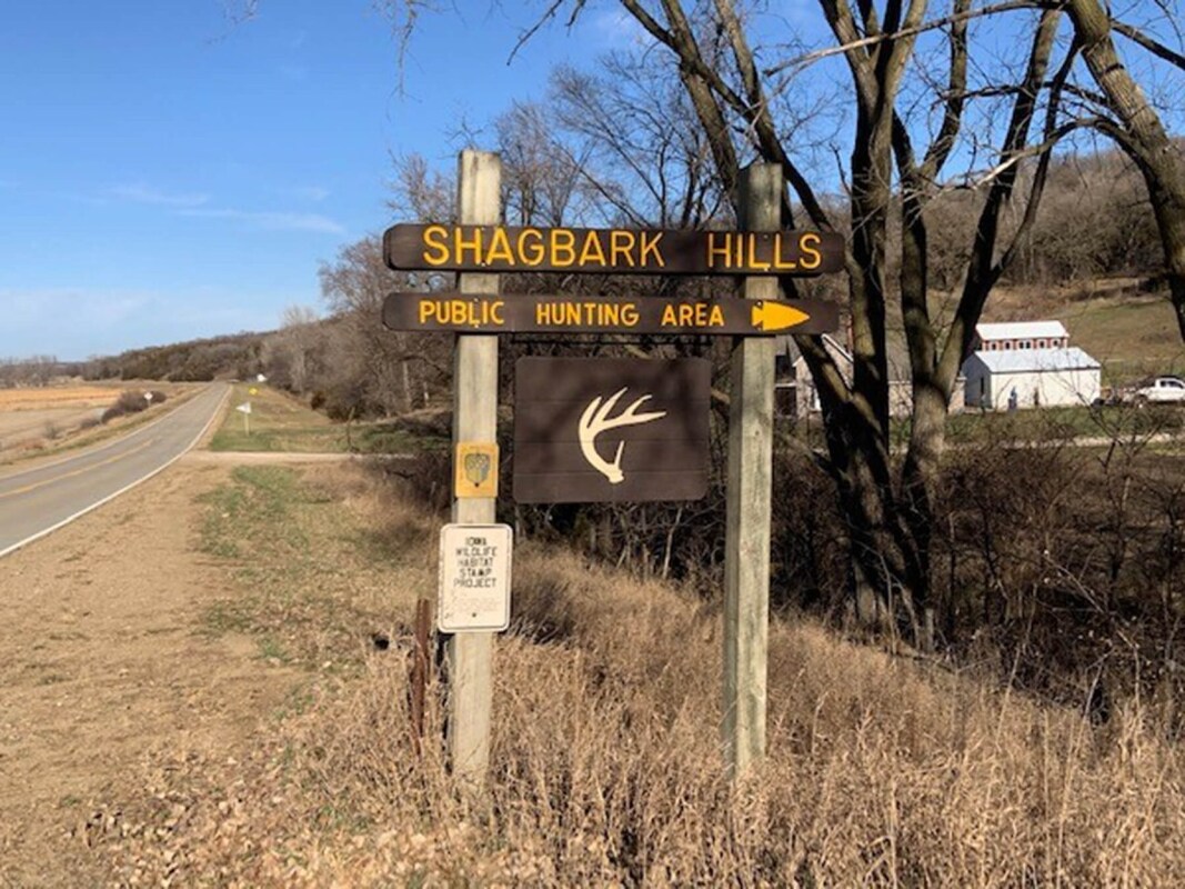
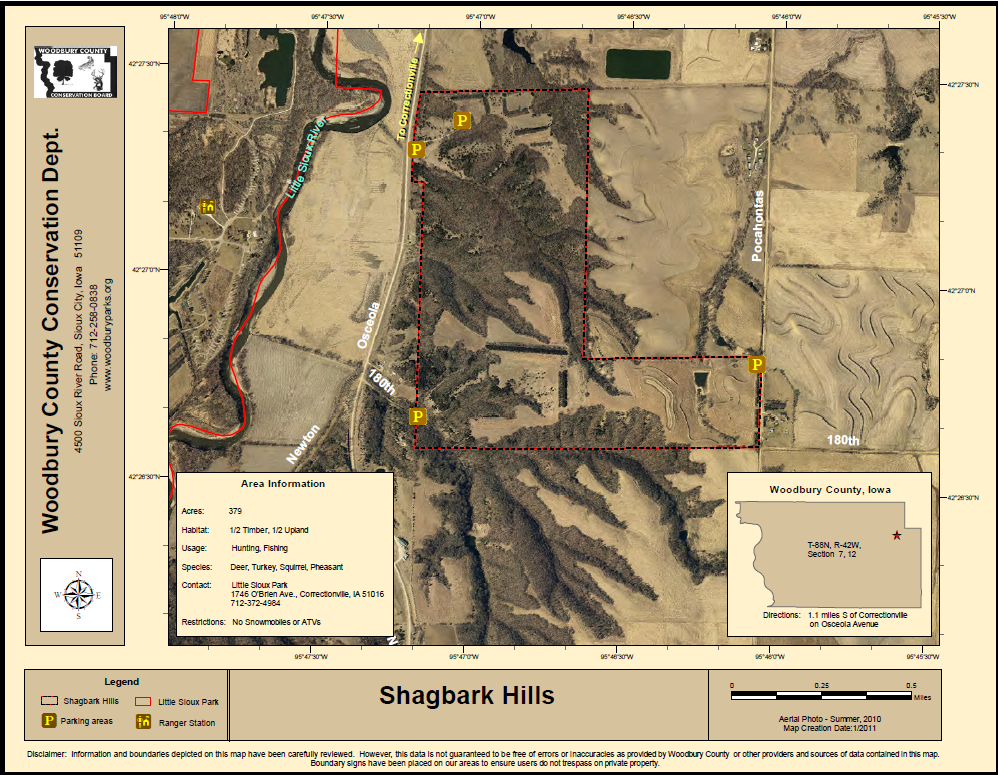
Shagbark Hills was acquired in 1976 for wildlife habitat. The area contains a native stand of shagbark hickory trees unique to the area. The undeveloped 379-acre area is located one-half mile south of Correctionville and is open for hiking and public hunting.
Hiking the Byways is a regular series by Golden Hills RC&D that features publicly accessible lands open to hiking on the three scenic byways in western Iowa that Golden Hills RC&D coordinates: Glacial Trail Scenic Byway, Loess Hills National Scenic Byway, and Western Skies Scenic Byway. Each Friday a blog post covers hiking areas in one county on one of the aforementioned byways. For questions about hiking on the byways, contact Seth Brooks ([email protected]).

National Ag Day kicks off National Ag Week, celebrated in 2023 from the 21st to the 27th of March. The week celebrates and acknowledges the agricultural industry and the role it plays in stabilizing the economy.
Agriculture plays a vital role in western Iowa. Not only is agriculture the engine of western Iowa's economy, it has shaped its landforms, and organized our communities. Western Iowa would not be what it is today without agriculture. Ag's footprint on western Iowa is seen all along its scenic byways: grain silos and semi-trucks full of grain, terraced fields and center pivot irrigation, and even the Loess Hills that were never ploughed because of their steep grade. There are numerous ways that you can show your support for agriculture in western Iowa, not only on National Ag Day or National Ag Week, but throughout the entire year. Agritourism is increasing in popular and is a great way to support your local agricultural industry. 
The National Agricultural Law Center defines agritourism as, "the crossroads of tourism and agriculture. Stated more technically, agritourism can be defined as a form of commercial enterprise that links agricultural production and/or processing with tourism to attract visitors onto a farm, ranch, or other agricultural business for the purposes of entertaining and/or educating the visitors while generating income for the farm, ranch, or business owner."
There are many forms of agritourism: pumpkin picking patches; corn mazes, U-Pick operations, petting and feeding zoos, hay rides, cut-your-own Christmas tree farms;, dude ranches, demonstration farms, agricultural museums, living history farms, on-farm farmers’ markets, winery tours and wine tasting, rural bed & breakfasts, garden tours, and more. While we could compile a lengthy list of all the agritourism attractions and activities on western Iowa's scenic byways, below is a truncated list of some notable agritourism destinations. If you have any questions about local agriculture and agritourism in western Iowa, send us an email ([email protected]). Local Foods
Iowans are surrounded by fertile farmland, yet most of the food consumed in the state travels an average of 1,500 miles before landing on a dinner plate. Golden Hills strives to improve the southwest Iowa foodshed by building and maintaining alliances between regional producers and consumers. These alliances are further supported by raising awareness among southwest Iowans about the food that is available in this region.
Golden Hills convenes the Southwest Iowa Food and Farm Initiative (SWIFFI), a multi-county coalition of individuals and organizations within the local food system. Golden Hills provides training, assists in navigating regulations, helps with grant writing, and offers other forms of support. The assistance provided by Golden Hills helps make local food more accessible to those living in southwest Iowa. The benefits of an active and local foodshed are felt by all involved. Revitalization of rural communities by boosting local economic development and improving the health of its citizens are just a few examples of the benefits of an active local foods system. Golden Hills organizes farmer meet-ups to meet local food producers for networking and socializing. Check the SWIFFI website for upcoming meet-ups and other programs. Farmers Markets & Festivals
Golden Hills maintains a Local Food Guide that is available in both English and Spanish. The guide highlights farmers markets, food hubs and local food delivery, and local farms and value-added farm products. Purchasing produce from farmers markets is an excellent way to support local agriculture, as is signing up for CSAs and supporting your local food hubs and food delivery services.
Audubon Century Farm Tour
Get out and see real farms that are a century old. The Audubon Century Farm Tour is a self-driving tour of eight of Audubon County's century farms. A brochure, with a map included, is available at the county tourism office (800 Market St, Audubon, IA 50025). Private tours are available upon request.
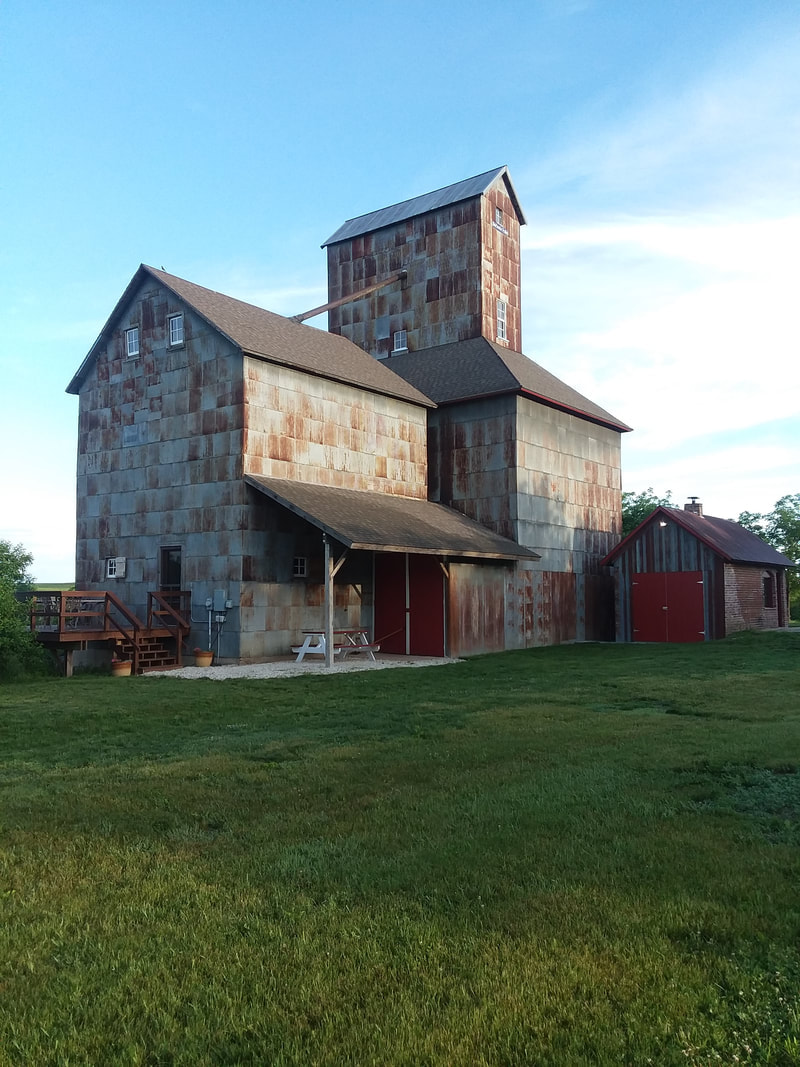
Ross Grain Elevator
Shelby County Historical Museum
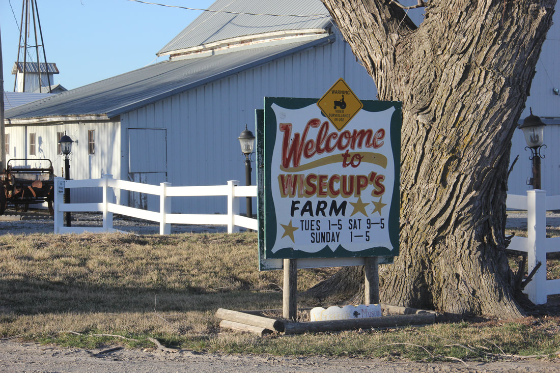
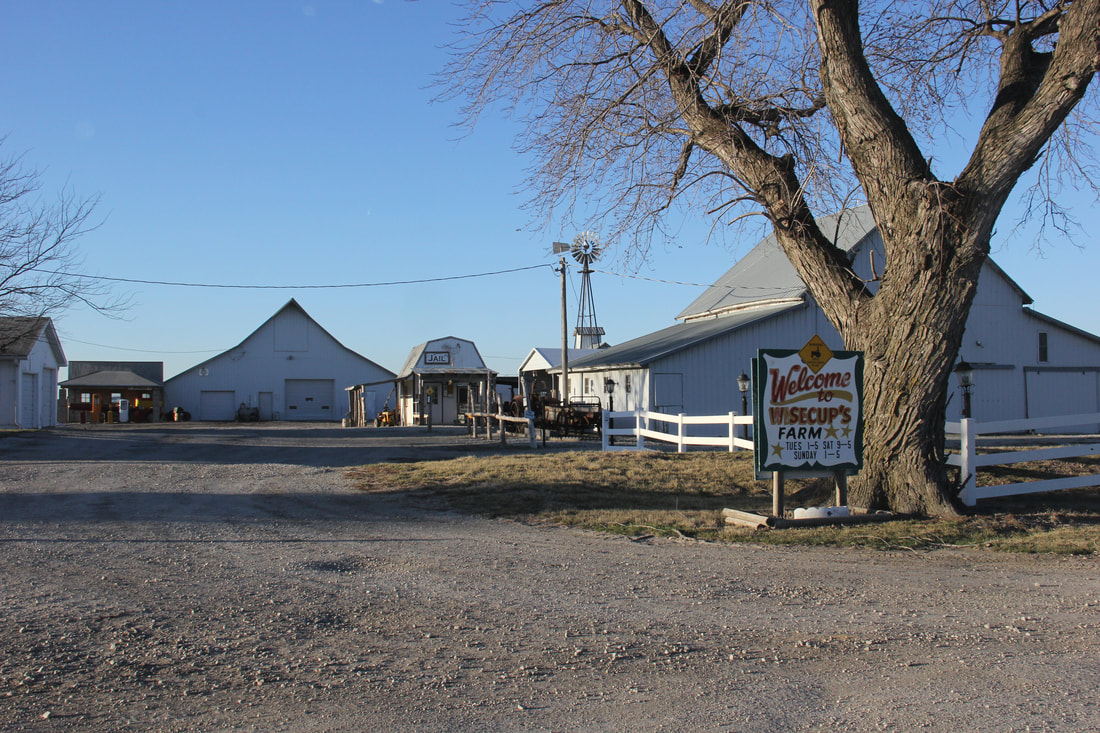
Wisecup Farm Museum
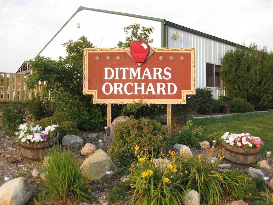
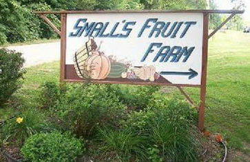
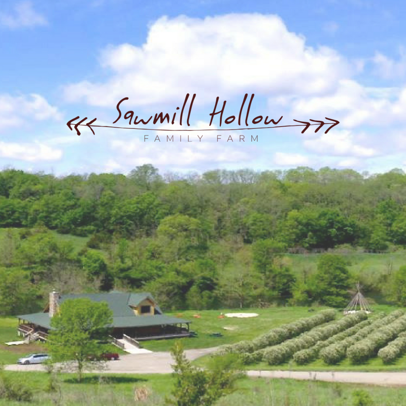
Local Orchards, Fruit Farms, Family Farms, etc.
The list above is just a sampling of the agritourism attractions and activities in western Iowa. For a more detailed list of farmers markets and local producers and farms, check out our Local Food Guide.
Western Skies Scenic Byway between Harlan and Woodbine (photo © 2016 Kenneth West)
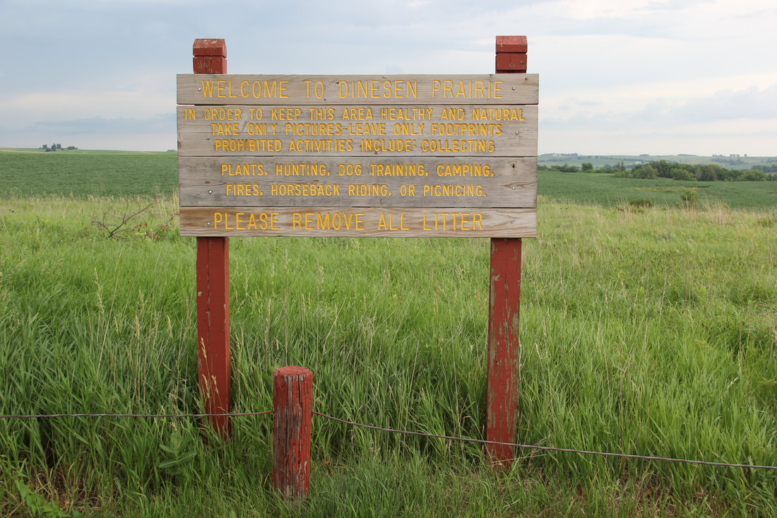
Derald W. Dinesen Prairie is a 20-acre remnant of native tallgrass prairie. It is located six miles northeast of Harlan in northeastern Shelby County. Derald Dinesen purchased the area in 1943, realizing that the Iowa prairie was nearly a thing of the past. It was dedicated in 1977 as a biological state preserve. He told reporters at the dedication, “I guess the reason I set aside the land was based on instinct. The instinct to leave something behind for posterity of what you believe in. I just wanted to see and have others see the beauty of the land as it existed years ago when the Indians roamed [the land].”
Dinesen Prairie State Preserve
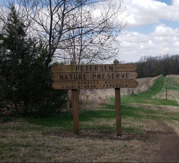
The Elkhorn Creek Recreation Area is a multiple use area, and is the ideal setting for a family on an outing, or for a person looking for solitude. With it's groomed trails and unique wildlife, the adventures are never ending. The upper picnic area contains what is believed to be the original site of the pioneer village of Elk Horn. Many building foundation blocks remain to mark the site. Petersen Preserve is roughly 32 acres and also part of the park; it has many grass walking trails.
Elkhorn Creek Recreation Area
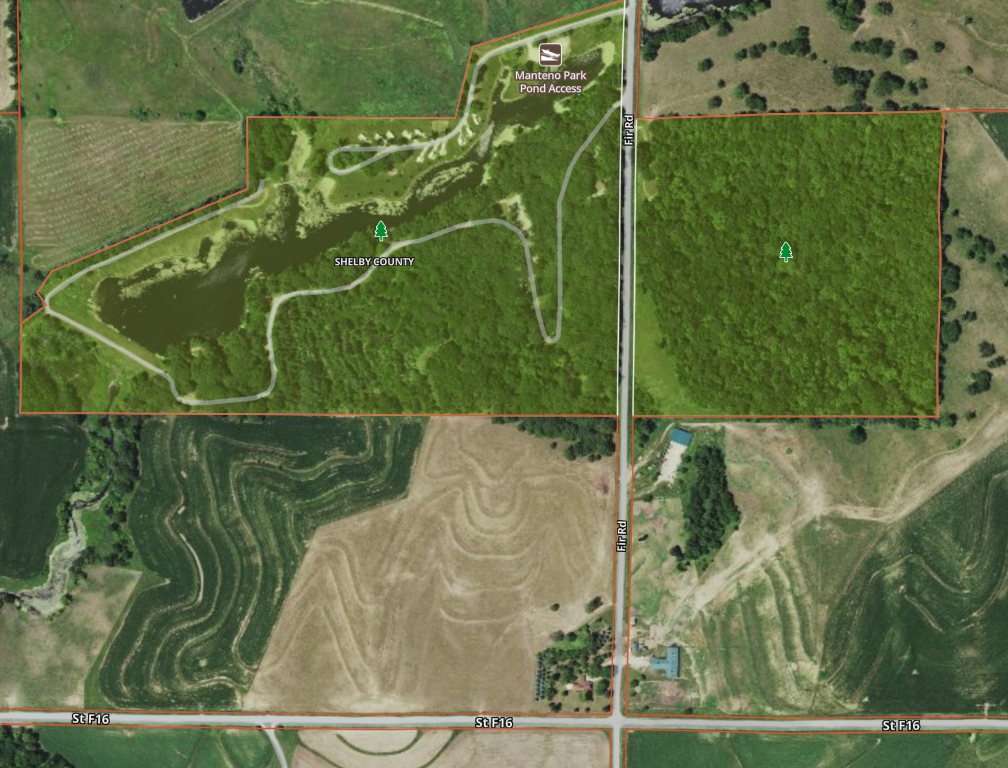
Set in the hills of Grove township is Manteno Park, Shelby County Conservation Board's most popular area. Located northwest of Earling, it contains a 12-acre lake and includes hiking trails. Manteno is known for its shaded picnic areas and calm atmosphere. A 40-acre tract of timber adjacent to the park was purchased in 1994 and made into a nature area.
Manteno Park
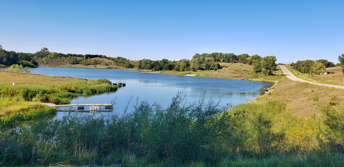
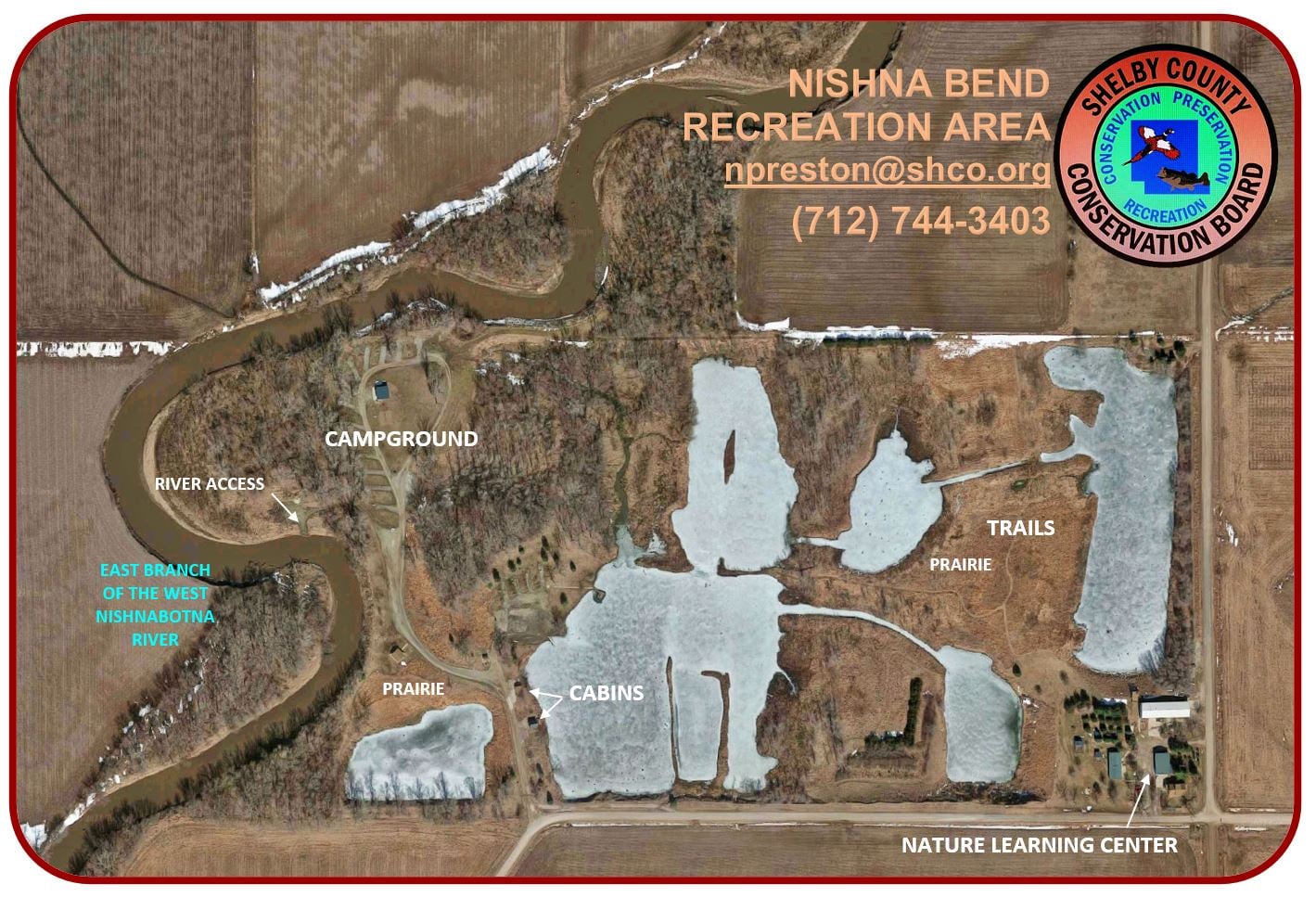
The 80-acre Nishna Bend Recreation Area contains over 30 acres of wetland created from past gravel mining operations and is located southeast of Corley. Its acquisition was partially funded with grants from Duck Unlimited and Pheasants Forever. The ponds left from past mining operations contain bass, crappie, catfish, bluegill and bullhead to delight any angler. The other features include camping, a camping cabin, hiking trails, river access, an arboretum, a planting of tall grass, shortgrass prairie with many species of wildflowers, and a nature learning center.
Nishna Bend Recreation Area
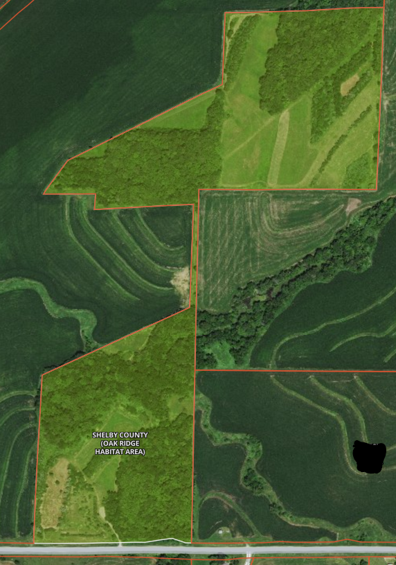
Oak Ridge Habitat Area
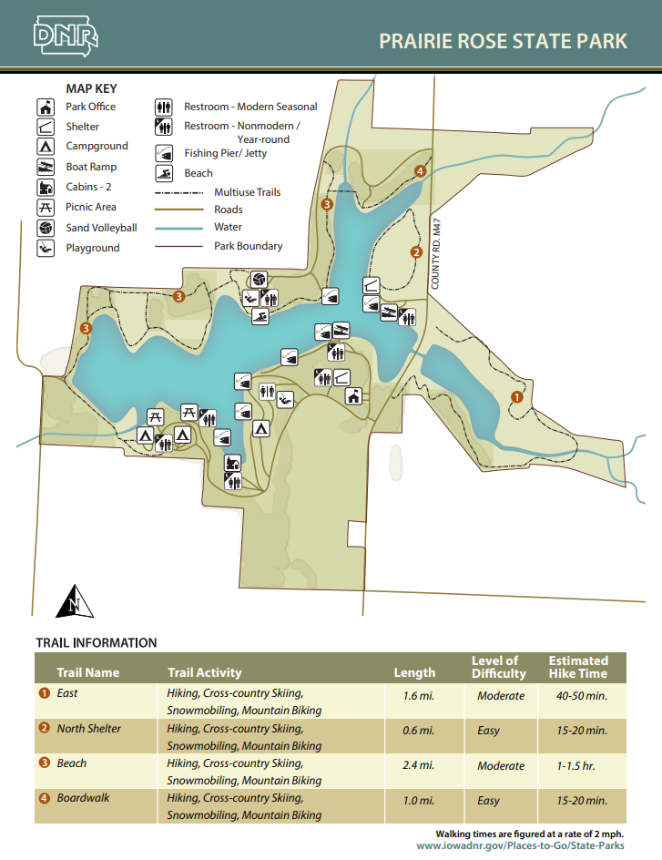
Approximately 7 miles of trails weave throughout the park. All the trails are open for hiking, biking, snowmobiling and cross-country skiing. An interpretive trail starts in the northwest corner of the park and winds along the shoreline. The trails are great places to observe a variety of plants and wildlife. There are several areas of restored prairie along the trails.
Prairie Rose State Park
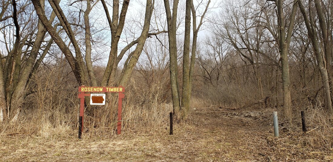
Rosenow Timber
Manager: Shelby CCB Location: 41.810704, -95.498675 Acres: 120 Trails: No Camping: No Amenities: None Dogs: Yes, just no interfering with nesting birds in May-June. Hunting: Yes
Rosenow Timber is owned by the Iowa Department of Natural Resources and managed by the Shelby County Conservation Board. This 120 acres of virgin timber is a public hunting area that abounds with deer, turkey, squirrels, and many woodland plants.
Six Bee Tree Timber
Manager: Shelby CCB Location: 41.855796, -95.459858 Acres: 40 Trails: Mowed trails Camping: No Amenities: None Dogs: Yes, just no interfering with nesting birds in May-June. Hunting: Yes Six Bee Tree Timber is 40 acres of timber located directly across the road to the east of Manteno Park. This is a public hunting area that is archery only allowed with a mowed trail loop going through it.
Upper Nish Habitat Area
Manager: Shelby CCB Location: 41.801018, -95.189460 Acres: 18 Trails: Mowed trails Camping: No Amenities: None Dogs: Yes, just no interfering with nesting birds in May-June. Hunting: Yes Upper Nish is approximately 3 miles of old railroad right of way that starts just 1/2 mile northeast of Irwin and is open to public hiking and hunting.
Hiking the Byways is a regular series by Golden Hills RC&D that features publicly accessible lands open to hiking on the three scenic byways in western Iowa that Golden Hills RC&D coordinates: Glacial Trail Scenic Byway, Loess Hills National Scenic Byway, and Western Skies Scenic Byway. Each Friday a blog post covers hiking areas in one county on one of the aforementioned byways. For questions about hiking on the byways, contact Seth Brooks ([email protected]).
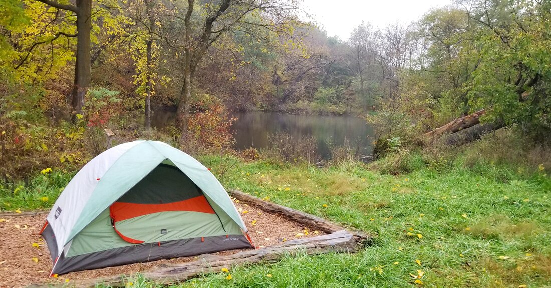
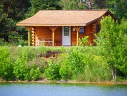
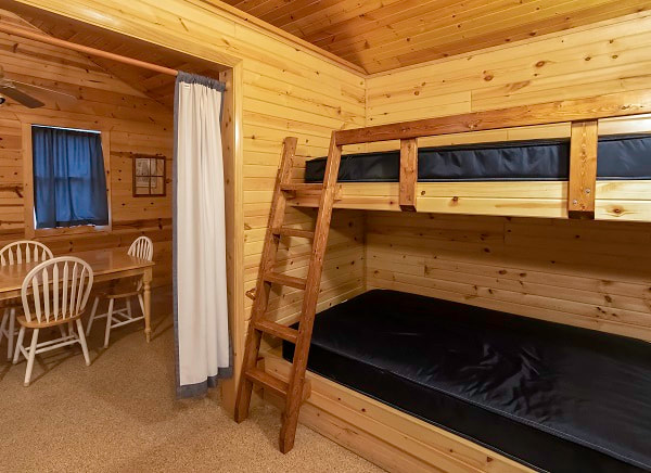
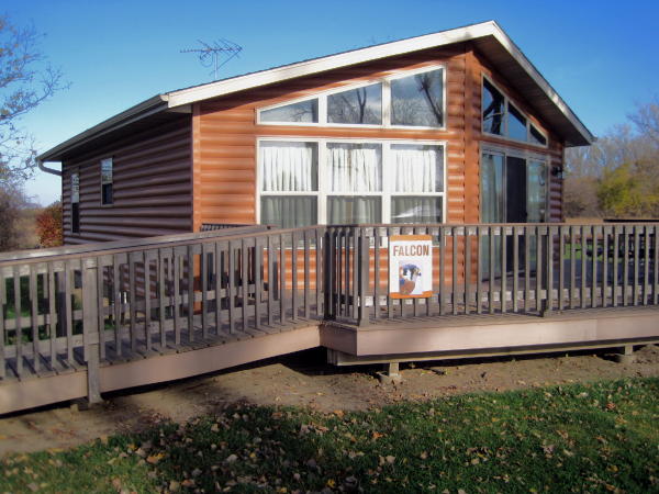
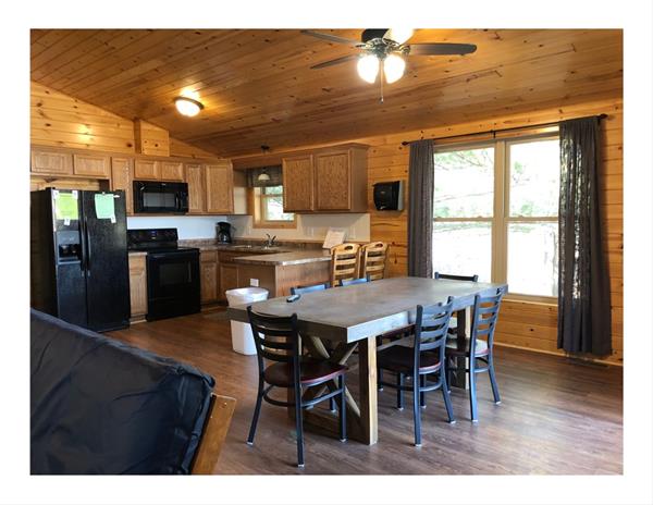
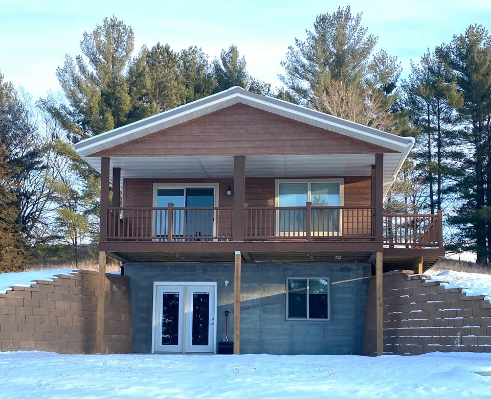
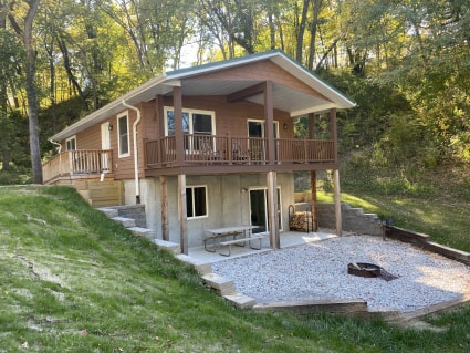
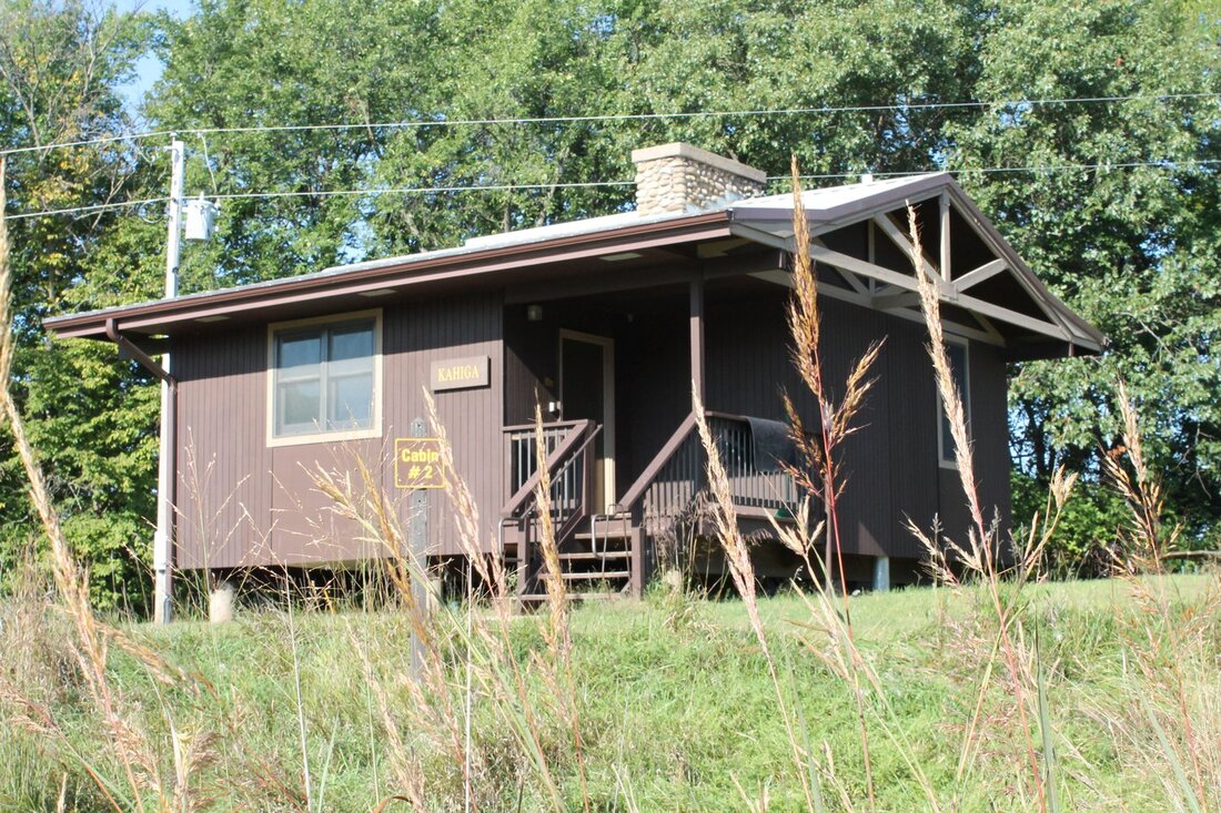
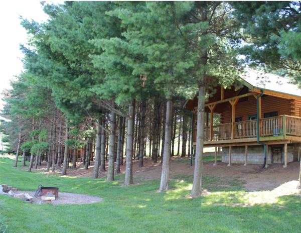
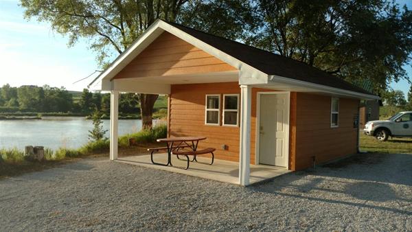
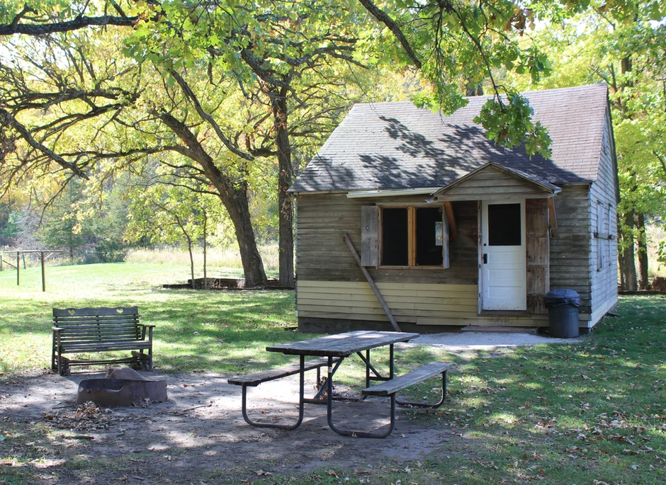
Last week we posted about camping on the three scenic byways that Golden Hills coordinates in western Iowa. With Memorial Day weekend approaching, and with it the summer outdoor recreation season, now is the time to make plans and reservations for campsites, as well as cabins. There are numerous parks on the byways that have cabins available to rent, with options with modern showers, Wi-Fi, and smart TVs, t0 rustic cabins without running water or electricity. We have compiled a spreadsheet listing the cabins at parks managed by the Iowa DNR and county conservation boards on the Glacial Trail Scenic Byway, Loess Hill National Scenic Byway, and Western Skies Scenic Byway. To view the spreadsheet of cabins on the byways managed by the Iowa DNR and county conservation boards, click here. There are three tabs at the bottom for each separate byway. The information was collected from Iowa DNR and county conservation board websites. It is recommended that you contact the managing agency directly if you have questions or to confirm amenities and availability. Cabins on the Byways spreadsheet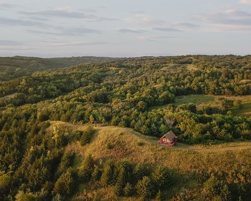 Camping Cabin at Five Ridge Prairie on the Loess Hills National Scenic Byway There are also cabins managed by private individuals and organizations; check out previous blog posts about Unique Places to Stay on the Loess Hills National Scenic Byway and Unique Places to Stay on Western Skies and Glacial Trail Scenic Byways. Glacial Trail Scenic Byway
Loess Hills National Scenic Byway
Western Skies Scenic Byway
There are no camping cabins in Audubon County at parks managed by the Iowa DNR or Audubon County Conservation. For campsites and unique places to stay in Audubon County, check out our blog posts Camping on the Byways and Unique Places to Stay on Western Skies and Glacial Trail Scenic Byways. For a detailed spreadsheet of cabins on the byways managed by the Iowa DNR and county conservation boards, click the link below. Cabins on the Byways spreadsheetThere are also cabins managed by private individuals and organizations; check out our blog posts about Unique Places to Stay on the Loess Hills National Scenic Byway and
Unique Places to Stay on Western Skies and Glacial Trail Scenic Byways.
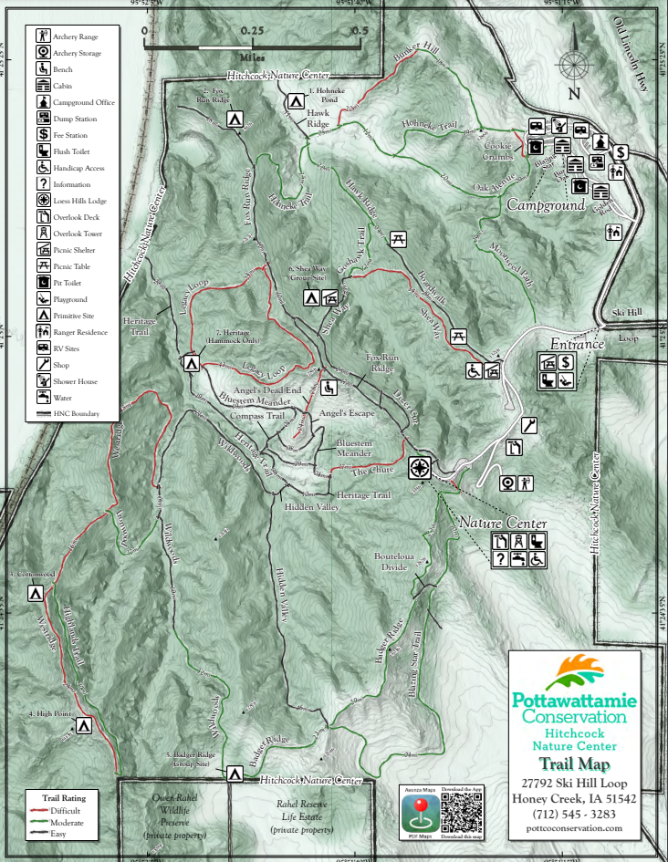
Trails network together so visitors can be creative to enjoy any length of hike they desire. Due to the rugged terrain of the Loess Hills, the trails vary from easy ridgeline walks to difficult climbs. Trail maps can be found at Fox Run Ridge, Badger Ridge, and Hohneke trailheads, or at the Loess Hills Lodge during gallery hours. It's difficult to create an easy loop at Hitchcock because at some point you will have to descend steeply into a valley or climb steeply onto a ridge. If you're looking for an easy family-friendly hike, do an out-and-back hike starting from the Badger Ridge or Fox Run Ridge trailheads in the parking lot below the Loess Hills Lodge. Another option is the ADA-accessible boardwalk that ends at Hawk Ridge.
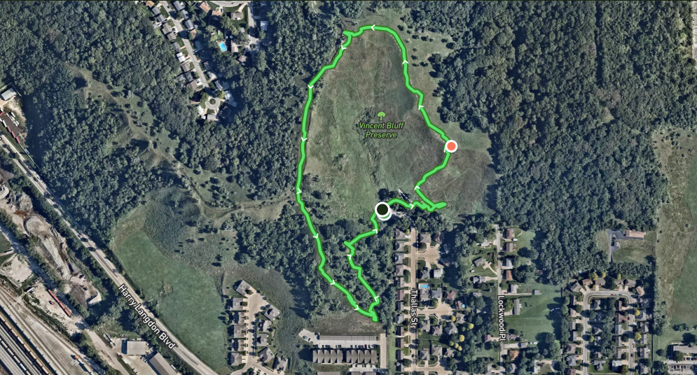
Vincent Bluff State Preserve is a cooperative venture between the City of Council Bluffs, Iowa Natural Heritage Foundation, and the Loess Hills Preservation Society to preserve a unique urban prairie in the Loess Hills. The preserve is located in the heart of Council Bluffs. Today, Vincent Bluff Prairie Preserve stands as the only truly urban prairie preserve in the state of Iowa, and likewise, is a great example of Loess Hills prairie, oak savanna, and eastern deciduous forest ecosystems. A footpath begins at the shelter near the parking lot and climbs steeply to the top of the prairie ridge. The climb is short but strenuous. You can follow the GPX track below to hike a loop, or just wander along the ridge enjoying the views and native flora. 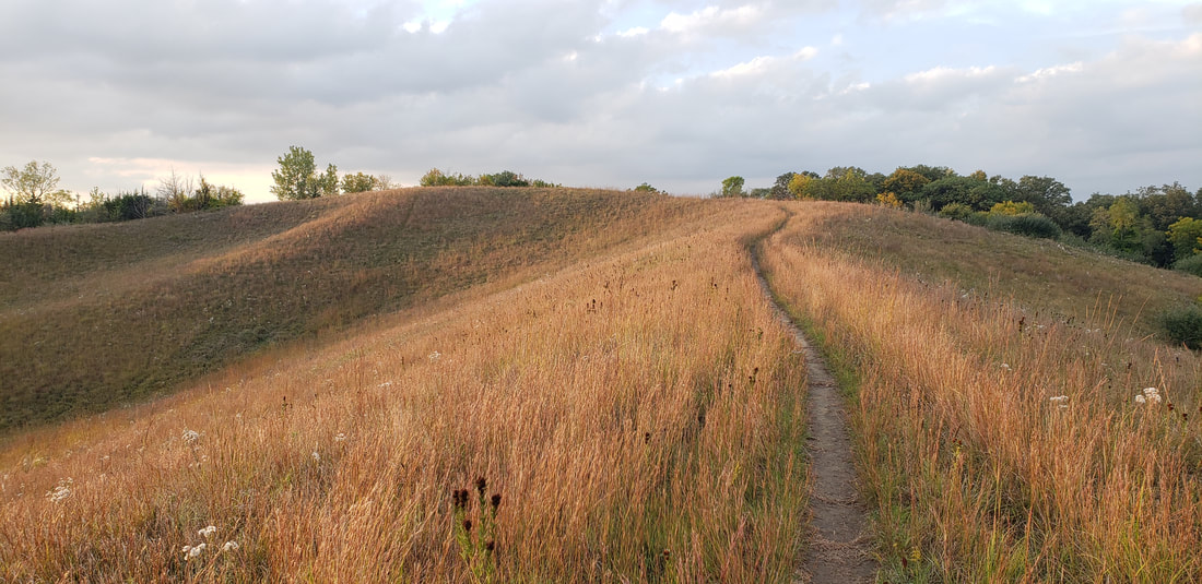 Vincent Bluff State Preserve (photo by Lance Brisbois)
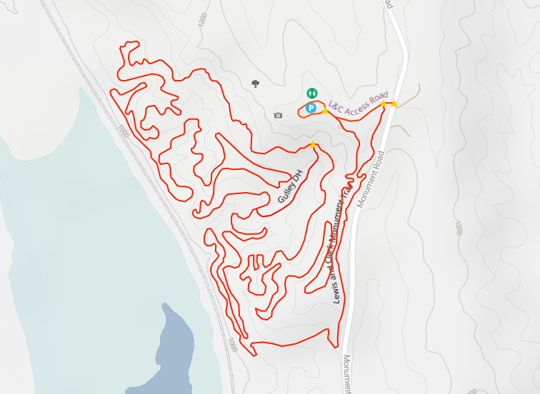
Dedicated in 1936 to honor the Corps of Discovery, Lewis & Clark Monument Park has a small observation deck and two large commemorative stone markers, quarried from the Folsom Quarry in Vermont and created by sculptor Harry E. Stinson and architect George L. Horner. The images and text on the markers explain Lewis and Clark’s meeting with local Oto and Missouri Indians. (The actual site of the meeting took place on the west side of the Missouri about 10 miles north of Omaha near today’s Fort Calhoun, Nebraska.) The monument stands atop a ridge of the Loess Hills, which run along much of the western edge of Iowa. For this reason, mountain bikers enjoy the challenging route through the heavy woods of the park, hikers appreciate the nearby trails, and aerial enthusiasts love the panoramic view of planes landing at Omaha’s Eppley Airfield just across the Missouri. Trails Have Our Respect (THOR) maintains the mountain bike trails. 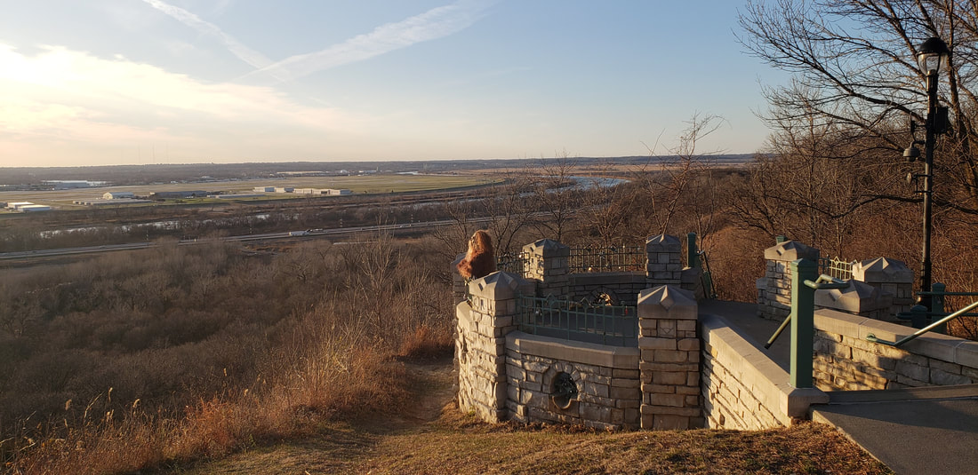 Lewis and Clark Monument Park
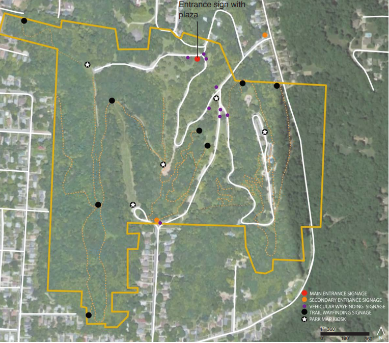
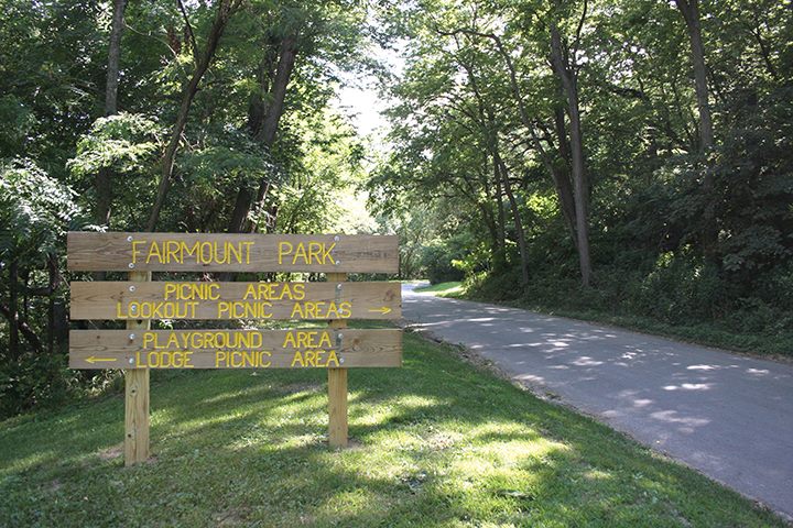 Fairmount Park (photo: Council Bluffs Fairmount Park Neighborhood Association) Fairmount Park (East Graham Ave and Park Entrance) hiking trails wind through the hills. At Fairmount Park, you'll also find a scenic overlook, a playground, a splash pad, a firepit, picnic shelters, and ample parking. Gibraltar Trailhead (9th Ave and High St) has picnic tables and direct access to the Fairmount Park hiking trails making it a great place to meet up with friends.
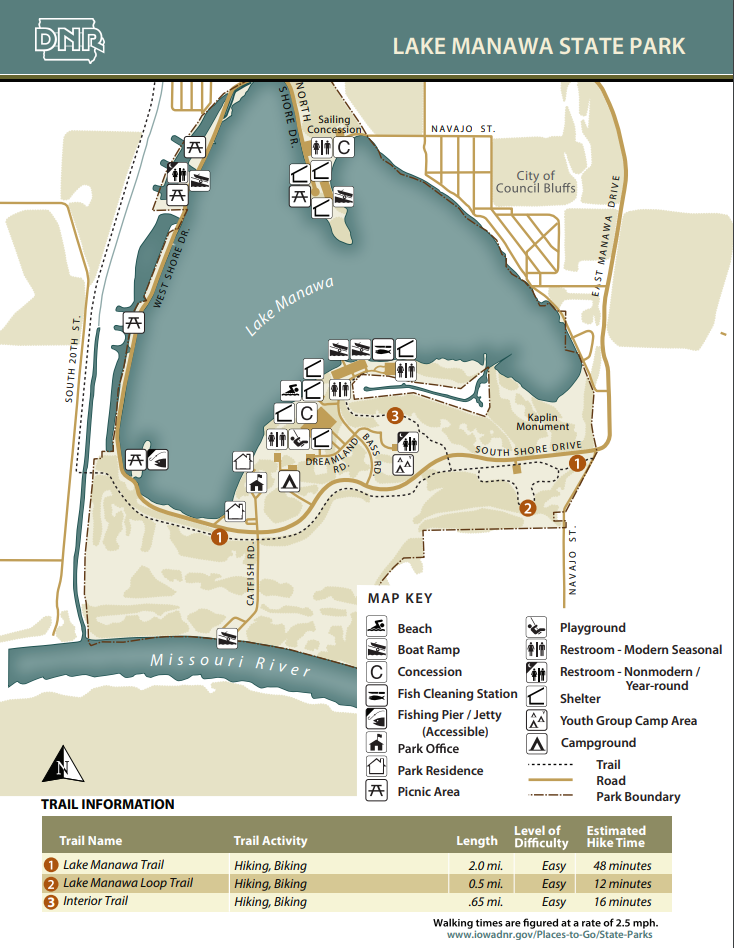
These trails connect to the trail system that runs throughout Council Bluffs including the Wabash Trace Trail and the Bob Kerry Pedestrian Bridge. There are also eight miles of unpaved trails perfectly suited for mountain biking located on either side of the Missouri River access on the south side of the park.  Lake Manawa State Park (photo by Chris Lind, Instagram @boipinoy) The mountain bike trails along the Missouri River just south of Lake Manawa are also hiker-friendly. The area is right along the river, so whenever there is a flood the trails will likely be impassable and damaged. The trails are maintained by the THOR group.
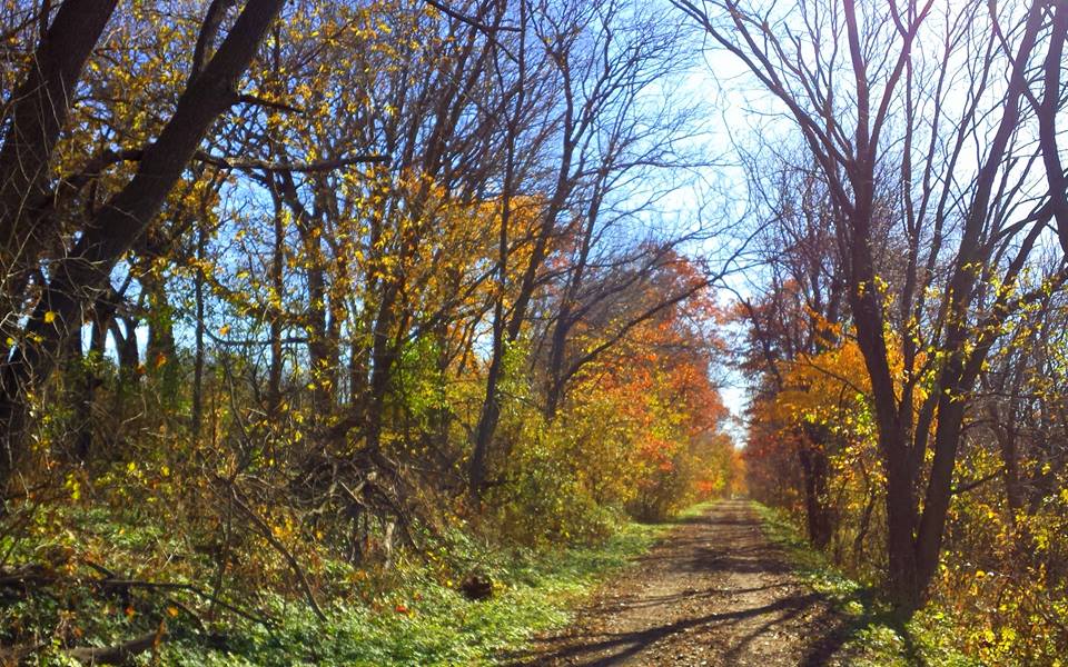
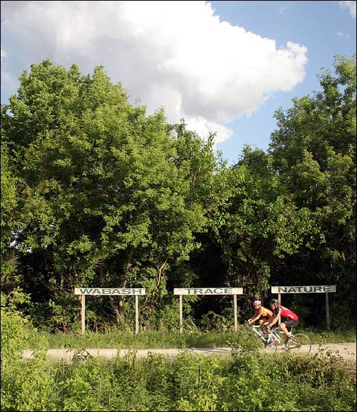
Wabash Trace Nature TrailWhile it's mostly known as a bike trail, the Wabash Trace Nature Trail is another opportunity for hikers to explore Pottawattamie County. The northern terminus of the trail is located in Pottawattamie County on the very southern boundary of Council Bluffs. The level grade makes it a nice option for a leisurely out-and-back hike from the Iowa West Foundation Trailhead, especially in fall when the leaves are turning colors.
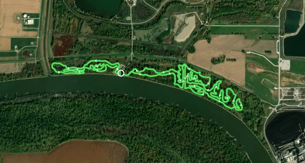
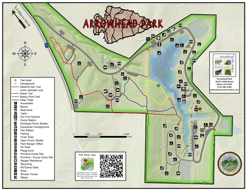
 Arrowhead Park and Botna Bend Park
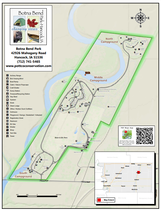 Botna Bend Park Hiking the Byways is a regular series by Golden Hills RC&D that features publicly accessible lands open to hiking on the three scenic byways in western Iowa that Golden Hills RC&D coordinates: Glacial Trail Scenic Byway, Loess Hills National Scenic Byway, and Western Skies Scenic Byway. Each Friday a blog post covers hiking areas in one county on one of the aforementioned byways. For questions about hiking on the byways, contact Seth Brooks ([email protected]).
Campsite at Hitchcock Nature Center (photo by Golden Hills RC&D)
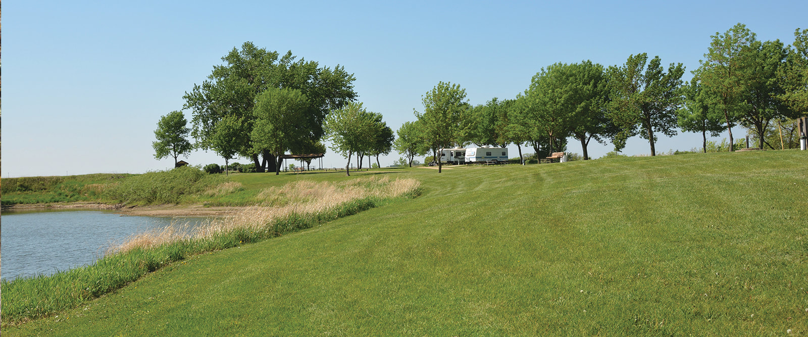
Are you ready to start making summer plans? With spring right around the corner, it's a good idea to start thinking about your summer recreation plans. There are a wide range of camping options along western Iowa's scenic byways, from primitive hike-in campsites to full hook-up RV sites. From state parks and recreation areas, county parks, and city parks, outdoor enthusiasts have plenty of places to pitch a tent or park their RV. Some of these sites can be reserved ahead of time, for example at Iowa's state parks where you can reserve a site up to three months in advance. The traditional camping season begins on Memorial Day weekend, so the first week of March is when reservable campsites at Iowa state parks can be reserved. We've compiled a spreadsheet below of campsites along the three scenic byways that Golden Hills RC&D coordinates: Glacial Trail Scenic Byway, Loess Hills National Scenic Byway, and Western Skies Scenic Byway.
The list is not comprehensive; if there is a campground missing from the list, please contact Seth Brooks ([email protected]) to get it added to the list. Additionally, we cannot guarantee the accuracy of the information listed below. All information was compiled from the websites of the campground's manager (Iowa DNR, county conservation boards, municipalities, etc.). To correct or add information, also please contact Seth Brooks at Golden Hills ([email protected]).
The absence of an amenity, for example showers does not mean there are not showers at the facility; rather, it means that Golden Hills was unable to confirm on the manager's website whether the campground featured that amenity. It's always best to contact the campground's manager to confirm amenities, prices, season dates, and more. Explanation of spreadsheet columns: Electric - campsites with electrical hook-up; may or may not have sewer hook-up Non-electric - campsite without electrical hook-up; available for RV and/or tent camping Tent - tent-only campsites; some may be backcountry hike-in sites $ per night - if there is more than one type of campsite, the range of the lowest to highest price is listed Reserve - if campsites are able to be reserved in advance Cabins - number of cabins available Showers - showers for campers to use Restrooms - modern and/or pit toilets Water - pumps and/or hydrants for drinking water Dump site - dump site for RVs Season - dates campground is open or campground amenities are available; cabins may be open year-round
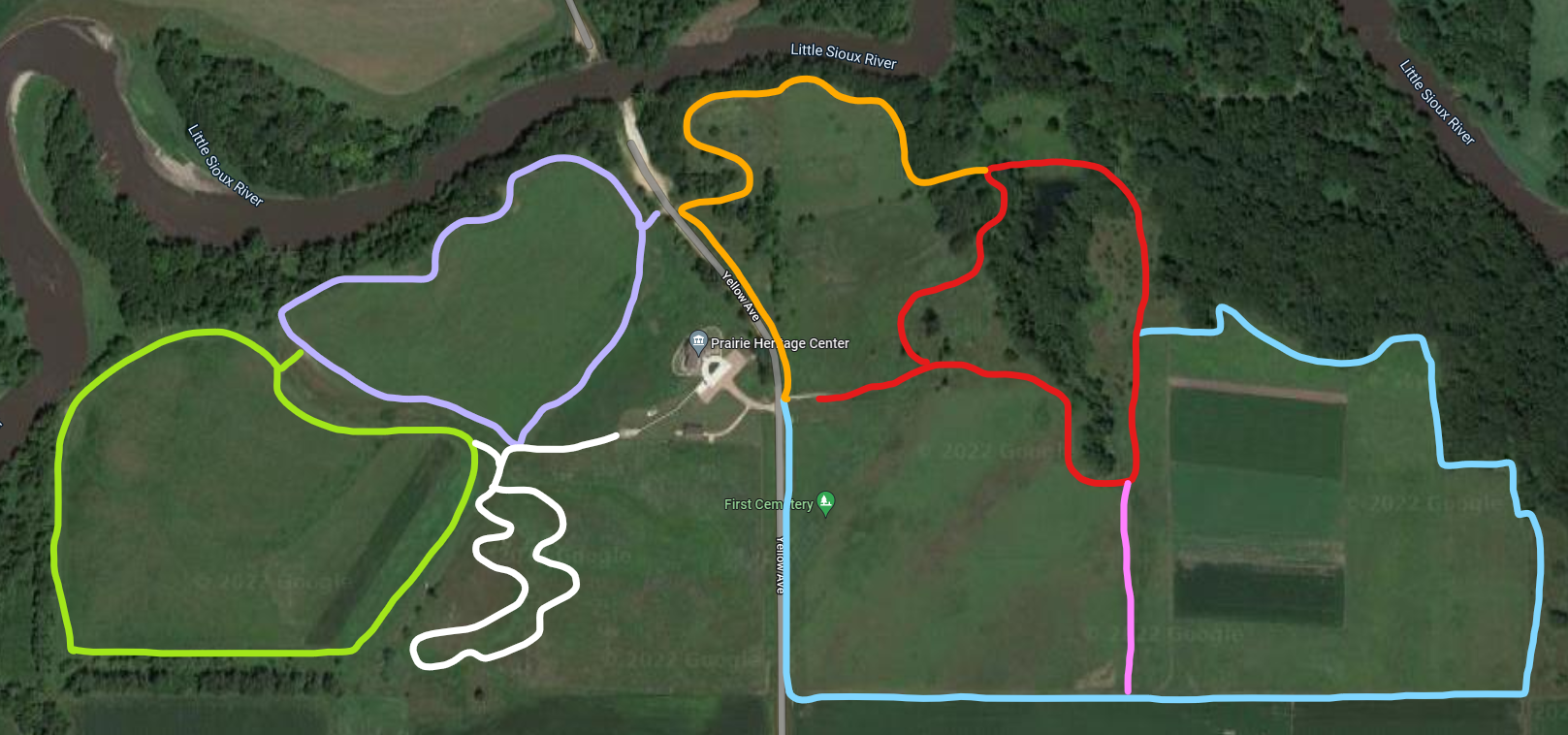
The purpose of the Prairie Heritage Center is to provide environmental education as it relates to the prairie and the county, to preserve and protect our prairie heritage, and to encourage economic development with regards to recreation and historic exploration. Every season of the year is a great one on the prairie! The Prairie Heritage Center opened its doors to the public on November 28, 2006. Over 100,000 people have visited the center since that time. They have come from all 50 states and over 26 foreign countries. It is a great place to enjoy educational and interactive displays, hike the trails, savor the wildflowers, and engage in bird and wildlife watching. Visit the Prairie Heritage Center and check out all the things to do! text source: O'Brien County Conservation 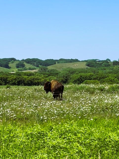 Bison at the Prairie Heritage Center (photo by O'Brien County Conservation)
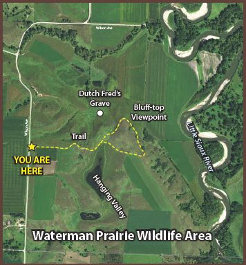
The section of Waterman Prairie south of Highway 10 offers an accessible prairie experience for byway visitors. A parking lot on Wilson Avenue, 1½ miles south of Highway 10, leads to a trail that meanders through prairie-covered ridges with spectacular vistas of the Little Sioux River valley. The Iowa Department of Natural Resources is restoring the prairie to its original plant community.
 Waterman Prairie (photo by Lance Brisbois)
 Dog Creek Park (photo by Lance Brisbois)
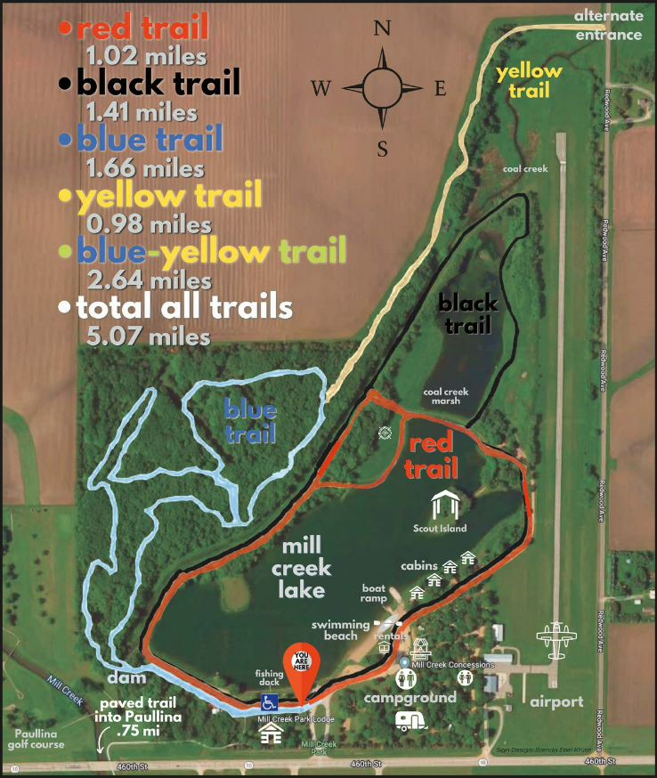
There is something for every outdoor lover at Mill Creek State Park including camping, swimming, hiking, a playground, electric boating, picnicking, and even cabin rentals. Fishing is also a popular activity, giving anglers a chance to catch largemouth bass, sunfish, channel catfish, crappie and yellow perch. Mill Creek Park is located just 1/2 mile east of Paullina on Iowa Highway 10. 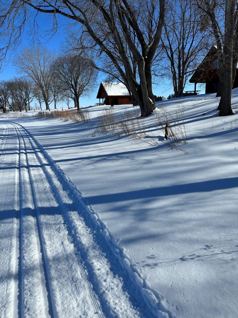 Mill Creek Park features groomed cross-country ski trails in winter.
 Tjossem Park (photo by O'Brien County Conservation)
 McCormack Area Hiking the Byways is a regular series by Golden Hills RC&D that features publicly accessible lands open to hiking on the three scenic byways in western Iowa that Golden Hills RC&D coordinates: Glacial Trail Scenic Byway, Loess Hills National Scenic Byway, and Western Skies Scenic Byway. Each Friday a blog post covers hiking areas in one county on one of the aforementioned byways. For questions about hiking on the byways, contact Seth Brooks ([email protected]).
|
Archives
June 2024
Categories
All
|


 RSS Feed