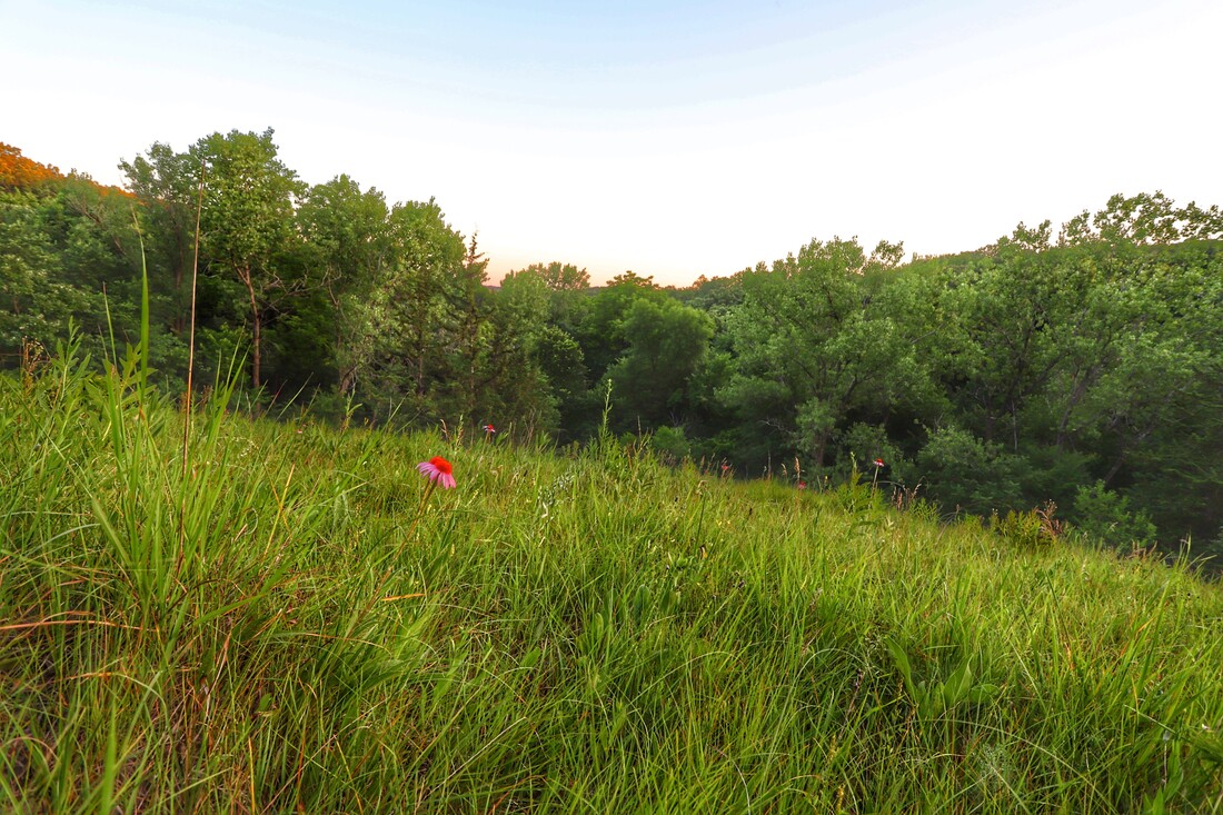
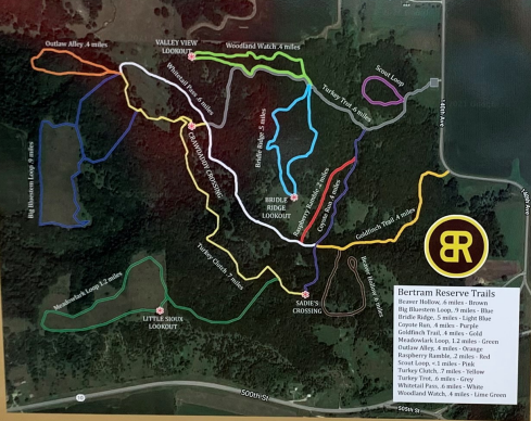
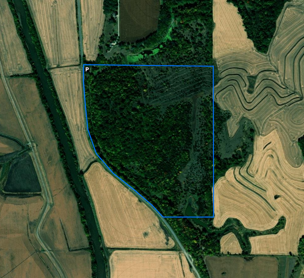
 Photo of Bertram Reservation by Lynn Graesing Our last post in the Hiking the Byways series takes us to Clay County on the Glacial Trail Scenic Byway. There are multiple areas open to hiking in the county, some with maintained trails like Bertram Reservation. If you are looking for off-trail exploration, there are 15 wildlife management areas and numerous county properties to explore native prairie, bottomland timber, and the Little Sioux River. Bertram Reservation
Oneota Park
Other Areas in Clay CountyWanata Park - Wanata Park is a 144-acre park situated along the Little Sioux River next to the town of Peterson. Come enjoy the trails as you hike along the flood plains or hills of the Little Sioux River. Bob Howe Thunder Bridge Wildlife Refuge - 29.5 Acre wildlife refuge with the Little Sioux River flowing through it. Bike and hiking trail. Home to historic Thunder Bridge, a through truss bridge built in 1905. Donahoo Wildlife Area - 171 acre wildlife area located in both Clay and Buena Vista counties. It is located in the Little Sioux flood plain with prairie uplands and Oak Savannah prairie remnants. Kindlespire Complex - 310-acre wildlife area located along the Little Sioux River with hiking trails. Mori Prairie - 40 acres of open prairie. Ideal for pheasant hunting using non-toxic shot and bird watching. Outstanding for those who are interested in native plant ecology. One of the very few pristine native prairies in Clay County. Riverton Wildlife Area - 160-acre wildlife area along the Ocheyedan River open to hiking. Schmerse Wildlife Area - Hiking trail around the pond. Stouffer Memorial Wildlife Preserve - 20 acre wildlife reserve located along the Little Sioux River off of Highway 18. Summit Wildlife Area - Summit Wildlife Area is approximately 132 acres of re-constructed prairie area located on the Little Sioux River. Wildlife Management AreasThere are 15 wildlife management areas in Clay County. These areas are managed by the Iowa DNR and are open to hunting. There are no maintained trails, however, some may have maintenance tracks that can be used for hiking. Off-trail hiking is permitted, but take caution during hunting season to not disturb wildlife or hunters. Go to the Iowa DNR's website to search for WMAs in Clay County. Hiking the Byways is a regular series by Golden Hills RC&D that features publicly accessible lands open to hiking on the three scenic byways in western Iowa that Golden Hills RC&D coordinates: Glacial Trail Scenic Byway, Loess Hills National Scenic Byway, and Western Skies Scenic Byway. Each Friday a blog post covers hiking areas in one county on one of the aforementioned byways. For questions about hiking on the byways, contact Seth Brooks ([email protected]).
0 Comments
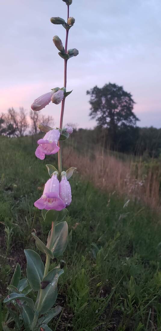
Aqua Archer Farms is a small aquaponics farm in Missouri Valley. While working for UPS, owner Chris Archer delivered an aquaponics system and was intrigued. After learning more about it, he decided to give it a try. In 2018, Chris visited an aquaponics farm in Colorado, and the Nelson Pade facilities in Wisconsin. He took a 3-day mastery class with Nelson Pade, who is one of the premier companies in the aquaponics business. The farm consists of a series of tanks and plant beds where greens are grown on water instead of soil. Aqua Archer Farms have a “Family Plus System” consisting of four 100-gallon tanks with fish, and two 55-gallon clarifying tanks. Ammonia comes from fish urine, but the fish solid waste does not come anywhere near the food production. The ammonia that is produced by the fish is broken down organically by bacteria, similar to how it does in soil, producing nitrate that is beneficial to the plants. From the fish tanks, water goes into a degassing tank. Water is then put into beds where greens are floating on raft beds. Their roots go directly into the water. 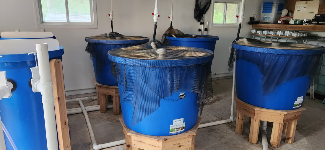 They use tilapia, which are considered a highly invasive species by Iowa Department of Natural Resources. The farm is required to have a DNR permit, an annual aquaculture permit, and the facilities are inspected by DNR to ensure they are following all environmental regulations. Although the fish are edible, selling them would require another expensive permit so they do not sell the fish. The fish are all males, which reduces the chance of unchecked population growth. They arrive as 1-5 gram fingerlings. 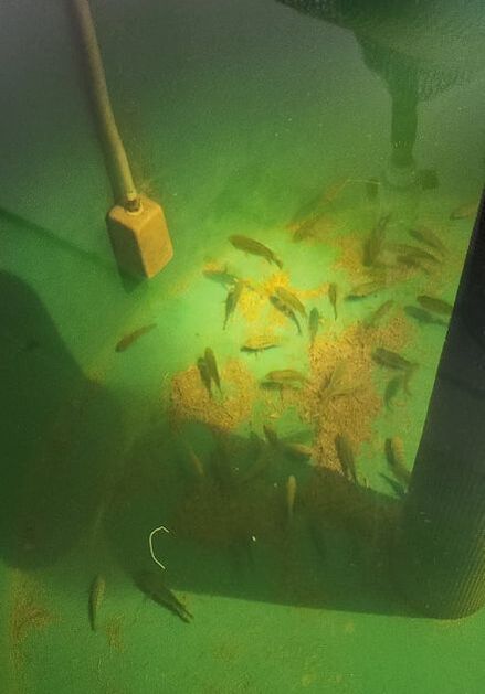 As they grow, the size of the food pellets they eat also grows. Nelson Pade has their own meal formula, which does not include any bloodmeal. The fish are fed 3-5 times per day depending on their size. Because tilapia like to jump and can easily jump out of the tanks, the tanks are covered with nets. The fish live about 7 months. A general rule is to have 1 pound of fish per 2-3 gallons of water. A ¼ horsepower pump is all that’s needed to recirculate water through the system, in addition to using gravity as much as possible. It is an enclosed loop system which conserves water and improves efficiency. The plants take 30 to 55 days to grow to a harvestable size. They require temperatures between 65-85 degree F to thrive. Fans are needed to help circulate air. Grow lights are used in the greenhouse to help increase the light spectrum for the plants’ growth cycles, and generate small amount of heat. A “purge tank” system is used when they are harvesting the fish at the grow out stage of 1.5-2 pounds. They are taken from the 100 gallon tank once at weight and are not fed, to clean out their system. Salt is added as a calming agent and to help clean out the fish from any remaining waste, to produce a cleaner meat and taste when harvested. They add DTPA Iron, magnesium and calcium to the water. The iron is not readily available for the plants in this form of iron so they add the calcium and magnesium for the iron to attach to so the plants can uptake the nutrients. They have several biosecurity measures in place to reduce the risk of contamination and pests. They do weekly chemical testing of the water to make sure pH, nitrite, dissolved oxygen, and other qualities are adequate. Tanks are cleaned monthly (or as needed) depending on the fish stocking density. The Archers do not use any pesticides or other chemicals. 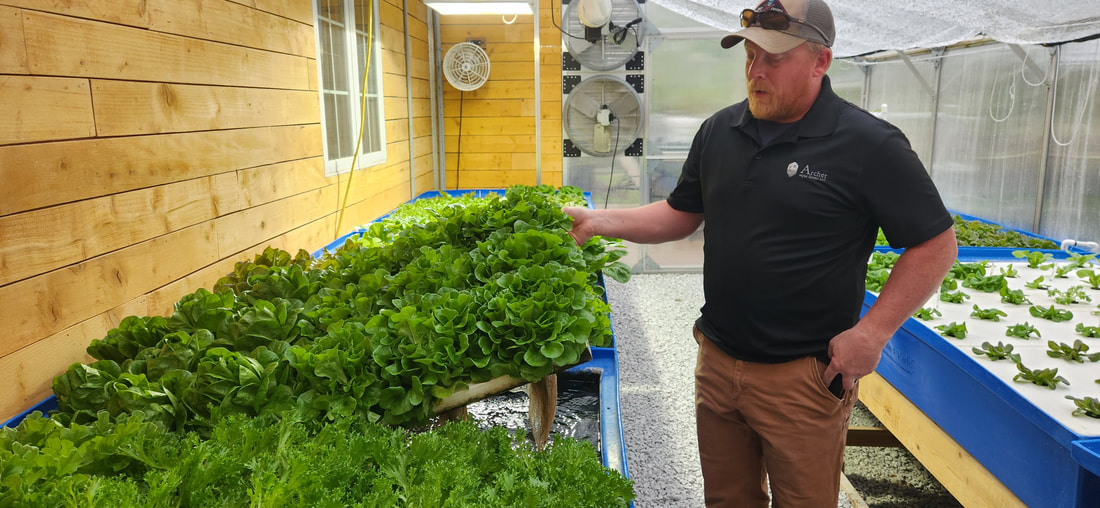 Archer Aqua farms started growing produce about a year ago. To harvest the greens, they lift up the floating beds and snip off the roots. They are currently selling 9 types of greens, and plan to add berries and tomatoes in the future. Customers often comment on the great flavor of their greens compared to store-bought counterparts. 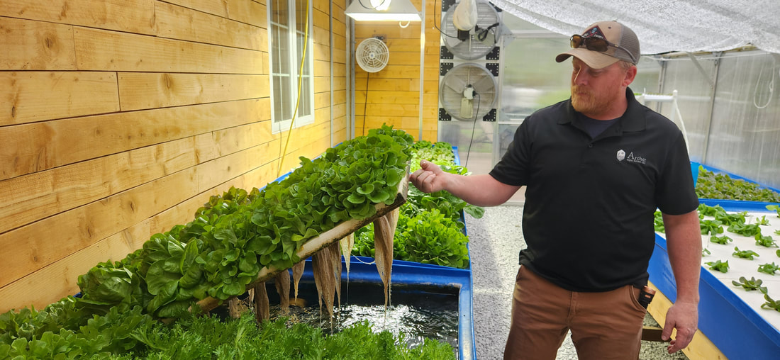 They are planning to start producing Microgreens in the next month or so, using a ZipGrow Microgreens Station. The Archers are currently participating in Upstart University, where they’re learning more tools and tips of the trade. You can find Archer Aqua Farm’s greens at the Blair Farmers Market in the summer, and at S&S Pumping in Blair in the off-season of the farmers market on Saturday mornings. One Farm Market in Logan also regularly sells them. They have at times sold to the Pink Poodle in Crescent. They will have anywhere from 70-90 heads of greens available each week. You can also contact them through their Facebook page to place an order. For a small fee, you can get a tour of their facilities. 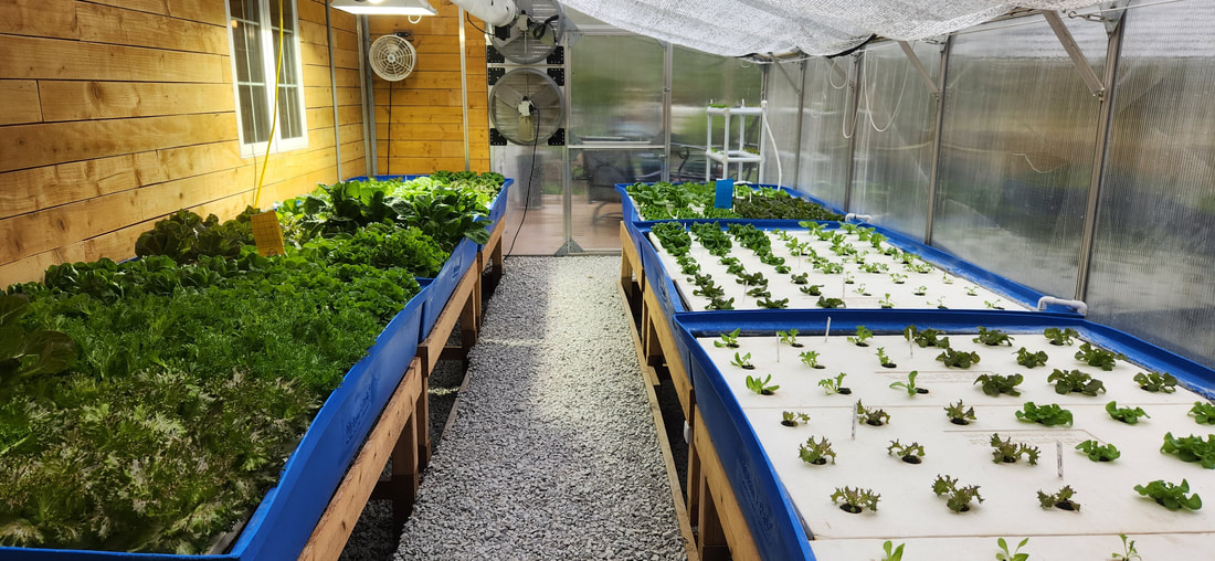 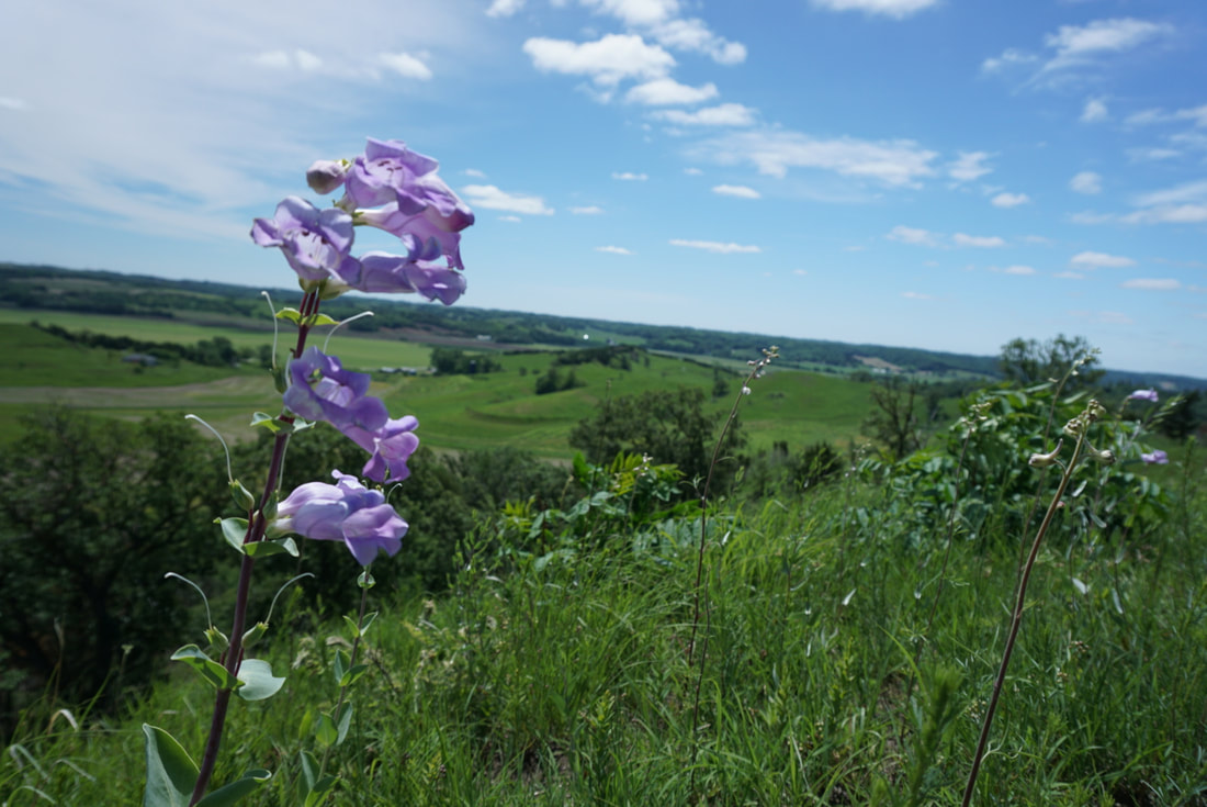 Penstemon grandiflorus at Hitchcock Nature Center (photo by Seth Brooks)
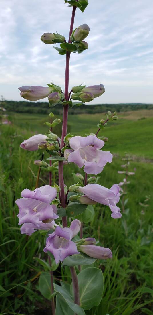
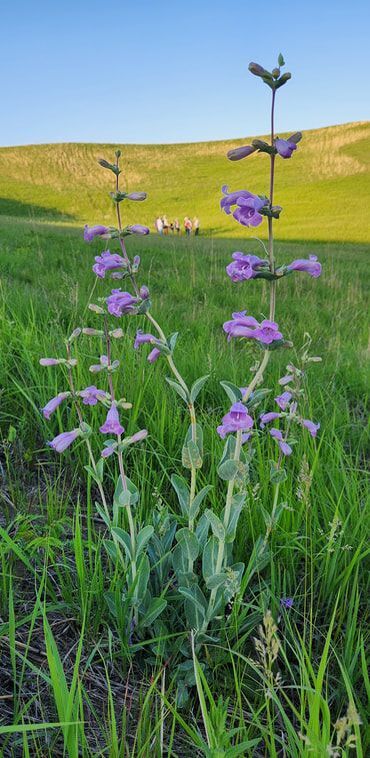
Penstemon species are commonly called beardtongue because of an interesting adaptation to attract pollinators. "One of the five stamens is sterile and does not produce pollen. It is often modified into a hairy or bearded tongue and probably attracts insects," as noted in the field guide Wildflowers of Iowa Woodlands by Sylvan Runkel and Alvin Bull. Penstemon grandiflorus is common on Loess Hills prairies in western Iowa but very infrequent elsewhere on dry, sandy prairies and stabilized sand dunes. Its purple flowers bloom from late May to mid-June.
 Penstemon grandiflorus 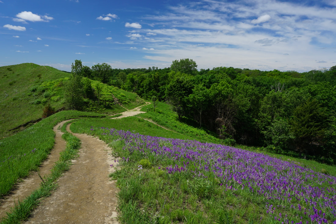 Locoweed on Badger Ridge at Hitchcock Nature Center (photo by Seth Brooks)
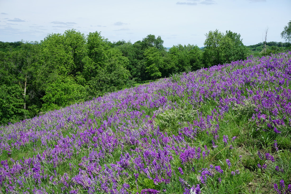
Locoweed flowers from late May to mid-June. Oxytropis lambertii plant is one of the locoweeds most frequently implicated in livestock poisoning. Locoweed is a common name in North America for any plant that produces swainsonine, a phytotoxin harmful to livestock.
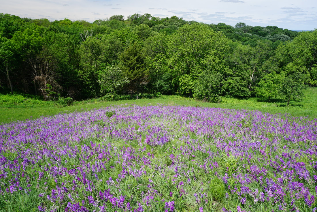
 Whiterock Conservancy (photo by Lance Brisbois)
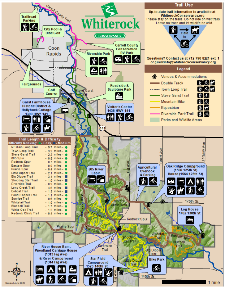
Explore over 40+ miles of hiking, mountain biking, equestrian, and UTV trails; set up camp in our RV or tent camping areas; or enjoy the comforts of home in one of our vacation rentals. A Whiterock Conservancy trail pass is required for all visitors mountain biking and horseback riding on the trails. A trail pass is not required for walking or hiking, however a suggested donation of $2 is appreciated. The annual pass is good for the calendar year and the daily pass is good for the day of purchase. Trail fees help cover the cost of maintenance, as well as preserve the landscape. Self-serve kiosks are located with payment envelopes throughout Whiterock Conservancy and can be found at the campgrounds, trailheads, Bur Oak Visitor's Center, and the Historic Garst Farmstead. (text source: Whiterock Conservancy) 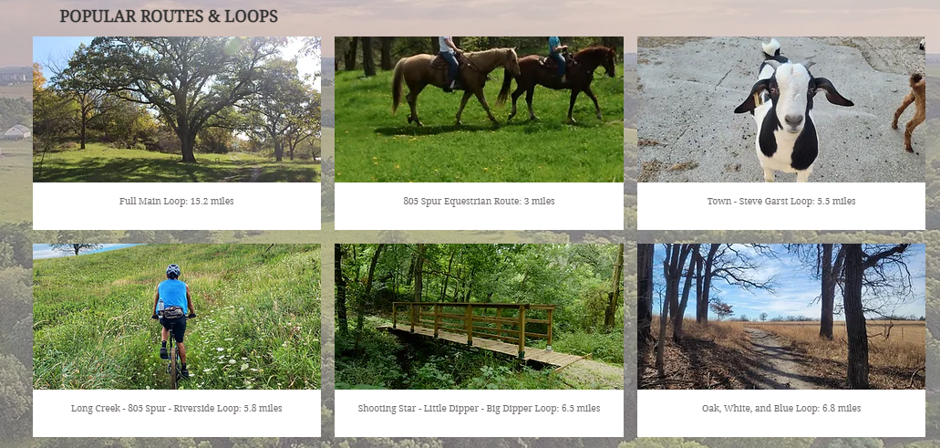 Source: Whiterock Conservancy Springbrook State Park
Springbrook State Park is a quiet retreat in Guthrie County, encompassing 930 acres of rolling hills and mature timber. Many of the park’s structures were built by the Civilian Conservation Corps (CCC) in the 1930s, creating a nostalgic setting for park visitors. A multifamily cabin called the Sherburne House is perfect for large families or groups, and the lake is a popular destination for swimming and kayaking. Hike or bike 12 miles of trails at Springbrook, offering leisurely routes through timber and prairie areas or more challenging paths for the seasoned hiker or biker. Trails also lead to small ponds, the Middle Raccoon River, and the park’s 17-acre lake. Snowmobiling is allowed on four miles of designated trails in the winter. (text source: Iowa DNR) Sheeder Prairie State Preserve
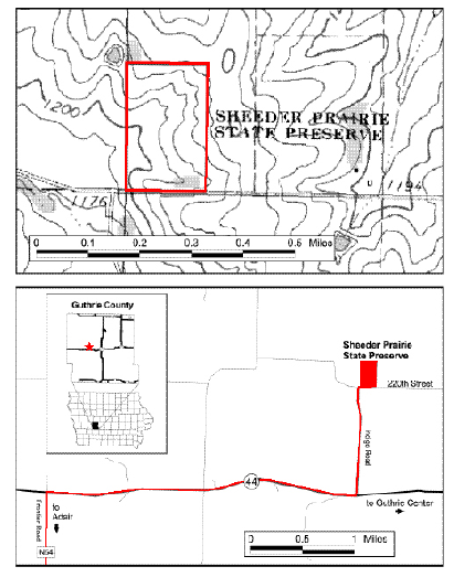
This preserve lies within the Southern Iowa Drift Plain, a landform region of gently rolling terrain. Over 200 plant species are found in this preserve, including thirty grasses. The prairie hilltops and slopes contain big bluestem, little bluestem, porcupine grass, and prairie dropseed along with leadplant, rosinweed, prairie willow, and redroot. Prairie phlox, golden alexanders, flowering spurge, rattlesnake master, purple coneflower, and gray-headed coneflower are also common. The wooded ravines are dominated by box elder, wild plum, and black willow. In the spring, prairie false dandelion, bird’s-foot violet, prairie violet, lousewort, and hoary puccoon are among the first plants to begin blooming. By May, ground plum, indigo bush, blue-eyed grass, prairie ragwort, tall green milkweed, prairie larkspur, and yellow stargrass join the display. Prairie loosestrife, butterfly weed, purple prairie clover, compass plant, ironweed, wild bergamot, rough blazing star, and prairie blazing star can be found in June and July. Nodding ladies’-tresses, white sage, silky aster, sky-blue aster, showy goldenrod, Canada goldenrod, smooth goldenrod, and downy gentian bloom during the fall months. A total of sixty-nine species of birds can be found here, with twenty-five nesting on a regular basis. Nearly three-fourths of the nesting species are woodland species. Two grassland species, the bobolink and grasshopper sparrow, nest sporadically. Several preferring the woodland edge habitat found here include gray catbird, eastern kingbird, brown thrasher, rosebreasted grosbeak, red-headed woodpecker, downy woodpecker, blackcapped chickadee, Baltimore oriole, northern cardinal, house wren, and American goldfinch. The Conservation Education Center, located at Springbrook State Park north of Guthrie Center, sponsors workshops and interpretive events that often include field trips to Sheeder Prairie. (text source: Iowa DNR state preserves guide) 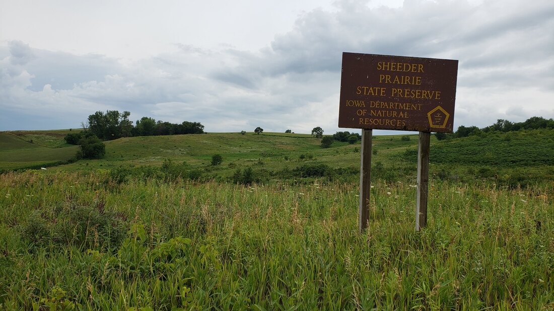 Nations Bridge Park
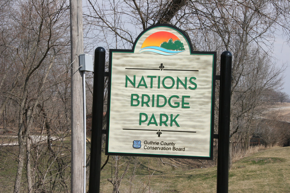
 offers a variety of recreational opportunities to the public and is a favorite spot for many. The park has a total of 81 acres that can be used for camping, picnicking, kayaking, hiking, bird watching fishing, disc golf, and horse shoes. Wildlife is abundant at Nations Bridge Park. Deer, turkeys, squirrels, rabbits, quail, raccoons, coyotes, and a variety of songbirds can be seen at the park. Nature trails can be found throughout the park and a self-guided nature trail is located on the east side of the park, County Highway P28. (text source: Guthrie County Conservation) 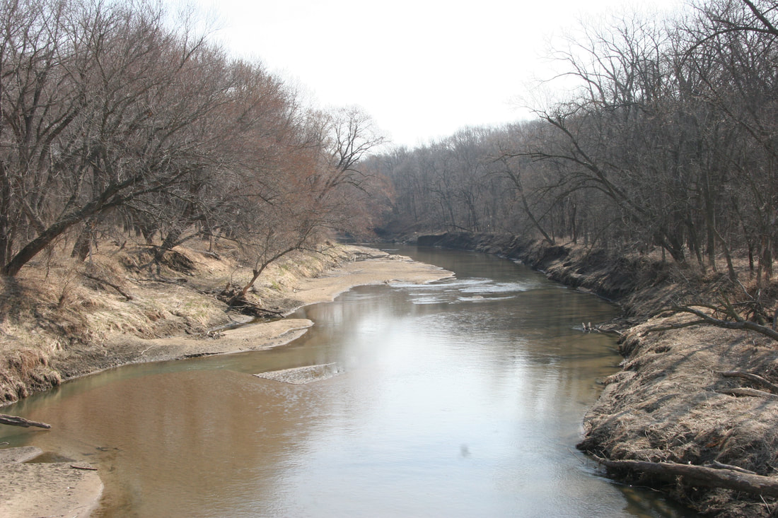 Sutcliffe Woodland
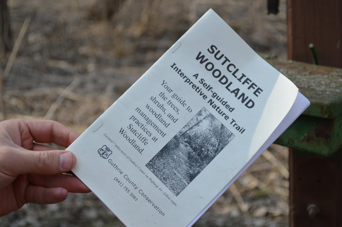
 is a beautiful, 55-acre oak-hickory area designated as a wildlife refuge. It offers a 31-post, self-guided interpretive nature trail, as well as picnicking, hiking, and pond fishing. (text source: Guthrie County Conservation)  Raccoon River Valley Trail
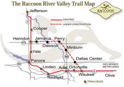
The trail winds its way through the Middle and North Raccoon River corridors with areas of prairie and canopies of timber that remind us of what Iowa was like in the 1870's. Common uses for the multi-recreational trail are hiking, biking, walking, in-line skating, jogging, bird watching , or cross-country skiing, and snowmobiling in the winter. Trailheads in Guthrie County:
(text source: Guthrie County Conservation) The following Guthrie County Conservation properties are open to hiking but have no maintained trails: Hiking the Byways is a regular series by Golden Hills RC&D that features publicly accessible lands open to hiking on the three scenic byways in western Iowa that Golden Hills RC&D coordinates: Glacial Trail Scenic Byway, Loess Hills National Scenic Byway, and Western Skies Scenic Byway. Each Friday a blog post covers hiking areas in one county on one of the aforementioned byways. For questions about hiking on the byways, contact Seth Brooks ([email protected]).

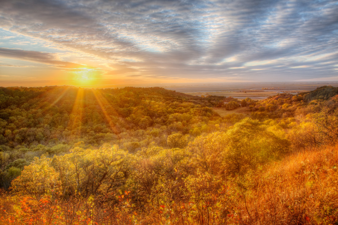
Loess Hills Scenic Overlook (© 2016 Kenneth West)
Aalfs Family Preserve
Land status - Broken Kettle Grasslands Overlook location - Butcher Rd south of Westfield Access - via a kissing gate on Butcher Rd Notes - Bench and interpretive panel overlooking the bison enclosure Five Ridge Prairie Cabin Land status - Five Ridge Prairie State Preserve Overlook location - 26616 IA-12, Westfield, IA 51062 Access - Requires a hike up a steep trail Notes - Cabin is perched on the ridge overlooking the Bix Sioux River and the Missouri River floodplain Elk Point Overlook Land status - Stone State Park Overlook location - Stone State Park Dr, Sioux City, IA 51109 Access - Parking area on the park road Notes - Overlooks the southern section of the state park Dakota Point Overlook Land status - Stone State Park Overlook location - Dakota Point Rd, Sioux City, IA 51109 Access - Parking area on the park road Notes - Overlooks the Big Sioux River and South Dakota Kestrel Point Land status - Dorothy Pecaut Nature Center Overlook location - Bluestem Trail Access - Requires hiking the nature center trails Notes - Overlooks the nature center Mount Lucia Land status - Stone State Park Overlook location - Mt. Lucia Trail Access - Requires hiking the state park trails Notes - Views of Sioux City War Eagle Park Land status - War Eagle Park Overlook location - Sioux City, IA 51103 Access - Ample parking lot Notes - Overlooking I-29, the Missouri River, and Nebraska Sergeant Floyd Monument Land status - Sergeant Floyd Monument Overlook location - 2601 S Lewis Blvd, Sioux City, IA 51103 Access - Ample parking lot Notes - Views of I-29, Sioux City, Missouri River, and Nebraska Loess Hills Scenic Overlook Land status - Loess Hills State Forest - Preparation Canyon Unit Overlook location - Oak Ave, Moorhead, IA 51558 Access - Wood platform that is wheelchair and stroller accessible Notes - Interpretive panels and views of prairie ridges and state forest Preparation Canyon State Park Viewpoint Land status - Preparation Canyon State Park Overlook location - Moorhead, IA 51558 Access - Via hiking trail; quickest access via the overnight camping parking lot off Highway 183 Notes - Bench atop a prairie ridge with views of the state park and Soldier River Valley Murray Hill Scenic Overlook Land status - Harrison County Conservation Overlook location - 1634 Co Rd F20, Little Sioux, IA 51545 Access - Requires a short hike from the parking lot Notes - Interpretive panels, picnic table, bench, and views of the Missouri River floodplain Little Sioux Viewpoint Land status - Loess Hills State Forest - Little Sioux Unit Overlook location - 41.773667, -96.004111 Access - Requires hiking up a steep trail from the parking lot on 165th Trail Notes - Bench overlooking the junction of the Soldier River Valley and Missouri River floodplain, and views of the Mondamin unit of the state forest Mondamin Viewpoint Land status - Loess Hills State Forest - Mondamin Unit Overlook location - 41.721694, -95.964556 Access - Requires hiking the state forest trails, including a steep section from the south trailhead on Highway 127 Notes - Bench atop a steep ridge with views west of the Missouri River floodplain Lincoln Highway Overlook Land status - Harrison County Iowa Welcome Center Overlook location - 2931 Monroe Ave, Missouri Valley, IA 51555 Access - Requires walking a paved path from the welcome center Notes - Overlooking the Lincoln Highway Loveland Scenic Overlook Tower Land status - I-880 rest area Overlook location - 16614 I-880, Honey Creek, IA 51542 Access - Stairs to top of the overlook tower Notes - Overlooking I-880 and the surrounding Loess Hills Loess Hills Lodge & HawkWatch Tower Land status - Hitchcock Nature Center Overlook location - 27792 Ski Hill Loop, Honey Creek, IA 51542 Access - HawkWatch Tower requires climbing up stairs, while there is a viewing platform around the Lodge Notes - Views of the nature center Badger Ridge Viewpoint Land status - Hitchcock Nature Center Overlook location - Badger Ridge Trail Access - Requires hiking one-half mile from the Badger Ridge Trailhead Notes - Views of the southern section of the nature center and the Simon Run valley Lewis & Clark Monument Overlook Land status - Lewis and Clark Monument Park Overlook location - 19962 Monument Rd, Council Bluffs, IA 51503 Access - Accessible for wheelchairs and strollers Notes - Views of planes landing and taking off from Eppley Airfield and the Omaha skyline Lookout Point Land status - Fairmount Park Overlook location - End of Park Rd Access - Small parking area at the end of Park Rd Notes - Views west of Council Bluffs and downtown Omaha West Oak Forest Viewpoint Land status - West Oak Forest Overlook location - 41.0742, -95.81053 Access - Requires a steep hike from the parking lot to the ridge, then additional hiking along the ridge Notes - Views of the Missouri River floodplain Pony Creek Park Overlook Tower Land status - Pony Creek Park Overlook location - 41.06962, -95.78753 Access - Requires hiking the park's trails Notes - Views of Pony Creek Mile Hill Lake Scenic Overlook Land status - Mile Hill Lake Overlook location - 21193 US, Mile Hill Lake Park, US-34, Pacific Junction, IA 51561 Access - Viewing platform at the parking lot Notes - Overlooking Mile Hill Lake Riverton Wildlife Overlook Land status - Riverton Wildlife Management Area Overlook location - 40.7181, -95.5658 Access - Wood platform Notes - Overlooking the northern section of the wildlife area Waubonsie State Park Scenic Overlook Land status - Waubonsie State Park Overlook location - 40.67549, -95.69093 Access - Near the parking lot near the park office Notes - Benches and interpretive panels overlooking the state park Sunset Ridge Viewpoint Land status - Waubonsie State Park Overlook location - 40.67206, -95.70318 Access - Requires hiking Sunset Ridge Trail Notes - Interpretive panel and view overlooking the Missouri River floodplain Flavor Country Farms, located in the Loess Hills near Honey Creek, is a small farm specializing in mushrooms and microgreens. They started at the current site in September 2018, but owner Kevin Novak had been growing in his Omaha basement before the move. Prior to that, Kevin spent several years in the restaurant industry in Chicago before returning to his hometown. While studying at Metro Community College, he became interested in fungi and tried growing mushrooms for the first time. Kevin is primarily self-taught, though he did attend a two-day training with world-renowned fungi expert Paul Stamets. Most of his expertise comes from years of experience and experimentation to figure out what works and what doesn’t. In January 2022, fire destroyed a building that was primarily being used for storage. The structure is currently being rebuilt as a packing house. Once completed, it will increase their capacity for production and storage. They plan to incorporate more value-added products like lion’s mane jerky, powder & capsules, and more.  Flavor Country is a “chef-inspired” farm – Kevin asks the restaurant chefs what they want and caters to their needs. They currently sell to 40-50 markets per week, totaling about 700 pounds of product. The mushrooms grown by Flavor Country are called primary decomposers, and commonly are found in the wild growing on trees. The “big 4” – lion’s mane, oyster, chestnut & black pearl—are most popular for restaurants. Each variety has their own unique flavor and preferred recipes. Lion’s mane crab cakes, for example, are popular with many chefs. Oyster mushrooms grow the quickest are the least likely to be contaminated as they have the most aggressive mycelium to fight against contamination. Oysters are a great mushroom for an entry-level or hobbyist grower. Used mushrooms blocks are used to create mushroom compost for their vegetables. The mushroom process starts with clones or spores, then agar or liquid culture. From there is Generation 1 spawn, followed by Gen 2 and Gen 3. Next, it goes into a fruiting substrate, into incubation, then the grow room, and finally packing. The fuiting chamber requires very specific temperature, humidity, CO levels, and fresh air. An intricate geoair thermal battery was built into the ground beneath the grow room to help regulate the environmental conditions for optimal mushroom growth. October to March seems to be the best time to grow mushrooms, as they are not fans of the heat. Bugs like fungus gnats are more likely to cause problems in warmer weather.  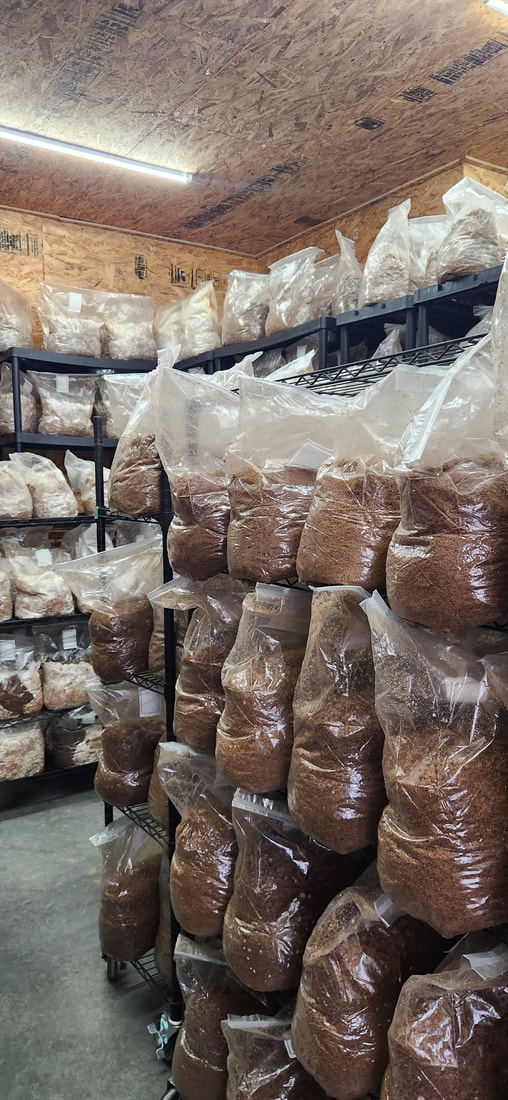 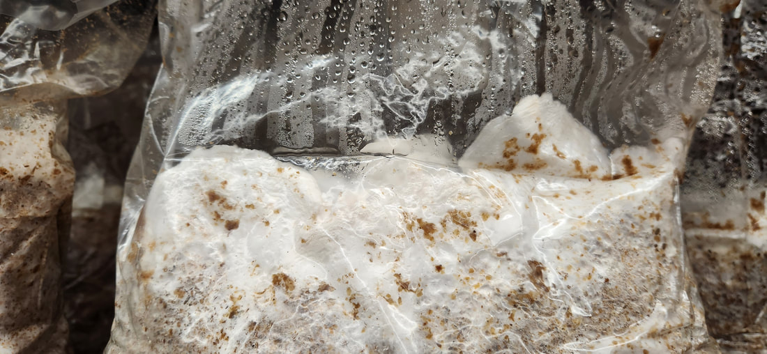 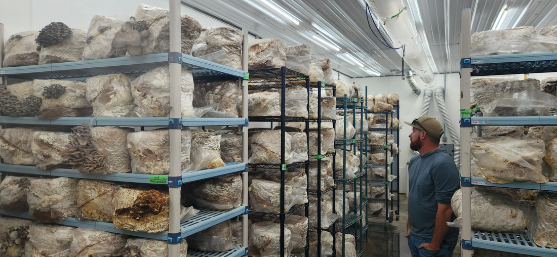 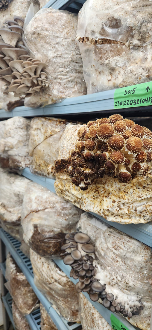 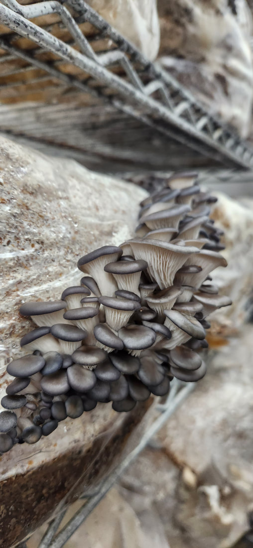 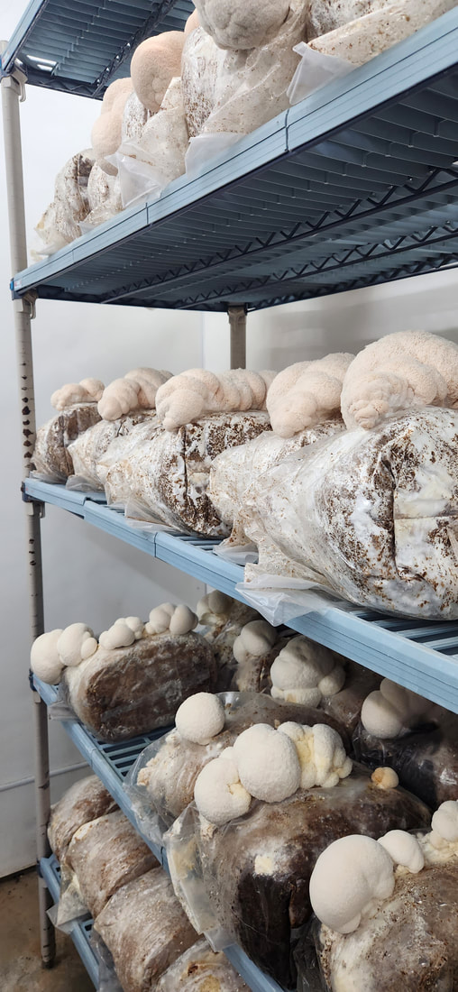 Besides mushrooms, Flavor Country’s microgreens are popular with restaurants. They currently sell 30 varieties of microgreens, but Kevin has developed at least 50 varieties over the years. 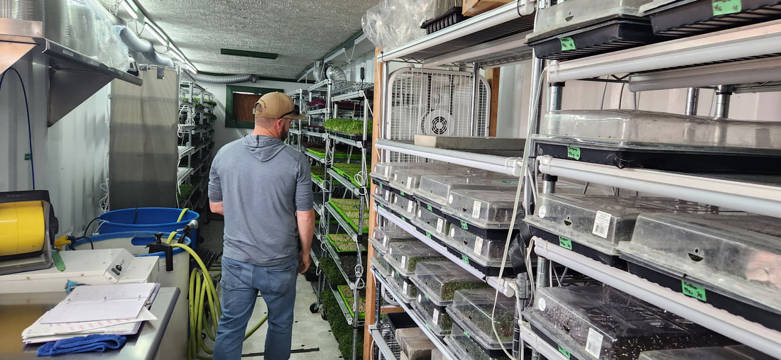 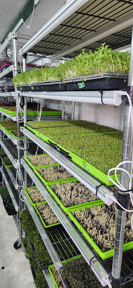 They also grow garlic and several types of herbs. Squash blossoms are a popular seasonal treat that restaurants enjoy. For a while in the spring they even sell locally-harvested morel mushrooms. 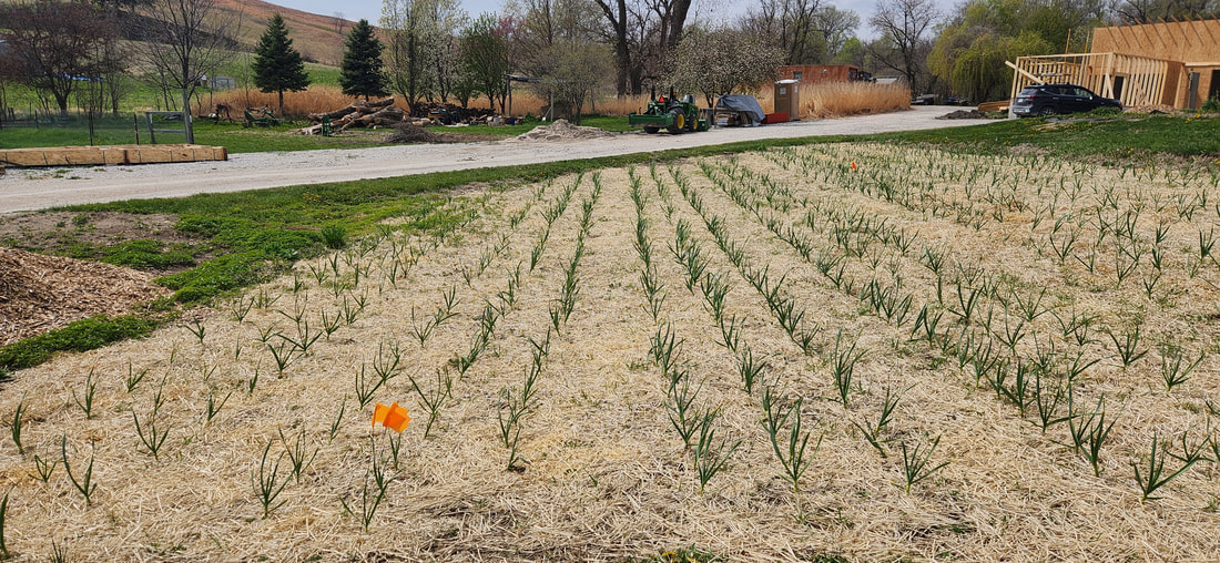 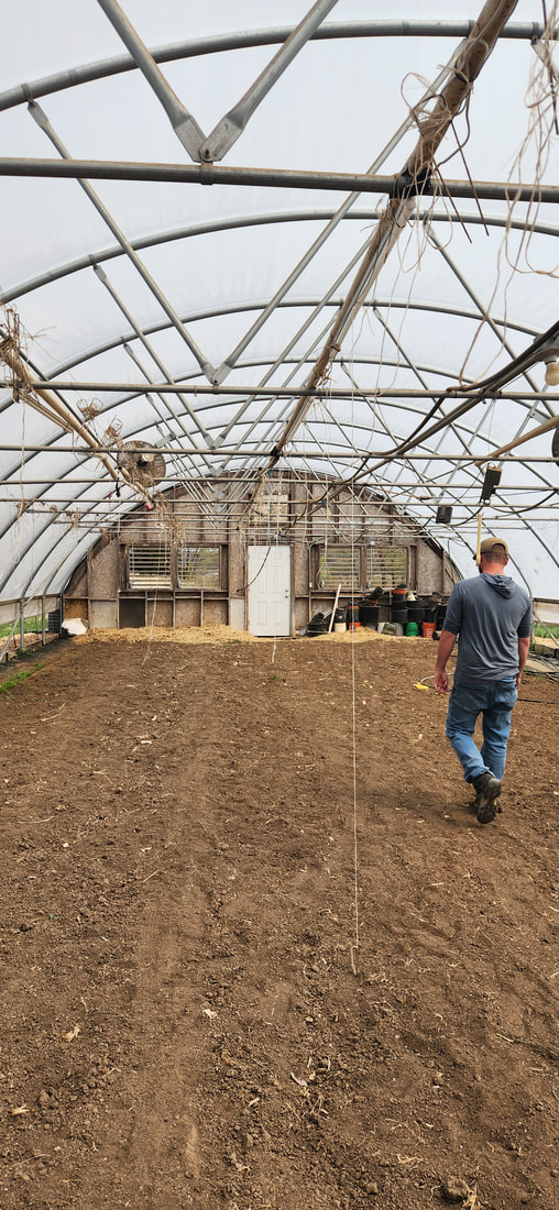 Flavor Country Farms' mushrooms, microgreens, garlic, and herbs can be found at numerous restaurants in the Omaha metro, as well as 712 in Council Bluffs and Pink Poodle in Crescent. In addition to restaurants (their primary customer), several Omaha grocery stores carry their products, including: Hy-Vees at 90th & Center, 180th & Pacific, and 96th & Q in Omaha; Exist Green in Dundee; and Berreras Farms at 194th & F. Additionally, you can find their products at Berreras Farms’ CSA, Iowana Farms’ CSA, and No More Empty Pots. They sometimes have a farm stand at the Casey’s in Crescent on Friday evenings.
They are also considering some on-farm events and are hosting a PFI Field Day this fall, so stay tuned! Follow Flavor Country Farms on Facebook, Instagram, and their website. 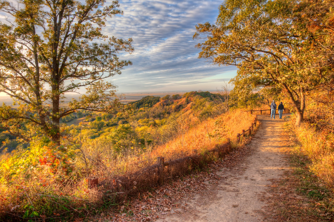 © 2016 Kenneth West
anyone eager to hike amongst the tranquil surroundings of the park’s ridgetop prairies and shaded woodland valleys. With nearly 2,000 acres of recreational opportunity and quiet beauty, Waubonsie State Park is an Iowa gem waiting to be explored. 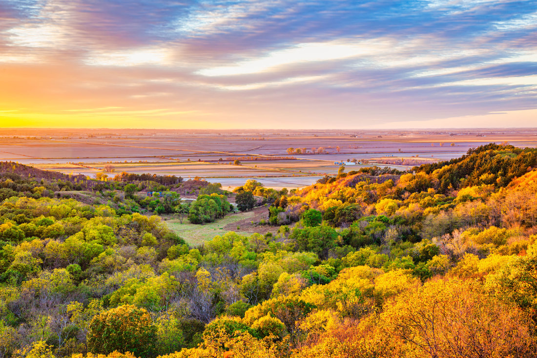 © 2016 Kenneth West Named for Chief Waubonsie of the Native American Pottawattamie tribe, the park is much the same today as it was when it was purchased in 1926. The changing seasons complement the beauty of this countryside. Spring brings the blossoms of dozens of varieties of flowers and shrubs. Summer beckons with cooling breezes on the high places and in shady glens. Nowhere in Iowa are there more brilliant splashes of color than at Waubonsie in the fall, and in the winter the bluffs and ridges are sometimes beautifully blanketed with snow. Several miles of hiking and equestrian trails are available throughout the park. Hike the Sunset Ridge Nature Trail that traverses the heart of the park, offering sweeping views of the Missouri River Valley. The Ridge and Valley trails also provide ample hiking opportunities, taking visitors through quiet and shaded woodland areas. Eight miles of trails are accessible only to hikers. Another eight miles of multi-use trails wind through the northern regions of Waubonsie and are perfect for anyone in search of challenging hikes, mountain biking, horseback riding or snowmobiling opportunities. The trail to the main overlook is accessible for all ages and abilities.
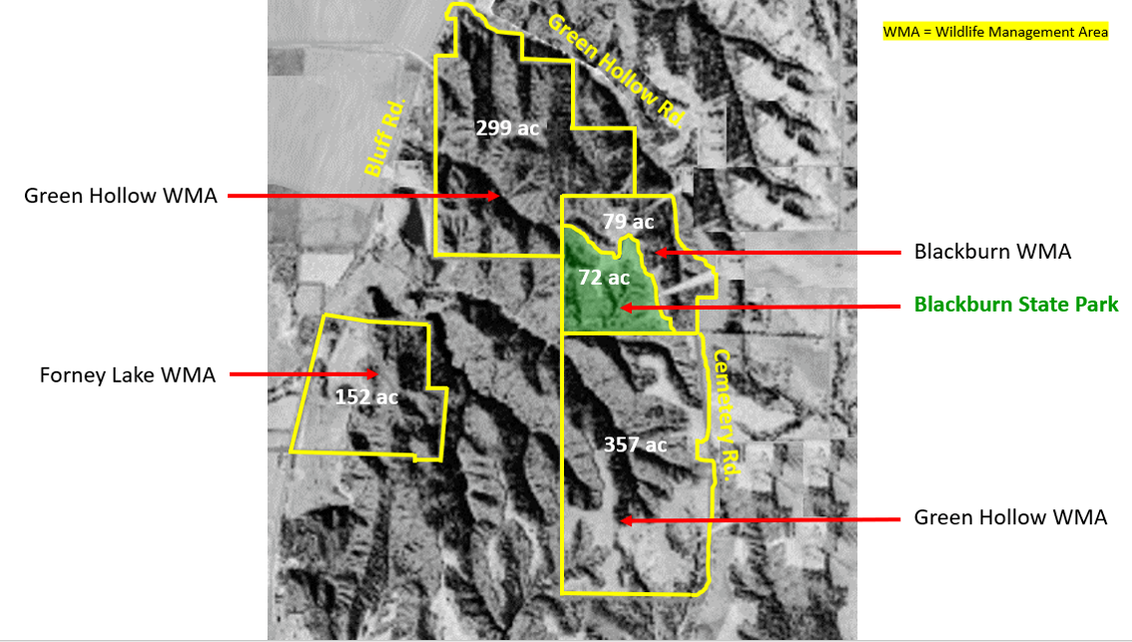
Blackburn State Park Unit, managed by Waubonsie State Park, is a 72-acre park formed in 2019 from the donation of over 150 acres by William R. (Bill) and Sara Blackburn. The park is at the center of approximately 1,000 acres of preserved public grounds, including the Blackburn and Green Hollow Wildlife Management Areas, which are managed by the Nishnabotna Wildlife Unit of the Iowa DNR. The unit includes an overlook platform and reservable large picnic shelter. Given the site’s remote location, there is no public water supply, and all garbage must be removed by the visitor. A 20-acre restored prairie graces high ground where native flowers bloom, especially in late spring. Three beautiful stone benches positioned on the ridge offer grand views of the sunset over the woods. Blackburn WMA & Green Hollow WMA
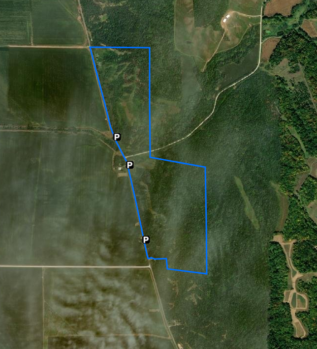
Bring your camera, as there's been reported Sasquatch sightings at this remote and rugged wildlife area!
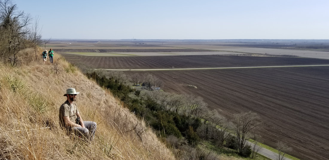
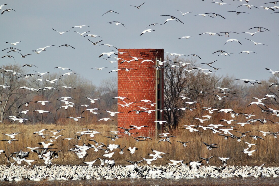 Photo by Carter Oliver
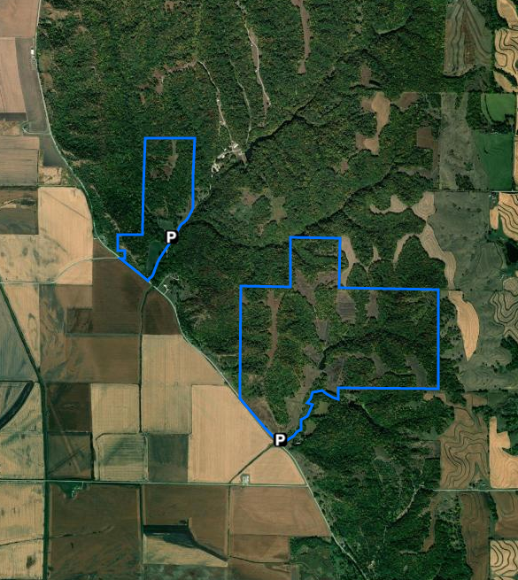
Eli Slusher has only been open to the public since 2016, but has attracted bird watchers, hikers, mushroom hunters and a growing number of archery deer hunters. Being adjacent to Waubonsie State Park and its campsites, cabins and modern shower and restroom facilities, visitors can totally immerse themselves in Iowa’s outdoors. Timbered draws, prairie ridges, steep hills and deep valleys. Eli Slusher WMA is full of wildlife from the hardy — like deer, turkey and badgers — to the more fragile, like zebra swallowtail butterflies and, quite likely, the state endangered Great Plains skink. 
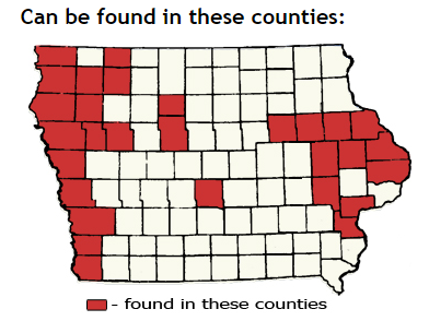
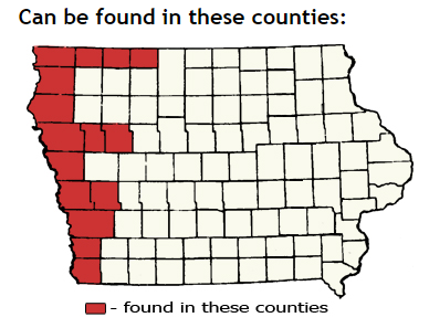
  © 2016 Kenneth West Hiking the Byways is a regular series by Golden Hills RC&D that features publicly accessible lands open to hiking on the three scenic byways in western Iowa that Golden Hills RC&D coordinates: Glacial Trail Scenic Byway, Loess Hills National Scenic Byway, and Western Skies Scenic Byway. Each blog post covers hiking areas in one county on one of the aforementioned byways. For questions about hiking on the byways, contact Seth Brooks ([email protected]). One of the early-blooming flowers on Iowa's prairies is Nothocolais cuspidata, the prairie false dandelion. The yellow flower looks like the common non-native dandelion, but is generally larger. The leaves are long, narrow, and wavy. Nothocolais prefers dry slopes, and is relatively common in the Loess Hills (compared to other parts of Iowa), and more common in drier, western states. It typically blooms in April-May, and most plants have already gone to seed by now (late May). 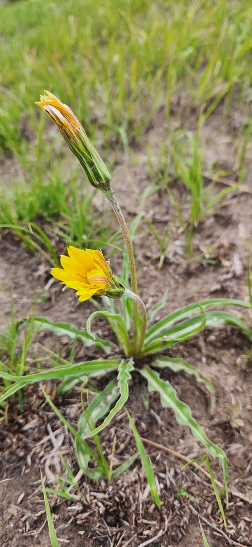 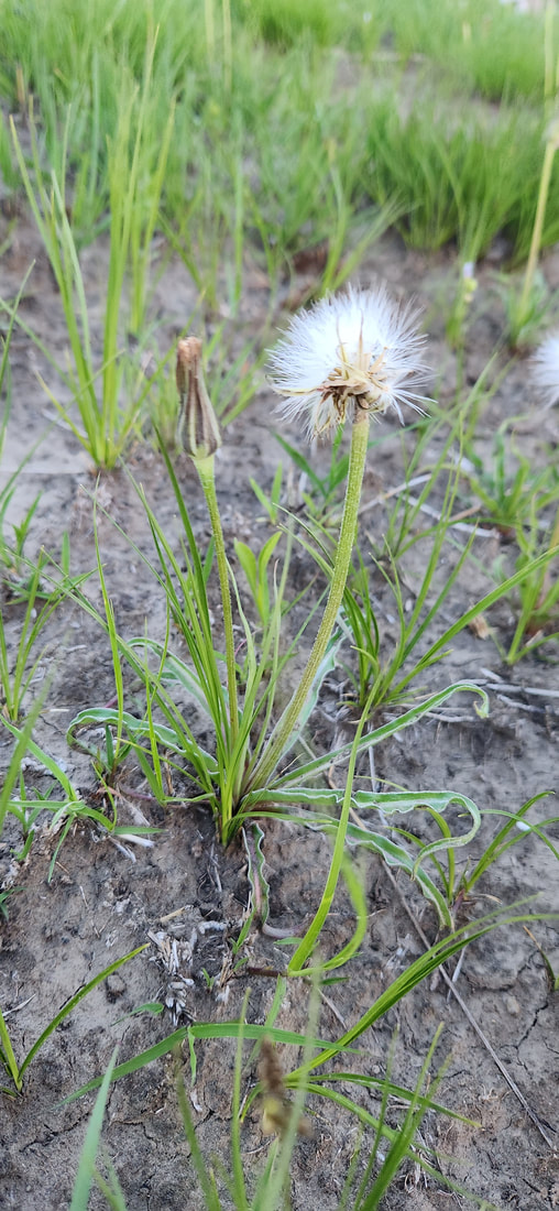 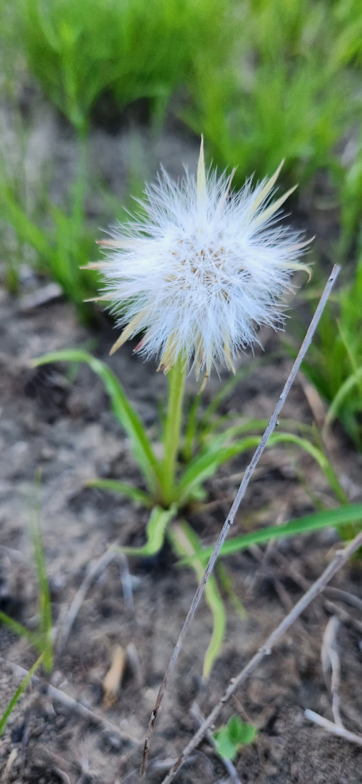 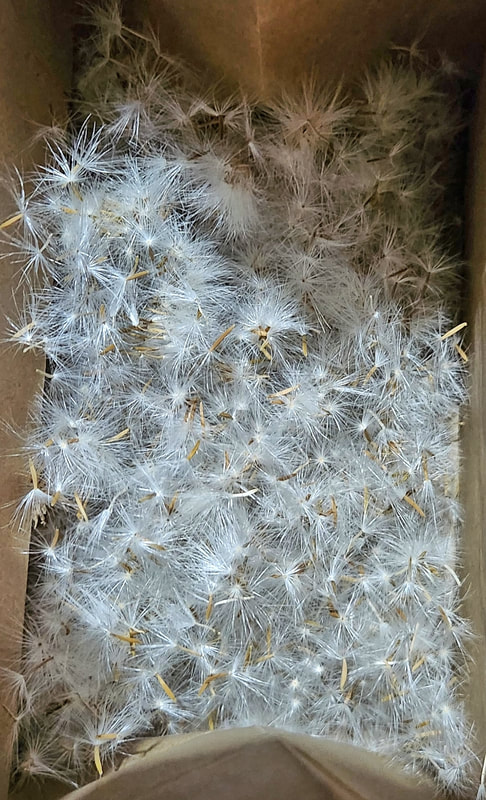 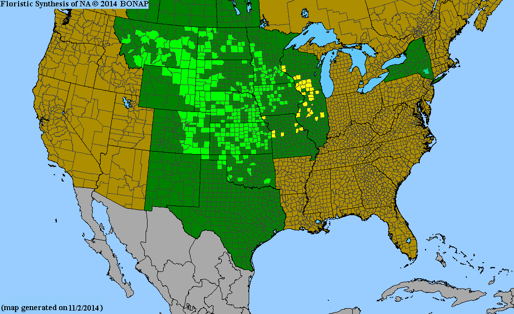 Nothocolais cuspidata range map. Source: http://bonap.net/Napa/TaxonMaps/Genus/County/Nothocalais Check out these links to learn more about Nothocolais cuspidata:
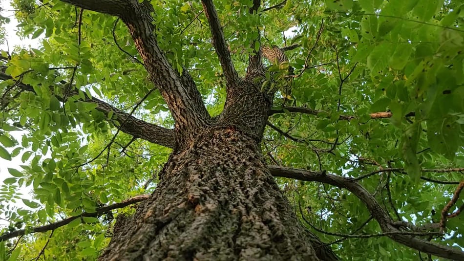
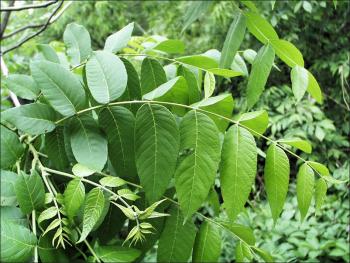
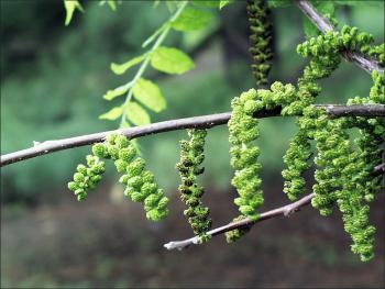
Black walnut (Juglans nigra) is native to Iowa and found in all 99 counties. It occurs on a variety of sites, but is most common on bottomlands, stream terraces, and moist sheltered coves and slopes. It grows best on deep, rich, well drained soils. It usually has a full, well-formed trunk with no branches for quite some distance from the ground. The crown is oval to rounded and somewhat open. A typical black walnut reaches 50 to 75 feet, but it may reach maximum heights of 125 to 150 feet. The leaves are alternately arranged on the twig, compound with 1 to 23 leaflets, and ranging in size from 1 to 2 feet. Common associates of black walnut vary as much as the sites but include oaks, basswood, maples, ashes, and Kentucky coffeetree. Walnut is considered a good invader species and often is one of the first species to become established in abandoned fields and pastures. Squirrels are especially fond of the nuts and aid in the establishment of walnut on these sites. Black walnut roots produce chemicals called juglones which are very toxic to certain other plants such as azaleas, rhododendrons, blueberries, peonies, and solanaceous crops (tomatoes, peppers, potatoes). Most of the toxicity is limited to within the drip line of the tree, but the area of toxicity typically increases outward as the tree matures. sources: Iowa State University Extension and Outreach, Dickinson County Conservation 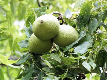 Black Walnut Fruit - Photo by Paul Wray, Iowa State University
|
Archives
June 2024
Categories
All
|


 RSS Feed