Donate to Friends of Blackburn State Park
About
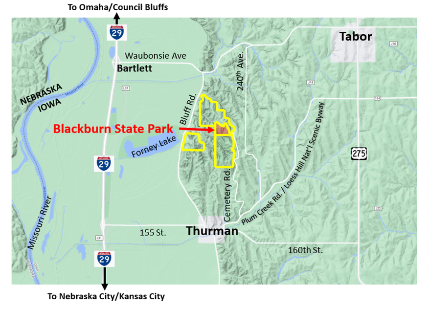
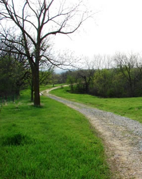
Blackburn State Park, which is managed by Waubonsie State Park, is located in Fremont County, IA, at 1291 Cemetery Road, approximately 3 miles northeast of the town of Thurman and a few miles north of the Loess Hills National Scenic Byway. It’s a 72-acre park formed in 2019 from the donation of over 150 acres by William R. (Bill) and Sara Blackburn. Bill grew up in Southwest Iowa and the donated land is near where his ancestors settled in the 1840s.
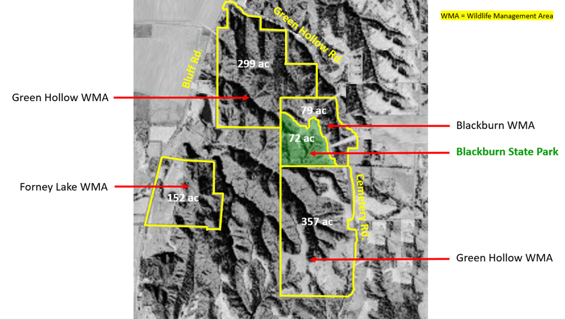
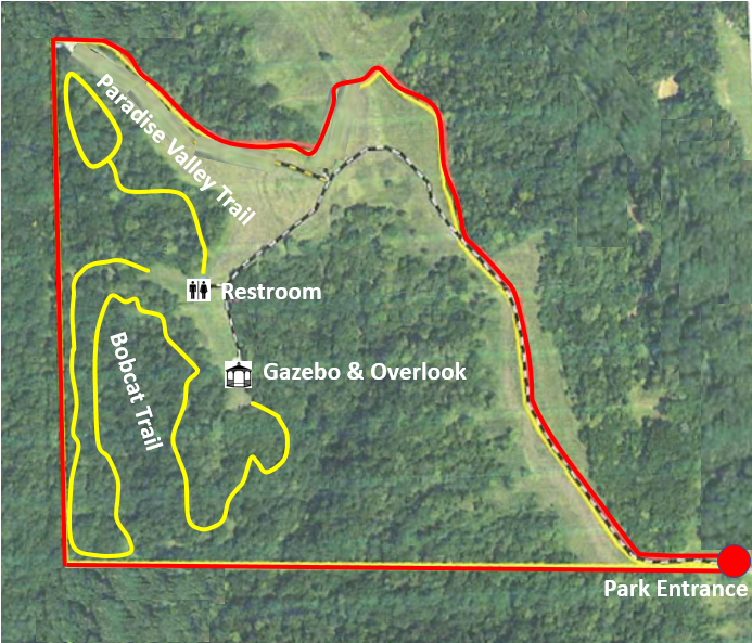
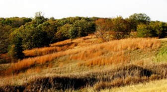
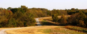
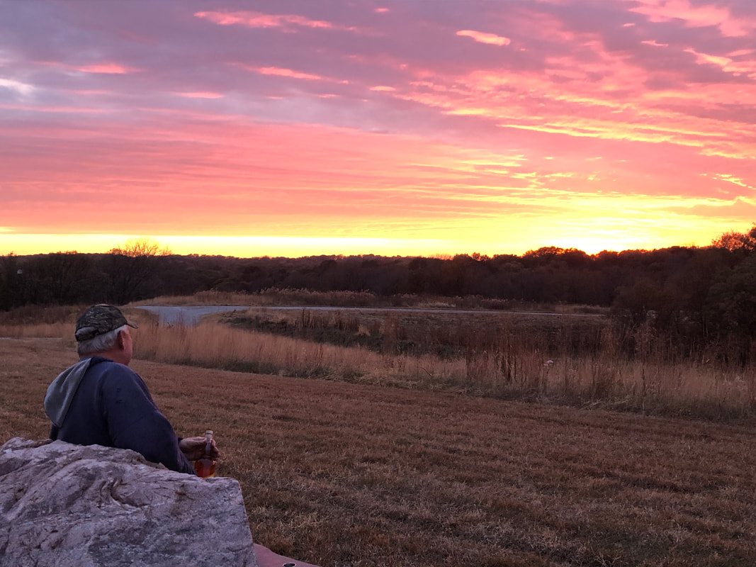
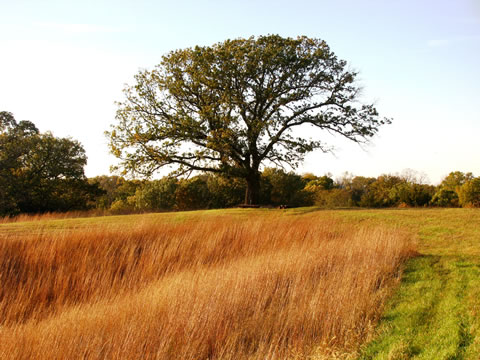
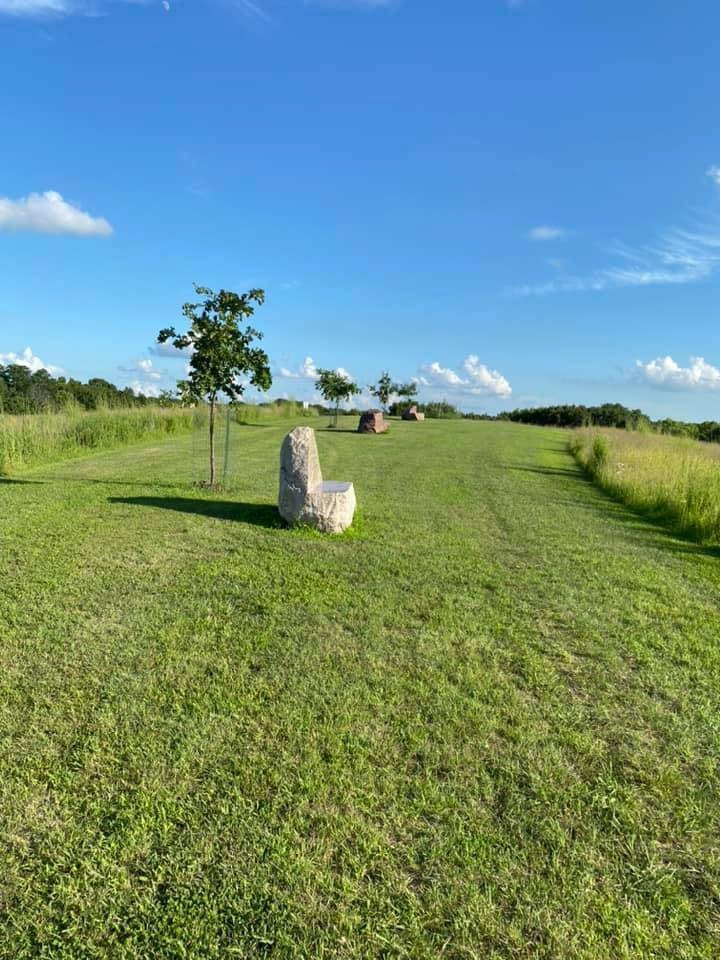
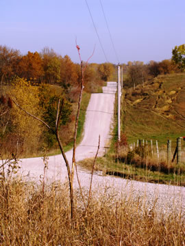
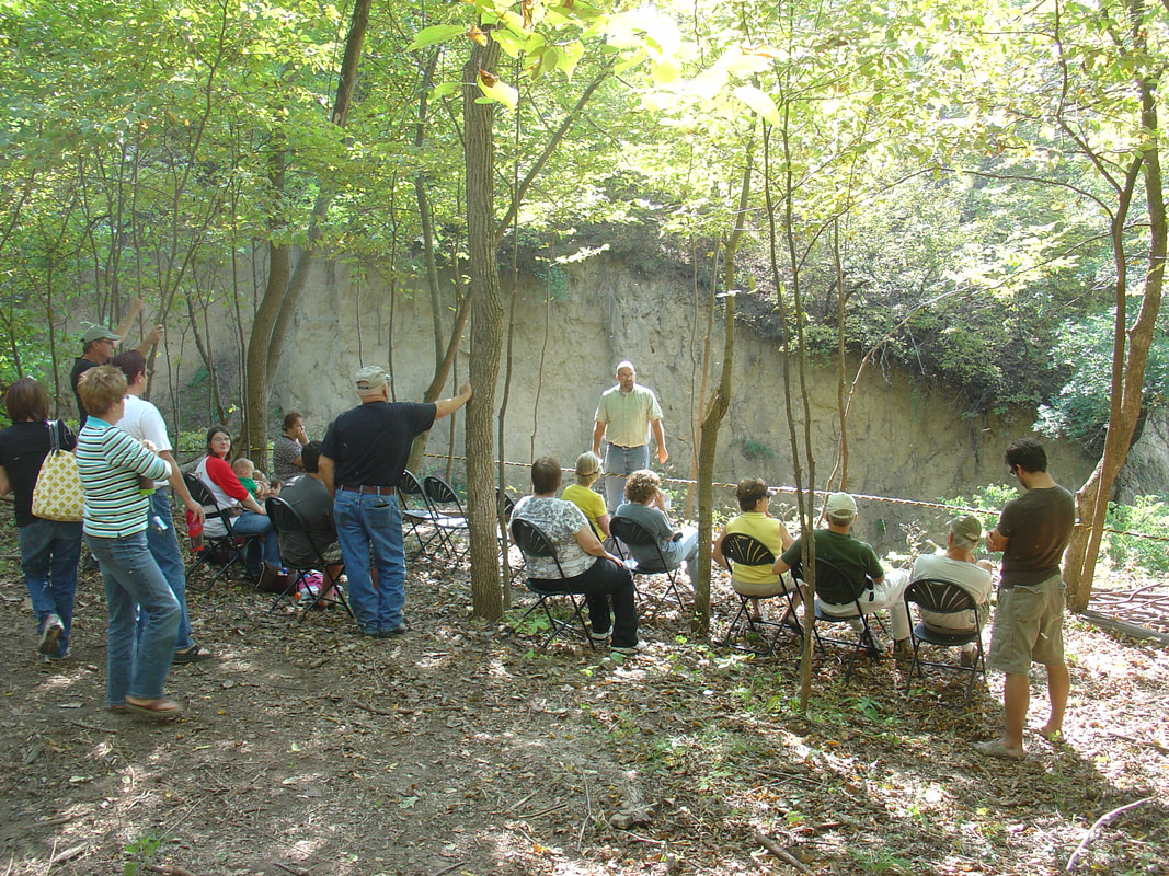
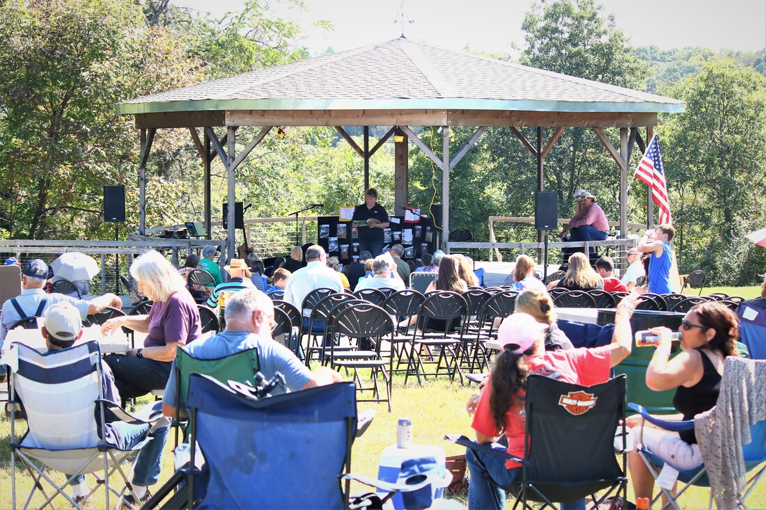
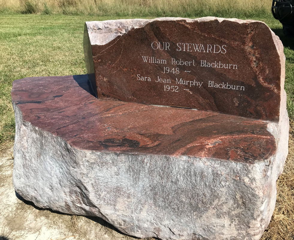
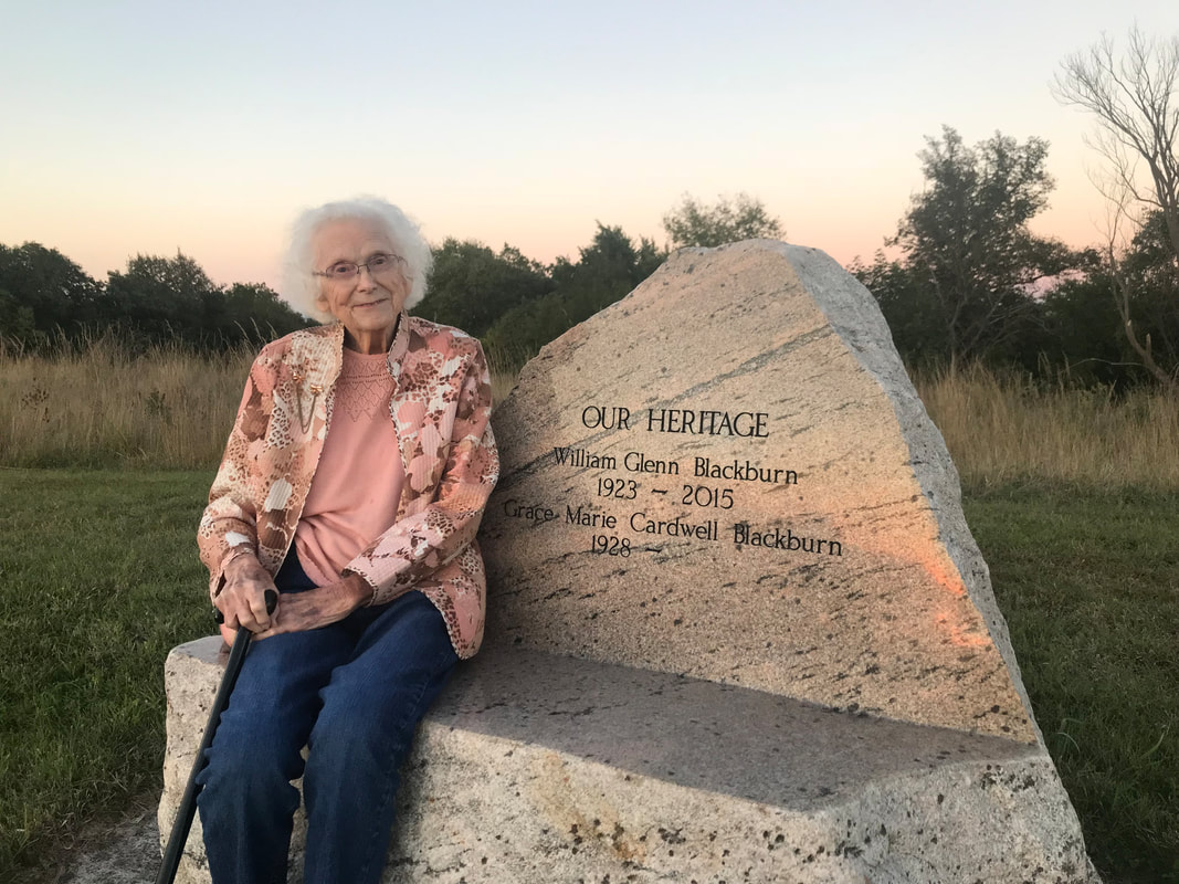
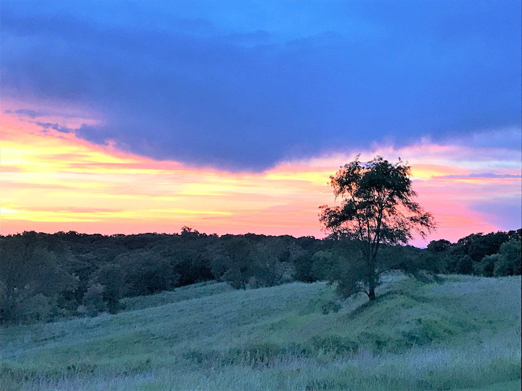
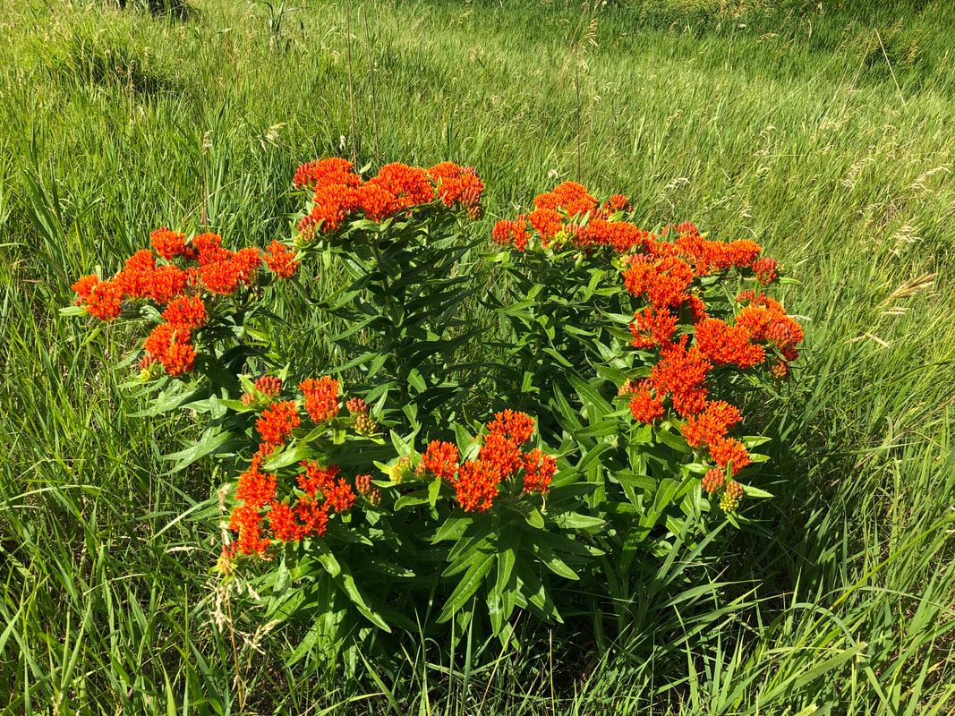
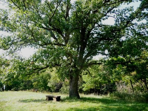
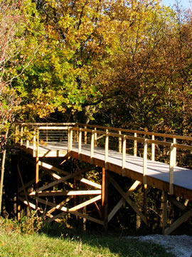
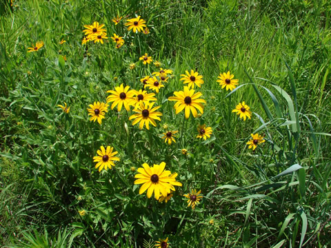
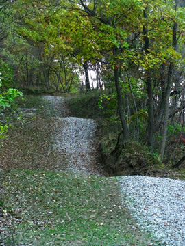
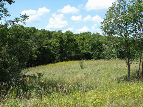
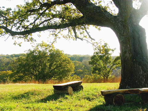
The park is at the center of approximately 1000 acres of preserved public grounds, including the Blackburn and Green Hollow Wildlife Management Areas, which are managed by the Nishnabotna Wildlife Unit of the State Department of Natural Resources. The state park includes a reservable large pavilion/picnic shelter and overlook platform that can accommodate family and community gatherings. The shelter may be reserved by contacting the Waubonsie State Park representatives, below. Hiking trails wind through the timber, with a waterless restroom nearby, as shown in the trails map below. Given the site’s remote location, there is no public water supply, and all garbage must be removed by the visitor. A 20-acre restored prairie graces high ground where native flowers bloom, especially in late spring. Three beautiful stone benches positioned on the ridge offer grand views of the sunset over the woods.
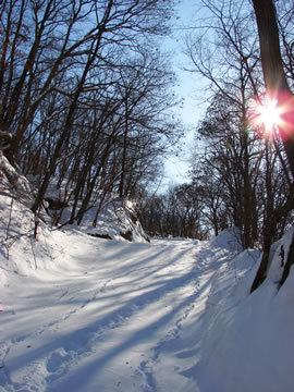
Park hours: Current hours at 4:00AM to 10:30PM daily. The park is only accessible to hikers from December 1st to April 1st.
To host an event at Blackburn State Park, please request a permit through Iowa DNR . A special event is anything that impacts other’s use of the park, such as reserving the gazebo for exclusive use for a wedding or reunion.
Further information about the Blackburn State Park and the surrounding wildlife management areas can be obtained at www.iowadnr.gov and by contacting:
For Blackburn State Park:
Waubonsie State Park
Office: 712-382-2786
Cell: 712-350-0873
https://www.iowadnr.gov/Places-to-Go/State-Parks/Iowa-State-Parks
For the Wildlife Management Areas:
Nishnabotna Wildlife Unit, Iowa Department of Natural Resources
Cell: 712-350-0147
https://www.iowadnr.gov/Hunting/Places-to-Hunt-Shoot/Wildlife-Management-Areas#13254114-d---j
The park is at the center of approximately 1000 acres of preserved public grounds, including the Blackburn and Green Hollow Wildlife Management Areas, which are managed by the Nishnabotna Wildlife Unit of the State Department of Natural Resources. The state park includes a reservable large pavilion/picnic shelter and overlook platform that can accommodate family and community gatherings. The shelter may be reserved by contacting the Waubonsie State Park representatives, below. Hiking trails wind through the timber, with a waterless restroom nearby, as shown in the trails map below. Given the site’s remote location, there is no public water supply, and all garbage must be removed by the visitor. A 20-acre restored prairie graces high ground where native flowers bloom, especially in late spring. Three beautiful stone benches positioned on the ridge offer grand views of the sunset over the woods.
Park hours: Current hours at 4:00AM to 10:30PM daily. The park is only accessible to hikers from December 1st to April 1st.
To host an event at Blackburn State Park, please request a permit through Iowa DNR . A special event is anything that impacts other’s use of the park, such as reserving the gazebo for exclusive use for a wedding or reunion.
Further information about the Blackburn State Park and the surrounding wildlife management areas can be obtained at www.iowadnr.gov and by contacting:
For Blackburn State Park:
Waubonsie State Park
Office: 712-382-2786
Cell: 712-350-0873
https://www.iowadnr.gov/Places-to-Go/State-Parks/Iowa-State-Parks
For the Wildlife Management Areas:
Nishnabotna Wildlife Unit, Iowa Department of Natural Resources
Cell: 712-350-0147
https://www.iowadnr.gov/Hunting/Places-to-Hunt-Shoot/Wildlife-Management-Areas#13254114-d---j
Newsletters
Press Releases
Maps
Access to Blackburn State Park
Blackburn State Park & Surrounding Public Land
Blackburn State Park Trails Map
Address & Google Map Directions
The address of the park is
1291 Cemetery Road
Thurman, IA 51640
Click to open in Google Maps.
1291 Cemetery Road
Thurman, IA 51640
Click to open in Google Maps.
Friends of Blackburn State Park: Donations & Volunteers
"The Friends of Blackburn State Park (otherwise known as The Green Hollow Center, Inc.) is a volunteer organization of people who are supporters of the park. It works with park management to help identify and assist with park improvements. It is a 501(c)3 Iowa nonprofit corporation that accepts tax-deductible donations (the non-profit IRS Tax ID no. 26-463 9738).
Donations are used to fund special park improvements and educational and community activities hosted at the park. For example, the group has sponsored student Earth Day events, volunteer days, and other events.
If you would like to make a financial contribution to help sustain our efforts, please donate below. Donate with PayPal (credit or debit cards), Venmo (@FriendsOBSP), or via check (mail to Glenwood State Bank, Tabor Branch, 711 Main St., Tabor, IA 51653)."


Send checks made payable to:
"Friends of Blackburn State Park"
Glenwood State Bank, Tabor Branch
711 Main St.
Tabor, IA 51653
People may also request to be approved as a park volunteer to help with funded projects or to assist the park with its own initiatives, such as tree planting, prairie burns, or the removal of invasive plants. Of course, the park’s own initiatives will be performed under the direction and supervision of personnel from the state Department of Natural Resources, who will also provide any needed training, equipment and government approvals and notifications. Each volunteer for a park initiative will be listed in the combined listserv for Friends of Waubonsie (and Blackburn) State Park for ease of communication and may be invited to participate in projects from both parks.
Inquiries about funded projects, volunteer initiatives, or the Friends group may be directed to one of the following representatives:
- Ken Forney, ph. 712.313.0315, email: [email protected]
- Mike Younts, ph. 402.209.7292, email: [email protected]
- Sharon Nyquist 515-991-6978 [email protected]
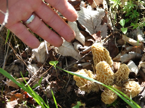
Plants & Animals
Plants and animals that have been found in and around Blackburn State Park are listed here.
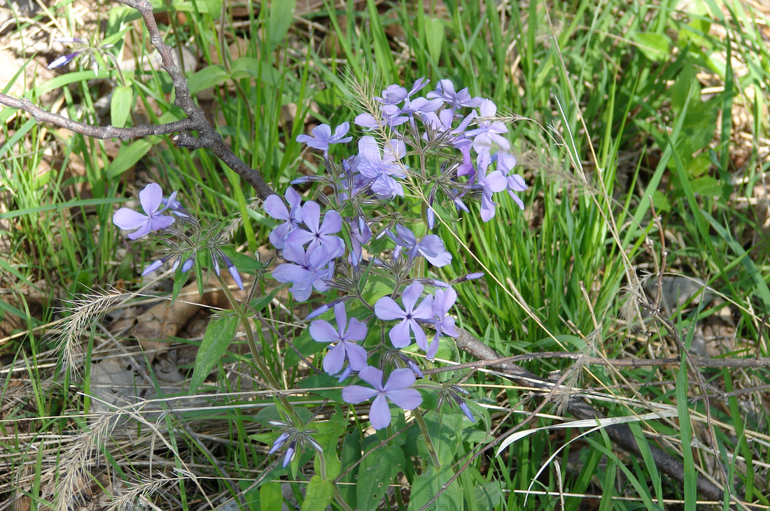
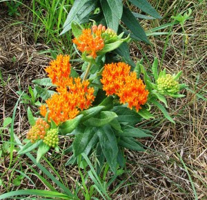
Ninety-seven Loess Hills plant and animal species are of special interest to experts because they are either eastern species on the western edge of their range, western species on the eastern end of their range, or are among the 39 listed by the state of Iowa as endangered, threatened or of special concern. In fact, this region has one of the largest concentrations of rare species in the state.
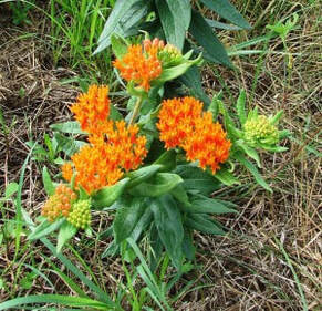
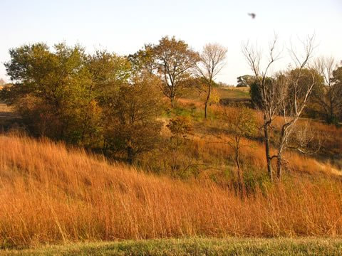
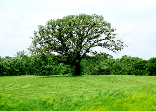
With government assistance, a number of timber and prairie improvement projects have been undertaken on the site over the years. Scrub trees have been thinned and many invasive plants removed. Original prairie grasses have re-sprouted in areas where cedars were cut back. In 2008-2010 all tilled agricultural lands, approximately 20 acres in total, were planted in native Iowa prairie grasses and forbs (flowers), many of which were originally found in this part of the Loess Hills centuries ago.
Ninety-seven Loess Hills plant and animal species are of special interest to experts because they are either eastern species on the western edge of their range, western species on the eastern end of their range, or are among the 39 listed by the state of Iowa as endangered, threatened or of special concern. In fact, this region has one of the largest concentrations of rare species in the state.
With government assistance, a number of timber and prairie improvement projects have been undertaken on the site over the years. Scrub trees have been thinned and many invasive plants removed. Original prairie grasses have re-sprouted in areas where cedars were cut back. In 2008-2010 all tilled agricultural lands, approximately 20 acres in total, were planted in native Iowa prairie grasses and forbs (flowers), many of which were originally found in this part of the Loess Hills centuries ago.
The Loess Hills
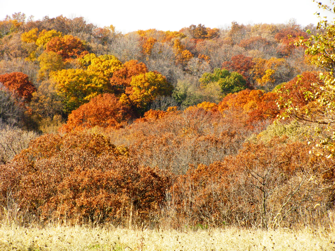
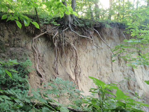
The Loess Hills - Blackburn State Park is located in the Iowa Loess Hills, a rare landform. Loess (pronounced “luss”), a German term meaning loose or crumbly, is a yellowish sedimentary deposit of wind-blown silt forming a distinctive 640,000-acre range of hills (bluffs or “miniature mountains”) up to 250 feet high and 3 to 10 miles wide, running parallel to the Missouri River 220 miles from Mound City, MO to Westfield, IA. During the warm months of the glacial period 12,000 to 30,000 years ago, glacial melt from the north brought glacier-ground silt (or “rock flour”) down the Missouri River, where it accumulated in mud flats. During the winter, when the water froze and glacial flow subsided, the mud dried and the silt was blown by westerly winds into dunes on the east side of the river. These dunes were eventually stabilized with grass and trees.
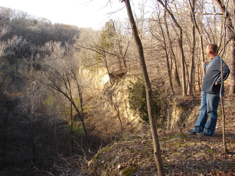
The loess, called “sugar clay” by the locals, is extremely hard when dry but becomes very slippery and easily eroded from the top when exposed and wet. However, when protected at the top by trees and other vegetation, the loess ravines maintain their steep, stable cliffs, up to 100 feet in height. Loess naturally sloughs into terraces or “cat steps” along steep slopes. While loess is found in many locations, including the Rhine River valley in Germany, only this region along the Missouri River and another near Shaanxi, China have sufficient deposits (60-200 feet) to form an extended range of hills. It is loess that gives China’s Yellow River its color.
The loess, called “sugar clay” by the locals, is extremely hard when dry but becomes very slippery and easily eroded from the top when exposed and wet. However, when protected at the top by trees and other vegetation, the loess ravines maintain their steep, stable cliffs, up to 100 feet in height. Loess naturally sloughs into terraces or “cat steps” along steep slopes. While loess is found in many locations, including the Rhine River valley in Germany, only this region along the Missouri River and another near Shaanxi, China have sufficient deposits (60-200 feet) to form an extended range of hills. It is loess that gives China’s Yellow River its color.
Government & Public Interest
In the 1930s, three state parks were established in the Loess Hills. More than 10,000 acres in the northern part of the range were included in the National Registry of National Landmarks in 1986. Through the effort of multiple public agencies, local communities and private organizations, the Loess Hills Scenic Byway was established through the heart of the hills formation in the 1990s. A part of the byway passes near the park. In 2000 the route was designated as a National Scenic Byway by the Federal Highway Administration. It was named one of the 10 most scenic roads in the U.S. by nonprofit Scenic America. In 1995, the Natural Resources and Conservation Service of the US Department of Agriculture undertook a study that showed that nearly 85,000 acres of Loess Hills contains natural and cultural resources of critical importance. Four years later, the Iowa legislature formed the Loess Hills Alliance, a broad, grass-roots organization composed of representatives from each of the seven counties in the Loess Hills. Their charter is to promote the protection of the hills. In 2002, the National Park Service published the results of a survey and study of the region undertaken at the direction of Congress to evaluate the Loess Hills for possible designation as a unit of the National Park System. While a majority of the cross section of interviewees in the seven affected counties agreed with federal land purchase for a national park, the landowners in the northerly four counties strongly disagreed. Since then, state, local and private conservation groups along with concerned landowners, have been the main actors in securing Loess Hills lands for protection.
History
|
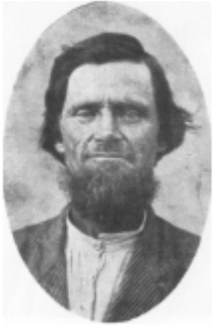
George Forney (Old Graybeard)
|
William G. (Big Bill) Blackburn, 1930s neighbor, storyteller, and park supporter.
|
Humans first arrived in the Loess Hills area soon after most of the loess sediment was deposited, around 11,000 BCE (BC) to 8,500 BCE (BC). These so-called Paleoindians were nomadic hunters of bison and other large game. The Archaic peoples that followed from 8,500 BCE (BC) to 800 BCE (BC) were nomadic hunter-gathers but made greater use of semi-permanent base camps and smaller seasonal camps. The Woodland Indians (800 BCE (BC) to 1300 CE (AD)) were more sedentary, living in small hamlets of structures that were earth-covered or wattle-and-daub (woven lattice of wooden strips--wattle– that was daubed with a sticky material usually made of some combination of wet soil, clay, sand, animal dung and straw). These people made pottery, hunted deer and small game, cultivated corn and squash, and gathered wild berries and seeds. They prospered for approximately 300 years, disappearing from the archaeological record around 1300 CE (AD) due to extended drought, according to some experts, or because the threats of Oneota Indian raiders (predecessors of the Ioway and Otoe tribes), according to others.
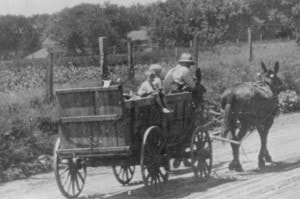
The Oneota were about the only Indians roaming the hills from 1300 CE (AD) to until the 1700s. Then the Ioway Indians (called Ayauway by Lewis and Clark) and ancestors of the Pawnee began to appear. Hunting parties from the Otoe and Omaha tribes that lived on the west side of the Missouri River also started venturing to the Iowa side and into the Hills. The nomadic Dakota Sioux traveled the river, roving the territory on both sides. In 1837, the Potawatomi[1] Indians were relocated from Indiana and Illinois to Missouri and ultimately to this part of Iowa. They remained there with their great war chief, Waubonsie[2], until 1846-48, when, in response to pressures from growing pioneer settlements, they were moved to Northeast Kansas. George Forney, Bill’s grandmother’s great grandfather, owned the eastern portion of the property in the mid-1800s. Called Graybeard by the Pottawatomie Indians, he was asked by the tribe to care for their platform burial grounds nearby when those native people were relocated to Northeastern Kansas. Bill’s father, William G. Blackburn grew up not far from the center property, and during his youth often found arrowheads and other Native American artifacts in the ravines and creek beds that bound the property.
On July 16, 1804, Meriwether Lewis and William Clark observed this part of the hills. Clark recorded in his journal: “This prairie I call the Ball pated (sic) prairie from a range of ball hills parrell (sic) to the river from 3 to 6 miles distant & extends as far up the down as I can see.” At that time the Loess Hills had remained generally treeless except for a few oak savannahs due to the drier climate and repeated prairie fires. Artist George Catlin traveling by steamboat up the Missouri River in 1832 went ashore to climb the Loess Hills and described the place as one where a “thousand velvet-covered hills go tossing and leaping down with steep or graceful declivities.”
Click here to download a PowerPoint presentation about the history of the park.
[1] Sometimes spelled “Pottawattamie” or “Pottawatomie.” The name is a traditional word meaning “Fire Keepers” or “Keepers of the Council Fires”.
[2] Sometimes spelled “Waubonsee” or “Wabaunsee”.
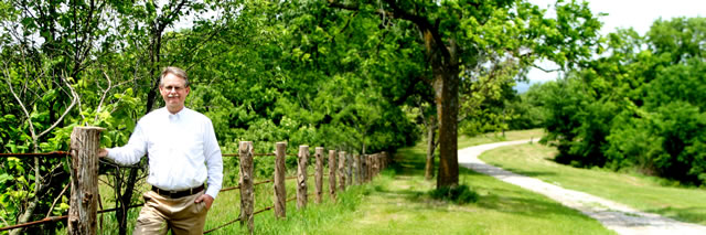
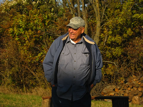
William R. (Bill) Blackburn, park donor
References
- Mutel, Cornelia F., Fragile Giants, Iowa City: University of Iowa Press, 1989
- U.S. Department of Interior, National Park Service Midwest Regional Office, Loess Hills of Western Iowa: Special Resource Study and Environmental Assessment, January 2002
Photo Gallery


Drone footage below courtesy of Piercing Sight Drone LLC, Thurman, IA, 712-581-3030, [email protected]
This website is sponsored by Friends of Blackburn State Park and hosted by Golden Hills RC&D.
Contact info for Golden Hills is below.
Contact info for Golden Hills is below.