
East Nishnabotna River (photo by Seth Brooks)
Cold Springs Park, a 104-acre park managed by Cass County Conservation, is a long-time favorite of area residents. The park is one mile south of Lewis. A large camping area and a 16-acre lake provide numerous recreational opportunities, including fishing, swimming, and paddling.
Once you reach the East Nishnabotna, there are several ways to the river. The footpath on the north of the loop at the end of the trail leads to an access point requiring a short scramble down to the river. There is another access that leads to a sandy area. If water is low, you can also access the rock shelf from here. If water is high, however, you will need to scramble down the aforementioned path to reach the rock shelf.
The area is a popular destination for family picnics and swimming during the summer, but it has dangerous currents and deep water. There are some spots in the river that are thirty to forty feet deep. Additionally, the currents can create a whirlpool effect that can be dangerous even for very good swimmers. Unfortunately, several people have drowned over the years despite warnings. If you recreate at the Rock Cut, please take the warnings seriously.

Fishing at the Nishnabotna Rock Cut

Fishing at the Nishnabotna Rock Cut

Map via AllTrails. Note the trailhead's location in relation to the park's main entrance.
0 Comments
Check out the Summer 2024 newsletter for the East & West Nishnabotna River watershed below, or download a pdf here!    Our mission at Golden Hills RC&D is to collaboratively develop and lead community, conservation, and cultural initiatives to improve our quality of life in rural western Iowa. Our "official" territory from our original organizational bylaws is an eight-county region in the southwestern portion of Iowa (Cass, Fremont, Harrison, Mills, Montgomery, Page, Pottawattamie, and Shelby). In 2023, we added four more counties (Audubon, Carroll, Crawford, and Monona). Several projects extend beyond these 12 counties into more than 20 counties (learn more about where we work). 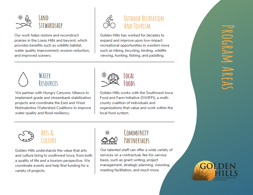 Our goals are to develop industries in local communities that utilize local resources; ensure healthy natural resources that meet the needs of agriculture, industry, private use, and recreational facilities; promote and enhance art, culture and historic resources in rural communities; collaborate with local governments and organizations on projects that benefit the environment; and work on projects that fill gaps in community services to benefit people of southwest Iowa. We accomplish these goals by focusing our work in five program areas: outdoor recreation and tourism, land stewardship, water resources, local foods, and arts and culture. Today's Mission Monday focus is Water Resources. 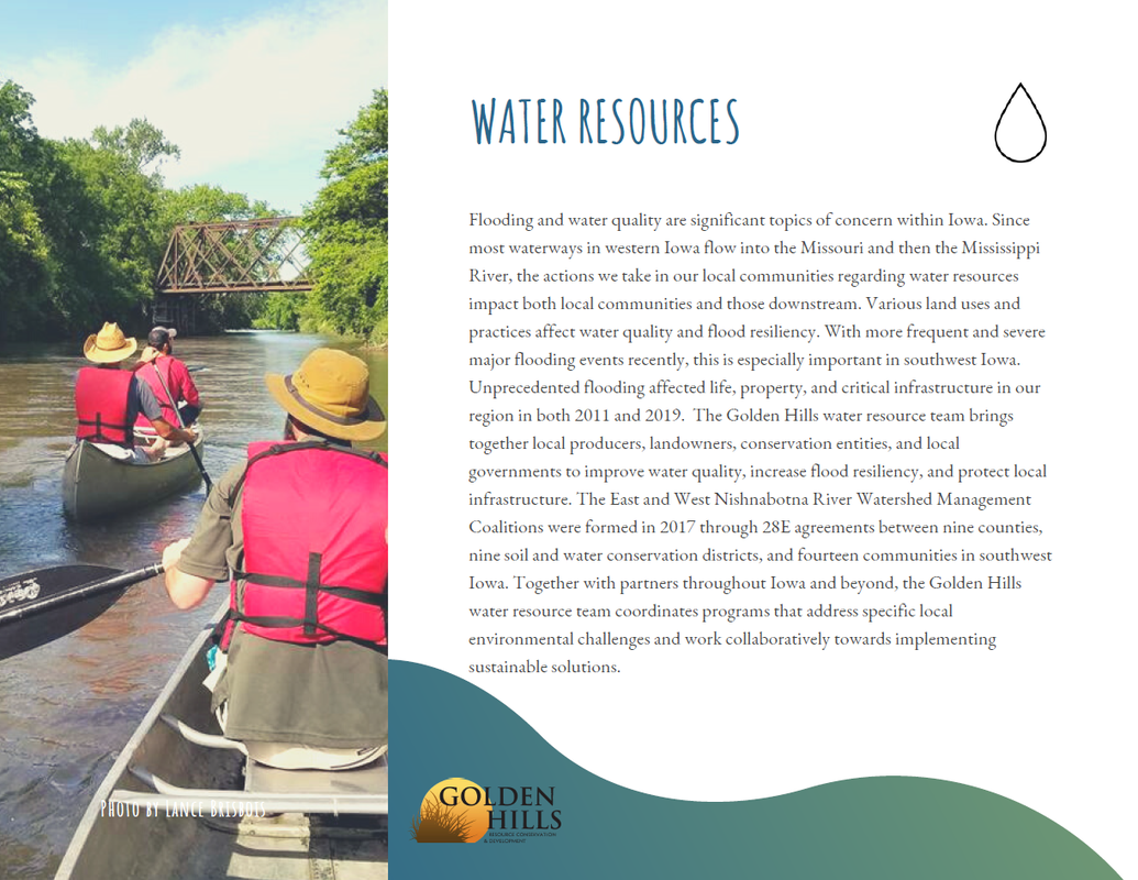 The West Nishnabotna River in Pottawattamie County has been designated as a water trail by the Iowa Department of Natural Resources, and is the only such water trail in Southwest Iowa. Golden Hills has been the West Nish Water Trail coordinator since 2010. Pottawattamie County Conservation Board helps manage the water trail and maintains river accesses at two county parks (Botna Bend and Old Town). The Iowa Department of Natural Resources' Water Trails program has provided funding and support since the beginning. Many water trails exist across Iowa. Visit the DNR's website to learn more. If you would like to experience the West Nishnabotna River Water Trail, check out the interactive Google map on this page or click here to download a pdf brochure. To learn more about the West Nish Water Trail, contact Lance Brisbois at [email protected] or 712-482-3029.      Artwork by Kurt Sloop Waubonsie State Park, Golden Hills RC&D and the Loess Hills National Scenic Byway are excited to announce the Waubonsie State Park Artist-in-Residence award for the 2024 June program! The Artist in Residence program was created to help reach a broader audience of park-goers, thus increasing the number of visitors and ultimately educating more people about the Loess Hills ecosystem. The artist will engage with the natural resources of the park through an artistic lens. Many quality applications were received from artists representing a wide array of disciplines. One artist was selected to fill one residency from June 14-28. The artist will use his time at Waubonsie to immerse themselves in the landscape as a source of inspiration and opportunity to intensely focus on their work. The artist receiving the residency award for the June program of the Waubonsie State Park Artist-in-Residence Program is Kurt Sloop, a native of southwest Iowa. Kurt Sloop, a versatile artist and dedicated art teacher, has spent over 20 years inspiring young minds in Tarkio, Missouri and Essex, Iowa. Growing up in Hamburg, Iowa, with Waubonsie State Park as his playground, Sloop's artistic journey has been shaped by his love for nature and his unique creativity. His art defies categorization, ranging from delicate colored pencil drawings of fall leaves to inventive Cosplay blasters. But his native art language is spoken in oil painting and drawing. Most of his artwork is displayed in hundreds of elementary students' homes across Northern Missouri and Southwest Iowa. Sloop's residency at Waubonsie State Park will highlight his passion for exploring new ideas, experimenting with different mediums, and bringing his unique perspective to life through his art.  Artwork by Kurt Sloop One of the region’s ecological and recreational treasures, Waubonsie State Park’s 2,000 acres in the Loess Hills of southwest Iowa feature prairies, savannas, and woodlands which are home to diverse flora and fauna, not to mention breathtaking vistas. Park manager Matt Moles worked with Golden Hills RC&D to develop and launch the project. While there have been other artist residency programs offered through the National Parks System and parks in other states, this was the first such program in one of Iowa’s state parks. The program is loosely modeled after similar regional residency programs. The artists will receive lodging in a studio cabin and a primitive studio space in the park at no cost for the duration of the residency. In return, artists are encouraged to deliver at least one public program and donate one piece of art to the park at the conclusion of their stay.   Click for a larger image Our mission at Golden Hills RC&D is to collaboratively develop and lead community, conservation, and cultural initiatives to improve our quality of life in rural western Iowa. Our "official" territory from our original organizational bylaws is an eight-county region in the southwestern portion of Iowa (Cass, Fremont, Harrison, Mills, Montgomery, Page, Pottawattamie, and Shelby). In 2023, we added four more counties (Audubon, Carroll, Crawford, and Monona). Several projects extend beyond these 12 counties into more than 20 counties (learn more about where we work). 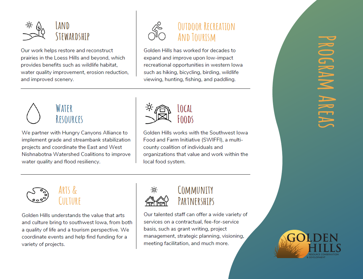 Click for a larger image Our goals are to develop industries in local communities that utilize local resources; ensure healthy natural resources that meet the needs of agriculture, industry, private use, and recreational facilities; promote and enhance art, culture and historic resources in rural communities; collaborate with local governments and organizations on projects that benefit the environment; and work on projects that fill gaps in community services to benefit people of southwest Iowa. We accomplish these goals by focusing our work in five program areas: outdoor recreation and tourism, land stewardship, water resources, local foods, and arts and culture. Today's Mission Monday focus is Local Foods.  Click for a larger image  Click for a larger image The 2024 farmers market season is here! We have updated our Southwest Iowa Farmers Market Guide to include new markets and updated dates, hours, and locations. The guide covers eight counties in southwest Iowa that are part of the Southwest Iowa Food and Farm Initiative (SWIFFI). New markets this year include the once monthly Crescent Farmers Market, Red Oak Market at Montgomery Hospital, and The Mill in Shenandoah. Additionally, 2024 sees the return of a farmers market in Sidney!  Click for a larger image In Southwest Iowa, farmers markets are vibrant hubs of community activity, where locals and visitors alike gather to celebrate the region's agricultural bounty. These markets, often nestled amidst picturesque rural landscapes, offer a delightful assortment of fresh produce, artisanal goods, and homemade treats. From crisp sweet corn to juicy tomatoes and fragrant herbs, the seasonal offerings showcase the rich diversity of Iowa's fertile lands. Visiting a farmers market in Southwest Iowa is more than just a shopping trip; it's an opportunity to connect directly with the hardworking farmers and producers who nurture the land. Conversations flow freely as shoppers chat with vendors about sustainable farming practices, heirloom varieties, and favorite recipes. There's a sense of camaraderie as everyone comes together to support local agriculture and savor the flavors of the season. Beyond the stalls of fruits and vegetables, Southwest Iowa farmers markets often feature live music, cooking demonstrations, and family-friendly activities, creating a festive atmosphere that's enjoyed by all ages. Whether you're stocking up on groceries for the week or simply soaking in the sights and sounds, a visit to one of these markets is sure to leave you with a deeper appreciation for the rural heritage and culinary treasures of Southwest Iowa.  On Thursday, May 23, Golden Hills hosted an educational field day about prairie strips as part of the West Nishnabotna Water Quality & Infrastructure Partnership.  This field day at Maple Edge Farm highlighted the innovative in-field conservation practice of prairie strips. Shortly after Golden Hills RC&D Project Coordinator Shaun Ahern made some opening announcements, attendees took a wagon ride across the nearby field to the prairie strip site.  On the way there, a brief stop was made overlooking the prairie strip site downslope. Host farmer Jon Bakehouse shared his experience in witnessing the erosion in the adjacent field and his desire to install a conservation practice such as prairie strips to minimize such erosion. Jon explained the process of working with Golden Hills RC&D through the Iowa Watershed Approach to install the prairie strips. 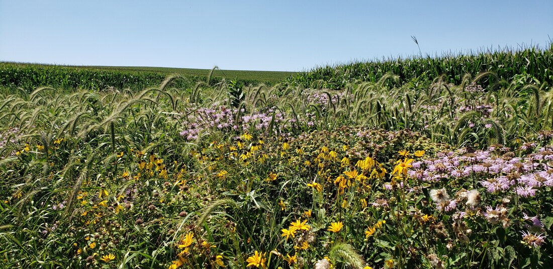 example of a prairie strip in a cornfield Once in the field at the strips site, Tim Youngquist with Iowa State University spoke about the ISU STRIPS program, prairie strips as a practice, and their multitude of benefits. Benefits not only include the reduction of soil erosion and nutrient runoff, but increased biodiversity and health benefits. In fact, Jon stated how he visits the prairie strips when he’s having a bad day. He also spoke about seeding and management recommendations, such as prescribed fire and mowing. After speaking, Tim took a number of questions, including the difference between buffer and prairie strips, explaining how they are a long-term practice, and giving suggestions for resources to help someone with planning establishment and management of their prairie. 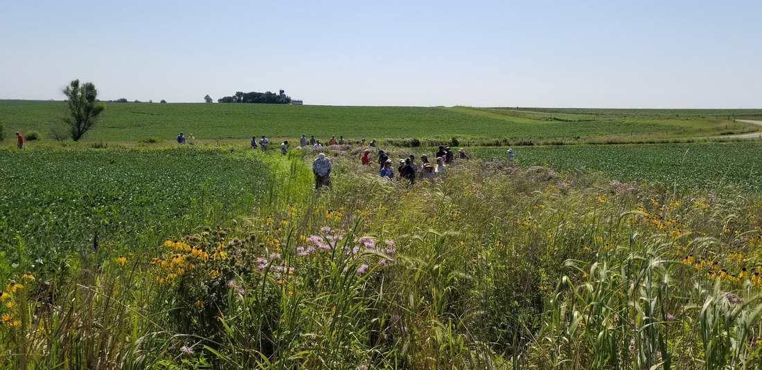 example of prairie strips in a rowcrop field After that, Andrew Olson from the Tallgrass Prairie Center (TPC) started off by showing a banner of a prairie plant highlighting how deep their roots are. He then gave some background of the TPC and explained that research has shown that prairie plants don’t clog tile lines. He also fielded a few audience questions after speaking. Since time allowed, attendees got the chance to walk the prairie strip if they wanted. During that time Tim pointed out a prairie plant there affected by herbicide drift, emphasizing that it shouldn’t be of concern if it isn’t a direct application given how tough prairie species are. Attendees then headed back on a wagon ride and a few closing announcements were made before the event concluded.   photo from KMTV The strips field day was also covered by KMTV. You can read their story here.
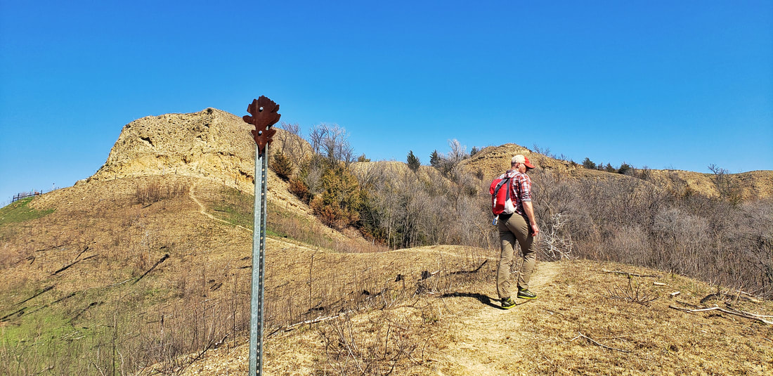
Golden Hills would like to thank everyone who attended the event, and special thanks to the Bakehouses for hosting, and to Tim Youngquist and Andy Olson for presenting! If you are interested in learning more about implementing prairie strips on your farm, reach out to us! 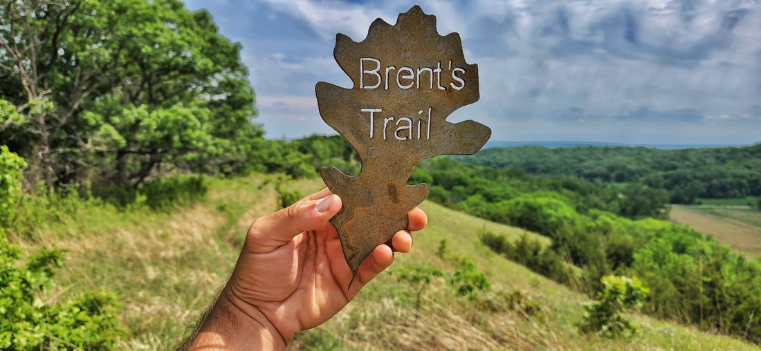 Photo by Lance Brisbois Brent's Trail is dedicated in loving memory to Brent Olson, the area forester for the Loess Hills State Forest. Brent had a vision of a long-distance hiking trail in Harrison County—he wanted people to experience the beauty of the Loess Hills in a unique way, and the trail named in his honor delivers in every aspect. Since its opening in 2019, Brent's Trail has gained national attention as one of the best (and most difficult!) hikes in the state of Iowa. It's a partnership between Harrison County Conservation Board and Iowa Department of Natural Resources. Other partners and supporters include Friends of Loess Hills State Forest and Preparation Canyon State Park, Loess Hills Missouri River Region, Golden Hills RC&D, and Loess Hills Alliance. Brent's Trail is an 8-mile hiking trail connecting Harrison County Conservation’s Murray Hill Scenic Overlook and Gleason-Hubel Wildlife Area via the Loess Hills State Forest. The trail is the start of a proposed trail that will eventually connect the northern and southern ends of the State Forest. A three-mile southern extension was added in 2021, giving hikers the choice of an 11-mile arduous trek through the state forest. Primitive, dispersed camping is allowed within Loess Hills State Forest. Potable water and restrooms are not available along the trail. Where should you start Brent's Trail?
Unfortunately, there are no shuttle services to return you from one trailhead to another. While not eco-friendly, the simplest solution is to drive two cars and leave one at your finishing point, whether that is one of the three trailheads or another point along Brent's Trail. Our preferred route is to begin at Murray Hill Scenic Overlook, as the views are better hiking south. Photo by Lance Brisbois What if you only have one car?
Another option is to turn around at the parking area at 1715 138th Trail and return in the opposite direction. This parking area in the state forest is approximately the halfway point of the original 8-mile Brent's Trail, which makes it an ideal place to turn around whether you begin at Murray Hill or Gleason-Hubel. There is plenty of shade in this parking area, so you can rest before resuming your journey.
What are the top scenic spots along Brent's Trail?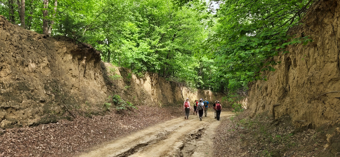 Sections of Brent's Trail follows classic Loess Hills road cuts. Photo by Lance Brisbois. Murray Hill - Murray Hill Scenic Overlook offers a panoramic view of the Missouri River Valley. Yucca plants and native flowers dominate the Loess Hill prairie landscape. Interpretive signs are located at the overlook that explain the significance and history of the Loess Hills. Make the steep climb on the trail and you will be rewarded with one of the most picturesque locations in the Loess Hills.
View of the Missouri and Little Sioux - Overlooking 138th Trail near the junction of Brent's Trail and state forest trail LS-2 (refer to the trail map), this spot was Brent Olson's favorite view in the Loess Hills State Forest. Both the Missouri and Little Sioux Rivers are visible from this point, as well as Nebraska further to the west. Fulton Ave - The trail once again follows a section of a classic road cut in the Loess Hills. Fulton Ave is one of the most scenic and impressive Level B roads in the Loess Hills. Gleason-Hubel Wildlife Area - Gleason-Hubel Wildlife Area has 165 acres that is predominately woodland, along with ridge top native prairie stands and a network of trails of almost 3 miles. It is an excellent bird watching location for migrating woodland species and morel mushroom hunting. Little Sioux Scenic Overlook - If you hike the southern extension, there is a bench atop a ridge overlooking the Missouri River floodplain. The hike to the overlook is steep, but the expansive views and solitude are worth the effort. 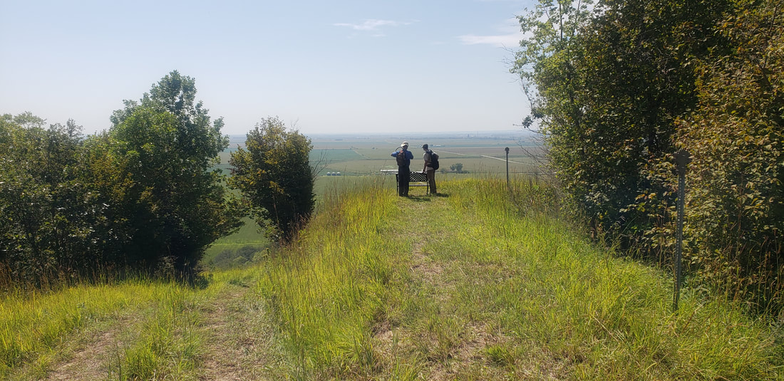 Scenic overlook on the southern extension. Photo by Lance Brisbois. What do you need to hike Brent's Trail? A hiker wearing the essentials for Brent's Trail. Photo by Lance Brisbois.
 A hiker begins the steep ascent up the southern face of Murray Hill. Photo by Lance Brisbois. Can you camp along Brent's Trail?There are no campsites along Brent's Trail, however, dispersed camping is permitted throughout the Loess Hills State Forest. There is no potable water along the trail, so if you plan to camp you will either have to carry all your water or cache water somewhere along the trail. The parking areas (blue address signs on the trail map) are logical places to safely store extra water and supplies. 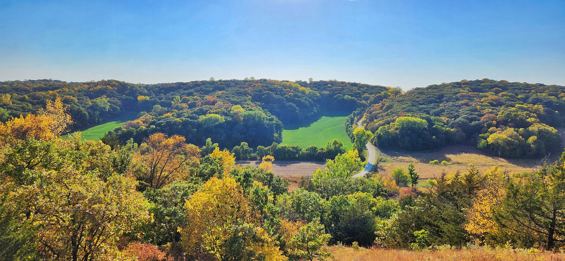 View of 138th Trail from Brent's Trail. Photo by Lance Brisbois. 
Our mission at Golden Hills RC&D is to collaboratively develop and lead community, conservation, and cultural initiatives to improve our quality of life in rural western Iowa. Our "official" territory from our original organizational bylaws is an eight-county region in the southwestern portion of Iowa (Cass, Fremont, Harrison, Mills, Montgomery, Page, Pottawattamie, and Shelby). In 2023, we added four more counties (Audubon, Carroll, Crawford, and Monona). Several projects extend beyond these 12 counties into more than 20 counties (learn more about where we work).
Our goals are to develop industries in local communities that utilize local resources; ensure healthy natural resources that meet the needs of agriculture, industry, private use, and recreational facilities; promote and enhance art, culture and historic resources in rural communities; collaborate with local governments and organizations on projects that benefit the environment; and work on projects that fill gaps in community services to benefit people of southwest Iowa.
We accomplish these goals by focusing our work in five program areas: outdoor recreation and tourism, land stewardship, water resources, local foods, and arts and culture. Today's Mission Monday focus is Local Foods. 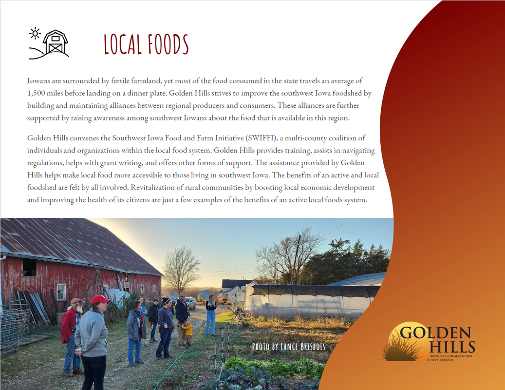
The Local Food Guide is a part of our Local Foods program area. The guide lists local producers in southwest Iowa, including farmers markets, farms, stores, restaurants, and other local food businesses. The guide is also available in Spanish.
Click here or on the map image above to see the guide in an interactive map, or scroll down to see a list of farmers markets, farms, stores, restaurants, and other local food businesses. This guide includes Audubon, Cass, Fremont, Harrison, Mills, Montgomery, Page, Pottawattamie, and Shelby counties in southwestern Iowa. If you are a local producer and not currently included in the local food guide, please fill out this form. Please note the Local Food Guide is regularly updated and we rely on farmers, market managers, and others to provide the most updated information. It is best to call ahead to confirm business and market hours before visiting. If you see anything that needs updated, please email [email protected]. Our mission at Golden Hills RC&D is to collaboratively develop and lead community, conservation, and cultural initiatives to improve our quality of life in rural western Iowa. Our "official" territory from our original organizational bylaws is an eight-county region in the southwestern portion of Iowa (Cass, Fremont, Harrison, Mills, Montgomery, Page, Pottawattamie, and Shelby). In 2023, we added four more counties (Audubon, Carroll, Crawford, and Monona). Several projects extend beyond these 12 counties into more than 20 counties (learn more about where we work). Click to open a larger version Our goals are to develop industries in local communities that utilize local resources; ensure healthy natural resources that meet the needs of agriculture, industry, private use, and recreational facilities; promote and enhance art, culture and historic resources in rural communities; collaborate with local governments and organizations on projects that benefit the environment; and work on projects that fill gaps in community services to benefit people of southwest Iowa. We accomplish these goals by focusing our work in five program areas: outdoor recreation and tourism, land stewardship, water resources, local foods, and arts and culture. Today's Mission Monday focus is Local Foods. Click to open a larger version  The Southwest Iowa Food and Farm Initiative (SWIFFI) is a network for food producers and consumers working to develop a healthy local food system. SWIFFI works to build a sustainable regional food system that links production, processing, distribution, and consumption, for better health, food security, stronger communities and economic development. SWIFFI is a multi-county coalition of individuals and organizations working together with Golden Hills Resource Conservation and Development. We are a part of the Regional Food System Working Group network at the Leopold Center for Sustainable Agriculture. SWIFFI works in Harrison, Shelby, Pottawattamie, Cass, Mills, Montgomery, Fremont, and Page counties. This 2010 report provides great information about the economic potential of local food in Southwest Iowa: The Economic Impact of Fruit and Vegetable Production in Southwest Iowa Considering Local and Nearby Metropolitan Markets. 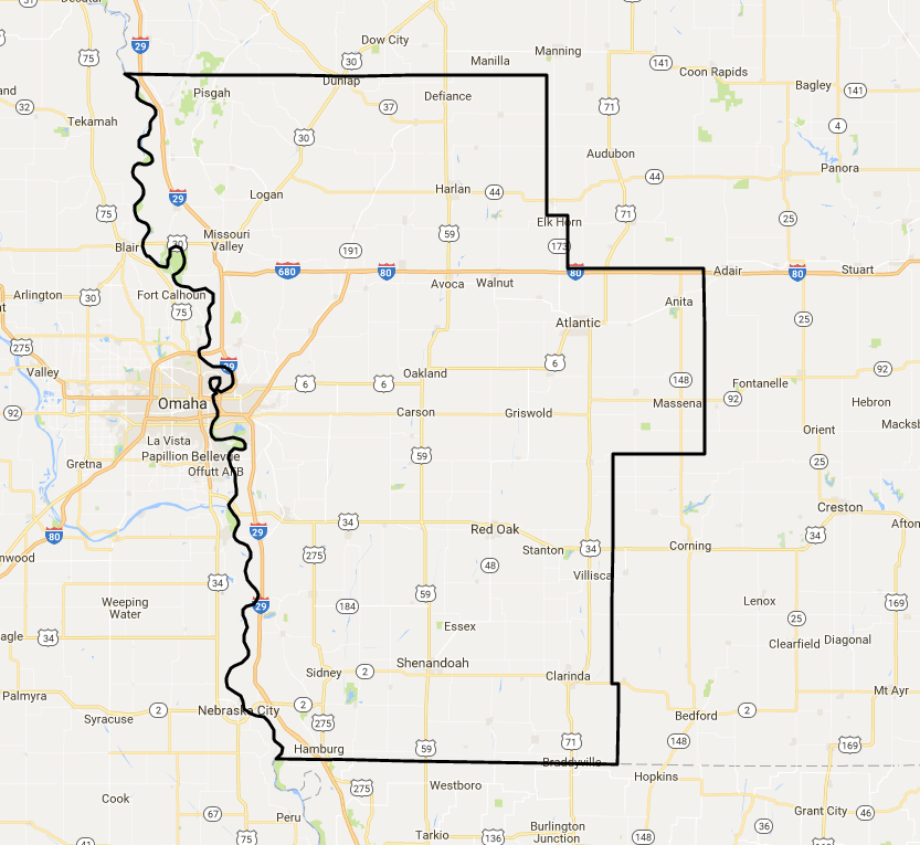 Golden Hills sends (about) monthly email newsletters about local food and sustainable agriculture events & programs, funding opportunities, and other news & resources. Email [email protected] to get added to the SWIFFI email list. Click the links below to learn more:
We are currently planning farmer meetups and field days. If you are interested in hosting or have suggestions, please complete this form.  Check out the latest edition of the East & West Nishnabotna Watershed Coalition newsletter below or download a pdf here. 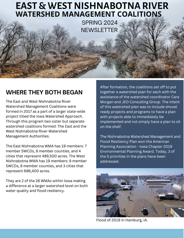 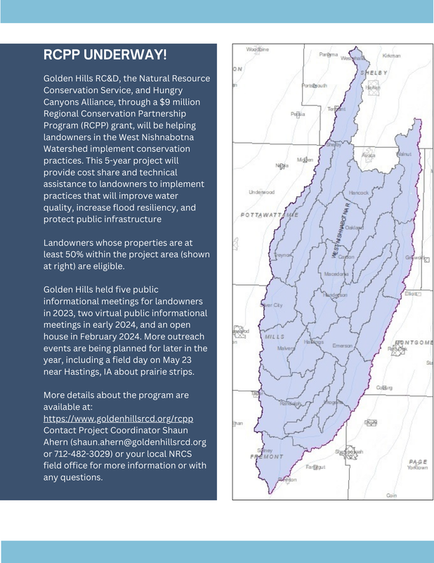 |
Archives
June 2024
Categories
All
|


 RSS Feed