We recently announced our new leadership team: Executive Director Cara Marker-Morgan and Deputy Director Lance Brisbois. This week, meet several new staff who have joined the team within the last few months. You can find info about all our team members here.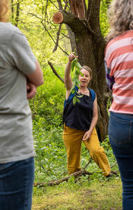 Jamie Smidt Fowler Local Foods Coordinator Jamie joined Golden Hills in 2022. She grew up in Casper, Wyoming, developing a love of Southwest Iowa while visiting grandparents and friends. She attended the University of Montana, in Missoula, where she obtained a B.A. in Environmental Studies. Her areas of study ranged from native plant restoration and sustainable agriculture to environmental politics and policy. Jamie loves all things plants. Her relationship with the green world began as a youngster in Casper working on her father’s tree and vegetable farm. During her time in Missoula, she managed a bustling, locally-owned greenhouse and later maintained her own gardening business. She continues to follow her passion for plants through her hobbies of growing food, studying plant medicine, which she believes should be accessible to everyone, and serving on the Shenandoah Tree Board. She can often be found sharing her plant knowledge regionally through foraging walks and informational talks. In 2013, Jamie and her husband, Jean-Paul, decided to escape the smokey summers of the West by moving to Shenandoah, a halfway point between their hometowns. They have an elementary aged daughter, Elke, who also loves to spend time outdoors. 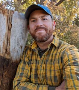 Seth Brooks Project Coordinator Seth joined Golden Hills RC&D in 2022 as a project coordinator focusing on scenic byways, local foods, and other projects. A native of Fremont, Nebraska, he has a B.A. in Political Science from Creighton University and a B.S. in Secondary Education from the University of Nebraska-Omaha. Seth has worked as a political organizer in western Iowa, Colorado, and southeast Asia. From 2013 until 2020, Seth lived in Spain where he worked as an English teacher. Upon returning to the United States, Seth has worked as a program instructor at the North Cascades Institute in Washington and most recently as a conservation technician at the Iain Nicolson Audubon Center at Rowe Sanctuary near Kearney, Nebraska. Additionally, Seth writes hiking guidebooks, with the following titles to be published by Falcon Guides: Hiking Nebraska in 2023. Hiking Iowa in 2024, and Hiking Kansas in 2024. In his free time, Seth enjoys photography, reading, and exploring the Loess Hills with his dog Jasper. 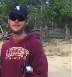 Shaun Ahern Project Coordinator Shaun joined Golden Hills in 2022 with work focusing on watershed management projects. A native of Ankeny, IA in the Des Moines metro area, he graduated with a B.S. in Community & Regional Planning and Environmental Studies from Iowa State University. After serving two AmeriCorps terms with Conservation Corps of Iowa 2017-2018 doing habitat restoration and volunteering as a Natural Resources Steward for Polk County Conservation starting in 2019 while working for a Des Moines company doing tree care, he then moved to southwest Iowa. Volunteer opportunities to continue his passion of doing that natural resource conservation work and the close proximity to the Loess Hills were appealing factors to make that move to Council Bluffs in April 2021. Living there, he enjoys doing that volunteer work with a few area conservation organizations primarily at Hitchcock Nature Center for Pottawattamie County Conservation and Vincent Bluff Prairie State Preserve in Council Bluffs. He enjoys exploring the Loess Hills or other nearby natural areas and also cheering on the Ankeny Hawks, Iowa State Cyclones, Chicago Bears, and White Sox. 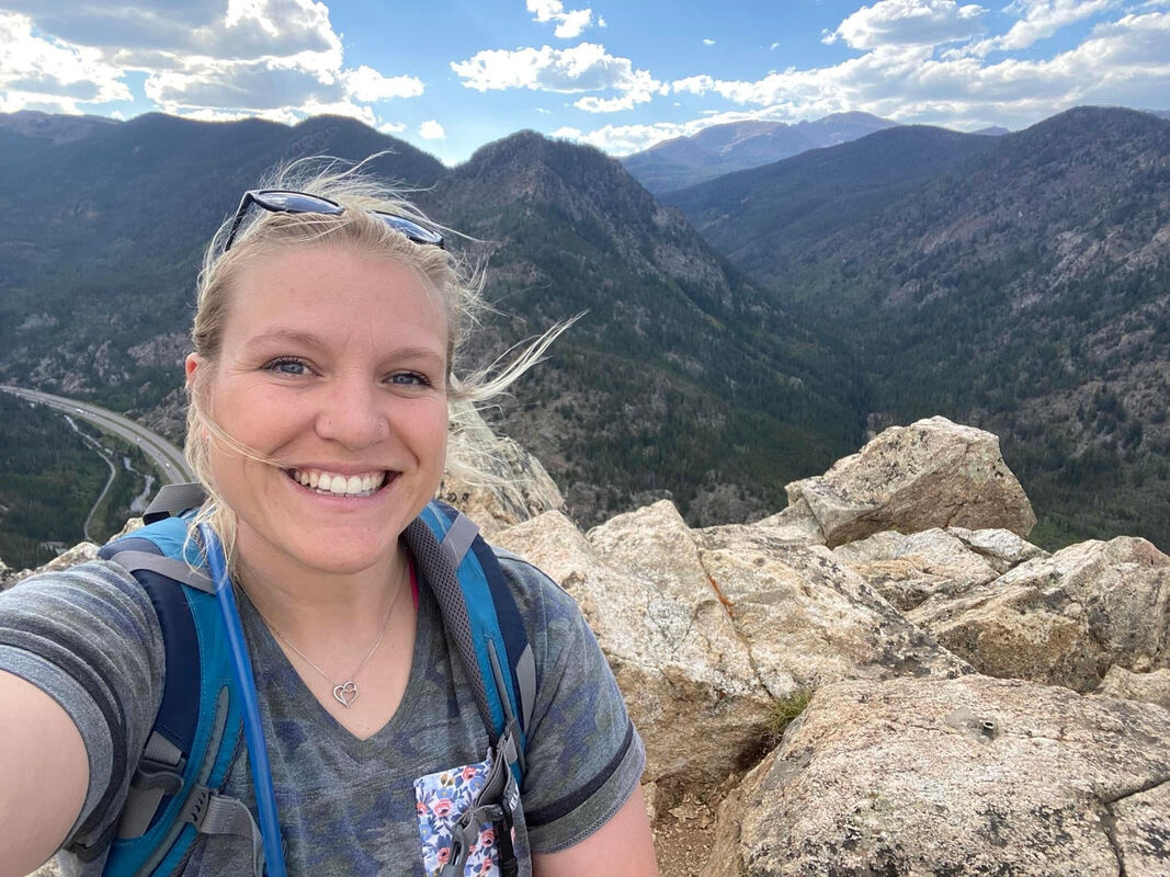 Jackie Johnson Fiscal Manager Jackie is a native of Southwest Iowa, graduating from Riverside in Oakland. She attended Iowa Western Community College and worked at Riverside Community School District for 12 years before joining the Golden Hills team. She currently resides in Harlan with her fiance, Nate, their 4 daughters Carly, Brylei, Layla, and Brecklin, and their two dogs, Marv and Ella. In her free time, Jackie enjoys photography and singing. She has been singing since she was a young girl and is currently in an Acoustic Duo called Riverside Drive that travels all over Southwest Iowa to perform. She has sang the National Anthem for many events locally, but she has also been selected to sing for the University of Nebraska at Omaha sporting events, the National Finals Rodeo in Las Vegas, and the College World Series! Jackie also got her first motorcycle in the summer of 2022 and enjoys riding her motorcycle with Nate in the Loess Hills and throughout Southwest Iowa. Board of Directors Updates
Additionally, we have new members and changes within our Board of Directors. Steve Baier from Cass County is our new Board Chair and Kathy Fiscus from West Pottawattamie County is Vice Chair. New board member Susan Miller from East Pottawattamie is now treasurer, and Sheryl Sanders from Fremont County is continuing as Secretary. Brian Rife is the new Harrison County representative. Learn more about all our board members at goldenhillsrcd.org/board
0 Comments
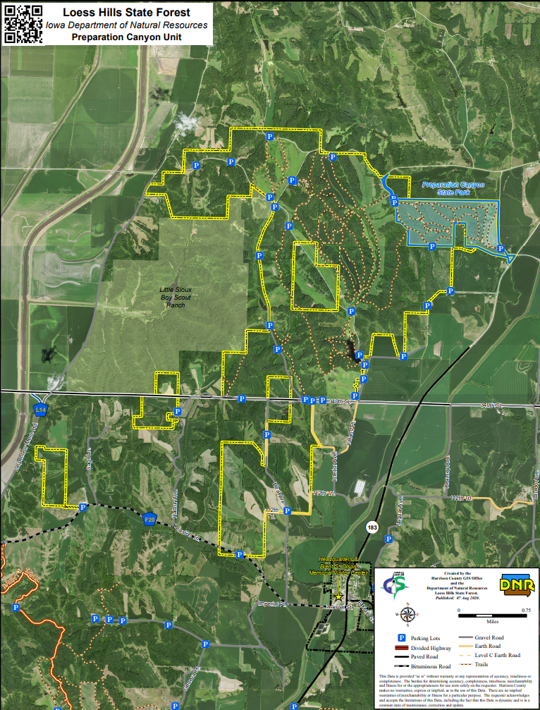
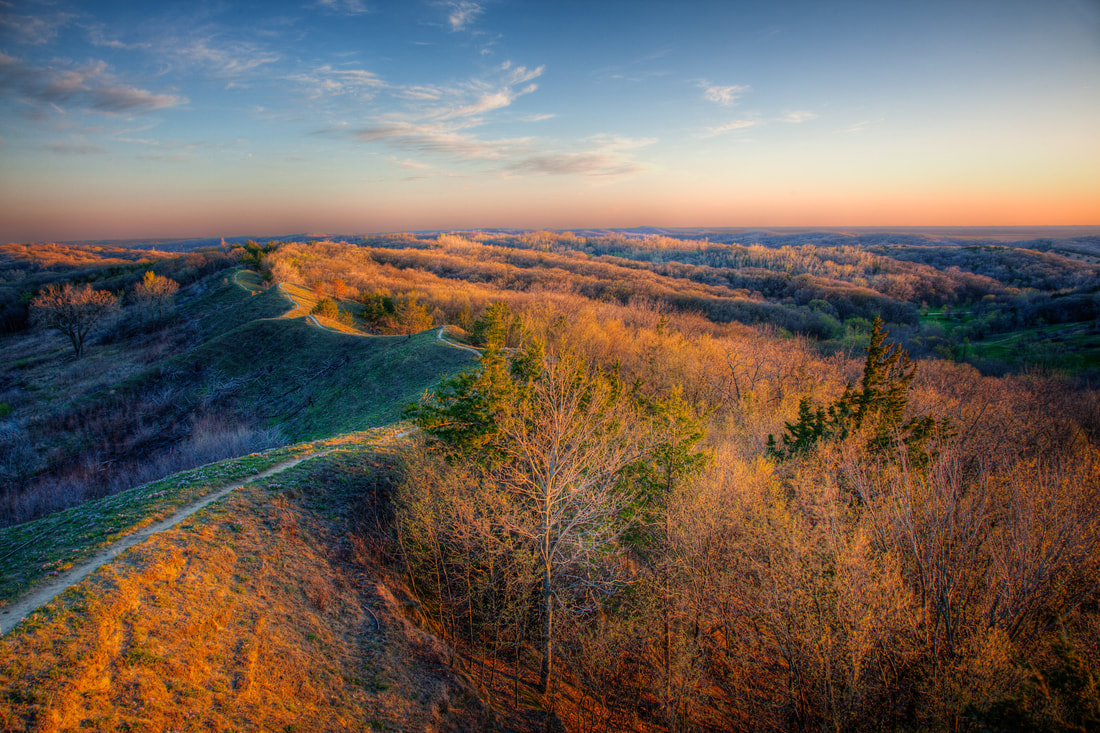 LHSF Preparation Canyon Unit (photo © 2016 Kenneth West)
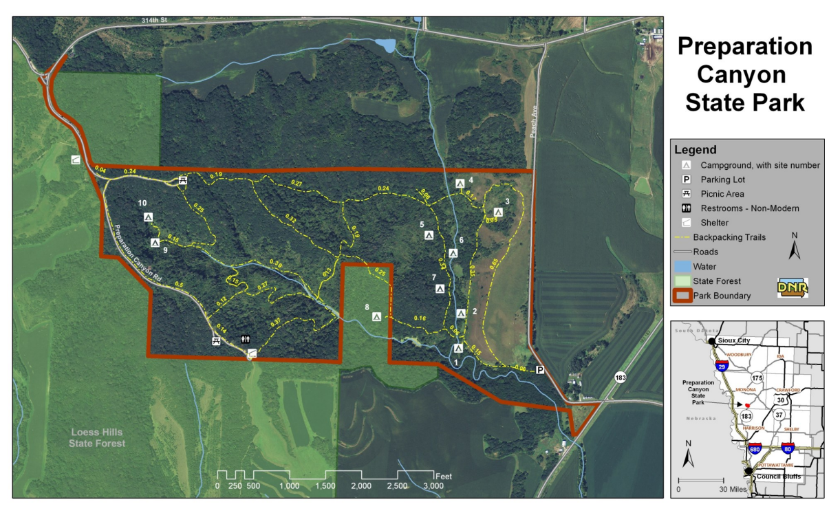
Preparation Canyon State Park, in the heart of the Loess Hills in western Iowa, encompasses 344 acres, including what used to be the town of Preparation. Today, Preparation Canyon is a quiet enclave offering backcountry hiking, picnicking, and beautiful views of the unique Loess Hills. In 1853, Charles B. Thompson broke from the Utah-bound Mormon wagon trail and settled in this area. At one point, Preparation had sixty-seven houses, a school, newspaper, post office, skating rink and blacksmith shop. But by 1900, the town had all but faded away. The land was sold by descendants of the original settlers to the state of Iowa in parcels during the mid-20th century and became the state park. Hike on one of the several trails that wind through the rugged Loess Hills. The backcountry trails follow hills and valleys, leading to a nature study area and the hike-in camping sites. Hikers should be prepared for rough terrain and loose soil with sturdy hiking shoes and appropriate gear. Camp in one of ten hike-in camping sites, which are some of the only hike-in sites in the Iowa state park system. The trailhead to the hike-in sites is located in the southeast corner of the park. The sites each have a table and fire ring, but no bathroom facilities. Registration is on a first-come first-served basis with self-registration in the east parking lot. text source: Iowa DNR
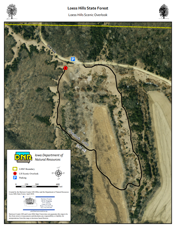
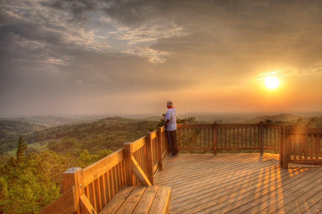 Loess Hills Scenic Overlook (photo © 2016 Kenneth West) 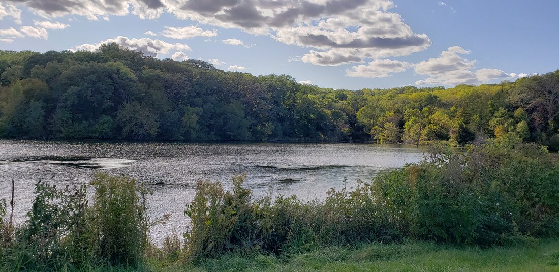 Jones Creek Pond (photo by Lance Brisbois)
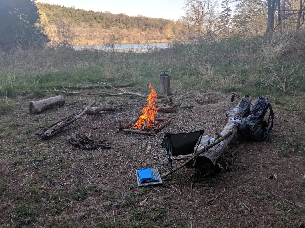 Primitive campsite at Jones Creek Pond (photo by Seth Brooks)
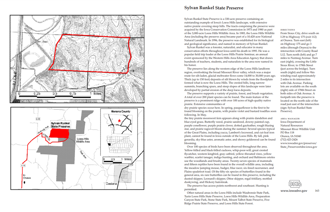
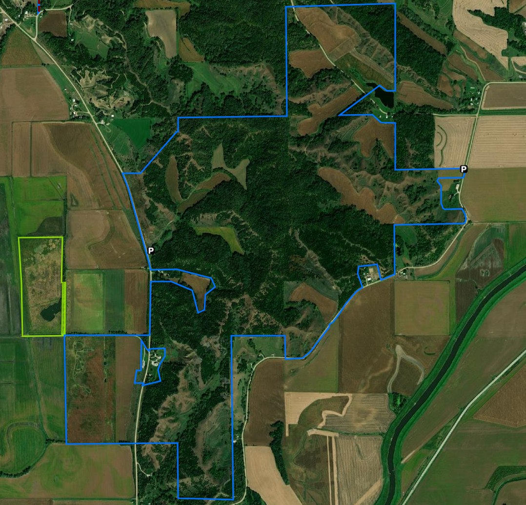
Sylvan Runkel State Preserve is a 330-acre preserve containing an outstanding example of Iowa’s Loess Hills landscape, with extensive native prairie covering steep hills. The tracts comprising the preserve were acquired by the Iowa Conservation Commission in 1973 and 1980 as part of the 3,000-acre Loess Hills Wildlife Area. In 1985, the Loess Hills Wildlife Area (including the preserve area) became part of a 10,420-acre National Natural Landmark. In 1996, the preserve was established for its biological and geological significance, and named in memory of Sylvan Runkel. 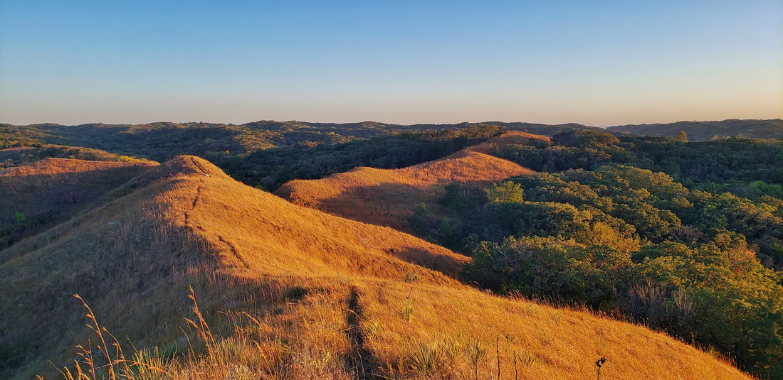 Sylvan Runkel State Preserve (photo by Lance Brisbois)
A number of Iowa threatened or endangered animals make their home here including the northern grasshopper mouse, plains pocket mouse and spadefoot toad. Wild turkeys and prairie chickens have been reintroduced. White-tail deer, fox squirrel, cottontail rabbit, coyote, raccoon and badger are common. Turkey vultures, bobwhite quail, ring-necked pheasant, whip-poor-will and many songbirds also exist in good populations. Controlled burns prevent brush and tree invasion and stimulate growth of prairie plants. The Loess Hills Prairie Seminar is held here every summer (intersection of Oak Avenue and 178th St). Before visiting a public wildlife area, please check out Chapter 51 : Wildlife Management Areas.  The Loess Hills Prairie Seminar is held at the wildlife area every summer (photo by Lance Brisbois)
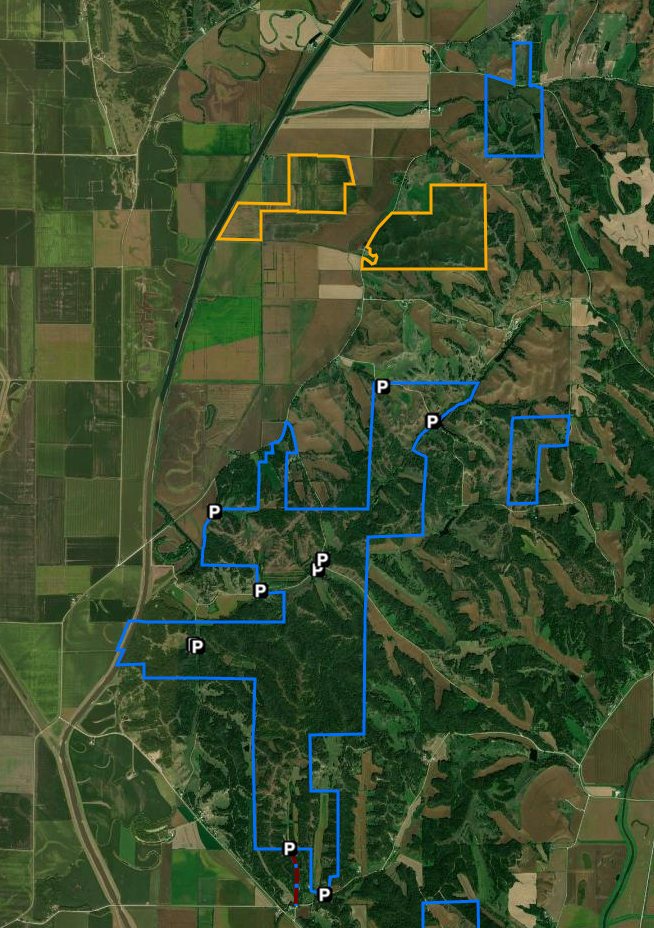
 Turin Preserve Wildlife Area (photo by Golden Hills RC&D) Turin Preserve Wildlife Area is a 220-acre area featuring a rugged Loess Hills landscape with an abrupt west-facing ridge. It is located in the southern unit of the 3,000-acre Loess Hills Wildlife Area, 2 miles north of Turin and 7.5 miles east of Onawa in Monona County. The Iowa Conservation Commission purchased the area in 1974. In 1978, the area was dedicated as a biological and geological state preserve and became part of a National Natural Landmark in 1986. Before visiting a public wildlife area, please check out Chapter 51 : Wildlife Management Areas.
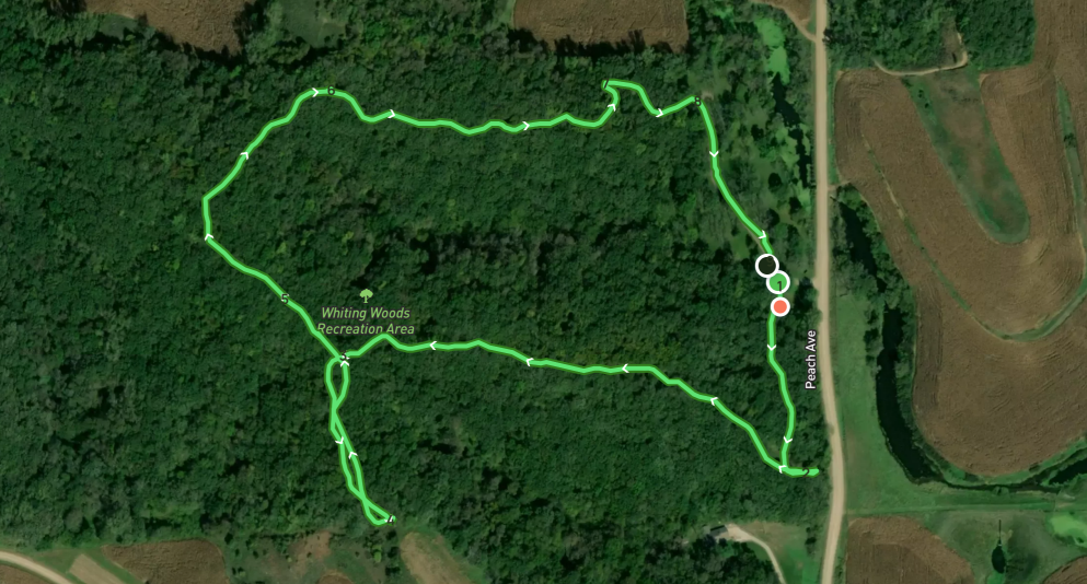
This 80-acre tract of dense native timber is located 4 miles southwest of Mapleton and just east of the Loess Hills Scenic Byway on Peach Avenue. Approximately 10 acres have been developed for camping, picnicking, hiking, and nature studies. A 1.6 mile trail takes you around the whole timber, with four benches for stopping and relaxing along the way. An open shelter house, 3 camping pads with 30 amp hook-ups, drinking water, and vault type toilet facilities are available. Upright/ground grills and picnic tables are also available. Whiting Woods is an excellent place to view wildlife and provides great hunting opportunities. Electric campsites are $20.00 per night, non-electric are $15.00 per night. A 10:30 curfew is enforced for all visitors. We currently do not take reservations for camping at this park as it is first come, first serve. text source: Monona County Conservation 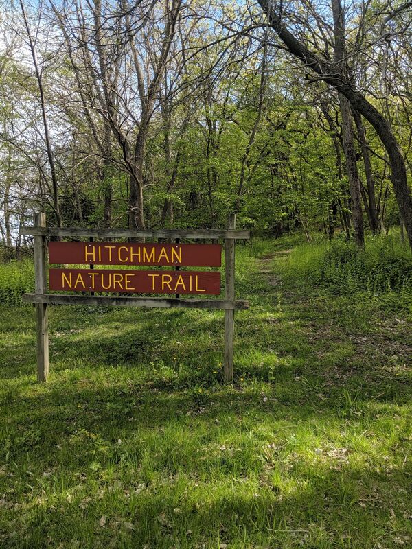 Hitchman Nature Trail at Whiting Woods (photo by Seth Brooks) Other hiking opportunitiesThe following areas, managed by Monona County Conservation, also allow hiking. Check the linked websites for more information. Masters Prairie Trail This linear park is an abandoned railroad right of way, which consisting of 24 acres that have been smoothed and planted to native short grasses and wildflowers. The two-mile trail begins on the west side of the Maple River and follows Hwy. 141 to the west. It was purchased from the Rail Road in 1990, with money from NIPCO in return for a permanent easement for their power lines. Hunting is not allowed. Gramm Wetland Gramm Wetland has a popular 2-mile walking trail. Beaver Run Wildlife Area Davis Wetland Hiking the Byways is a regular series by Golden Hills RC&D that features publicly accessible lands open to hiking on the three scenic byways in western Iowa that Golden Hills RC&D coordinates: Glacial Trail Scenic Byway, Loess Hills National Scenic Byway, and Western Skies Scenic Byway. Each Friday a blog post covers hiking areas in one county on one of the aforementioned byways. For questions about hiking on the byways, contact Seth Brooks ([email protected]).
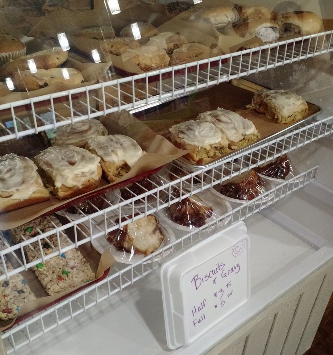
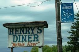
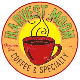
 Milk & Honey in Harlan Monday was National Muffin Day and yesterday was Pancake Day, so what better way to celebrate than trying a muffin or flapjacks at one of the many breakfast joints on the three scenic byways that Golden Hills RC&D coordinates in western Iowa. Even if muffins and pancakes aren't your jam, swing by one of the places below for a hot cup of coffee that will give you the fuel you need to explore western Iowa's scenic byways.
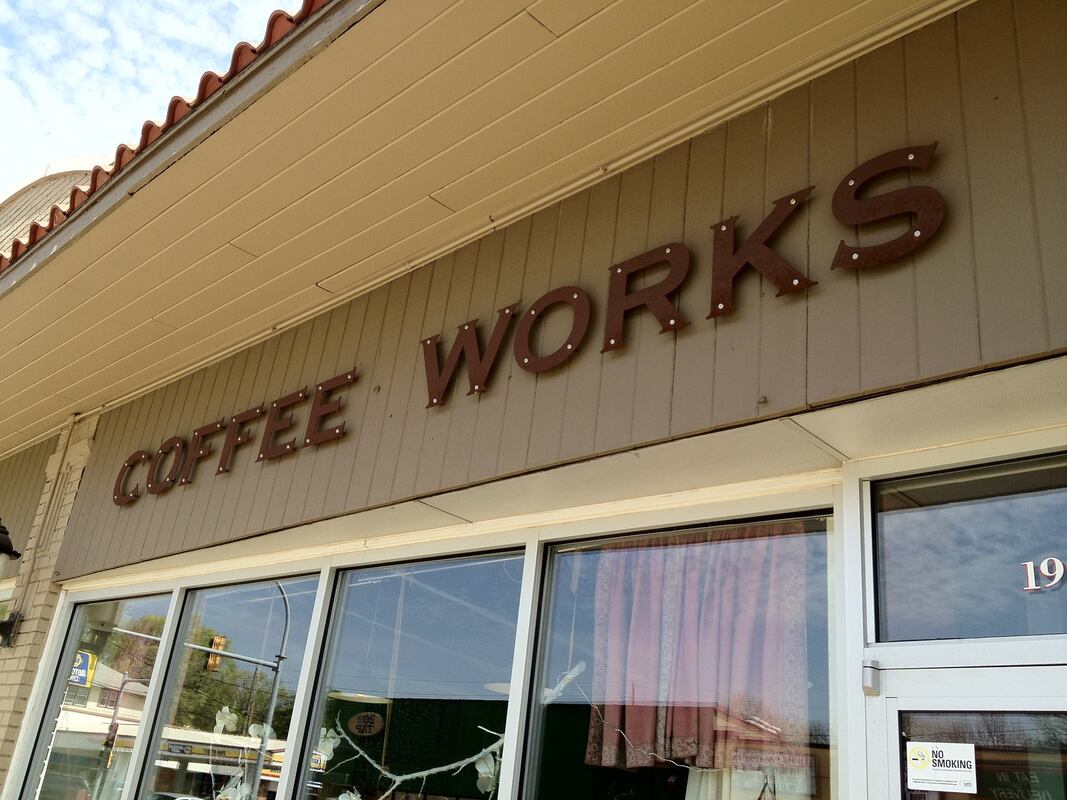
Western Skies Scenic Byway
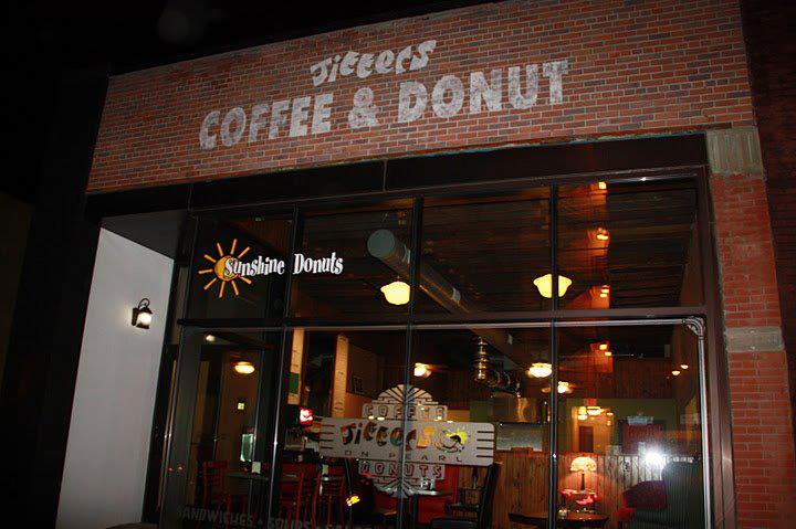
Loess Hills National Scenic Byway
The SPOT Espresso Bar & Cafe is more than just a coffee shop. At the SPOT, we pride ourselves in providing a clean, community friendly, art centric atmosphere where we will always greet you with a smile. You can stop-in for your morning Joe while preparing for the day ahead or you may choose to ‘drive-thru’ while on the go - we are here for you. In addition to coffee drinks of all kinds, The SPOT offers smoothies, baked goods, breakfast burritos and flatbreads. At lunchtime, our soups and gourmet paninis are the buzz. Our menu is prepared with only the best fresh ingredients daily.
Hardline Coffee Company began as the brainchild of Nisa Salmen in March 2018. Combining an interest in experimenting with new brewing methods and a knack for creating delicious new recipes, Hardline serves up some seriously unique brews and treats. Hardline owner Nisa got her start in the coffee industry in 2010. Since then she has refined her skills as a barista, pastry chef, and restaurant manager at shops across the Midwest. She is passionate about providing ethically-sourced and environmentally conscious products to a growing community with dietary restrictions. She specializes in the shop's vegan and vegetarian menu options. When she's not baking up a storm, Nisa can be found cuddling with her cats, riding her motorcycle, or building things.
The Stone Bru Cafe located at 5822 Sunnybrook Dr. is the culmination of years of experience in the coffee business. From the beautiful design to the award winning coffee, this location is a must see. Perfect for meeting up with friends and family, or a cozy place to work and study.
Glacial Trail Scenic Byway
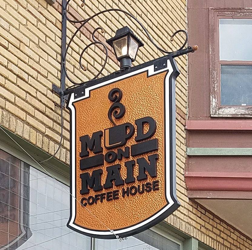
expanding the whole bean and ground coffee sales. In 2019, Mud on Main moved the roasting operation and coffee shop to a historic building at 207 West Main Street in Cherokee, further expanding the menu to include lunch. The coffee shop stays active well after dark with a stage featuring live music and serving beer, wine and cocktails. They are proud to partner with nonprofit organizations and charities, providing fundraising opportunities through bulk coffee sales.
The Iowa Department of Natural Resources, Golden Hills RC&D and the Loess Hills National Scenic Byway are excited to announce the Waubonsie State Park Artist in Residence awards for the 2023 Program! The Artist in Residence program was created to help reach a broader audience of park-goers, thus increasing the number of visitors and ultimately educating more people about the Loess Hills ecosystem. The artists and visitors will engage with the natural resources of the park through an artistic lens. Many quality applications were received from artists representing a wide array of disciplines. Three artists were selected to fill residencies ranging from one to two weeks long in March and April. Those artists receiving the residency awards for the current season of the Waubonsie State Park Artist in Residence Program include Rodger Geberdling, Marcia Wilson Holliway and Tina Campbell. The artists will use their time at Waubonsie to immerse themselves in the landscape as a source of inspiration and opportunity to intensely focus on their work. The artists represent a variety of mixed media, painting, and photography. Rodger Geberdling is a multidisciplinary artist from Council Bluffs who is active in applied arts, book illustration, art instruction, writing and acting. His painting, drawing, collage, and other multimedia work is currently represented at multiple galleries and exhibitions across the country. Rodger’s mixed media paintings and found/created object constructions range from portraits (real and imagined) to still-lifes and landscapes. He works primarily from imagination as colored by his surroundings, using sketches and memory to make personal impressions of people and places. During his time at Waubonsie, Rodger will focus on landscapes and impressions of structures as seen on daily walks. He sees this residency as a kind of visual, day-to-day journal. Rodger will occupy the first residency period of 2023, during the first half of March.  Marcia Wilson Holliway is a multidisciplinary artist from Nebraska City. Marcia shares, “Seeing and feeling texture, pattern, light and color stirs my soul. People, places, and nature are inspirations for my art! When I’m not painting in Plein Air you might find me arranging found objects. As they start relating to one another they become cohesive. Something beautiful comes to life, reminding me this process is happening in my own life as well. As I collaborate with purpose, my Creator, and others, I continue writing my story, creating goodness, beauty, and art. Although my life, poems, art, and journals can be kept private, I am convinced that life is most fulfilled when I share them.” Although the dates and details have not been secured yet, Marcia says that her programming piece will be an invitation to park goers of all ages to participate in a hands-on experience that will encourage celebrating nature, further exploration, and appreciation of their surroundings. Marcia’s residency will take place during the second half of March.  Tina Campbell with Fence Row Photography is a landscape photographer from Norwalk, Iowa. She shares, “As a landscape photographer I am not just discovering the beauty but also the healing element of being in nature. Whether on the backroads or hiking trails, or just in my own backyard, nature has provided me a consistent element of connection and peace. It is my hope that my photography might bring that connection to others and inspire more awareness of the beauty in our everyday.” When Tina does her public program, she plans to lead a group on a guided photo walk and explain her gratitude practice approach of not just looking at the big picture, but really focusing on the little things. Tina will participate in a one-week residency at the beginning of April. 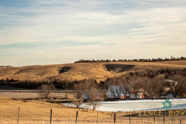 One of the region’s ecological and recreational treasures, Waubonsie State Park’s 2,000 acres in the Loess Hills of southwest Iowa feature prairies, savannas, and woodlands which are home to diverse flora and fauna, not to mention breathtaking vistas. Park Manager Matt Moles has worked with Golden Hills RC&D Project Coordinator Lance Brisbois and Loess Hills National Scenic Byway Coordinator Rebecca Castle to develop and launch the project. While there have been other artist residency programs offered through the National Parks System and parks in other states, this was the first such program in one of Iowa’s State Parks. The program is loosely modeled after similar regional residency programs. The artists will receive lodging in a studio cabin and a primitive studio space in the park at no cost for the duration of the residency. In return, artists will deliver at least one public program and donate one piece of art to the park at the conclusion of their stay. The programs will be announced as they are scheduled, and may happen either during the residency period or at a later date during the peak season.
Waubonsie State Park is only about an hour’s drive from Omaha or Lincoln, NE; two hours from Kansas City; and 2.5 hours from Des Moines. It is located near the southern end of the Loess Hills National Scenic Byway. To learn more about the Artist in Residence program and the artists, visit www.goldenhillsrcd.org/artist-in-residence. If you are an artist and are interested in learning about how to apply, please email [email protected].
There are six places in Harrison County on the Western Skies Scenic Byway that offer hiking opportunities. DeSoto National Wildlife Refuge is a birder's dream with trails through prairie and woodlands. Harrison County Conservation manages several areas with fully developed trail systems and areas with only off-trail hiking. The trails at Old Town Conservation area, for example, offer a quiet hiking experience only half an hour from Council Bluffs and Omaha.
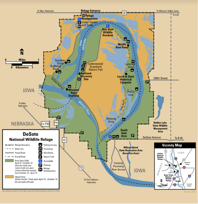
DeSoto National Wildlife Refuge is located along the Missouri River and borders both Iowa and Nebraska. Within its 8,365 acres lies DeSoto Lake, an oxbow lake that used to be a bend in the Missouri River. The refuge contains bottomland forests, tallgrass prairie, and wetland habitats that are managed to mimic the natural Missouri River floodplain habitat to benefit a diversity of migratory birds that flock to the refuge each year in the spring and fall. The refuge also contains a piece of history within its borders, the Bertrand Steamboat. The Bertrand sunk on the bend of river that is now DeSoto Lake, leaving behind the cargo and historic time pieces amounting to almost 250,000 different artifacts housed within the walls of the DeSoto National Wildlife Refuge Visitor Center. DeSoto National Wildlife Refuge is truly a place where wildlife meets history! The refuge provides hiking opportunities through a diversity of refuge habitat. The Bertrand Excavation Site Trail and the Cottonwood and Grassland Nature Trails are open year round on the Nebraska side of DeSoto Lake. The Green Heron Trail and the Missouri Meander Trail are seasonal trails open April 15 - October 14. For detailed information about each trail, check the refuge's trails website. text source: U.S. Fish & Wildlife Service 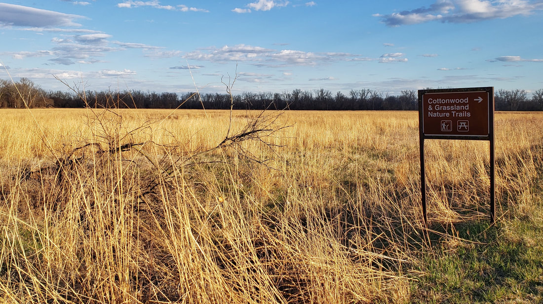 DeSoto National Wildlife Refuge (source: Golden Hills RC&D)
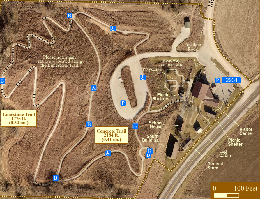
The Harrison County Historical Village and Iowa Welcome Center is located 3 miles northeast of Missouri Valley on Highway 30 (five miles east of Interstate 29, Exit 75). This museum complex is straight out of the 1800s, with an original log cabin, general store, and school. The official Iowa Welcome Center provides tourism information and assistance to travelers. The Iowa Products Store offers food, beverage, clothing, crafts, and a wide variety of souvenirs. Stretch your legs on the 1-mile trail and learn about the Loess Hills. The 0.41-mile Concrete Trail is accessible to wheelchairs. There are many stairs along the 0.34-mile Limestone Trail.  Harrison County Historical Village & Iowa Welcome Center (source: Golden Hills RC&D)
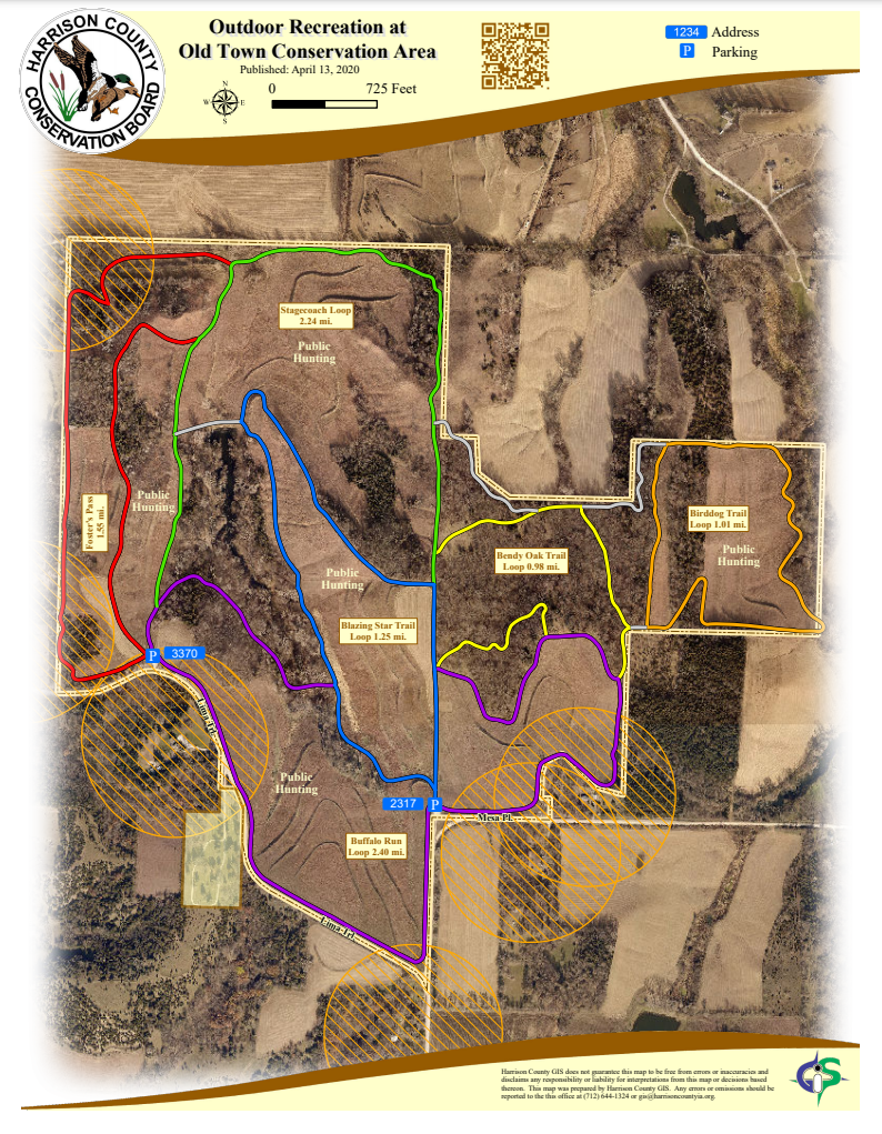
The Old Town Conservation Area is located off Lima Trail about 3 miles southeast of the Loess Hills National Scenic Byway and Missouri Valley. There are two parking areas that provide access to the trails.  Old Town Conservation Area (source: Lance Brisbois)
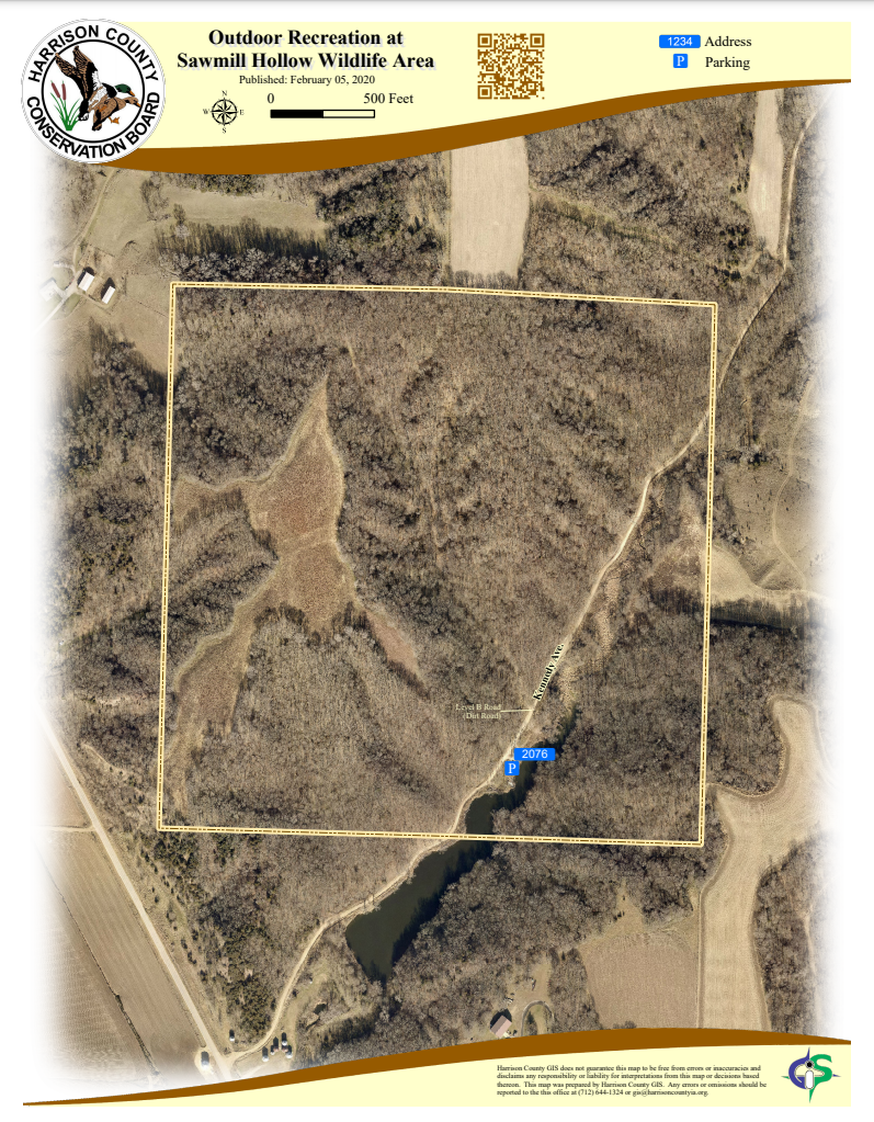
Located seven miles north of Missouri Valley off Loess Hills Trail (L20), the wildlife area is not directly on the byway but is a short drive from the main route. Access to Sawmill Hollow Wildlife Area is on a Level B dirt road. 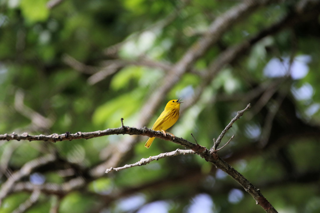 Yellow warbler at Sawmill Hollow Wildlife Area (source: Carter Oliver)
Schaben Park is not located on the Loess Hills National Scenic Byway but is a short drive from the main route or the Orchard Ridge loop. It is located 2 miles off Highway 30, between Woodbine and Dunlap on 141st Lane (gravel road). 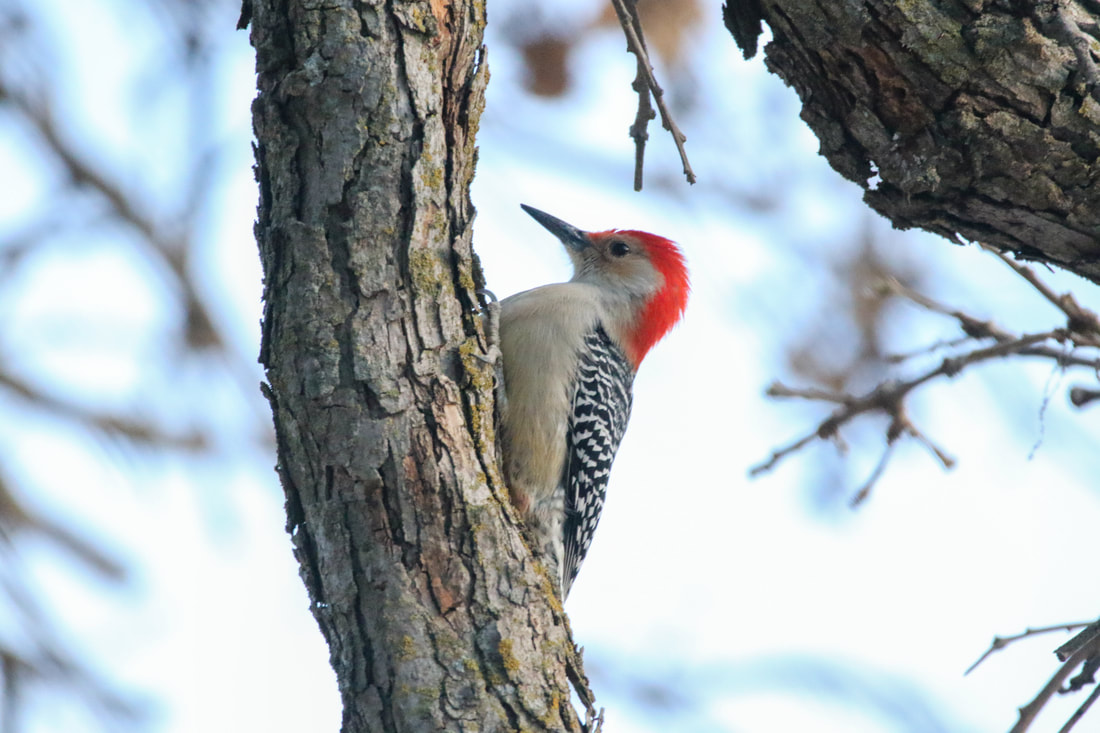 Red-bellied woodpecker at Schaben Park (source: Carter Oliver)
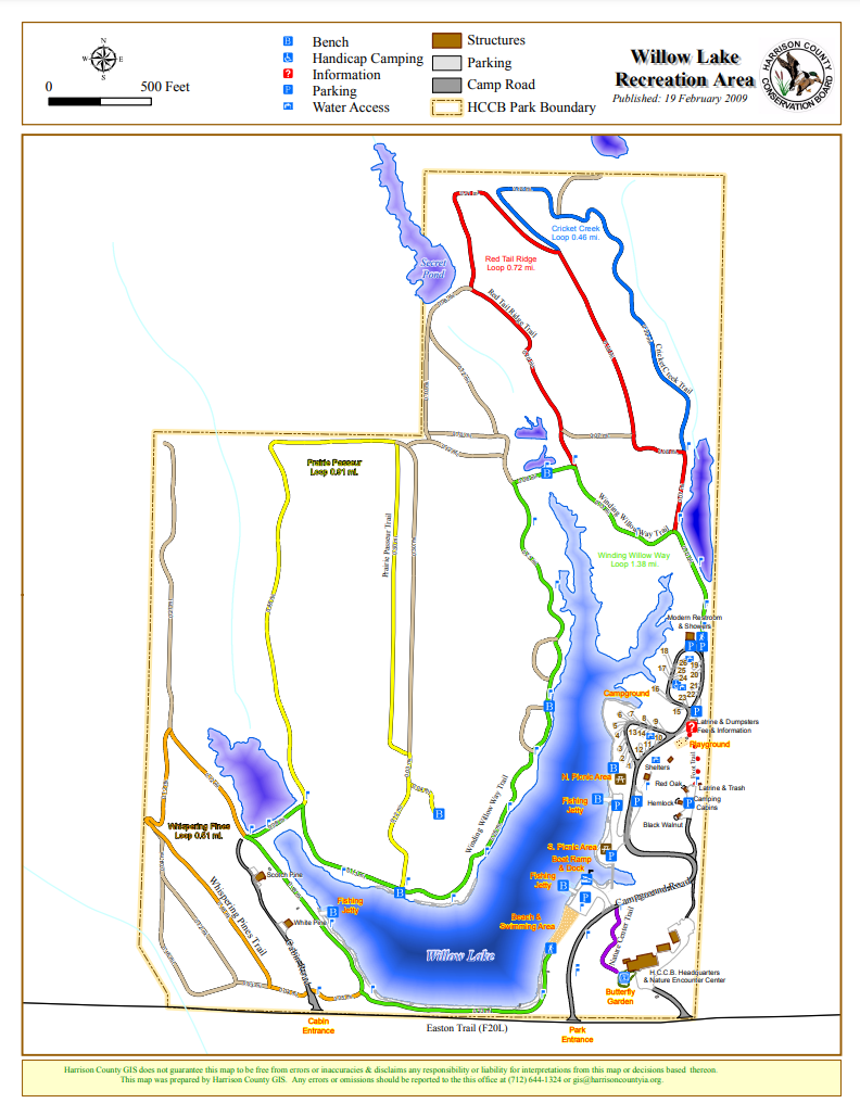
There are 6 miles of hiking trails with Smart Trail interpretive signs using QR (quick response) codes allow users to learn about the Loess Hills and Iowa's natural resources. The Willow Lake Recreation Area is also an excellent location for bird watching, especially migrating songbirds and waterfowl. Willow Lake Recreation Area is not located on the Loess Hills National Scenic Byway but is a short drive from the main route near Logan or the Orchard Ridge loop from Pisgah. It is located 6 miles northwest of Woodbine on F20L (Easton Trail). 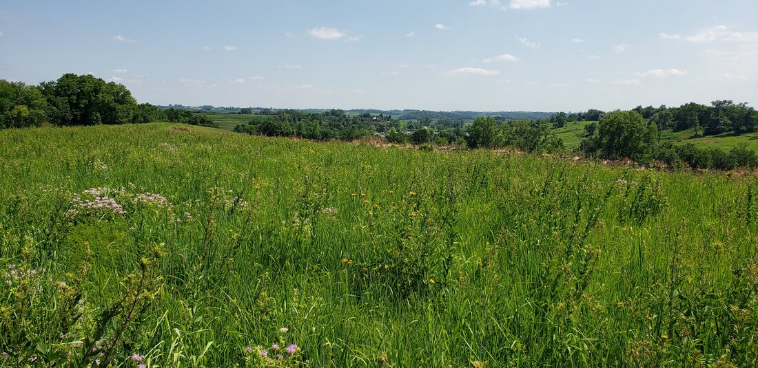 Willow Lake Recreation Area (source: Golden Hills RC&D) Hiking the Byways is a regular series by Golden Hills RC&D that features publicly accessible lands open to hiking on the three scenic byways in western Iowa that Golden Hills RC&D coordinates: Glacial Trail Scenic Byway, Loess Hills National Scenic Byway, and Western Skies Scenic Byway. Each Friday a blog post covers hiking areas in one county on one of the aforementioned byways. For questions about hiking on the byways, contact Seth Brooks ([email protected]).
Golden Hills is excited to announce that Cara Marker-Morgan has been promoted to Executive Director. Cara has been the Watershed Coordinator since 2017 and was Interim Director since Michelle Wodtke Franks left last April. Cara will continue to assist in the Water Resources program as well as the other programs that Golden Hills provides including Community Support.  Additionally, Lance Brisbois is now Golden Hills' Deputy Director. This is a new position assisting the Executive Director with day-to-day operations and management for the organization. Lance is still leading and assisting with several of our Land Stewardship and Outdoor recreation projects. He started as a Project Coordinator in 2014.  We have also hired new staff members and have new board members. Stay tuned for details on these changes in our next newsletter soon!
Find information about all our team members at goldenhillsrcd.org/staff
These intrinsic qualities are the essence of the Glacial Trail Scenic Byway. It is “old Iowa” at its best. Below are some places to explore the historical and cultural heritage along the Glacial Trail Scenic Byway. 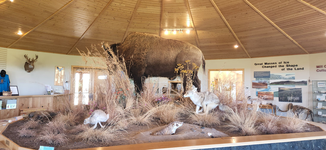 Prairie Heritage Center O'Brien County Prairie Heritage Center Prairie Heritage Center is located in the southeastern corner of O’Brien County, near the corners of Buena Vista, Cherokee, and Clay counties. It is the primary contact point for visitors to the Glacial Trail Scenic Byway, providing interpretation of the area’s natural, cultural, and archaeological history. The center, operated by O’Brien County Conservation, opened in 2006 to interpret the prairie landscape of northwestern Iowa. The visitor center is open Wednesdays through Sundays and features exhibits about prairie ecology, the Mill Creek Indian Culture, and O’Brien County’s settlers. Staff naturalists offer environmental education programs for youth and the public. The center’s icon is the bison, and a small herd is fenced on the property. A replica pioneer wagon pulled by oxen statues invites visitors to climb inside and learn about the first settlers in the area. The center overlooks the Little Sioux River Valley and a patchwork of grassland and forested hills and valleys. An access point offers water-based recreation on the Little Sioux River. Walking trails loop through restored grassland and oak savanna. Pear Tree House This historic home in Sutherland is a community museum and houses historical documents and other memorabilia. It is open for special events during the summer. General N.B. Baker Library William Houston Woods and his wife, Roma Wheeler Woods, of Old O’Brien founded the General N.B. Baker Library Association in 1874 in their log cabin. Residents came from miles around to borrow books and magazines to help them pass the long winters. Gen. N.B. Baker, formerly governor of New Hampshire, moved to Iowa in 1856. He was instrumental in the early growth of the library, which is now located in a former school. Heritage Park This historic village in Primghar features a log cabin, historic home, hotel, bank, Philby Church, and Center Township No. 3 School. The buildings feature artifacts, exhibits, and research materials. The O’Brien County Historical Society manages the park. Hannibal Waterman Wildlife Area The wildlife area, across the road from the visitor center, is the site of the first settler in O’Brien County in 1856. Trails circle through the property, passing the Hannibal Waterman family cemetery and a historic marker placed by the O’Brien County Daughters of the American Revolution. In 1857, Santee Sioux Chief Inkpaduta and his band stopped at Hannibal Waterman’s cabin, gathering food and supplies and then moving upriver. Hanging Valley and Dutch Fred's Grave The section of Waterman Prairie south of Highway 10 offers an accessible prairie experience for byway visitors. A parking lot on Wilson Avenue, 1½ miles south of Highway 10, leads to a trail that meanders through prairie-covered ridges with spectacular vistas of the Little Sioux River valley. The Iowa Department of Natural Resources is restoring the prairie to its original plant community.
Cherokee County Sanford Museum & Planetarium Sanford Museum in Cherokee opened in 1951 to offer exhibits and activities about archaeology, history, geology, astronomy, natural history, and paleontology. Exhibits interpret prehistoric northwestern Iowa, featuring the Mill Creek Culture (using artifacts such as pottery, tools, and artwork), and the history of Cherokee. The museum also offers planetarium shows. The facility is open daily and admission is free. 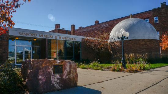 Sanford Museum & Planetarium Cherokee Library Cherokee’s public library was established in 1886 by the Cherokee Ladies Library Association and was housed in the YMCA and other shared facilities. In 1903, the Carnegie Foundation awarded $10,000 to the city to build a library. The foundation later awarded an additional $2,000, and by 1905 the building was finished. The community’s library is still in use and is listed on the National Register of Historic Places. Cherokee Depot Cherokee served as a hub for the Illinois Central rail line. The Illinois Central passenger depot, built in 1896, was used as a passenger station until 1971 and as a freight station until 1982, when the building was vacated. The rail yard complex was listed on the National Register of Historic Places in 1990. A nonprofit community group purchased the depot complex in 1991 and maintains it. It is open by appointment. Buena Vista County Brooke Creek Bridge This bridge over Brooke Creek, a tributary of the Little Sioux River, was built in 1909. It was listed on the National Register of Historic Places because of its historic architecture and construction. The bridge is accessible from an unmaintained gravel road and is closed to traffic. Clay County Jim’s History Barn A collector since childhood, Jim Hass bought a 1928 barn in Spencer and had it moved to Peterson to display his collections. Included are Native American artifacts, war memorabilia, local history items, and curiosities of all kinds. Tours available by appointment.
Jacob Kirchner Memorial Park Peterson Heritage, a nonprofit organization founded in 1971 to preserve and maintain historical sites in Peterson, established this park for that purpose. The park includes a playground, veterans’ memorial, the Machinery Museum, Christian Kirchner House, J.A. (Gust) Kirchner House, and Rock Forest School. The Kirchner Farm Machinery Museum houses antique farm equipment including a covered wagon that trekked to Yellowstone Park and back in 1898, a sheepherder’s wagon, a fence making machine, and more. The museum is open by appointment. J.A. (Gust) Kirchner built his Italianate style, two-story home in 1875. It includes period furniture. Built in 1867, the Christian Kirchner Home was the first frame house in Clay County. It still stands at its original location. Descendants deeded this home of Christian and Magdalene Kirchner, parents of J.A. (Gust) and Jacob Kirchner, to the city in 1971. Peterson Heritage restored and furnished the home. It is open by appointment. Built in 1868, Rock Forest School was one of the first frame schoolhouses in Clay County. It was originally located in the northwest quarter of Peterson Township and was used until 1918. The building was moved to the park in 1963 and restored by the Peterson Lions Club. It is open for school group tours, special occasions, and by request. Kirchner French Memorial Library In 1925, Lena Kirchner French willed a farm west of Peterson to provide funds for the construction of a library. The structure was built in 1937 with assistance from the Works Progress Administration. French, a member of the first family to settle in Peterson, wanted people of all ages to be exposed to the joy of reading. The library is still in use today. 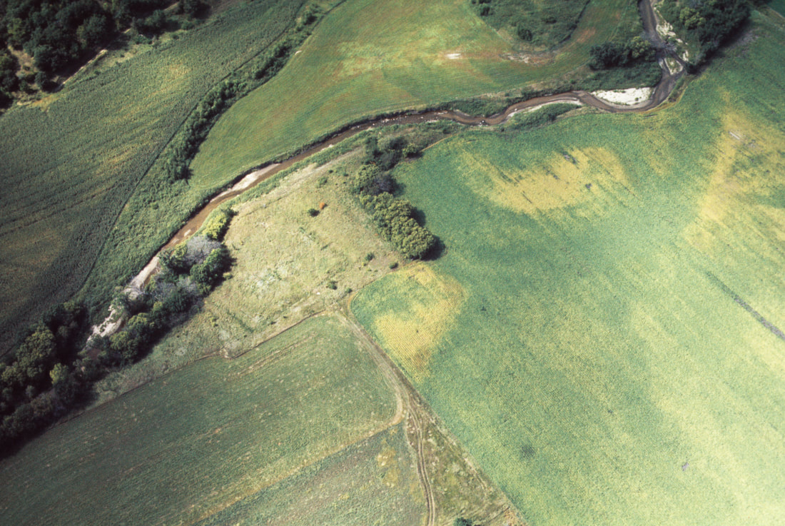 Wittrock Indian Village State Preserve Wittrock Indian Village State Preserve
Wittrock Indian Village on Waterman Creek, just northeast of Sutherland, is a model depiction of late prehistoric Mill Creek culture. This 6-acre site features the buried remains of a fortified village occupied by Indians of the Mill Creek Culture between the years 1200 and 1300. Located on a low terrace of Waterman Creek, the site included 20 rectangular earth lodges that archaeologists have identified. A wide ditch and solid stockade wall protected the village from attack. The village has never been affected by construction or cultivation. The Mill Creek people hunted bison and grew corn and other produce in the rich creek bottoms. The site is a National Historic Landmark and an Archaeological State Preserve. 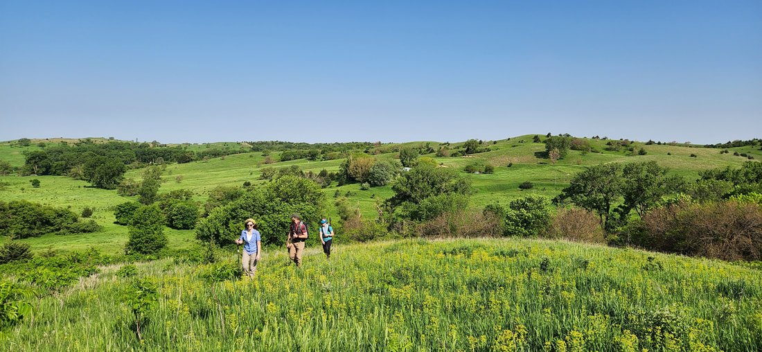
The 964 acre Five Ridge Prairie, a dedicated state preserve in western Plymouth County, exemplifies the northern loess bluffs of western Iowa with a mixture of oak timbered valleys, native prairie ridge tops and west facing slopes. This unique loess landform site is home to several state threatened and endangered plant and animal species. It was also the site of the original wild turkey restoration stocking for Plymouth County. The public is invited to hike and enjoy Five Ridge year round. This is a very large, hilly park, so be sure you let someone know where you will be and when you will be back. Take a map along, and do not cross any fences. Crossing a fence will take you out of our park boundaries and will make it much harder to rescue a lost hiker. Mowed fire breaks offer a number of paths for hikers, snowshoers and cross country skiers alike. Fire breaks are typically mowed in July. Metal sign posts with the exit to the parking lot are clearly marked throughout the fire break system. Public hunting is permitted beginning the 3rd Saturday in September through January 31 according to Iowa DNR regular seasons and hours. Spring wild turkey hunting is permitted all day, each day per Iowa DNR seasons and regulations. It is unlawful to hunt badger, woodchuck, or fox at Five Ridge. No target shooting. text source: Plymouth County Conservation Commonly seen birds: Grasshopper Sparrow, Eastern Kingbird, Rose-breasted Grosbeak Birds to look for: Townsend’s Solitaire, Bobolink, Blue Grosbeak Other Inhabitants: White-tailed Deer, Red Fox, Coyote, Badger wildlife source: Loess Hills Audubon Society
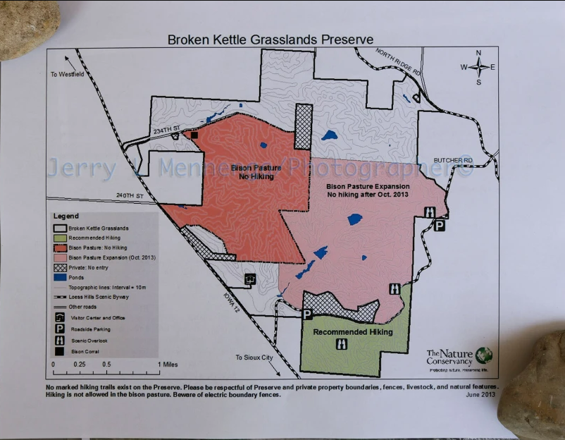
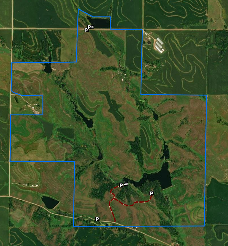
Broken Kettle is a sweeping reminder of nature’s beauty. Not only is it the Nature Conservancy’s largest preserve in Iowa, but it contains the largest remaining prairie in Iowa. In 1999, the Conservancy found the prairie rattlesnake, an extremely rare species, at this site, making Broken Kettle even more important to the region. The Nature Conservancy welcomed a herd of 28 bison at Broken Kettle Grasslands preserve in the fall of 2008—an historic event benefiting the native prairie and the bison herd itself. The extensive prairie ridgetops feature a variety of plants and animals typically found further west in the Great Plains, and also provide a critical habitat for many species of prairie butterflies. This area also hosts the largest tract of contiguous native prairie left in the state. The terrain is steep and rugged in places and predominantly grasslands. Expect to see snakes, insects, grassland birds and breathtaking vistas while you hike. There are no official trails but hiking is permitted south of Butcher Road. text source: The Nature Conservancy Commonly seen birds: Field Sparrow, Bell’s Vireo, Dickcissel, Eastern Meadowlark, Western Meadowlark Birds to look for: Black-billed Magpie, Grasshopper Sparrow, Bobolink, Upland Sandpiper Other Inhabitants: White-tailed Deer; Bison; Coyote; Badger; Great Plains Toad; Plains Spadefoot; Dusted Skipper; Regal Fritillary; Ottoe Skipper; Pawnee Skipper. wildlife source: Loess Hills Audubon Society 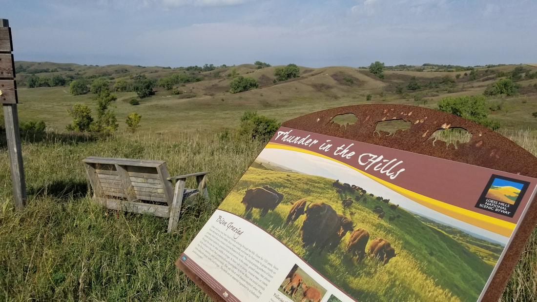 Broken Kettle Grasslands (source: Lance Brisbois)
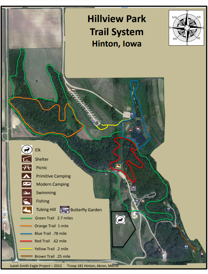
The 580-acre Hillview Recreation Area contains a mixture of open grasslands, reconstructed prairie, oak woodlands, and wildlife habitat. The park also manages a herd of elk. Hillview has a series of trails that can be a short loop or can be combined to take a long walk through the park. Trails wind through oak forests, prairies, and around the pond. The trails are great places to observe the abundant wildlife in the park. There is also a mountain bike trail in the park. During the fall and winter, October 15 - January 10, parts of Hillview are open to public hunting. Should you choose to use the trail system during hunting seasons, please make yourself visible by wearing blaze orange and be aware of your surroundings. text source: Plymouth County Conservation 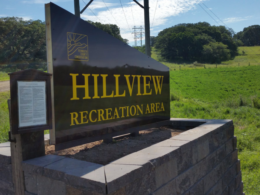 Hillview Recreation Area (source: Travel Iowa)
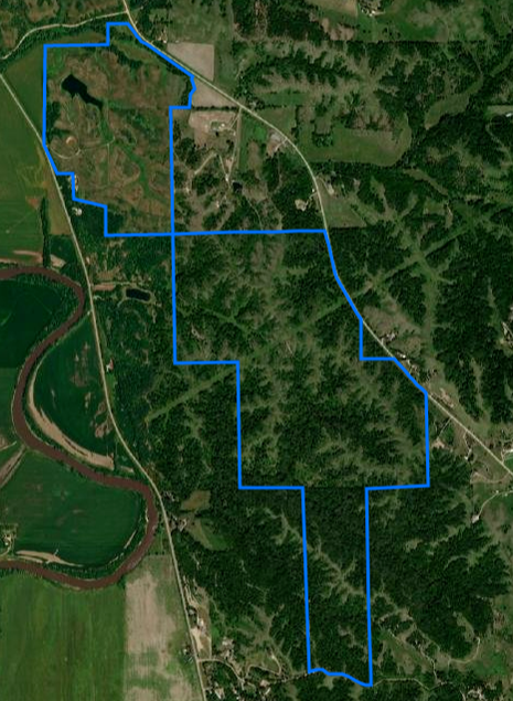
Originally named “Spirit Knoll” (a term coined by the previous owner of the property during the development of a proposed subdivision), the name Heendah Hills was approved by the State Preserves Advisory Board and pays homage to the American Indian identity of the preserve. Heendah is the phonetic pronunciation of “hinda”, meaning Great Horned Owl, in the Ioway/Baxoje language. The Great Horned Owl is a resident species of the region. High quality native prairie is present on approximately 23 acres on a ridge along the south edge of the preserve. An additional 26 acres of formerly grazed prairie with good representation of native plants (“prairie pasture”) is found in the northeast corner of the new preserve. Woodland (with bur oak and other tree species) and thickets form patches scattered on the landscape. Small patches of former cropland now dominated by a variety of volunteer plant species are found below the dam holding a 6-acre pond and in an old bottomland field in the far northeast corner of the preserve. text source: Loess Hills Audubon Society Commonly seen birds: Field Sparrow, Ring-necked pheasant, Dickcissel, Great Horned Owl Birds to look for: Grasshopper Sparrow, Bell’s Vireo, Great Crested Flycatcher Other Inhabitants: White-tailed Deer, Beaver, Badger, Coyote, Ball-nosed Hopper (insect) and Rainbow Grasshopper (first Iowa report of this species) wildlife source: Loess Hills Audubon Society 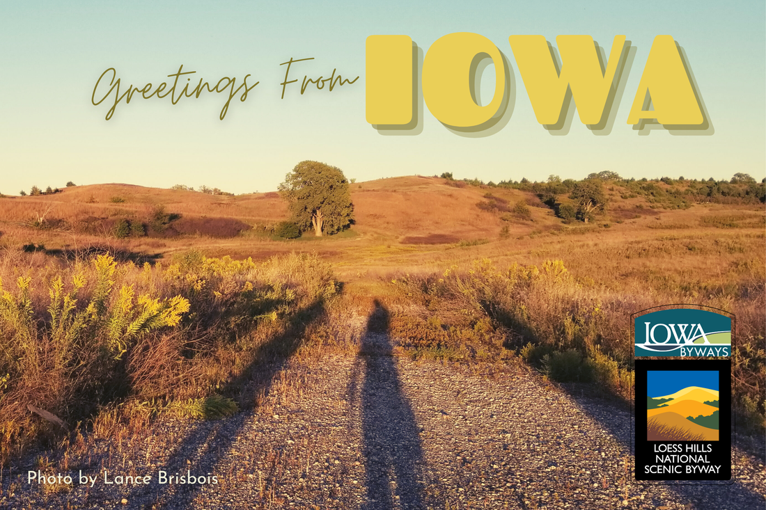 Heendah Hills State Preserve (source: Lance Brisbois, Golden Hills RC&D)
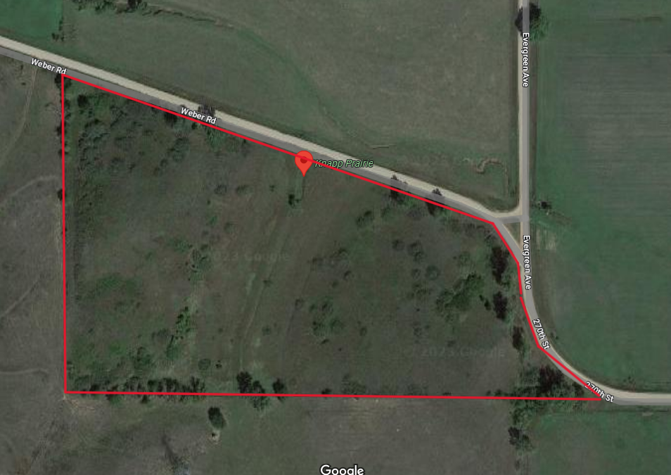
Knapp Prairie was donated to the Nature Conservancy by Barry and Carolyn Knapp in 1997. It is a rare example of mesic Loess Hills prairie growing on the lower portions of moderate slopes, saved from conversion to row crops or brome pasture by the tradition of cutting prairie hay. This site is an important seed source for the reconstruction of lower slopes and valleys at other nearby preserves. Knapp Prairie Preserve is dominated by tallgrass prairie species adapted to deeper, mesic loess soils. Knapp Prairie is also an important prairie butterfly conservation area. More than 900 regal fritillaries, orange and yellow butterflies, have been observed in a single survey at Knapp prairie, making it one of the largest U.S. populations of this butterfly. The Conservancy harvests seeds from the plants that attract these butterflies for use in restoring other prairies in the area. The terrain is steep and rugged in places and predominantly grasslands. Expect to see snakes, insects, grassland birds and breathtaking vistas while you hike. There are not any official trails but hiking is permitted throughout. text source: The Nature Conservancy
Hiking the Byways is a regular series by Golden Hills RC&D that features publicly accessible lands open to hiking on the three scenic byways in western Iowa that Golden Hills RC&D coordinates: Glacial Trail Scenic Byway, Loess Hills National Scenic Byway, and Western Skies Scenic Byway. Each Friday a blog post covers hiking areas in one county on one of the aforementioned byways. For questions about hiking on the byways, contact Seth Brooks ([email protected]).
Danelle Myer grew up on a conventional rowcrop farm in the rolling hills of southwest Iowa, near Logan in Harrison County. She moved away for college, where she studied public relations, then worked in PR and marketing for more than 15 years. During that time she liked gardening and cooking, but enjoyed her work and wasn’t looking for a career change. Danelle became interested in healthy eating and learned about the benefits of organic agriculture and food. When she realized the opportunity and incredible privilege she had with access to family land, Danelle decided she wanted to grow food for her hometown community. She was accepted into an apprenticeship program at University of California-Santa Cruz Center for Agriculture & Sustainable Food Systems, where she learned about sustainable and healthy food production. She then moved back to Logan and started One Farm.  Her first season farming was 2011. One Farm started selling at the Harrison County Welcome Center Farmers Market, which she continued to do through 2021. For several years she did weekly online orders, and also had a One Box (similar to a CSA). In the third season, One Farm built a high tunnel to extend the growing season. This has allowed the farm to continue and expand their Thanksgiving Box every November, and offers greens like spinach outside of the typical seasons in Iowa. Today One Farm continues to grow the foods that have proven to be the most popular and sellable over the past 12 years, including several varieties of heirloom tomatoes, sungold cherry tomatoes, green beans, lettuce, spinach, and herbs. You can find these products when in season at the store. 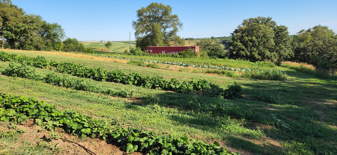 For years, Danelle pondered the possibility of a retail store to sell her products and other local products, but wondered about the feasibility of running both a farm and a store. In February 2020, she attended the Southwest Iowa Community & Economic Development Forum, hosted by TS Bank, Golden Hills, and Western Iowa Development Association. This event reignited her interest and inspired her to dive in and give it a try during One Farm’s 10th year. Two weeks later, the new COVID-19 virus caused unprecedented shutdowns and impacted every facet of daily life. Grocery store shelves were emptied as supply-chain issues lingered for many months. During this time, more and more people looked for places to buy local foods and support their community. 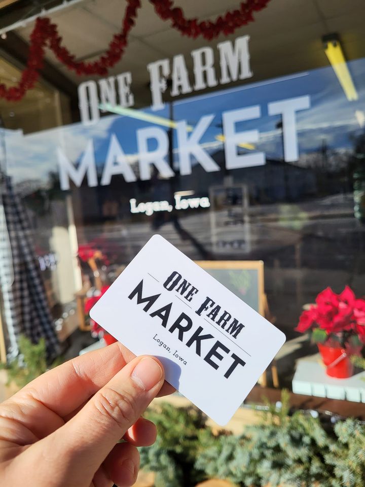 On Halloween in 2020, during the height of the pandemic, One Farm had its first pop-up market at a space on Logan’s main street, with a long line out the door. The market had numerous subsequent pop-ups through Christmas that year, selling produce, flours, honey, jams, soaps, and a few other items. Based on the resounding success of the pop-ups, One Farm Market started hosting regular hours and became a full-on retail shop in 2021. Their product listing has continued to diversify over time. Everything at One Farm Market is grown or made in Iowa or the Omaha area. Products include: vegetables, herbs, dairy, meat, eggs, flours, pasta noodles, jams, honey, granola, granola bars, maple syrup, oils, salad dressings, sauces, chocolate treats, soda, bath & body products, charcuterie boards, wooden bowls & utensils, candles, dog treats, handmade home goods, One Farm swag (shirts, mugs, etc.), and much more. For a limited time, they are offering some citrus fruits from a friend of Danelle’s in California. Products are shipped directly from farms, sourced through Farmtable Delivery, and in some instances picked up directly by One Farm. 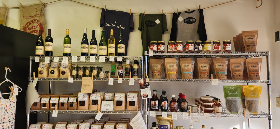 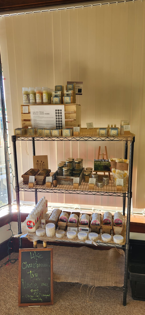 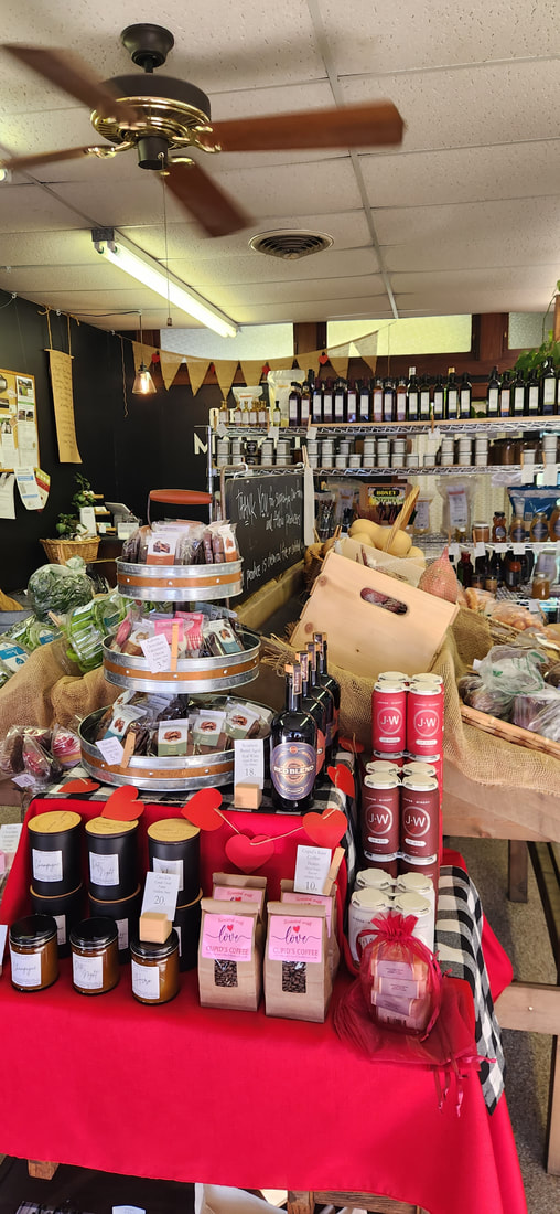 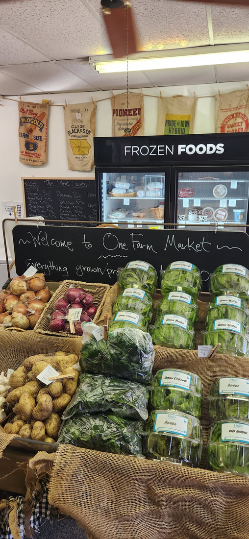 One Farm Market is located at 215 East 7th Street in Logan, right along Highway 30 and three of Iowa's scenic byways: Loess Hills National Scenic Byway, Lincoln Highway Heritage Byway, and Western Skies Scenic Byway.
One Farm Market is currently open Wednesdays from 3:30-6:30 and Saturdays from 10am-1pm, with additional hours coming in 2023. Follow One Farm on Facebook for updated information on their hours, products, and sales. |
Archives
June 2024
Categories
All
|


 RSS Feed