There are six places in Harrison County on the Western Skies Scenic Byway that offer hiking opportunities. DeSoto National Wildlife Refuge is a birder's dream with trails through prairie and woodlands. Harrison County Conservation manages several areas with fully developed trail systems and areas with only off-trail hiking. The trails at Old Town Conservation area, for example, offer a quiet hiking experience only half an hour from Council Bluffs and Omaha.
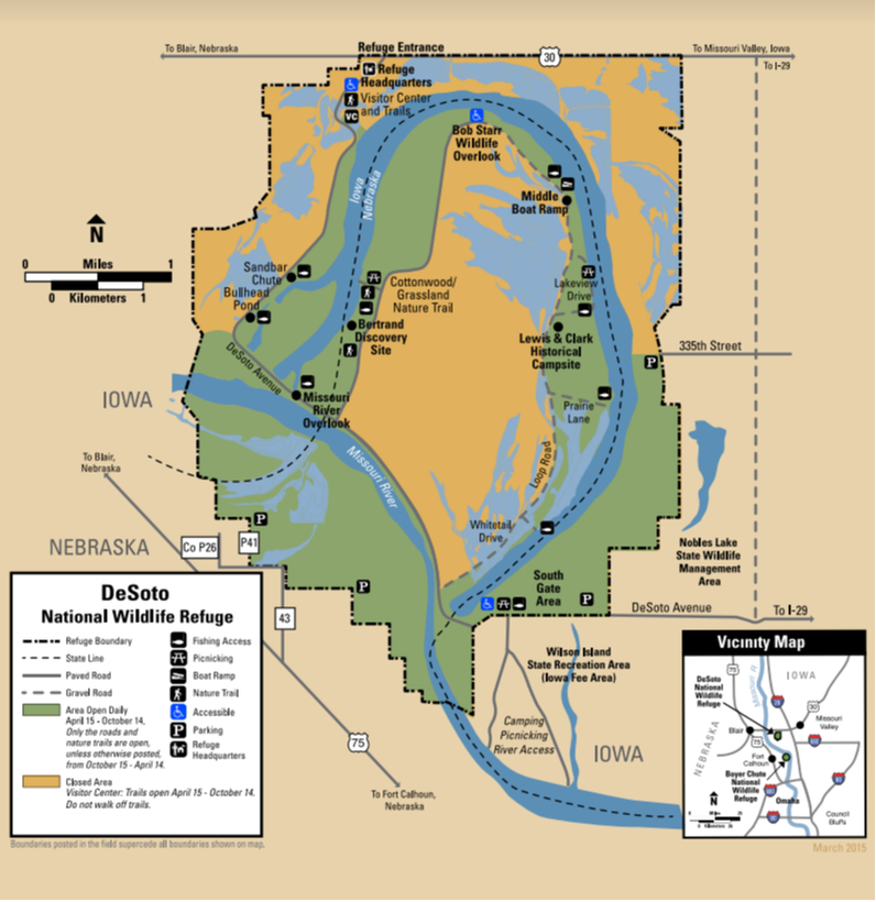
DeSoto National Wildlife Refuge is located along the Missouri River and borders both Iowa and Nebraska. Within its 8,365 acres lies DeSoto Lake, an oxbow lake that used to be a bend in the Missouri River. The refuge contains bottomland forests, tallgrass prairie, and wetland habitats that are managed to mimic the natural Missouri River floodplain habitat to benefit a diversity of migratory birds that flock to the refuge each year in the spring and fall. The refuge also contains a piece of history within its borders, the Bertrand Steamboat. The Bertrand sunk on the bend of river that is now DeSoto Lake, leaving behind the cargo and historic time pieces amounting to almost 250,000 different artifacts housed within the walls of the DeSoto National Wildlife Refuge Visitor Center. DeSoto National Wildlife Refuge is truly a place where wildlife meets history! The refuge provides hiking opportunities through a diversity of refuge habitat. The Bertrand Excavation Site Trail and the Cottonwood and Grassland Nature Trails are open year round on the Nebraska side of DeSoto Lake. The Green Heron Trail and the Missouri Meander Trail are seasonal trails open April 15 - October 14. For detailed information about each trail, check the refuge's trails website. text source: U.S. Fish & Wildlife Service 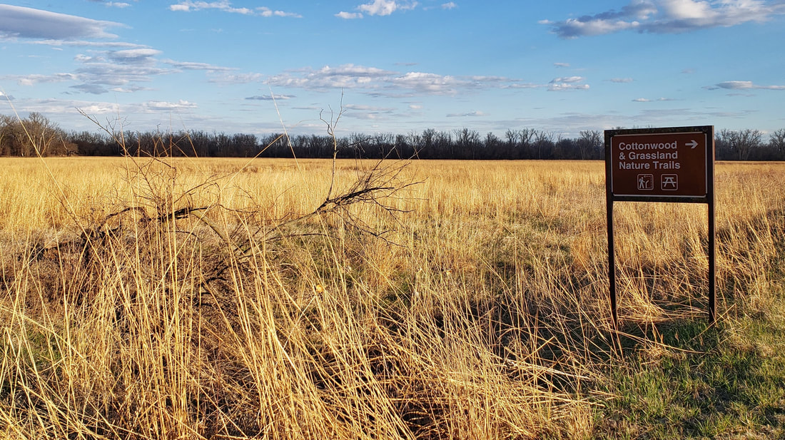 DeSoto National Wildlife Refuge (source: Golden Hills RC&D)
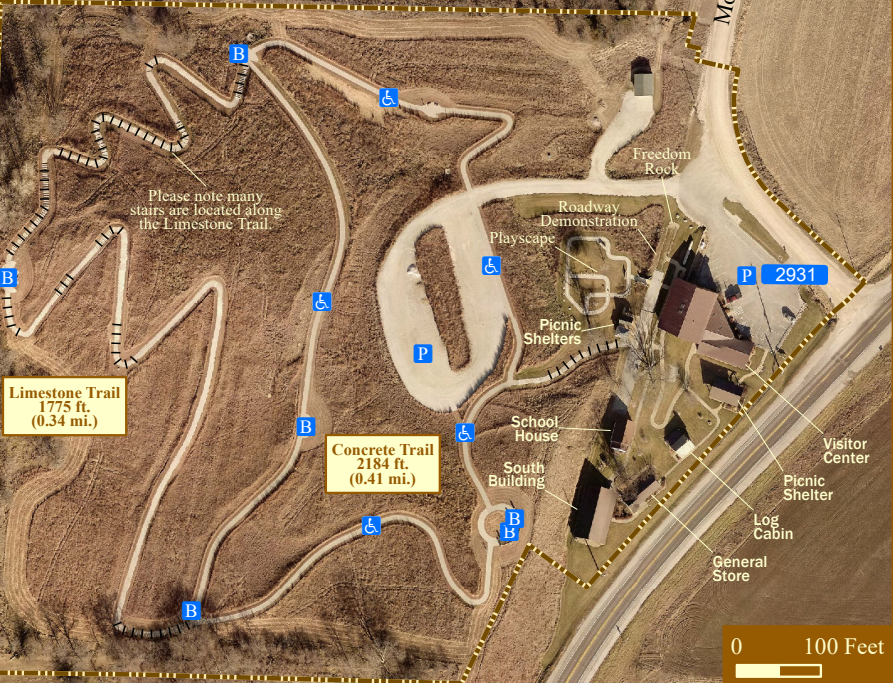
The Harrison County Historical Village and Iowa Welcome Center is located 3 miles northeast of Missouri Valley on Highway 30 (five miles east of Interstate 29, Exit 75). This museum complex is straight out of the 1800s, with an original log cabin, general store, and school. The official Iowa Welcome Center provides tourism information and assistance to travelers. The Iowa Products Store offers food, beverage, clothing, crafts, and a wide variety of souvenirs. Stretch your legs on the 1-mile trail and learn about the Loess Hills. The 0.41-mile Concrete Trail is accessible to wheelchairs. There are many stairs along the 0.34-mile Limestone Trail.  Harrison County Historical Village & Iowa Welcome Center (source: Golden Hills RC&D)
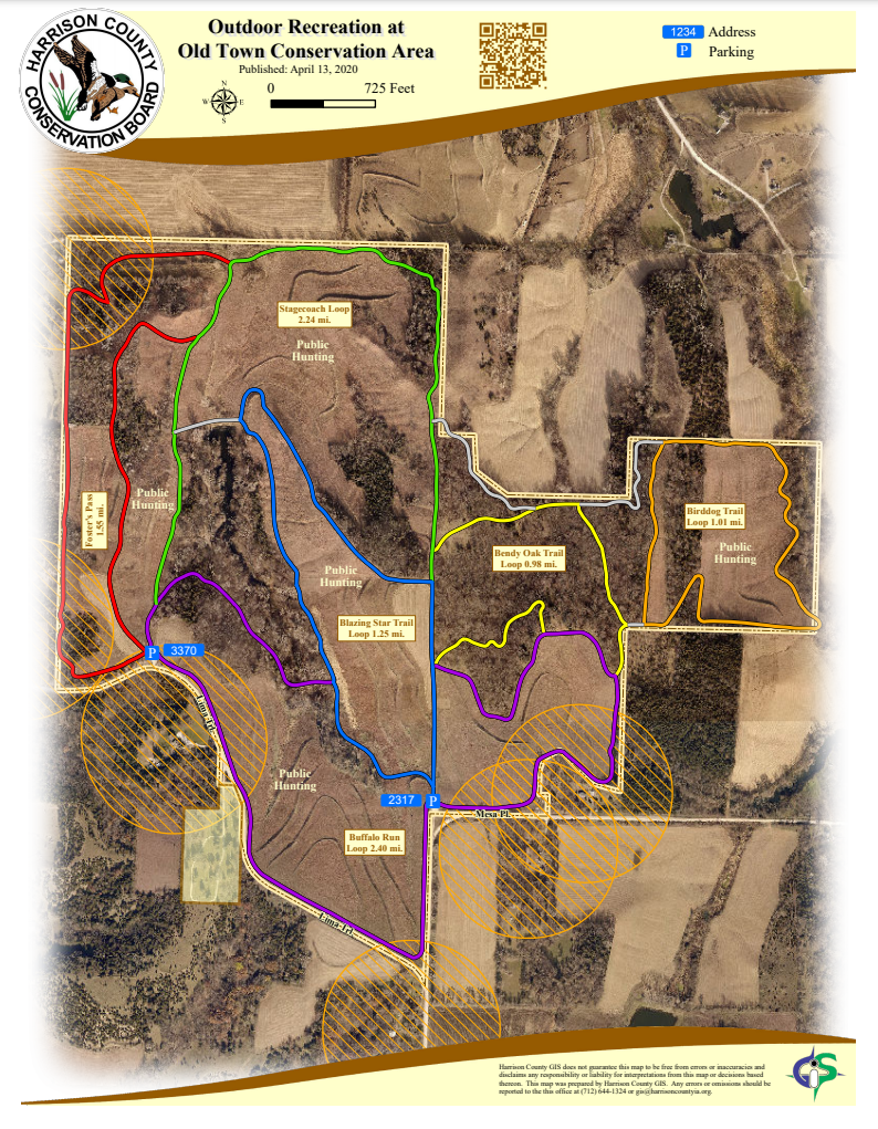
The Old Town Conservation Area is located off Lima Trail about 3 miles southeast of the Loess Hills National Scenic Byway and Missouri Valley. There are two parking areas that provide access to the trails.  Old Town Conservation Area (source: Lance Brisbois)
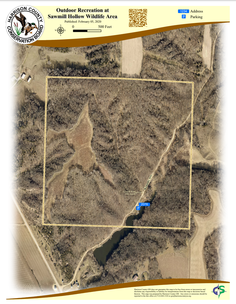
Located seven miles north of Missouri Valley off Loess Hills Trail (L20), the wildlife area is not directly on the byway but is a short drive from the main route. Access to Sawmill Hollow Wildlife Area is on a Level B dirt road. 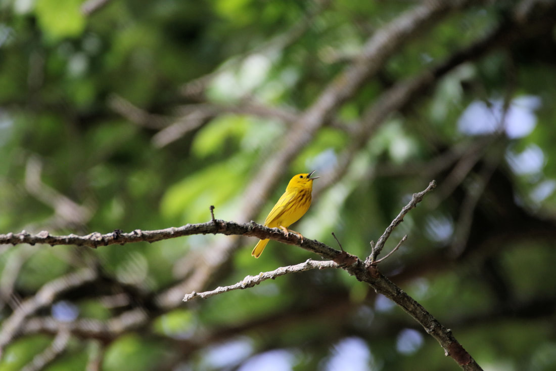 Yellow warbler at Sawmill Hollow Wildlife Area (source: Carter Oliver)
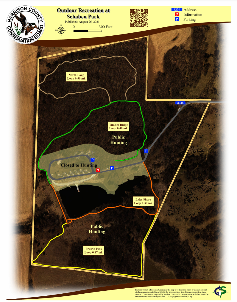
Schaben Park is not located on the Loess Hills National Scenic Byway but is a short drive from the main route or the Orchard Ridge loop. It is located 2 miles off Highway 30, between Woodbine and Dunlap on 141st Lane (gravel road). 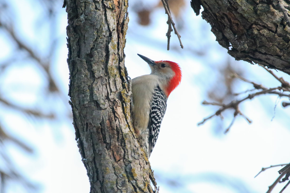 Red-bellied woodpecker at Schaben Park (source: Carter Oliver)
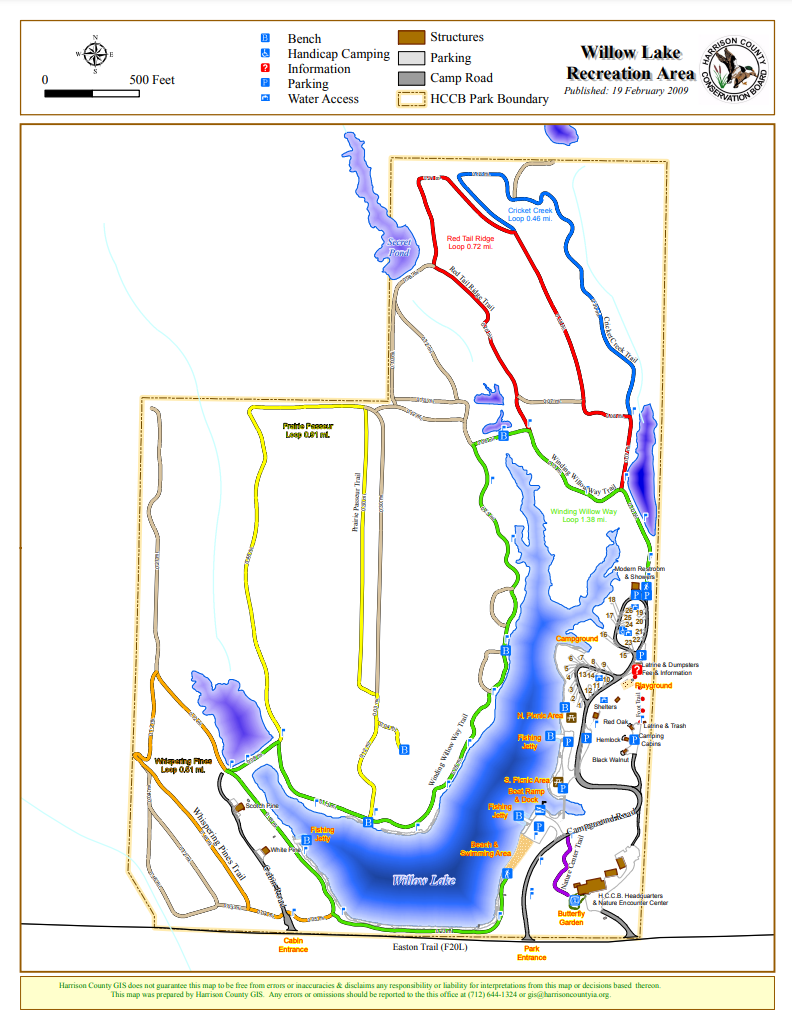
There are 6 miles of hiking trails with Smart Trail interpretive signs using QR (quick response) codes allow users to learn about the Loess Hills and Iowa's natural resources. The Willow Lake Recreation Area is also an excellent location for bird watching, especially migrating songbirds and waterfowl. Willow Lake Recreation Area is not located on the Loess Hills National Scenic Byway but is a short drive from the main route near Logan or the Orchard Ridge loop from Pisgah. It is located 6 miles northwest of Woodbine on F20L (Easton Trail). 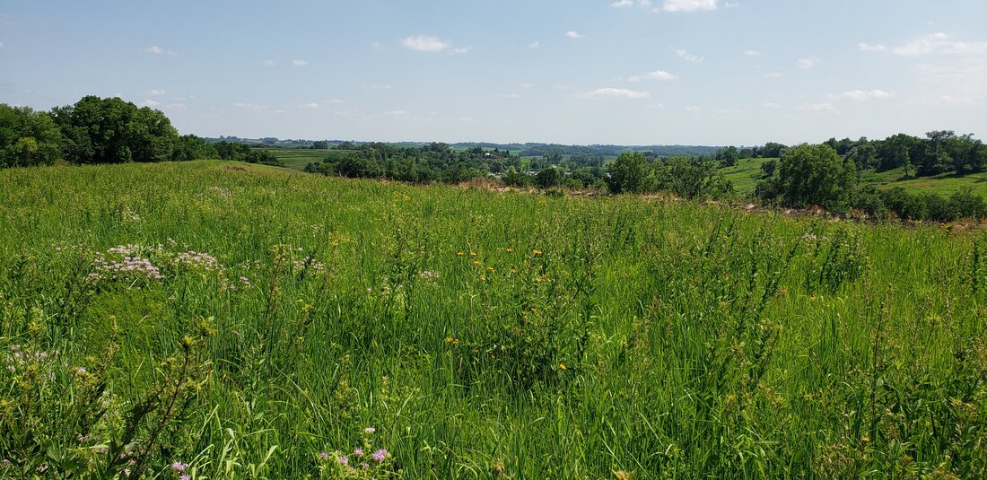 Willow Lake Recreation Area (source: Golden Hills RC&D) Hiking the Byways is a regular series by Golden Hills RC&D that features publicly accessible lands open to hiking on the three scenic byways in western Iowa that Golden Hills RC&D coordinates: Glacial Trail Scenic Byway, Loess Hills National Scenic Byway, and Western Skies Scenic Byway. Each Friday a blog post covers hiking areas in one county on one of the aforementioned byways. For questions about hiking on the byways, contact Seth Brooks ([email protected]).
0 Comments
Leave a Reply. |
Archives
June 2024
Categories
All
|

 RSS Feed