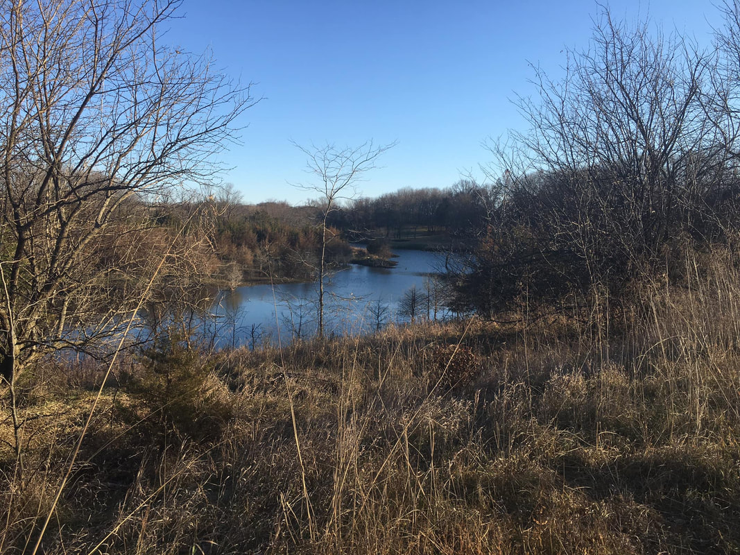
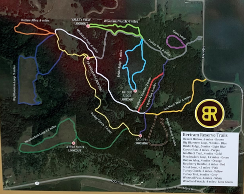
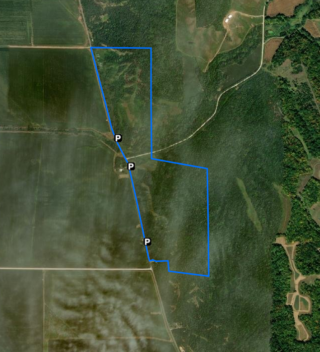
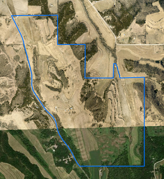
 Photo of Bertram Reservation by Lynn Graesing Our last post in the Hiking the Byways series takes us to Clay County on the Glacial Trail Scenic Byway. There are multiple areas open to hiking in the county, some with maintained trails like Bertram Reservation. If you are looking for off-trail exploration, there are 15 wildlife management areas and numerous county properties to explore native prairie, bottomland timber, and the Little Sioux River. Bertram Reservation
Oneota Park
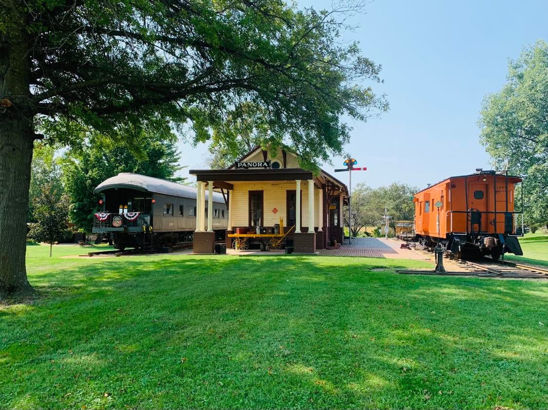
Other Areas in Clay CountyWanata Park - Wanata Park is a 144-acre park situated along the Little Sioux River next to the town of Peterson. Come enjoy the trails as you hike along the flood plains or hills of the Little Sioux River. Bob Howe Thunder Bridge Wildlife Refuge - 29.5 Acre wildlife refuge with the Little Sioux River flowing through it. Bike and hiking trail. Home to historic Thunder Bridge, a through truss bridge built in 1905. Donahoo Wildlife Area - 171 acre wildlife area located in both Clay and Buena Vista counties. It is located in the Little Sioux flood plain with prairie uplands and Oak Savannah prairie remnants. Kindlespire Complex - 310-acre wildlife area located along the Little Sioux River with hiking trails. Mori Prairie - 40 acres of open prairie. Ideal for pheasant hunting using non-toxic shot and bird watching. Outstanding for those who are interested in native plant ecology. One of the very few pristine native prairies in Clay County. Riverton Wildlife Area - 160-acre wildlife area along the Ocheyedan River open to hiking. Schmerse Wildlife Area - Hiking trail around the pond. Stouffer Memorial Wildlife Preserve - 20 acre wildlife reserve located along the Little Sioux River off of Highway 18. Summit Wildlife Area - Summit Wildlife Area is approximately 132 acres of re-constructed prairie area located on the Little Sioux River. Wildlife Management AreasThere are 15 wildlife management areas in Clay County. These areas are managed by the Iowa DNR and are open to hunting. There are no maintained trails, however, some may have maintenance tracks that can be used for hiking. Off-trail hiking is permitted, but take caution during hunting season to not disturb wildlife or hunters. Go to the Iowa DNR's website to search for WMAs in Clay County. Hiking the Byways is a regular series by Golden Hills RC&D that features publicly accessible lands open to hiking on the three scenic byways in western Iowa that Golden Hills RC&D coordinates: Glacial Trail Scenic Byway, Loess Hills National Scenic Byway, and Western Skies Scenic Byway. Each Friday a blog post covers hiking areas in one county on one of the aforementioned byways. For questions about hiking on the byways, contact Seth Brooks ([email protected]).
0 Comments
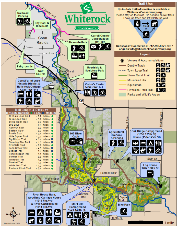
 Whiterock Conservancy (photo by Lance Brisbois)
Explore over 40+ miles of hiking, mountain biking, equestrian, and UTV trails; set up camp in our RV or tent camping areas; or enjoy the comforts of home in one of our vacation rentals. A Whiterock Conservancy trail pass is required for all visitors mountain biking and horseback riding on the trails. A trail pass is not required for walking or hiking, however a suggested donation of $2 is appreciated. The annual pass is good for the calendar year and the daily pass is good for the day of purchase. Trail fees help cover the cost of maintenance, as well as preserve the landscape. Self-serve kiosks are located with payment envelopes throughout Whiterock Conservancy and can be found at the campgrounds, trailheads, Bur Oak Visitor's Center, and the Historic Garst Farmstead. (text source: Whiterock Conservancy) 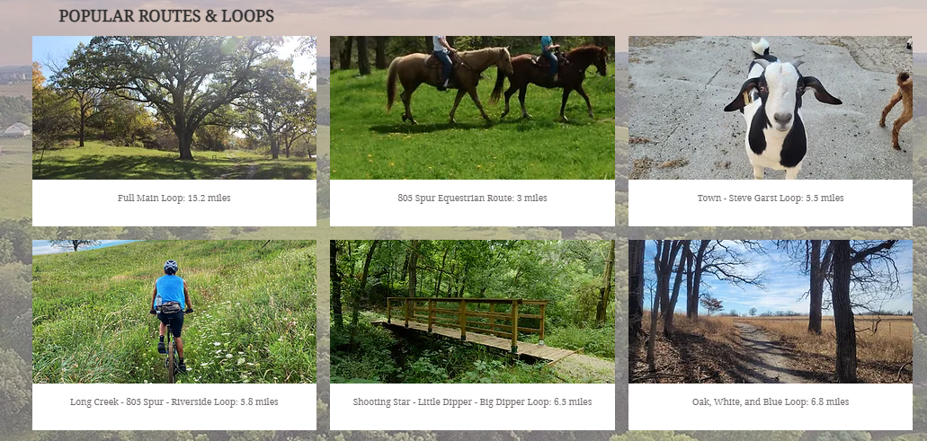 Source: Whiterock Conservancy Springbrook State Park
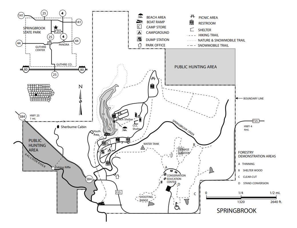
Springbrook State Park is a quiet retreat in Guthrie County, encompassing 930 acres of rolling hills and mature timber. Many of the park’s structures were built by the Civilian Conservation Corps (CCC) in the 1930s, creating a nostalgic setting for park visitors. A multifamily cabin called the Sherburne House is perfect for large families or groups, and the lake is a popular destination for swimming and kayaking. Hike or bike 12 miles of trails at Springbrook, offering leisurely routes through timber and prairie areas or more challenging paths for the seasoned hiker or biker. Trails also lead to small ponds, the Middle Raccoon River, and the park’s 17-acre lake. Snowmobiling is allowed on four miles of designated trails in the winter. (text source: Iowa DNR) Sheeder Prairie State Preserve
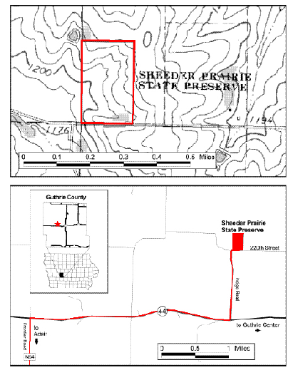
This preserve lies within the Southern Iowa Drift Plain, a landform region of gently rolling terrain. Over 200 plant species are found in this preserve, including thirty grasses. The prairie hilltops and slopes contain big bluestem, little bluestem, porcupine grass, and prairie dropseed along with leadplant, rosinweed, prairie willow, and redroot. Prairie phlox, golden alexanders, flowering spurge, rattlesnake master, purple coneflower, and gray-headed coneflower are also common. The wooded ravines are dominated by box elder, wild plum, and black willow. In the spring, prairie false dandelion, bird’s-foot violet, prairie violet, lousewort, and hoary puccoon are among the first plants to begin blooming. By May, ground plum, indigo bush, blue-eyed grass, prairie ragwort, tall green milkweed, prairie larkspur, and yellow stargrass join the display. Prairie loosestrife, butterfly weed, purple prairie clover, compass plant, ironweed, wild bergamot, rough blazing star, and prairie blazing star can be found in June and July. Nodding ladies’-tresses, white sage, silky aster, sky-blue aster, showy goldenrod, Canada goldenrod, smooth goldenrod, and downy gentian bloom during the fall months. A total of sixty-nine species of birds can be found here, with twenty-five nesting on a regular basis. Nearly three-fourths of the nesting species are woodland species. Two grassland species, the bobolink and grasshopper sparrow, nest sporadically. Several preferring the woodland edge habitat found here include gray catbird, eastern kingbird, brown thrasher, rosebreasted grosbeak, red-headed woodpecker, downy woodpecker, blackcapped chickadee, Baltimore oriole, northern cardinal, house wren, and American goldfinch. The Conservation Education Center, located at Springbrook State Park north of Guthrie Center, sponsors workshops and interpretive events that often include field trips to Sheeder Prairie. (text source: Iowa DNR state preserves guide) 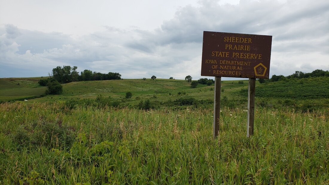 Nations Bridge Park
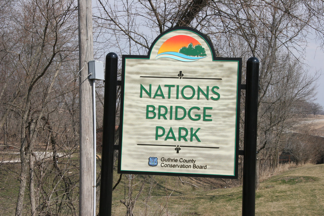
 offers a variety of recreational opportunities to the public and is a favorite spot for many. The park has a total of 81 acres that can be used for camping, picnicking, kayaking, hiking, bird watching fishing, disc golf, and horse shoes. Wildlife is abundant at Nations Bridge Park. Deer, turkeys, squirrels, rabbits, quail, raccoons, coyotes, and a variety of songbirds can be seen at the park. Nature trails can be found throughout the park and a self-guided nature trail is located on the east side of the park, County Highway P28. (text source: Guthrie County Conservation) 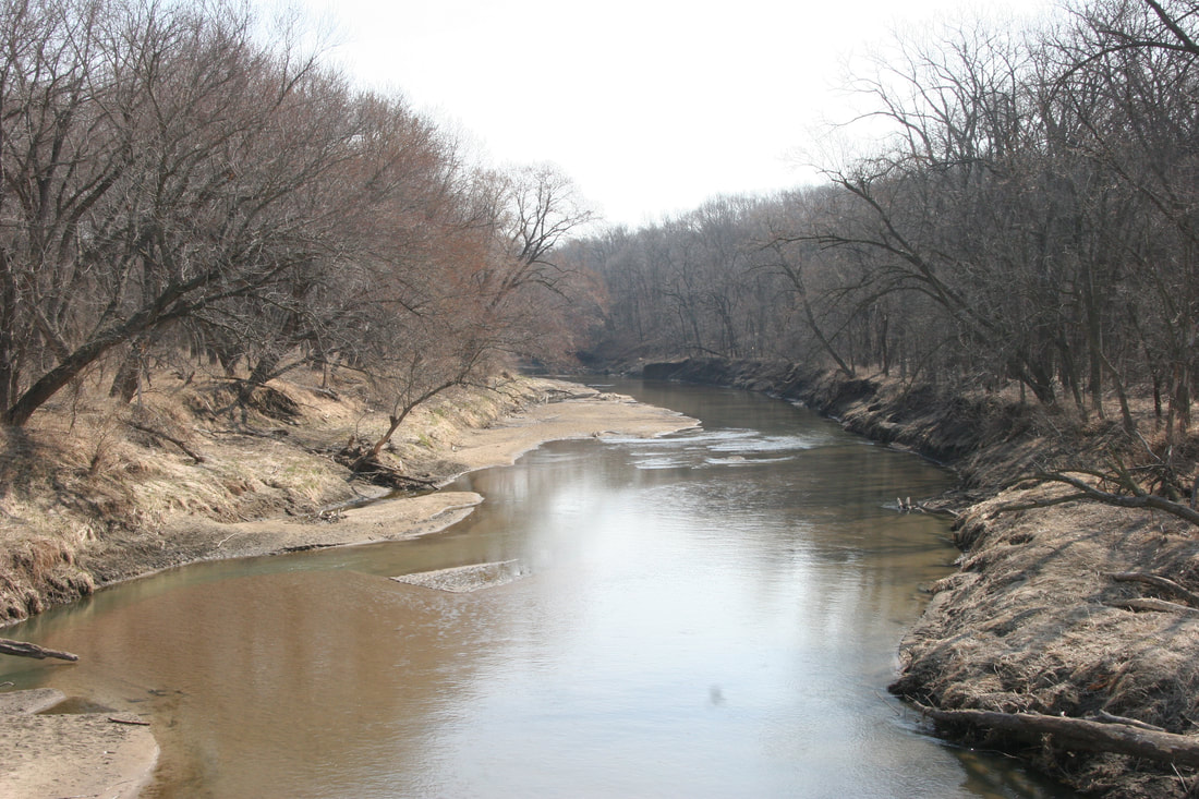 Sutcliffe Woodland
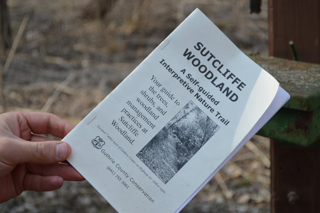
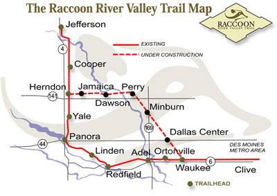
 is a beautiful, 55-acre oak-hickory area designated as a wildlife refuge. It offers a 31-post, self-guided interpretive nature trail, as well as picnicking, hiking, and pond fishing. (text source: Guthrie County Conservation)  Raccoon River Valley Trail
The trail winds its way through the Middle and North Raccoon River corridors with areas of prairie and canopies of timber that remind us of what Iowa was like in the 1870's. Common uses for the multi-recreational trail are hiking, biking, walking, in-line skating, jogging, bird watching , or cross-country skiing, and snowmobiling in the winter. Trailheads in Guthrie County:
(text source: Guthrie County Conservation) The following Guthrie County Conservation properties are open to hiking but have no maintained trails: Hiking the Byways is a regular series by Golden Hills RC&D that features publicly accessible lands open to hiking on the three scenic byways in western Iowa that Golden Hills RC&D coordinates: Glacial Trail Scenic Byway, Loess Hills National Scenic Byway, and Western Skies Scenic Byway. Each Friday a blog post covers hiking areas in one county on one of the aforementioned byways. For questions about hiking on the byways, contact Seth Brooks ([email protected]).
Loess Hills Scenic Overlook (© 2016 Kenneth West)
Aalfs Family Preserve
Land status - Broken Kettle Grasslands Overlook location - Butcher Rd south of Westfield Access - via a kissing gate on Butcher Rd Notes - Bench and interpretive panel overlooking the bison enclosure Five Ridge Prairie Cabin Land status - Five Ridge Prairie State Preserve Overlook location - 26616 IA-12, Westfield, IA 51062 Access - Requires a hike up a steep trail Notes - Cabin is perched on the ridge overlooking the Bix Sioux River and the Missouri River floodplain Elk Point Overlook Land status - Stone State Park Overlook location - Stone State Park Dr, Sioux City, IA 51109 Access - Parking area on the park road Notes - Overlooks the southern section of the state park Dakota Point Overlook Land status - Stone State Park Overlook location - Dakota Point Rd, Sioux City, IA 51109 Access - Parking area on the park road Notes - Overlooks the Big Sioux River and South Dakota Kestrel Point Land status - Dorothy Pecaut Nature Center Overlook location - Bluestem Trail Access - Requires hiking the nature center trails Notes - Overlooks the nature center Mount Lucia Land status - Stone State Park Overlook location - Mt. Lucia Trail Access - Requires hiking the state park trails Notes - Views of Sioux City War Eagle Park Land status - War Eagle Park Overlook location - Sioux City, IA 51103 Access - Ample parking lot Notes - Overlooking I-29, the Missouri River, and Nebraska Sergeant Floyd Monument Land status - Sergeant Floyd Monument Overlook location - 2601 S Lewis Blvd, Sioux City, IA 51103 Access - Ample parking lot Notes - Views of I-29, Sioux City, Missouri River, and Nebraska Loess Hills Scenic Overlook Land status - Loess Hills State Forest - Preparation Canyon Unit Overlook location - Oak Ave, Moorhead, IA 51558 Access - Wood platform that is wheelchair and stroller accessible Notes - Interpretive panels and views of prairie ridges and state forest Preparation Canyon State Park Viewpoint Land status - Preparation Canyon State Park Overlook location - Moorhead, IA 51558 Access - Via hiking trail; quickest access via the overnight camping parking lot off Highway 183 Notes - Bench atop a prairie ridge with views of the state park and Soldier River Valley Murray Hill Scenic Overlook Land status - Harrison County Conservation Overlook location - 1634 Co Rd F20, Little Sioux, IA 51545 Access - Requires a short hike from the parking lot Notes - Interpretive panels, picnic table, bench, and views of the Missouri River floodplain Little Sioux Viewpoint Land status - Loess Hills State Forest - Little Sioux Unit Overlook location - 41.773667, -96.004111 Access - Requires hiking up a steep trail from the parking lot on 165th Trail Notes - Bench overlooking the junction of the Soldier River Valley and Missouri River floodplain, and views of the Mondamin unit of the state forest Mondamin Viewpoint Land status - Loess Hills State Forest - Mondamin Unit Overlook location - 41.721694, -95.964556 Access - Requires hiking the state forest trails, including a steep section from the south trailhead on Highway 127 Notes - Bench atop a steep ridge with views west of the Missouri River floodplain Lincoln Highway Overlook Land status - Harrison County Iowa Welcome Center Overlook location - 2931 Monroe Ave, Missouri Valley, IA 51555 Access - Requires walking a paved path from the welcome center Notes - Overlooking the Lincoln Highway Loveland Scenic Overlook Tower Land status - I-880 rest area Overlook location - 16614 I-880, Honey Creek, IA 51542 Access - Stairs to top of the overlook tower Notes - Overlooking I-880 and the surrounding Loess Hills Loess Hills Lodge & HawkWatch Tower Land status - Hitchcock Nature Center Overlook location - 27792 Ski Hill Loop, Honey Creek, IA 51542 Access - HawkWatch Tower requires climbing up stairs, while there is a viewing platform around the Lodge Notes - Views of the nature center Badger Ridge Viewpoint Land status - Hitchcock Nature Center Overlook location - Badger Ridge Trail Access - Requires hiking one-half mile from the Badger Ridge Trailhead Notes - Views of the southern section of the nature center and the Simon Run valley Lewis & Clark Monument Overlook Land status - Lewis and Clark Monument Park Overlook location - 19962 Monument Rd, Council Bluffs, IA 51503 Access - Accessible for wheelchairs and strollers Notes - Views of planes landing and taking off from Eppley Airfield and the Omaha skyline Lookout Point Land status - Fairmount Park Overlook location - End of Park Rd Access - Small parking area at the end of Park Rd Notes - Views west of Council Bluffs and downtown Omaha West Oak Forest Viewpoint Land status - West Oak Forest Overlook location - 41.0742, -95.81053 Access - Requires a steep hike from the parking lot to the ridge, then additional hiking along the ridge Notes - Views of the Missouri River floodplain Pony Creek Park Overlook Tower Land status - Pony Creek Park Overlook location - 41.06962, -95.78753 Access - Requires hiking the park's trails Notes - Views of Pony Creek Mile Hill Lake Scenic Overlook Land status - Mile Hill Lake Overlook location - 21193 US, Mile Hill Lake Park, US-34, Pacific Junction, IA 51561 Access - Viewing platform at the parking lot Notes - Overlooking Mile Hill Lake Riverton Wildlife Overlook Land status - Riverton Wildlife Management Area Overlook location - 40.7181, -95.5658 Access - Wood platform Notes - Overlooking the northern section of the wildlife area Waubonsie State Park Scenic Overlook Land status - Waubonsie State Park Overlook location - 40.67549, -95.69093 Access - Near the parking lot near the park office Notes - Benches and interpretive panels overlooking the state park Sunset Ridge Viewpoint Land status - Waubonsie State Park Overlook location - 40.67206, -95.70318 Access - Requires hiking Sunset Ridge Trail Notes - Interpretive panel and view overlooking the Missouri River floodplain 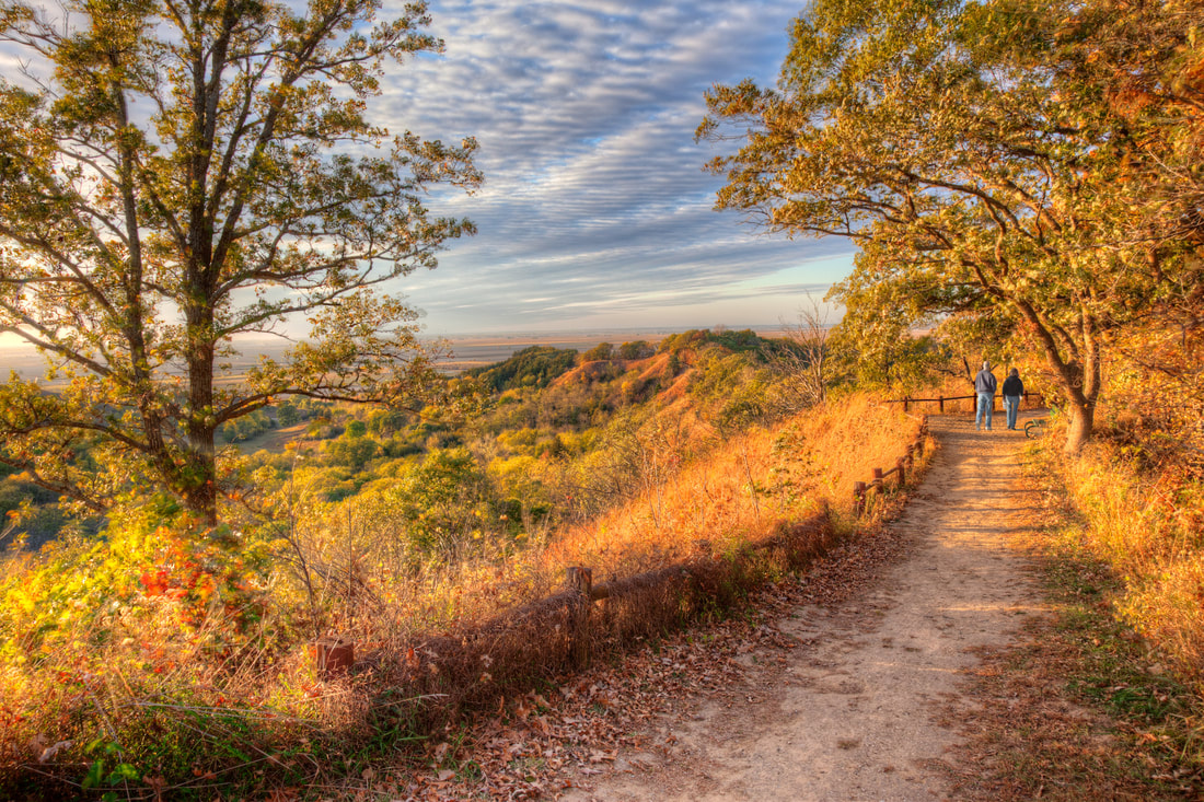 © 2016 Kenneth West
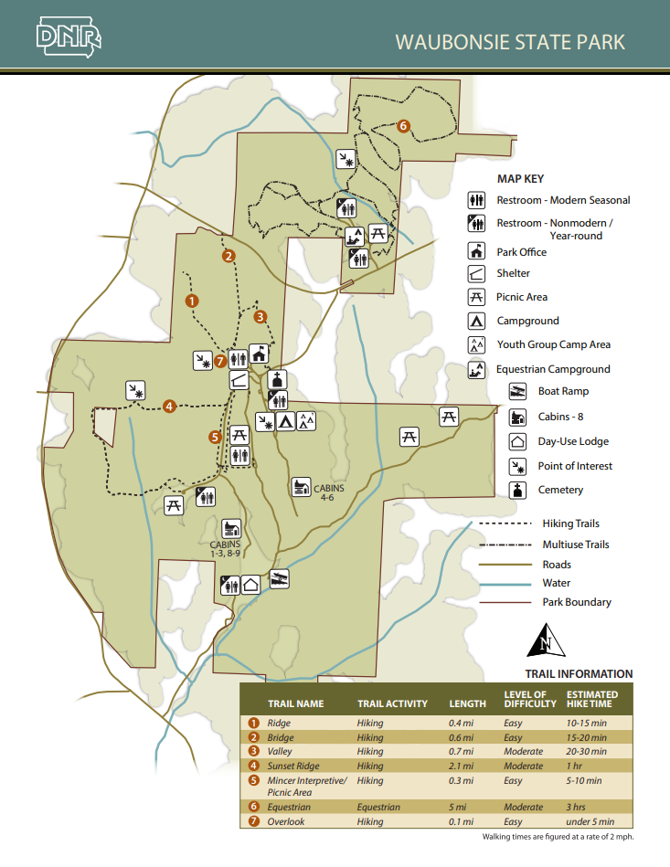
anyone eager to hike amongst the tranquil surroundings of the park’s ridgetop prairies and shaded woodland valleys. With nearly 2,000 acres of recreational opportunity and quiet beauty, Waubonsie State Park is an Iowa gem waiting to be explored. 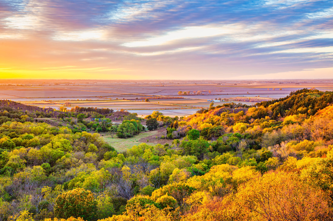 © 2016 Kenneth West Named for Chief Waubonsie of the Native American Pottawattamie tribe, the park is much the same today as it was when it was purchased in 1926. The changing seasons complement the beauty of this countryside. Spring brings the blossoms of dozens of varieties of flowers and shrubs. Summer beckons with cooling breezes on the high places and in shady glens. Nowhere in Iowa are there more brilliant splashes of color than at Waubonsie in the fall, and in the winter the bluffs and ridges are sometimes beautifully blanketed with snow. Several miles of hiking and equestrian trails are available throughout the park. Hike the Sunset Ridge Nature Trail that traverses the heart of the park, offering sweeping views of the Missouri River Valley. The Ridge and Valley trails also provide ample hiking opportunities, taking visitors through quiet and shaded woodland areas. Eight miles of trails are accessible only to hikers. Another eight miles of multi-use trails wind through the northern regions of Waubonsie and are perfect for anyone in search of challenging hikes, mountain biking, horseback riding or snowmobiling opportunities. The trail to the main overlook is accessible for all ages and abilities.
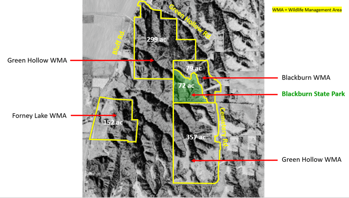
Blackburn State Park Unit, managed by Waubonsie State Park, is a 72-acre park formed in 2019 from the donation of over 150 acres by William R. (Bill) and Sara Blackburn. The park is at the center of approximately 1,000 acres of preserved public grounds, including the Blackburn and Green Hollow Wildlife Management Areas, which are managed by the Nishnabotna Wildlife Unit of the Iowa DNR. The unit includes an overlook platform and reservable large picnic shelter. Given the site’s remote location, there is no public water supply, and all garbage must be removed by the visitor. A 20-acre restored prairie graces high ground where native flowers bloom, especially in late spring. Three beautiful stone benches positioned on the ridge offer grand views of the sunset over the woods. Blackburn WMA & Green Hollow WMA
Bring your camera, as there's been reported Sasquatch sightings at this remote and rugged wildlife area!
 Photo by Carter Oliver
Eli Slusher has only been open to the public since 2016, but has attracted bird watchers, hikers, mushroom hunters and a growing number of archery deer hunters. Being adjacent to Waubonsie State Park and its campsites, cabins and modern shower and restroom facilities, visitors can totally immerse themselves in Iowa’s outdoors. Timbered draws, prairie ridges, steep hills and deep valleys. Eli Slusher WMA is full of wildlife from the hardy — like deer, turkey and badgers — to the more fragile, like zebra swallowtail butterflies and, quite likely, the state endangered Great Plains skink. 
  © 2016 Kenneth West Hiking the Byways is a regular series by Golden Hills RC&D that features publicly accessible lands open to hiking on the three scenic byways in western Iowa that Golden Hills RC&D coordinates: Glacial Trail Scenic Byway, Loess Hills National Scenic Byway, and Western Skies Scenic Byway. Each blog post covers hiking areas in one county on one of the aforementioned byways. For questions about hiking on the byways, contact Seth Brooks ([email protected]).
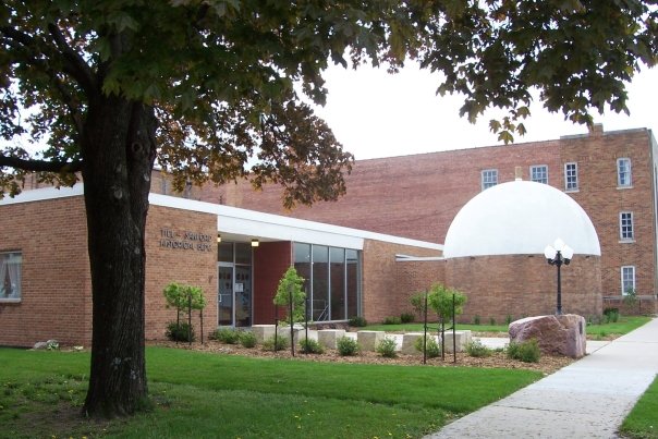
Sanford Museum & Planetarium
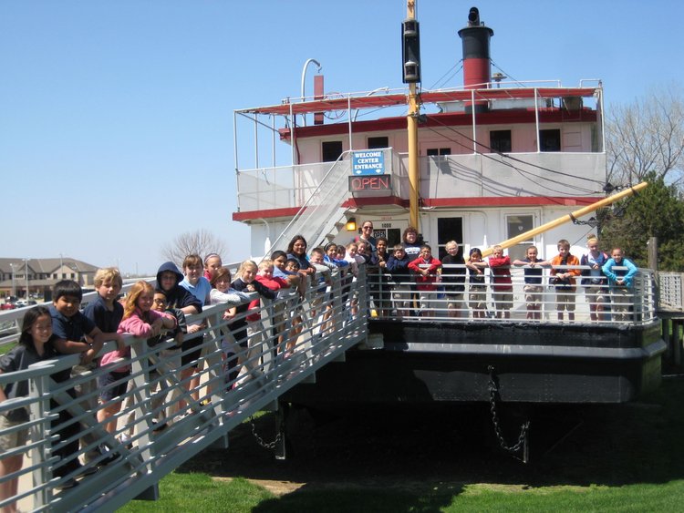
Sergeant Floyd River Museum
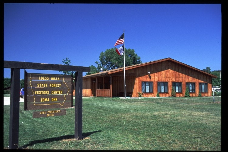
Brent S. Olson Memorial Visitor Center
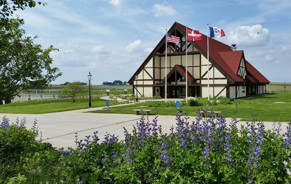
Museum of Danish America
Guthrie County Historical Village & Museum
Historic General Dodge House
Iowa's Championship Rodeo Museum
 If you are looking for a local craft brew to try as you explore one of western Iowa's scenic byways, you're in luck as there are several located on or near the Loess Hills National Scenic Byway, Western Skies Scenic Byway, and Glacial Trail Scenic Byway. Take a look at our list below, check out each brewery's website for their menu and tap room hours, and then make plans for a weekend trip. And, of course, drink responsibly!
Buena Vista County Conservation Park
This park is just off the Glacial Trails Scenic Byway on 400th Street, 2 miles east of M-27 in the beautiful Little Sioux River Valley of northwest Buena Vista County. Buena Vista Park offers multiple camping areas, cabin and lodge overnight rental facilities, day-use shelter, arboretum, prairie grass plantings, and miles of trails through woodland areas for visitors to explore.
The former 120 acre gravel pit area has been developed and contains picnic shelters, pit toilet, and playground equipment. Several plots of prairie grass have been established. The lake provides excellent deep pond fishing. No firearms or bows and arrows are allowed but deer and pheasants can be driven. There is a trail for hiking available around the pit
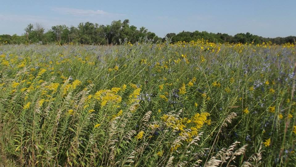
Located within more then 3,000 contiguous acres of prairie in the Little Sioux Valley region, the property provides habitat for wildflowers, butterflies and grassland nesting birds. This particular tract of land was historically pastured, but much of the native grass has survived. A special feature of the tract is a small, crystal-clear, spring-fed steam that meanders through it. Browns' Prairie is level to steeply rolling. Care should be exercised by the elderly and children. This area is extremely hot in the summer and cold in the winter without trees to break the wind or sun. Cattle grazing is used to manage native grasses so please exercise caution when visiting the area. WHAT TO SEE: PLANTS Grasses on this prairie include: little bluestem grass, porcupine grass and side-oats gramma. Flowers include: pale purple coneflower, prairie violets, pasque flower and grey headed coneflower. WHAT TO SEE: ANIMALS Birds on the Browns' Prairie include: bobolinks, grasshopper sparrows, meadowlarks, and kingfishers often fishing in the prairie streams during the summer. 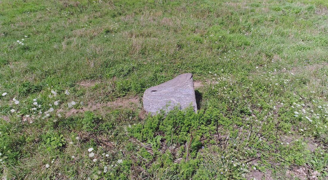 Photo by The Nature Conservancy Buena Vista Conservation allows off-trail hiking at all of their properties, including wildlife areas. Below is a list with addresses. Brooke Wildlife Area Buena Vista 440th Street, Linn Grove IA 51033 Elk Wildlife Area 60th Avenue, Alta IA 51002 Gabrielson Park 1322 440th Street, Sioux Rapids IA 50585 Gaherty Wildlife Area 580th Street, Storm Lake IA 50588 Gary Christiansen Wildlife Area 30th Avenue, Linn Grove IA 51003 Hankens Wildlife Area 10th Avenue, Alta IA 51002 Pheasant Ridge Wildlife Area 660th Street, Newell IA 50568 Starr-Robbins Wildlife Refuge Evans Street, Linn Grove IA 51033 Three Waters Wildlife Area 600th Street, Newell IA 50568 Hiking the Byways is a regular series by Golden Hills RC&D that features publicly accessible lands open to hiking on the three scenic byways in western Iowa that Golden Hills RC&D coordinates: Glacial Trail Scenic Byway, Loess Hills National Scenic Byway, and Western Skies Scenic Byway. Each blog post covers hiking areas in one county on one of the aforementioned byways. For questions about hiking on the byways, contact Seth Brooks ([email protected]). 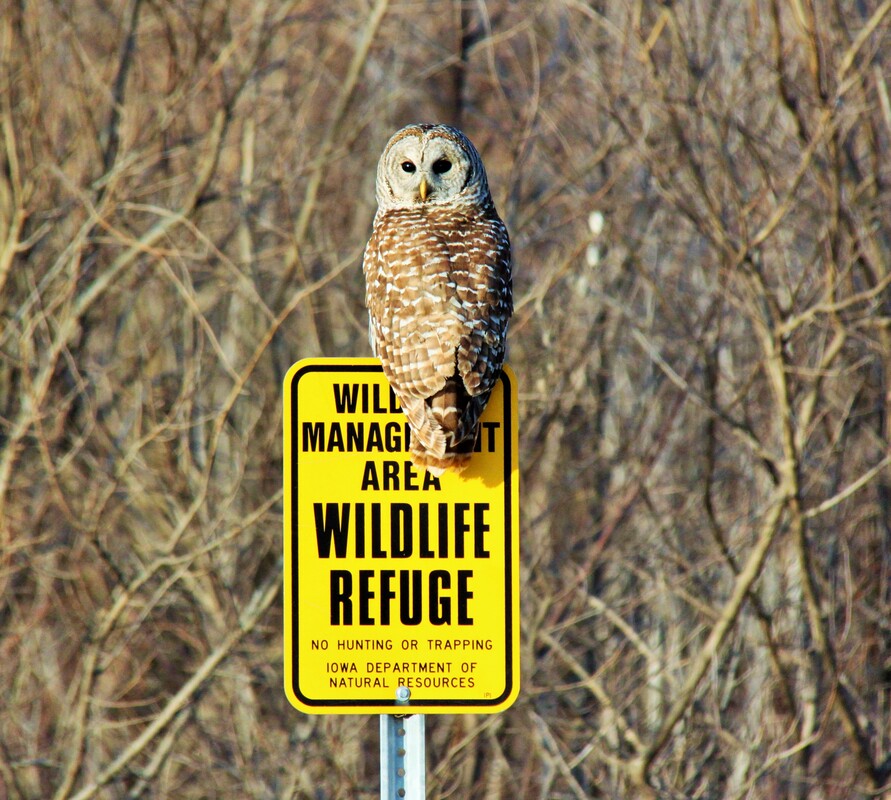
Barred owl at Riverton WMA (photo by Carter Oliver)
May is a big birding month in Iowa. It kicks off with National Bird Day on May 4th, then is followed by the Iowa Ornithologists' Union 100th Anniversary celebration from May 5th to 7th. World Migratory Bird Day on May 13th coincides with the predicted peak migration, which has been forecasted to occur between May 9th and 14th.
We have compiled a list of birding resources to help you explore the wonderful birding opportunities in western Iowa. Read about them below. Birding Organizations
The Iowa Ornithologists' Union spring meeting will kick off their celebration of 100 years of birding as an organization. The venue for the weekend is the beautiful Stine Barn and grounds in West Des Moines. Join them for exceptional programs, great birding, and fellowship with like-minded individuals. The keynote speaker is Ted Floyd, of the American Birding Association, who will examine how much birding has changed over the course of one hundred years. Activities are planned for newer birders, families, photographers, and seasoned veterans alike!
If you cannot make the celebration, check out the IOU website. They have a wealth of information to learn about birds and find birds in Iowa, including an Iowa bird list with 433 species, an Iowa breeding bird atlas, birding by county, Iowa hot spots, and more! The Ann Barker Library includes issues of Iowa Bird Life dating back to 1931.
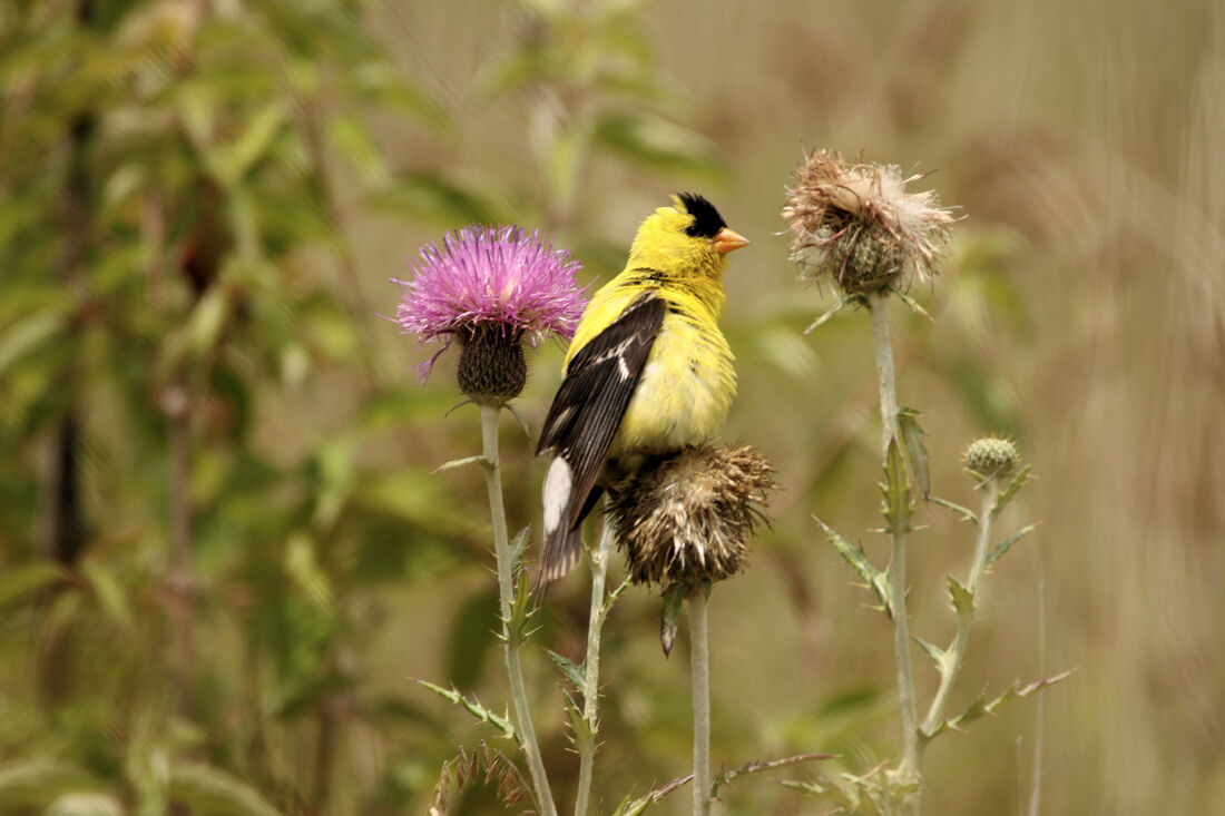
American goldfinch at Loess Hills State Forest Little Sioux Unit (photo by Carter Oliver)
Iowa Audubon is an organization of people, corporations and other organizations, including National Audubon Society chapters, all interested in improving bird habitat in Iowa. They are a grass-roots organization that maximizes the use of our collective resources to have the largest impact on habitat issues. Iowa Audubon is a non-profit member organization, with a mission to protect, restore and enjoy Iowa’s natural ecosystems with a focus on birds, other wildlife, and their habitats. Our focus on bird conservation fills a unique niche in Iowa. There is a great opportunity to conserve and improve the habitats most essential to birds across the state.
Iowa Audubon offers small grants for bird conservation research and projects. They also partner with other organizations to manager and monitor Important Bird Areas. If you would like to support Iowa Audubon, consider becoming a member; they have several membership options.
Loess Hills Audubon Society has a dedicated group of members that offer programming and bird outings in the greater Siouxland area. They are currently seeking Bird Friendly designation for Sioux City. Golden Hills RC&D is partnering with LHAS to revise their Siouxland Bird Guide that was originally published in 2003.
Check their Conservation Notes blog for bird-related news. Also, take a look at their calendar for a birding event in the Siouxland area. LHAS organizes annual Christmas Bird Counts, among other birding excursions. 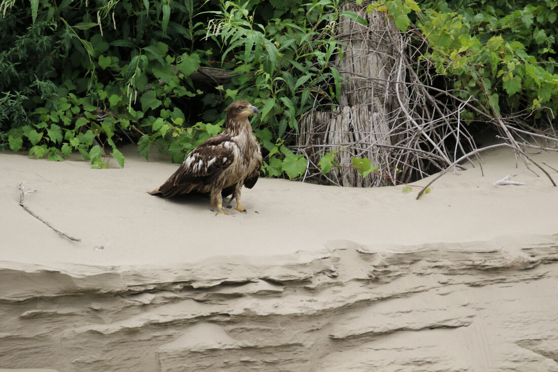
Bald eagle at Deer Island WMA (photo by Carter Oliver)
Join IAYB at Springbrook State Park on May 20th at 9 AM as they search for the last migrants of spring and pause to appreciate the local breeding birds as they sing and establish territories. May 20th often marks the peak of warbler diversity in Iowa as amazing species such as Connecticut Warbler, Mourning Warbler, and Canada Warbler fill the woods with their beautiful songs. IAYB will search for these fleeting species and learn about the breeding strategies of different birds. This event is free but advanced registration is required. This outing is open to young birders and their parents/guardians/caretakers. No previous knowledge or experience is necessary.
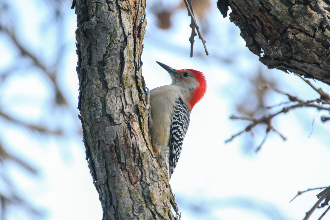
Red-bellied woodpecker at Schaben Park (photo by Carter Oliver)
Birding the Byways
From the Missouri River to the Raccoon River, Western Skies Scenic Byway traverses four of Iowa's landforms and many unique habitat types. If you're looking for waterfowl, upland birds, woodland birds, Western Skies Birding Trail has you covered.
Check out the Western Skies Birding Trail website to learn where you can go birding in the Western Skies corridor (Audubon, Guthrie, Harrison & Shelby counties) and what species you might find.
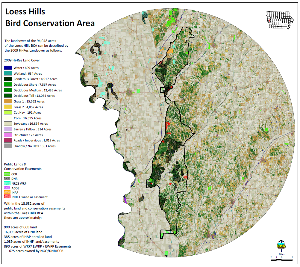
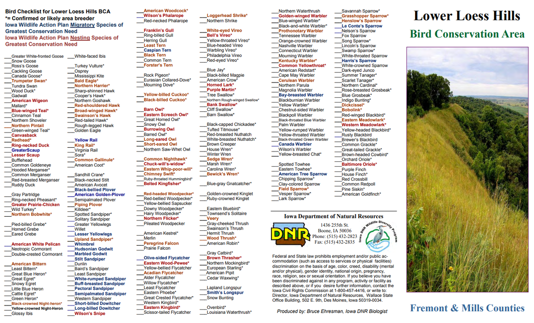
Bird diversity here is exceptional, with 249 species identified, including 80 Iowa Species of Greatest Conservation Need. Currently, 111 species are known to nest in this BCA’s prairies, savannas, woodlands, and wetlands. This same crucial habitat supplies important bird wintering grounds and migratory stopover sites. Special birds of this area include wood thrush, Bell’s vireo, whip-poor-will, redheaded woodpecker, grasshopper and field sparrows, Blue-winged warbler, and both meadowlark species. The BCA’s western Iowa location makes it a good place to see western bird species that are less often seen elsewhere, like western kingbird, Townsend’s solitaire, and perhaps Lazuli bunting.
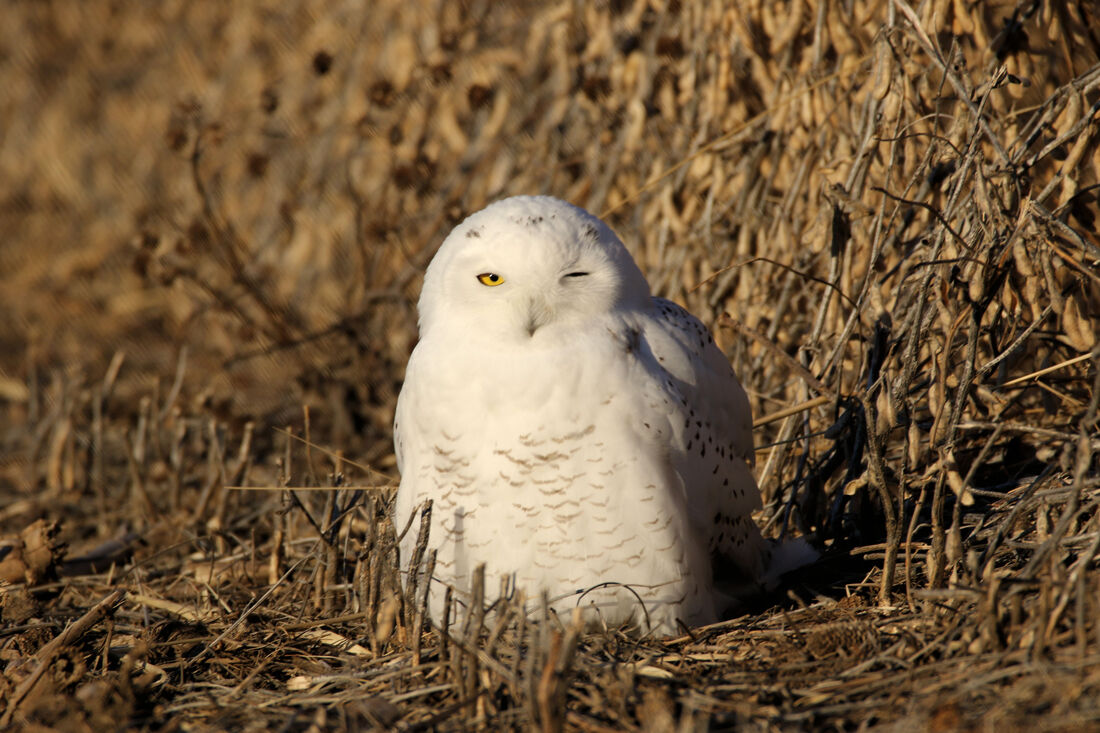
Snowy owl near Harlan (photo by Carter Oliver)
There are numerous parks and nature centers in western Iowa that are excellent birding sites. State parks managed by the Iowa DNR, parks managed by county conservation boards, and other publicly accessible lands in western Iowa all offer birding opportunities. Check the park's respective website for organized birding events and tips.
DeSoto National Wildlife Refuge offers great birding year round. The visitor center viewing windows provide great birding of waterfowl and bald eagles during the spring, fall and winter season. Bird feeders are stocked daily at the visitor center and provide good “backyard” birding opportunities. Hitchcock Nature Center is home to HawkWatch, a citizen science driven research project that monitors raptor migration from September 1st to December 13th, counting an average of 13,000 migrating raptors annually. Anyone can join the Hitchcock HawkWatch volunteer team. All you need is a love of birds and a willingness to learn. On-the-job training is provided by the experienced team of HawkWatch volunteers and park staff. To become a Hitchcock HawkWatch volunteer, please complete and submit a volunteer application on the HawkWatch website. The Chris L. Lloyd Swan Restoration Refuge in Buena Vista County is a 10-acre area to promote the restoration of trumpeter swans. A kiosk with information and an observation deck help inform the public about the swans. A five acre lake is surrounded by prairie grasses. The swan refuge is located 10 miles south of Sioux Rapids on Highway 71. Other notable birding sites include, but are not limited to, Sawmill Hollow Wildlife Area in Harrison County, Riverton Wildlife Management Area in Fremont County,and Prairie Heritage Center in O'Brien County. Birding Resources
Besides the aforementioned organizations, the following resources are helpful to both novice and experienced birders.
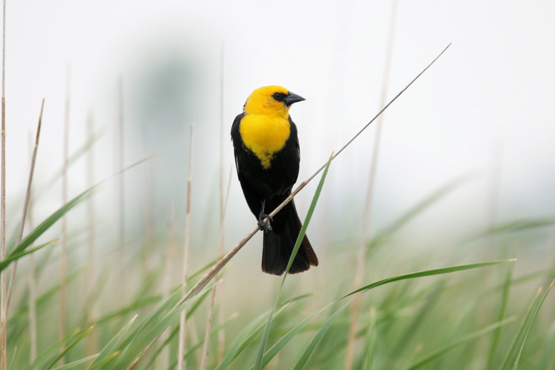
Yellow-headed blackbird at Missouri Bottoms Wetland Area (photo by Carter Oliver)
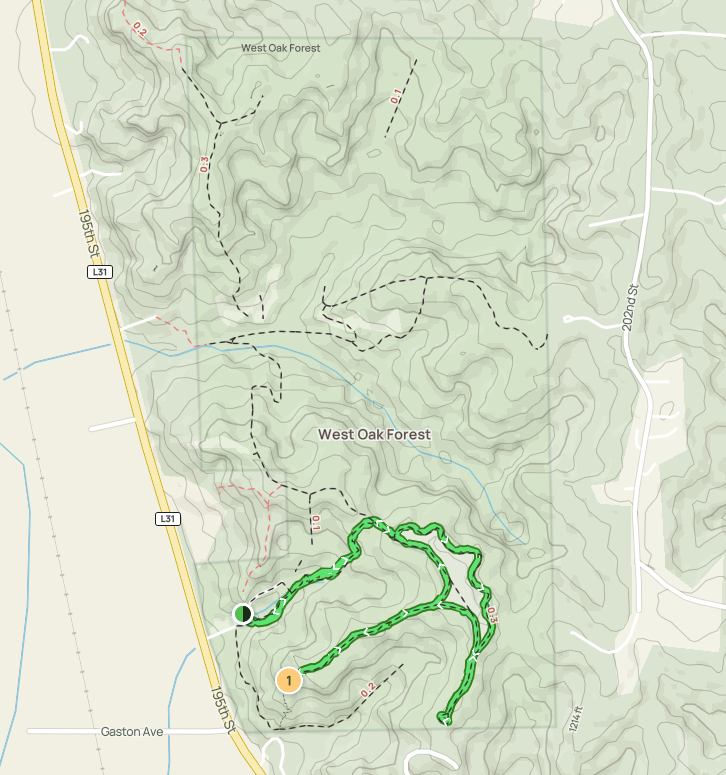
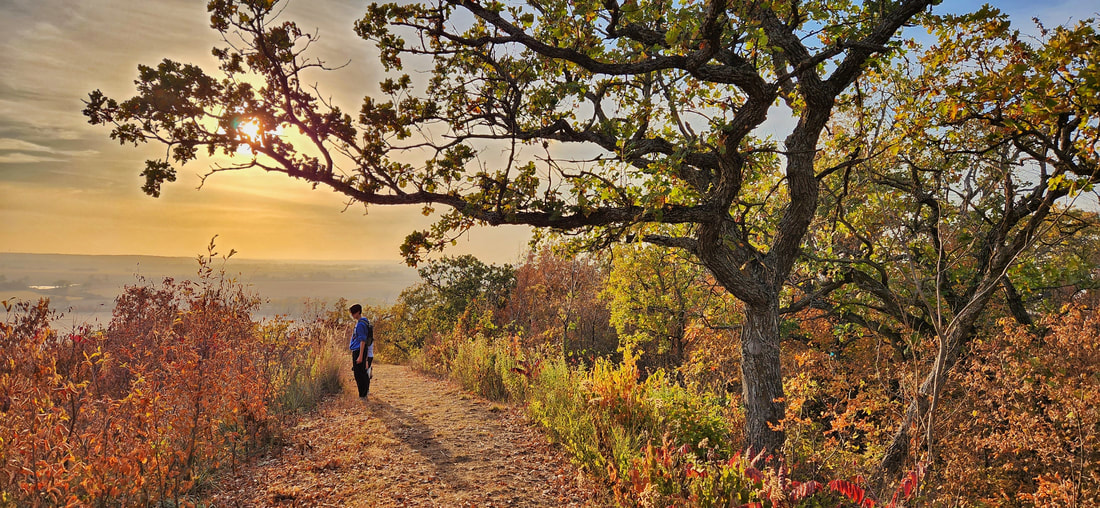 West Oak Forest (photo by Lance Brisbois)
Folsom Point Preserve protects one of the largest remaining contiguous prairie remnants in the southern Loess Hills. Purchased in 1999, the prairie provides a valuable habitat for grassland animals, particularly in an area where the prairie community has largely disappeared. The terrain is quite rugged with steep slopes. The preserve is used for research by local students; visitors should avoid flags and other markers. There are no official trails at the preserve but there are several well-traveled footpaths that lead up to and along the ridges, allowing sweeping views of the Missouri River floodplain and the Loess Hills. The nearby factories, however, degrade the view from the ridges. A hike at Folsom Point is still enjoyable, as it is much less frequented than Hitchcock Nature Center yet about the same driving distance from the Omaha/Council Bluffs metro. 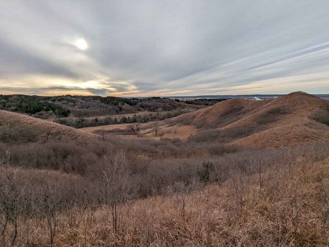 Folsom Point Preserve (photo by Seth Brooks)
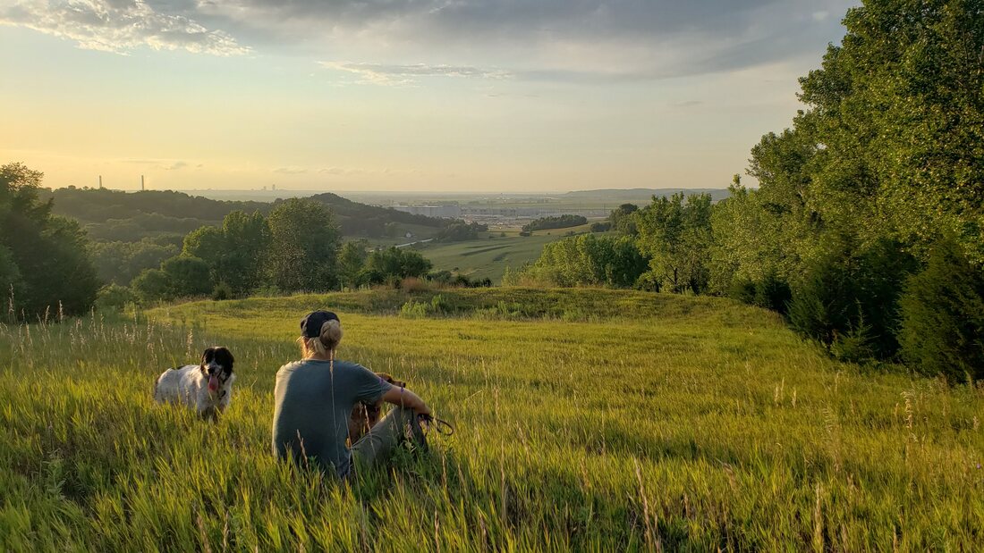 Photo by Lance Brisbois
This is the second largest park within the Mills County Conservation Board’s park system. It consists of forest, numerous hilltop prairie remnants, 7-acres of restored prairie, and well over 3 miles of hiking trails. Being nestled in the west side of Iowa’s beautiful Loess Hills, the park provides a spectacular view overlooking the Missouri River floodplain. West Oak Forest is inhabited by many threatened and endangered species of the Loess Hills, including the Yucca Moth, Western Spadefoot Toad, Ottoe Skipper, Northern Grasshopper Mouse, and various others.. The topography of the property is very steep with corrugated hills and the highest point being 1,100 feet above sea level. Heavily forested with upland hardwoods including bur oak, red oak, ironwood, basswood, scattered black walnut and shagbark hickory.  Photo by Lance Brisbois
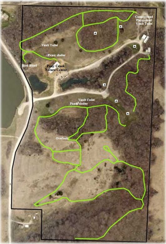
Pony Creek is located along the Loess Hills Scenic Byway. Pony Creek Park is a National Historic Landmark. The Davis Oriole earth lodge site is located here. To protect the archaeological integrity of the site, it is not specifically marked.  Pony Creek Nature Center
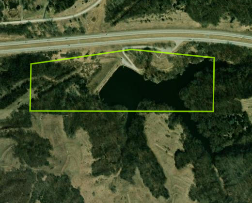
Mile Hill Lake consists of a hardwood forest, which is open to public hunting, and a 10-acre fishing lake with boat dock and ramp. When driving into the park you will find an interpretive panel discussing the prehistoric culture that lived in this region, and the handicap accessible Scenic Overlook, which offers an interpretive panel discussing the Loess Hills Scenic Byway. You will also see a2 acre restored prairie, and several flowerbeds which are maintained by the Mills County Co-Horts. There are various hiking trails within the park, including the most recent addition that leads through a marsh area, with a newly installed footbridge. 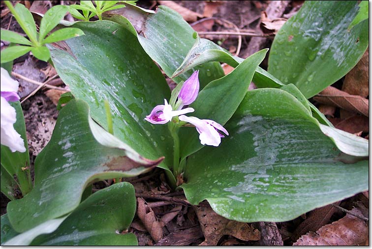 Showy orchis at Mile Hill Lake
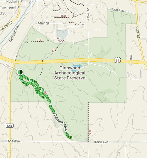
The preserve is a low impact recreation area, meaning that no public activity can impair the integrity of the site. The site hosts multi-use trails ready for running, hiking, biking and wildlife observation. Aside from the archaeological sites within the property, one can also find forest, oak savanna, native prairie, restored prairie and agricultural grounds on the site. There are 107 recorded archaeological sites in the Glenwood Archaeological State Preserve, ranging from about 10,000 years in age to the early Euro-American settlement era, 150 years ago. Most significant are 27 earth lodge sites in the preserve that are related to the Glenwood Culture, also known as the Nebraska phase of the Central Plains tradition. Only a small fraction of the preserve has been archaeologically surveyed, so many more sites probably exist in the preserve. 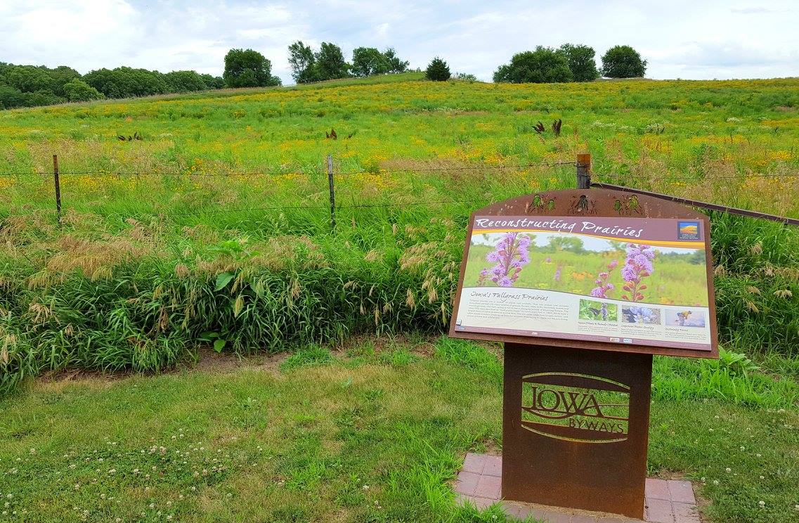 Photo by Lance Brisbois Hiking the Byways is a regular series by Golden Hills RC&D that features publicly accessible lands open to hiking on the three scenic byways in western Iowa that Golden Hills RC&D coordinates: Glacial Trail Scenic Byway, Loess Hills National Scenic Byway, and Western Skies Scenic Byway. Each blog post covers hiking areas in one county on one of the aforementioned byways. For questions about hiking on the byways, contact Seth Brooks ([email protected]).
 Trail at Littlefield Recreation Area
Littlefield Recreation Area is Audubon County Conservation Board's largest and most popular park. It began in 1965 with 40 acres of timber and 20 acres that were developed into a recreational area. In 1975 and 1976 the park's sized increase by 385 acres due to the Troublesome Creek Watershed Project. Two dams were built along Troublesome Creek forming the lake that is used for recreational purposes and flood control. There are roughly 3 miles of maintained hiking trails. The park road is also a great spot to walk or ride a bike. The timber area provides an excellent area to view and photograph wildlife & wildflowers. These trails are available for use as cross country ski trails in the winter. Littlefield Park is located six miles east of Exira on County Road F58, just a few miles north of Interstate 80. It is approximately an hour from Des Moines and an hour and a half from Omaha, Nebraska. 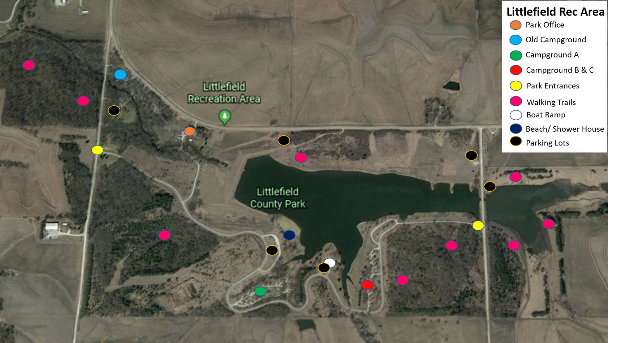 Click to open a larger version in a new window
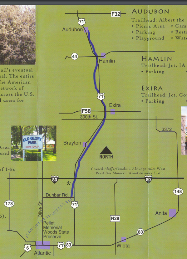
The trail is hard surface making it great for biking, walking, running, and rollerblading. Most of the trail is asphalt with a few miles in the middle made out of concrete. The T-Bone Trail is a former railroad right of way; purchased with the help of the Iowa Natural Heritage Foundation. It is named for the T-Bone event that originated in the 1950s in Audubon when the farmers all loaded up their cattle on to a train and rode with them to market in Chicago. 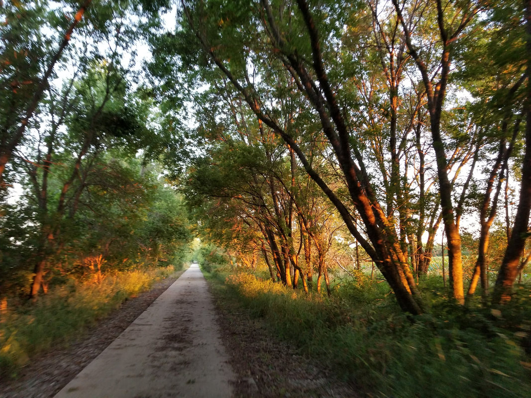 T-Bone Trail
Audubon's old old county home was built in 1890 for indigent persons of the county. In the 1970s the ACHS acquired the house (and other buildings) to create a museum. The facility is collectively called Nathaniel Hamlin Park. Early members of the historical society created a wonderful museum that tells the story of settlement of the area from 1850 to the present. The 2-story brick home has its original floor plan and 1800 sq.ft. of display space including: large kitchen & pantry, Victorian parlor, and bedrooms. Other room displays: quilt & sewing, military, children's play room, schools, churches, collections (beauty shop), hats & clothing, and the "Audubon" Room -- a collection of birds and animals.The park includes: one room schoolhouse, barns and antique farm machinery. That's not all -- the 10-acre park has live elk & windmill displays, and many picnic tables. Come and spend the day! 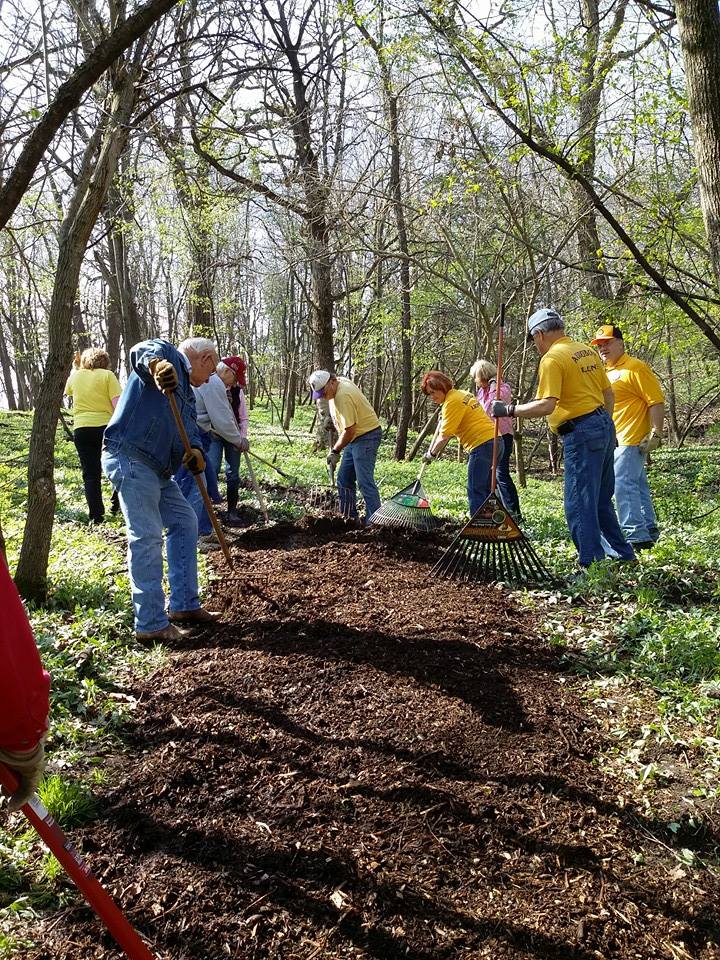 (photo by Nathanial Hamlin Park & Museum) Hiking the Byways is a regular series by Golden Hills RC&D that features publicly accessible lands open to hiking on the three scenic byways in western Iowa that Golden Hills RC&D coordinates: Glacial Trail Scenic Byway, Loess Hills National Scenic Byway, and Western Skies Scenic Byway. Each blog post covers hiking areas in one county on one of the aforementioned byways. For questions about hiking on the byways, contact Seth Brooks ([email protected]).
|
Archives
June 2024
Categories
All
|


 RSS Feed