GOLDEN HILLS RC&D
  • Home
  • About Us
    • Job Openings
    • Who We Are
    • Where We Work
    • What We Do >
      • Community Partnerships
      • Arts and Culture
      • Water Resources
      • Local Foods
      • Outdoor Recreation & Tourism
      • Land Stewardship
  • News
  • Events
  • Donate to Golden Hills

News

Hiking the Loess Hills National Scenic Byway: Monona County

2/24/2023

0 Comments

 
Picture
LHSF Preparation Canyon Unit (photo © 2016 Kenneth West)
This week's installment of Hiking the Byways takes us to Monona County on the Loess Hills National Scenic Byway.

The hiking in Monona County is incredible, with several different areas to explore the geologically unique Loess Hills. The Preparation Canyon Unit of the Loess Hills State ​Forest, and the adjacent Preparation Canyon State Park, are the highlights of today's post. There are several specific trail recommendations; feel free to follow those or create your own adventure by hiking countless miles of trails in the state forest and state park.

If you wish to get off the beaten path, head to Sylvan Runkel State Preserve, Loess Hills Wildlife Area, or Turin Preserve Wildlife Area, all near the town of Castana.
Picture

Preparation Canyon State Park

​Manager: Iowa DNR
GPS: 41.89921, -95.92094​ (main entrance)
GPS: 41.88875, -95.89515​ (campsites)
Size: 344 acres​
Trails: 6 miles
Camping: Yes, ten hike-in campsites
Amenities: Pit toilets, shelter
Dogs: Yes, on leash
Hunting: Not in the state park but hunting is allowed in the adjacent state forest

Picture
Click to download the PDF version (campsites 5-8 are labeled incorrectly)
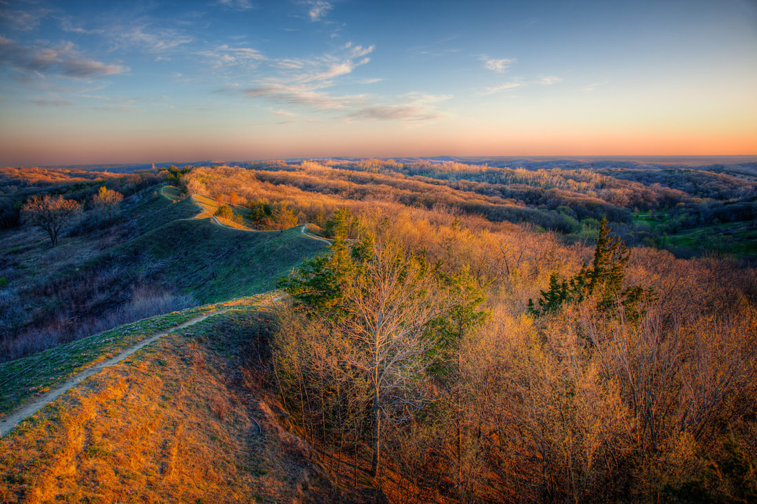
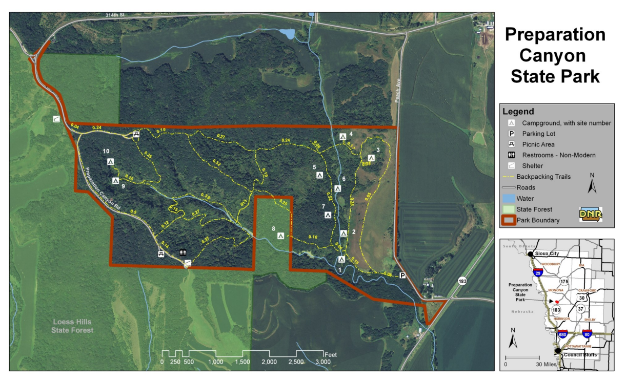
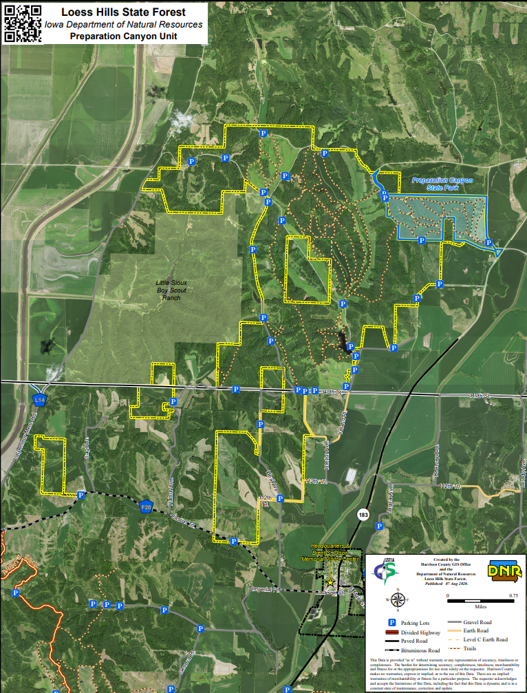
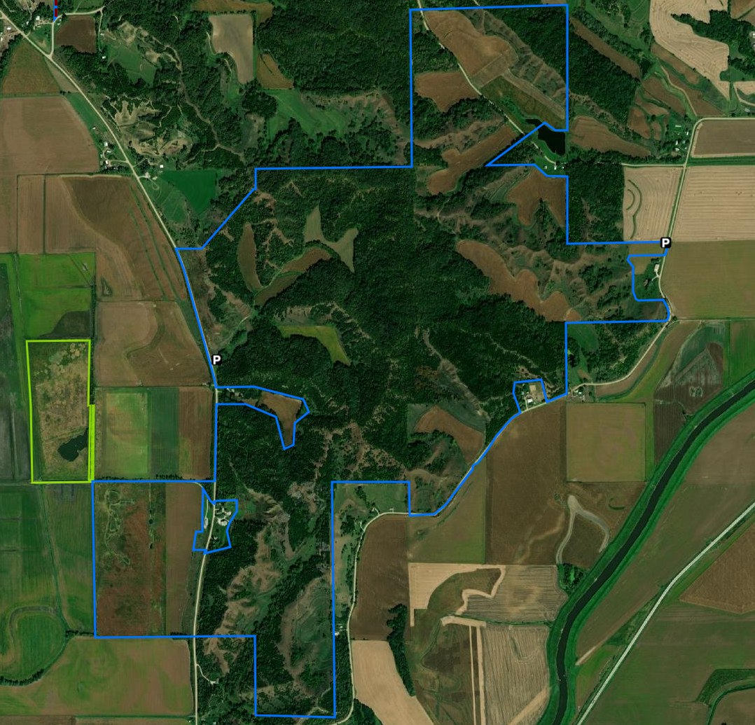
Preparation Canyon State Park, in the heart of the Loess Hills in western Iowa, encompasses 344 acres, including what used to be the town of Preparation. Today, Preparation Canyon is a quiet enclave offering backcountry hiking, picnicking, and beautiful views of the unique Loess Hills.

In 1853, Charles B. Thompson broke from the Utah-bound Mormon wagon trail and settled in this area. At one point, Preparation had sixty-seven houses, a school, newspaper, post office, skating rink and blacksmith shop. But by 1900, the town had all but faded away. The land was sold by descendants of the original settlers to the state of Iowa in parcels during the mid-20th century and became the state park.

Hike on one of the several trails that wind through the rugged Loess Hills. The backcountry trails follow hills and valleys, leading to a nature study area and the hike-in camping sites. Hikers should be prepared for rough terrain and loose soil with sturdy hiking shoes and appropriate gear.

Camp in one of ten hike-in camping sites, which are some of the only hike-in sites in the Iowa state park system. The trailhead to the hike-in sites is located in the southeast corner of the park. The sites each have a table and fire ring, but no bathroom facilities. Registration is on a first-come first-served basis with self-registration in the east parking lot.


text source: Iowa DNR

Loess Hills State Forest Preparation Canyon Unit

Manager: Iowa DNR
Trailheads: Refer to map for parking areas
Size: 4,068 acres
Trails: More than 20 miles
Camping: Primitive camping is allowed throughout the state forest
Amenities: Shelter at Jones Creek Pond
Dog-friendly: Yes, on leash
Hunting: Yes

Preparation Canyon Unit is 4,068 acres and located north of the town of Pisgah. The unit has a small fishing lake and numerous hiking trails.
Picture
Click to download the PDF version
Visit the Loess Hills Scenic Overlook, showcasing spectacular views of the forest, prairies, Missouri River bottomlands, and across the Nebraska plains. Preparation Canyon State Park is located on the northeast corner of the Preparation Canyon Unit of the state forest. The park is also the historical site of the town of Preparation, a Mormon gathering place with an interesting history located in the southeast corner of the state park.​

​
There are about two miles of trails that begin at the Loess Hills Scenic Overlook. Two maps are provided below, one from the Iowa DNR that shows a one-mile loop, and another that utilizes trails in the southern section of this part of the state forest unit contiguous with the scenic overlook to make a 2.5-mile hike.
Picture
Click to download the PDF version
Picture
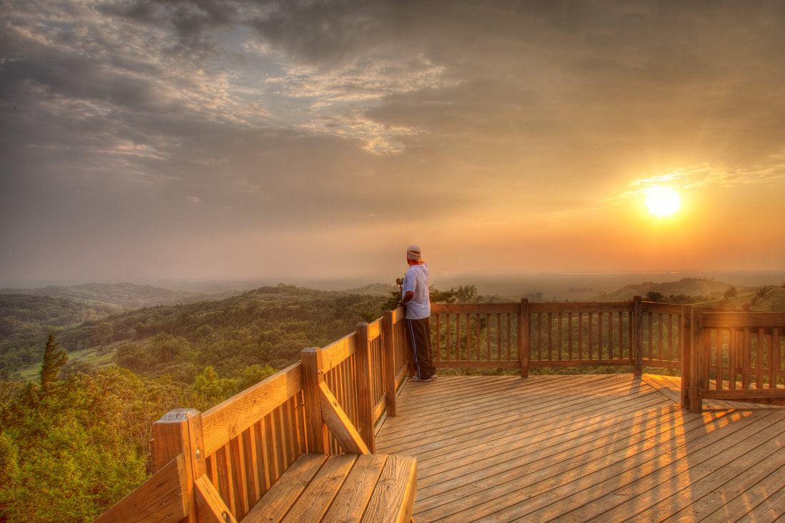
Loess Hills Scenic Overlook (photo © 2016 Kenneth West)
Picture
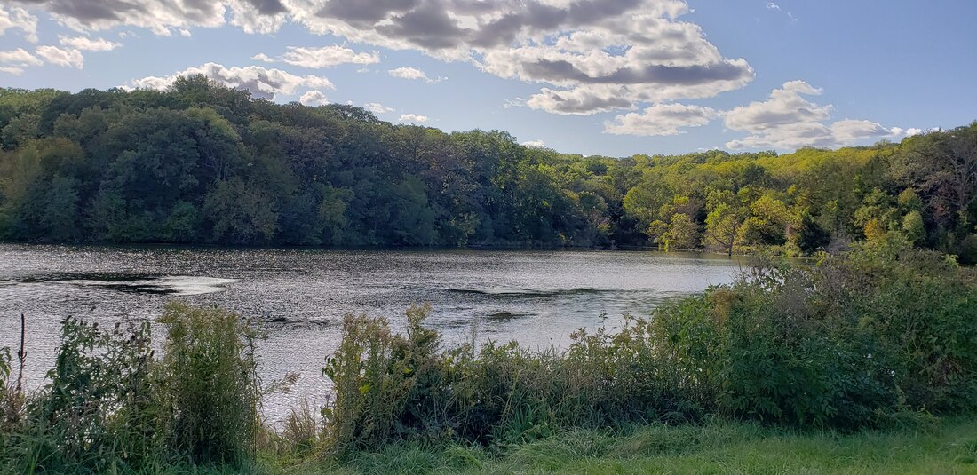
Jones Creek Pond (photo by Lance Brisbois)
The trails around Jones Creek Pond are great to explore any time of year: spring for wildflowers, summer under the shady tree canopy, fall for changing leaves, and winter for animal tracks and snowshoeing or cross-country skiing (remember to wear blaze orange during hunting season). If you combine the trails in the DNR map below, you can make a nice 3-mile loop around the lake. Per reports on All Trails in September 2022, however, the walking bridge on the north end of the pond was closed. If that is the case, you'll have to continue north to the road, where you can cross and complete the loop by connecting with mowed trails through the grass on each side of the stream that empties into the pond.​
Picture
Click to download the PDF version
Picture
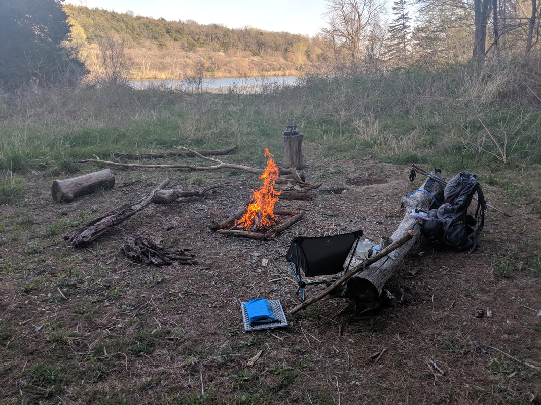
Primitive campsite at Jones Creek Pond (photo by Seth Brooks)

​Sylvan Runkel State Preserve

​Manager: Iowa DNR
GPS: 42.10281, -95.97124 (Oak Avenue)
Size
: 330 acres

Trails: No maintained trails but hiking permitted throughout​
Camping: No
Amenities: None
Dogs: Yes, however, no dogs are allowed during nesting season March 15 to July 15.​​
Hunting: No
​​
Picture
Click to download the PDF version
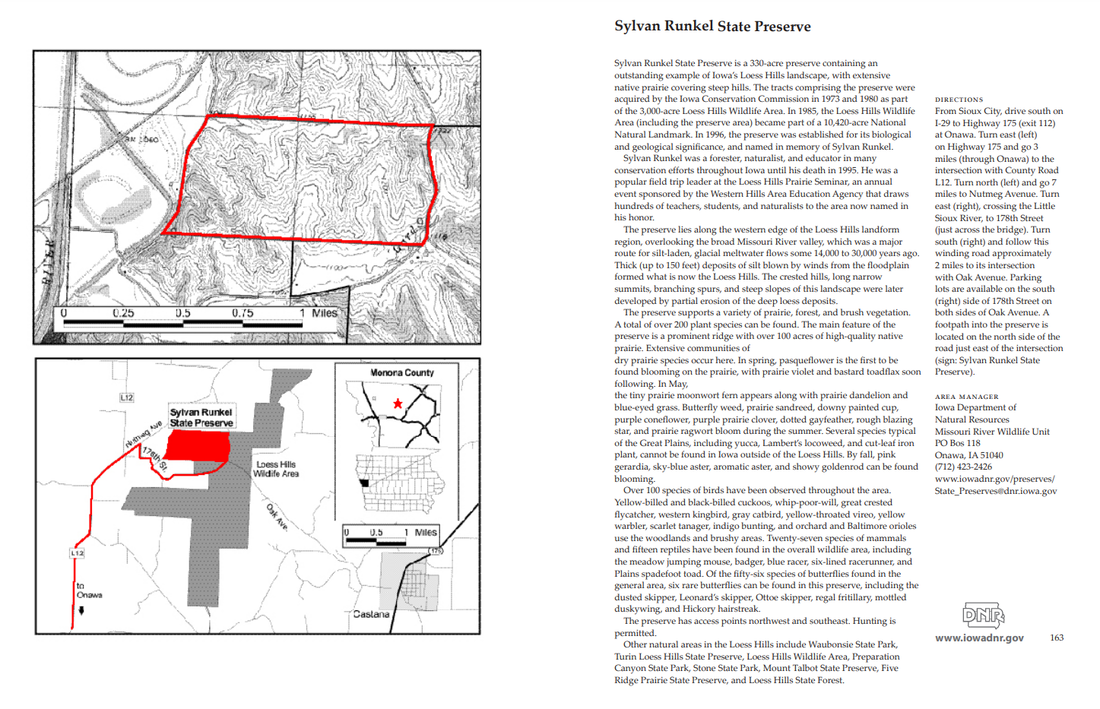
Sylvan Runkel State Preserve is a 330-acre preserve containing an outstanding example of Iowa’s Loess Hills landscape, with extensive native prairie covering steep hills. The tracts comprising the preserve were acquired by the Iowa Conservation Commission in 1973 and 1980 as part of the 3,000-acre Loess Hills Wildlife Area. In 1985, the Loess Hills Wildlife Area (including the preserve area) became part of a 10,420-acre National Natural Landmark. In 1996, the preserve was established for its biological and geological significance, and named in memory of Sylvan Runkel.
Picture
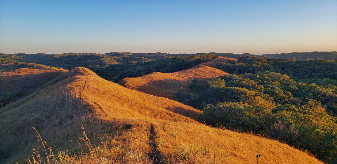
Sylvan Runkel State Preserve (photo by Lance Brisbois)

Loess Hills Wildlife Area

Manager: Iowa DNR
GPS: Multiple parking areas
Size: 3,119 acres

Trails: No maintained trails but hiking permitted throughout​
Camping: Primitive
Amenities: None
Dogs: Yes, on leash, however, no dogs are allowed during the nesting season from March 15 to July 15.​​
Hunting: Yes (Deer, Turkey, Squirrel, Rabbit, Quail​)
​​​

T​he Loess Hills Wildlife Area is a 3.119-acre site of timber and prairie located just west of Castana. The area is a mixture of timber, primarily burr oak, red cedar and sumac, and native grass prairie. 
Picture
Loess Hills Wildlife Management Area (boundaries in blue)
A number of Iowa threatened or endangered animals make their home here including the northern grasshopper mouse, plains pocket mouse and spadefoot toad. Wild turkeys and prairie chickens have been reintroduced. White-tail deer, fox squirrel, cottontail rabbit, coyote, raccoon and badger are common. Turkey vultures, bobwhite quail, ring-necked pheasant, whip-poor-will and many songbirds also exist in good populations. Controlled burns prevent brush and tree invasion and stimulate growth of prairie plants. The Loess Hills Prairie Seminar is held here every summer (intersection of Oak Avenue and 178th St).

Before visiting a public wildlife area, please check out 
Chapter 51 : Wildlife Management Areas.
Picture
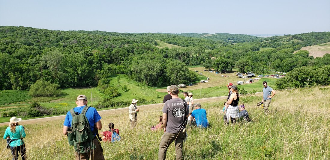
The Loess Hills Prairie Seminar is held at the wildlife area every summer (photo by Lance Brisbois)

Turin Preserve Wildlife Area

Manager: Iowa DNR
GPS: Multiple parking areas
Size
: 1,107 acres
Trails: No trails but hiking allowed
Camping: Primitive
Amenities: None
Dogs: Yes, on leash, however, no dogs are allowed during the nesting season from March 15 to July 15.​​
Hunting: Yes (Deer, Turkey, Squirrel, Pheasant, Rabbit, Quail​)
​​​
Picture
Turin Preserve Wildlife Management Area (boundaries in blue)
Picture
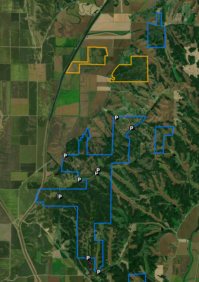
Turin Preserve Wildlife Area (photo by Golden Hills RC&D)
Turin Preserve Wildlife Area is a 220-acre area featuring a rugged Loess Hills landscape with an abrupt west-facing ridge. It is located in the southern unit of the 3,000-acre Loess Hills Wildlife Area, 2 miles north of Turin and 7.5 miles east of Onawa in Monona County. The Iowa Conservation Commission purchased the area in 1974. In 1978, the area was dedicated as a biological and geological state preserve and became part of a National Natural Landmark in 1986.​

​Before visiting a public wildlife area, please check out Chapter 51 : Wildlife Management Areas.

Whiting Woods

Manager: Monona County Conservation
GPS: 42.13892, -95.88534​
Size: 80 acres
Trails: 1.6 miles
Camping: Yes, electric and non-electric
Amenities: Shelter, picnic area, vault toilet
Dogs: Yes, on leash
Hunting: Yes
​​​
Picture
Hitchman Nature Trail at Whiting Woods
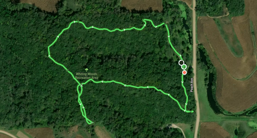
This 80-acre tract of dense native timber is located 4 miles southwest of Mapleton and just east of the Loess Hills Scenic Byway on Peach Avenue.  Approximately 10 acres have been developed for camping, picnicking, hiking, and nature studies. A 1.6 mile trail takes you around the whole timber, with four benches for stopping and relaxing along the way.  An open shelter house, 3 camping pads with 30 amp hook-ups, drinking water, and vault type toilet facilities are available.  Upright/ground grills and picnic tables are also available. Whiting Woods is an excellent place to view wildlife and provides great hunting opportunities. Electric campsites are $20.00 per night, non-electric are $15.00 per night.  A 10:30 curfew is enforced for all visitors. We currently do not take reservations for camping at this park as it is first come, first serve. 

text source: Monona County Conservation
Picture
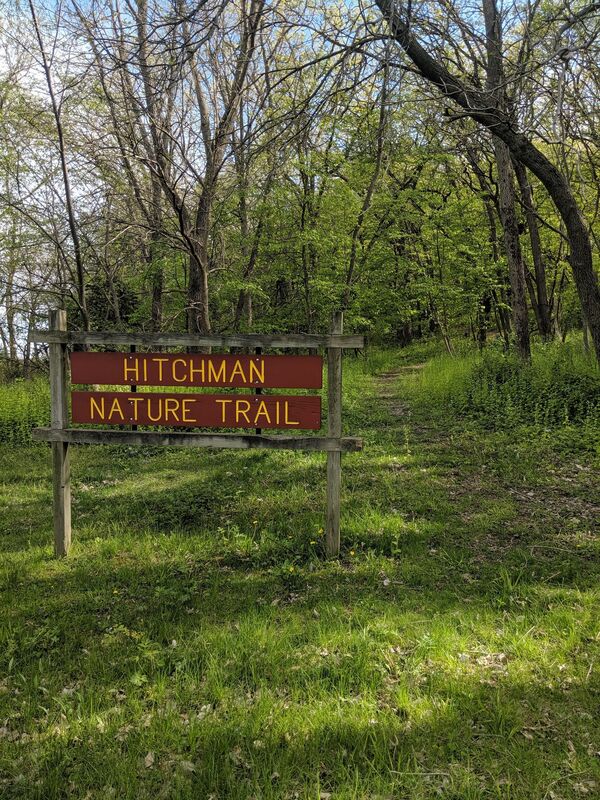
Hitchman Nature Trail at Whiting Woods (photo by Seth Brooks)

Other hiking opportunities

The following areas, managed by Monona County Conservation, also allow hiking. Check the linked websites for more information.

Masters Prairie Trail
​This linear park is an abandoned railroad right of way, which consisting of 24 acres that have been smoothed and planted to native short grasses and wildflowers. The two-mile trail begins on the west side of the Maple River and follows Hwy. 141 to the west. It was purchased from the Rail Road in 1990, with money from NIPCO in return for a permanent easement for their power lines. Hunting is not allowed. 

Gramm Wetland
Gramm Wetland has a popular 2-mile walking trail.

Beaver Run Wildlife Area

Davis Wetland

Hiking the Byways is a regular series by Golden Hills RC&D that features publicly accessible lands open to hiking on the three scenic byways in western Iowa that Golden Hills RC&D coordinates: Glacial Trail Scenic Byway, Loess Hills National Scenic Byway, and Western Skies Scenic Byway. Each Friday a blog post covers hiking areas in one county on one of the aforementioned byways. For questions about hiking on the byways, contact Seth Brooks ([email protected]).
0 Comments


Leave a Reply.

    Archives

    April 2025
    January 2025
    November 2024
    October 2024
    September 2024
    July 2024
    June 2024
    May 2024
    April 2024
    March 2024
    February 2024
    January 2024
    December 2023
    November 2023
    October 2023
    September 2023
    August 2023
    July 2023
    June 2023
    May 2023
    April 2023
    March 2023
    February 2023
    January 2023
    December 2022
    November 2022
    May 2022
    April 2022
    February 2022
    January 2022
    December 2021
    November 2021
    October 2021
    August 2021
    July 2021
    June 2021
    May 2021
    April 2021
    March 2021
    February 2021
    December 2020
    November 2020
    October 2020
    September 2020
    August 2020
    July 2020
    June 2020
    May 2020
    April 2020
    January 2020
    December 2019
    September 2019
    August 2019
    July 2019
    May 2019
    April 2019
    March 2019
    January 2019
    November 2018
    October 2018
    September 2018
    August 2018
    July 2018
    May 2018
    April 2018

    Categories

    All
    Arts & Culture
    Botany On The Byways
    Community Partnerships
    Hiking The Byways
    Land Stewardship
    Local Foods
    Outdoor Recreation & Tourism
    Water Resources

    RSS Feed

      Newsletter sign-up

    Subscribe to Newsletter

Address

712 South Highway Street 
P.O. Box 189
​Oakland, IA 51560

Contact

Phone: 712-482-3029
General inquiries: [email protected]
Visit our Staff Page for email addresses and office hours.
  • Home
  • About Us
    • Job Openings
    • Who We Are
    • Where We Work
    • What We Do >
      • Community Partnerships
      • Arts and Culture
      • Water Resources
      • Local Foods
      • Outdoor Recreation & Tourism
      • Land Stewardship
  • News
  • Events
  • Donate to Golden Hills