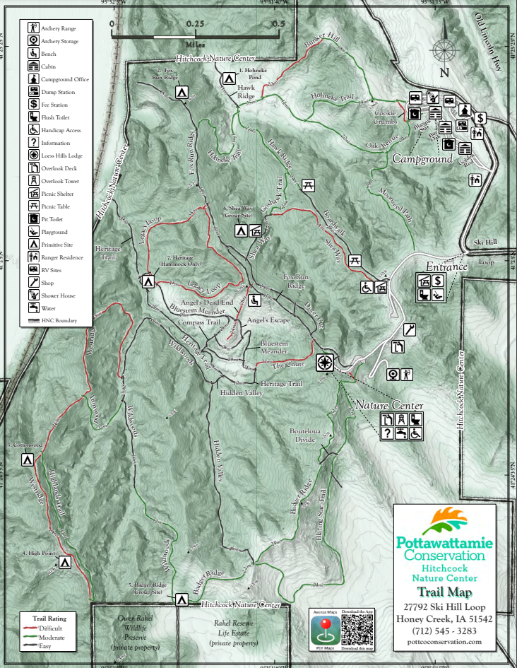
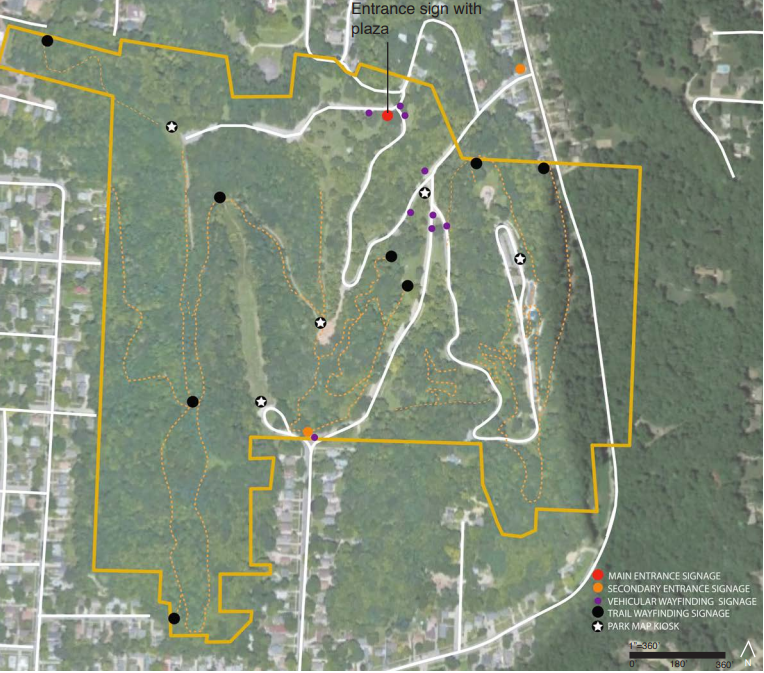
Trails network together so visitors can be creative to enjoy any length of hike they desire. Due to the rugged terrain of the Loess Hills, the trails vary from easy ridgeline walks to difficult climbs. Trail maps can be found at Fox Run Ridge, Badger Ridge, and Hohneke trailheads, or at the Loess Hills Lodge during gallery hours. It's difficult to create an easy loop at Hitchcock because at some point you will have to descend steeply into a valley or climb steeply onto a ridge. If you're looking for an easy family-friendly hike, do an out-and-back hike starting from the Badger Ridge or Fox Run Ridge trailheads in the parking lot below the Loess Hills Lodge. Another option is the ADA-accessible boardwalk that ends at Hawk Ridge.
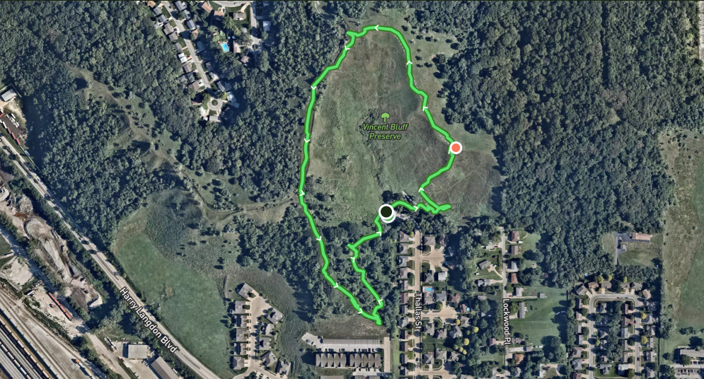
Vincent Bluff State Preserve is a cooperative venture between the City of Council Bluffs, Iowa Natural Heritage Foundation, and the Loess Hills Preservation Society to preserve a unique urban prairie in the Loess Hills. The preserve is located in the heart of Council Bluffs. Today, Vincent Bluff Prairie Preserve stands as the only truly urban prairie preserve in the state of Iowa, and likewise, is a great example of Loess Hills prairie, oak savanna, and eastern deciduous forest ecosystems. A footpath begins at the shelter near the parking lot and climbs steeply to the top of the prairie ridge. The climb is short but strenuous. You can follow the GPX track below to hike a loop, or just wander along the ridge enjoying the views and native flora. 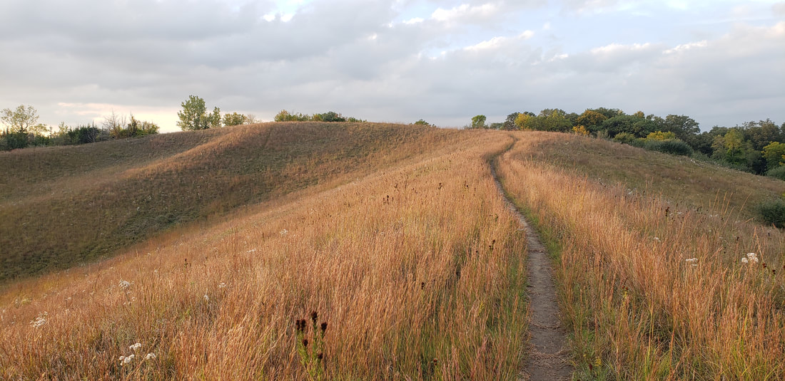 Vincent Bluff State Preserve (photo by Lance Brisbois)
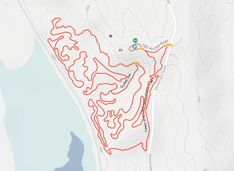
Dedicated in 1936 to honor the Corps of Discovery, Lewis & Clark Monument Park has a small observation deck and two large commemorative stone markers, quarried from the Folsom Quarry in Vermont and created by sculptor Harry E. Stinson and architect George L. Horner. The images and text on the markers explain Lewis and Clark’s meeting with local Oto and Missouri Indians. (The actual site of the meeting took place on the west side of the Missouri about 10 miles north of Omaha near today’s Fort Calhoun, Nebraska.) The monument stands atop a ridge of the Loess Hills, which run along much of the western edge of Iowa. For this reason, mountain bikers enjoy the challenging route through the heavy woods of the park, hikers appreciate the nearby trails, and aerial enthusiasts love the panoramic view of planes landing at Omaha’s Eppley Airfield just across the Missouri. Trails Have Our Respect (THOR) maintains the mountain bike trails. 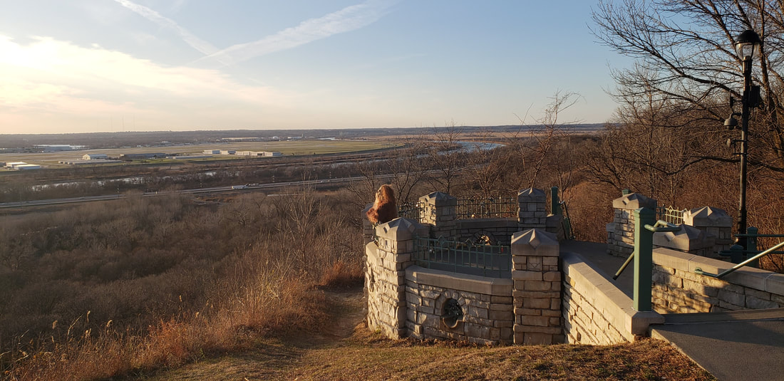 Lewis and Clark Monument Park
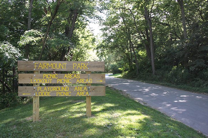 Fairmount Park (photo: Council Bluffs Fairmount Park Neighborhood Association) Fairmount Park (East Graham Ave and Park Entrance) hiking trails wind through the hills. At Fairmount Park, you'll also find a scenic overlook, a playground, a splash pad, a firepit, picnic shelters, and ample parking. Gibraltar Trailhead (9th Ave and High St) has picnic tables and direct access to the Fairmount Park hiking trails making it a great place to meet up with friends.
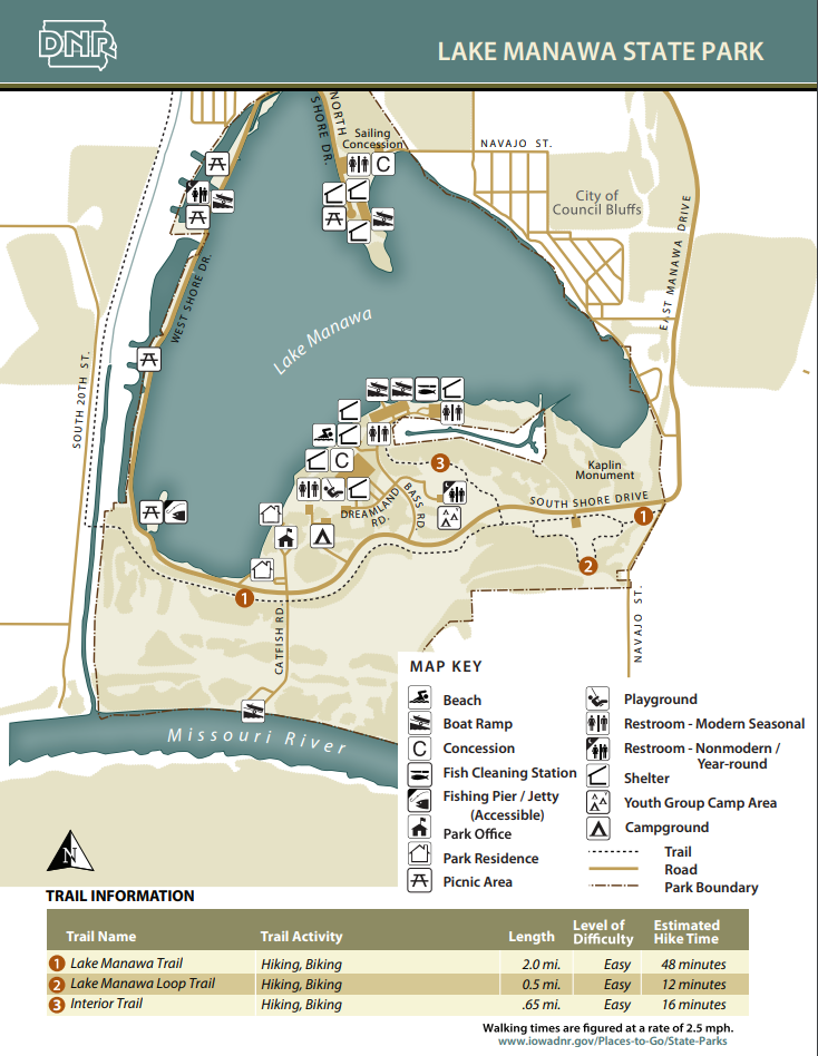
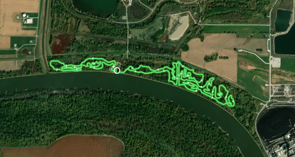
These trails connect to the trail system that runs throughout Council Bluffs including the Wabash Trace Trail and the Bob Kerry Pedestrian Bridge. There are also eight miles of unpaved trails perfectly suited for mountain biking located on either side of the Missouri River access on the south side of the park.  Lake Manawa State Park (photo by Chris Lind, Instagram @boipinoy) The mountain bike trails along the Missouri River just south of Lake Manawa are also hiker-friendly. The area is right along the river, so whenever there is a flood the trails will likely be impassable and damaged. The trails are maintained by the THOR group.
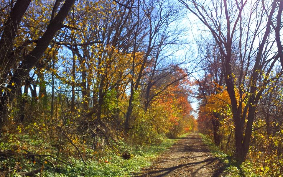
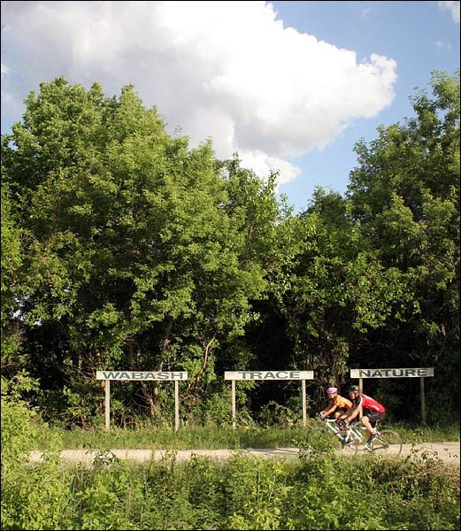
Wabash Trace Nature TrailWhile it's mostly known as a bike trail, the Wabash Trace Nature Trail is another opportunity for hikers to explore Pottawattamie County. The northern terminus of the trail is located in Pottawattamie County on the very southern boundary of Council Bluffs. The level grade makes it a nice option for a leisurely out-and-back hike from the Iowa West Foundation Trailhead, especially in fall when the leaves are turning colors.
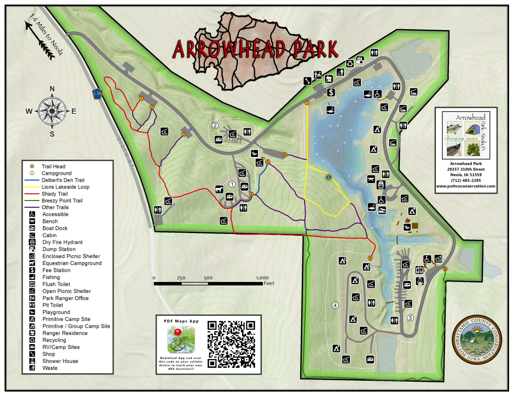
 Arrowhead Park and Botna Bend Park
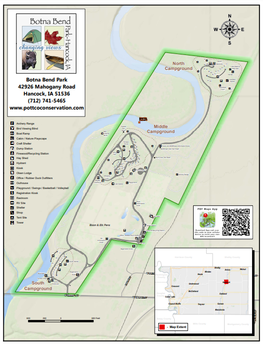 Botna Bend Park Hiking the Byways is a regular series by Golden Hills RC&D that features publicly accessible lands open to hiking on the three scenic byways in western Iowa that Golden Hills RC&D coordinates: Glacial Trail Scenic Byway, Loess Hills National Scenic Byway, and Western Skies Scenic Byway. Each Friday a blog post covers hiking areas in one county on one of the aforementioned byways. For questions about hiking on the byways, contact Seth Brooks ([email protected]).
0 Comments
Leave a Reply. |
Archives
June 2024
Categories
All
|
 RSS Feed