GOLDEN HILLS RC&D
  • Home
  • About Us
    • Who We Are
    • What We Do
    • Where We Work
  • Donate

News

Explore new trails with Sasquatch!

4/6/2021

0 Comments

 
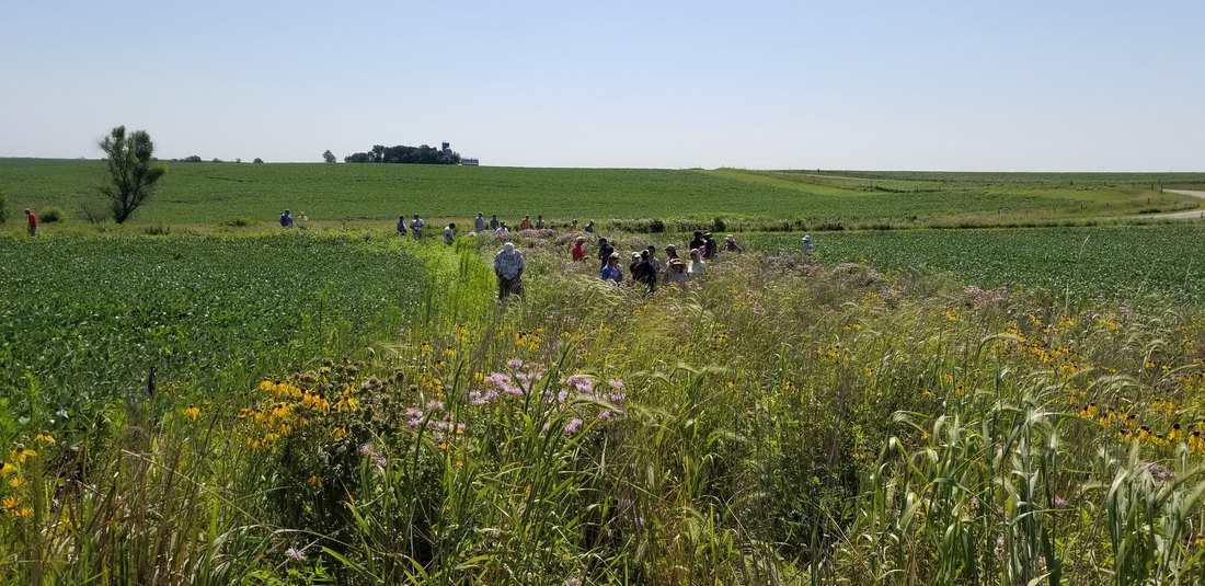
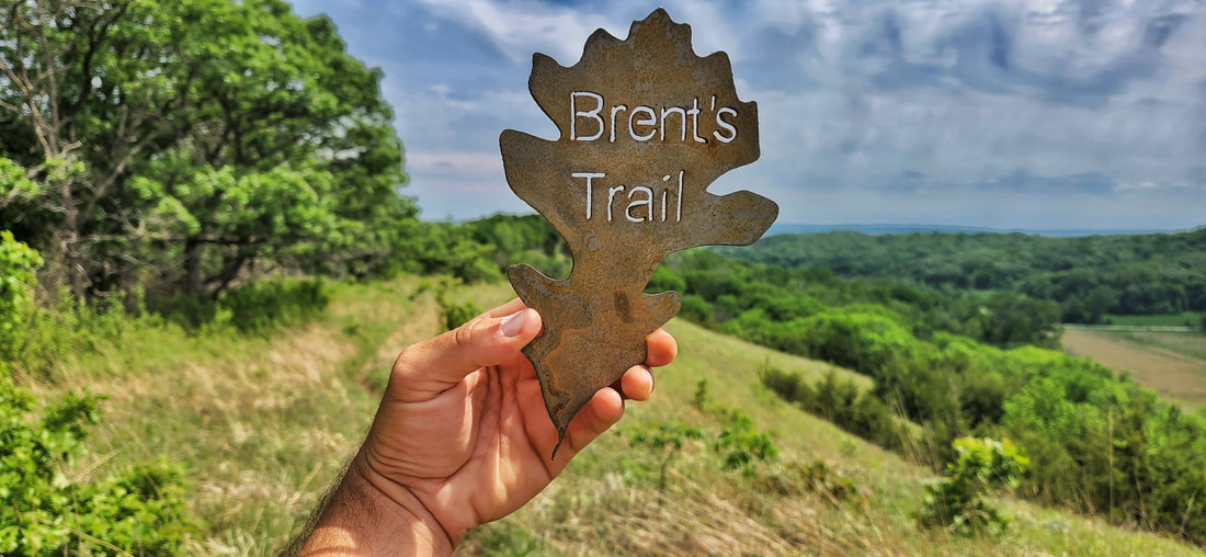
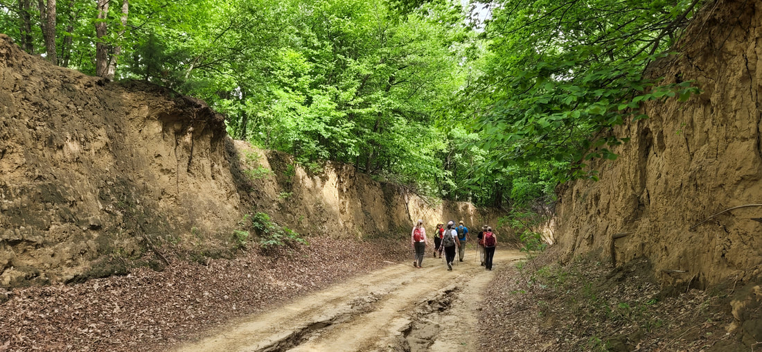
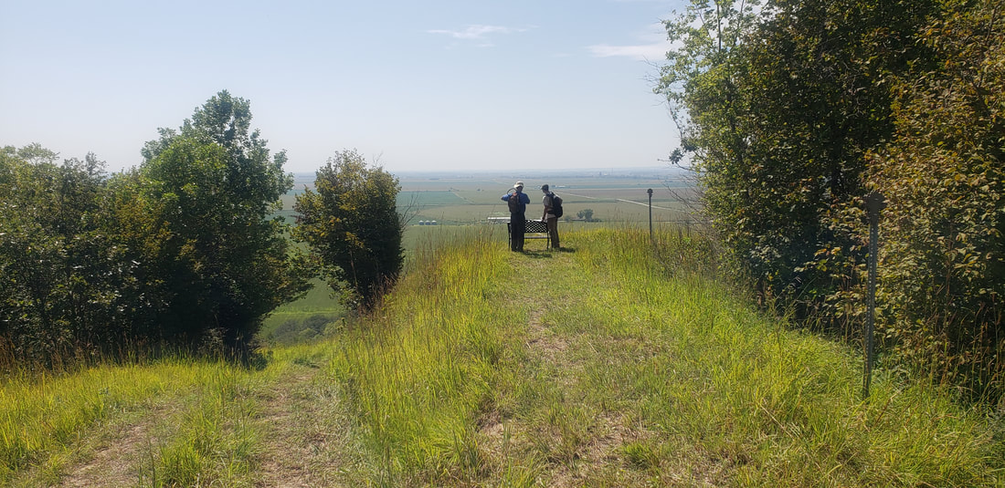
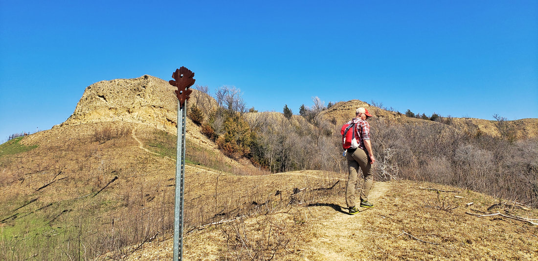
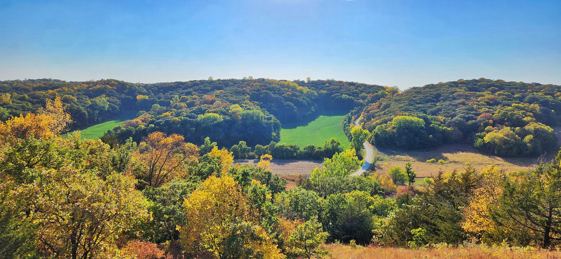
As the weather warms, it's a great time to explore local trails. While you're out, keep your eyes peeled--Sasquatch has been spotted at several sites in western Iowa, including...
Pottawattamie County trail near Weston:
Wabash Trace Nature Trail in Malvern:
Picture
Public art in downtown Malvern
Picture
Wabash Trace Nature Trail in Malvern
Hitchcock Nature Center in Pottawattamie County.
Picture
Hitchcock Nature Center
Picture
Hitchcock Nature Center
Picture
Hitchcock Nature Center
Willow Lake Nature Center near Woodbine in Harrison County
There are many more trails, parks, and wildlife areas to explore. Here are additional useful links and resources for safe walking and biking in western Iowa:
  • Loess Hills Missouri River Region hiking and walking trails
  • Loess Hills Hiking Guide
  • Western Skies Scenic Byway parks and trails
  • Frontier Iowa Trails 
  • Bicycling and walking safety tips from Golden Hills​
0 Comments

Western Skies Scenic Byway prize package featured in new Scenic Byways Passport promotion

3/9/2021

0 Comments

 
Golden Hills RC&D is pleased to announce that Western Skies Scenic Byway is the featured byway for the month of March.  As part of the participation in the new Scenic Byways Passport program, each byway will offer a prize package from businesses and attractions along the byway for the featured month.  The free digital Scenic Byways Passport encourages people to explore scenic byways and more than 100 unique attractions and destinations. Geofencing at participating locations allows travelers to check-in on the passport, earning them an entry into a monthly drawing for a prize package including an overnight stay, gift certificates and more valued at approximately $200.  Select businesses along the byways will offer deals and discounts exclusively for passholders. Each deal redemption also earns an entry into the monthly drawing. The promotion runs through December 31, 2021 and features multiple stops on thirteen of Iowa’s Byways. 

The Western Skies Scenic Byway prize package is valued at over $400 and features everything you need for a great getaway in western Iowa.  Local businesses and attractions have generously donated the following items: a two-night stay at 
Whiterock Conservancy’s Garst Historic Farmhouse, $200 in gift certificates to Coon Rapids businesses (Coon Rapids Hardware Hank,  Nature Ammil, The Trading Post, Brown Bag & Co., Frohlich's SuperValu, Chuck's Bar and Grill, Cady's Coffee Shop and Coon Bowl III); an  Audubon County Tourism bundle including a t-shirt, an Albert the Bull Sticker, free tour for two at Nathaniel Hamlin Park & Museum, $25 gift certificate to Darrell’s Place and two nights free for camping at Littlefield Recreation Area; and Harlan’s Milk & Honey package including a t-shirt and a $25 gift certificate. 

Travelers can sign up for the passport at 
explore.traveliowa.com/byways with their email address or by scanning a QR code from posters at locations included on the passport. 

“The Passport program is a great partnership between the Iowa Tourism Office, the DOT and the local byways,” noted the Western Skies Scenic Byway Coordinator Rebecca Castle Laughlin.  “It provides a new interactive component to the byway experience while allowing travelers to choose their level of interaction.  Many of the locations on the passport are parks and other outdoor attractions, which don’t limit visitors to standard operational hours and can provide for natural social distancing." 

“Transportation is essential to connecting people with all the wonderful things Iowa has to offer,” said Scott Marler, director of the Iowa Department of Transportation. “Our state’s scenic byways system helps travelers recognize both main roadways and roads less traveled that highlight the uniqueness of our great state.” 

“Iowa’s scenic byways offer both a breathtaking view of our state’s diverse landscapes and a journey through Iowa’s cultural heritage through historic sites, national landmarks and other attractions that tell our state’s story,” said Debi Durham, executive director of the Iowa Economic Development Authority and Iowa Finance Authority. “The new Scenic Byways Passport is a great new way to explore Iowa all year long.”  

Passport holders are encouraged to follow Travel Iowa on Facebook, Instagram and Twitter for updates on monthly prize packages.  More information can also be found on the Golden Hills RC&D and Western Skies Scenic Byway Facebook pages. 

Tourism in Iowa generates nearly $9 billion in expenditures and $517.5 million in state taxes, while employing
 70,200 people statewide. The Iowa Tourism Office is part of the Iowa Economic Development Authority. For more information, visit traveliowa.com.  
Picture
0 Comments

Improving Water Quality through Stream Stabilization in the Nishnabotna Watershed

3/5/2021

0 Comments

 
(from Iowa Learning Farms)

Iowa Learning Farms
, in partnership with the Iowa Nutrient Research Center, and Conservation Learning Group (CLG), is hosting a free virtual field day highlight the stream stabilization efforts in the East and West Nishnabotna Watersheds to improve water quality and reduce flooding on Thursday, March 18 at 1 p.m. CST. Join us for a live discussion with Cara Marker-Morgan, project coordinator for the East and West Nishnabotna River Watersheds and Golden Hills RC&D, and Jake Miriovsky, Project Manager For JEO Consulting Group, Inc.
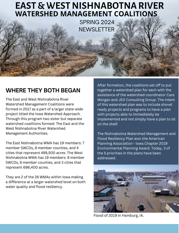
Located in the Loess Hills region of Iowa, the East and West Nishnabotna Watersheds were selected to work with the Iowa Flood Center at the University of Iowa and many other partners to develop Watershed Management Authorities as part of the Iowa Watershed Approach. Through the project, Iowans are working together to address factors that contribute to floods and nutrient flows and enjoy the improvements in quality of life and health resulting from upstream watershed investments. Supported by U.S. Housing & Urban Development dollars, this approach is leveraging the principles of Iowa’s innovative Nutrient Reduction Strategy to make communities more resilient to flooding and help improve water quality.
“One of the keys to success on projects within a watershed is collaboration.  This project is a perfect example of that with multiple landowners coming together to make a difference in our watershed,” noted Marker-Morgan.
To participate in the live virtual field day at 1:00 pm CST on March 18 to learn more, click this URL:
https://iastate.zoom.us/meeting/register/tJUpduihpj8iE9ZHcjpsenc2DWQILG41wg0D or visit www.iowalearningfarms.org/page/events and click “Join Live Virtual Field Day”.
 Or, join from a dial-in phone line:
    Dial: +1 312 626 6799 or +1 646 876 9923
    Meeting ID: 914 1198 4892
The field day will be recorded and archived on the ILF website so that it can be watched at any time. The archive will be available at
https://www.iowalearningfarms.org/page/events.
Participants may be eligible for a Certified Crop Adviser board-approved continuing education unit (CEU). Information about how to apply to receive the credit (if approved) will be provided at the end of the live field day.
Established in 2004, Iowa Learning Farms is building a Culture of Conservation by encouraging adoption of conservation practices. Farmers, researchers and ILF team members are working together to identify and implement the best management practices that improve water quality and soil health while remaining profitable. Partners of Iowa Learning Farms include the
Iowa Department of Agriculture and Land Stewardship, Iowa State University Extension and Outreach, Leopold Center for Sustainable Agriculture, USDA Natural Resources Conservation Service, and Iowa Department of Natural Resources (USEPA section 319) and GROWMARK, Inc.
Picture
Watershed coordinator Cara Marker-Morgan
Picture
Picture
panoramic shot of a streambank restoration project
0 Comments

Identifying Iowa's grasses and grass-like plants

3/5/2021

0 Comments

 
"Sedges have edges
Rushes are round
Grasses have nodes that are easily found

(or 'grasses are hollow, what have you found?')"


If you've done much plant identification, you may have heard this or a similar expression.

Prairies, in short, are grasslands. They are dominated by grasses and grass-like plants such as sedges and rushes, along with abundant forbs (flowers) but only sparse woody vegetation (trees & shrubs). At first glance, especially from a distance, prairies may look like monotonous monocultures. This could not be farther from the truth. A high-quality tallgrass prairie remnant can have more than 300 species, many of which are grasses, or grass-like plants.

In our Loess Hills Plant List, which includes many of the species found in western Iowa's natural areas, we have identified 58 species in the Poaceae family, 35 in Cyperaceae, and 4 Juncaceae. In other words, grasses are the most common, followed by sedges and rushes. Overall, there is greater species diversity of forbs (flowering plants), but typically the quantity of grass and grass-like plants exceeds that of forbs in prairies. 
Picture
Prairie Plant Functional Groups. Slide from Lisa Schulte Moore's presentation, Iowa's Prairies, from Iowa State University's Master Conservationist Program, Module 2a - Understanding Iowa's Ecosystems: Prairies. https://naturalresources.extension.iastate.edu/programs/master-conservationist
Picture
Classification of grasses, sedges, and rushes. Source: http://www.countrysideinfo.co.uk/grass_id/intro2.htm
Grasses, sedges, and rushes are all monocots. Monocots have one seed leaf and share other common characteristics. "Although all grass-like plants are monocots, not all monocots are grass-like plants." Learn more in this short video from Native Plant Trust:
Differences between the three can include stem structure, sheath form, and flower type, This page from Minnesota Wildflowers is an excellent synopsis of the differences. The chart below from Florida also provides a great summary. 
Picture
Summary of sedge, rush, and grass characteristics. From Erick A. Revuelta's presentation, CENTRAL FLORIDA GRAMINOID IDENTIFICATION WORKSHOP: Introduction to Florida’s Graminoids. Source: https://bugwoodcloud.org/CDN/floridainvasives/2019/Part1-Introduction.pdf
Grasses are commonly sorted into warm-season and cool-season species. According to Missouri Prairie Journal: "Native cool-season grasses are referred to as “C3 grasses” because, during photosynthesis, they use the Calvin-Benson cycle and produce three carbon molecules, while a C4 grass does not directly use the Calvin-Benson Cycle and produces a four-carbon molecule...

These physiological differences allow native cool-season grasses to grow and reproduce in cooler conditions, offering forage in early spring, fall, and part of winter, and seed by early summer, while warm-season grasses continue growing when cool-season grasses are dormant. For more information on comparing these two groups of grasses" (Read more here). 
Warm-season grasses include some of the most common grasses in many prairies, such as andropogon gerardii (big bluestem), schizachyrium scoparium (little bluestem), sorghastrum nutans (Indian grass), panicum virgatum (switchgrass), and bouteloua curtipendula (side-oats grama). 
Picture
Andropogon gerardii (big bluestem) inflorescense. This is a warm-season native prairie grass species.
Native cool-season grasses include elymus canadensis (Canada wild rye), elymus virginicus (Virginia wild rye), and koeleria macrantha (June grass). Many non-native pasture grasses, such as brome and fescue, were planted because they can provide a food source for plants earlier in the season compared to many of the native warm-season grasses. 
Picture
Elymus canadensis (Canada wild rye) is a cool-season native prairie grass.
Sedges, in the family Carex, are the next most abundant grass-like plants in Iowa's prairies. ​This blog post by Leland Searles also offers helpful information: "Sedges are an important, often overlooked group of native plants. In Iowa there are at least 125 species belonging to one genus, Carex."

People often remember "sedges have edges" to help identify them while in the field using their stems. 
Picture
Sedges have edges! (From In Defense of Plants Facebook page - https://www.facebook.com/InDefenseOfPlants)
Golden Hills worked with Dr. Tom Rosburg to record this Carex Identification class in March 2021. Dr. Rosburg covers some of the more common sedges found in Iowa. A sedge identification key and other resources can be found at goldenhillsrcd.org/plantid.
Dr. Anton Reznicek (Curator of the University of Michigan Herbarium and Research Scientist in the Department of Ecology and Evolutionary Biology)
The charts below show how a grass (andropogon gerardii/big bluestem), a sedge (carex gravida/heavy sedge) and a rush (juncus dudleyi) are 
In this video, Bob Lichvar of the US Army Corps of Engineers briefly describes how to field-identify common rushes.
The taxonomic charts below show where three common species fit into into the classification system. Andropogon gerardii (big bluestem) is a grass, carex gravida (heavy sedge) is a sedge, and juncus dudleyi (Dudley's rush) is a rush.
Andropogon gerardii
Picture
Carex gravida
Picture
Juncus dudleyi
Picture
As important as it is to learn native plants, it's also good to identify invasive and unwanted plant species that can harm native prairie, wetland, savanna and woodland ecosystems. Reed canary grass is one of the most aggressive invasive grasses. It can take over large areas in short amounts of time and crowd out native species. Removing it once it is establish can be very difficult, so it's better to identify it early and prevent it from spreading as much as possible. The Grasses of Iowa's Weedy and Invasive Grasses page is a great resource for learning about non-native and problematic species. 
Links & Resources for grass & grass-like plant ID and classification:​
  • Iowa Prairie Plants​
  • ​Iowa Grasses ID
  • Minnesota Wildflowers
  • ​Grasses of Iowa​
  • Iowa DNR -Invasive Species
  • Iowa State Extension - Invasive Species
0 Comments

Tapping trees in Fremont County

3/2/2021

0 Comments

 
At the end of winter, sap starts flowing from tree roots back up the trunk. This sap contains the vital nutrients that trees need to survive and thrive. We visited Waubonsie State Park in Fremont County on a warm day in early March to practice tapping trees with Park Manager Matt Moles. Always check with property managers before tapping trees on public lands. We received approval to do this for educational purposes.

The process is a lot simpler than many people might expect.  Basically you find a tree you want to tap and drill a hole that will fit the size of your spile. The hole should be at a slight upward angle to help the sap drip down the spile. If the sap is flowing, you will likely see it dripping out already.

​We used inexpensive plastic spiles found online but traditionally the spiles were made of metal. 
Picture
Example of the spiles we used.
Next, attach a tube to the spile and tap the spile into the drilled hole so that it fits tightly and will not fall out of the tree. Measure beforehand to ensure the tubing will fit on your spiles. 
Below you can see the sap flowing from the spile into the tube. Put the other (bottom) end of the tube into some kind of container like a bucket placed on the ground. You could also hang the bucket on the tree and eliminate the need for the tubing. Make sure to wash the bucket, tubing, and spiles before and after each use, and don't use a bucket that has stored any toxic substances. 
Depending on the tree, the weather, and other factors, the sap my drip quite slowly or flow fairly rapidly like this one:
It's best to cover the bucket to prevent insects, dust, and other debris from settling into the sap. Check the bucket regularly to make sure it doesn't overflow. 

Now you've done the easy part! Turning the sap into syrup requires boiling it down until the water evaporates, leaving mostly sugar. Maples generally have
higher sugar content than most other trees, which means it takes less boiling to get more syrup.  Still, many other species can be tapped. Even with maples, a rough estimate is about 40 gallons of sap boils down to one gallon of maple syrup. For other species, the difference is even greater. If you don't have the right equipment to boil down that much sap, start small and try it out on your stovetop or over an outdoor fire. 

You can also skip the boiling process completely and drink the sap alone or with other beverages like coffee or tea. Sap, or maple water, as it's been branded, is marketed as a healthy alternative to sugary drinks. It has a slightly sweet taste and includes some nutrients and electrolytes. 

For more details on tapping trees, check out this recent blog post from Perennial Homestead. 
0 Comments

Signs of spring in Fremont County

3/2/2021

0 Comments

 
"One swallow does not make a summer, but one skein of geese, cleaving the murk of March thaw, is the Spring." - Aldo Leopold

The first week of March is recognized as Aldo Leopold Week. Leopold, born in Iowa, is known as one of the founders of the modern conservation movement.  His book, published in 1949, continues to be a staple of conservation literature today. It is fitting that here in southwest Iowa, the first week of March often fittingly coincides with some of the earliest signs of spring. 

The videos below were recorded in Fremont County on March 2, 2021. Large flocks of snow geese are flying north from their wintering grounds. Fremont County is an especially good place to see bird migrations, as it is located near the confluence of the East & West Nishnabotna Rivers and the Missouri River. Numerous wetlands on public and private land offer the birds places to rest on their long northward journey. Riverton Wildlife Management Area is one example of a public area where you can see bird migrations. Waubonsie State Park and several other wildlife areas in the Loess Hills also offer excellent birding and wildlife viewing. Driving along the Loess Hills National Scenic Byway is another option. If you decide to stop along roadways, be sure to pull completely off to the side and turn on hazard lights.
Golden Hills is planning several events in Fremont County this spring and summer to get people out into the great outdoors, including a Spring Wildflower Walk at the new Blackburn State Park Unit near Thurman. Learn more at our Fremont County Outdoor Adventures page. 
Picture
Picture
0 Comments

Join Golden Hills in welcoming two new board members

2/8/2021

0 Comments

 
Golden Hills is excited to welcome two new members to our Board of Directors. Kathy Fiscus of Council Bluffs and Seth Watkins of rural Clarinda were recently approved by the Board as West Pottawattamie and Page county representatives. They both bring a wealth of skills and knowledge to help guide our organization and fulfill our mission of collaboratively developing and leading community, conservation and cultural initiatives to improve our quality of life in rural western Iowa. 
Council Bluffs native Kathy Fiscus enjoyed a 40-year career in television broadcasting in Iowa, Wisconsin, and Nebraska. After retiring from TV, Fiscus spent 14 years at the Council Bluffs Convention and Visitors Bureau in various capacities. While at the CVB, Fiscus worked closely with Pottawattamie Conservation and became an avid enthusiast and promoter of outdoor conservation and activities. Now fully retired, Fiscus concentrates on several board positions, advisory committees, and being a full time artist. One extensive artistic passion is the Loess Hills National Scenic Byway (TM). Fiscus has a daughter and family living in Kansas City, Kansas, and a son living in Des Moines, Iowa.
Picture
Kathy Fiscus, Pottawattamie County
Seth Watkins is the fourth generation to care for his family’s heritage farm near Clarinda, where he raises beef cattle, corn, hay, oats, and various cover crops. Watkins is passionate about stewardship, especially water quality, the restoration of prairie, woodlands, & riparian areas. Watkins believes that when you have a healthy and diverse landscape combined with the values of inclusion, equality, & accessibility you can accomplish anything. Watkins serves on The Iowa Natural Heritage Foundation board of Directors and the Leadership Council for The Iowa Learning Farms. His wife Christy is an Early Childhood Specialist for Green Hills AEA. They have a son Spencer and a daughter Tatum.
PictureSeth Watkins, Page County

Please join us in welcoming Kathy and Seth to the Golden Hills team!

​Learn more about our B0ard of Directors here.
0 Comments

Black history month in western Iowa

2/3/2021

0 Comments

 
Although Iowa is not known as an extremely diverse place, the state has a long history of civil rights successes. Iowa desegregated schools, legalized interracial marriage, and allowed black men voting rights before most other states and the federal government. Iowa was always a "free" state, not allowing slavery.

The first documented black person in what is now recognized as the State of Iowa was York with the Lewis and Clark Expedition. York was a slave owned by William Clark and passed through during the 1804-1806 trek (Source: Iowa PBS). He helped care for Sergeant Floyd, who fell ill while the crew passed near current-day Sergeant Bluff and was the expedition's only death (Source: National Park Service).  


While slavery was still legal, fugitive slaves found safe harbors in many Iowa communities along the Underground Railroad.
PictureMap of Underground Railroad in Iowa. Source: Cedar Rapids Gazette. https://www.thegazette.com/subject/life/people-places/iowa-was-more-than-a-stopover-in-anti-slaverys-underground-railroad-20170226

Among the most important Underground Railroad sites in southwest Iowa were the Todd House and Tabor Antislavery District. According to the National Park Service: "Townspeople met in the square to discuss and reinforce their controversial, yet strongly held beliefs in opposition to the “flagrant sin” of slavery.  As a result, they developed strong networks of resistance to slavery and assistance to fugitive slaves.  The square was also used for camping and drilling exercises executed by local militiamen and by abolitionist John Brown before his raid on Harper’s Ferry."
Picture
Rev. Todd House in Tabor. photo by Lance Brisbois
Picture
Tabor Congregational Church, part of the Antislavery District.
The Reverend George B. Hitchcock House near Lewis, on the banks of the East Nishnabotna River in Cass County, was another important site.

In the Loess Hills of Monona County, a little-known all-black cemetery hides on a rural gravel road. According to a 2004 Sioux City Journal article: "[T]he site is alternately called the Black Cemetery or the Negro Cemetery. Only nine headstones remain and the history of the people buried there can't be determined from the inscriptions.
But the tale is that there once was a thriving African-American settlement in the Loess Hills of rural Moorhead..." (Source: Sioux City Journal).
Picture
All-black cemetery in Monona County. photo by Lance Brisbois.
Preston Love, a jazz musician from Omaha, played his first professional show at the Aeroplane Inn, located in the Loess Hills in Honey Creek. The Love's Jazz & Art Center in Omaha honors his name and legacy. From their website: "His big break came when he joined the Count Basie Orchestra at the age of 22, and from there, he went on to play in the bands of renowned artists like Ray Charles and Aretha Franklin. Love traveled worldwide, headlining jazz festivals, touring with bands and fronting his own Preston Love Orchestra. With other local musicians like Buddy Miles, Anna Mae Winburn and Lomie Washburn, among others, Love helped make Omaha a destination for jazz from the 1920s to the early 1960s." (Source: LJAC.org)

Oscar Micheaux, a Black writer and filmmaker, lived in Sioux City in the early 20th Century.  Micheaux focused on race relations in many of his works, and has influenced many well-known fillmmakers since then (Source: Sioux City History).

According to Sioux City History, "The Sioux City Ghosts were an all-black fast-pitch softball team. They started in Sioux City and began touring the United States, Canada, and Mexico during the 1930s, and played until 1956. Because of their pranks on the softball field, they were often compared to the famous Harlem Globetrotters" (Source: Sioux City History).

In Council Bluffs, the historic Cooper House "once belonged to a couple who helped found the Iowa-Nebraska chapter of the National Association for the Advancement of Colored People, better known as the NAACP." (source: Des Moines Register).

Many black Iowans experienced discrimination through legal practices like redlining. While segregation was technically illegal in Iowa, many communities were still, in reality, segregated (Source: Iowa PBS). Sundown towns, where Black people could be arrested for being in a community after dark, were found throughout Iowa. New Market, in southwest Iowa's Taylor County, had a sundown law on the books until the 1980's (Source: Undesign DSM). Despite these challenges, Black people have continued to live and thrive across Iowa. 


Visit the national African American History Month website here.
0 Comments

Celebrate Iowa's wetlands on World Wetlands Day

2/2/2021

0 Comments

 
Today is World Wetlands Day, an annual event to "raise global awareness about the vital role of wetlands for people and our planet. This day also marks the date of the adoption of the Convention on Wetlands on 2 February 1971"

What is a wetland?
According to U.S. Fish & Wildlife Service, "Wetlands are lands transitional between terrestrial and aquatic systems where the water table is usually at or near the surface or the land is covered by shallow water. For the purposes of this classification wetlands must have one or more of the following three attributes:
(1) at least periodically, the land supports predominantly hydrophytes;
(2) the substrate is predominantly undrained hydric soil; and
(3) the substrate is nonsoil and is saturated with water or covered by shallow water at some time during the growing season of each year." (Source: USGS National Water on Wetland Water Resources).
​
Picture
Wetland in Shelby, Iowa. photo by Lance Brisbois
Why they matter:
A few wetland facts from Iowa Association of Naturalists' Iowa's Biological Communities series on Iowa Wetlands:
  • "Approximately 99 percent of Iowa's once plentiful prairie marshes have been destroyed.
  • More than 1,200 species of plants make U.S. freshwater wetlands their home.
  • More than 10,000 invertebrate species are adapted to life in freshwater wetlands.
  • The majority of Iowa's endangered species live in, or association with, wetlands. • Wetlands filter pollutants from soil runoff, and help control flooding."

Most of Iowa's wetlands were located in the Des Moines Lobe, known as the Prairie Pothole region due to the abundance of small lakes, ponds, and wetlands from the most recent glaciation. But even western Iowa had plenty of wetlands. The early General Land Office surveys from the mid-19th Century shows wet areas in the rolling hills of northern Shelby and Pottawattamie counties, for example. While these areas are generally well-drained, beaver dams on small streams likely helped create many of the wetlands. The Missouri Alluvian Plain and valleys of other large rivers also had wetlands, as they flooded regularly prior to channelization and damming. ​
Picture
Map of northern Shelby County from General Land Office survey indicating wet areas in blue. Source: Iowa Geographic Map Server (http://minneapolis.gis.iastate.edu/)
Picture
Map of northern Pottawattamie County from General Land Office survey indicating wet areas in blue. Source: Iowa Geographic Map Server (http://minneapolis.gis.iastate.edu/)
Wetlands offer many benefits to people, wildlife, land, and water. They are sometimes called "nature's kidneys" due to their ability to cleanse water before it enters streams and rivers. They absorb excess nutrients and chemicals from agriculture and industry, as well as trap sediment from soil erosion. They capture excess water and slowly soak it into the ground, which reduces flooding. 

Wetlands can also provide recreational opportunities like hunting, trapping, fishing, wildlife watching, birding, and paddling. Living or even spending time near biodiversity, greenery, and water have all been shown to improve well-being and happiness.
Picture
Wetland in Shelby, Iowa. photo by Lance Brisbois
Areas that are often too wet for farming can be problematic for farmers, but several funding programs are available to restore wetlands and make it profitable, including the Wetland Reserve Program, Conservation Reserve Program, Conservation Reserve Enhancement Program, and Farmable Wetlands Program (Source: NRCS Restoring Iowa Wetlands).
​

This video from Iowa Outdoors provides a great summary of wetland restoration in Iowa.
And this video from The Nature Conservancy is an excellent primer on the benefits of Iowa's wetlands.
​Learn more about World Wetlands Day and how you can help protect and restore these fragile and endangered ecosystems at worldwetlandsday.org
More Links & Resources
  • East & West Nishnabotna Watershed Coalition
  • Iowa DNR Wetlands page
  • Ducks Unlimited Wetland Conservation
  • The Nature Conservancy in Iowa - The Power of Wetlands
0 Comments

Solvitur ambulando – It is solved by walking.

12/29/2020

0 Comments

 
Solvitur ambulando – It is solved by walking.

Many people, including great thinkers and philosophers, swear by this mantra. Walking is known to provide innumerable benefits for our physical, mental, and spiritual health. It is also an excellent way to boost creativity, focus, and even productivity.
 When a global pandemic caused Iowan Kelly Madigan to cancel her 2020 travel plans, she took a long walk—270 miles—through the Loess Hills of western Iowa. 

The Loess Hills are a globally significant landform. Loess soil deposits of this depth are unique to the western hemisphere; in fact, China's Loess Plateau is the only place in the world where you will find larger ones. The region is known for beautiful vistas, small communities, farmland, woodlands, and prairies, and is popular for tourists looking to escape to rural and wild spaces. The Hills encompass parts of seven counties: Plymouth, Woodbury, Monona, Harrison, Pottawattamie, Mills, and Fremont. Several coordinated conservation and recreation efforts have and continue to take place in the landform, such as the Loess Hills National Scenic Byway, Loess Hills Alliance, and Loess Hills Fire Partners. 

While more than 99.9% of Iowa’s native prairies have been removed from the landscape, the majority of the state’s remnant prairies are located in the Loess Hills. Similarly, although Iowa ranks nearly last in public land access, the Loess Hills offer some of the largest public conservation and recreation areas in the state. These public areas include many miles of hiking trails, including some of the longest and most rugged trails in the Midwest. Over the years, many people have discussed the idea of a through hiking trail, similar to the Appalachian Trail, connecting these parks and trails over the the length of the Loess Hills. Until recently, however, the concept had not been attempted.

In October and November 2020, Kelly Madigan hiked the entire length of the Loess Hills, totaling about 270 miles miles. She visited public conservation and recreation areas as much as possible, hiking on gravel, dirt, and paved roads in between. She calls it the LoHi Trail, short for Loess Hills. Kelly used Facebook to post regular photo, video and text updates during her journey, which took just over six weeks. She hiked between 2 and 10 miles per day and took off eight days. She has already gained significant interest from outdoor enthusiasts and is spurring a conversation like never before. A new LoHi Trail Facebook group gained more than 100 new members in its first two weeks and continues to grow.

Kelly was born in Massachusetts. Her father was a career Air Force officer and the family moved around frequently as Kelly was growing up, which may have contributed to her longing for a deep sense of place. Today she lives in the heart of the Loess Hills in rural Monona County. Kelly and her partner Doug Chafa and his daughter, Isabel, live near the Turin Wildlife Management Area, which Doug helps manage with his job as Wildlife Biologist with Iowa Department of Natural Resources.

Kelly says, “I had visited the Loess Hills for decades, and then lived in them, and spent time hiking them. I trained to become a wildland firefighter and volunteered to assist with prescribed fire. I attended the Loess Hills Prairie Seminar year after year, and occasionally helped hand-collect local ecotype seed. Still, I wanted to understand the Loess Hills better.  Literally, I wanted to know what I was standing on, what was under me. Experiencing the hills on foot was an opportunity to take in information at a human pace, and form a relationship with this landform that would live in my muscle memory. I had dreamed about it for a long time. The set of conditions the pandemic created made it seem like it was time.” While she often walked alone, Kelly occasionally had people join, with Doug and Isabel being her most frequent companions on the trail.
 
Patrick Swanson, a Loess Hills landowner and author of a book about his story, wrote this article about a similar idea after attending the opening hike for Brent’s Trail in 2019. Brent’s Trail is part of a trail envisioned by staff at Loess Hills State Forest connecting the largest public land complex in the Loess Hills with a hiking trail from Preparation Canyon on the north to the southern end of the Mondamin Unit. Brent’s Trail is currently just under 8 miles with an additional 5 miles under construction.


The route Kelly hiked already exists. It uses a combination of paved, gravel and dirt roads connecting existing public lands and trails wherever possible. Existing trails in the region are maintained by state, county, and municipal government agencies, nonprofit land trusts and trail groups. Roadways and streets are also maintained by the state DOT, county roads departments, and cities. Parts of the on-road route follow the Loess Hills National Scenic Byway’s main spine and excursion loops, which offer some of the most beautiful views in the Midwest. Kelly paid special attention to respecting private property, always seeking permission before walking on any privately owned land. The route Kelly hiked may not necessarily be the best route, but she tried to choose lower-traffic and more scenic routes over busy highways and the most direct routes. 
 
Kelly’s walk began at the Iowa/South Dakota border at Millsite Access on the Big Sioux River in Plymouth County. She followed the roads east through Westfield. County roads led her through The Nature Conservancy’s Broken Kettle Grasslands, the largest remnant prairie and roadless area in all of Iowa. South of Broken Kettle, her route went through Five Ridge Prairie State Preserve, The Nature Conservancy’s Knapp Prairie and Hummel Tract, Heendah Hills State Preserve, Mount Talbot State Preserve, Stone State Park, and Sioux City Prairie Preserve. 
Picture
Broken Kettle Grasslands. photo by Kelly Madigan
Picture
Five Ridge Preserve. Photo by Kelly Madigan.
Picture
Kelly hiking in Plymouth County. Photo by Doug Chafa.
Picture
Gravel road in Plymouth County. Photo by Kelly Madigan.
Picture
Plymouth County Loess Hills. Photo by Kelly Madigan.
Sioux City, the largest city on her route, offered a very different experience than the wild, rural terrain to the north. Fortunately, some recreational trails and sidewalks are available to provide hikers a more pleasant walk through the city’s downtown, industrial, and residential neighborhoods. This urban stretch includes Perry Creek Trail, South Ravine Park, Cone Park, and Sertoma Park. In Sioux City, her route crossed the Floyd River and was at its closest point to the Missouri River. After Sioux City, the LoHi route continues southeast out of Sergeant Bluff.
Picture
Sioux City Prairie. Photo by Kelly Madigan.
Picture
Perry Creek Trail in Sioux City. Photo by Kelly Madigan.
Picture
Woodbury County Courthouse in Sioux City. Photo by Kelly Madigan.
In rural Woodbury County near Smithland, Kelly passed through Woodbury County Conservation Board’s Oak Ridge Conservation Area, Fowler Preserve, and Southwood Conservation Area. Kelly got permission to hike through a small parcel owned by Iowa Natural Heritage Foundation (INHF) connecting these public areas.
Picture
Kelly walking in rural Woodbury County. Photo by Doug Chafa.
Picture
Kelly poses at the entrance to Woodbury County's Southwood Conservation Area. Photo by Doug Chafa.
After the small town of Rodney, her route passed through Monona County Conservation’s Peter’s Park/Rodney Pits, Iowa DNR’s Loess Hills Wildlife Area and Turin Preserve Wildlife Management Area (WMA). South of the unincorporated community of Turin and the Maple River, Kelly hiked through INHF’s Monona Complex, which she got permission to hike. 
Picture
Monona County Loess Hills. Photo by Kelly Madigan.
Picture
Monona County Loess Hills. Photo by Kelly Madigan.
Picture
Monona County Loess Hills. Photo by Kelly Madigan.
In southern Monona and northern Harrison counties, Kelly hiked through three of Iowa DNR’s four Loess Hills State Forest units (Preparation Canyon, Little Sioux, Mondamin), including part of Brent’s Trail.
Picture
Loess Hills Scenic Overlook, Monona County. Photo by Kelly Madigan.
Picture
A recently-cleared hiking trail within the Little Sioux Unit of Loess Hills State Forest, Harrison County. Photo by Kelly Madigan.
Picture
Mondamin Unit of Loess Hills State Forest. Photo by Kelly Madigan.
Picture
Mondamin Unit of Loess Hills State Forest. Photo by Kelly Madigan.
Picture
Kelly at the Mondamin Unit of Loess Hills State Forest. Photo by Doug Chafa.
Kelly's route through Harrison County also included Harrison County Conservation Board’s Gleason-Hubel Wildlife Area and Old Town Conservation Area, Soldier and Boyer river crossings, and the city of Missouri Valley.
Picture
Loess Hills Trail in Harrison County. Photo by Kelly Madigan.
Picture
Downtown Missouri Valley. Photo by Kelly Madigan.
Picture
Boyer River in Harrison County. Photo by Kelly Madigan.
In Pottawattamie County, Kelly hiked through unincorporated Honey Creek and then used hiking trails at the popular Hitchcock Nature Center, managed by Pottawattamie Conservation. She then hiked through the town of Crescent and into Council Bluffs, entering at Lewis & Clark Monument Park. Parts of Council Bluffs are similar to Sioux City, with a large urban center surrounded by older traditional neighborhoods and newer suburbs. Kelly's route went through Council Bluffs’ Fairmount Park trails, Vincent Bluff State Preserve’s prairie, and the Wabash Trace Nature Trail. 
Picture
Crossing Interstate 880 in Pottawattamie County. Photo by Doug Chafa.
Picture
Kelly happened to be at Hitchcock Nature Center when county conservation staff and agency partners were conducting a prescribed fire. The fire was intentional and controlled. Photo by Kelly Madigan.
Picture
View of the Loess Hills from the base along Joslyn Avenue in Pottawattamie County. Photo by Kelly Madigan.
Picture
Lewis & Clark Monument, Council Bluffs. Photo by Kelly Madigan.
Picture
Lewis & Clark Monument Park trail, Council Bluffs. Photo by Kelly Madigan.
Picture
Residential street in Council Bluffs. Photo by Kelly Madigan.
Picture
Black Angel Statue, Council Bluffs. Photo by Kelly Madigan.
Picture
Vincent Bluff Preserve in Council Bluffs. Photo by Kelly Madigan.
Picture
Residential neighborhood in Council Bluffs. Photo by Kelly Madigan.
Picture
Wabash Trace Nature Trail just south of Council Bluffs. Photo by Kelly Madigan.
Picture
Wabash Avenue south of Council Bluffs. Photo by Kelly Madigan.
Near the Pottawattamie-Mills county line is TNC’s Folsom Point Preserve with remnant prairies and a well-worn footpath. ​Mills County Conservation Board’s Pony Creek Park and Glenwood State Archeological Preserve were also located on Kelly's route in addition to the city of Glenwood. 
Picture
Folsom Point Preserve, Mills County. Photo by Doug Chafa.
Picture
Folsom Point Preserve, Mills County. Photo by Kelly Madigan.
Picture
Pony Creek Lake, Mills County. Photo by Kelly Madigan.
Picture
Pony Creek Nature Center, Mills County. Photo by Kelly Madigan.
Picture
Glenwood Town Square. Photo by Kelly Madigan.
Picture
Trail at Glenwood Archaeological State Preserve, Mills County. Photo by Kelly Madigan.
South of Glenwood, Kelly mostly took gravel and dirt roads into Fremont County, where she passed through Possum Hollow WMA, Waubonsie State Park and Eli Slusher WMA. 
Picture
Deep Loess Hills roadcut, Mills County. Photo by Kelly Madigan.
Picture
Deep Loess Hills roadcut, Mills County. Photo by Kelly Madigan.
Picture
Mills County dirt road. Photo by Kelly Madigan.
Picture
Long shadows and cattle in rural Mills County. Photo by Kelly Madigan.
Finally, Kelly passed through Hamburg near the Nishnabotna River, then one final public land area at O.S. Wing WMA, before reaching the Missouri state line.
Picture
Fremont County scenery. Photo by Kelly Madigan.
Picture
Possum Hollow Wildlife Area, Fremont County. Photo by Kelly Madigan.
Picture
View along Bluff Road in Fremont County. Photo by Kelly Madigan.
Picture
Sunset Ridge at Waubonsie State Park, Fremont County. Photo by Kelly Madigan.
Picture
Sheep and cattle on a Fremont County farm. Photo by Kelly Madigan.
Picture
Kelly crosses the Nishnabotna River, the last large river before the end of her hike. Photo by Doug Chafa.
Picture
View of Hamburg from O.S. Wing Wildlife Area, Fremont County. Photo by Kelly Madigan.
Picture
O.S. Wing Wildlife Management Area, Fremont County. Photo by Kelly Madigan.
Picture
Kelly finishing her Iowa Loess Hills hike at the Missouri state line south of Hamburg. Photo by Doug Chafa.
Kelly is currently collaborating with Larksong Writers Place to host a (virtual) place-based writing workshop focused on the Loess Hills that begins January 19th. “From the Black Angel statue in Council Bluffs, to a cave in Sergeant Bluff, to a lighted star on a bluff in Turin, to a young female cougar with a radio collar, a long-lost uncle with a steep driveway, a badger letting you know to back off, a voice heard in the night, the view from a turkey blind, or a miraculous harvest of morel mushrooms, the Loess Hills are alive with stories. Using a variety of examples, prompts and exercises, we will explore the hills creatively, crafting poems, stories and short memoir that reflect the unusual terrain and the experiences held there. Participants will be invited (but not required) to share a sample of their completed work at a Loess Hills Writers event.” Learn more and register here. 

Kelly is also working with other hiking enthusiasts on planning a multi-day trail hike in Monona County in 2021. Stay updated by joining The LoHi Trail Facebook group. The group is a place for people to share ideas for conserving the fragile Loess Hills while promoting low-impact recreation and ecotourism. 
0 Comments
<<Previous

    Archives

    April 2021
    March 2021
    February 2021
    December 2020
    November 2020
    October 2020
    September 2020
    August 2020
    July 2020
    June 2020
    May 2020
    April 2020
    January 2020
    December 2019
    September 2019
    August 2019
    July 2019
    May 2019
    April 2019
    March 2019
    January 2019
    November 2018
    October 2018
    September 2018
    August 2018
    July 2018
    May 2018
    April 2018

    Categories

    All

    RSS Feed

Address

712 South Highway Street 
P.O. Box 189
​Oakland, IA 51560

Contact

Phone: 712-482-3029

Visit our Staff Page for email addresses.


Hours

​Office hours are 8:30am-4:30pm Monday-Friday, Closed all federal holidays.
  • Home
  • About Us
    • Who We Are
    • What We Do
    • Where We Work
  • Donate