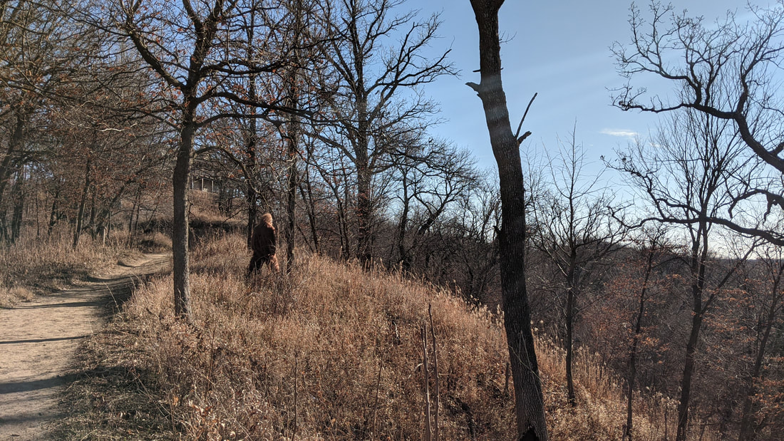
 Photo of an unknown animal at Hitchcock Nature Center For the past several years, there are been wild rumors circulating throughout the Loess Hills that suggest a hairy hominid known to many as Bigfoot or Sasquatch. Some have even gone as far as coining the cryptid "Loessy the Sasquatch" as numerous sightings have been reported. The reports from southwestern Iowa have been met with doubt, even scorn. However, this weekend Golden Hills was present with irrefutably evidence that something is lurking in the Loess Hills of western Iowa.
The first footage came from an anonymous tipster. They were enjoying Pottawattamie County's Arrowhead Park when a large, hairy figure walked nonchalantly through the timber. The figure did not appear threatening, as it walked right past the person recording the footage. It appeared that the figure had no interest in the person. Shortly after receiving the videos from Arrowhead Park, Golden Hills received footage from Fremont County in southwestern Iowa. The first was taken near Green Hollow Cemetery. The creature crossed a gravel road, looking both ways for oncoming traffic, before continuing west into the dense timber. The second clip was taken at Waubonsie State Park. The shocking video shows that the Bigfoot has no concern about being seen in plain view. Park manager Matt Moles declined to comment when asked by Golden Hills staff if park visitors and campers are safe. Harrison County also had reports of the same creature. The brazenness of the creature's behavior was on full display in another anonymous video we received recently. Perhaps the Sasquatch was interested in learning about the Loess Hills at the new Willow Lake Nature Center near Woodbine. If you have seen Bigfoot/Sasquatch, please send us any photos of videos of the encounter. Like all wildlife, maintain a safe distance of at least 50-100 yards. If the creature approaches you, wave your arms and make noise. If that fails, run as fast as you can. If you are with friends of family, make sure you are not the slowest person in your group.
0 Comments
Last week, Golden Hills hosted a program at Iowa Western Community College about creating your own soil mixes. Nick Bonham with Lucky Toad Restorative Gardens taught the class, which included a classroom portion followed by mixing the ingredients in the greenhouse.  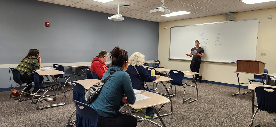 The following info is from Nick Bonham with Lucky Toad Restorative Gardens: Soil is a composite of organic matter, clay, and rock particles, the nature of which varies between climactic and geographic regions. It is an incredibly dynamic environment (about which we know surprisingly little) and provides a home to plants, fungi, animals, and microbes. It is the driving engine for life on earth. When cultivating plants in a greenhouse, we aren’t using “soil” per se, but rather a growing medium that simulates its necessary attributes while minimizing risk. Different plants have unique adaptations and therefore specific requirements of their growing medium. For example, cacti have evolved expansive, shallow root systems and require soil with rapid drainage. Such factors are crucial when determining the proper growing medium for your plants. This class focused on a general purpose “nursery” mix, one that is especially conducive to starting seeds and raising plants though the early stages of life before installation. Like animals, plants require a varied diet of macro- and micronutrients to truly thrive. Before we get into the composition of the mix, let’s review some basic soil chemistry: -Nitrogen is a key component not only of protein synthesis, but chlorophyll production as well. It is fixed into the soil by microorganisms. All plants need it, but certain crops like corn are especially ravenous for this nutrient. -Phosphorous helps with plant metabolism (nutrient acquisition/ transportation) and energy production. Deficiency usually appears as stunted, dark green foliage. -Potassium is a key factor in moderating water, carbohydrates, and nutrient transportation and has been attributed to cold-hardiness. It also facilitates enzymatic processes. These three comprise the NPK portion of fertilizers, and their respective ratios can be inferred as such. While these comprise the “macro” or primary nutritional requirements of plants, there are several others worth mentioning: -Sulfur helps maintain cellular health and proper DNA synthesis. Over-watering particularly leaches sulfur. Affected plants will display new growth that is yellow/yellow-green. -Calcium assists with cell division and maintenance of structure. Woody plants contain 10x the amount of calcium as non-woody plants. Deficiency results in stunted new growth, often with brown spots that begin at margins and spread to the interior. -Magnesium is a component of chlorophyll and helps fortify the cell wall. Deficiency displayed in older leaves with dark green veins but yellow to pale green foliage. Magnesium sulfate (non-scented Epsom salt) is a wonderful occasional treat for plants, and an incredibly effective shock reducer while transplanting. Now that we know what plants crave in soil, we can create a successful facsimile using ingredients from a garden supply store. The following recipe is one I have used for years to great effect, and the contents are as follows: Structural Medium -Coco coir (3.5 cubic feet, sifted)--- Preferable to Peat Moss, details in discussion -Vermiculite, coarse grade A3 (equal by volume to coco coir)----Preferable to Perlite, details in discussion -Worm Castings (30 lb, sifted) Nutrient Profile -Blood meal ( 3 C ) -Bone Meal ( 3 C ) -Kelp Meal ( 3 C ) -Azomite (1.5 C ) -Mycorrhiza (2 Tbsp) When combined, these ingredients create a mix that is not only properly nutrified but facilitates root growth and minimizes the risks of disease. By retaining water well but draining and drying at an advantageous rate, risks of fungus and root damage are minimized. The relative porosity of the mix facilitates oxygenation and rapid root movement. It is particularly well- suited to vegetables and many species of prairie plants, though I wouldn’t advise using it for hydroponics. Nick discussed which types and brands of ingredients he used to provide which nutrients: 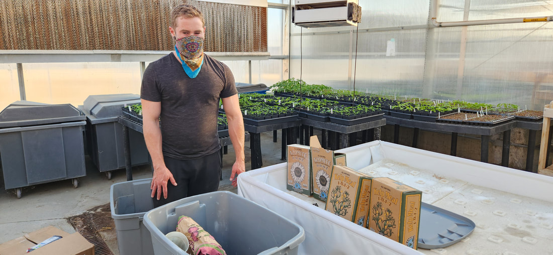 Then demonstrated how to mix the ingredients together... Once all the ingredients are mixed, you have a growing medium that will help germinating plants thrive! Lucky Toad Restorative Garden specializes in native plants, but this soil mix is also great for vegetables and other garden or farm crops. 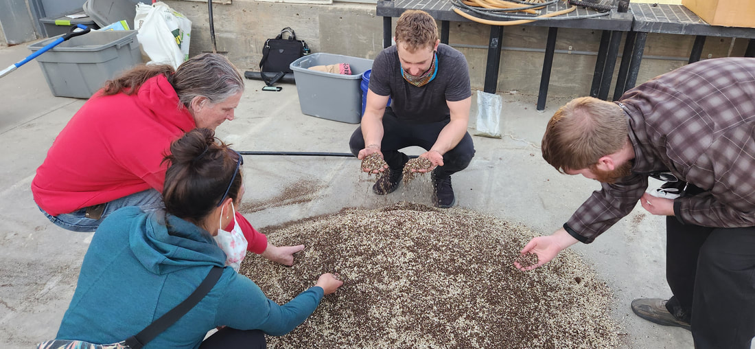 To find out about upcoming Golden Hills programs, visit goldenhillsrcd.org/events.
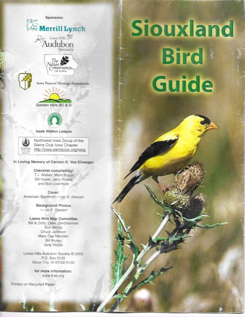
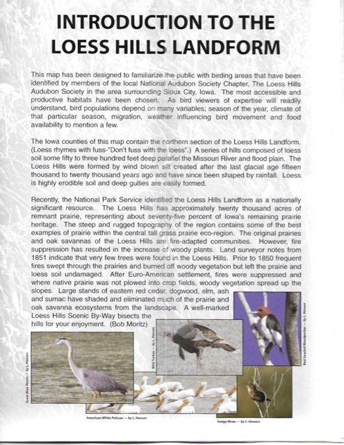
 Our mission at Golden Hills RC&D is to collaboratively develop and lead community, conservation, and cultural initiatives to improve our quality of life in rural western Iowa. Our "official" territory from our original organizational bylaws is an eight-county region in the southwestern portion of Iowa (Cass, Fremont, Harrison, Mills, Montgomery, Page, Pottawattamie, and Shelby). In 2023, we added four more counties (Audubon, Carroll, Crawford, and Monona). Several projects extend beyond these 12 counties into more than 20 counties (learn more about where we work).  Click to open a larger version Our goals are to develop industries in local communities that utilize local resources; ensure healthy natural resources that meet the needs of agriculture, industry, private use, and recreational facilities; promote and enhance art, culture and historic resources in rural communities; collaborate with local governments and organizations on projects that benefit the environment; and work on projects that fill gaps in community services to benefit people of southwest Iowa. We accomplish these goals by focusing our work in five program areas: outdoor recreation and tourism, land stewardship, water resources, local foods, and arts and culture. Today's Mission Monday focus is Outdoor Recreation & Tourism.  Click to open a larger version  Golden Hills RC&D recently worked with the Loess Hills Audubon Society to update their Siouxland Bird Guide. The project was completed thanks to grant funding from Loess Hills Audubon Society, Iowa Audubon, Fund for Siouxland, and the Conservation Education Program, a key provision of the Resource Enhancement and Protection (REAP) Act of 1989. Based out of Sioux City, the Loess Hills Audubon Society exists to educate individuals and the general public, to enjoy and promote birding, to support ornithology, and to be an advocate for wild areas and environmental issues. The Sioux City Chapter of the Audubon Society obtained a Provisional Charter from the National Audubon Society in 1973. The Sioux City Chapter of the Audubon Society was renamed the Loess Hills Audubon Society (LHAS) in the fall of 1981. Loess Hills Audubon Society meets at the Dorothy Pecaut Nature Center in Sioux City the first Thursday of the month during the months of September through May at 7:00 P.M.
The original Siouxland Bird Guide checklist and map was compiled by T.J. Walker, Mark Brogie, Bill Huser, Jerry Probst and Bob Livermore in May 2003. The checklist also included a map of the northern Loess Hills landform which was produced by Golden Hills RC&D. Birding areas and cultural features were added to the map through the work of a committee consisting of Bill and Dotty Zales, Bob Moritz, Chuck Johnson, Mary Cae Madden, Bill Huser, and Jody Moats.
Golden Hills RC&D updated the map of the Siouxland area and handled the design of the brochure, which maintains the original design of the 2003 guide. The new Siouxland Bird Guides are available at Loess Hills Audubon Society chapter meetings, the Golden Hills RC&D office in Oakland, and at area nature centers and visitor centers throughout the Siouxland area and along the Loess Hills National Scenic Byway.  Click to open in a new window
You probably heard about the recent fertilizer spill and fish kill on the East Nishnabotna River near and south of Red Oak.
According to Iowa Department of Natural Resources (DNR), approximately 1,500 tons of liquid nitrogen fertilizer--with 32% solution--was discharged into a drainage ditch near Red Oak. A survey of a stretch of the river south of Red Oak indicated few if any living fish. The plume of nitrogen flowed downstream past the confluence with the West Nishnbotna, impacting the Nishnabotna River all the way to its confluence with the Missouri River in northwestern Missouri.
Here are a few things we know and don't yet know, confirmed by Iowa DNR staff:
Video above from Chad Tiemeyer on Facebook, footage taken by Todd Meyer.
Rivers are incredibly resilient systems, and the constant flow means that the excess nitrogen will eventually be flushed out of the river. Nitrate levels in the river are already back to pre-spill levels near Red Oak.
As a precaution, people may want to avoid direct contact with the river for a couple more weeks. Human consumption of fish in the affected area is discouraged until further testing can be completed. Contamination through groundwater depends on variety of factors including the pollutant, geology, hydrogeology, and groundwater table. If you have a private well located near the East Nish south of Red Oak, you can get your well tested for nitrates by contacting your county sanitarian. An administrative fine of up to $10,000 could be incurred by NEW Cooperative for the spill, which is the highest amount allowed by Iowa law. Additionally, fish restitution fees may be applied which could potentially be significantly more.
Videos above from Justin Baucom on Facebook.
An updated March 14 DNR press release adds: "The DNR encourages private well owners in Montgomery, Page, and Fremont counties with wells in near proximity to the East Nishnabotna River to contact their county health department to test their wells for nitrate. This service is free using Iowa's Grants-to-Counties (GTC) program.
The DNR will be providing county health officials with lists of registered private wells that may be vulnerable. Due to low water levels in the East Nishnabotna, the concentration of the liquid nitrogen fertilizer is higher than during normal stream flows, causing concern for all animals due to high nitrate and urea levels. Iowa State University College of Veterinary Medicine Toxicologist Scott Radke recommends keeping all animals away from the East Nishnabotna River until the plume of contaminant moves out of the area." More recently, a gasoline spill in Atlantic is also impacting the East Nishnabotna. "Residents are encouraged to avoid the area around the spill as an environmental consulting firm helps with the clean-up process. The Iowa DNR is still investigating the incident." If you are interested in helping monitor water quality on the East Nishnabotna or other southwest Iowa streams, check out the Izaak Walton League's Stream Monitoring website. 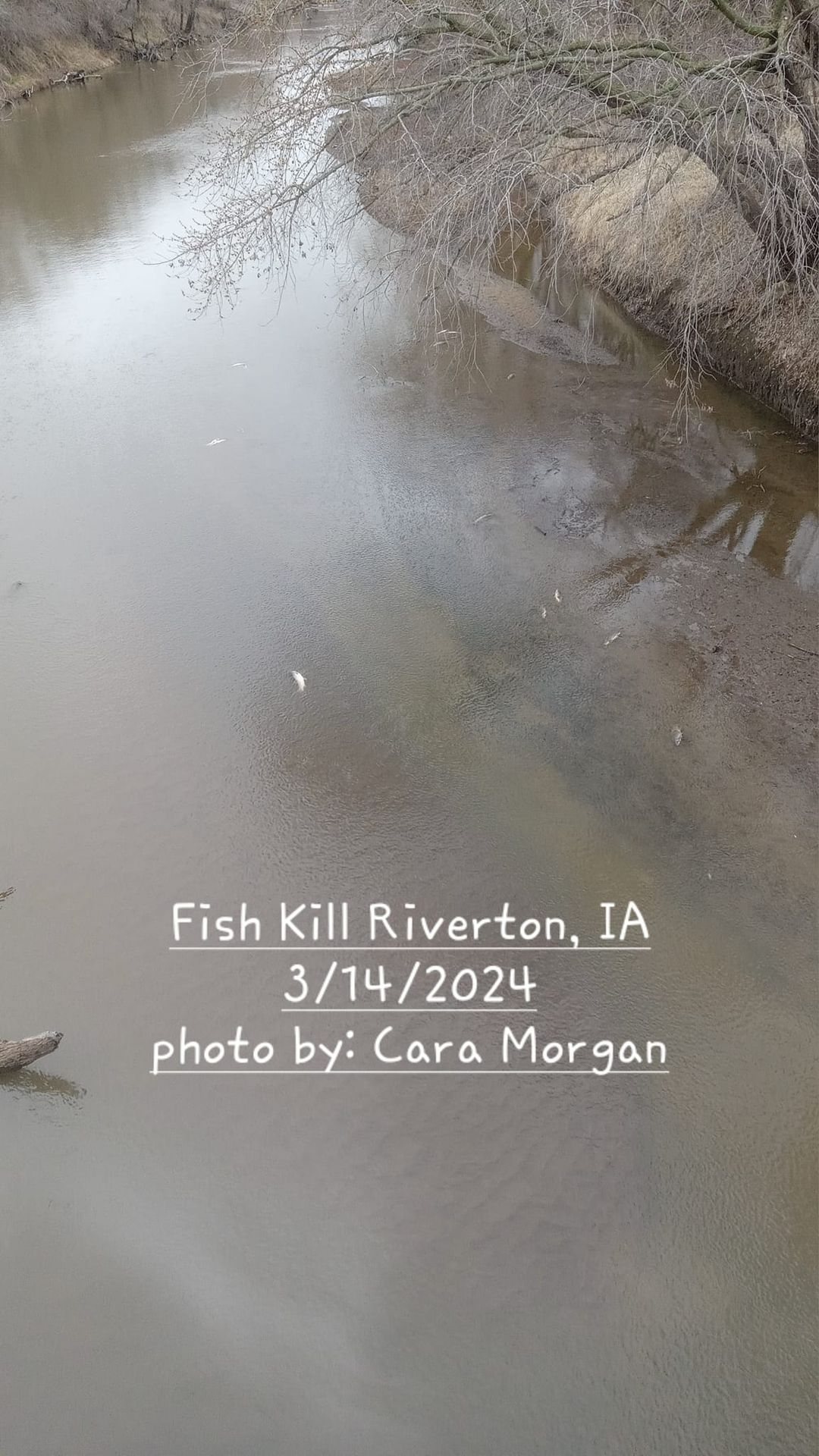
Golden Hills will share more information as it is confirmed by DNR. Learn about our watershed, water quality, and other water resources projects at goldenhillsrcd.org/water.
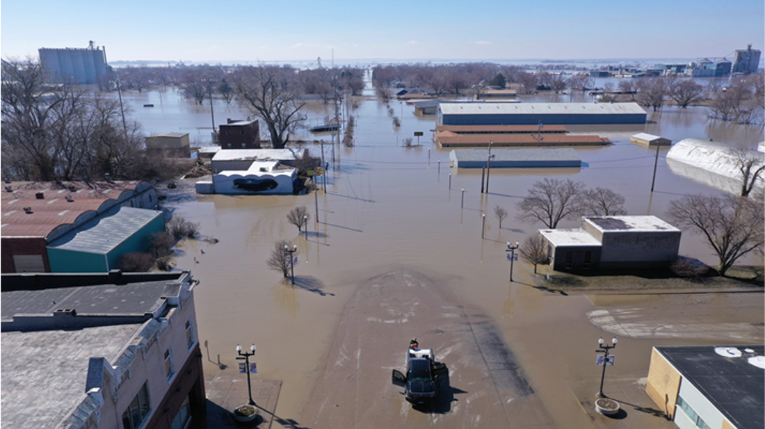 2019 Hamburg Flooding Our mission at Golden Hills RC&D is to collaboratively develop and lead community, conservation, and cultural initiatives to improve our quality of life in rural western Iowa. Our "official" territory from our original organizational bylaws is an eight-county region in the southwestern portion of Iowa (Cass, Fremont, Harrison, Mills, Montgomery, Page, Pottawattamie, and Shelby). In 2023, we added four more counties (Audubon, Carroll, Crawford, and Monona). Several projects extend beyond these 12 counties into more than 20 counties (learn more about where we work). Click to open a larger version Our goals are to develop industries in local communities that utilize local resources; ensure healthy natural resources that meet the needs of agriculture, industry, private use, and recreational facilities; promote and enhance art, culture and historic resources in rural communities; collaborate with local governments and organizations on projects that benefit the environment; and work on projects that fill gaps in community services to benefit people of southwest Iowa. We accomplish these goals by focusing our work in five program areas: outdoor recreation and tourism, land stewardship, water resources, local foods, and arts and culture. Today's Mission Monday focus is Water Resources.  Click to open a larger version The East and West Nishnabotna River Watershed Coalitions work in a collaborative effort to coordinate to reduce flood risks to life and property and improve the water quality within the Nishnabotna Watershed for future generations.
2024 Meetings: Quarterly board meetings are held on Wednesday mornings at the Oakland Community Center.
 Learn more about WMAs at the links below:
Click here to sign up to receive our quarterly Nishnabotna Currents newsletter! 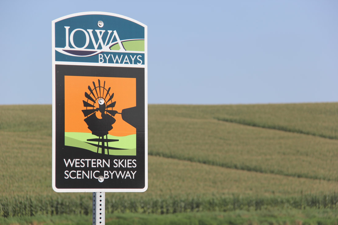
Whether you’re looking for a change of scenery or a change of pace, the Western Skies Scenic Byway offers both while showcasing Iowa’s agricultural past and cultural heritage.
This 140-mile byway parallels I-80, offering travelers several easy opportunities to venture off the beaten path and experience what Iowa is truly about. Travelers can start their byway journey just off of Exit 75 on I-29 near Missouri Valley. Taking Highway 30 east from Missouri Valley, travelers have the option to turn east onto State Highway 44 or to continue north into Woodbine where the byway forms a loop at County Road F32. Both routes lead travelers to Harlan, where they continue east on Highway 44 into the heart of the Danish countryside: Kimballton and Elk Horn. A spur of the Byway runs south from Kimballton on Highway 173 through Elk Horn and on to Interstate 80. Back on Highway 44, follow the rolling ridge top through Hamlin and Guthrie Center, and into Panora. Turning south on to P28, the byway ends at Stuart, located along Interstate 80 at exit 93. Learn about the Local Legends of the Western Skies Scenic Byway using the Iowa Scenic Byways Passport! 
The Iowa Scenic Byway Passport is new this year with an emphasis on Local Legends and fun new prizes, including limited edition Local Legend collectable cards. Now you can enjoy the beauty of Iowa’s scenic byways while learning about the history, people and places along the byways. Who knows, you might even become a Legend yourself!
It’s free to sign up and the more locations along the byways you visit, the more points you earn. Earn enough points and you can use them to secure a packet of 14 limited edition Local Legend Trading Cards. 
Make sure you also stop at the five Local Legends locations on the Western Skies Scenic Byway. Check in at each site to earn points. Those points can be redeemed for a set of 14 collectible cards featuring Local Legends from all 14 of Iowa's scenic byways.
The Local Legends and their check-in locations on the Western Skies Scenic Byway are listed below. 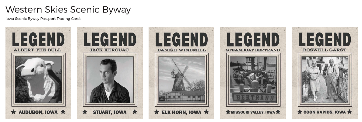
© 2016 Kenneth West
Get away ... from everything. When it's time to escape from the hustle and the bustle of your everyday life and finally spend some time in serenity, the Loess Hills are your destination. Unique, breathtaking scenery ... original, authentic, "down-home cooking" ... remarkable attractions ... and most of all, peace.
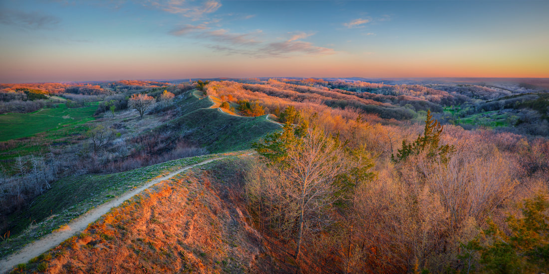
Situated along Iowa's western border, the Loess Hills National Scenic Byway passes through a unique land formation that is up to 15 miles wide and about 200 miles long from north of Sioux City, Iowa to near St. Joseph, Missouri. Learn about the Local Legends of the Loess Hills National Scenic Byway using the Iowa Scenic Byways Passport!
Click the image to sign up for the Iowa Scenic Byways Passport
The Iowa Scenic Byway Passport is new this year with an emphasis on Local Legends and fun new prizes, including limited edition Local Legend collectable cards. Now you can enjoy the beauty of Iowa’s scenic byways while learning about the history, people and places along the byways. Who knows, you might even become a Legend yourself!
It’s free to sign up and the more locations along the byways you visit, the more points you earn. Earn enough points and you can use them to secure a packet of 14 limited edition Local Legend Trading Cards. 
Make sure you also stop at the five Local Legends locations on the Loess Hills National Scenic Byway. Check in at each site to earn points. Those points can be redeemed for a set of 14 collectible cards featuring Local Legends from all 14 of Iowa's scenic byways.
The Local Legends and their check-in locations on the Loess Hills National Scenic Byway are listed below. 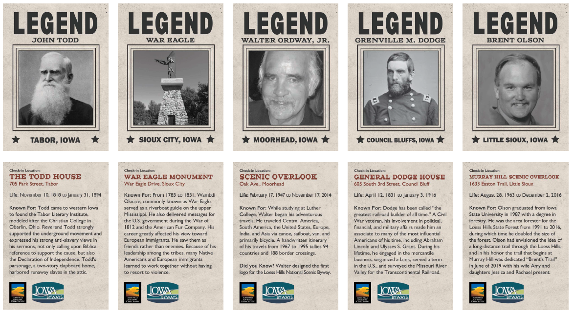
Click to open in a new window
Click to open in a new window
Our mission at Golden Hills RC&D is to collaboratively develop and lead community, conservation, and cultural initiatives to improve our quality of life in rural western Iowa. Our "official" territory from our original organizational bylaws is an eight-county region in the southwestern portion of Iowa (Cass, Fremont, Harrison, Mills, Montgomery, Page, Pottawattamie, and Shelby). In 2023, we added four more counties (Audubon, Carroll, Crawford, and Monona). Several projects extend beyond these 12 counties into more than 20 counties (learn more about where we work).
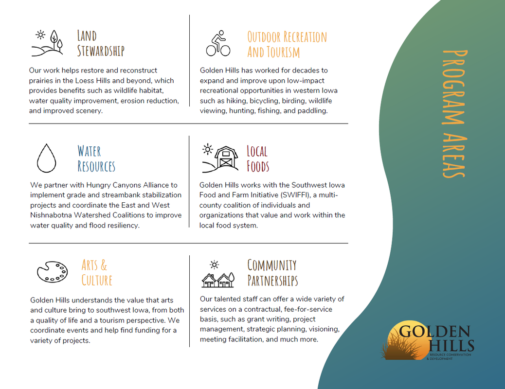
Our goals are to develop industries in local communities that utilize local resources; ensure healthy natural resources that meet the needs of agriculture, industry, private use, and recreational facilities; promote and enhance art, culture and historic resources in rural communities; collaborate with local governments and organizations on projects that benefit the environment; and work on projects that fill gaps in community services to benefit people of southwest Iowa.
We accomplish these goals by focusing our work in five program areas: outdoor recreation and tourism, land stewardship, water resources, local foods, and arts and culture. Today's Mission Monday focus is Water Resources. 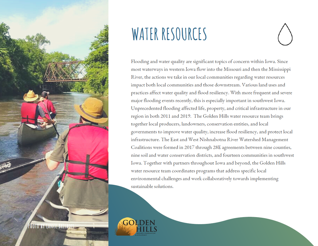
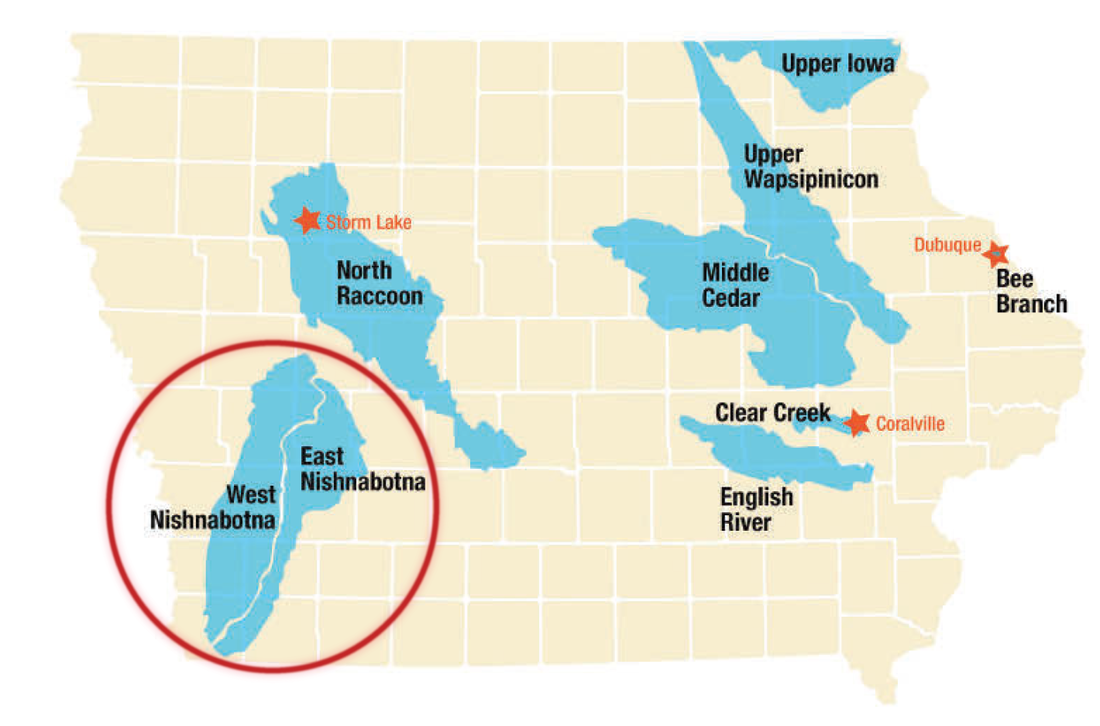
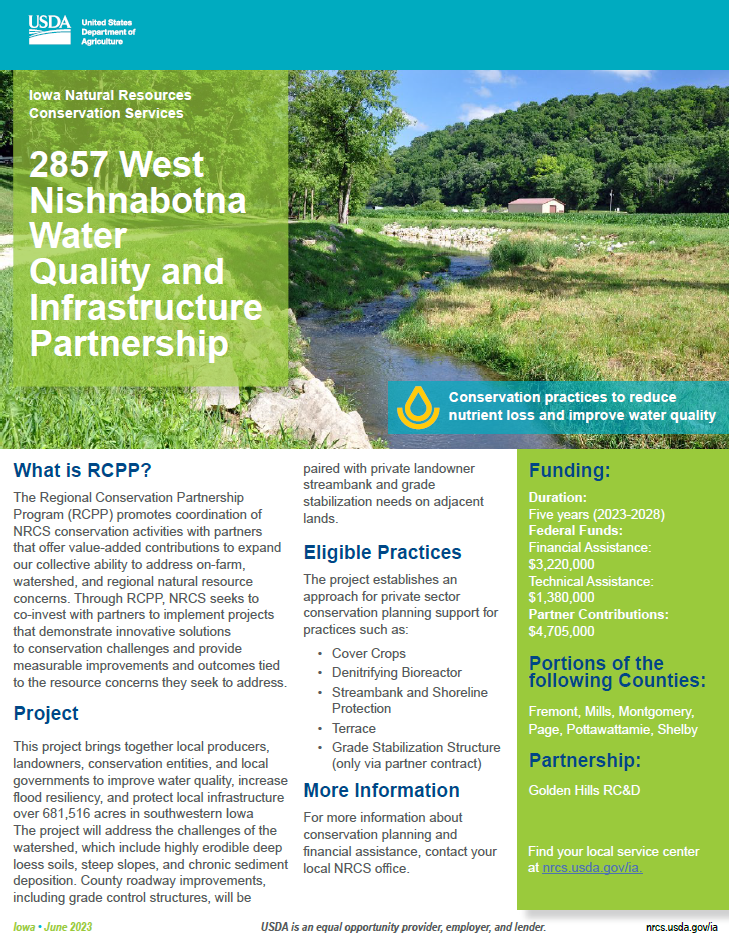
Golden Hills received funding from the Regional Conservation Partnership Program for the West Nishnabotna Water Quality and Infrastructure Partnership. This project aims to improve water quality, increase flood resiliency, and protect local infrastructure across a 681,000-acre project area in southwestern Iowa. The project will complement similar activity on private lands in service of making the landscape more resilient in the face of increasing catastrophic flooding events. The partnership will report project outcomes through monitoring and modeling of soil and nutrient loss reductions.
Landowners within the West Nishnabotna watershed (refer to map below to see if your property is within the watershed) are eligible for cost share to implement conservation practices to improve water quality, reduce erosion, and improve flood resiliency. There are several practices available for cost share, including cover crop, terracing, streambank stabilization, and many more. If you are interested in learning more about the West Nishnabota RCPP project, join a free virtual informational meeting this Thursday at 12:00 PM on Zoom. If you plan to attend the meeting, please fill out this contact form. 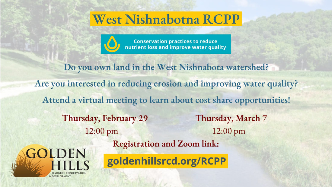
Click for more information
The HUC-12 watersheds in the map below are included in the West Nishnabota Water Quality and Infrastructure Project. If your land is located within any of these red outlined areas, you may be able to receive cost-share for conservation practices like terracing, cover crop, and more!
Golden Hills will be organizing more informational meetings in the future, as well as field days to learn about the various conservation practices that are available for cost share. Stay tuned to our social media channels for future events about the West Nishnabotna RCPP project to improve water quality and reduce erosion!
The Western Skies Scenic Byway, dedicated in 1998, is among the first state-designated scenic byways in Iowa. Western Skies offers travelers several easy opportunities to venture off the beaten path. The Byway is 142 miles long, traveling through Harrison, Shelby, Audubon and Guthrie Counties, including 14 rural towns. It is easily accessible to travelers from both Interstates 80 and 29.
The byway allows visitors to explore and take in a scenic journey along Iowa’s landscapes of rolling hills, working farmsteads, and tranquil small town life
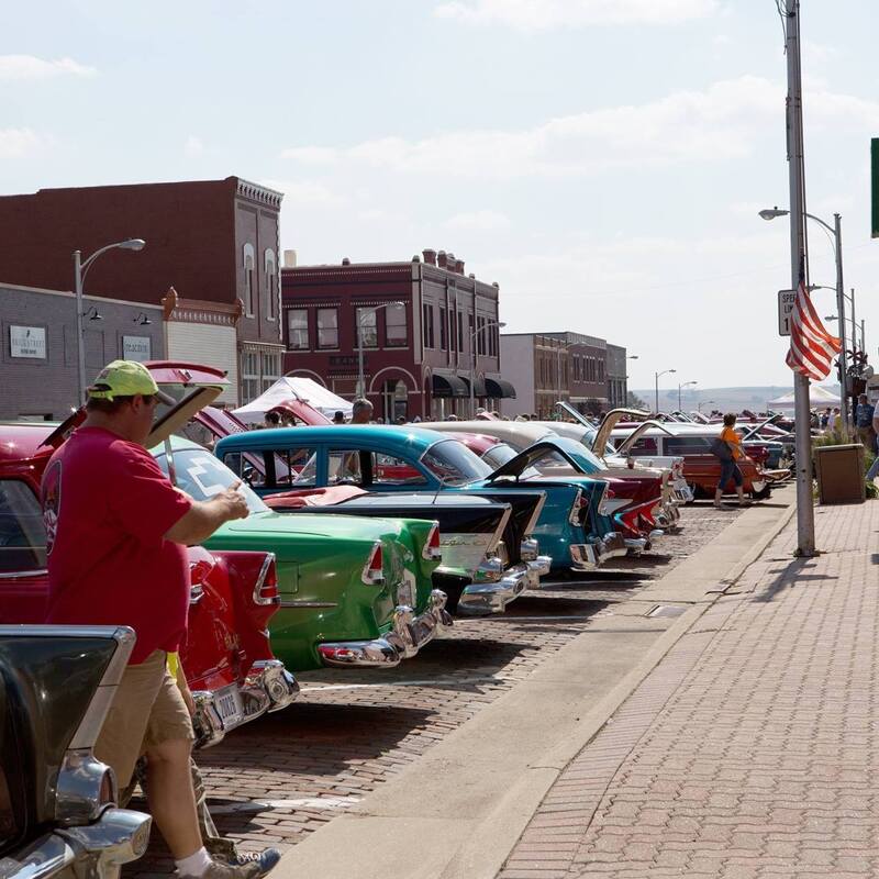
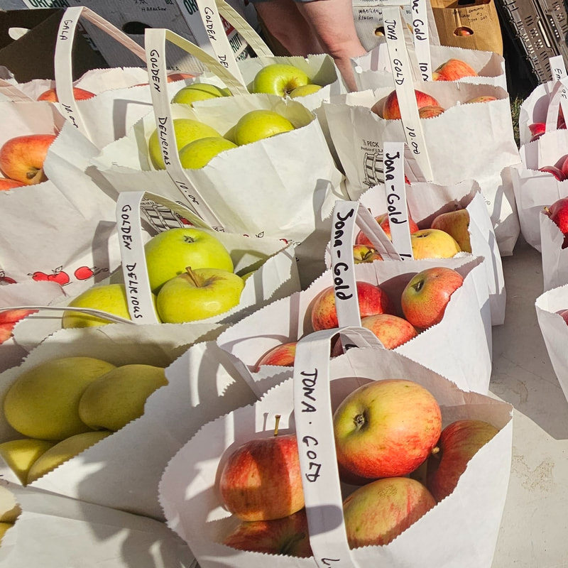
1. Go local at Woodbine Applefest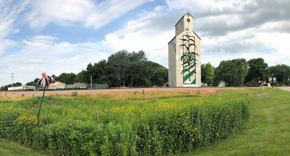
From pies to pastries to slushies to caramel, the last Saturday of every September is the Woodbine Applefest, dedicated to a festival of everything APPLE!
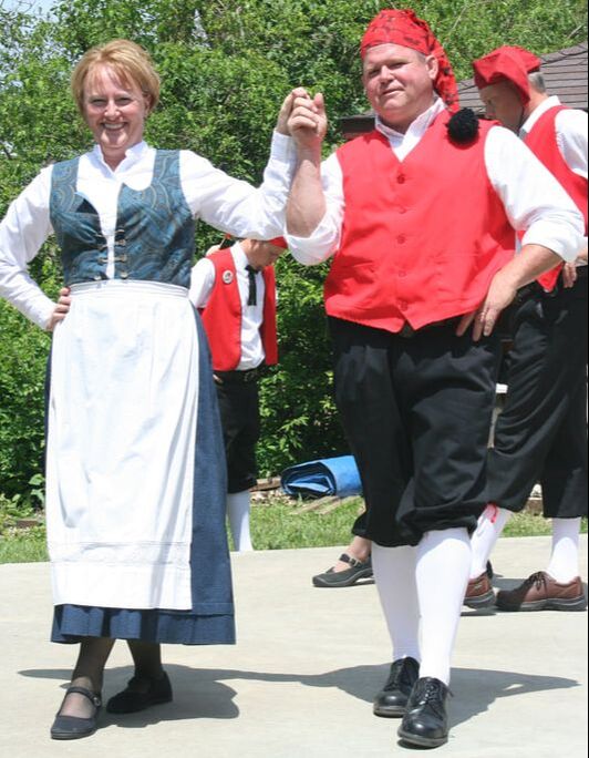
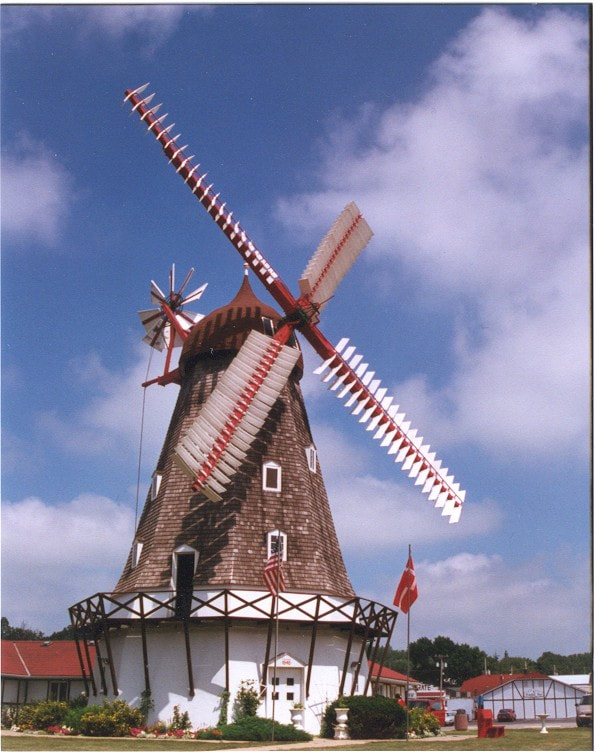
2. Celebrate Danish heritage at Tivoli Fest
Tivoli Fest is a Danish-American celebration held every year on Memorial Day weekend in the Danish Village of Elk Horn, Iowa.
Events include:
3. Walk amongst wildflowers at remnant prairies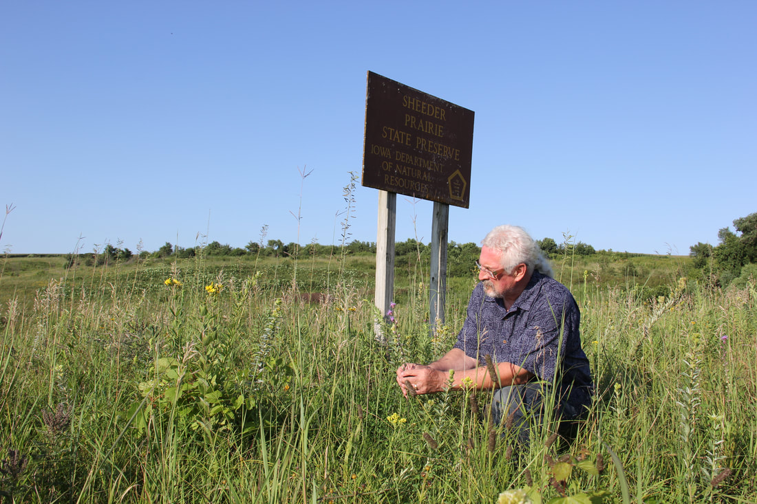
Dinesen Prairie in Shelby County consists of 20 acres of native prairie that has never been turned by a plow. There are 114 types of plants here, and springtime brings forbs like prairie phlos and indigo bush. Summertime flowers include Canada anemone and leadplant, and fall brings blooms like asters and blazing star. Typical grasses found here are porcupine grass and prairie horsetail. Habituating the prairie are birds including bobolink and meadowlark, as well as many small mammals like the white-tailed jackrabbit and the meadow vole. The preserve was dedicated as a biological state preserve in 1977 by Derald Dinesen, whose gravestone is on top of a hill in the preserve, from which a view of the prairie is seen.
Greenwood Cemetery Prairie sits next to one of the older cemeteries (1860s) in Guthrie County. Bundt Prairie is a rare gem located where a 1-room country school originally sat. A variety of native prairie grasses and forbs inhabit both sites. Bring your identification book and your camera to capture the beauty of this remarkable ecosystem. While you hike the area, keep in mind that what you see of the prairie plants is typically only 1/3 of the plant's height. Some plants have root systems that stretch over 15 feet into the ground. Friendly reminder: Please don't pick any wildflowers and be respectful of cemetery rules. Sheeder Prairie State Preserve is a 25-acre tallgrass prairie. It is located five miles west of Guthrie Center in Guthrie County. The property was purchased in 1961 by the Iowa Conservation Commission from Oscar and Clara Sheeder, the son and daughter-in-law of the original homesteader. It was dedicated as a biological state preserve in 1968. This preserve lies within the Southern Iowa Drift Plain, a landform region of gently rolling terrain. Over 200 plant species are found in this preserve, including thirty grasses. 4. Snap a selfie with Albert the Bull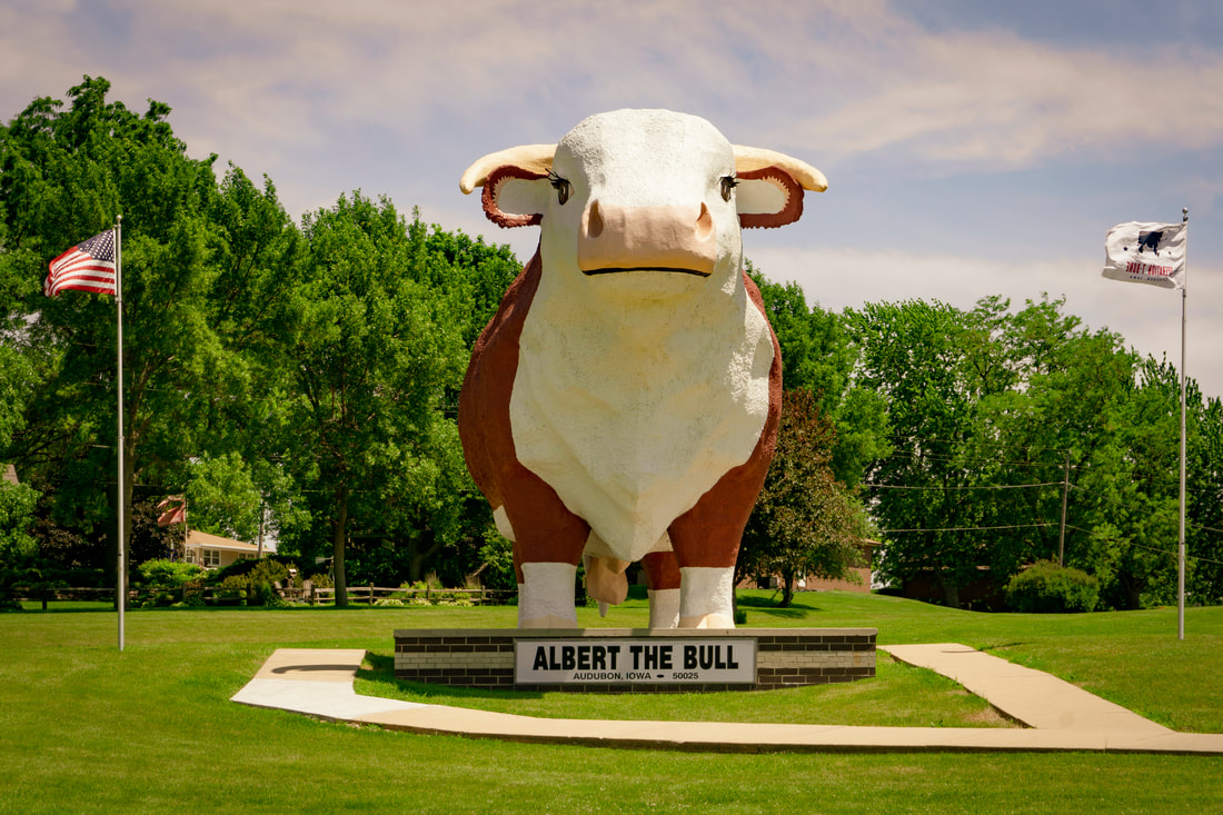
Albert, the "World's Largest Bull," is a Hereford bull nine times larger than life with a 15-foot span between his horns. It took 65 gallons of paint to cover Albert with the red and white colors of the Hereford breed. The steelwork for his frame was created from abandoned Iowa windmills.
Albert is celebrating his 60th birthday in 2024! Visit Audubon County this summer to snap a selfie with the birthday boy! 5. Hike at Whiterock Conservancy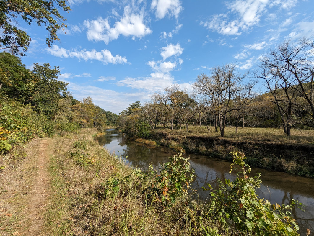
Whiterock Conservancy is a 5,500 acre, nonprofit land trust dedicated to providing educational and recreational opportunities for the public, improving and protecting the land through conservation, and demonstrating sustainable farming methods.
Explore over 40+ miles of hiking, running, mountain biking, and equestrian; set up camp in the RV or tent camping areas; or enjoy the comforts of home in one of several vacation rentals. Hikers, runners, and walkers are welcome on any of Whiterock's trails. There is no use fee, but a suggested donation of $5 can be made at any trailhead. 6. Ride the T-Bone Trail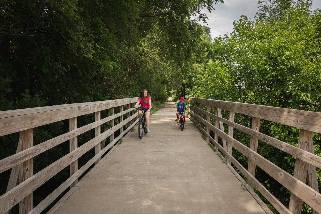
The T-Bone Recreation Trail runs from the city of Audubon into Cass County. It is named for the T-Bone event that originated in the 1950s in Audubon when the farmers all loaded up their cattle on to a train and rode with them to market in Chicago. The trail totals 21 miles; 16 of these miles are located in Audubon County. The trail begins in Audubon and goes south through Hamlin, Exira, Brayton, and into Cass County. Eventually, the trail will go into Atlantic, Iowa. The trail is hard surface making it great for biking, walking, running, and rollerblading. Most of the trail is asphalt with a few miles in the middle made out of concrete.
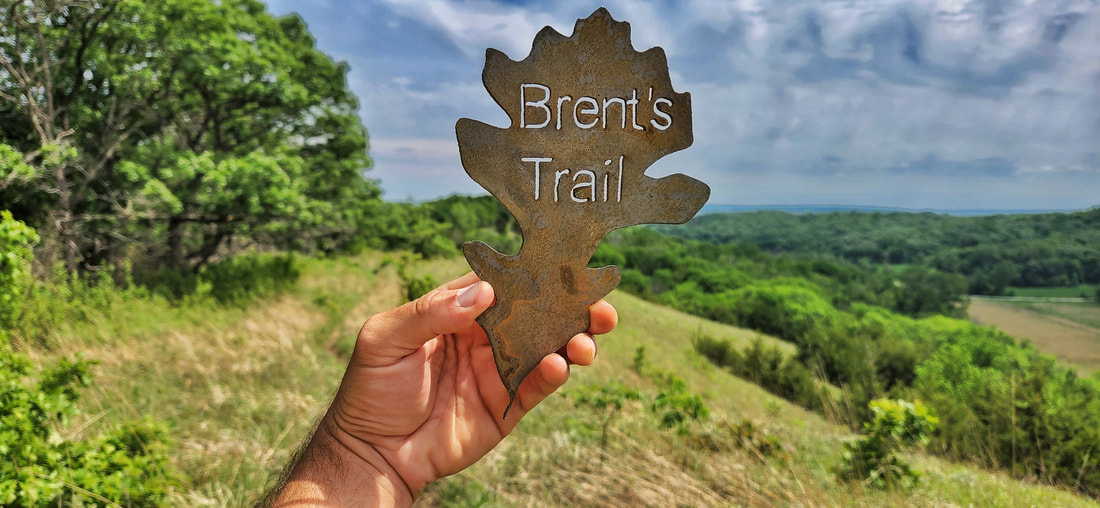
Photo by Lance Brisbois
Get away ... from everything. When it's time to escape from the hustle and the bustle of your everyday life and finally spend some time in serenity, the Loess Hills are your destination. Unique, breathtaking scenery ... original, authentic, "down-home cooking" ... remarkable attractions ... and most of all, peace. Check these seven things off your Loess Hills bucket list!
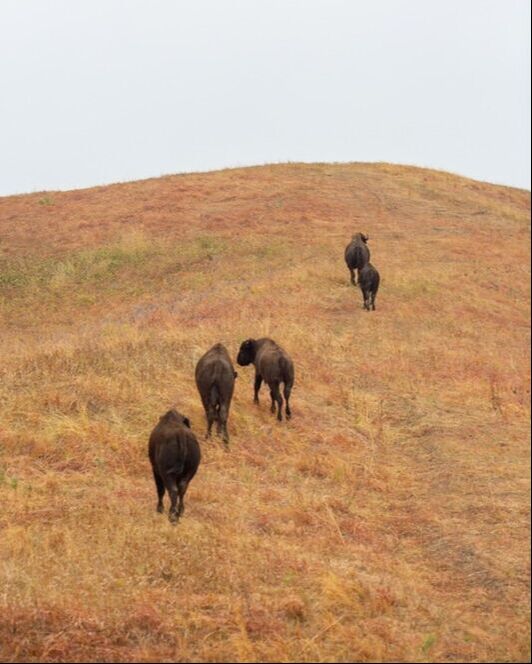
1. See the bison at Broken Kettle Grasslands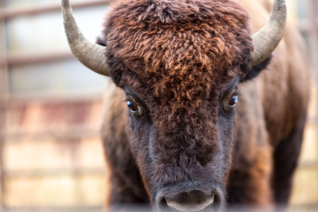
Photo by Geof Fischer
The best way to see the bison is to drive the Butcher Road Connection loop of the Loess Hills National Scenic Byway. The Aalfs Family Preserve Overlook is located on Butcher Road and provides a stunning view of Broken Kettle Grasslands.
2. Learn about the Loess Hills at Dorothy Pecaut Nature Center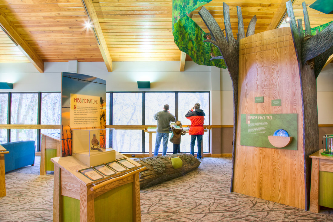
© 2016 Kenneth West
Hike a trail and let prairie grasses tickle your chin. Explore bur oak forests with 150-year old giants. Climb the ridges and imagine what Lewis and Clark might have seen. Learn at the award-winning Dorothy Pecaut Nature Center located in the heart of the Loess Hills.
The center is over 14,000 square feet large and boasts an amphitheater, playground, exhibits, gardens, and hiking trails, among other amenities. Admission is free to the general public. Hiking trails connect to adjacent Stone State Park. Woodbury County Conservation staff offer a wide array of environmental education and outdoor recreation programs. 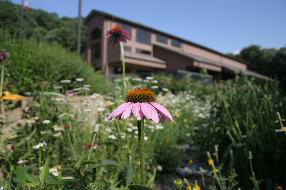
Coneflower outside Dorothy Pecaut Nature Center
3. Visit the Loess Hills Scenic Overlook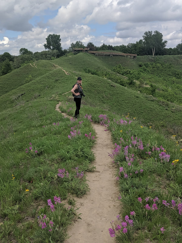
Photo by Seth Brooks
When approaching the western border of Iowa, travelers are often intrigued by the view of a most extraordinary landscape of prairie and forest covered steep bluffs, narrow ridges and rolling hills. Dubbed "The Spot" by local legend Walter Ordway, Jr., the Loess Hills Scenic Overlook is a must-see stop on the Loess Hills National Scenic Byway.
The accessible overlook platform offers 360-degree views of the Loess Hills in Monona County. There is a short, one-mile loop that traverses the ridge, then dips into the valley before returning on another ridge. The trail also connects to other trails in the Loess Hills State Forest. 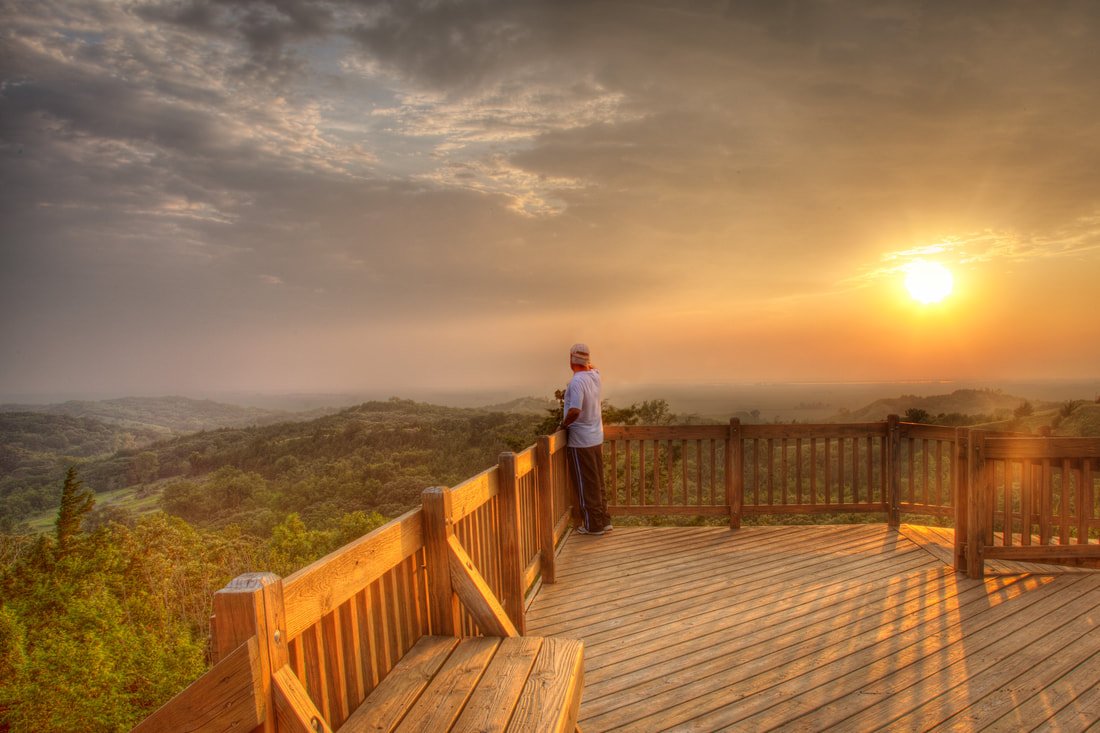
© 2016 Kenneth West
4. Hike Brent's Trail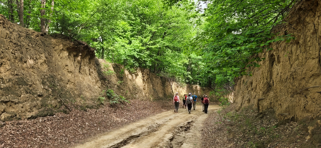
Photo by Lance Brisbois
Brent's Trail is an 8-mile hiking trail connecting Harrison County Conservation’s Murray Hill Scenic Overlook and Gleason-Hubel Wildlife Area via the Loess Hills State Forest. The trail is the start of a proposed trail that will eventually connect the northern and southern ends of the State Forest. The trail is named after longtime state forester Brent Olson.
Brent's Trail is open to the public daily, year-round. Hikers should note that this is a rugged hike on dirt and grass surfaces. Water and restrooms are not available, so hikers should come prepared for a true backcountry experience unlike anything else in Iowa. Primitive, dispersed camping is allowed within Loess Hills State Forest. The route is marked with metal oak leaf signs. A southern extension was added in 2021, allowing hikers to extend their hike for an 11-mile trek. 5. HawkWatch at Hitchcock Nature Center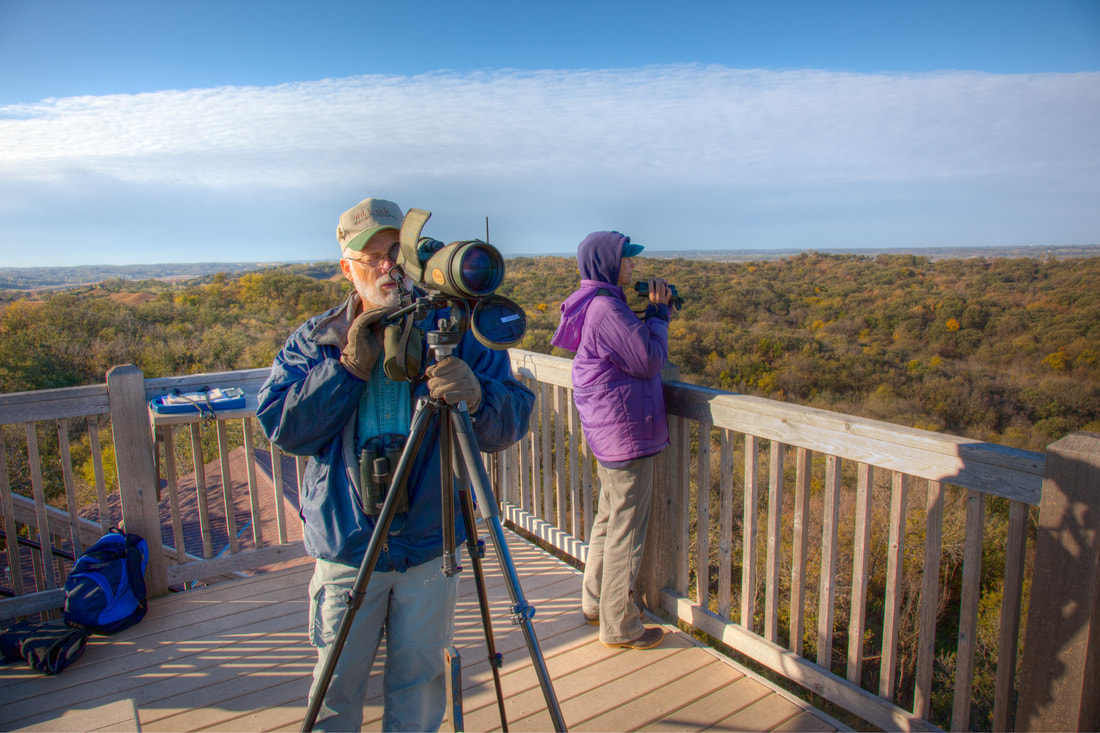
© 2016 Kenneth West
Every year, from September through December, birds of prey enthusiasts gather at Hitchcock Nature Center to observe & count thousands of eagles, hawks, and other raptors as they migrate south.
Hitchcock HawkWatch is a volunteer-driven research project based at Hitchcock Nature Center in Honey Creek, Iowa. Staffed by dozens of volunteers and one paid seasonal employee, this hawk watch effort counts an average of 13,000 migrating raptors annually. Occupying the observation tower at Hitchcock Nature Center, our team watches from a vantage point providing a 360-degree view of the Missouri River Valley. The official hawk watch season is from September 1st through December 13th annually. Hitchcock Nature Center is an optimal location to view the annual migration of numerous species of raptors due to its position in the Missouri River Valley. Here prevailing westerly winds create near-perfect conditions for migrating raptors as they soar on thermals and topographically-induced upward wind deflections on their journey south. 6. Explore B-Level Roads
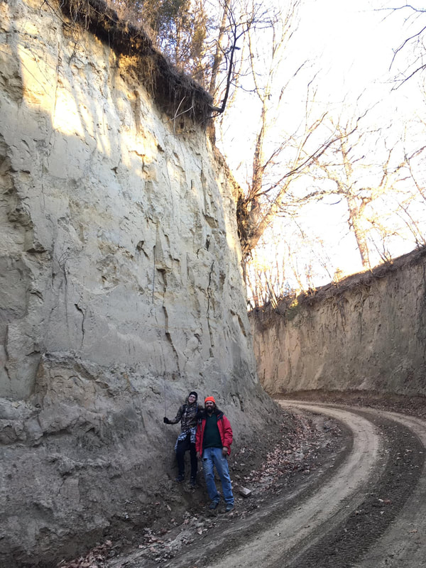
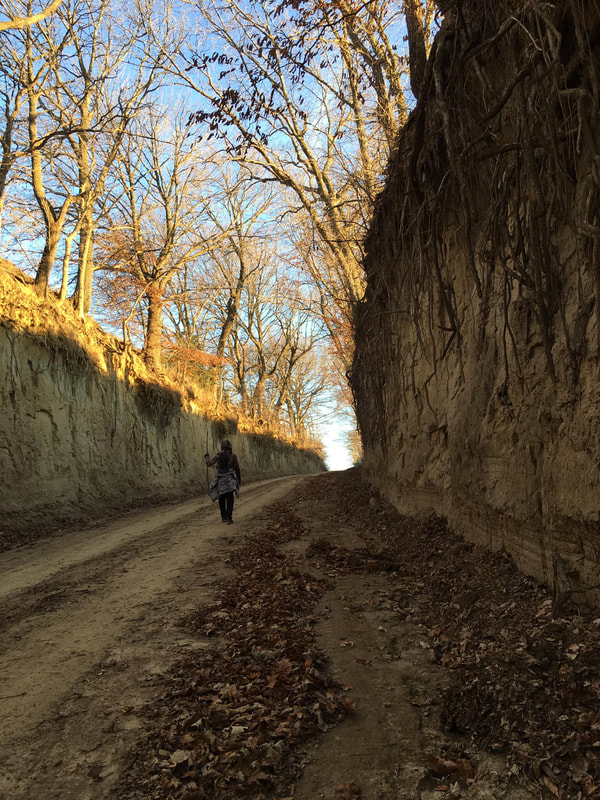
Vertical faces of loess in road cuts and gully walls have been known to stand for more than a hundred years, in contrast to loess slopes, which are prone to some of the highest erosion rates in the country. The style of roadcuts throughout the Loess Hills reflects the capacity of exposed loess to maintain nearly vertical faces.
Many impressive, nearly vertical road cuts can be seen on several level B, minimum maintenance roads in the Loess Hills. Mills County, in particular, has several of the most impressive level B roads such as Hastie Hollow (Pathfield Road) and Lake Hill (Raleigh Road) are very fun to drive. Fulton Ave in Harrison County is another highlight. One note of caution: don't drive level B roads if they are muddy. All-wheel drive and high clearence are also recommended. Check outIowa Road Trip's favorite level B roads in the Loess Hill.s. 7. See the fall colors at Waubonsie State Park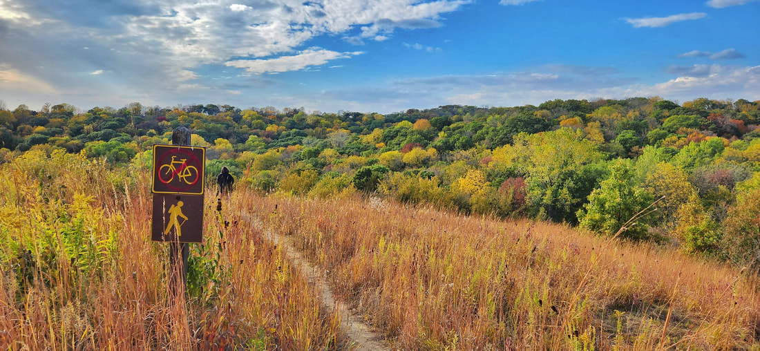
Photos by Lance Brisbois
As a site on the Lewis and Clark Historic Trail, Waubonsie State Park in southwest Iowa is known for its exceptional vistas of Iowa’s unique Loess Hills and the Nebraska plains. Its extensive trail system offers something for the avid mountain biker, equestrians looking for a relaxing ride, or anyone eager to hike amongst the tranquil surroundings of the park’s ridgetop prairies and shaded woodland valleys. With nearly 2,000 acres of recreational opportunity and quiet beauty, Waubonsie State Park is an Iowa gem waiting to be explored.
Peak fall color viewing at Waubonsie State Park is typically from mid to late October. Check the Iowa DNR's Fall Color Report for updates and estimates on peak color. 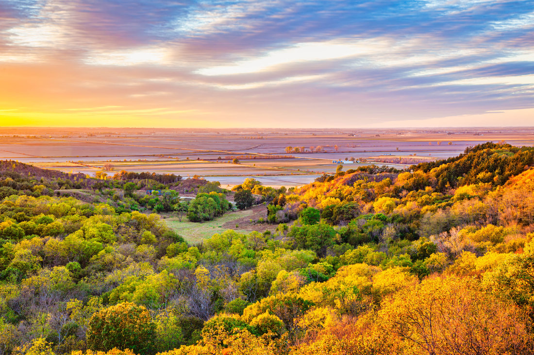
© 2016 Kenneth West
|
Archives
June 2024
Categories
All
|
 RSS Feed