|
by Seth Brooks I was living in a sleepy fishing village on the northwestern coast of Spain when COVID-19 shut down the world. Locked in a tiny rooftop apartment with no internet, and isolated from family and friends by thousands of miles, I decided to return home once Spain’s strict quarantine restrictions were loosened. Once at home in Nebraska, I found myself locked down again as a second wave swept across the nation just as winter set in. Another months-long quarantine would have been devastating to both my physical and mental health, so I searched for places to get outside and hike despite the dropping temperatures and dwindling daylight. I preferred Nebraska winters to the oppressive summers, anyway. My first instinct was to head to the Loess Hills. I was familiar with the region having worked in western Iowa as a political organizer upon graduating from Creighton University in 2004. When I walked the Camino de Santiago in Spain for the first time in 2009, I dreamed of blazing a path for a thru-hike up the spine of the Loess Hills (Kelly Madigan did so herself in 2020 when she created the LoHi Trail). The problem I encountered now, however, was the lack of centralized and comprehensive information about hiking trails in the Loess Hills. I spent hours searching the websites of the various organizations that managed land in western Iowa. Instead of getting outside, I wasted time inside figuring out where I could hike. Thus, an idea was born: to create a guide of the hiking trails in the Loess Hills. I gathered all the information I could about land open to the public where hiking was allowed: public lands managed by the Iowa Department of Natural Resources or county conservation boards and conservation areas managed by private organizations such as The Nature Conservancy. I also decided to include the eastern side of the Missouri River Valley, as the Nebraska bluffs offered various opportunities for outdoor recreation. Then, I walked. More than three hundred miles atop prairie grass ridges and through the wooded hollows of the Loess Hills. I recorded and mapped each hike, noting waypoints to provide detailed directions and distance. Since I began in early November, I have compiled a list of more than fifty hikes on both sides of the Missouri River Valley. Ultimately, I hope to publish these hikes in a guidebook with information about the unique geology, biology, and history of the Loess Hills. In the meantime, I am glad to share some of my favorites hikes that I have recorded over the previous seven months. The first trail is one that I have done several times since I began this project. The Loess Hills Ridge Trail is located in the Preparation Canyon Unit of the Loess Hills State Forest. This hike traverses two ridges that rise near Jones Creek Pond, where there is parking and a shelter, an ideal place to have a picnic after finishing the hike. This loop can be followed in either direction but clockwise leaves the easiest part at the end. 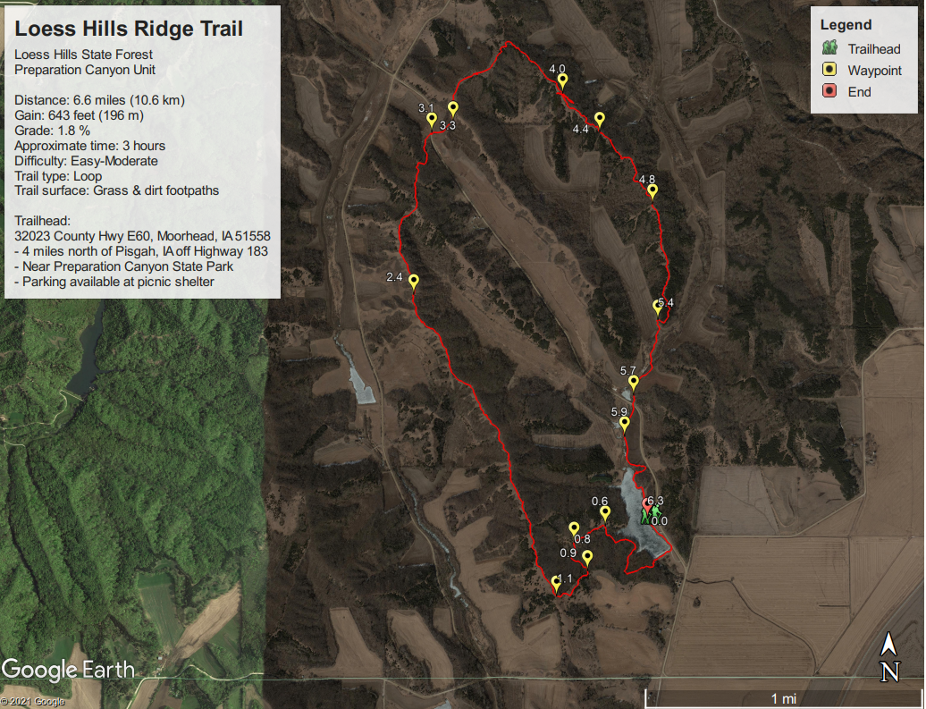 Map of Loess Hills Ridge Trail Beginning at the picnic shelter, the trail borders the southern end of Jones Creek Pond before entering the woods on the western side of the pond. You can explore the trail system of Jones Creek Pond as it meanders through a young forest of basswood, bur oak, bitternut hickory, black walnut, and other woodland species. Eventually, you want to take the trail named Prairie Pass (trail map with trail names available here) as it heads south to the forest’s edge. Here, the trail turns west and climbs uphill to reach the first ridge of this hike. 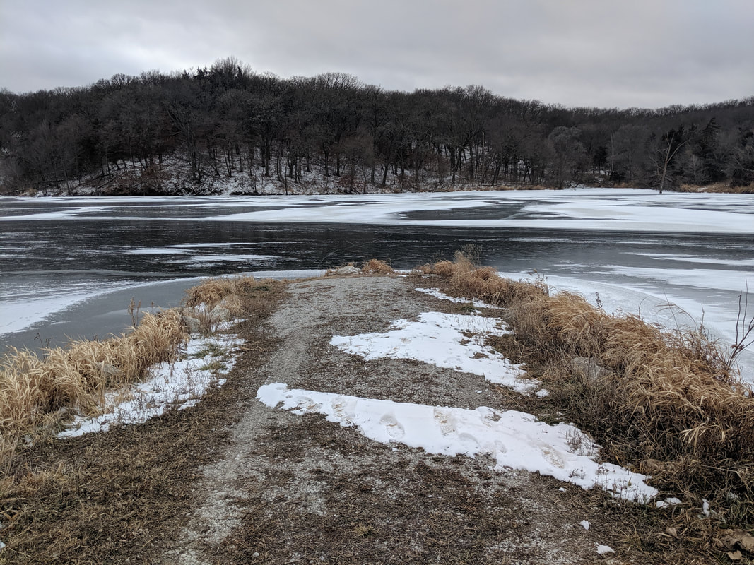 Jones Creek Pond in winter. Photo by Seth Brooks 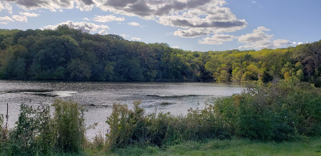 Jones Creek pond in the fall. Photo by Lance Brisbois Once you reach the top of the ridge, the trail heads north along a classic example of the prairie ridges that once dominated the Loess Hills. When Lewis and Clark first came upon them, they dubbed them “bald hills” as the woodland invasion had not yet begun in earnest. Today, unfortunately, it is becoming exceedingly difficult to encounter prairie remnants in the Loess Hills. Enjoy the uninterrupted path along the ridge’s crest with expansive views west. Both ridges this hike follows provide clear examples of the encroaching woodlands as they move uphill, particularly on their eastern slopes. As you walk north along the western ridge on this loop, notice bur oak and other trees on your right as the woodland comes right up to the ridgetop. On your left, you will find the invasive eastern redcedar, either solitary or in dense stands, that are the target of the prescribed burns and chainsaws of state forest rangers because it shades out native prairie grass. Several skeletal remains of dead eastern redcedars dot the western slope of the first ridge. 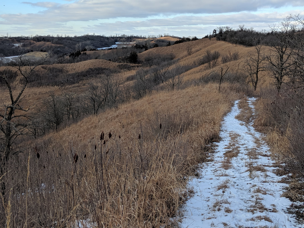 View from the Ridge Trail. Photo by Seth Brooks 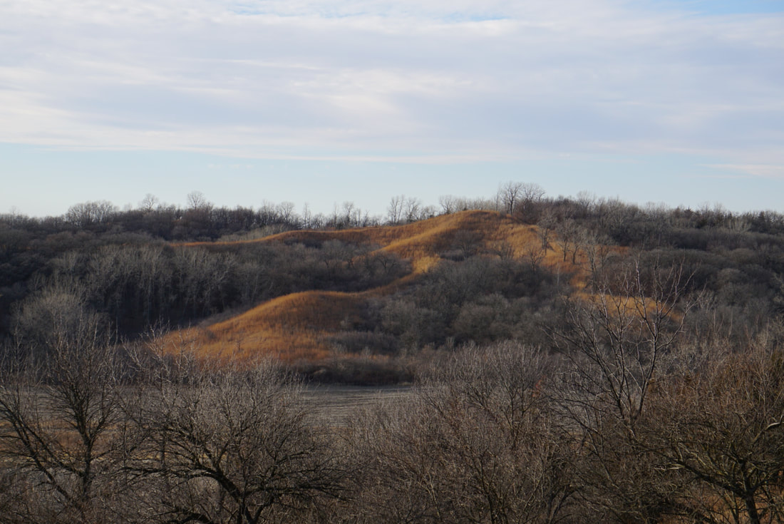 View from the Ridge Trail. photo by Seth Brooks 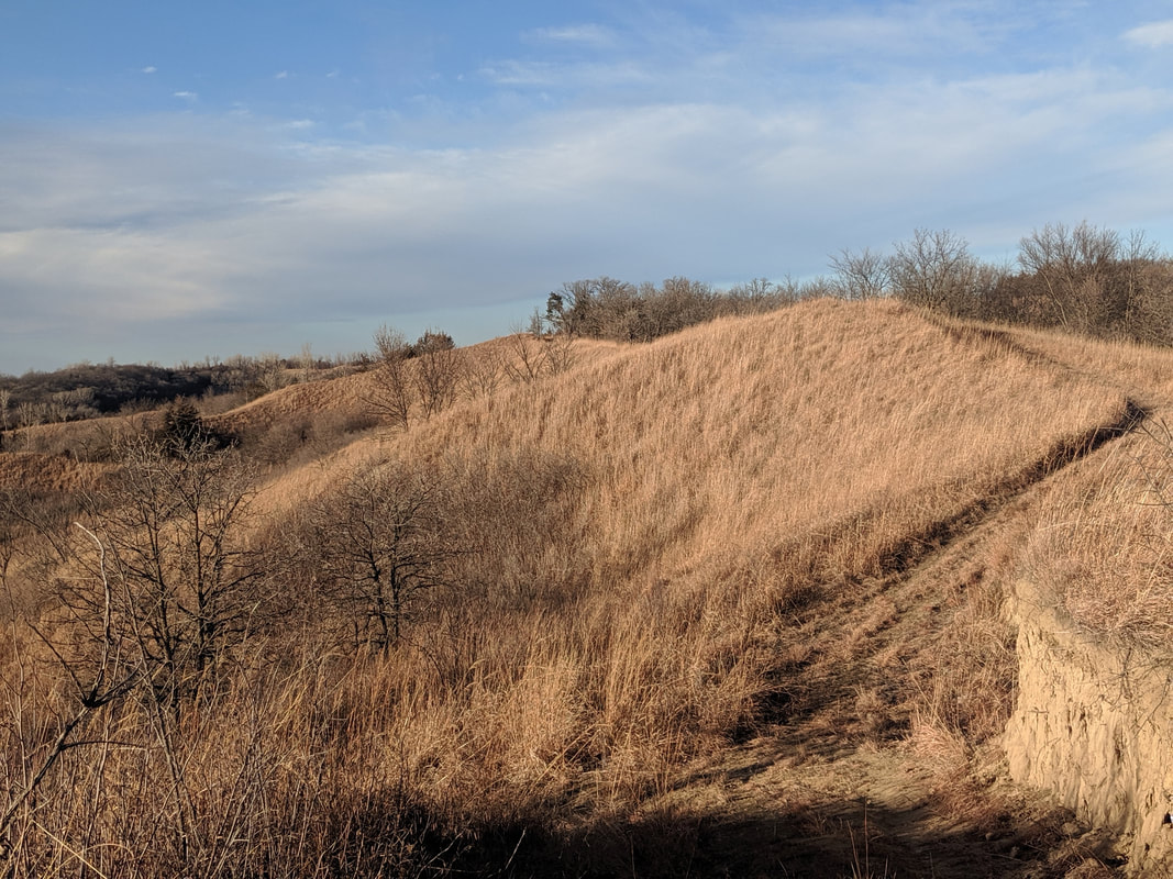 View from the Ridge Trail. photo by Seth Brooks 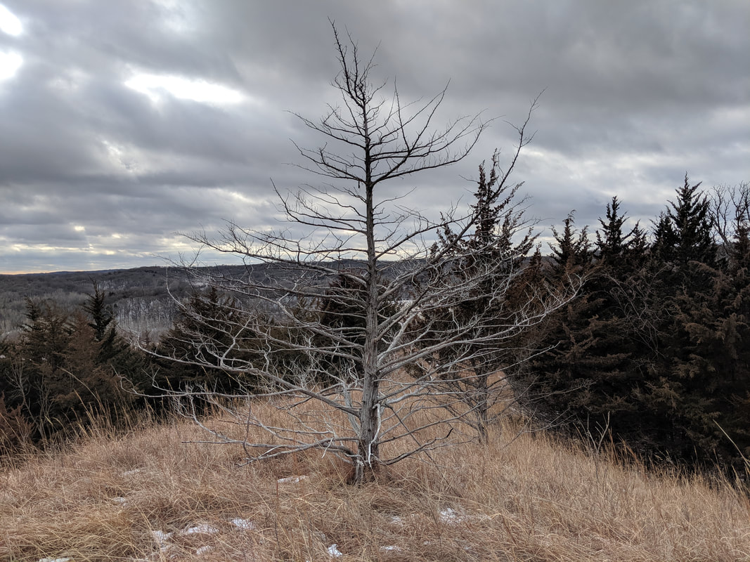 A dead cedar tree along Ridge Trail. photo by Seth Brooks After two miles, the trail descends from the ridge through some trees to County Highway E60 and, after crossing the road, climbs to reach a clearing. Your initial instinct is to follow the ridge on your right heading south. Instead, continue ahead through a broad prairie heading due northeast. The trail bends southeast and becomes less open. Eventually, you will reach a confusing intersection. Don’t take the hard right that descends to the cornfield. Also, resist the urge to continue straight on the wide path under trees; this leads to another cornfield on the eastern side of the ridge. You want to stay on top of the ridge, so look for a narrow footpath cut deep into the earth that climbs up onto the grassy ridge. This intersection sorely needs a trail marker to point hikers in the right direction. Once on top of the ridge, the trail comes and goes but the path is simple: continue atop the ridge heading southeast. The occasional Iowa DNR trail marker will confirm that you are on the right track. When you reach a deep roadcut in the ridge, the plan is the same: climb down, then back up to continue along the crest of the ridge heading southeast. 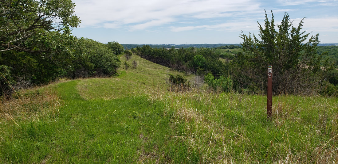 View from the Ridge Trail in the spring. photo by Lance Brisbois 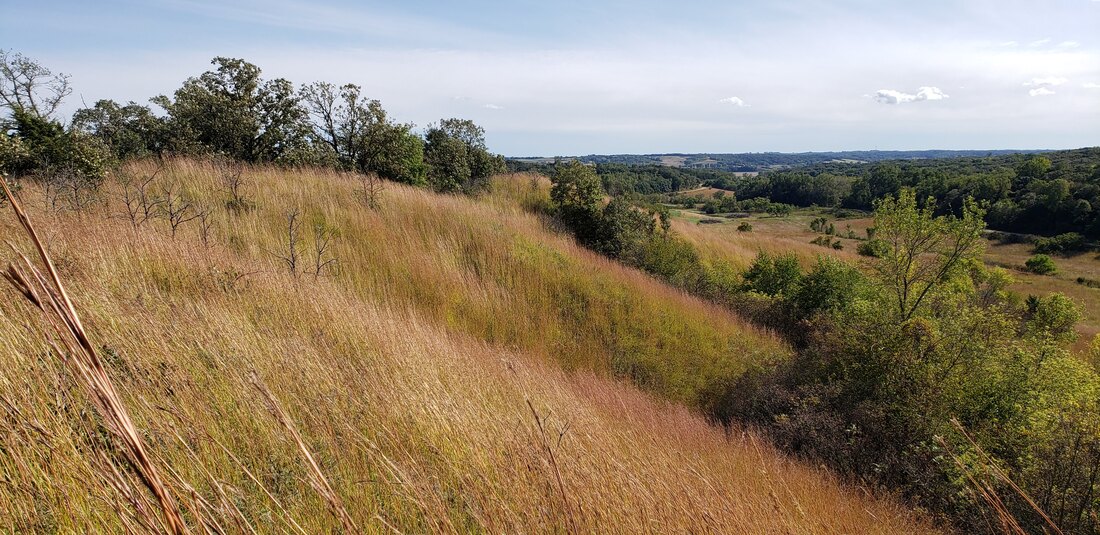 View from Ridge Trail in the fall. Photo by Lance Brisbois 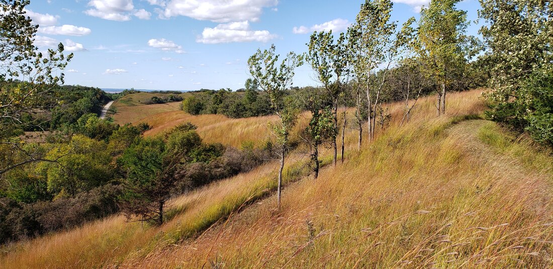 View from Ridge Trail in the fall. Photo by Lance Brisbois 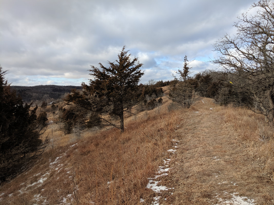 View along Ridge Trail. Photo by Seth Brooks View along Ridge Trail. Photo by Seth Brooks Eventually, the prairie is overtaken by eastern redcedar on both sides of the ridge. This forested section is an excellent spot to encounter wildlife. In December 2020, as I stopped along this section to check the Iowa DNR map and my GPS location, I heard a rustling in the woods on the eastern slope. I continued to look down until, from out of the redcedars, bounded a large whitetail deer with majestic antlers. The buck stopped in the middle of the trail, a mere twenty yards from me. We made eye contact, and before I could snap a photograph, it snorted and galloped down the western slope through the dense redcedar forest. Later, in January, dozens of turkey vultures took flight from the redcedar tops as I walked along the trail below. The trail descends under the canopy of the trees until it reaches a cornfield. Head southwest toward a gravel road, following it to reach a gate and a small parking turnout off County Highway E60. Cross the road with Jones Creek Pond ahead of you, staying on the trail on the eastern side of the pond. 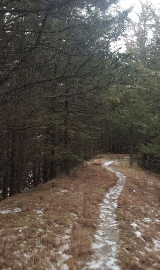 Cedar canopy along part of the trail. photo by Lance Brisbois Before you return to the shelter and parking area, look for signs of a busy beaver or groundhog that has gnawed several trees to stumps. If you didn’t bring a picnic, two good places to stop for food or refreshment in nearby Pisgah are Dave’s Old Home Cafe or Sportsman Bar, the latter located in the same building as Loess Hills Country Corner. Pisgah is also home to the Loess Hills State Forest Visitor Center, an excellent source of information on the state forest and Loess Hills in general.  Loess Hills exhibit at Brent Olson Visitor Center in Pisgah. Photo by Lance Brisbois 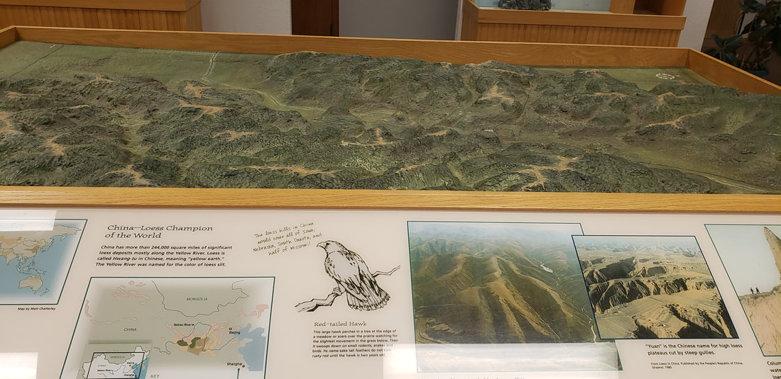 Loess Hills exhibit at Brent Olson Visitor Center in Pisgah. Photo by Lance Brisbois More info & resources:
6 Comments
Carrie
6/15/2021 01:08:54 pm
Seth, great article on this area. Thanks for taking me to Loess Hills this past May. It is an enchanting area that I knew nothing about when growing up less than an hour away. Look forward to exploring it more on future trips back home!
Scott
6/15/2021 01:28:26 pm
Great article! Been to Preparation Canyon once, need to go back soon.
Carmella Schultes
10/1/2021 04:00:31 pm
This is very interesting. I'm thinking of coming from northwest Iowa this fall to explore some trails. I would like to follow your blog.
Sandy
10/31/2021 01:41:16 pm
I just finished walking the loop trail. It was far more that I expected. Thanks for the article.
Fran
12/19/2021 08:06:51 pm
This is such beautiful creative writing about a magical place - your language begs for hikers living in the Midwest to visit! How are the trails in winter? Leave a Reply. |
Archives
June 2024
Categories
All
|
 RSS Feed