|
Solvitur ambulando – It is solved by walking. Many people, including great thinkers and philosophers, swear by this mantra. Walking is known to provide innumerable benefits for our physical, mental, and spiritual health. It is also an excellent way to boost creativity, focus, and even productivity. When a global pandemic caused Iowan Kelly Madigan to cancel her 2020 travel plans, she took a long walk—270 miles—through the Loess Hills of western Iowa. The Loess Hills are a globally significant landform. Loess soil deposits of this depth are unique to the western hemisphere; in fact, China's Loess Plateau is the only place in the world where you will find larger ones. The region is known for beautiful vistas, small communities, farmland, woodlands, and prairies, and is popular for tourists looking to escape to rural and wild spaces. The Hills encompass parts of seven counties: Plymouth, Woodbury, Monona, Harrison, Pottawattamie, Mills, and Fremont. Several coordinated conservation and recreation efforts have and continue to take place in the landform, such as the Loess Hills National Scenic Byway, Loess Hills Alliance, and Loess Hills Fire Partners. While more than 99.9% of Iowa’s native prairies have been removed from the landscape, the majority of the state’s remnant prairies are located in the Loess Hills. Similarly, although Iowa ranks nearly last in public land access, the Loess Hills offer some of the largest public conservation and recreation areas in the state. These public areas include many miles of hiking trails, including some of the longest and most rugged trails in the Midwest. Over the years, many people have discussed the idea of a through hiking trail, similar to the Appalachian Trail, connecting these parks and trails over the the length of the Loess Hills. Until recently, however, the concept had not been attempted. In October and November 2020, Kelly Madigan hiked the entire length of the Loess Hills, totaling about 270 miles miles. She visited public conservation and recreation areas as much as possible, hiking on gravel, dirt, and paved roads in between. She calls it the LoHi Trail, short for Loess Hills. Kelly used Facebook to post regular photo, video and text updates during her journey, which took just over six weeks. She hiked between 2 and 10 miles per day and took off eight days. She has already gained significant interest from outdoor enthusiasts and is spurring a conversation like never before. A new LoHi Trail Facebook group gained more than 100 new members in its first two weeks and continues to grow. Kelly was born in Massachusetts. Her father was a career Air Force officer and the family moved around frequently as Kelly was growing up, which may have contributed to her longing for a deep sense of place. Today she lives in the heart of the Loess Hills in rural Monona County. Kelly and her partner Doug Chafa and his daughter, Isabel, live near the Turin Wildlife Management Area, which Doug helps manage with his job as Wildlife Biologist with Iowa Department of Natural Resources. Kelly says, “I had visited the Loess Hills for decades, and then lived in them, and spent time hiking them. I trained to become a wildland firefighter and volunteered to assist with prescribed fire. I attended the Loess Hills Prairie Seminar year after year, and occasionally helped hand-collect local ecotype seed. Still, I wanted to understand the Loess Hills better. Literally, I wanted to know what I was standing on, what was under me. Experiencing the hills on foot was an opportunity to take in information at a human pace, and form a relationship with this landform that would live in my muscle memory. I had dreamed about it for a long time. The set of conditions the pandemic created made it seem like it was time.” While she often walked alone, Kelly occasionally had people join, with Doug and Isabel being her most frequent companions on the trail. Patrick Swanson, a Loess Hills landowner and author of a book about his story, wrote this article about a similar idea after attending the opening hike for Brent’s Trail in 2019. Brent’s Trail is part of a trail envisioned by staff at Loess Hills State Forest connecting the largest public land complex in the Loess Hills with a hiking trail from Preparation Canyon on the north to the southern end of the Mondamin Unit. Brent’s Trail is currently just under 8 miles with an additional 5 miles under construction. The route Kelly hiked already exists. It uses a combination of paved, gravel and dirt roads connecting existing public lands and trails wherever possible. Existing trails in the region are maintained by state, county, and municipal government agencies, nonprofit land trusts and trail groups. Roadways and streets are also maintained by the state DOT, county roads departments, and cities. Parts of the on-road route follow the Loess Hills National Scenic Byway’s main spine and excursion loops, which offer some of the most beautiful views in the Midwest. Kelly paid special attention to respecting private property, always seeking permission before walking on any privately owned land. The route Kelly hiked may not necessarily be the best route, but she tried to choose lower-traffic and more scenic routes over busy highways and the most direct routes. Kelly’s walk began at the Iowa/South Dakota border at Millsite Access on the Big Sioux River in Plymouth County. She followed the roads east through Westfield. County roads led her through The Nature Conservancy’s Broken Kettle Grasslands, the largest remnant prairie and roadless area in all of Iowa. South of Broken Kettle, her route went through Five Ridge Prairie State Preserve, The Nature Conservancy’s Knapp Prairie and Hummel Tract, Heendah Hills State Preserve, Mount Talbot State Preserve, Stone State Park, and Sioux City Prairie Preserve. 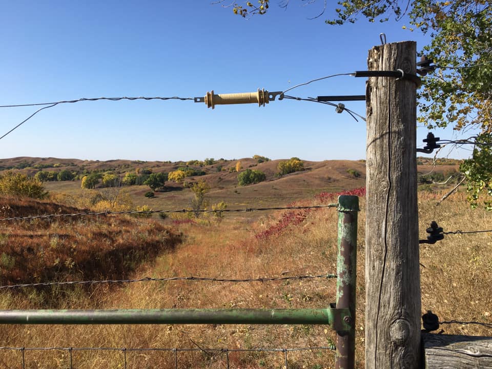 Broken Kettle Grasslands. photo by Kelly Madigan 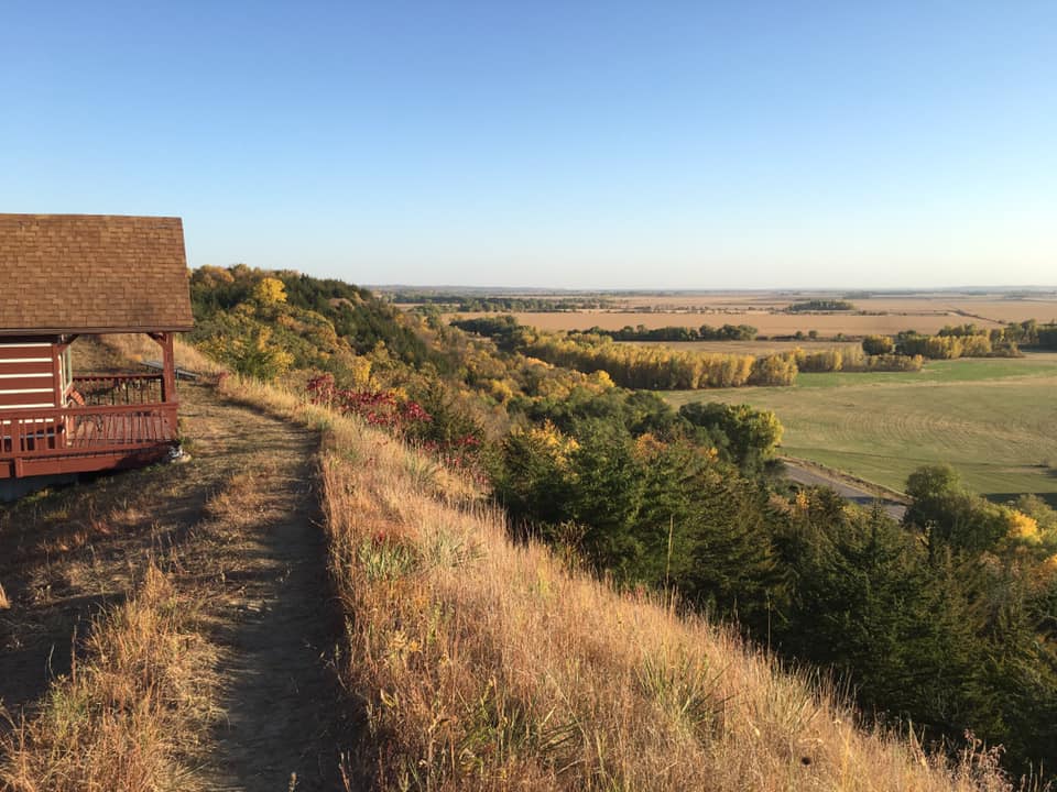 Five Ridge Preserve. Photo by Kelly Madigan. 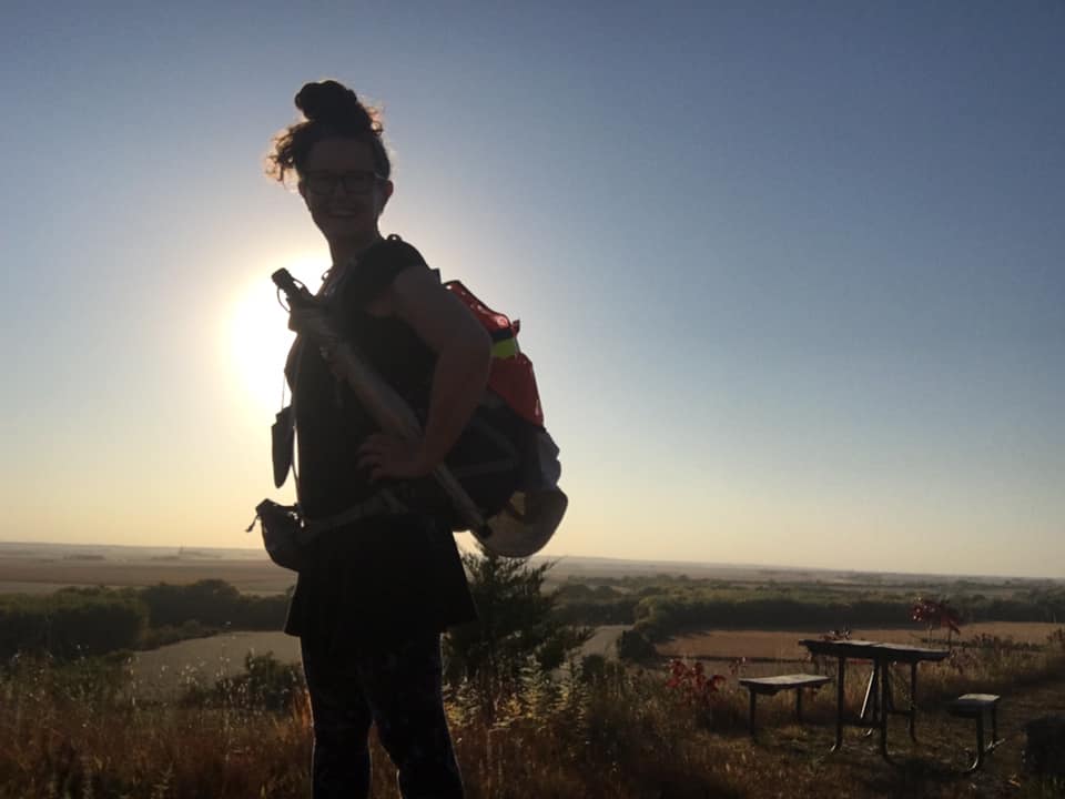 Kelly hiking in Plymouth County. Photo by Doug Chafa. 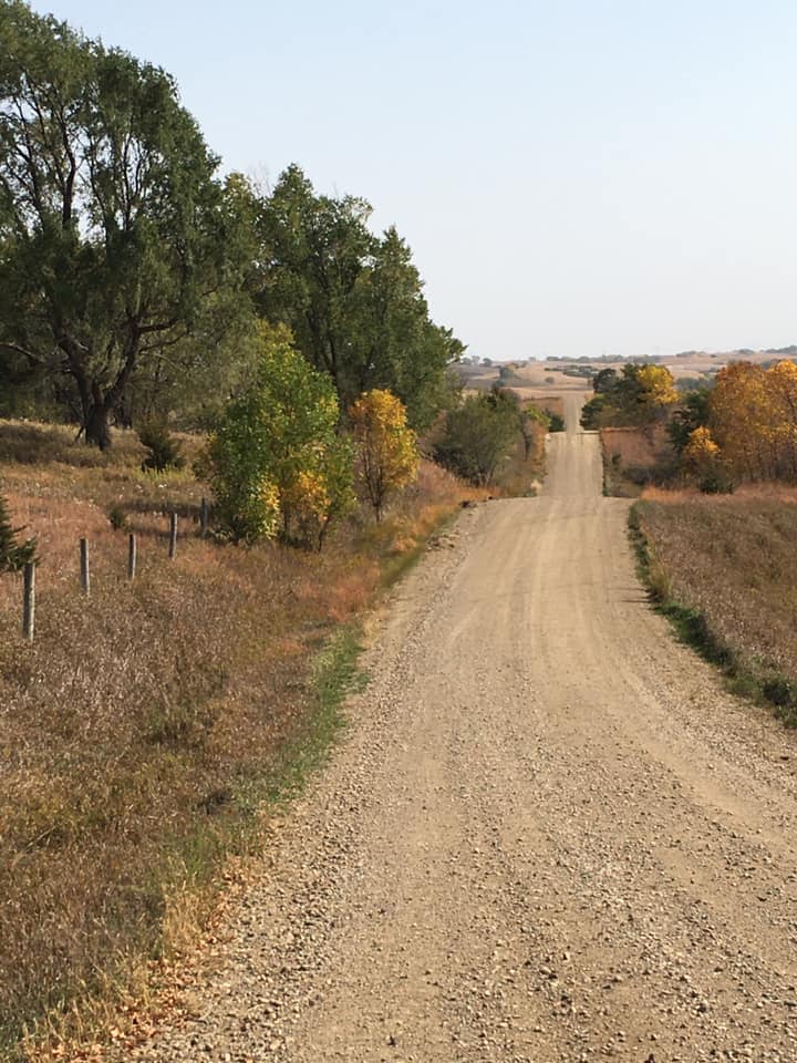 Gravel road in Plymouth County. Photo by Kelly Madigan. 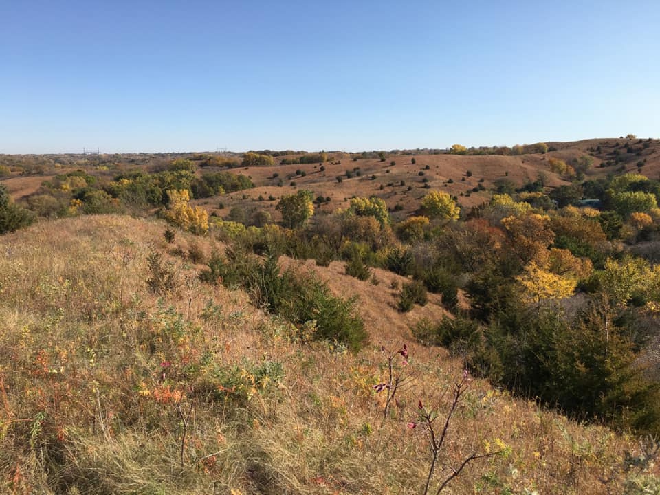 Plymouth County Loess Hills. Photo by Kelly Madigan. Sioux City, the largest city on her route, offered a very different experience than the wild, rural terrain to the north. Fortunately, some recreational trails and sidewalks are available to provide hikers a more pleasant walk through the city’s downtown, industrial, and residential neighborhoods. This urban stretch includes Perry Creek Trail, South Ravine Park, Cone Park, and Sertoma Park. In Sioux City, her route crossed the Floyd River and was at its closest point to the Missouri River. After Sioux City, the LoHi route continues southeast out of Sergeant Bluff. 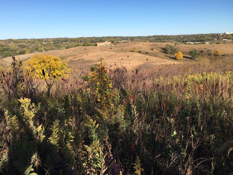 Sioux City Prairie. Photo by Kelly Madigan. 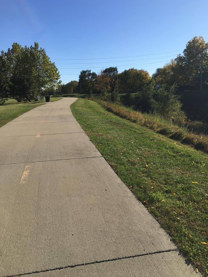 Perry Creek Trail in Sioux City. Photo by Kelly Madigan. 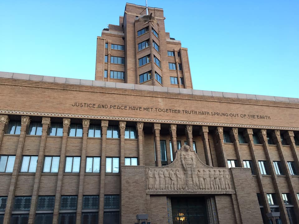 Woodbury County Courthouse in Sioux City. Photo by Kelly Madigan. In rural Woodbury County near Smithland, Kelly passed through Woodbury County Conservation Board’s Oak Ridge Conservation Area, Fowler Preserve, and Southwood Conservation Area. Kelly got permission to hike through a small parcel owned by Iowa Natural Heritage Foundation (INHF) connecting these public areas. 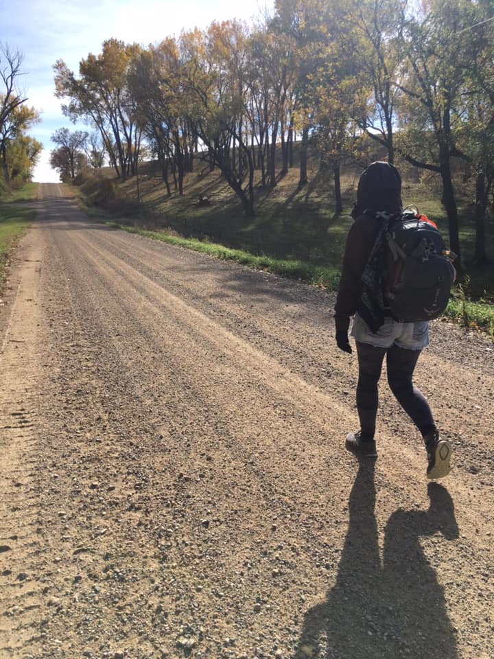 Kelly walking in rural Woodbury County. Photo by Doug Chafa. 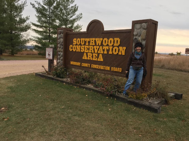 Kelly poses at the entrance to Woodbury County's Southwood Conservation Area. Photo by Doug Chafa. After the small town of Rodney, her route passed through Monona County Conservation’s Peter’s Park/Rodney Pits, Iowa DNR’s Loess Hills Wildlife Area and Turin Preserve Wildlife Management Area (WMA). South of the unincorporated community of Turin and the Maple River, Kelly hiked through INHF’s Monona Complex, which she got permission to hike. 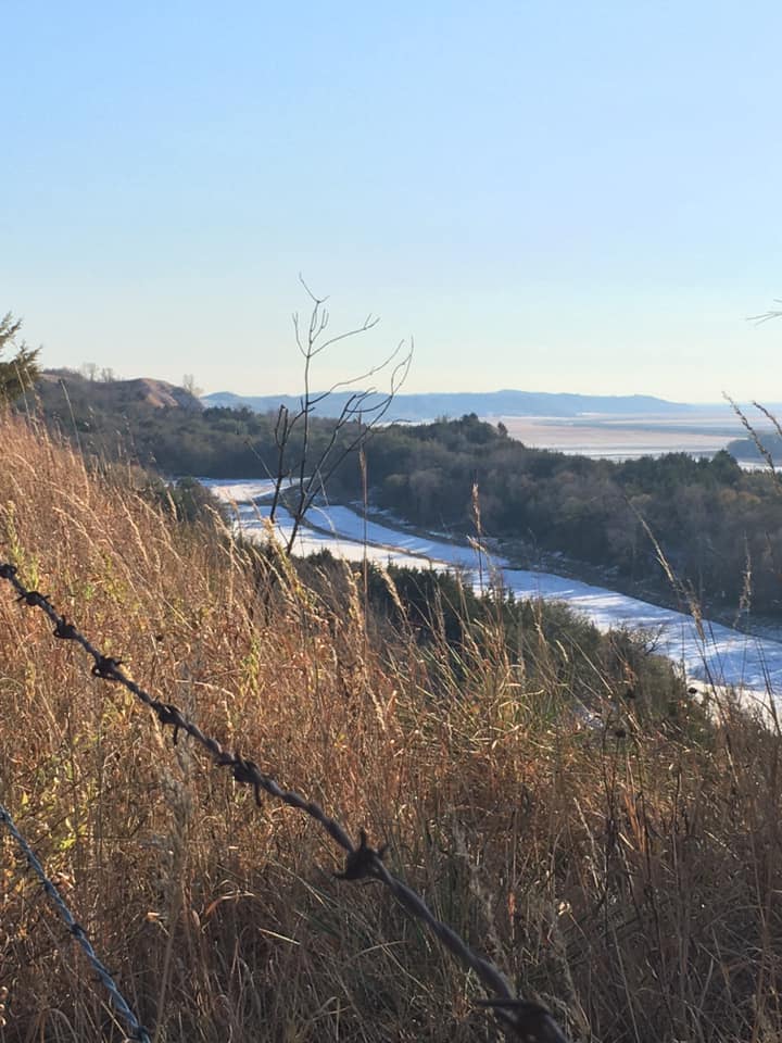 Monona County Loess Hills. Photo by Kelly Madigan. 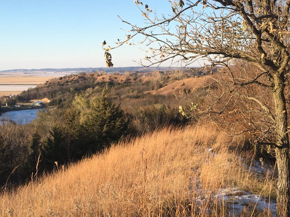 Monona County Loess Hills. Photo by Kelly Madigan. 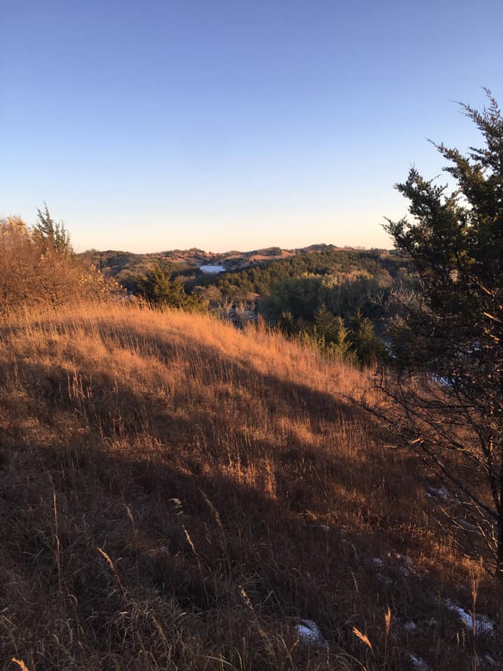 Monona County Loess Hills. Photo by Kelly Madigan. In southern Monona and northern Harrison counties, Kelly hiked through three of Iowa DNR’s four Loess Hills State Forest units (Preparation Canyon, Little Sioux, Mondamin), including part of Brent’s Trail. 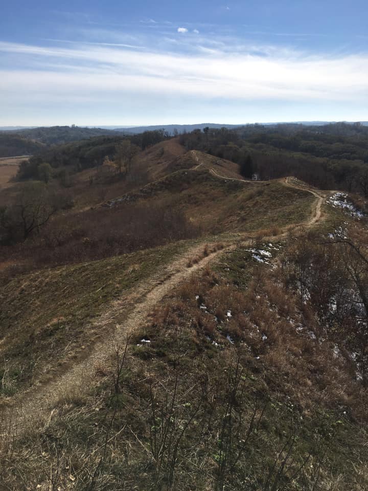 Loess Hills Scenic Overlook, Monona County. Photo by Kelly Madigan. 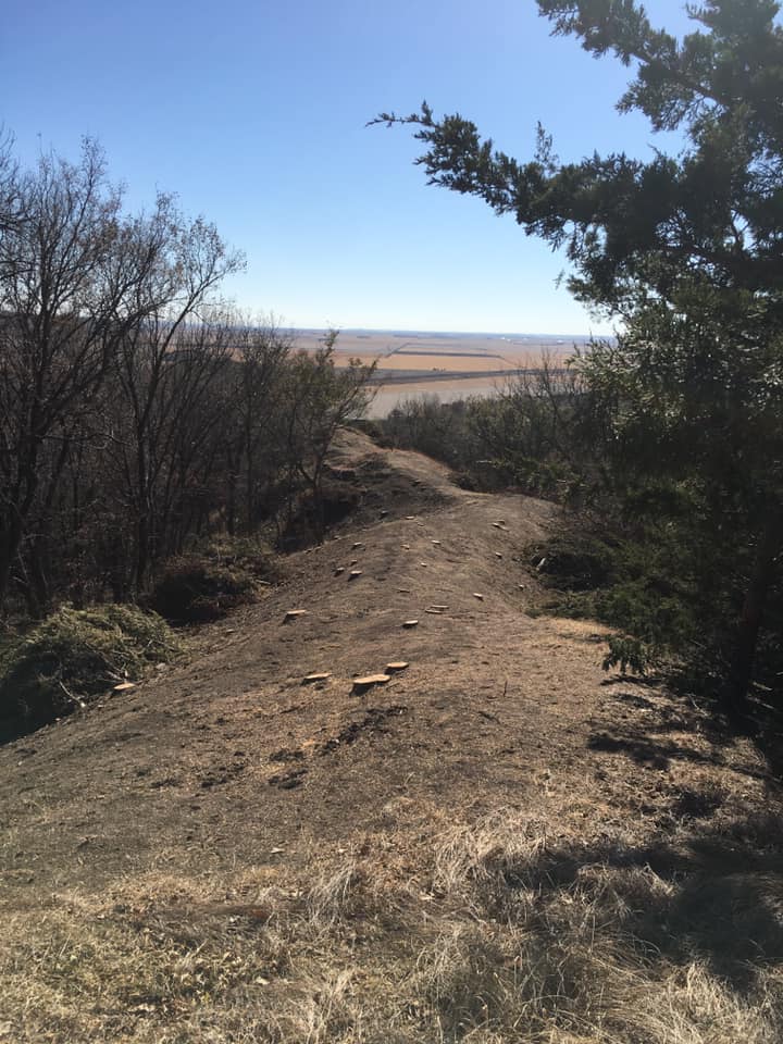 A recently-cleared hiking trail within the Little Sioux Unit of Loess Hills State Forest, Harrison County. Photo by Kelly Madigan. 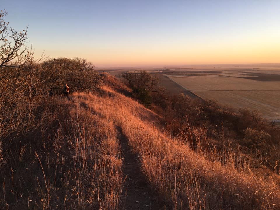 Mondamin Unit of Loess Hills State Forest. Photo by Kelly Madigan. 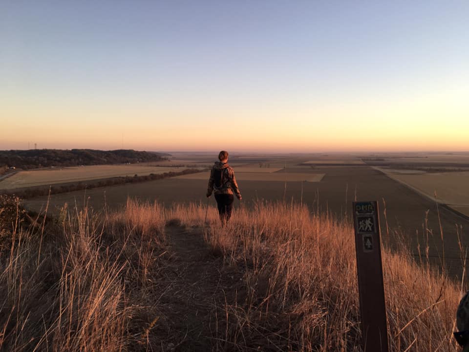 Mondamin Unit of Loess Hills State Forest. Photo by Kelly Madigan. 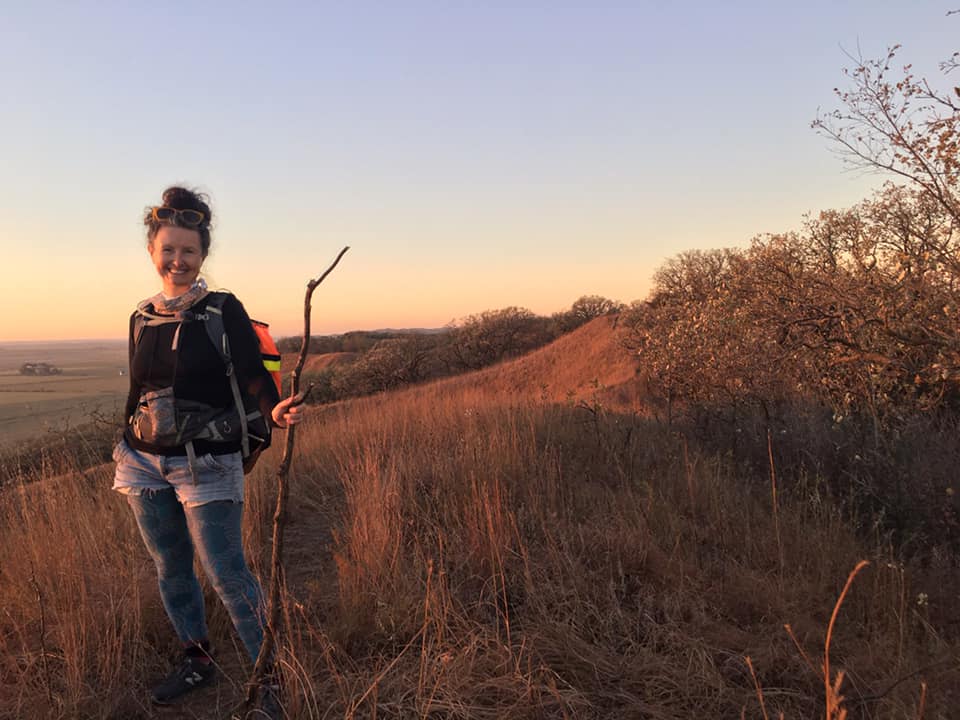 Kelly at the Mondamin Unit of Loess Hills State Forest. Photo by Doug Chafa. Kelly's route through Harrison County also included Harrison County Conservation Board’s Gleason-Hubel Wildlife Area and Old Town Conservation Area, Soldier and Boyer river crossings, and the city of Missouri Valley. 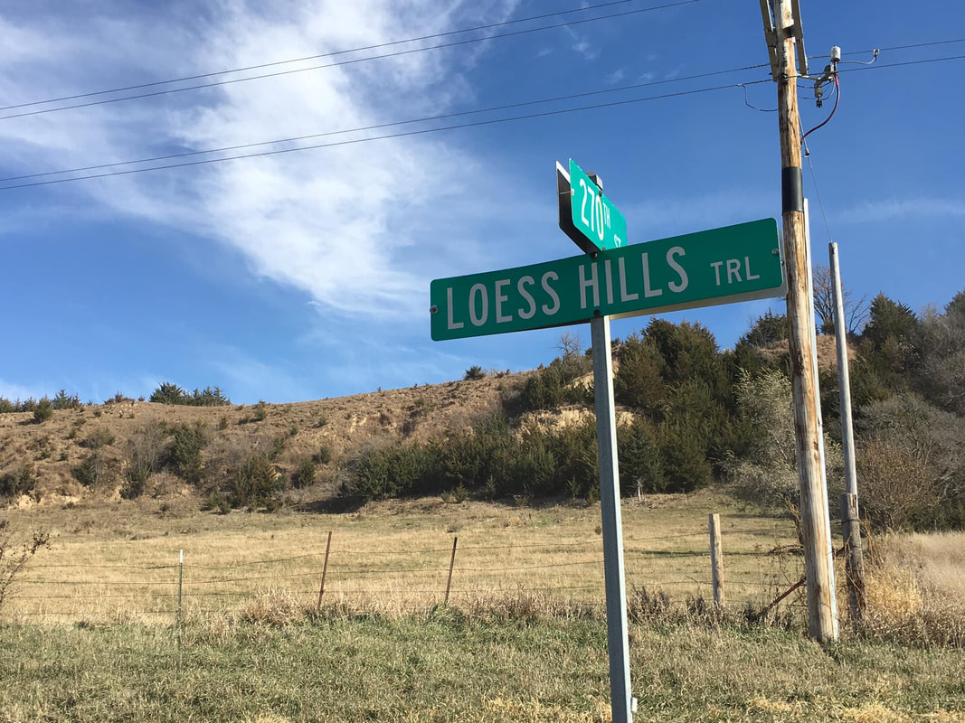 Loess Hills Trail in Harrison County. Photo by Kelly Madigan. 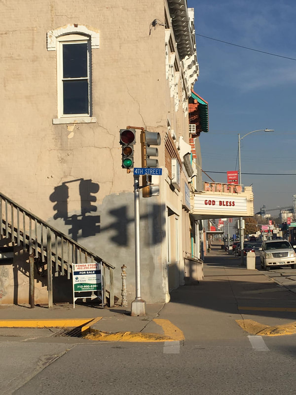 Downtown Missouri Valley. Photo by Kelly Madigan. 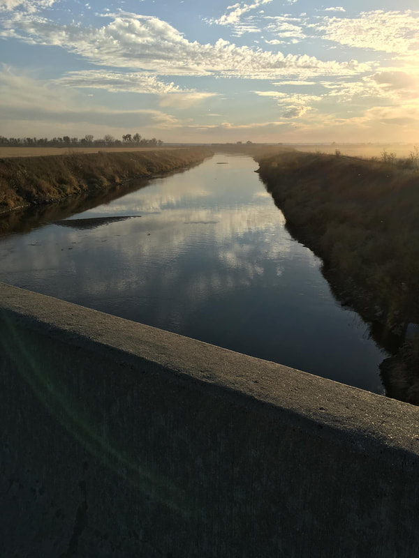 Boyer River in Harrison County. Photo by Kelly Madigan. In Pottawattamie County, Kelly hiked through unincorporated Honey Creek and then used hiking trails at the popular Hitchcock Nature Center, managed by Pottawattamie Conservation. She then hiked through the town of Crescent and into Council Bluffs, entering at Lewis & Clark Monument Park. Parts of Council Bluffs are similar to Sioux City, with a large urban center surrounded by older traditional neighborhoods and newer suburbs. Kelly's route went through Council Bluffs’ Fairmount Park trails, Vincent Bluff State Preserve’s prairie, and the Wabash Trace Nature Trail. 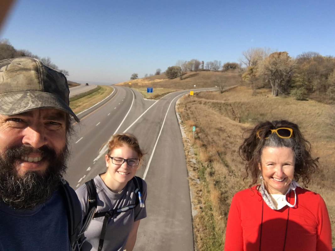 Crossing Interstate 880 in Pottawattamie County. Photo by Doug Chafa. 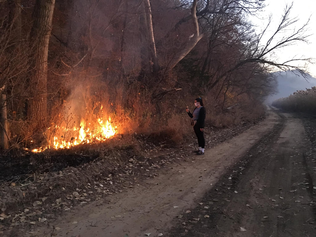 Kelly happened to be at Hitchcock Nature Center when county conservation staff and agency partners were conducting a prescribed fire. The fire was intentional and controlled. Photo by Kelly Madigan. 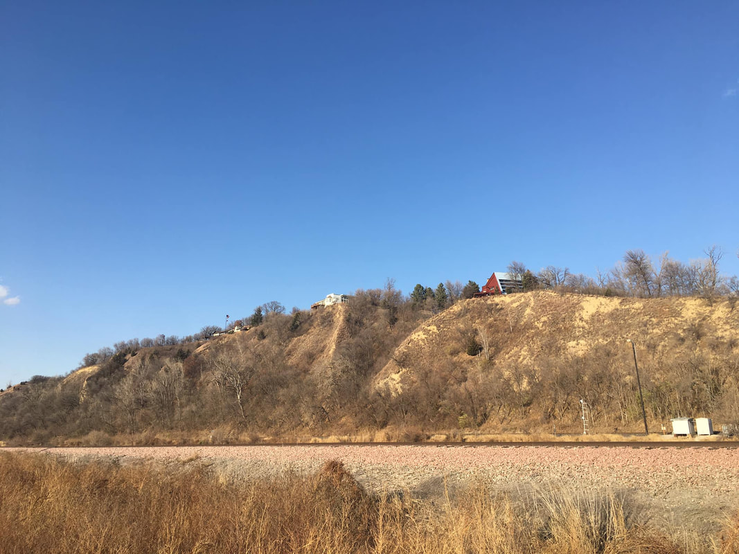 View of the Loess Hills from the base along Joslyn Avenue in Pottawattamie County. Photo by Kelly Madigan. 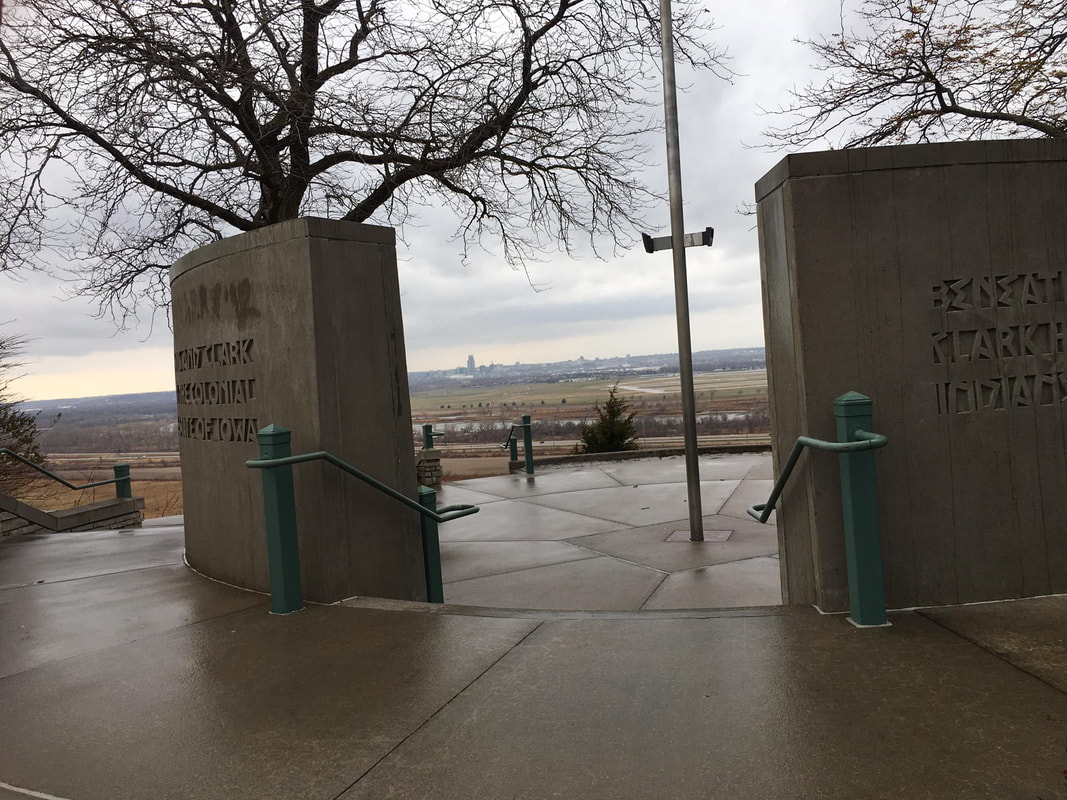 Lewis & Clark Monument, Council Bluffs. Photo by Kelly Madigan. 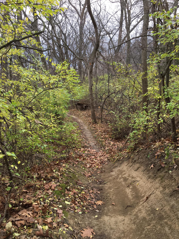 Lewis & Clark Monument Park trail, Council Bluffs. Photo by Kelly Madigan. 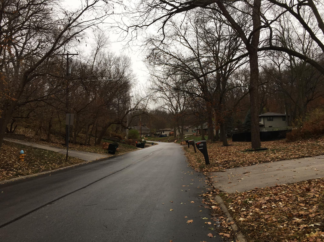 Residential street in Council Bluffs. Photo by Kelly Madigan. 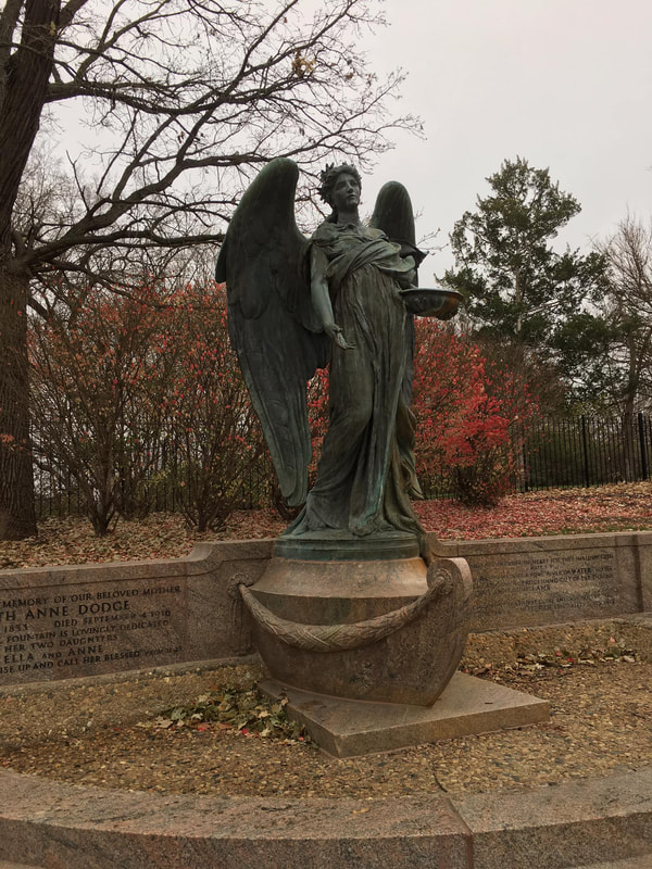 Black Angel Statue, Council Bluffs. Photo by Kelly Madigan. 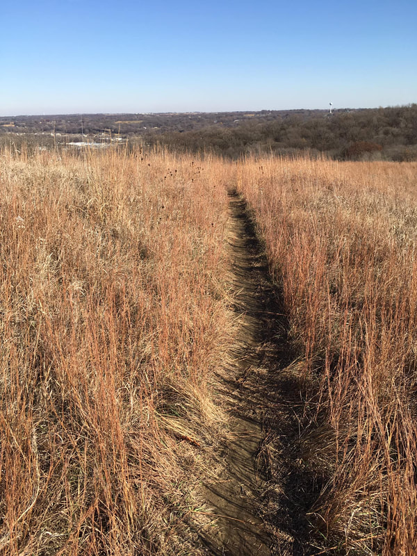 Vincent Bluff Preserve in Council Bluffs. Photo by Kelly Madigan. 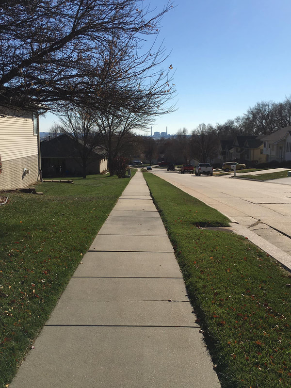 Residential neighborhood in Council Bluffs. Photo by Kelly Madigan. 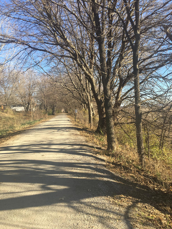 Wabash Trace Nature Trail just south of Council Bluffs. Photo by Kelly Madigan. 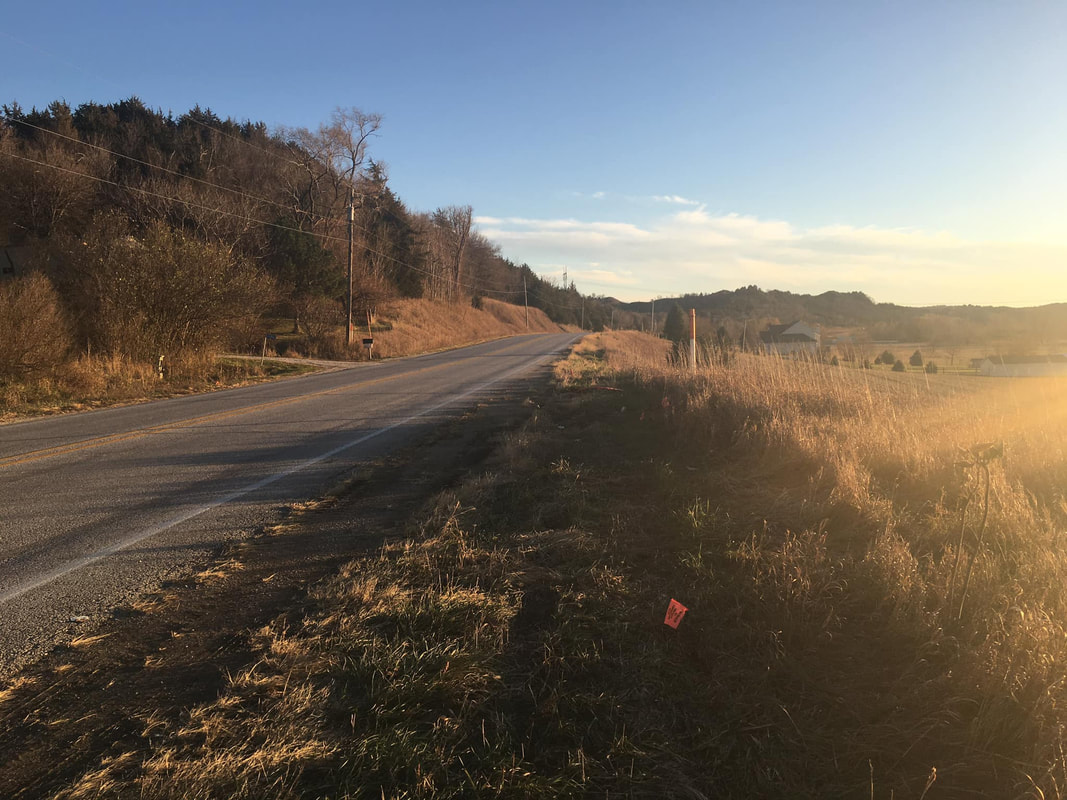 Wabash Avenue south of Council Bluffs. Photo by Kelly Madigan. Near the Pottawattamie-Mills county line is TNC’s Folsom Point Preserve with remnant prairies and a well-worn footpath. Mills County Conservation Board’s Pony Creek Park and Glenwood State Archeological Preserve were also located on Kelly's route in addition to the city of Glenwood. 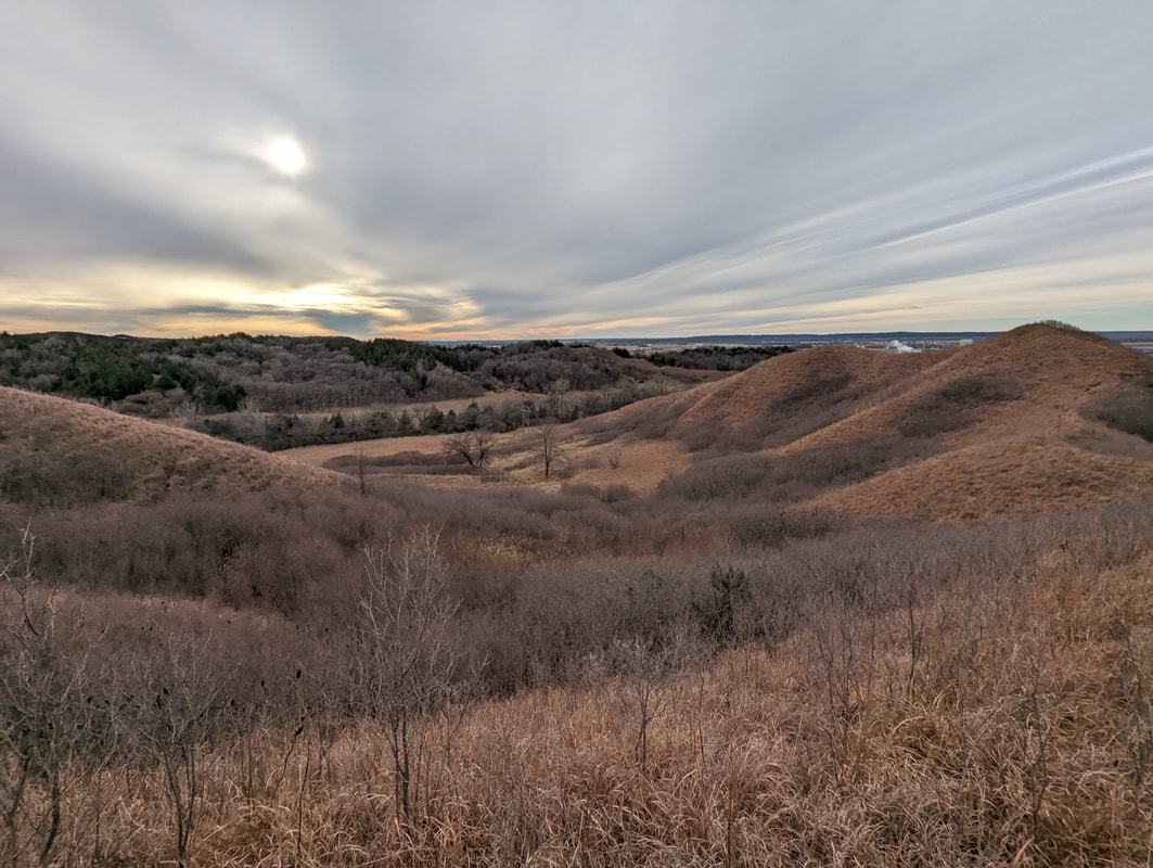 Folsom Point Preserve, Mills County. Photo by Doug Chafa. 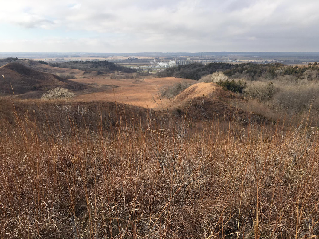 Folsom Point Preserve, Mills County. Photo by Kelly Madigan. 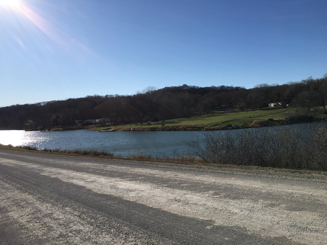 Pony Creek Lake, Mills County. Photo by Kelly Madigan. 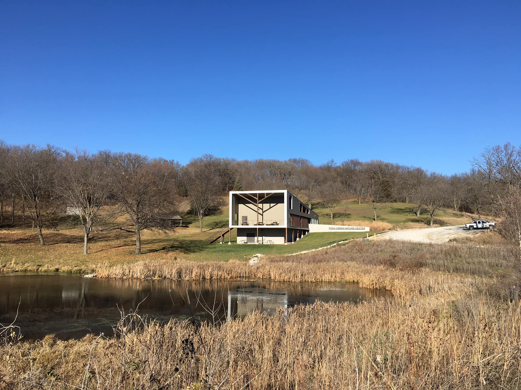 Pony Creek Nature Center, Mills County. Photo by Kelly Madigan. 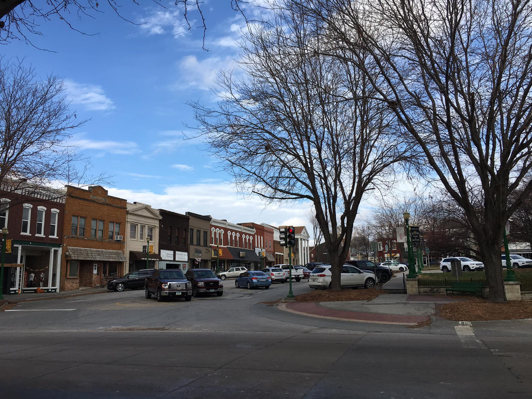 Glenwood Town Square. Photo by Kelly Madigan. 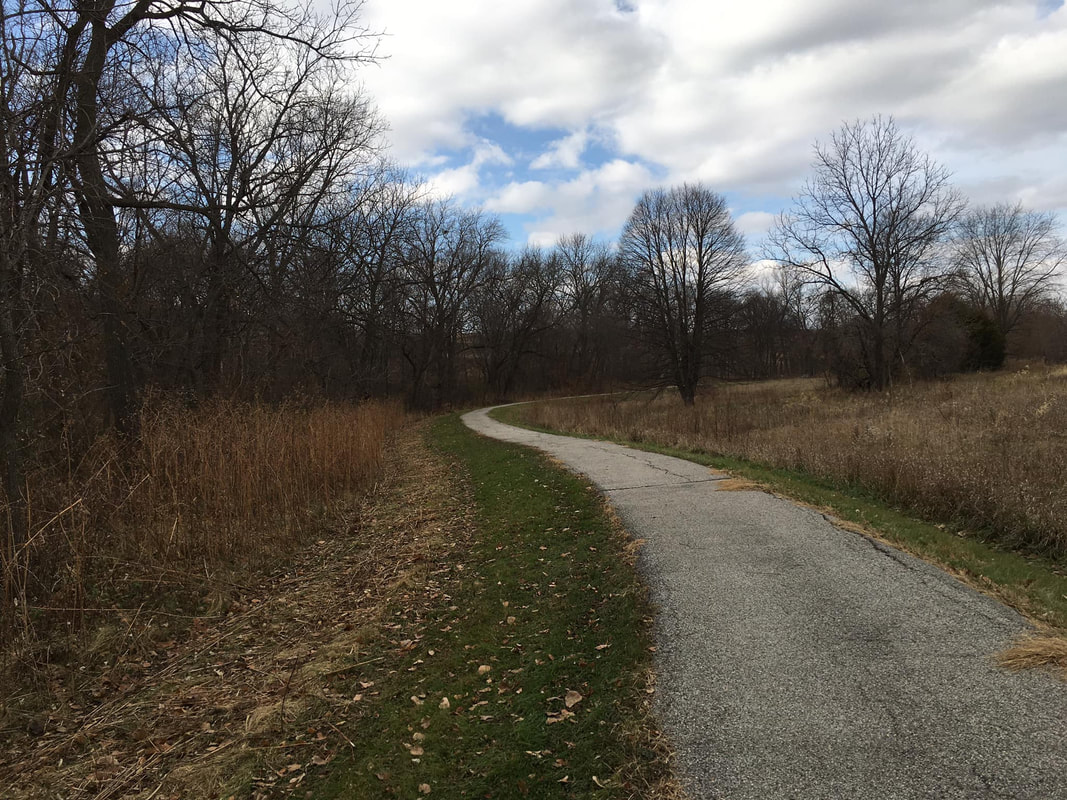 Trail at Glenwood Archaeological State Preserve, Mills County. Photo by Kelly Madigan. South of Glenwood, Kelly mostly took gravel and dirt roads into Fremont County, where she passed through Possum Hollow WMA, Waubonsie State Park and Eli Slusher WMA. 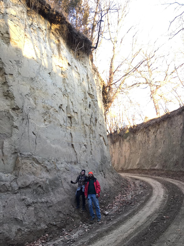 Deep Loess Hills roadcut, Mills County. Photo by Kelly Madigan. 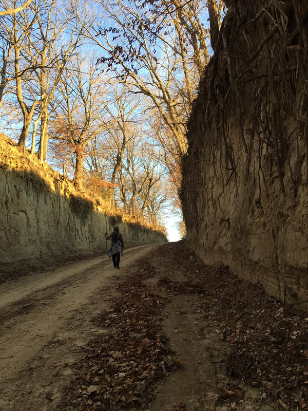 Deep Loess Hills roadcut, Mills County. Photo by Kelly Madigan. 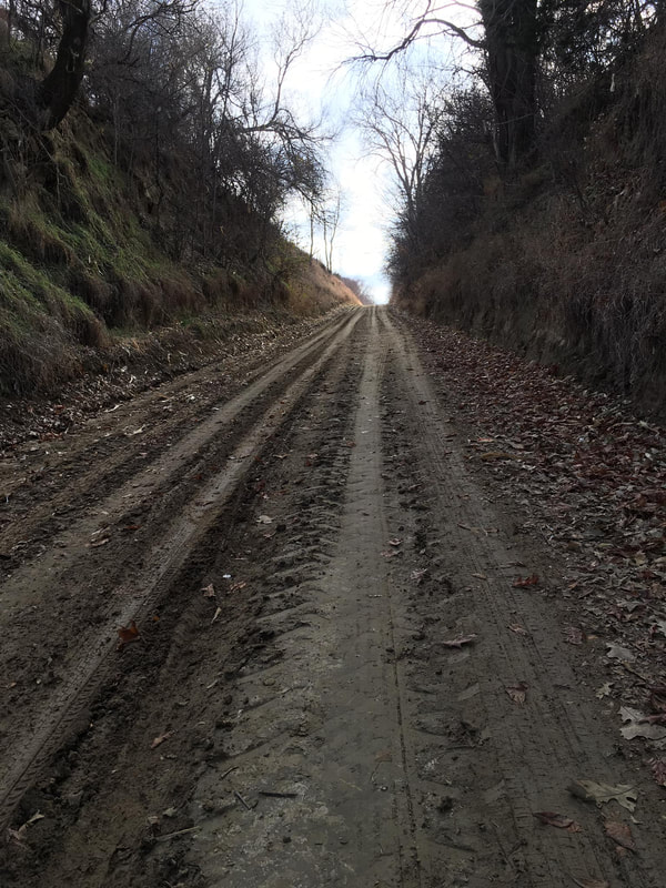 Mills County dirt road. Photo by Kelly Madigan. 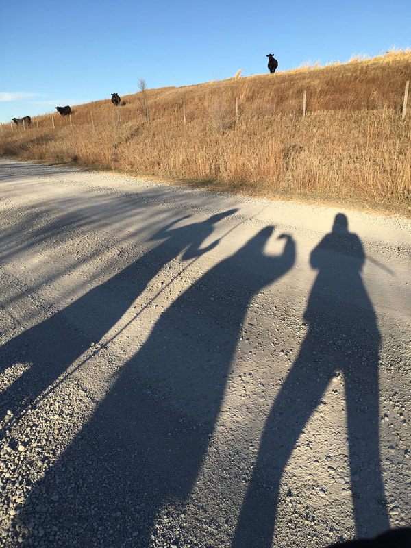 Long shadows and cattle in rural Mills County. Photo by Kelly Madigan. Finally, Kelly passed through Hamburg near the Nishnabotna River, then one final public land area at O.S. Wing WMA, before reaching the Missouri state line.  Fremont County scenery. Photo by Kelly Madigan. 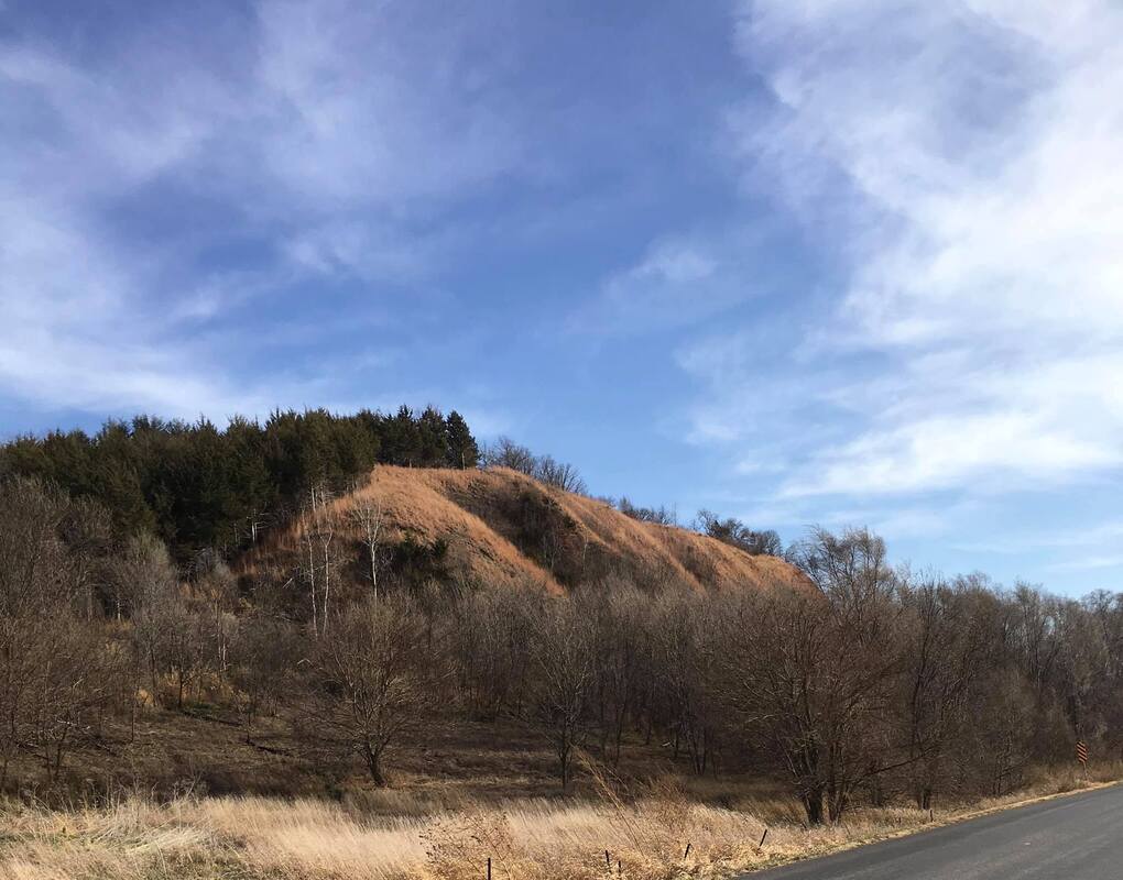 Possum Hollow Wildlife Area, Fremont County. Photo by Kelly Madigan. 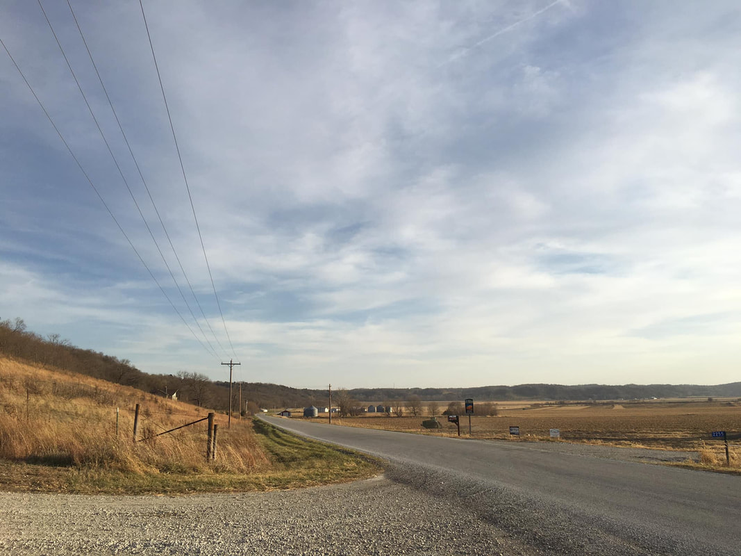 View along Bluff Road in Fremont County. Photo by Kelly Madigan. 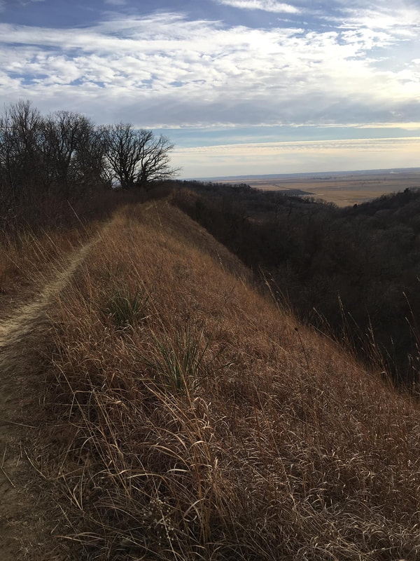 Sunset Ridge at Waubonsie State Park, Fremont County. Photo by Kelly Madigan. 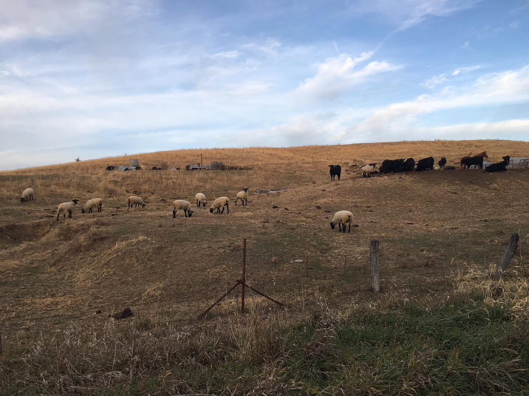 Sheep and cattle on a Fremont County farm. Photo by Kelly Madigan. 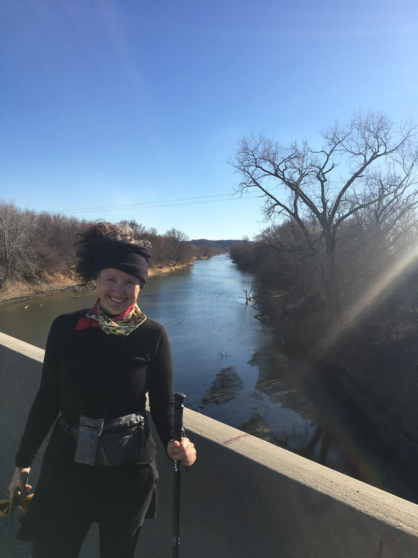 Kelly crosses the Nishnabotna River, the last large river before the end of her hike. Photo by Doug Chafa. 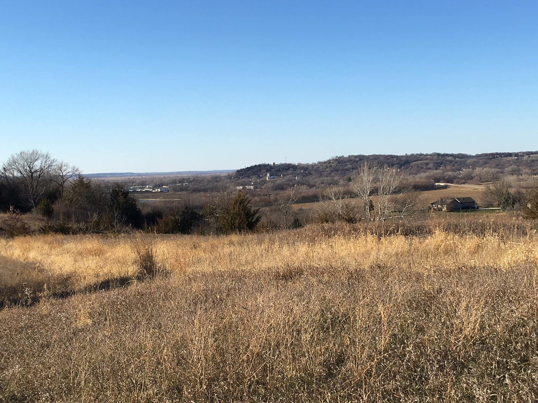 View of Hamburg from O.S. Wing Wildlife Area, Fremont County. Photo by Kelly Madigan. 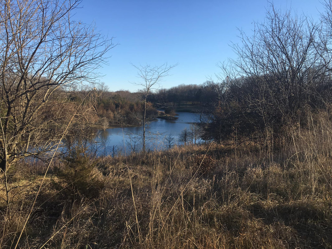 O.S. Wing Wildlife Management Area, Fremont County. Photo by Kelly Madigan. 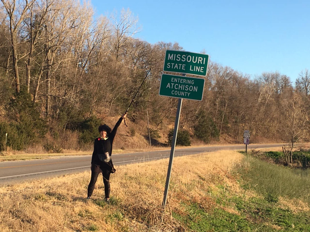 Kelly finishing her Iowa Loess Hills hike at the Missouri state line south of Hamburg. Photo by Doug Chafa. Kelly is currently collaborating with Larksong Writers Place to host a (virtual) place-based writing workshop focused on the Loess Hills that begins January 19th. “From the Black Angel statue in Council Bluffs, to a cave in Sergeant Bluff, to a lighted star on a bluff in Turin, to a young female cougar with a radio collar, a long-lost uncle with a steep driveway, a badger letting you know to back off, a voice heard in the night, the view from a turkey blind, or a miraculous harvest of morel mushrooms, the Loess Hills are alive with stories. Using a variety of examples, prompts and exercises, we will explore the hills creatively, crafting poems, stories and short memoir that reflect the unusual terrain and the experiences held there. Participants will be invited (but not required) to share a sample of their completed work at a Loess Hills Writers event.” Learn more and register here.
Kelly is also working with other hiking enthusiasts on planning a multi-day trail hike in Monona County in 2021. Stay updated by joining The LoHi Trail Facebook group. The group is a place for people to share ideas for conserving the fragile Loess Hills while promoting low-impact recreation and ecotourism.
3 Comments
Mark Edwards
6/24/2021 08:03:16 am
What a wonderful story illustrating a wonderful place.
Shaun Murphy-Lopez
1/14/2022 08:50:19 am
Love it, thanks for sharing Leave a Reply. |
Archives
June 2024
Categories
All
|
 RSS Feed