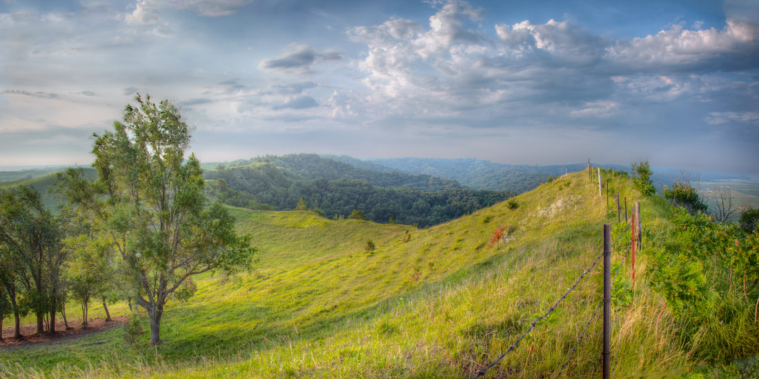
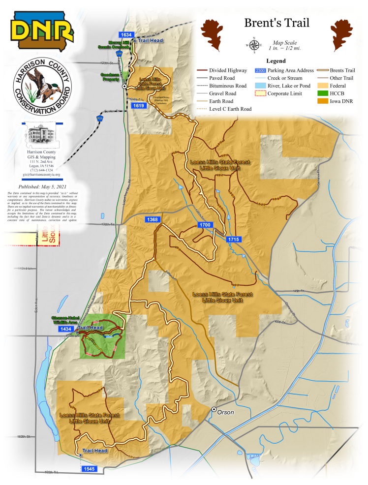
 Brent's Trail near Murray Hill Scenic Overlook (© 2016 Kenneth West)
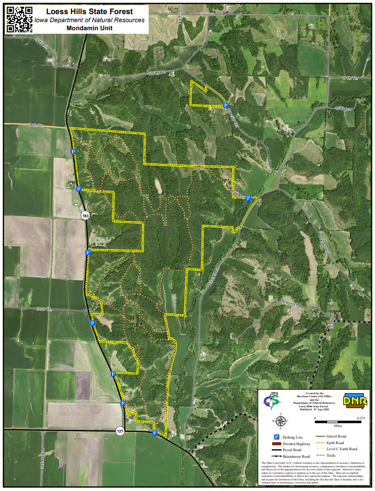
 Perhaps the best hiking on the byway is near Little Sioux, Pisgah, and Mondamin
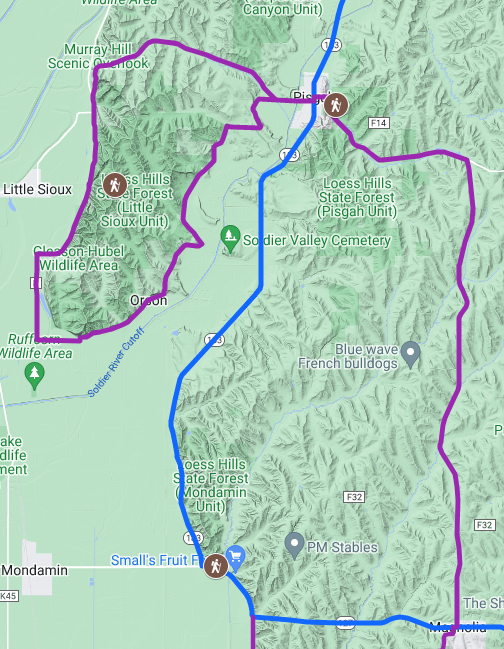
The trail is named after longtime state forester Brent Olson. It's a partnership between Harrison County Conservation Board and Iowa Department of Natural Resources. Other partners and supporters include Friends of the Loess Hills State Forest and Preparation Canyon State Park, Loess Hills Missouri River Region, Golden Hills RC&D, and Loess Hills Alliance. Murray Hill Scenic Overlook and Gleason-Hubel Wildlife Area are on the Fountainbleu byway loop. There are services in Pisgah.
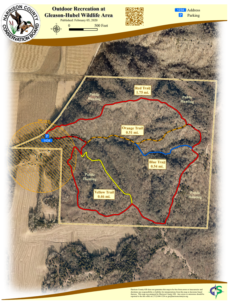
Gleason-Hubel Wildlife Area is an excellent bird watching location for migrating woodland species. It is part of the Loess Hills Bird Conservation Area designated by the Iowa DNR. The wildlife area is located on the Fountainbleu byway loop one mile southeast of Little Sioux on Larpenteur Memorial Road. 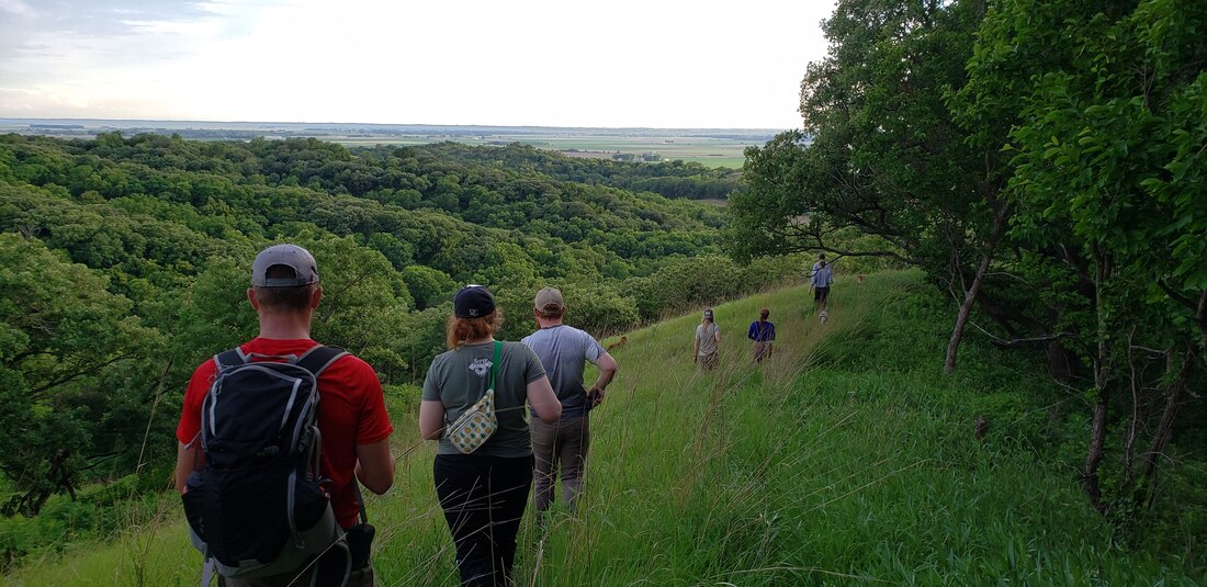 Gleason-Hubel Wildlife Area (photo by Lance Brisbois)
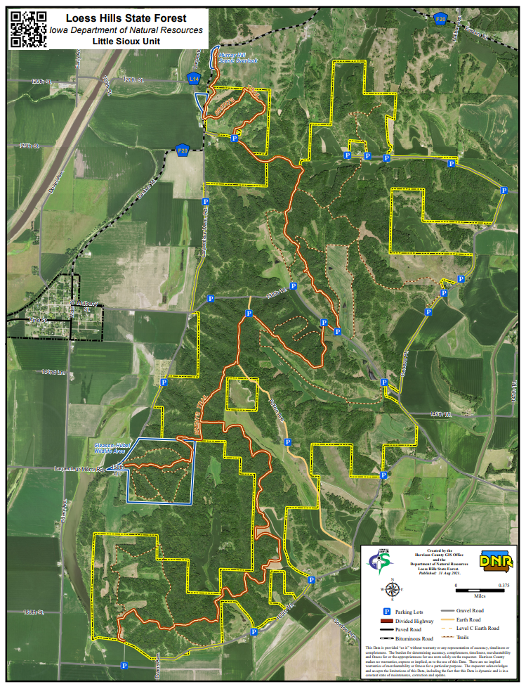
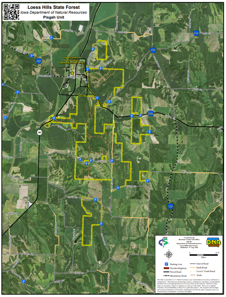
Brent's Trail traverses the length of the unit, while there are several miles of additional trails that can be accessed via different parking areas and trailheads. There are no restrooms or reliable sources of water in the Little Sioux unit. There are services in Pisgah. The unit is bordered by the Fountainbleu byway loop.
There are several parking areas to provide access to the various parcels that make up the Pisgah Unit. Some recommended trailheads include the following (refer to the map): 118th Ln; Easton Trl west of 110th St; and the three farthest east on 145th St. 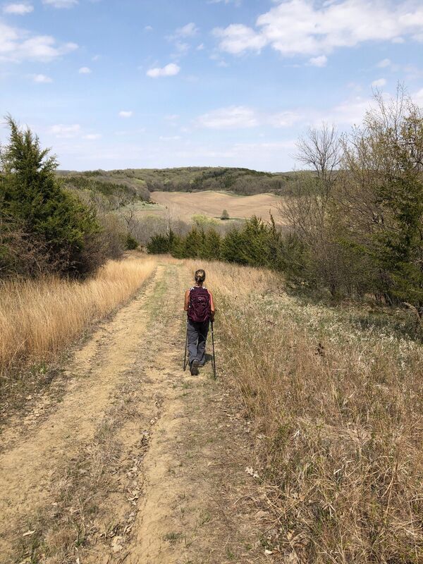 LHSF Pisgah Unit (photo by Paul Dietsch on All Trails)
The south trailhead leads to a trail that climbs the dramatic razor ridge that rises above the intersection of IA-183 and IA-127. Hiking the southern loop totals approximately 4.5 miles. The north trailhead also climbs steeply up to the ridge that runs parallel with IA-183. You can make a 3.5-mile loop back to the north trailhead. If you hike both the north and south loops, the total mileage will be around 10 miles.
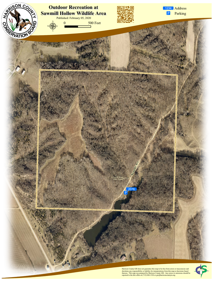
Located seven miles north of Missouri Valley off Loess Hills Trail (L20), the wildlife area is not directly on the byway but is a short drive from the main route. Access to Sawmill Hollow Wildlife Area is on a Level B dirt road. 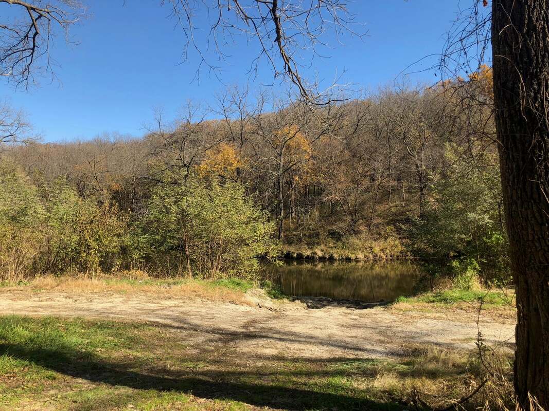 Sawmill Hollow Wildlife Area (photo by Harrison CCB)
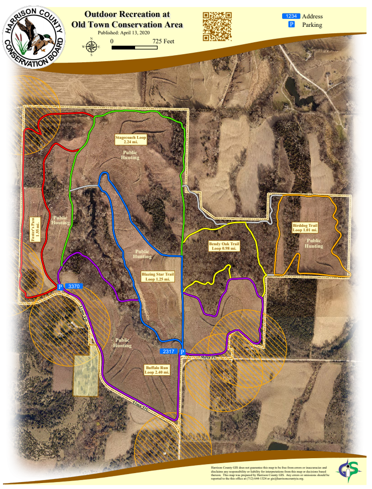
The Old Town Conservation Area is located off Lima Trail about 3 miles southeast of the Loess Hills National Scenic Byway and Missouri Valley. There are two parking areas that provide access to the trails. 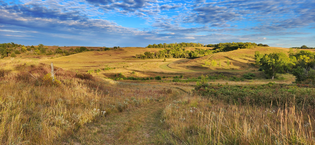 Old Town Conservation Area (photo by Lance Brisbois)
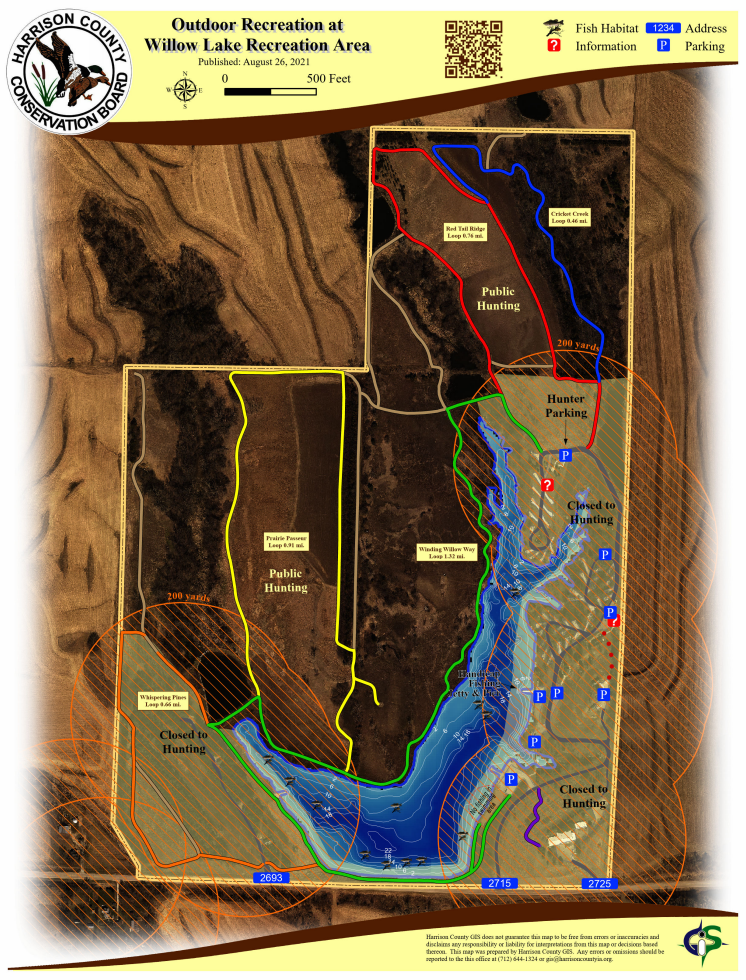
There are 6 miles of hiking trails with Smart Trail interpretive signs using QR (quick response) codes allow users to learn about the Loess Hills and Iowa's natural resources. The Willow Lake Recreation Area is also an excellent location for bird watching, especially migrating songbirds and waterfowl. Willow Lake Recreation Area is not located on the Loess Hills National Scenic Byway but is a short drive from the main route near Logan or the Orchard Ridge loop from Pisgah. It is located 6 miles northwest of Woodbine on F20L (Easton Trail). 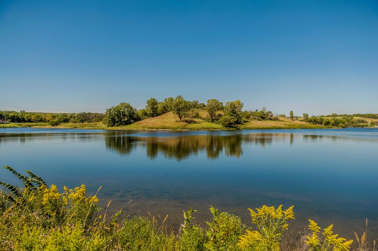 Willow Lake Recreation Area (photo by Harrison CCB)
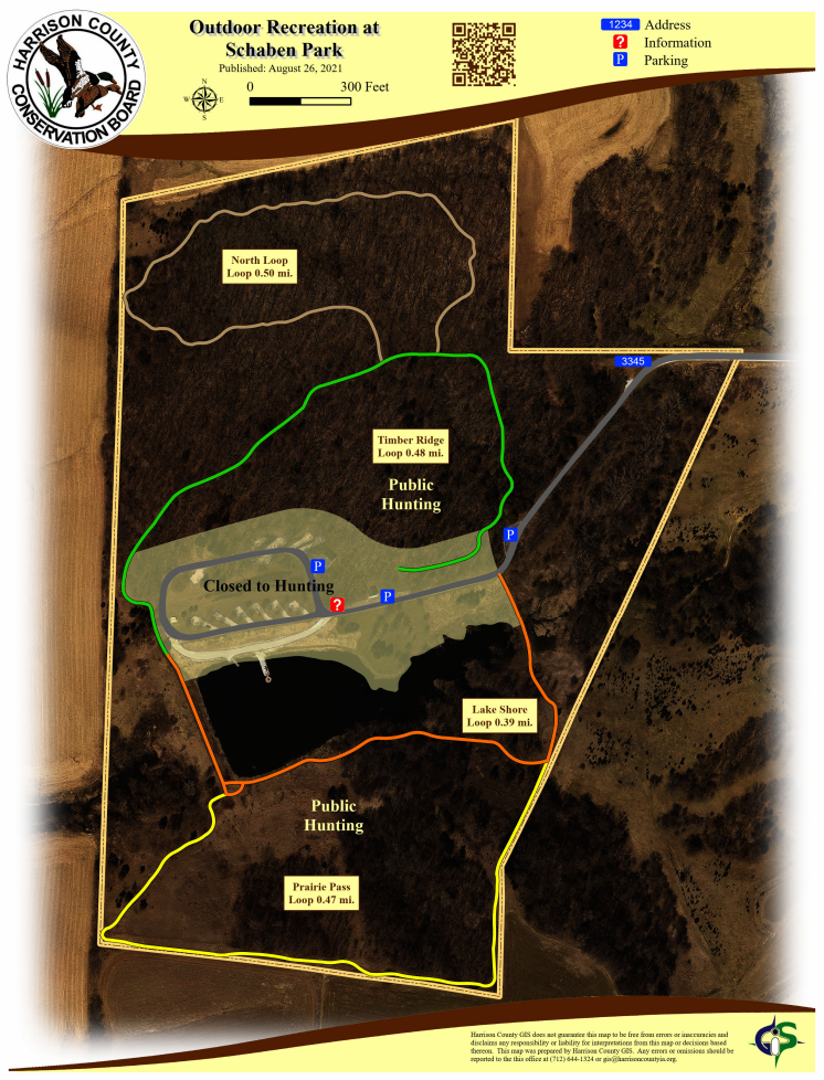
Schaben Park is not located on the Loess Hills National Scenic Byway but is a short drive from the main route or the Orchard Ridge loop. It is located 2 miles off Highway 30, between Woodbine and Dunlap on 141st Lane (gravel road). 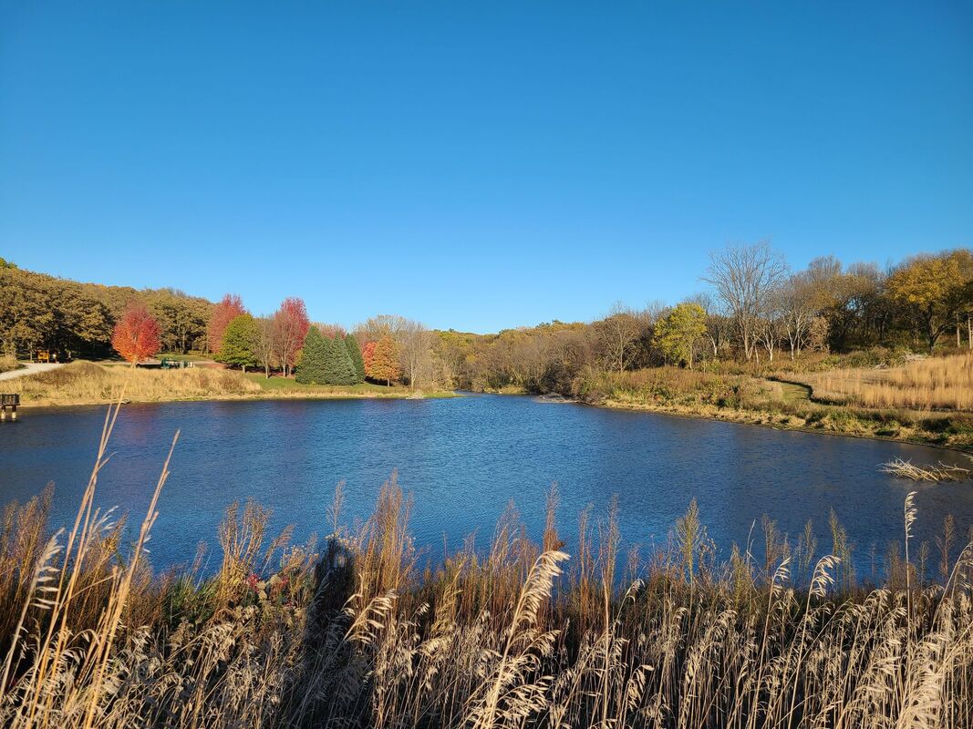 Schaben Park (photo by Amy Cramer on All Trails)
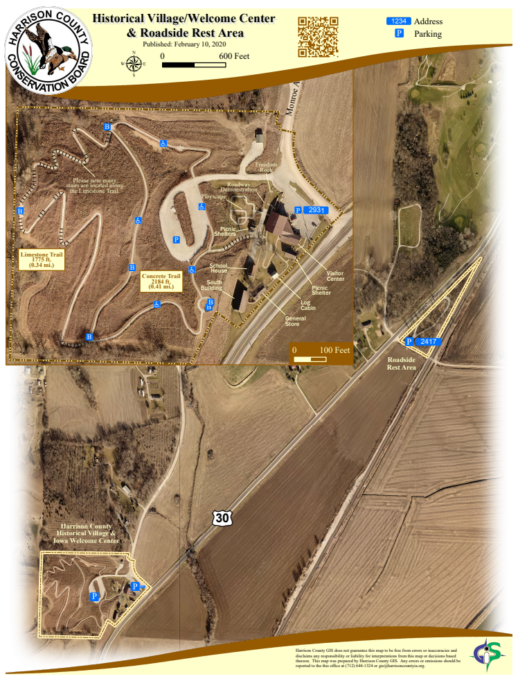
The official Iowa Welcome Center provides tourism information and assistance to travelers. The Iowa Products Store offers food, beverage, clothing, crafts, and a wide variety of souvenirs. Stretch your legs on the 1-mile trail and learn about the Loess Hills. The 0.41-mile Concrete Trail is accessible to wheelchairs. There are many stairs along the 0.34-mile Limestone Trail Hiking the Byways is a regular series by Golden Hills RC&D that features publicly accessible lands open to hiking on the three scenic byways in western Iowa that Golden Hills RC&D coordinates: Glacial Trail Scenic Byway, Loess Hills National Scenic Byway, and Western Skies Scenic Byway. Each blog post covers hiking areas in one county on one of the aforementioned byways. For questions about hiking on the byways, contact Seth Brooks ([email protected]).
0 Comments
Leave a Reply. |
Archives
June 2024
Categories
All
|
 RSS Feed