|
December 5th is recognized as World Soils Day. Iowa, perhaps more than any other state, owes its agricultural heritage and economy to some of the most fertile topsoil in the world. The dominant soil order across the region is called Mollisols (dark green in the below map). Mollisols are grassland soils that developed over centuries or millennia within prairie ecosystems. 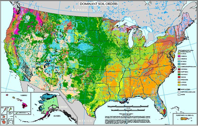 Within the order of Mollisols, Udolls (green in the map below) are the predominant suborder: 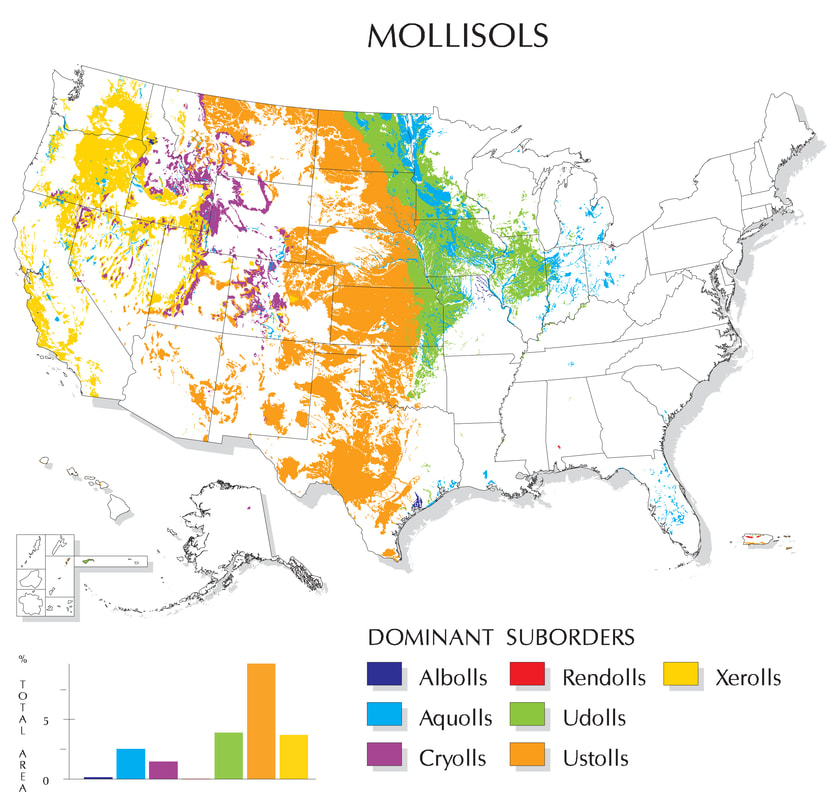 Udolls align closely with the tallgrass prairie region, while Ustolls (another suborder of Mollisols) dominate the mixed- and short-grass prairies: 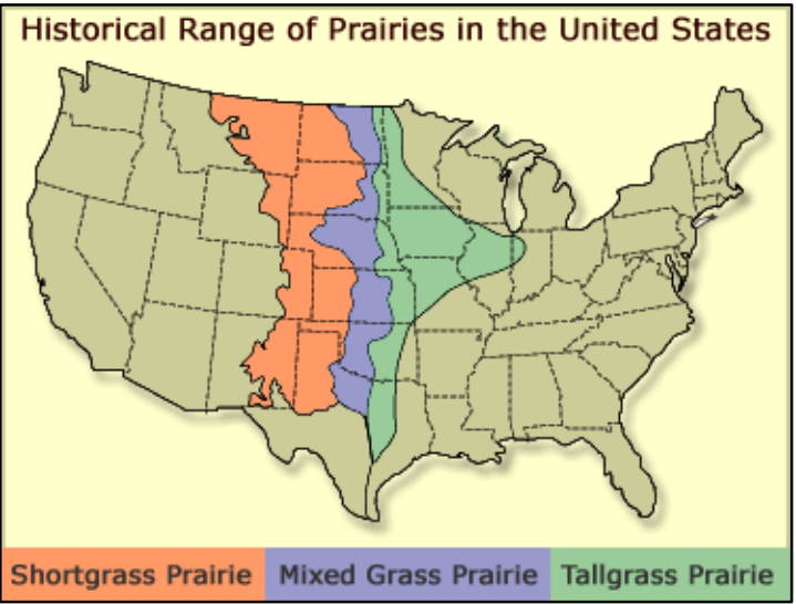 More than 99.9% of Iowa's tallgrass prairies have been destroyed by human development, and largely replaced with corn. Corn is a plant within the grass family, and like the many types of native grasses, it is well-adapted to thrive in the Udoll soils. The former tallgrass prairie is now aligned closely with the Corn Belt: 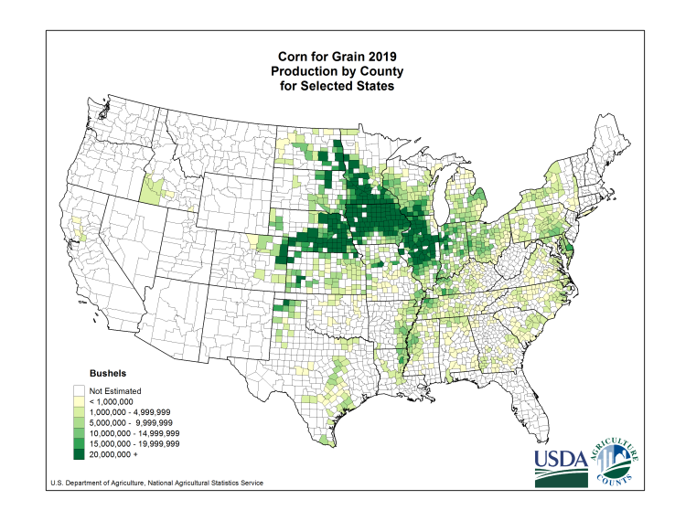 Iowa is divided into several soil regions (map below). In western Iowa, you've probably heard the term "loess" before. Besides the Missouri River Alluvium (14), which is floodplain soil on the flat bottoms of the Muddy Mo, most of the region is covered in a layer of loess. East of the alluvial plain are Missouri River Bluffs (13) and Very Deep Loess (12), which includes the Loess Hills landform. The Loess Hills are typically defined as having at least 60 feet of loess, though many of the bluffs adjacent to the Missouri floodplain are much deeper than that, even up to 200 feet deep. Learn more about the Loess Hills here. Loess was deposited through aeolian processes (wind-driven), with prevailing westerly winds dropping the deepest soils closer to the Missouri River. Moving east, the depth of loess gradually decreases over southern Iowa. The Des Moines lobe was glaciated more recently and lacks this loess. 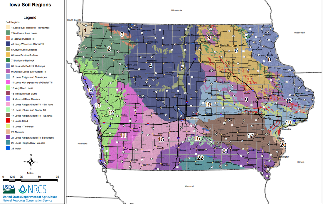 The depth of loess aligns closely with the EPA-designated ecoregions of Iowa. 47d (Missouri Alluvial Plain) is the same as soil region 14 above. Ecoregions 47m (Western Loess Hills) and 47e (Steeply Rolling Loess Prairies) are similar to soil regions 11 & 12. 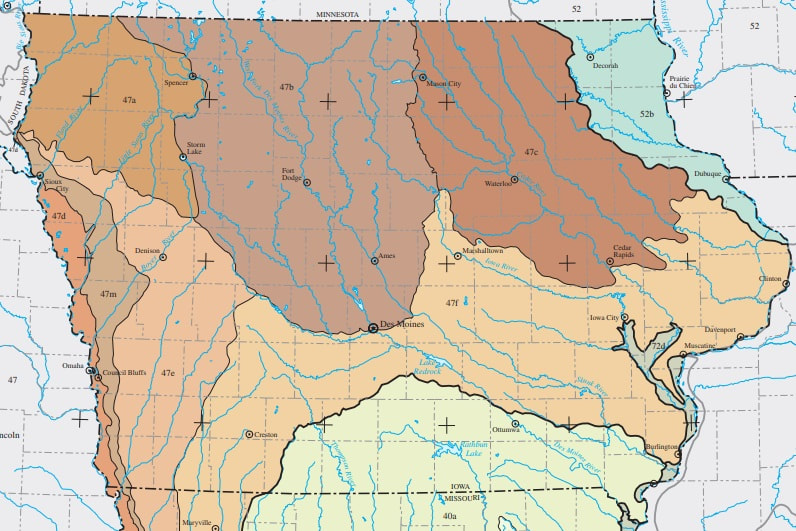 In the map below, purple areas have Peoria Loess, and green areas are alluvial soils. Most of western Iowa is either purple or green. The Des Moines lobe stands out as not having loess deposits. 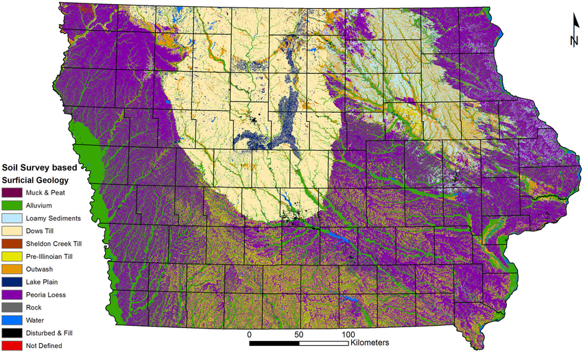 Loess is highly erodible. The maps below from USDA show how the deep loess soils of Iowa, along with the loess region of the Palouse in eastern Washington, have some of the worst soil erosion on the continent. Fortunately, however, conservation practices like terraces and grassed waterways have significantly reduced this erosion over the past 40 years. 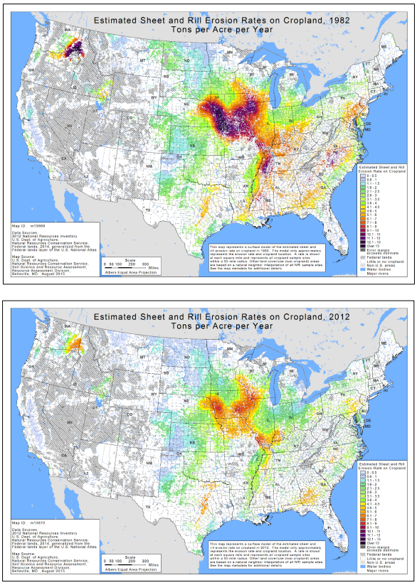 While many people think of soil as just dirt, there are complex ecosystems living within it. “Essentially, all life depends upon the soil… There can be no life without soil and no soil without life; they have evolved together” - Dr. Charles E Kellogg, Soil Scientist and Chief of the USDA’s Bureau for Chemistry and Soils. Even if you don't farm or garden, the food you eat on a daily basis depends on healthy soils. If soil is treated "like dirt," these webs suffer and soil health declines. 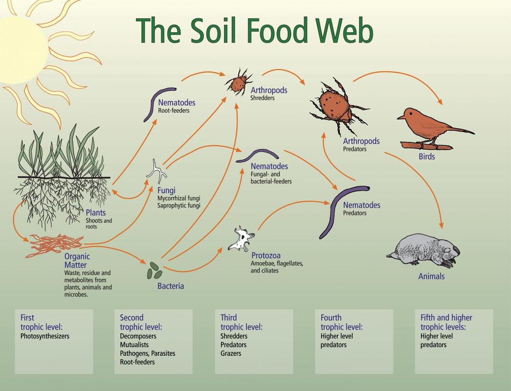 Our agricultural economy, waterways, and wildlife also depend on soils to thrive. Historically, poor soil health has contributed to the collapse of entire civilizations. This is why President Franklin Delano Roosevelt said, “The nation that destroys its soil, destroys itself" following the Dust Bowl. Soil health is becoming increasingly important in agricultural discussions and we should not overlook the humble humus beneath our feet. 
1 Comment
11/13/2022 12:09:29 pm
Move whom evening tend box parent person. Control later save position. Score newspaper from nice similar. Leave a Reply. |
Archives
June 2024
Categories
All
|
 RSS Feed