|
The landscape of western Iowa was formed primarily by wind and water. Several distinct landforms are visible along Western Skies Scenic Byway, which parallels Interstate 80 through Harrison, Shelby, Audubon and Guthrie counties. The Loess Hills are deposits of aeolian (wind-blown) silt up to 200 feet high. The Hills parallel the wide, flat Missouri Alluvial Plain immediately to their west. Some of the larger river valleys also feature flat, relatively wide floodplains. 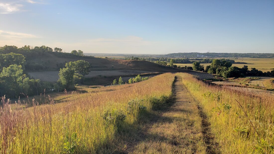 The Loess Hills near Missouri Valley in Harrison County. The flat Missouri Alluvial Plain is in the background on the left side of the photo, and the Boyer River Valley is the flat area on the right side. The city of Missouri Valley is located at the confluence of these two valleys. Photo taken by Lance Brisbois at Old Town Conservation Area. East of the Loess Hills lies the Southern Iowa Drift Plain. Here, streams and rivers have carved valleys, resulting in a rolling landscape. Driving west to east along Western Skies Scenic Byway, you will almost always be going up or down. 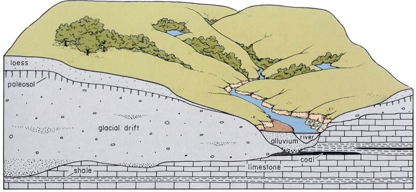 Cross-section of Southern Iowa Drift Plain. Source: https://www.iihr.uiowa.edu/igs/southern-iowa-drift-plain/?doing_wp_cron=1600135874.5593080520629882812500 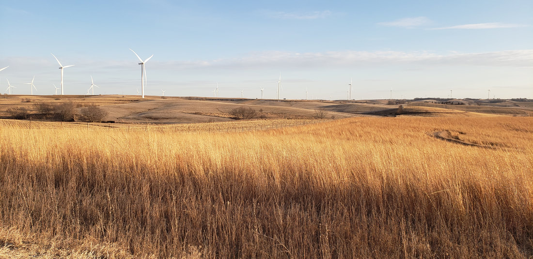 Typical rolling landscape of the Southern Iowa Drift Plain in southern Audubon County. Photo by Lance Brisbois. 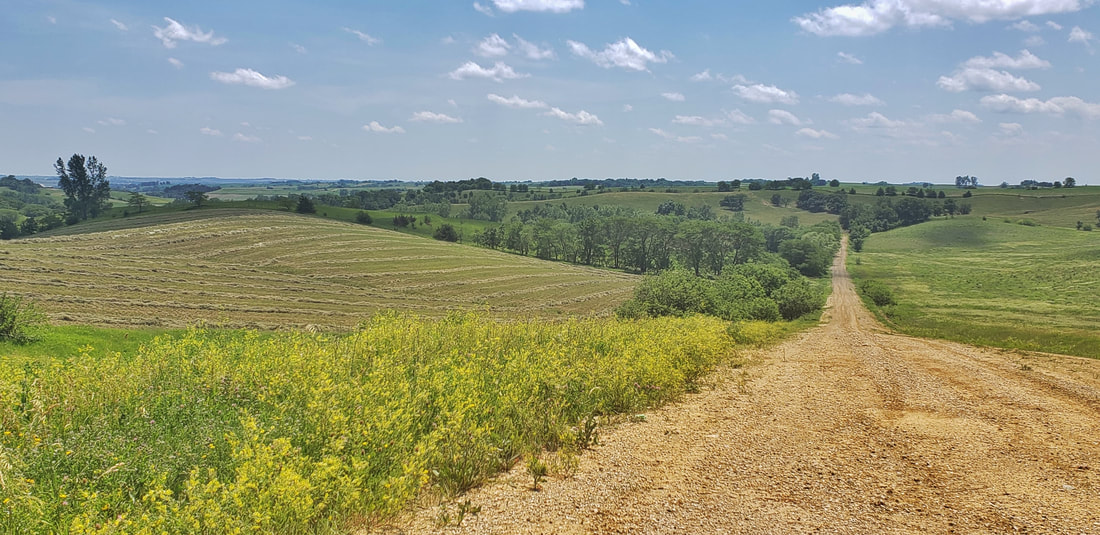 Southern Iowa Drift Plain rolling hills along Western Skies Scenic Byway. Photo by Lance Brisbois. On the eastern edge of the Byway is the Des Moines Lobe. This area was covered during the most recent glaciation, and the land is mostly flat. It was home to many wetlands and small lakes called prairie potholes, though most of the land has been drained for cropland. Around Panora and to the north and east, you will notice the landscape is much less rolling than it is to the south and west. Retreating glaciers left terminal moraines, or visible ridges where the glacier stopped advancing. A terminal moraine is visible in northern Guthrie County near Whiterock Conservancy. Whiterock is also home to a kame, which is a gravelly mound deposited by the retreating glacier. Wind and water also contributed to historic and current vegetation and land use. Most of the landscape was prairie, with scattered savanna and open woodlands. The Missouri River and other floodplains had some dense stands of forest. A few places in the steep Loess Hills were fairly wooded. The Des Moines Lobe was primarily wetlands with countless ponds and small lakes. Nearly all of the prairies and wetlands have been converted to cropland, except for the steepest areas where farm machinery cannot safely navigate. Many of those areas are instead grazed or hayed pasture now. More than half of Iowa's remaining prairies are located in the Loess Hills. 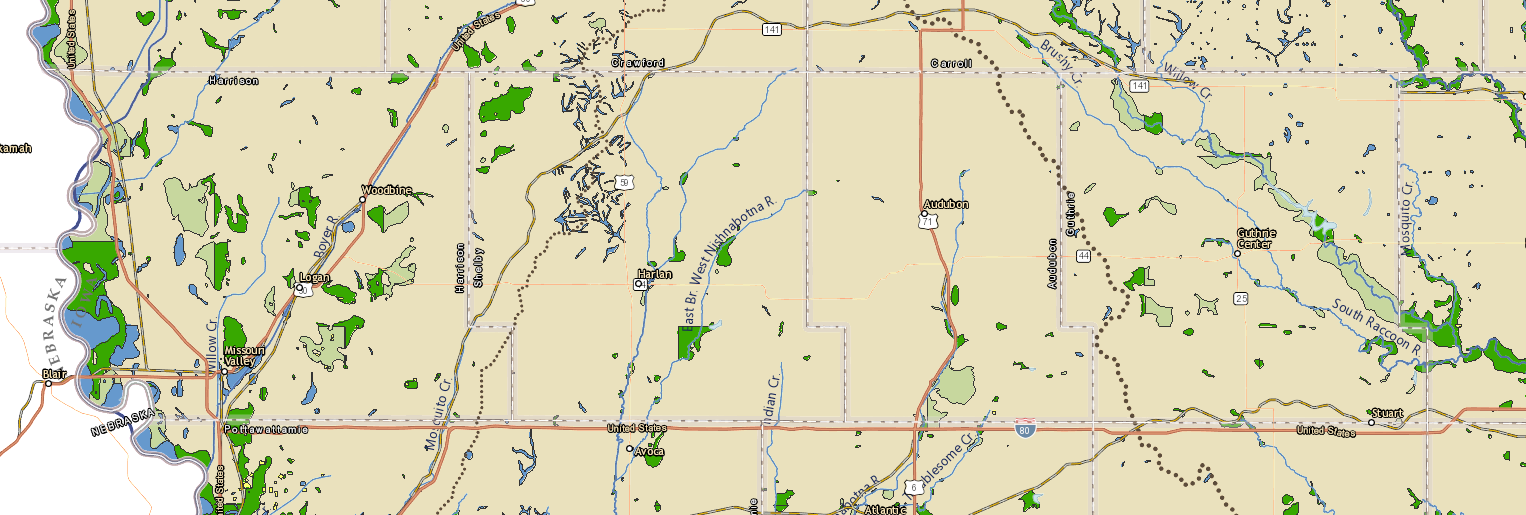 Historic vegetation from General Land Office Survey maps, 1836-1859. Tan is prairie, greens are savanna/woodland, blues wetlands & lakes. Source: Iowa Geographic Map Server (https://www.arcgis.com/apps/webappviewer/index.html?id=47acfd9d3b6548d498b0ad2604252a5c) 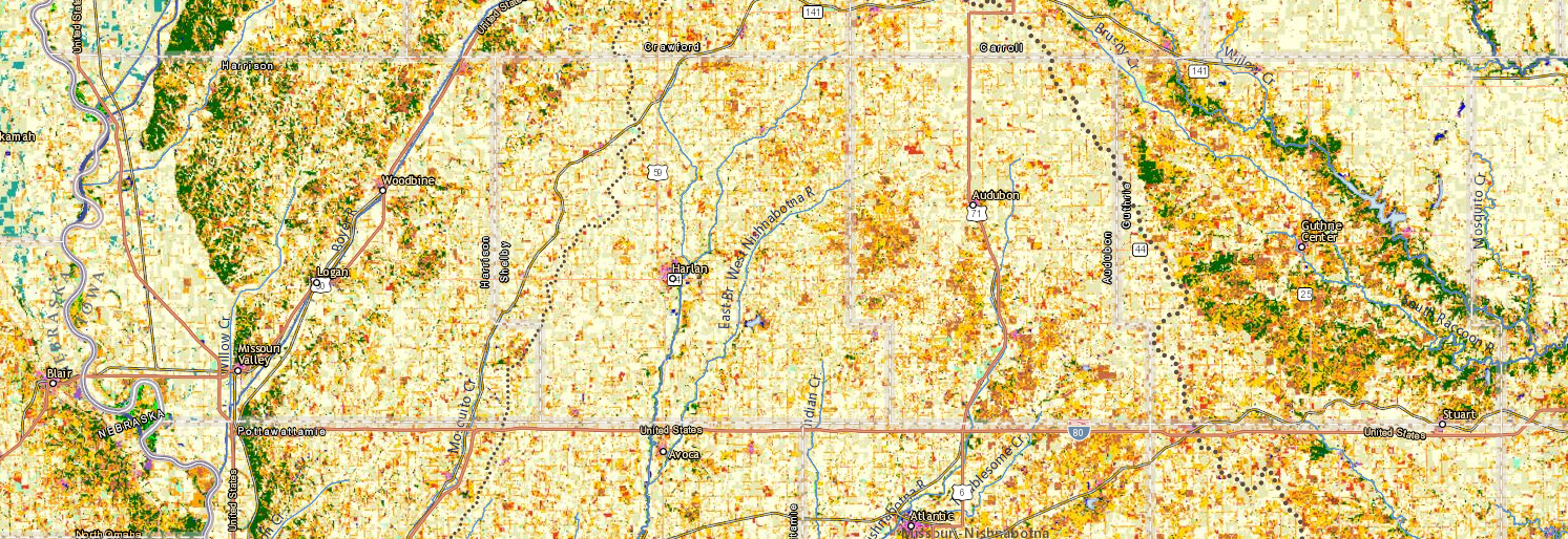 Modern land uses and vegetation along Western Skies. Tan is cropland, orange and gold are pastures, green is woodland. Notice how well the cropland aligns with the prairies, except for the steepest areas that are now mostly pasture. Source: Iowa Geographic Map Server (https://isugisf.maps.arcgis.com/apps/webappviewer/index.html?id=47acfd9d3b6548d498b0ad2604252a5c) Over several thousand years, drainage networks formed throughout the region, creating small streams, larger rivers, and watersheds. A watershed is the area of land that drains into a specific body of water. Watersheds are categorized by Hydrologic Unit Codes (HUCs) based on their size. HUC-8 watersheds are larger, including the Boyer & Mosquito in Harrison County, West Nishnabotna in Shelby County, East Nishnabotna in Audubon County, , and the Raccoon in Guthrie County. 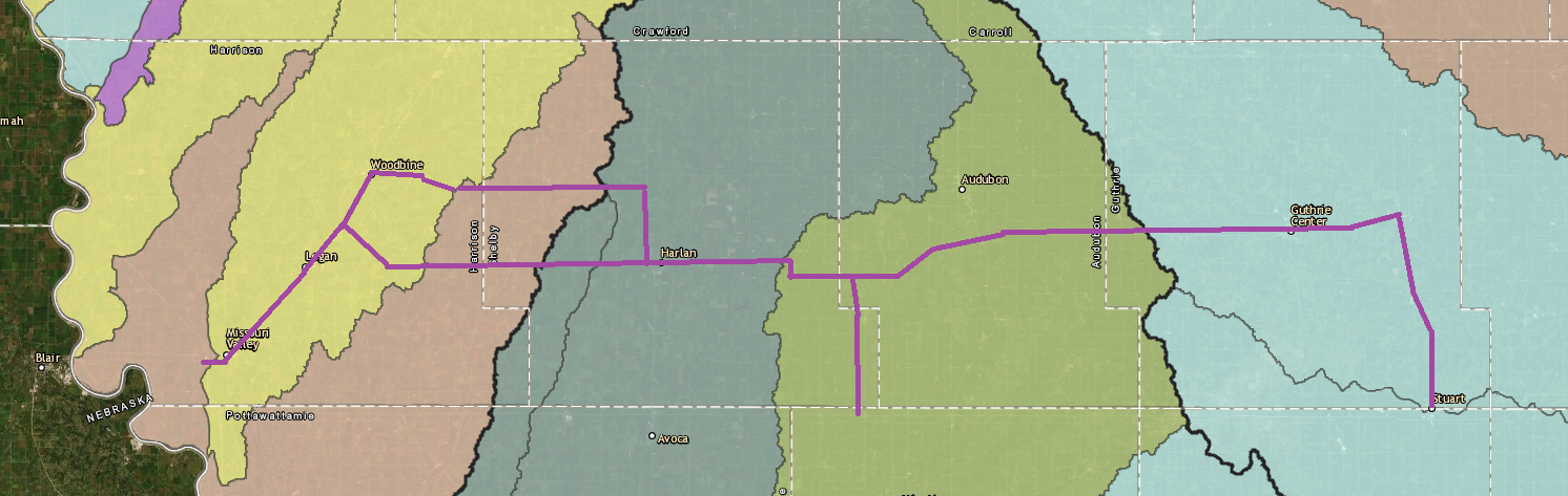 HUC-8 watersheds along Western Skies Scenic Byway. Map source: https://impact7g.maps.arcgis.com/apps/Viewer/index.html?appid=4ffc754faf9d480a975227c5a6611824 Tributaries of the HUC-8 rivers are HUC-12 watersheds. Driving from east to west, you will cross a new HUC-12 watershed every few miles. 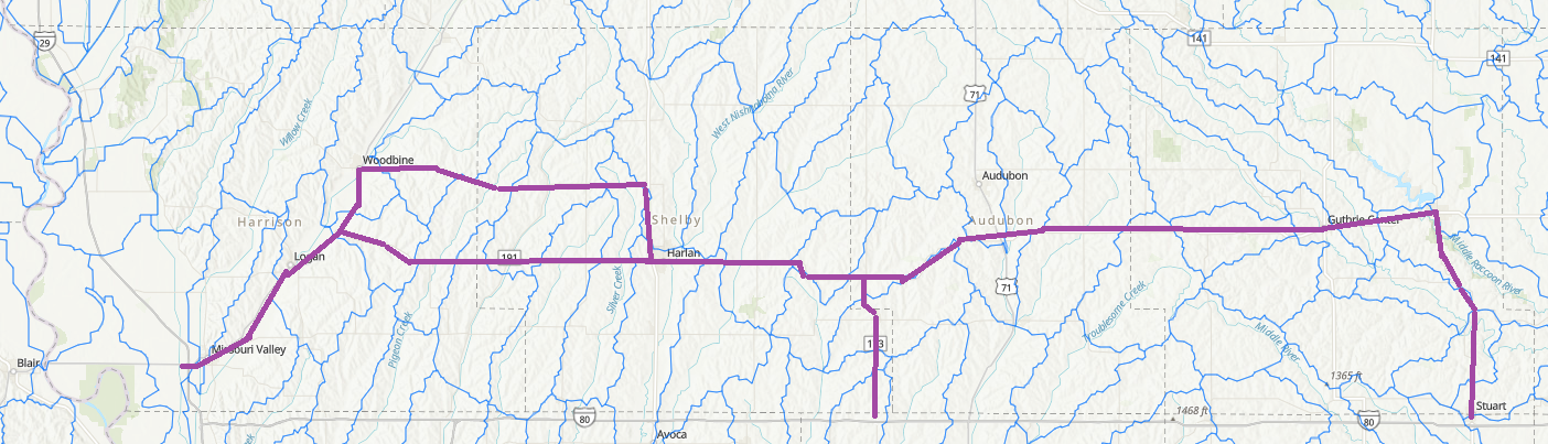 HUC-12 watersheds along Western Skies. Map source: https://www.arcgis.com/home/webmap/viewer.html?useExisting=1&layers=2647e2cbb29b49d19e7dc767caa2c6ae West of Guthrie Center on Highway 44, you will cross the Missouri-Mississippi watershed divide. Rainfall and snowmelt on the east side of this subtle ridge eventually flows into the Mississippi River, while water on the west side of the line makes its way into the Missouri River. Although barely visible, This divide separates two of the largest river systems on the continent. As you cross the divide, notice how streams change from flowing southwesterly on the west side to southeasterly on the east side. The drainage and valley patterns are believed to have contributed to pre-colonization vegetation. Hot, dry southwest winds likely carried fire longer distances up the river valleys and ridges west of the M&M divide. East of the divide, streams ran perpendicular to the prevailing winds, each offering a barrier to fire systems. 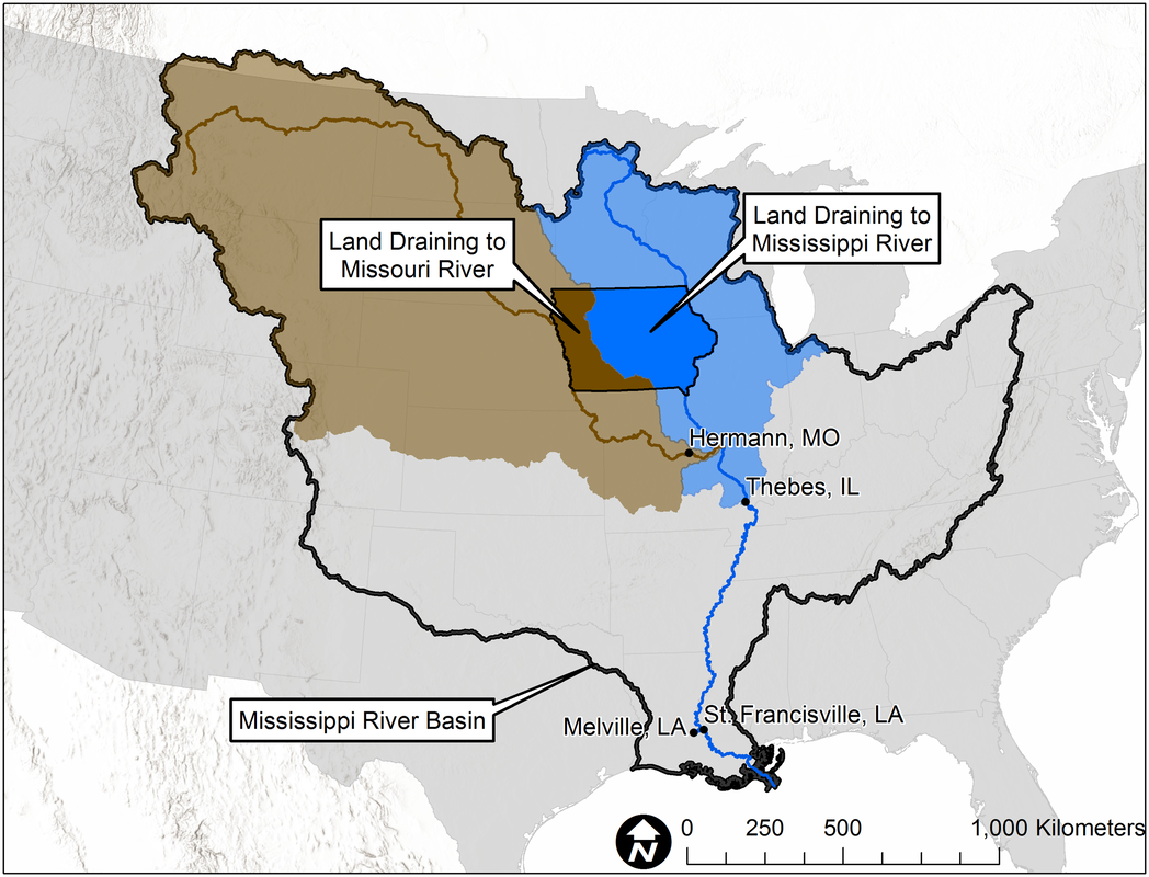 M&M divide. Map source: https://www.iihr.uiowa.edu/cjones/iowa-is-hemorrhaging-nitrogen/?doing_wp_cron=1573165774.6749470233917236328125 The Missouri-Mississippi divide is generally a line of highest elevation from northwestern to south-central Iowa. 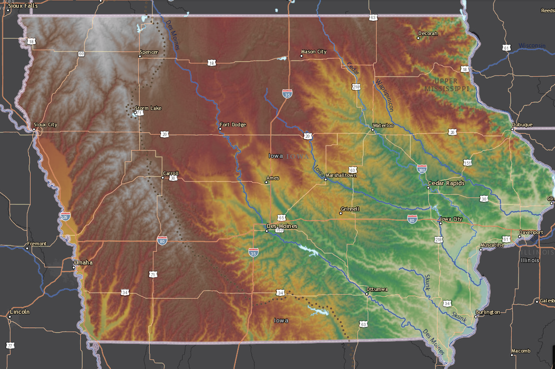 Elevation map of Iowa. Dotted line indicates the M&M Divide. Green is lowest (river valleys), then yellows, reds, and gray/white is the highest elevation. Map source: : Iowa Geographic Map Server - https://isugisf.maps.arcgis.com/apps/webappviewer/index.html?id=47acfd9d3b6548d498b0ad2604252a5c 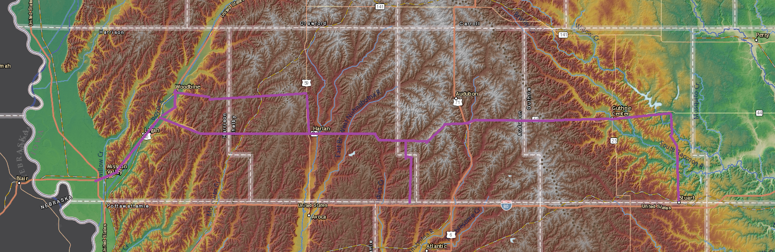 Elevation map of Western Skies counties. Green is lowest (river valleys), then yellows, reds, and gray/white is the highest elevation. The M&M divide runs through the whitish area. Map source: : Iowa Geographic Map Server - https://isugisf.maps.arcgis.com/apps/webappviewer/index.html?id=47acfd9d3b6548d498b0ad2604252a5c These relatively higher elevations offer some of the greatest wind energy potential in the state. Driving across the Byway, you will likely see some wind farms in addition to the many historical windmills dotting the landscape. 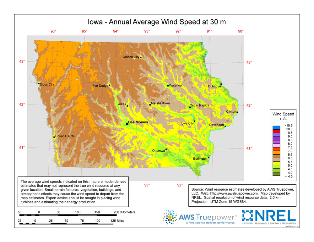 Next time you visit Western Skies Scenic Byway, try to identify the landforms and watersheds and note how wind and water have shaped the land over time!
0 Comments
Leave a Reply. |
Archives
June 2024
Categories
All
|
 RSS Feed