|
In a previous post about Western Skies Scenic Byway, we discussed how wind and water shaped the landscape of western Iowa. In addition to natural forces, people have also helped shape the modern landscape. Humans have inhabited the land that is western Iowa for thousands of years, impacting the landscape since the beginning. Indigenous people cultivated crops, built homes, and started regular fires. After European colonization beginning in the late 19th century, the land changed much more dramatically and rapidly. The contemporary landscape of western Iowa would be unrecognizable compared to the vast prairies and wetlands that covered the state prior to colonization. Iowa is the most altered of all 50 states, with the least amount of "wild" or "natural" places. "The state of Iowa has lost 99.9% of its prairies, 98% percent of its wetlands, 80% of its woodlands, 50% percent of its topsoils, and more than 100 species of wildlife since settlement in the early 1800’s. There has been a significant deterioration in the quality of Iowa’s surface waters and groundwaters." (Source: Iowa Code, Section 455A.15 Legislative Findings). The region has some of the best cropland in the world, and prairies and wetlands were converted to rowcrops over only a couple generations. Many of the steeper slopes were converted to non-native pastures. With this vegetation and land use change, the entire ecosystem changed from some of the most biodiversity on the planet to among the least. On top of the vegetative change, nearly all the rivers and creeks in western Iowa were channelized in the 20th Century. Straightening streams shortened their length, which increased the slope and caused the waterways to cut downwards into the deep, highly erodible loess soils. Most streams in the region have severe to extreme bank erosion and are carved 10 to 20 feet (or more) into the surrounding land. The increased stream slope also led to widespread gully erosion, with small waterfalls called knickpoints on many streams. The drastic elevation changes have required streambed grade control structures like spillways and dams to help protect roads, bridges, utilities and other infrastructure. 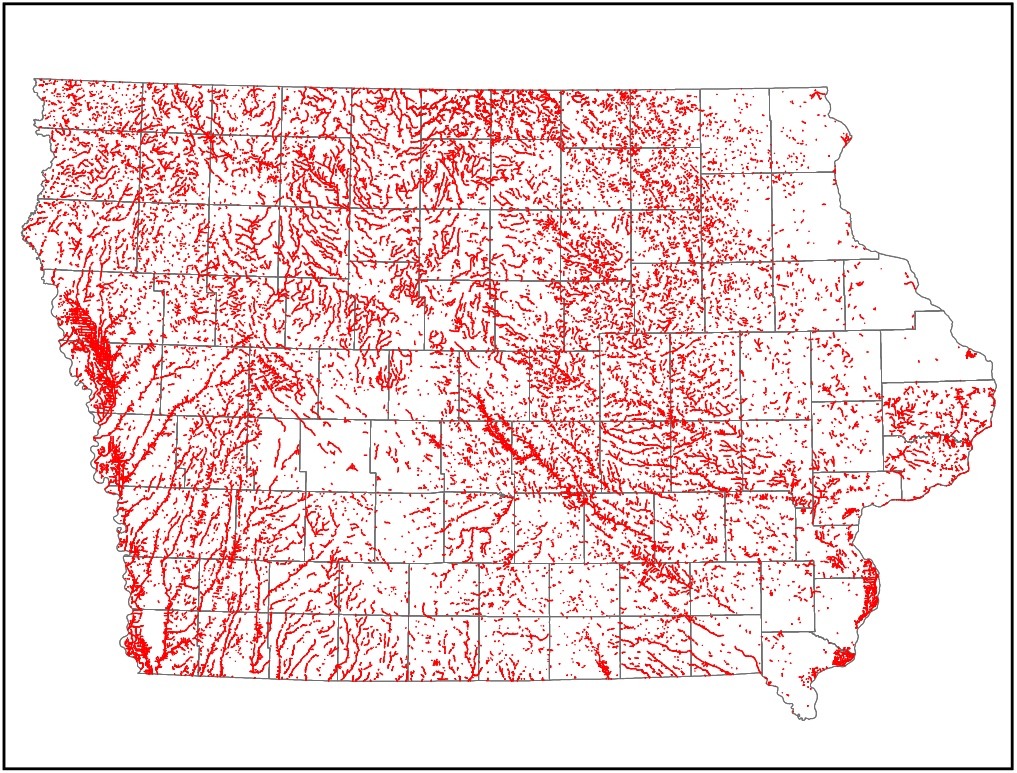 Channelized streams in Iowa. Source: Hungry Canyons Alliance 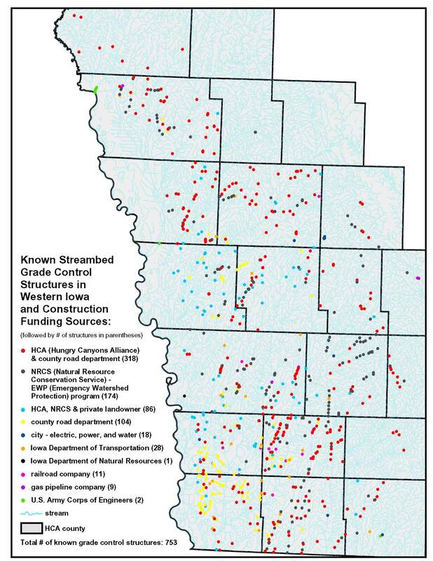 Streambed grade control structures in western Iowa. Source: Hungry Canyons Alliance (http://www.goldenhillsrcd.org/hungry-canyons-alliance.html) Due to their silty nature, the deep loess soils are home to the worst soil erosion on the continent. In fact, "loess" is a German word for "loose" and is colloquially called "sugarclay" due its erosiveness. The maps below show rill and sheet erosion in the continental U.S. in 2012 and 1982. While erosion has been reduced from more than 12 tons per acre to 6-8 tons per acre, this is still a concerning erosion rate. Learn about different types of soil erosion here. 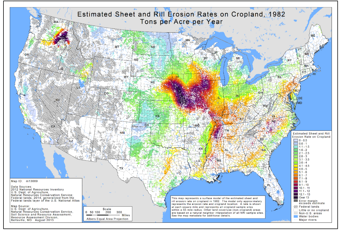 1982 erosion map. Source: http://1lbchallenge.com/wp-content/uploads/2018/03/Abreviated-2012-USDA-Natural-Resources-Inventory-Report-on-Sheet-and-Rill-Soil-Erosion-on-Private-Land-in-US.pdf 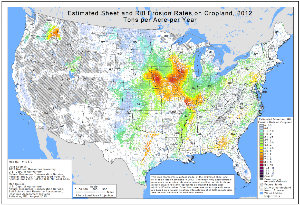 2012 erosion map. Source: http://1lbchallenge.com/wp-content/uploads/2018/03/Abreviated-2012-USDA-Natural-Resources-Inventory-Report-on-Sheet-and-Rill-Soil-Erosion-on-Private-Land-in-US.pdf 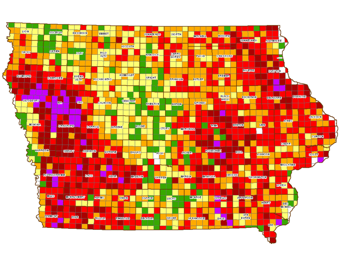 Average soil erosion per acre (Source: https://www.ewg.org/losingground/report/erosion-adds-up.html) Fortunately, agricultural conservation practices, especially terraces and water and sediment control basins, have reduced erosion. Planting rowcrops on contour instead of vertically on slopes also helps to slow erosion rates. These practices are nearly ubiquitous on western Iowa's croplands, further shaping the landscape. The earthen berms reduce rill and sheet erosion and runoff. 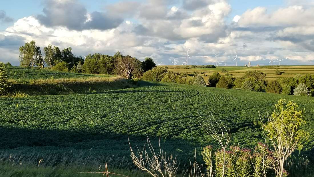 Typical western Iowa landscape, with contour rowcrops and terraced slopes. Photo by Lance Brisbois Prior to colonization and subsequent stream channelization, the prairie streams meandered across their valleys with crystal-clear water, as described in some early pioneer accounts. Today the sheet, rill, gully and streambank erosion makes the streams run a muddy brown color. New evidence has shown that phosphorous levels in streams are likely impacted significantly by streambank erosion, as "legacy" nutrients get stored in the soil and enter waterways when riverbanks erode. 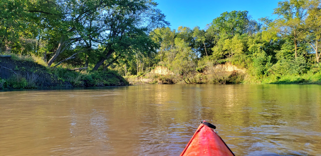 West Nishnabotna River in Shelby County, showing streambank erosion and muddy brown water. Photo by Lance Brisbois Some of the poorly-drained areas, especially on the Des Moines lobe in northeastern Guthrie County and some of the larger river valleys like the Missouri in Harrison County, were tiled to convey water off the land and improve agricultural opportunities. Tiling can carry nutrients, sediment, and pollutants into drainage ditches and streams, further decreasing water quality. Tiling is usually invisible above ground, but you may see the end of tile lines going into drainage districts or streams. Learn more about tiling and terracing here. 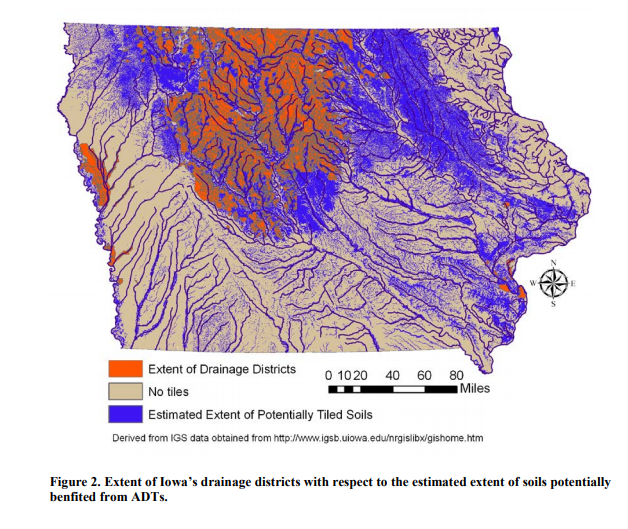 Drained soils and drainage districts in Iowa (Source: https://scholarworks.uni.edu/cgi/viewcontent.cgi?article=1000&context=other_facpub) Besides agricultural development, humans have built residential, industrial, commercial, and other infrastructure that shapes the land. Most of the communities in the region were founded along rail lines, which were some of the earliest transportation routes before many roads were built. 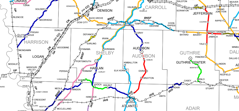 Source: Iowa DOT (https://iowadot.gov/iowarail/IOWA-FREIGHT-RAIL/RAILROAD-MAPS) Source: Iowa DOT (https://iowadot.gov/iowarail/IOWA-FREIGHT-RAIL/RAILROAD-MAPS) Most railroads in this corridor have been abandoned and are no longer active. Some have been replaced by recreational trails like the T-Bone Trail through Audubon County and the Raccoon River Valley Trail in Guthrie County. Many others were removed and have been farmed for decades, with no trace remaining. In some cases, the remnants are visible from satellite imagery and LIDAR, like this area just southwest of Harlan in Shelby County. 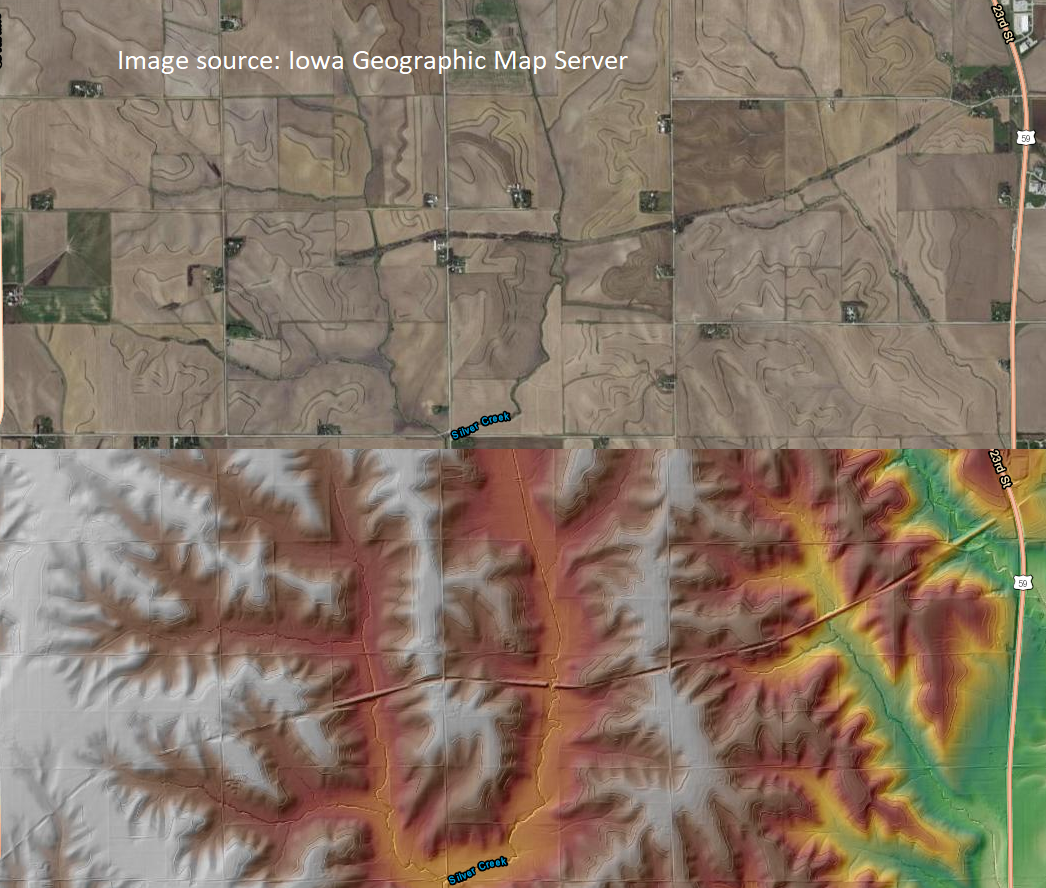 Many settlements that began before railroad construction eventually withered into ghost towns. In some cases, a few houses remain, but often there are no visible signs of these ghost towns on the landscape. The highway and road system also greatly contributed to the region's altered landscape and hydrology. For the most part, roadways are built up several feet from the surrounding landscape similar to railroads, and cut into the tops of the hills to reduce slopes. Unlike the railroads, which often followed the path of least resistance, the road system was set up on orthogonal grid system oriented along the cardinal directions, regardless of terrain. Some exceptions to the grid exist, especially in the hilliest parts of Harrison and Guthrie counties. Since the grid does not follow topographic or hydrologic boundaries, the construction of the road system in some cases altered watershed boundaries. Ditches on either side of the roads funnel water into the nearest stream, increasing flash flooding and nutrient runoff. 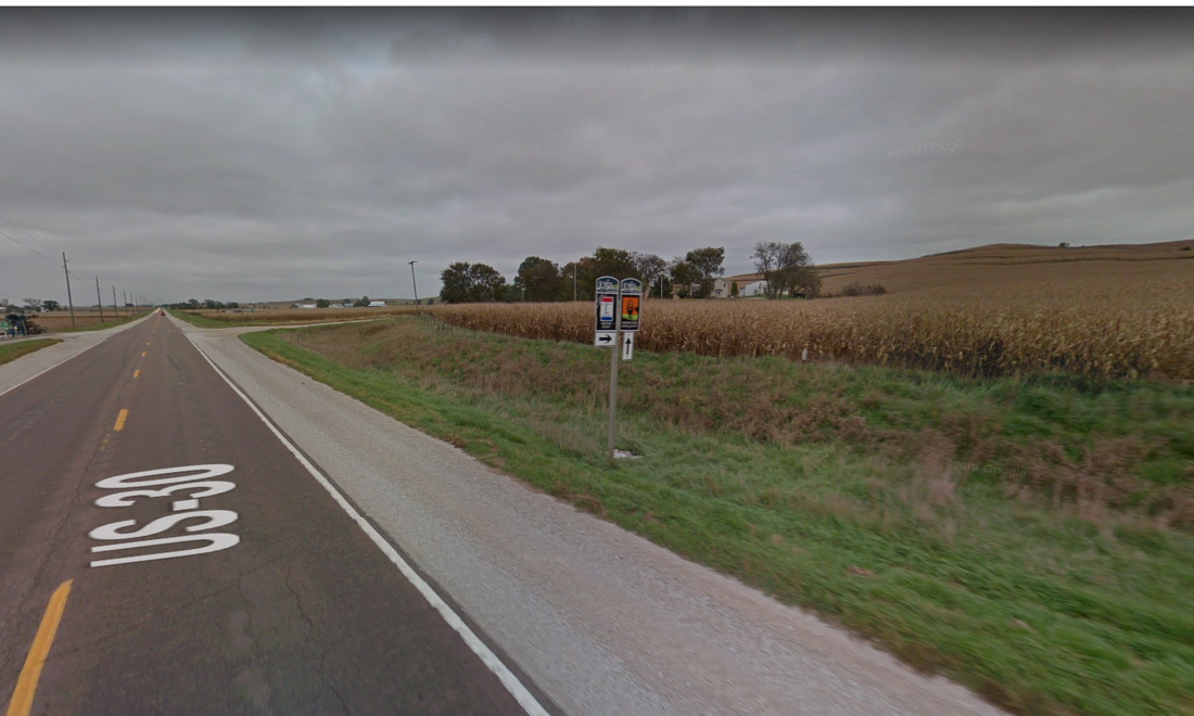 Roadbed built several feet above the river valley with drainage ditches on either side. Google Streetview Image from Highway 30 in Harrison County. 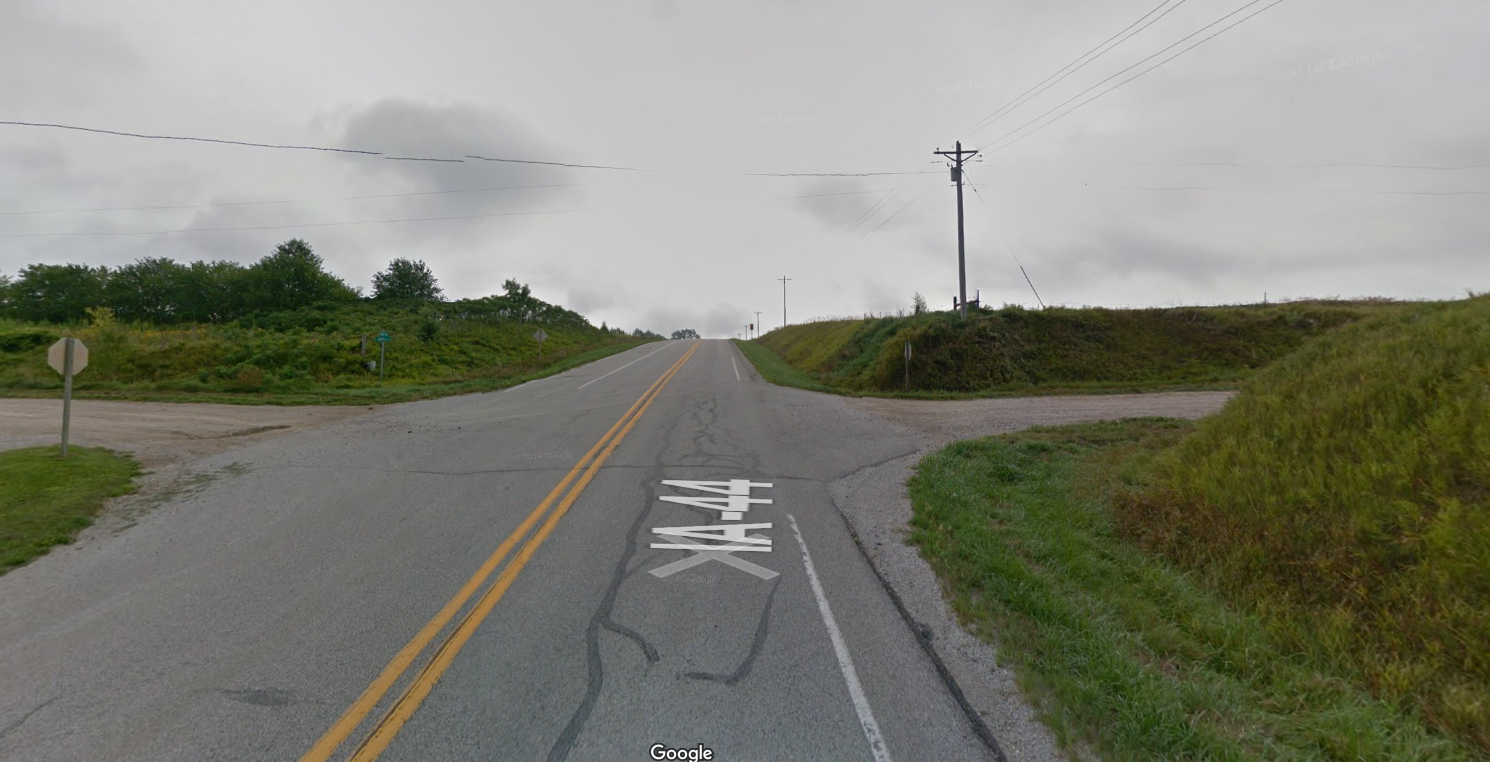 Example of highway roadcuts through the hills. Google Streetview image from Highway 44 in Harrison County. Next time you drive Western Skies Scenic Byway, try to spot how the land has been sculpted by human development, in addition to natural processes like wind and water.
2 Comments
11/18/2020 12:11:02 pm
Building awareness of these issues is crucial, because we are at a turning point for climate, biodiversity, and soil health. Many answers exist, but there is a lack of social and political will to implement them. Thanks for posting this, and especially thanks for the colorful and informative graphics. They communicate a lot at a glance. Leave a Reply. |
Archives
June 2024
Categories
All
|
 RSS Feed