|
by Seth Brooks The Loess Hills were formed by three natural forces: ice, wind, and water. During the final two glacial advances of the Ice Age—the first approximately 150,000 years ago and the second 18,000 years ago—glaciers in Canada, Minnesota, and the Dakotas ground bedrock into a fine sediment called glacial flour. Meltwater then carried the glacial flour south into the river valleys of today’s Midwest, where it was deposited in broad floodplains. As the meltwater slowed and the sediment dried, the fine particles were picked up by strong westerly winds and slowly accumulated into rolling dunes of dirt. These windblown sediment deposits, named loess from the German word for loose, were stabilized by grasses and then carved by water erosion into the razor ridges and deep gullies that we see today in the Loess Hills of western Iowa. The westernmost bluffs are the steepest and offer the most dramatic views of the abrupt change from the flat floodplain of the Missouri River Valley to the angular ridges of the Loess Hills. Perhaps the best place to experience this contrast is the Mondamin Unit of the Loess Hills State Forest. With over ten miles of trails in the unit, hikers can create several loops of varying distances. There are two main trailheads with parking that offer the best access to the Mondamin Unit. Approaching the unit from the east on Highway 127, Mondamin Hill rises abruptly at the junction with Highway 183. Continue east on Highway 127 through the junction to arrive at the southern trailhead—the turn-off is marked by a brown sign in both directions. To reach the northern trailhead, turn north at the junction and follow Highway 183 approximately two miles until you see the brown sign indicating the turn-off for the trailhead. Different loops can be hiked from each trailhead; let’s start with the southern section of the Mondamin Unit. The recommended way to begin the southern loop is clockwise, as climbing up the ridge of Mondamin Hill is much easier and safer than descending, especially if the path is muddy. The trail climbs over two hundred feet in three-tenths of a mile—not worth batting an eye at if you’re a mountaineer but for flatlanders this nearly qualifies as a mountain. After “summiting” Mondamin Hill, the trail levels out and follows a wide path cut in the prairie grass atop the ridge. Soak in the views to the west of the Missouri River Valley and note the steep western slope covered in prairie grass. The shrubs, hardwoods, and eastern redcedars creeping up the west-facing bluffs are kept at bay by periodic prescribed fires to preserve the ridgetop prairie. 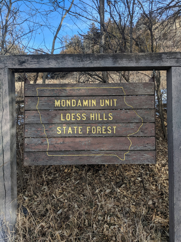 Photo by Seth Brooks 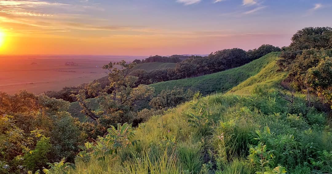 Photo by Lance Brisbois 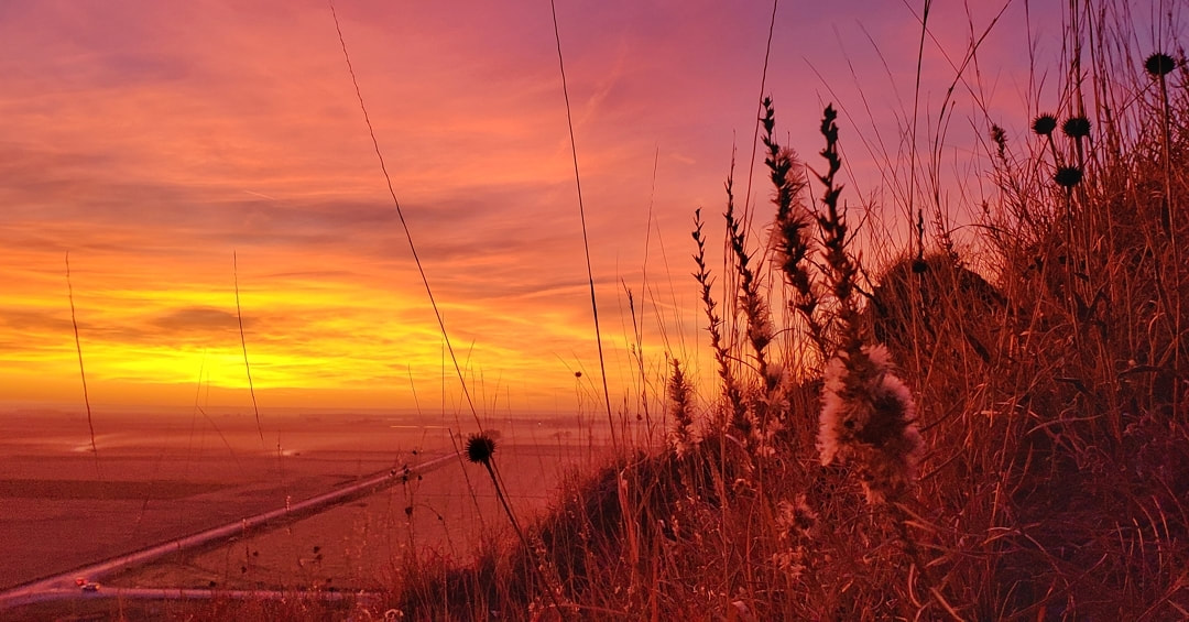 Photo by Lance Brisbois 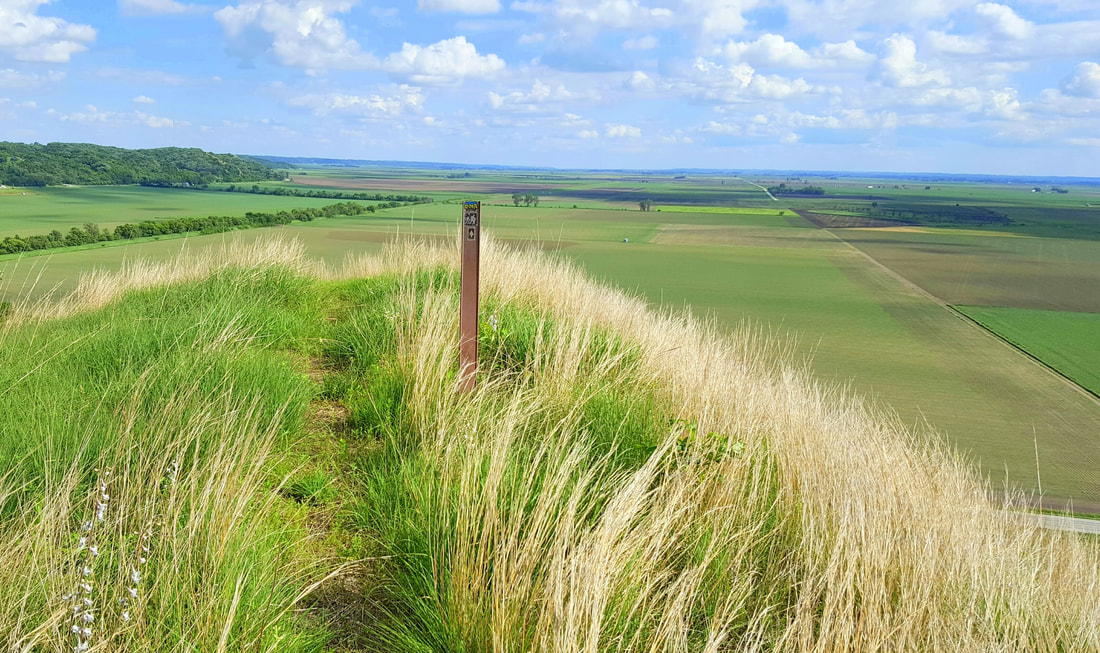 Photo by Lance Brisbois 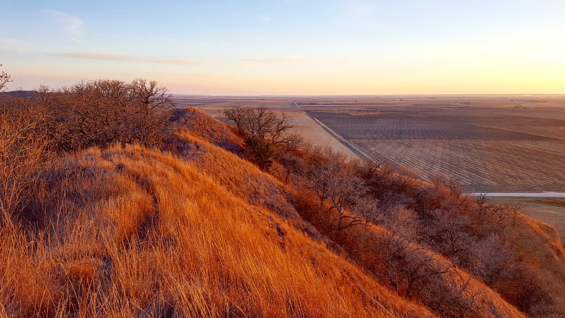 Photo by Lance Brisbois 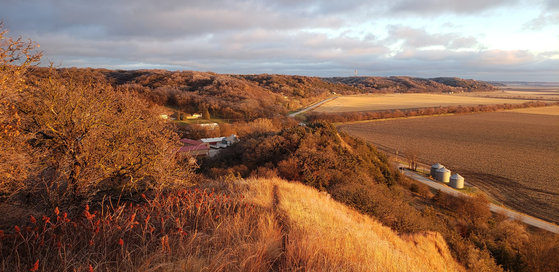 Photo by Lance Brisbois 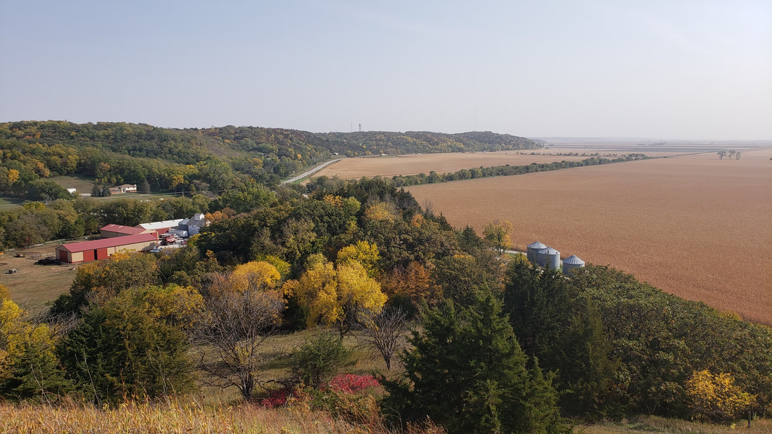 Photo by Lance Brisbois 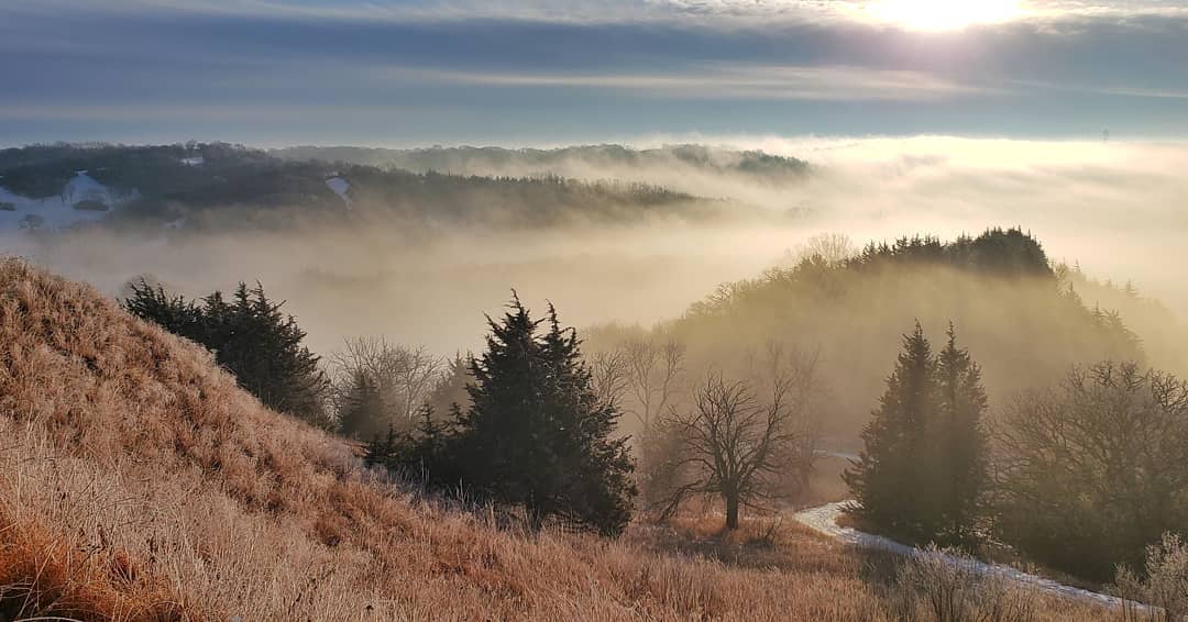 Photo by Lance Brisbois 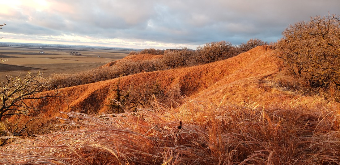 Photo by Lance Brisbois 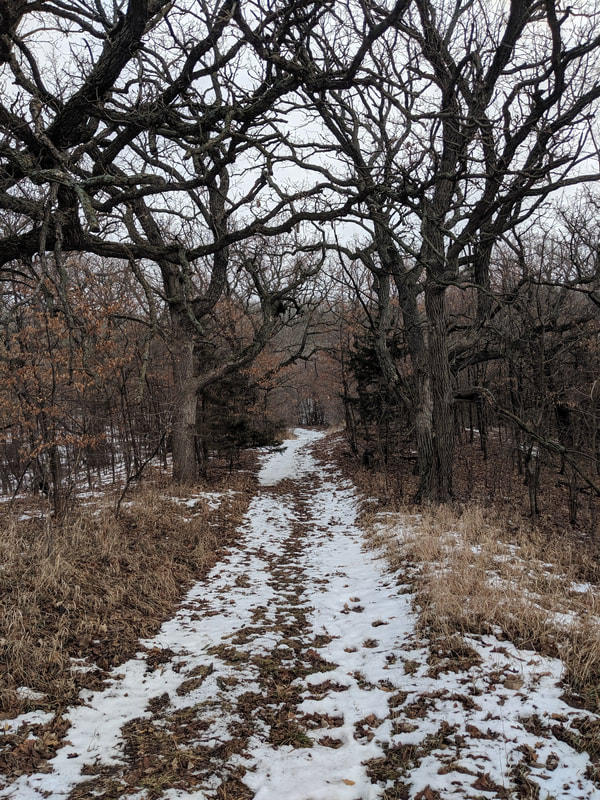 Photo by Seth Brooks 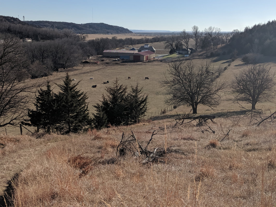 Photo by Seth Brooks 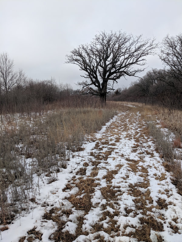 Photo by Seth Brooks After almost one mile, the ridgetop trail descends briefly down the eastern hillside through a wooded area only to climb back atop the ridge. The bench at the one-mile marker is a perfect place to sit and take in the expansive views of the Missouri River floodplain. Leaving the bench behind you, the trail ahead offers a few possibilities. I prefer to continue along the ridge for one mile (from the bench) until you have no other option but to descend down the western slope into a pleasant wooded hollow. This path will loop back up to the ridge, arriving at a crossroads you will have passed earlier while walking north along the ridge. This crossroads gives you several options again; I recommend continuing straight down the eastern hillside to investigate an interesting grove of white poplars that is conspicuously out of place amongst the bur oaks and hardwoods. This trail will loop back up to the ridge, where you will immediately descend once again the eastern slope albeit on a different trail. This trail will lead through a densely wooded area until you reach an open field. From here, the trail is a straight-forward: head south one and a half miles to return to the trailhead. Like the southern loop, the northern loop offers various options allowing you to make your own loop. I completed a variation of a lollipop loop that traverses the westernmost ridge in both directions. I believe the trail along this ridge is the most dramatic of all the razor ridge trails I have hiked in the Loess Hills, thus worthy of hiking the ridge in both directions. However, feel free to tackle this section of the Mondamin Unit as you wish. If you do hike a classic loop, however, you will miss a tranquil meadow that separates the western and eastern ridges of said loop. I recommend exploring this meadow, especially the southern end where you can find a great spot for a picnic or an overnight campsite next to an old bur oak. Someone has constructed a table and placed two large logs around a fire pit dug into the ground. The lack of water nearby, however, would require you to hike in all your water for the duration of your stay. This would be the ideal spot to camp if you wish to combine both the northern and southern loops into a ten-mile tour of the entire Mondamin Unit, made possible by a 1.5-mile trail that connects the two sections (refer to the Iowa DNR map of the Mondamin Unit). While certainly possible to hike all ten miles in one day, the option of dispersed camping in the Loess Hills State Forest allows you to take advantage of this spot in an idyllic meadow. If you do camp, please follow Leave No Trace principles. 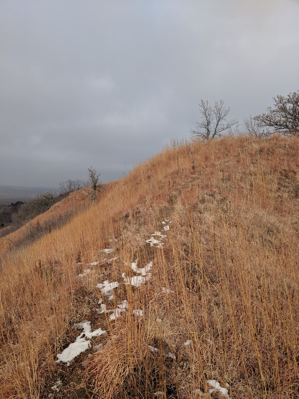 Photo by Seth Brooks 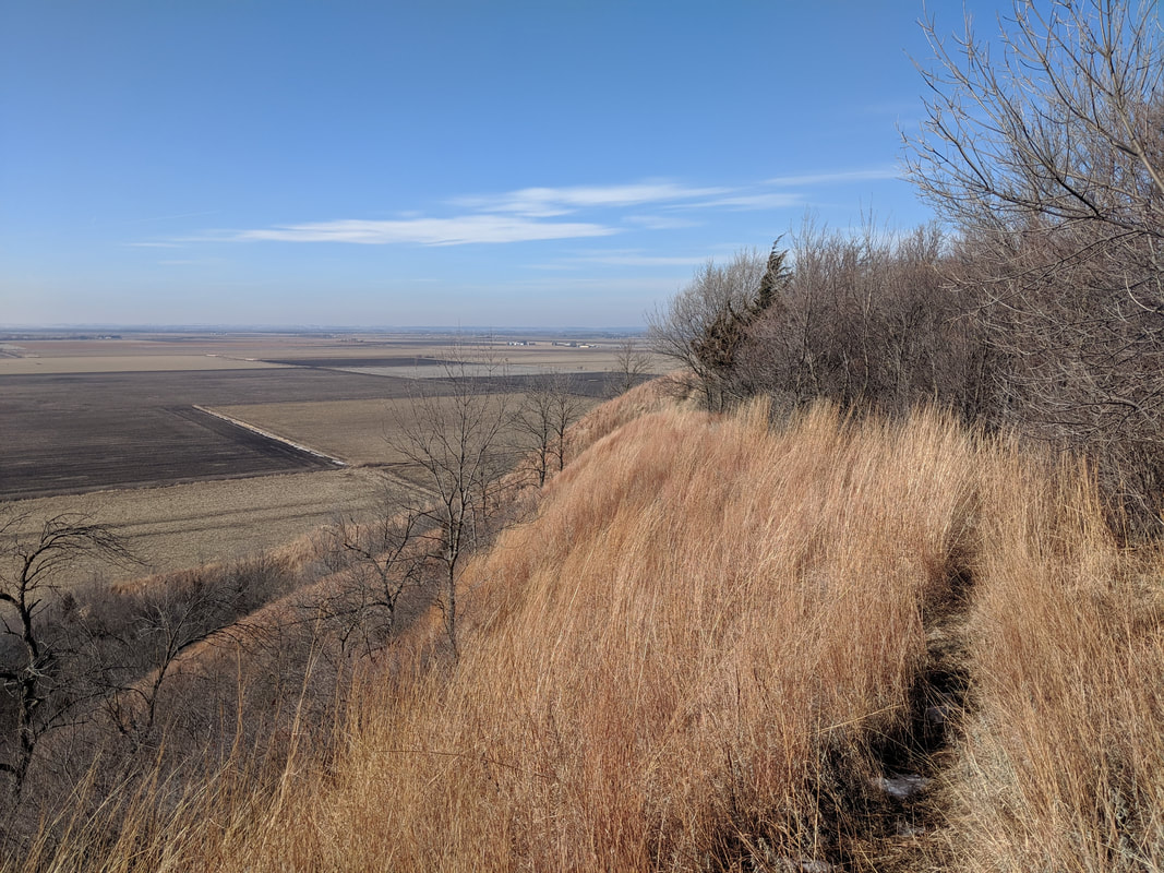 Photo by Seth Brooks 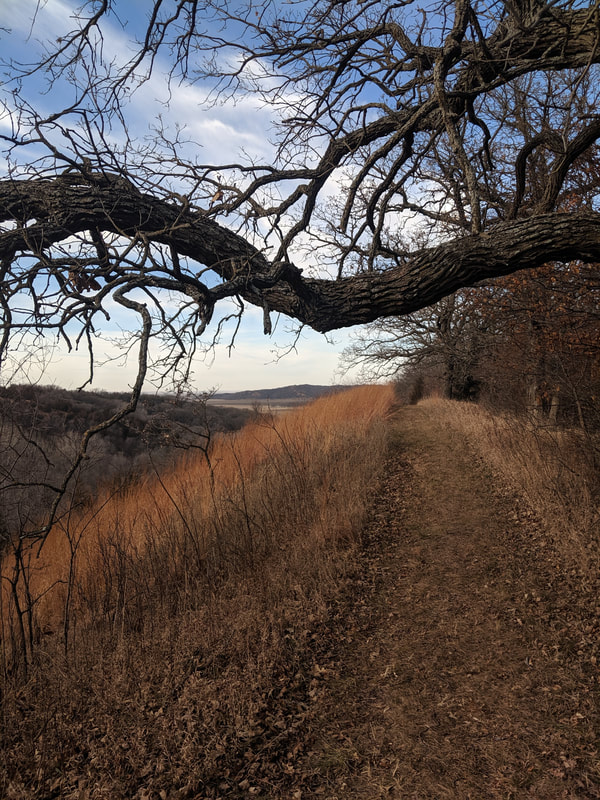 Photo by Seth Brooks 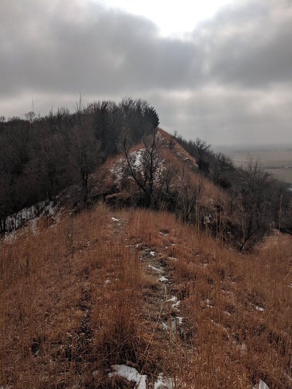 Photo by Seth Brooks 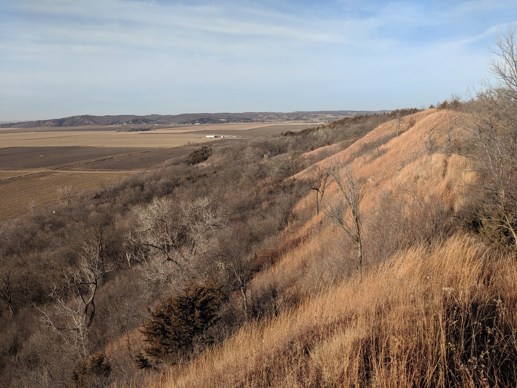 Photo by Seth Brooks 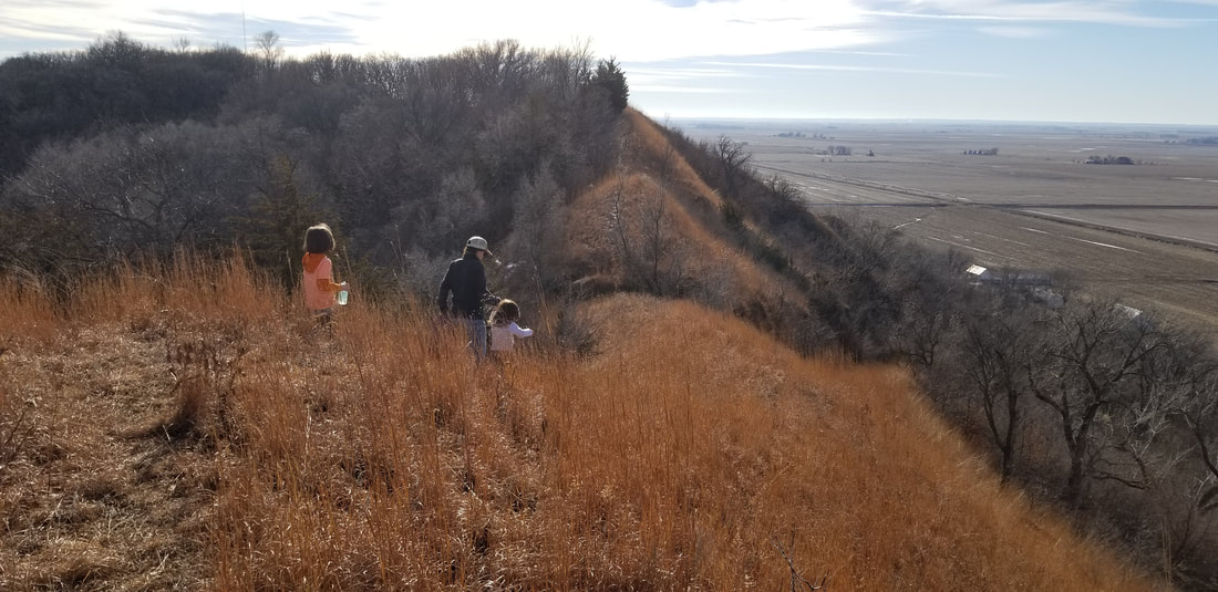 Photo by Lance Brisbois 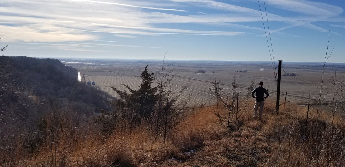 Photo by Lance Brisbois Maps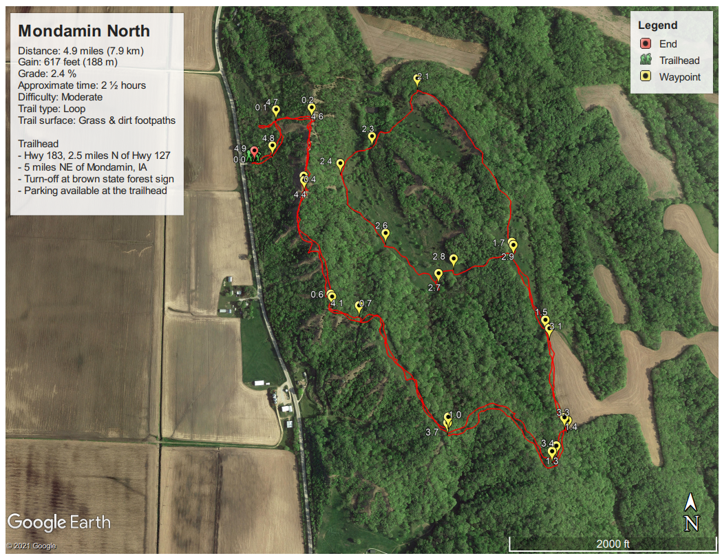 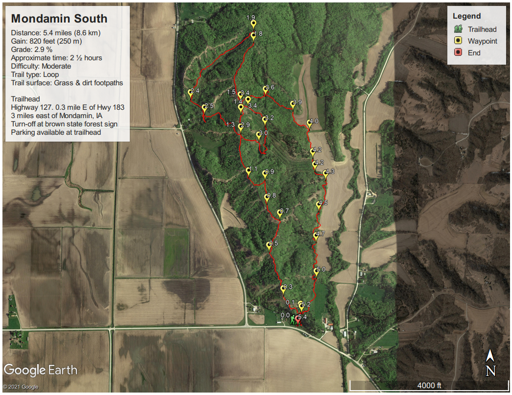 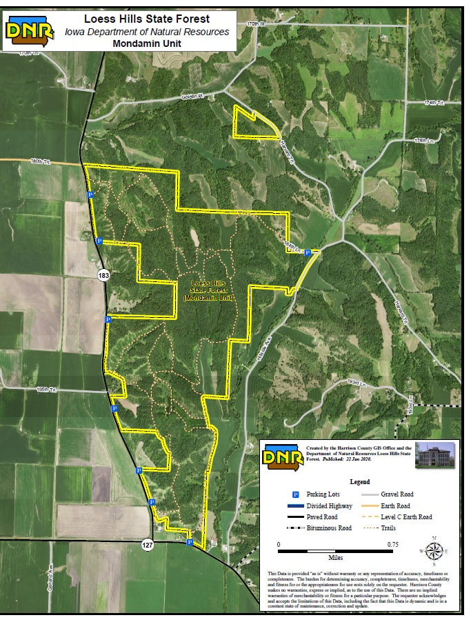 AllTrails tracks:
0 Comments
Leave a Reply. |
Archives
June 2024
Categories
All
|
 RSS Feed