|
We've been working with Pottawattamie County staff to photograph the water trail using Mapillary. The imagery provides a 360° view of the West Nish Water Trail in Pottawattamie County. We have currently completed Avoca to Carson and hope to finish Carson to Macedonia in 2019. The images can be useful to paddlers and tourists, as well as to landowners and farmers along the river. It will be useful long-term to see how the river changes over time. It will also be a good way to imagine being on the river this winter when it's too cold to get out there! A few sample images are below. Click here to see more. 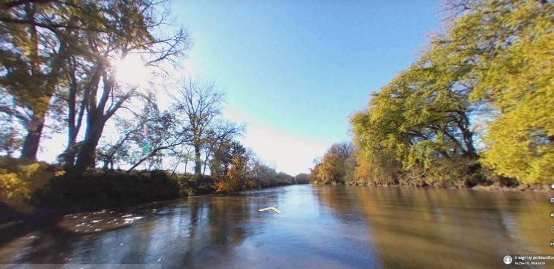 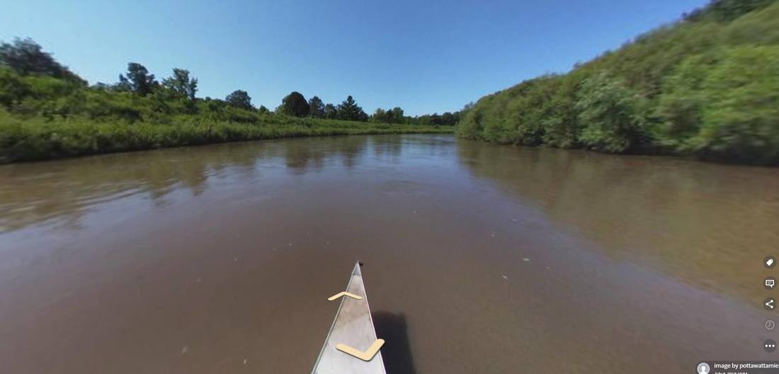 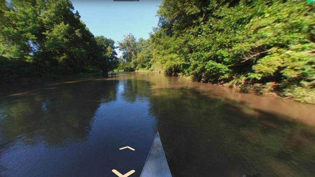
0 Comments
By John Thomas, Project Director and Fluvial Geomorphologist for the Hungry Canyons Alliance. This is part of the Loess Country series--stay tuned for more! Loess soil isn’t rare; what’s rare is the fact it is so thick in the Loess Hills along the Missouri River of Western Iowa. This thickness and the distinctive physical properties of loess make the Loess Hills a truly unique landform. Loess is made up of pre-dominantly silt-sized quartz grains that are calcareous (chalky), porous, and lightweight, which cause it to be very cohesive when dry but easily eroded when wet. Vertical faces of loess in road cuts and gully walls have been known to stand for more than a hundred years, in contrast to loess slopes, which are prone to some of the highest erosion rates in the country. Old U.S. Geological Service records show a stream gage in Waubonsie Creek in the Loess Hills (Mills and Fremont Counties) recorded 2.7 pounds of sediment per gallon of water in 1947, almost three times higher than any other suspended sediment load measured on any other Iowa stream in history. Also unique to the Loess Hills are the stair-like features found on very steep slopes called cat-steps. Gravity and water cause small rotational slips to form long, narrow benches, about a foot wide, with vertical scarps – like a flight of stairs – across the hillsides. The deep loess soils, steep slopes, and propensity for erosion by water have created a high number of stream channels per square mile in the Loess Hills. Many of these channels are gullies that have cut deeply into the landscape, some reaching depths of more than 80 feet, and having near-vertical side walls with a semi-circular headcut, or overfall, at their upstream end. Gullies expand and erode upstream during rainfall when either surface runoff, entering the gully via the headcut, or groundwater flow, entering the gully at the base of near-vertical walls, de-stabilize the gully walls causing bank collapse. Runoff then carries away the collapsed bank debris, preparing the walls again for collapse. While some of the larger gullies were likely present before Western Iowa was first settled in the 1850’s, many of the gullies we see today began after widespread unsustainable agricultural use on the steep, erosive uplands in the late 1800’s to mid 1900’s. The channels cut down even further after many streams in Western Iowa were straightened from 1900 to 1950. Dams, flumes, and other types of structures have been constructed throughout the Loess Hills to try to halt this channel degradation that has been so destructive to this unique landform. 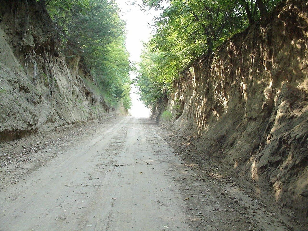 Loess Hills road cut. 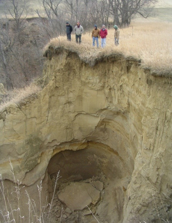 Loess gully headcut |
Archives
April 2024
Categories
All
|
 RSS Feed