Frontier Iowa Trails
Golden Hills RC&D helps coordinate the Frontier Iowa Trails (FIT) network, which is a group of western Iowans who are working to develop a regional multi-use trails system.
Western Iowa Bike Trails and Routes:
Western Iowa Bike Trails and Routes:
- Iowa DOT Bike Map - Statewide map showing trails, bike routes, paved shoulders, and traffic volumes. You can also pick up a printed copy of this at our office - 712 South Highway Street in Oakland.
- Metro Area Bike Map - interactive map icludes trails and bike routes in the Omaha-Council Bluffs area.
- Iowa by Trail - interactive mobile app that connects Iowans to trails and surrounding natural areas.
- Iowa Bike Routes - includes information about on-road routes, trails, gravel routes, and more.
- Bike Iowa - this site connects "cyclists with Iowa communities and making Iowa a better place to ride your bicycle with the most comprehensive Event and Race calendar, News, Features, Reviews, RAGBRAI and Team and Club information on the planet."
- American Discovery Trail - The ADT is a cross-country trail composed of many other existing trails and some unique connector routes between them.
- Great American Rail Trail - This coast-t0-coast trail passes through southwest Iowa. Parts of it are already built, with some gaps remaining.
- Cass County Trails Map - Current trails in Cass County.
- Avoca Trails Map - City trail system in Avoca.
- Pottawattamie County Trails - Current trails in Pott. County.
County Trail Plans
The maps below are from countywide trail plans specifically for hard-surface trails. These maps are based on community input sessions for the most popular routes by residents of the county. The plans are long-range and offer a guide for where people would like to see trails.
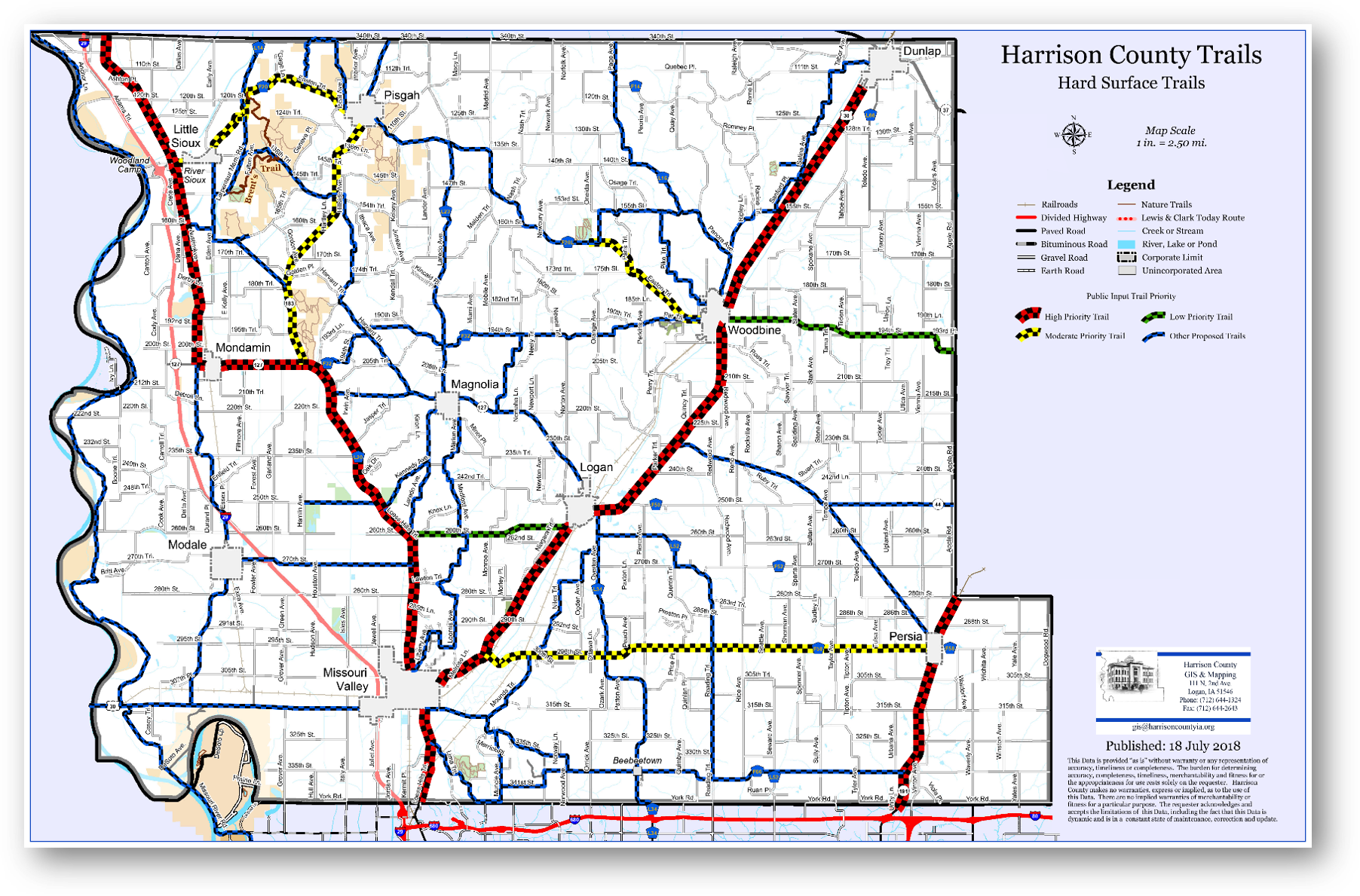
Harrison County
|
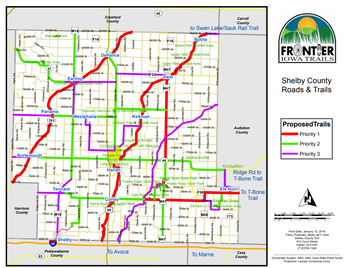
Shelby County
|
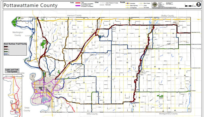
Pottawattamie County
|
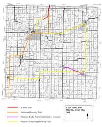
Cass County
|
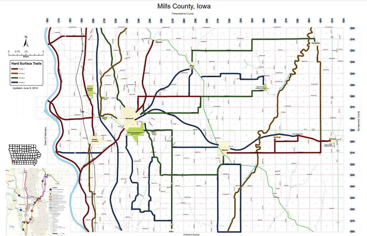
Mills County
|
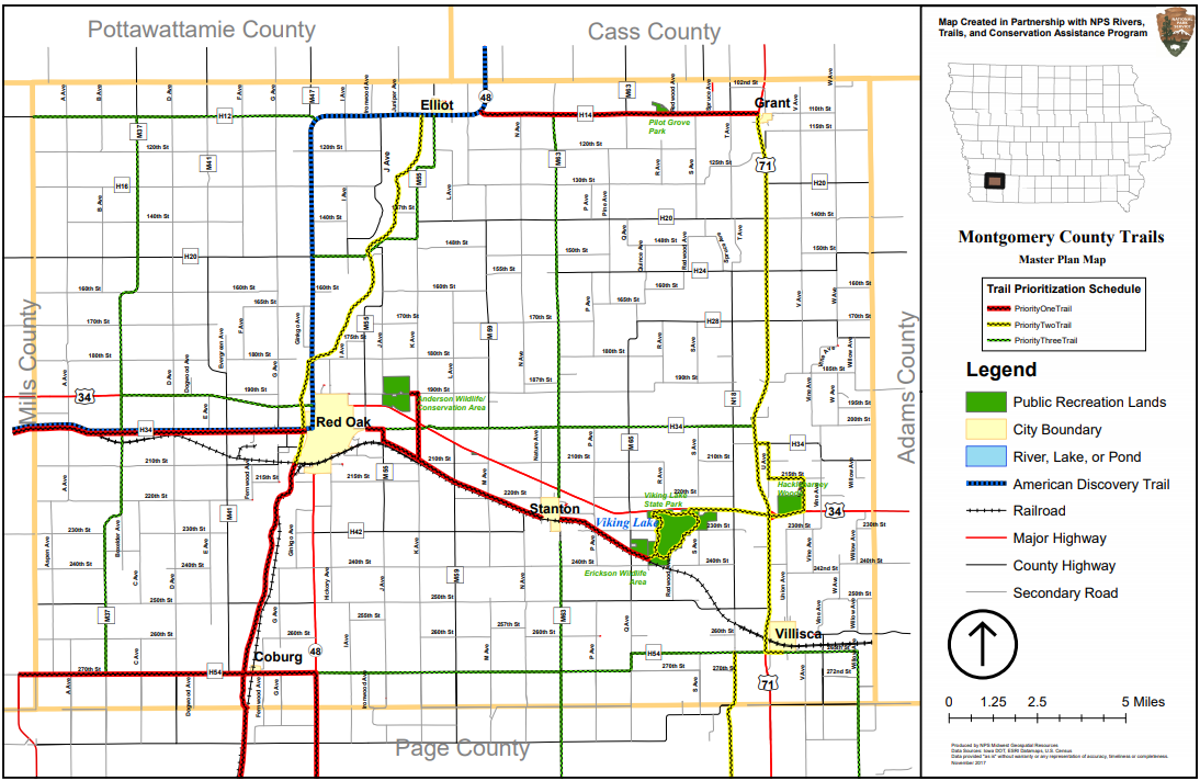
Montgomery County
|
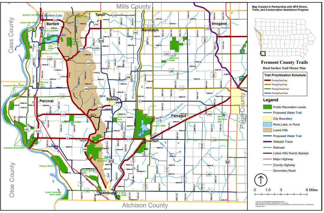
Fremont County
|
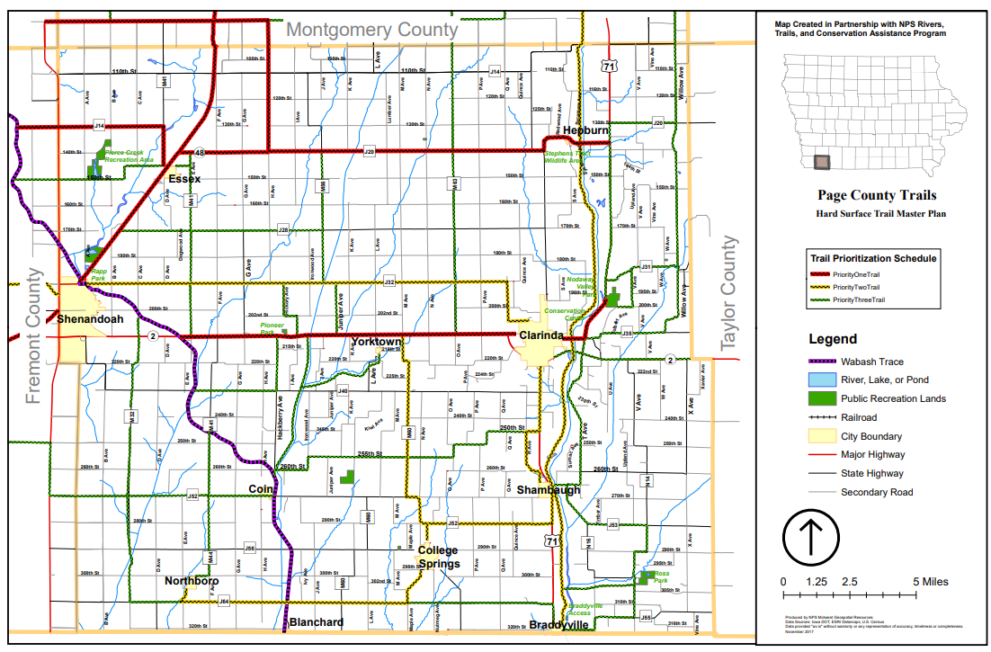
Page County
|
FIT partners include: