|
Cottonwood Hill Farms on the outskirts of McClelland in Pottawattamie County is a multigenerational livestock farm. John Springhower’s grandparents started farming what is now Cottonwood Hill Farms in 1955, and his grandmother lived in the house until 2020. John started farming the entire farm in 2013 with corn and soybeans. John’s dream of farming full-time came to fruition in 2021. After learning about environmental, human health, and economic concerns related to conventional rowcrops and the Standard American Diet, John decided to transition the farm primarily to livestock production, starting with grass-fed beef. He later added pigs and chickens, then a dairy herd last year. 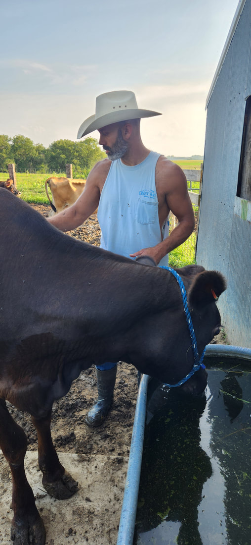 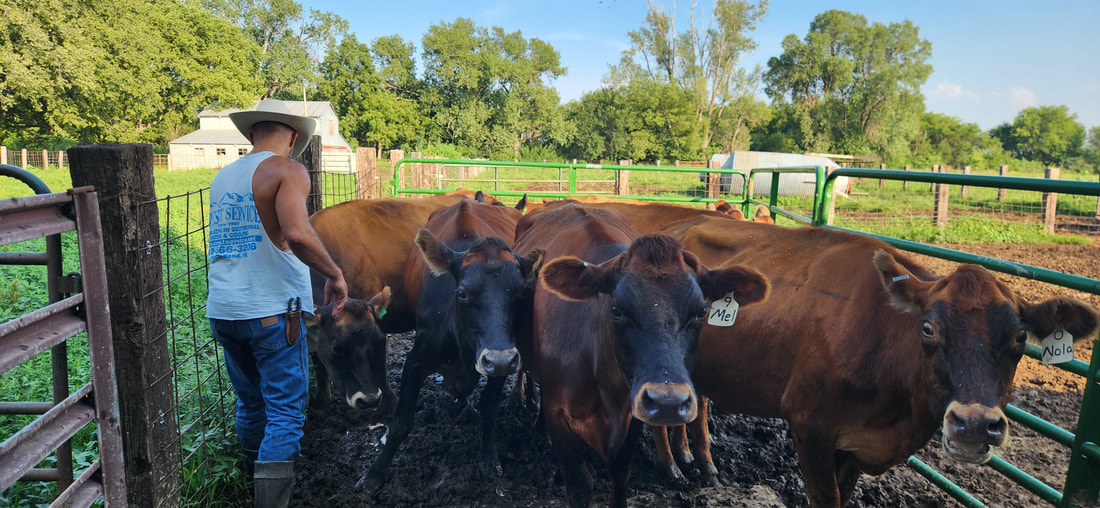 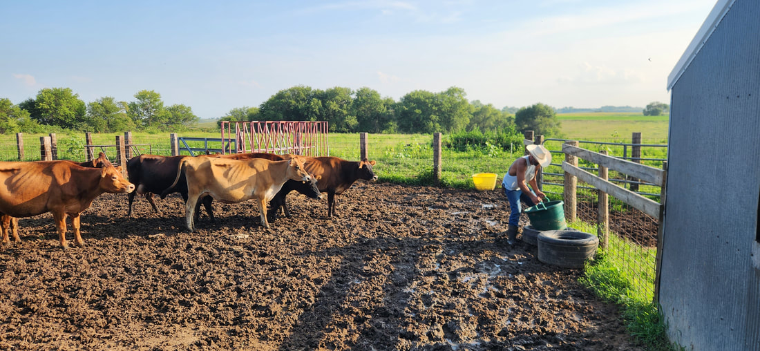 In 2021 Cottonwood Hill Farms purchased 21 head of cattle, including 18 dairy cows. Today they are milking 10 cows. They stopped using anhydrous fertilizer, sythentic chemicals, and genetically modified seed and feed. The livestock also no longer consume soy products. Their cattle are primarily Jersey, with some red angus, shorthorn, highland, Aubrac mixed in. The milk protein is A1/A2, but they are moving towards more A2 for the health benefits. The chickens include free-range layers and broilers. 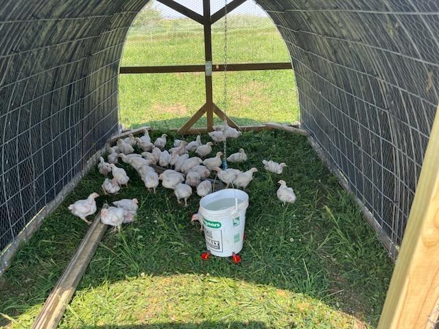 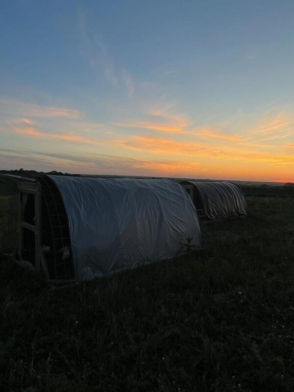 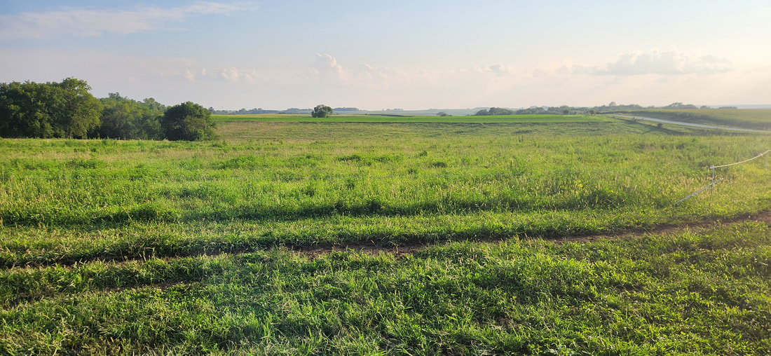 Some of the land on the farm had poor soil health due to many years of rowcrop production, and John wanted to improve the soil health. A rotation of alfalfa and oats has replaced soybeans and corn. Cattle are also rotated through paddocks regularly, and the chicken tractors are moved daily. In the spring, fresh cows are rotated daily, but dry cows and the bull are moved less frequently. Pastures include a mix of cool- and warm-season grasses like orchard grass, rye, timothy grass, and fescue. Some native species like big bluestem have made an appearance recently, a welcome sight indicating that soil health is improving. Eventually they would like to be able to raise all the feed to last throughout the year. They also get mushroom blocks from Terra Firma Fungi to create healthy compost for the soil. 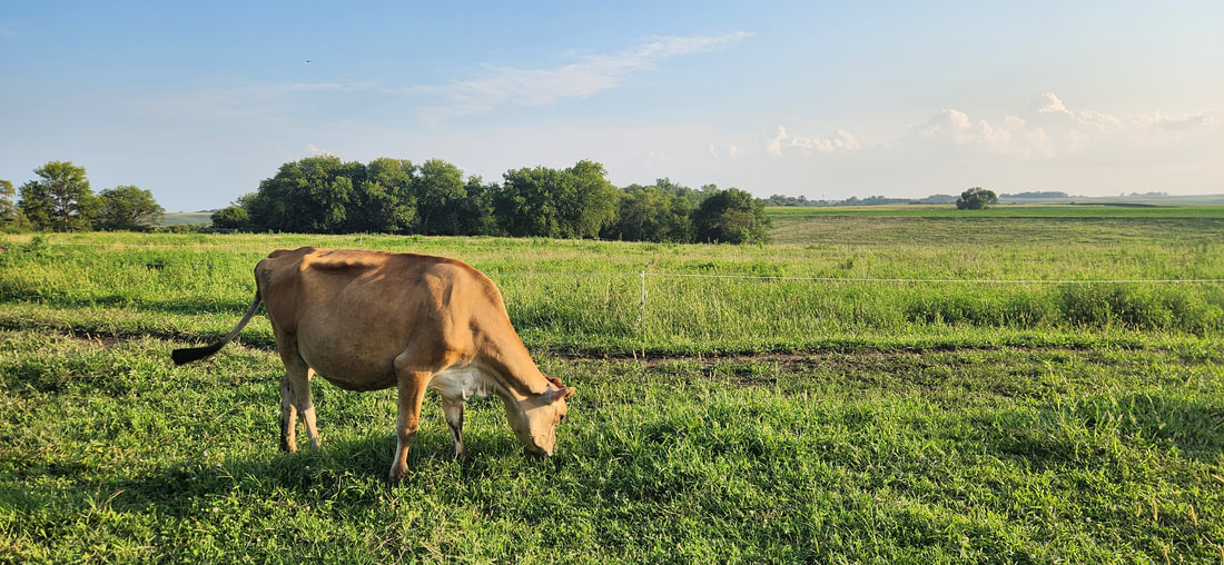 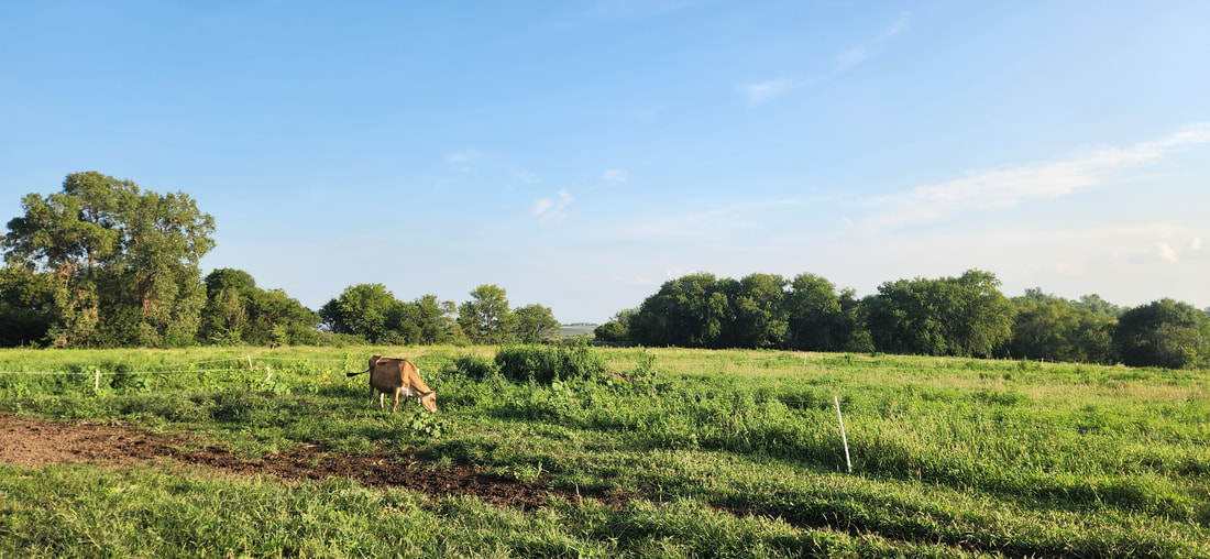 As of August 2023, Cottonwood Hill is taking a break from beef and pork to focus on the dairy. They currently are getting just over 20 gallons per day, but that can vary throughout the year. Food safety is of utmost importance for the dairy. Milking equipment is cleaned with Dawn dish soap and vinegar, and they avoid synthetic chemicals on the livestock and equipment. Just this year, the State of Iowa legalized on-farm sales of raw milk with numerous restrictions and requirements, however, Cottonwood Hill Farms does not sell their milk. Their milk is obtained through a “Herdshare Program” where they are developing a community of like-minded folks, and plan to do more on-farm events in the future. 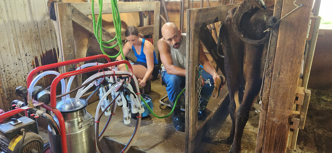 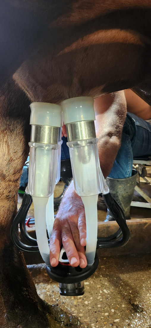
0 Comments
Adam Junge’s family has a long history of farming, starting in east Omaha in 1890. Adam has continued that tradition and started farming at his current location between Council Bluffs and Underwood 4 years ago. 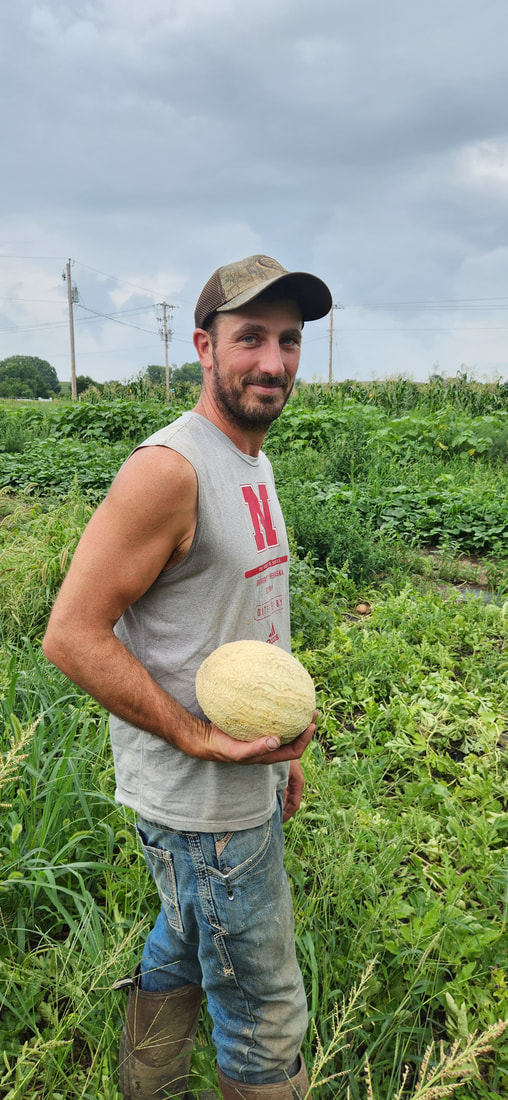 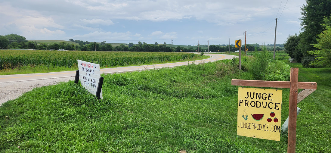 Junge Produce grows a wide variety of vegetables as well as some fruit, bedding plants, hanging baskets, and eggs depending on availability. You can buy their produce starting in spring with early crops like asparagus, well into the fall with pumpkins and squash. 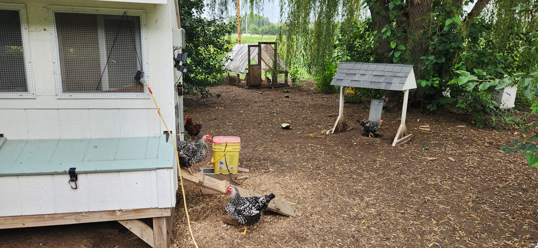    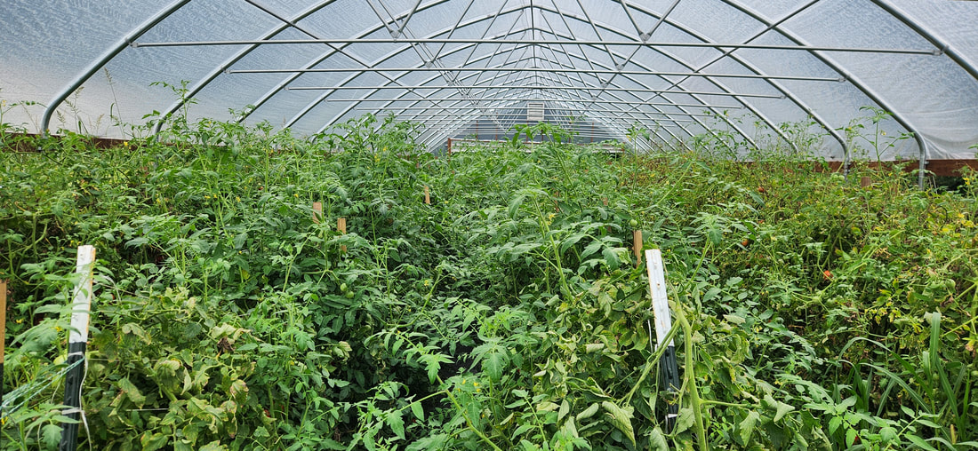 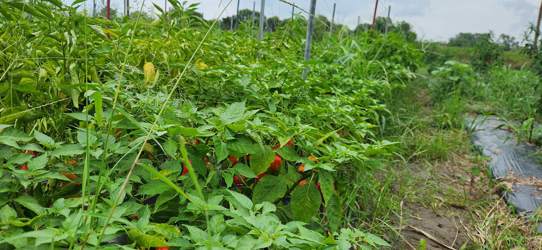   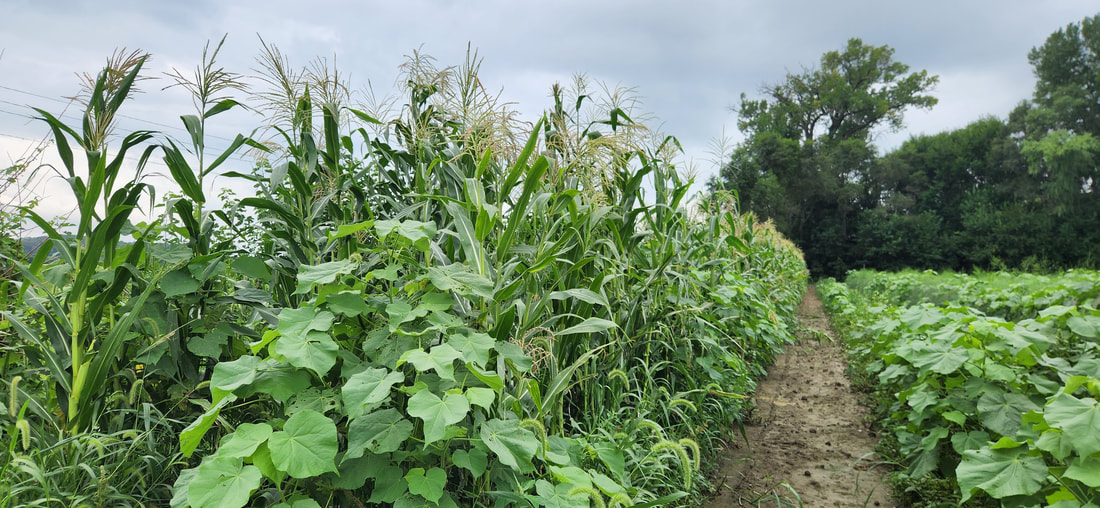 They grow on five acres at their home and have an additional four acres at a farm just down the road. They avoid spraying herbicides and use organic pest control for some crops, so weeding is a constant battle. Adam is currently farming full-time with help from his wife Erin and their two children. 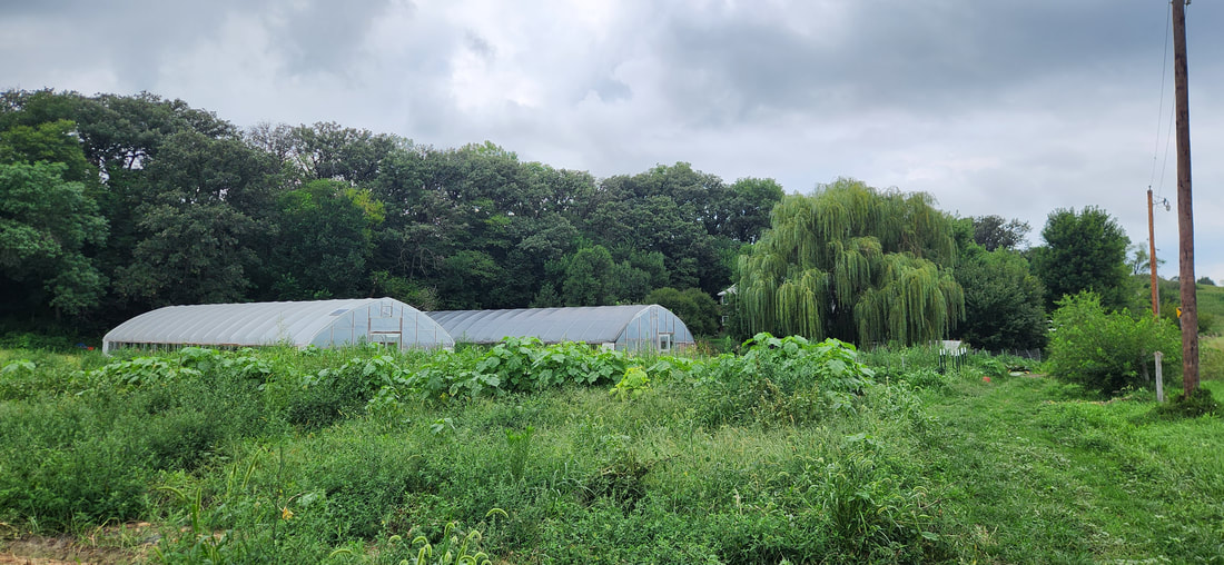 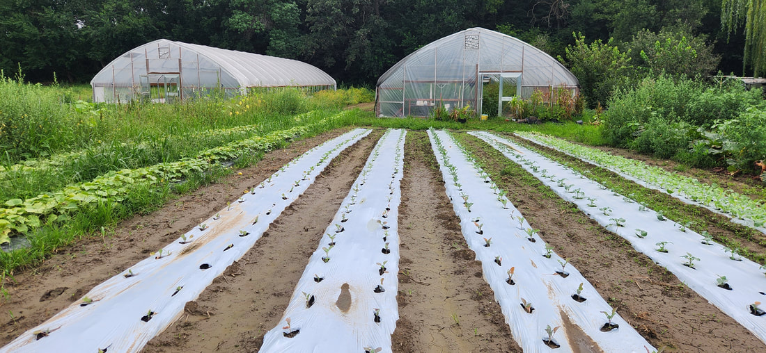  They have an on-farm market on Monday, Wednesday, and Saturday. They also sell at the Council Bluffs Farmers Market on Thursdays, Underwood Farmers Market, Treynor Farm, and Florence Mill Farmers Market. Learn more at their Facebook page: https://www.facebook.com/jungeproduce
Heath and Katie Hoppes started Hidden Hollow Farm in 2015 with a hay, small grains, and corn rotation on about 80 acres in the Loess Hills of Pottawattamie County. The Hoppes family’s goal was to grow more of their own food, know how it was raised, and to become more self-sufficient. Their crops have been Certified Organic since 2018. This year they had about 50 acres of hay, which is used to feed their cattle during the winter months. In addition to crops, they started raising broiler chickens in 2018, then later added pigs, and finally Aberdeen cattle. They raise 10-15 hogs per year, and currently have 30 head of cattle. The cattle are primarily grass-fed but do eat some spent grains from Full Fledged Brewing in Council Bluffs. They are rotated on several paddocks of grass including both native prairie species and brome. The hogs and cattle are processed at KB Meats in Blair, NE. Hidden Hollow typically has 2-3 batches of broilers per year, and a batch of turkeys each fall that are ready just in time for Thanksgiving.  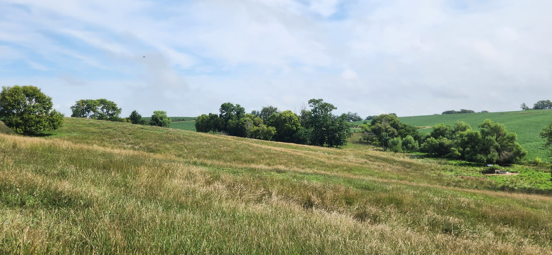 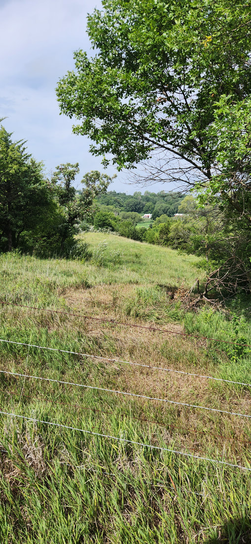 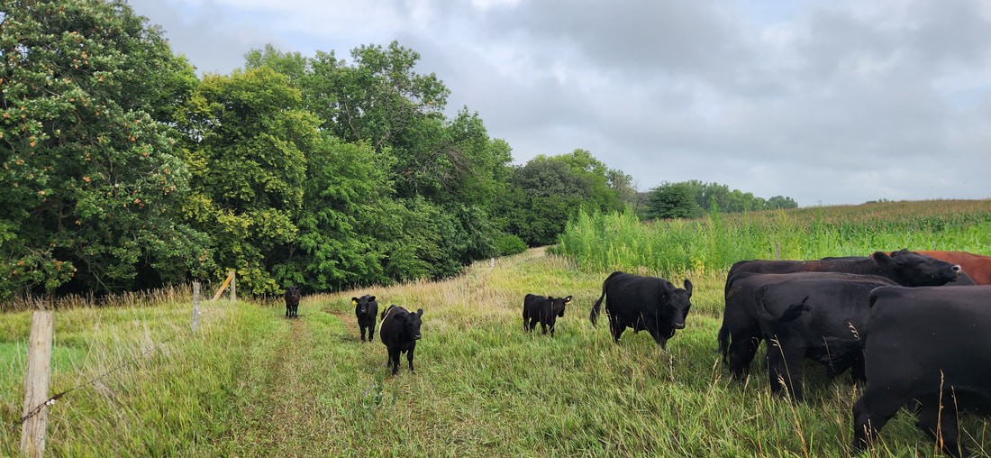 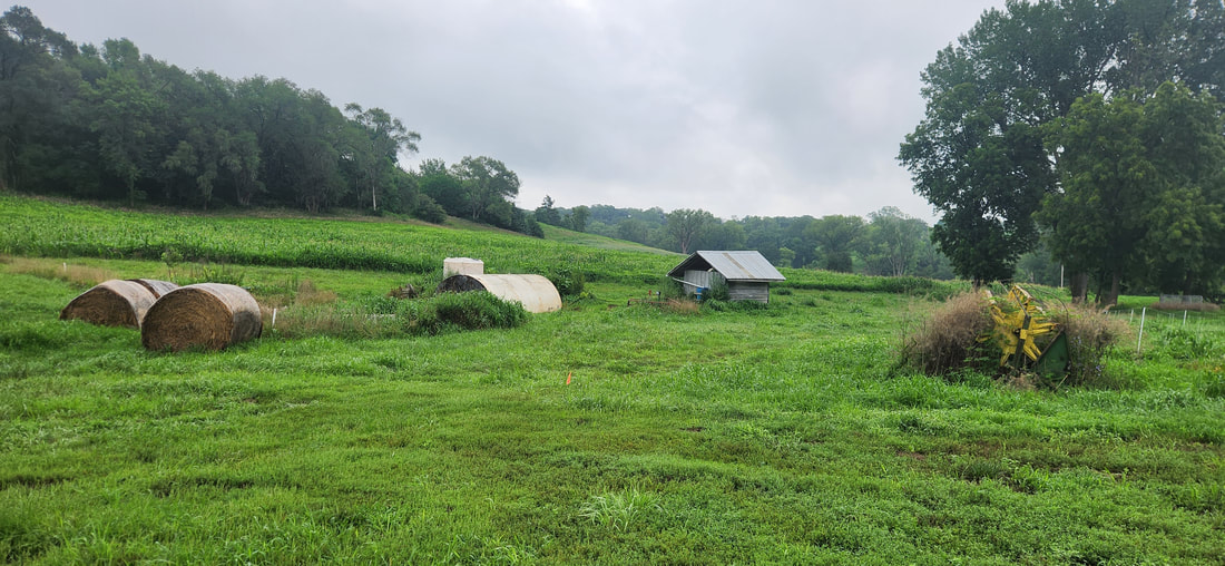  Customers can also order online or contact the farm to pick up on the farm. They also sell at the Council Bluffs Farmers Market. While they encourage you to try their products, they also want to promote local foods more broadly and support other local farmers.
Learn more by visiting their website, Facebook page, and Instagram. Emily & Nathan Paulsen, started Brun Ko Farm in 2015, with a milk cow and a few bottle calves. Since then, they have relocated twice, and finally landed at their current location east of Elk Horn in 2017. They started with 6 acres and have scaled up to 15. Unfortunately due to regulations and restrictions, they realized a dairy farm would be extremely difficult and have pivoted their focus to meat and vegetables. Brun Ko means Brown Cow in Danish, a nod to the area’s Danish heritage. Emily & Nathan currently have a small herd of Aberdeen angus, along with pigs, laying hens, and broiler chickens. They also graze sheep for Harrisdale Homestead periodically through the summer. Their beef, pork and lamb is processed at Anita and Minden lockers, while their chickens are processed at Duncan Poultry. 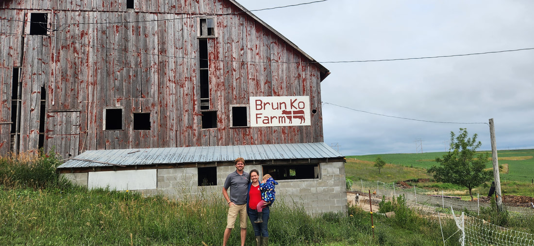 During late winter/early spring, Emily starts her seeds in a heated greenhouse but for fall crops, she uses a carport with shade cloth. Emily uses soil blocks as an alternative to plastic containers. Brun Ko prefers to use Beautiful Land soil c3 when making soil blocks. In addition to starting vegetable transplants, Emily also grows flowers for companion planting to attract beneficial insects to the vegetable fields. Brun Ko grows tomatoes, lettuce, carrots, cabbage, onions, beans, peppers, and herbs on about ¼ acre. This year they are growing sweet potatoes for the first time. They have also planted asparagus, fruit trees, and berries, which take a few years to produce at scale. In addition to their meat and eggs, Brun Ko Farm is probably best known for their lettuce and spring mix. 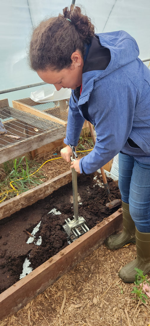 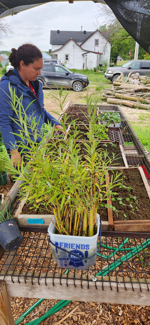 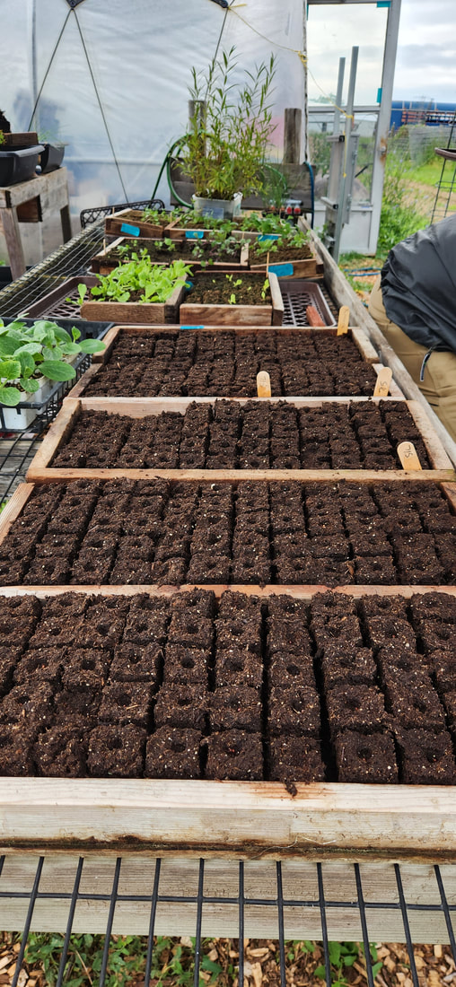   They currently have about 3 cow/calf pairs, 100 laying hens, 200 broilers twice a year, and 4 pigs. Meat can be purchased in wholes and halves and as individual cuts. 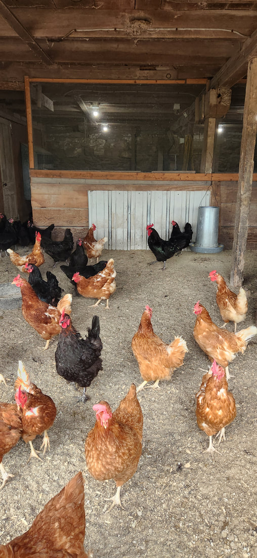 Emily & Nathan are finishing up work on a new pack shed that will improve their ability to wash and prepare crops from the field for market. This will also help them scale up vegetable production. 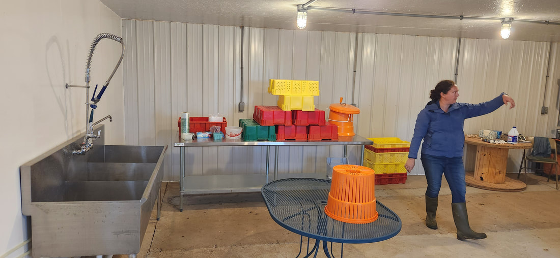 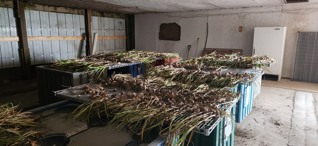 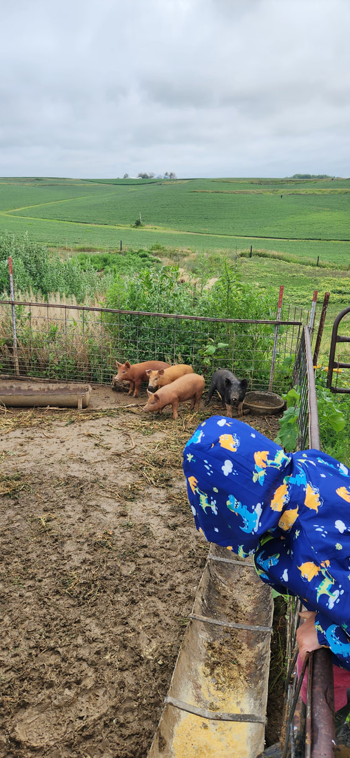 You can find Brun Ko’s products at Produce in the Park on Thursdays from 4:30 to 6:30 at the Atlantic City Park. They also sell through Farmtable Delivery. The Kringle Man in Elk Horn sells their produce, and One Farm Market in Logan sells their meat. Visit their website and Facebook page to learn more about Brun Ko Farm. 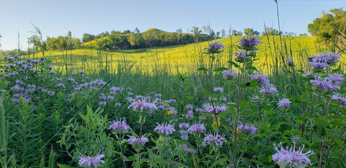
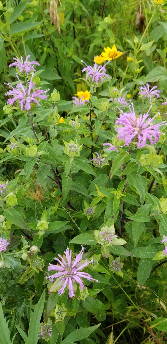
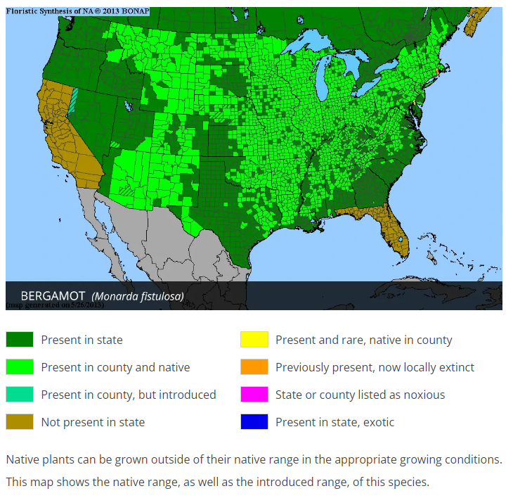
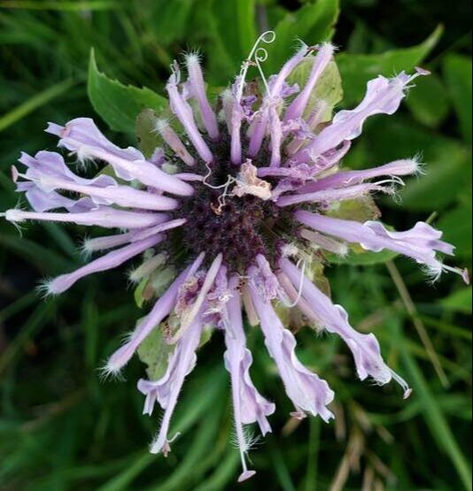
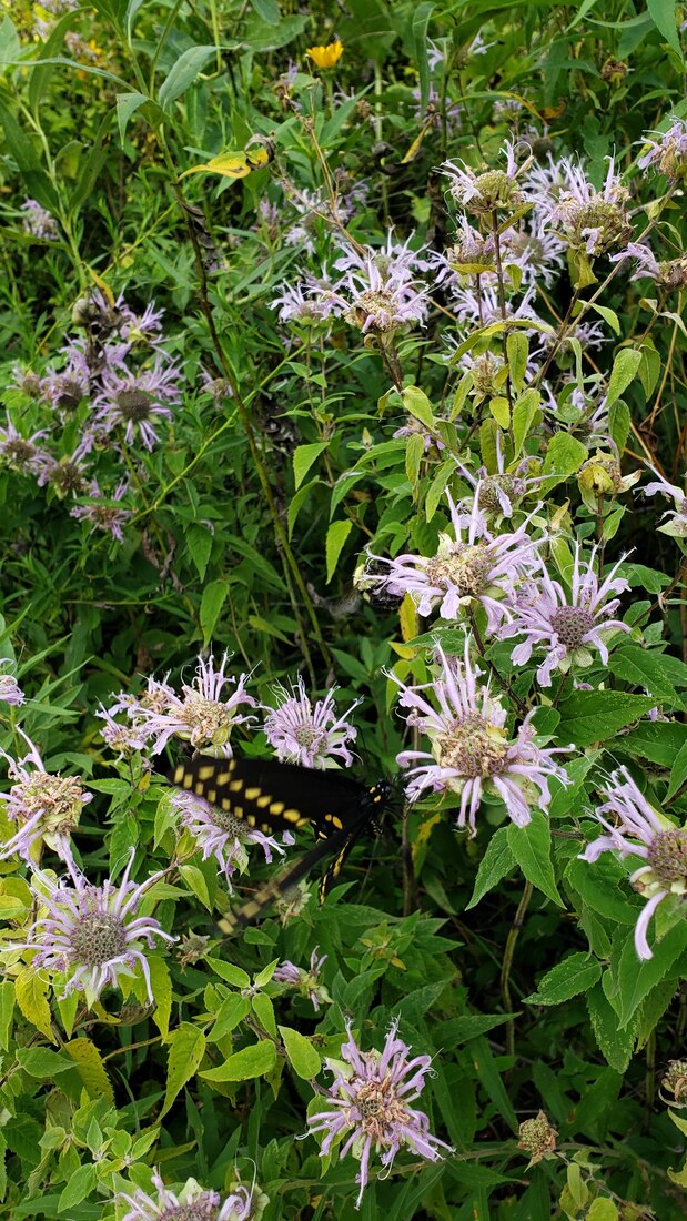
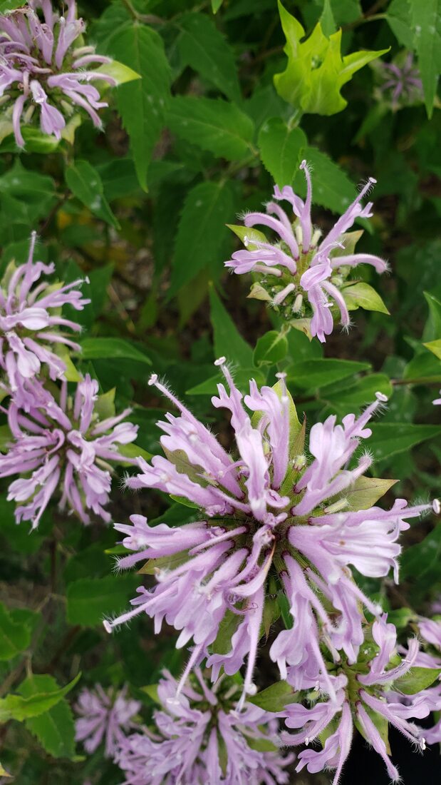
Wild bergamot is common on upland to moist prairies; also on dry prairies, on Loess Hills prairies, on roadsides, and in open woods. It flowers from early July to early August. There are many different uses of bee balm. The fragrant leaves can be used in perfumes or boiled as a tea. The flowers are edible. Indigenous people have many uses for the plant to treat a variety of health issues, from headaches to stomach issues to respiratory ailments. The Lady Bird Johnson Wildflower Center has an extensive list of medicinal uses.
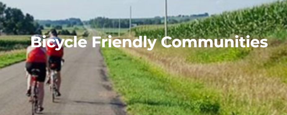
 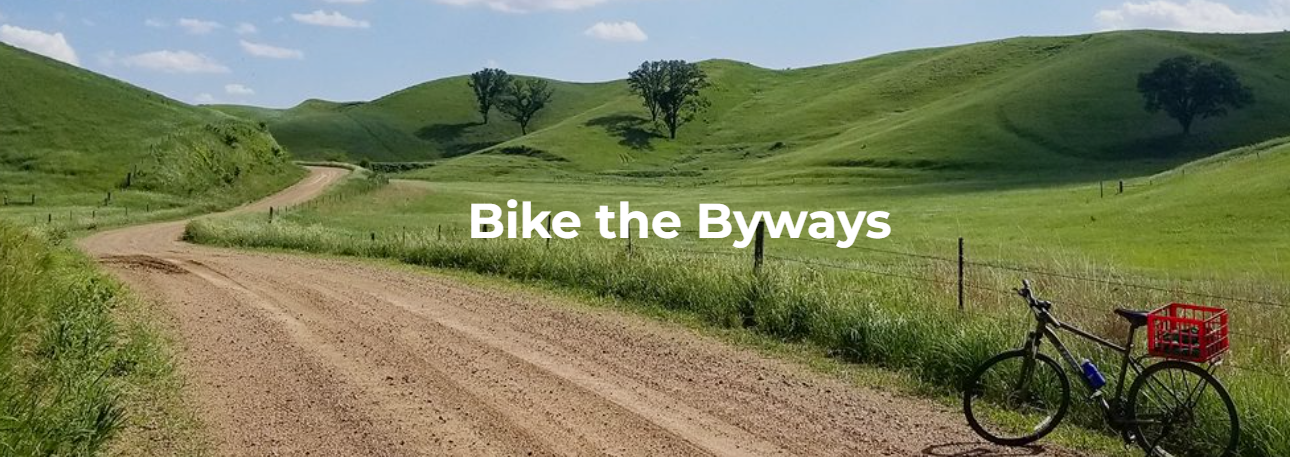 We love biking here at Golden Hills and over the years we have supported numerous projects supporting biking in western Iowa. Our website has a wealth of resources about biking in western Iowa. Check out the list below and start making plans to bike the byways! Best Bike Trails in Western Iowa
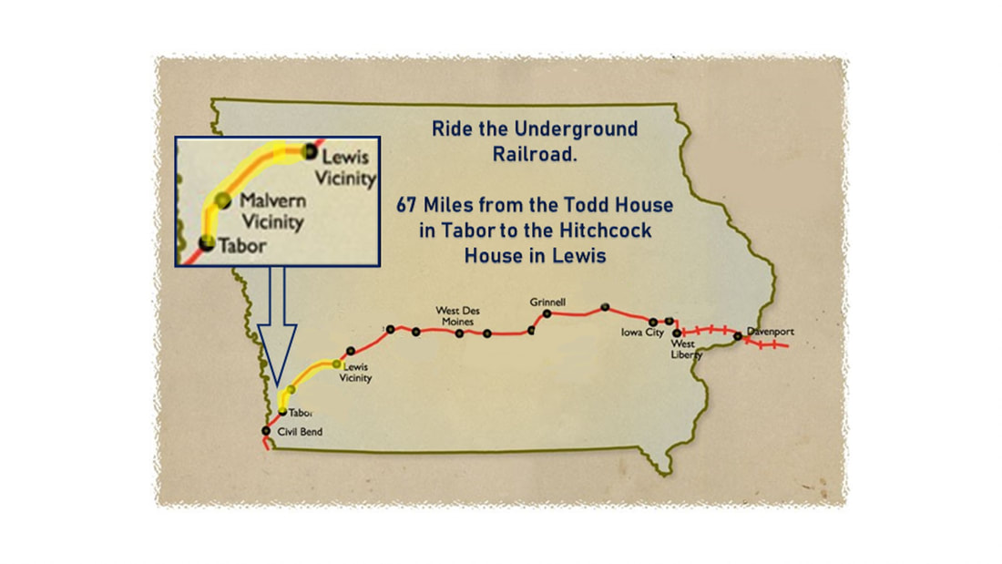 Join the Iowa Underground Railroad Bike Ride for an unforgettable experience that combines adventure, history, and camaraderie. This thrilling journey will uncover the hidden stories of Iowa’s courageous freedom seekers. Taking place September 15th to 17th, between Tabor and Lewis, Iowa, you’ll have the opportunity to explore Iowa’s fascinating heritage while enjoying the beauty of the countryside. From the moment you arrive, our passionate team will ensure your safety and comfort throughout the ride. The ride route includes rest stops, support vehicles, and history to enlighten you about the Underground Railroad’s significance in Iowa. Follow the footsteps of freedom with the supportive community of biking enthusiasts and history buffs. Don’t miss this chance to create lifelong memories and deepen your understanding of our nation’s history. Space is limited. Early bird pricing through August 1st, 2023. Register today: Iowa Underground Railroad Ride For any inquiries, contact iowaundergroundrailroadride@yahoo.com Come pedal through history on the Iowa Underground Railroad Bike Ride and be inspired, enlightened, and exhilarated.  Click to open the link in a new window 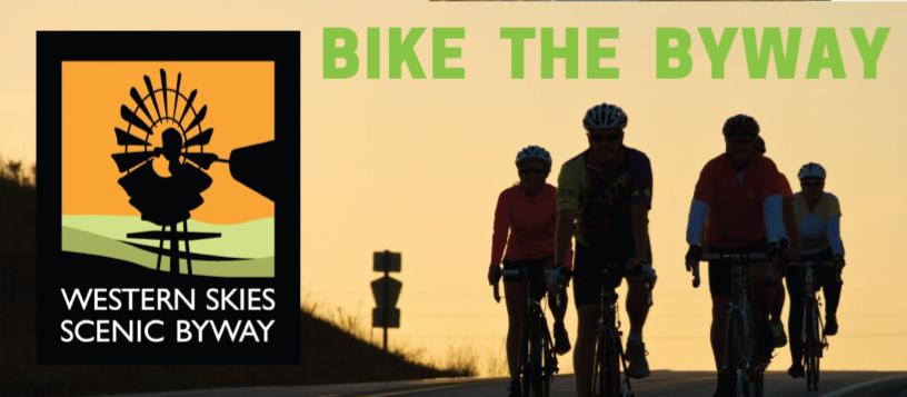 Click to open the link in a new window  Click to open the link in a new window
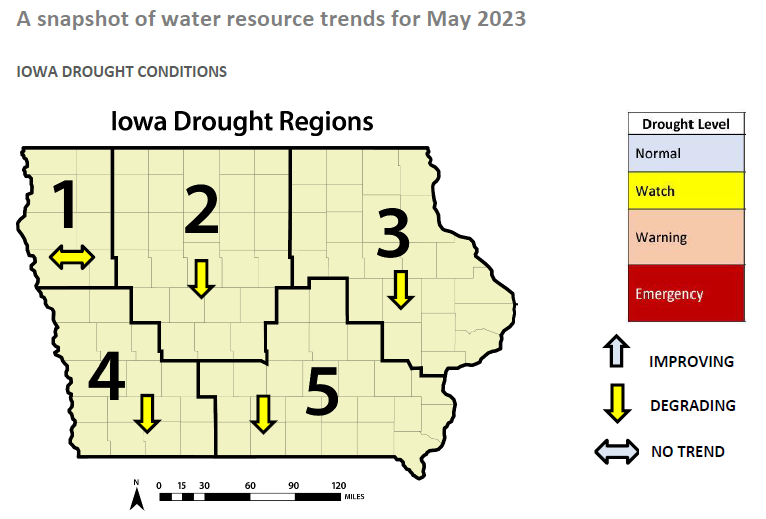
Finally, how could we not mention the world's largest bike-touring event in the world! This year's edition of RAGBRAI is extra special as it is the 50th anniversary of the first Great Ride Across Iowa in 1973. The ride began in Sioux City, so it's fitting that this year's edition will also begin in the Siouxland. Storm Lake and Carroll are the other two overnight towns on the 2023 RAGBRAI itinerary. Check out the RAGBRAI website for maps, events, and more. 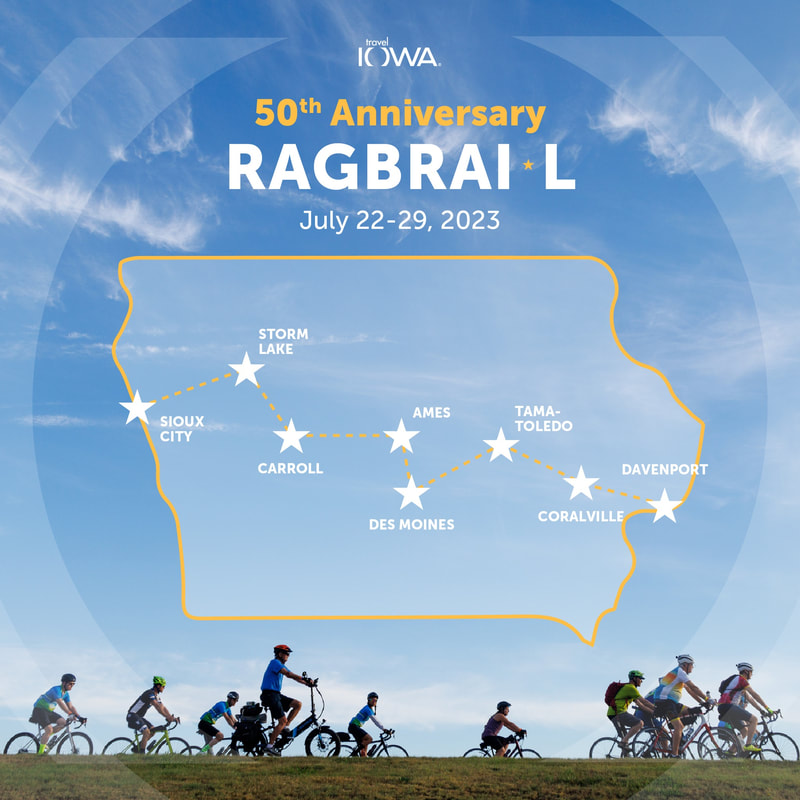 Click to open the link in a new window The Iowa DNR, in collaboration with the Iowa Department of Agriculture and Land Stewardship, the U.S. Geological Survey, and The Iowa Homeland Security and Emergency Management Division, prepares the Water Summary Update. It is a quick view of four ways to explain the status of Iowa’s water resources and observes events affecting water supplies. It is published every two weeks or as conditions significantly change.
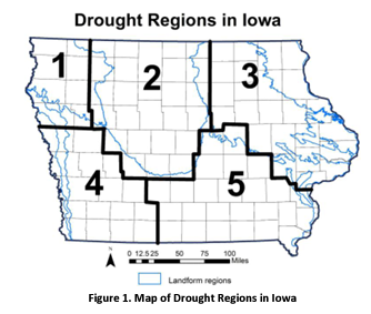
The landform regions have irregular boundaries but the drought regions follow county boundaries for planning and administrative purposes. Regions 1 and 4 lie entirely within western Iowa, while about half of Region 2 overlaps with the western region of the state. Region 1 encompasses eight counties in northwest Iowa in a landform area that corresponds to the Northwest Iowa Plains. The gently rolling landscape consists of wind-blown silt (loess) overlying fine-textured glacial till. The area is drier than elsewhere in Iowa and the intensely agricultural region relies heavily on groundwater obtained from shallow alluvial aquifers or deeper bedrock aquifers for irrigation, livestock watering, and municipal and private water supplies. A reliance on shallow groundwater sources makes the region more vulnerable to water supply shortages during drought. In this region, many private and public water users rely on Rural Water Districts that distribute water from centralized sources. Region 4 consists of 16 counties in southwest Iowa where the thick deposits of silt (loess) form steeply sloping hills and narrow valleys. The loess thins from a thickness of more than 100 feet along the Missouri River margin to tens of feet to the east tier of counties. The loess overlies fine-textured and dense glacial till. Bedrock groundwater resources are very poor in the region and characterized by highly mineralized and poor-yielding Pennsylvanian shales, limestone and sandstone. Deeper bedrock formations also contain poor water quality. Primary aquifers in the region consist of shallow sand and gravel deposits along major rivers and these units are particularly susceptible to overuse and drought. Many private and public water users rely on Rural Water Districts that distribute water from centralized sources collected from lakes, impoundments and developed well fields. Region 2 corresponds to the Des Moines Lobe region of Iowa, a landscape region of recent glaciation (<12,000 years old) consisting of a flat to gently undulating, poorly drained flat till plains marked by numerous small, poorly drained depressions and wetlands. Dominant soils consist of silty and loamy soils formed in glacial till and wetlands. Poor drainage characteristics and high water table levels in the region necessitated the building of widespread artificial drainage systems of subsurface tiles and ditches to improve the land for crop production. Today the land use in the region is dominated by corn and soybean production and the area is among the most productive crop regions in the world. The intense cropping in the region is vulnerable to drought-induced impacts to yields. Bedrock aquifers are available in the region for water supply and additional groundwater resources are available from alluvial sand and gravel aquifers.
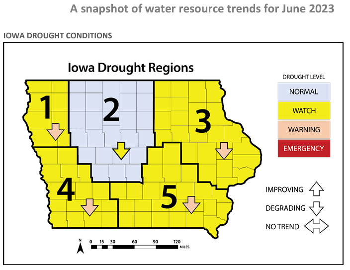
Upon a superficial look, drought conditions improved in June as compared to May. The drought level in Region 2 was upgraded to normal, while the rest of the state's regions remained on drought watch. Water resource trends in Region 4 continued to degrade in June, however, Region 1's trend shifted negatively last month after showing no trend in May. Perhaps increased precipitation in July will stabilize or reverse the downward trends in all drought regions in western Iowa. 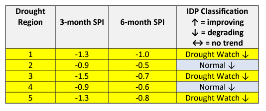 Standardized Precipitation Index (SPI) The SPI is an index based on accumulated precipitation for various time scales. SPI is the most commonly used indicator worldwide for detecting and characterizing meteorological droughts. The SPI indicator measures precipitation differences based on a comparison of observed total precipitation amounts over the period of interest with the long-term historical precipitation record for that period. Droughts are characterized by negative SPI values, while positive SPI values indicate wet periods. The range of SPI values is between -2 and +2. Looking at the SPI table for June, drought conditions have increased across the state over the last three months. Region 1 in northwest Iowa is under a drought watch according to the SPI, while Regions 2 and 4 are classified as normal; both regions 3-month SPI is below -1.0. 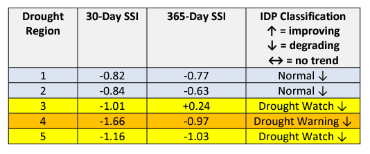 Standardized Streamflow Index (SSI) and Streamflow SSI is a metric that compares current streamflow against the historical record to determine how far away the current streamflow value is from the river’s historical mean observed on the same date. For this WSU daily streamflow yields from approximately six to 12 rivers in each region are averaged to create the region’s mean daily flow, which is then compared to historical streamflow since 1960 to determine how current streamflow fits into historical context. Drought index values typically range from 0 (streamflow is the same as the mean) to -3, which indicates the current streamflow is three standard deviations less than the historical mean for the period. Positive SSI values indicate wetter than normal or flood-level flows. If you have driven over the West Nishnabotna River or any of its tributaries in June, you probably noticed the low water level and streamflow. Unfortunately, a paddle on the West Nishnabotna Water Trail is impractical with current water conditions. The SSI lists Region 4 in a drought warning with significantly lower streamflow compared to historical records. 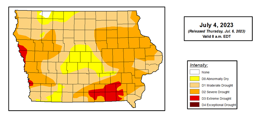 July 2023 Seasonal Outlook During the month of June, Severe Drought (D2) increased in significant portions of western Iowa counties. The area of Severe Drought (D2) now covers western and eastern Iowa, with about 40 percent of the state classified as D2. Additionally, the southwestern corner of Pottawattamie County and the northwestern corner of Mills County are now classified as Extreme Drought (D3). Less than one percent of Iowa is now free from drought or abnormal dryness. Abnormal dryness or drought conditions have now been continuously present in Iowa for more than three years. The last USDM to show no dryness or drought in the state was May 5, 2020. This is the longest continuous period of dryness or drought in Iowa since the start of the USDM in 2000. 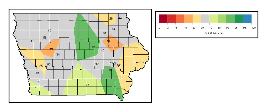 Soil moisture trends in western Iowa during the month of June were a mixed bag. The southwestern corner of Iowa, including all of Fremont County, most of Page county, and half of Mills County, saw increased soil moisture from May to June. However, portions of Woodbury, Monona, Harrison, Shelby, Pottawattamie, Cass, Crawford, Carroll, Ida, and Sac counties experienced decreases in soil moisture in June. 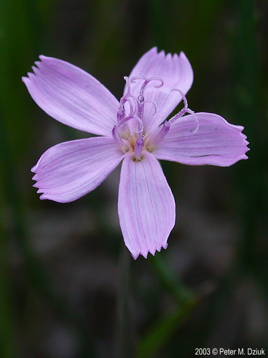
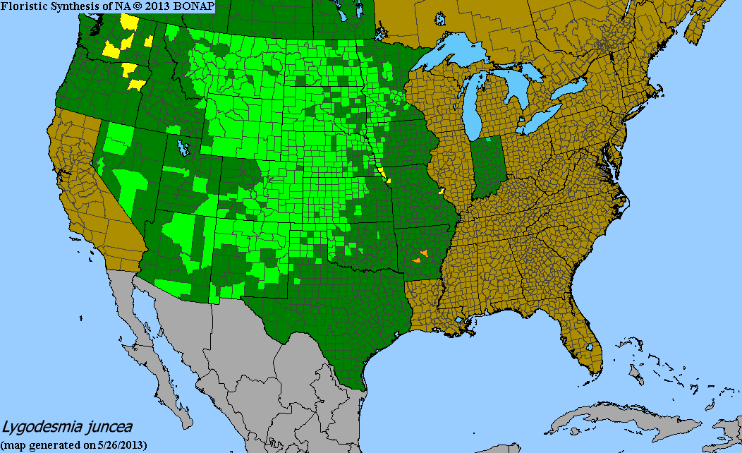
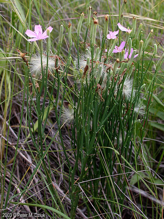
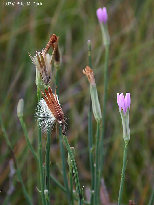
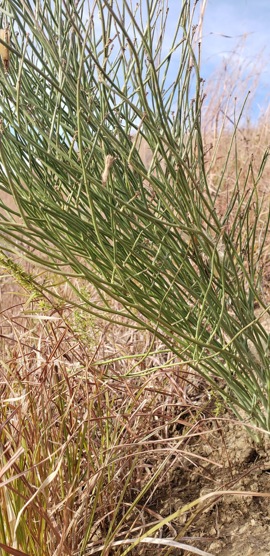
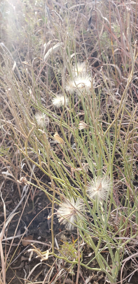
Common on Loess Hills prairies and dry, gravelly prairies, skeletonweed (Lygodesmia juncea) is mostly found in western Iowa. although it can be found in other parts of the state. It is native to western North America, hence it prefers dry areas. It is easy to overlook skeletonweed when the flowers are not blooming, as the plant is rather inconspicuous. When the flowers do bloom, typically from June to August, you will find single pink to lavender flowers at the end of branching stems. The flowers have five petals. A small wasp will make galls along the stems. The stems appear leafless, which provides the common name of skeletonweed. Great Plains Indians use this plant to treat diarrhea, coughs, heartburn, and kidney ailments, as well as saddle sores on their horses. After childbirth, mothers drink a tea made from the plant to enhance lactation.
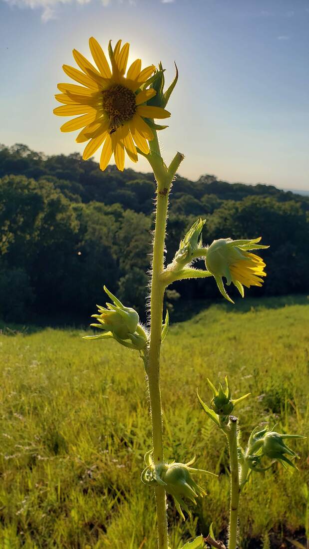
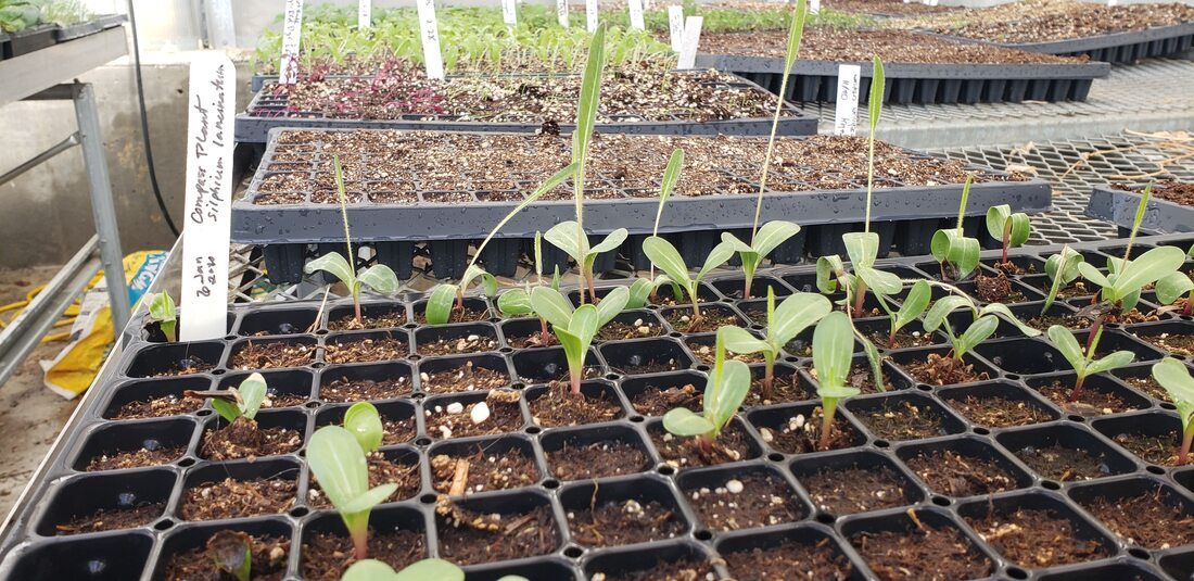
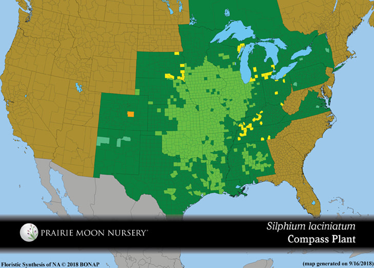
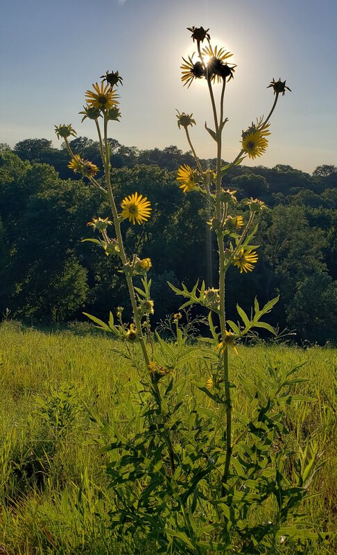
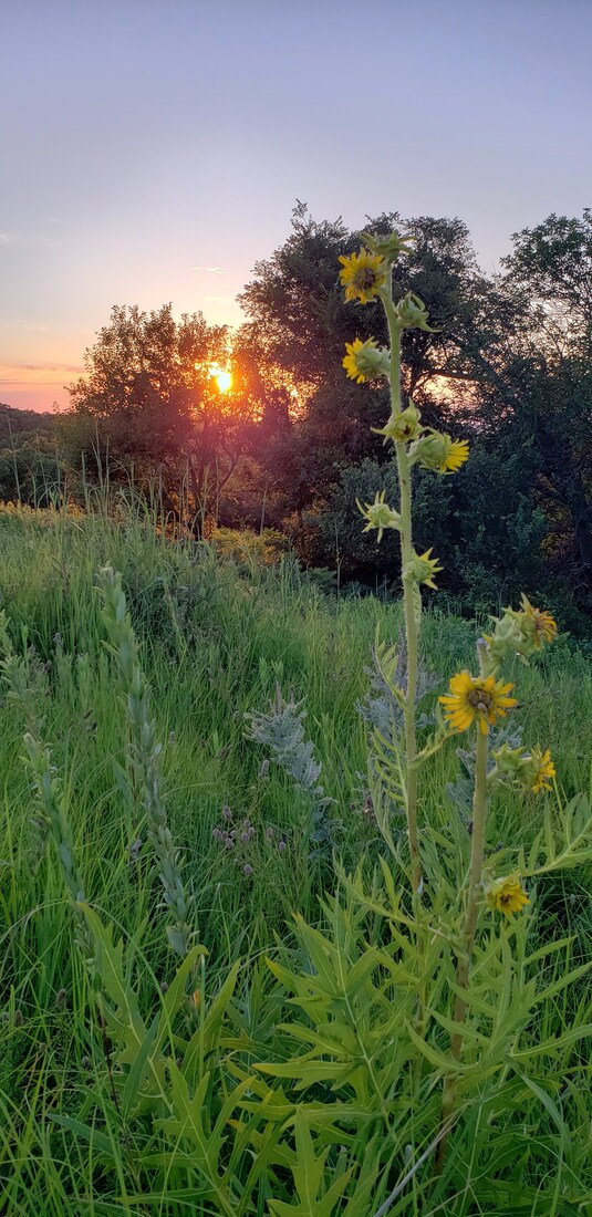
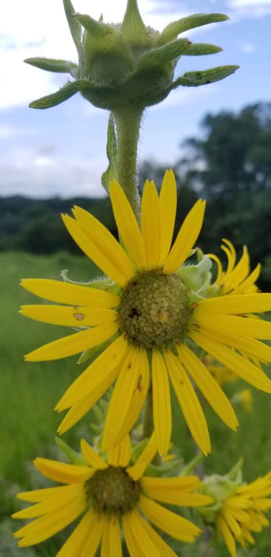
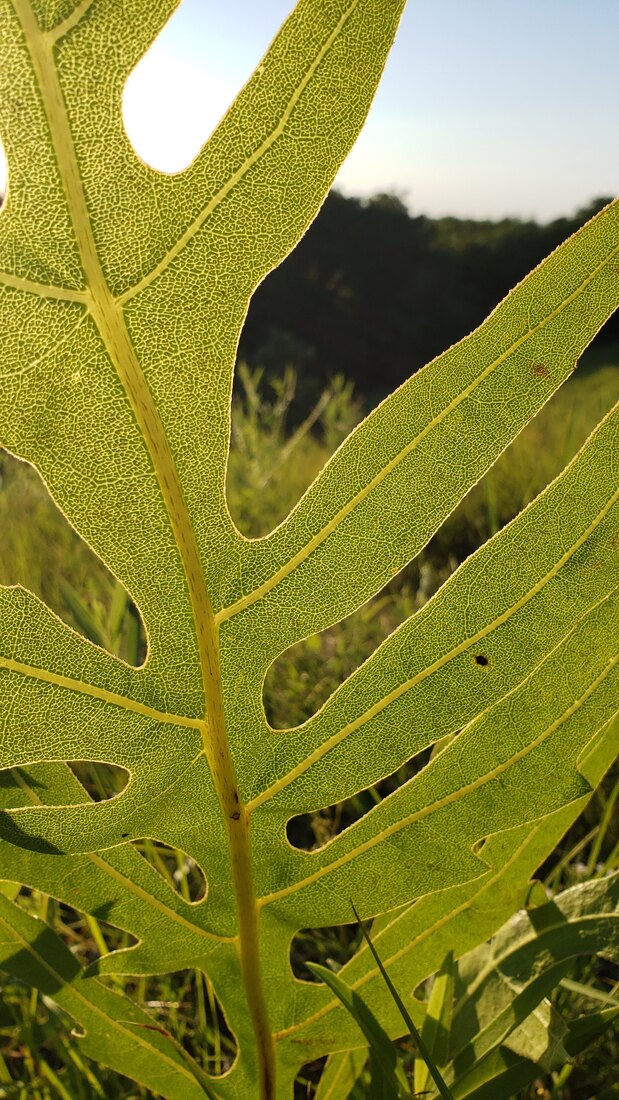
An icon of the prairie. The giant of the prairie. Reaching upwards of eight feet, compass plant (Silphium laciniatum) definitely stands out among its peers in the prairie. Compass plant not only stands tall over its peers, it can outlive them too, as individual plants have been known to live upwards of 100 years. Compass plant gets its name because of the leaves' tendency to orient themselves along a north-south axis. The leaves do this to maximize water use and to increase the carbon dioxide gain. The flowers bloom from early July to early August. The bitter, resinous sap could be made into a chewing gum. The pounded root of compass plant is used by the Pawnees to make a tea for “general debility”. This tea is also used by the Santee Dakotas to rid horses of worms and by the Omaha and Ponca as a horse tonic Birds and small mammals eat the seeds. In grasslands devoid of woody species, the compass plant provides a sturdy perch for prairie songbirds. Eastern kingbirds use the compass plant as a perch to locate and capture grassland insects
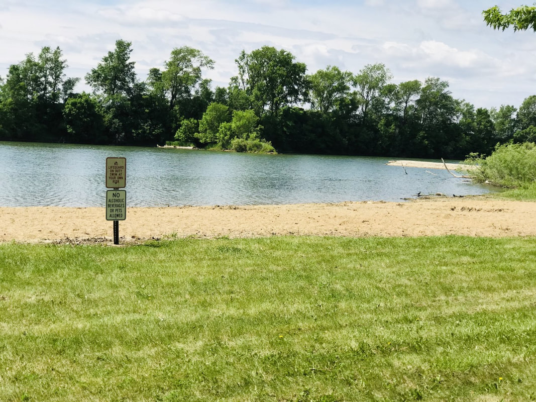
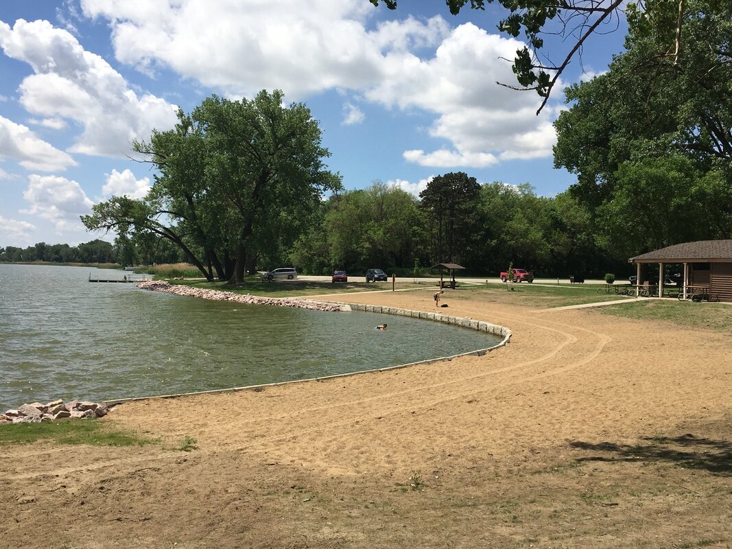
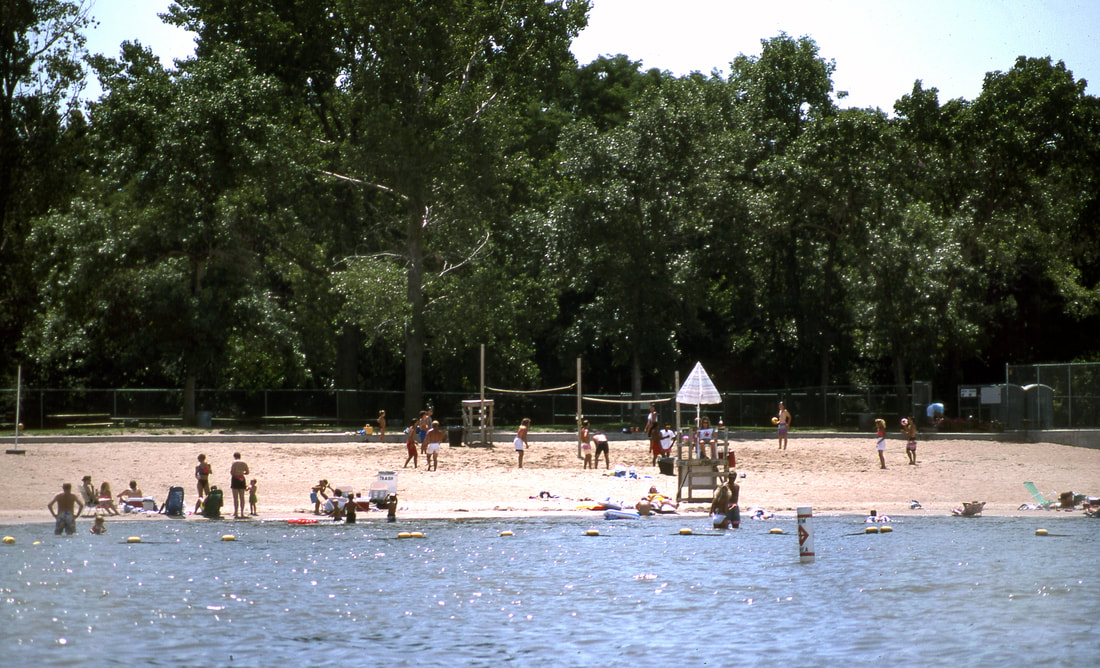
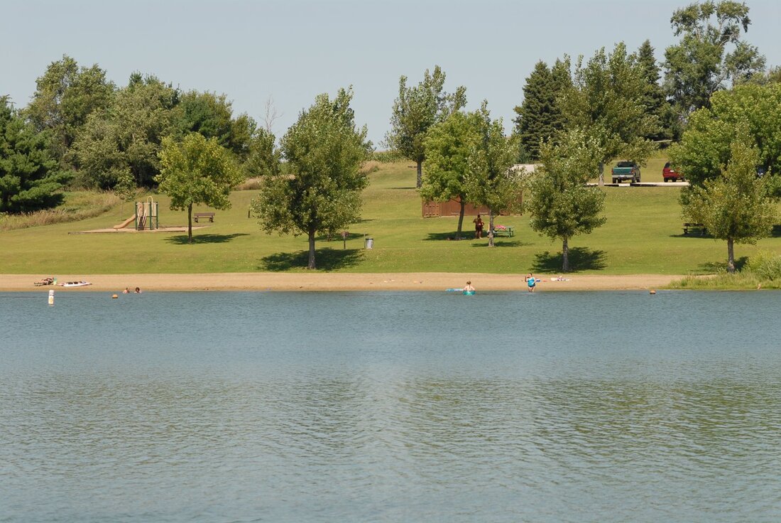
 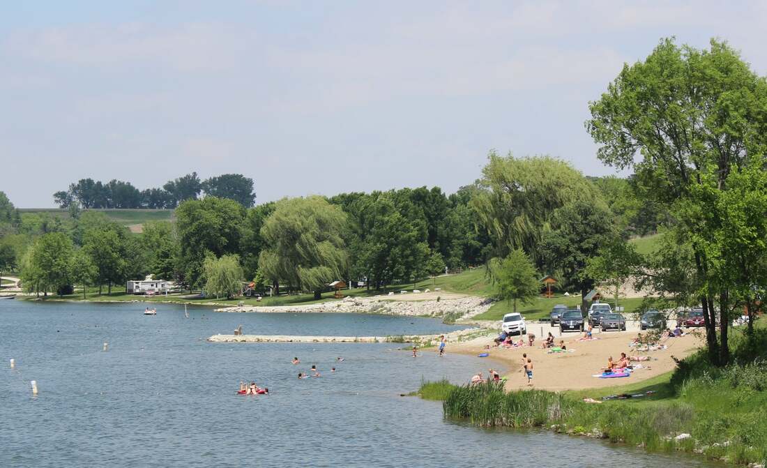 Willow Lake Recreation Area Beat the summer heat at one of western Iowa's public swimming beaches! There are a variety of locations on western Iowa's three scenic byways: Glacial Trail Scenic Byway, Loess Hills National Scenic Byway, and Western Skies Scenic Byway. Most of the beaches do not have lifeguards on duty, so swim at your own risk. 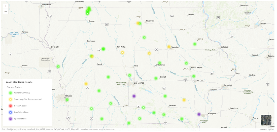 AQuIA is the Iowa DNR's beach monitoring website The Iowa Department of Natural Resources maintains a beach monitoring website, AQuIA, that provides the public with information about water quality at public beaches throughout the state. The site lists not only swimming beaches at state parks but also county and city parks. Routine water quality monitoring is conducted at all of the state park beaches and many locally managed beaches in Iowa. In order to help protect the health of those wishing to recreate at the beaches, the Iowa Department of Natural Resources works with various public health and management agencies throughout the state to inform the public of the most current water quality conditions. Outdoor recreation at beaches in Iowa is typically limited to the time period between Memorial Day and Labor Day. Therefore, most beach monitoring is conducted and standard swimming advisories are issued during this time frame. Results for specific beaches are published as soon as they become available.
Douma Park Sanborn, IA 51248
Scharnberg Park 3430 145th Ave, Everly, IA 51338
 Douma Park
Little Sioux Park 1746 O'Brien Ave, Correctionville, IA 51016
Bigelow Park - Brown's Lake 722 Bigelow Park Rd, Salix, IA 51052
Lewis and Clark State Park 21914 Park Loop, Onawa, IA 51040
 Lewis and Clark State Park Oldham Recreation Area 38852 245th Street, Soldier, Iowa 51572
Peter’s Park 10740 Oak Ave, Rodney, Iowa
Lake Manawa State Park 1100 S Shore Dr, Council Bluffs, IA 51501
 Lake Manawa State Park
 Prairie Rose State Park |
Archives
April 2024
Categories
All
|


 RSS Feed