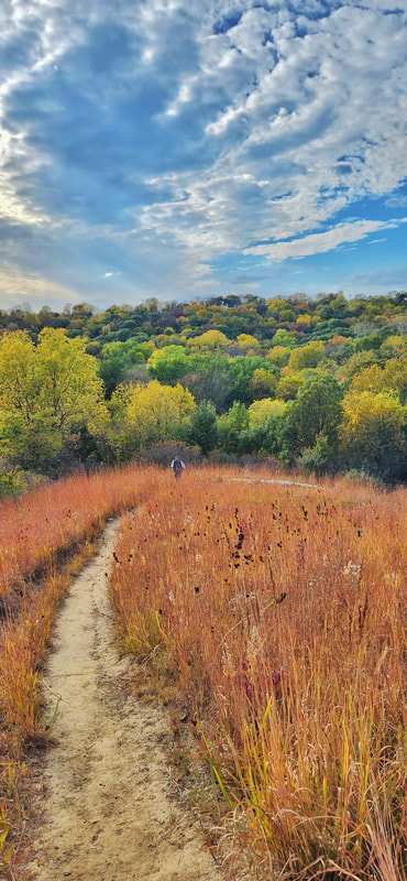
Brent's Trail in Harrison County (photo by Lance Brisbois)
New Year's Day was celebrated by many who took a hike on the Iowa side. First Day Hikes were held at several parks in western Iowa: more than 40 people hiked the canyon and forest trails at Preparation Canyon State Park in Monona County; more than 150 people joined park staff on a two-mile hike at Waubonsie State Park in Fremont County; and a great group hiked the trails at Prairie Rose State Park in Shelby County.
Hikers exploring Preparation Canyon State Park on the First Day Hike
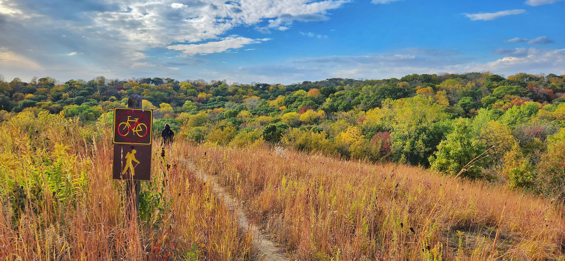
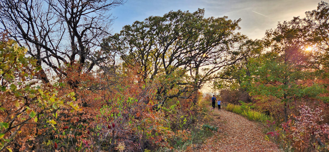
Hiking and walking are excellent ways to get outdoors. The Loess Hills Missouri River Region has many miles of beautiful public hiking and walking trails. The WanderLoess Backcountry Hikes page includes some of the more rugged and longer hikes in Harrison, Mills, and Pottawattamie counties. Golden Hills RC&D has also developed an online Loess Hills Hiking Guide with a map of places to hike throughout the seven-county Loess Hills region. This list expands on that and includes hiking trails and walking paths for all ages and abilities in the Loess Hills Missouri River region. Is your favorite hiking or walking trail missing? Let us know!
However, don't think that the only hiking trails in western Iowa are in the Loess Hills! There are many great public areas in counties outside the Loess Hills that offer quiet and tranquil trails to explore any season of the year. Whiterock Conservancy in Guthrie County is celebrating its 20th anniversary this year. For more hiking locations throughout western Iowa, check out our series about hiking the three scenic byways that Golden Hills coordinates in western Iowa: Glacial Trail Scenic Byway, Loess Hills National Scenic Byway, and Western Skies Scenic Byway.
For specific trail recommendations, we have you covered too!
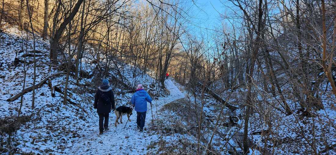
If you like to take your canine companion hiking, make sure you know about the rules and regulations of the public area where you intend to hike. Check out our blog post Hiking with Dogs in Western Iowa for more information. 
Dogs on leashes are allowed at Hitchcock Nature Center (photo by Seth Brooks)
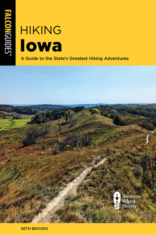
Other hiking resources to check out: The Iowa by Trail app includes hiking trails across Iowa. REI’s Hiking Project has info about hiking trails nationwide. AllTrails has maps and reviews of hundreds of trails in the state. The book Hiking Iowa has more detailed summaries of some of the best hikes across the state (look for the second edition by Golden Hills' Seth Brooks in July 2024).
The second edition of Hiking Iowa will be released in July 2024
Do some research before heading out, as nature centers, restrooms, campgrounds, and other public facilities may have reduced seasonal hours. Come prepared with snacks and water. Stay on trails and obey private property boundaries. Only take dogs where they are allowed, keep them on a leash, and pack out their waste. Take a bag to carry out any of your trash, too. Stay safe, and take a hike!
Arrowhead Park - Hiking trails wind through wooded hillsides around a beautiful pond popular for fishing and paddling. Arrowhead Park trails map.
Botna Bend Park - Best known for live elk and bison, Botna Bend includes nature trails through prairies and woods along the West Nishnabotna River in Hancock. Botna Bend map. 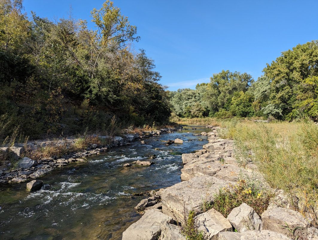
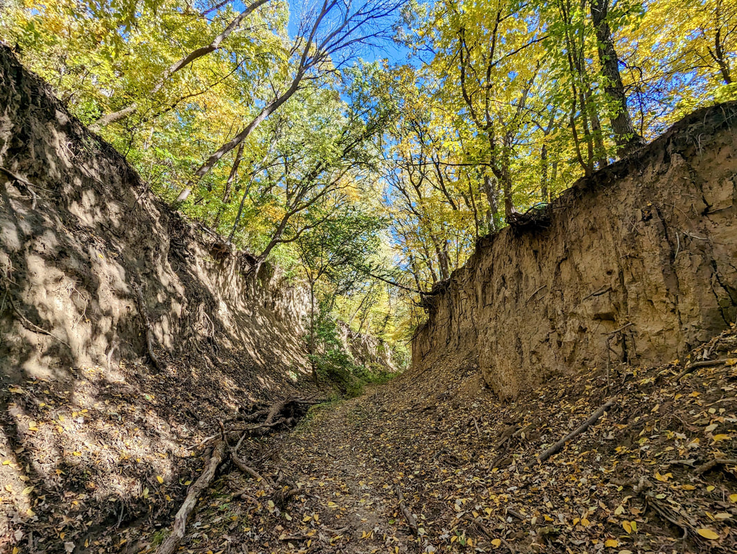
Nishnabotna Rock Cut Trail at Cold Springs Park in Cass County (photo by Seth Brooks)
Cold Springs Park - This 140-acre park is located south of Lewis, about 10 miles south of Atlantic. The highlight is the 0.7-mile Nishnabotna Rock Cut Trail (1.5 miles roundtrip) that leads to an unusual limestone outcropping on the East Nishnabotna River.
Council Bluffs trails - More than 40 miles of mostly-flat, paved trails connect the Missouri riverfront with Big Lake Park, Lake Manawa State Park, and much more. Council Bluffs trail map. Desoto National Wildlife Refuge - This refuge includes hiking trails through a large wildlife refuge along the Missouri River. It’s a great place to see wildlife, especially waterfowl and other birds. Desoto refuge brochure & map. Edgington Memorial Park, Avoca - Over a mile of paved, flat trails loop through this city park, along and across the East Branch of the West Nishnabotna River. Trails also connect into nearby neighborhoods. Map of Avoca trails. 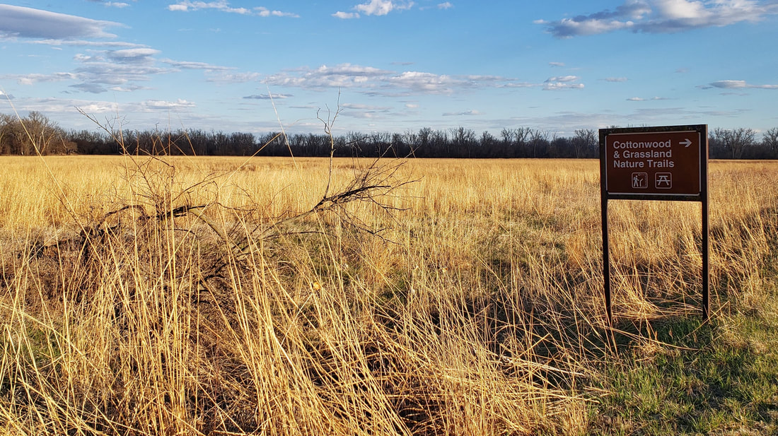
DeSoto National Wildlife Refuge in Harrison County (photo by Lance Brisbois)
Fairmount Park - Fairmount is a hidden gem in the middle of the metro. This city park has a few miles of rugged hiking trails through wooded Loess Hills with scattered prairies and restored oak savanna overlooking Council Bluffs and the Omaha skyline. Map to Fairmount Park.
Folsom Point Preserve - Owned and managed by The Nature Conservancy, this nearly-300 acre area features beautiful remnant prairies overlooking the Missouri River valley just minutes from Council Bluffs and Omaha. Hiking paths lead from the parking area to the ridgetop. Map to Folsom Point. 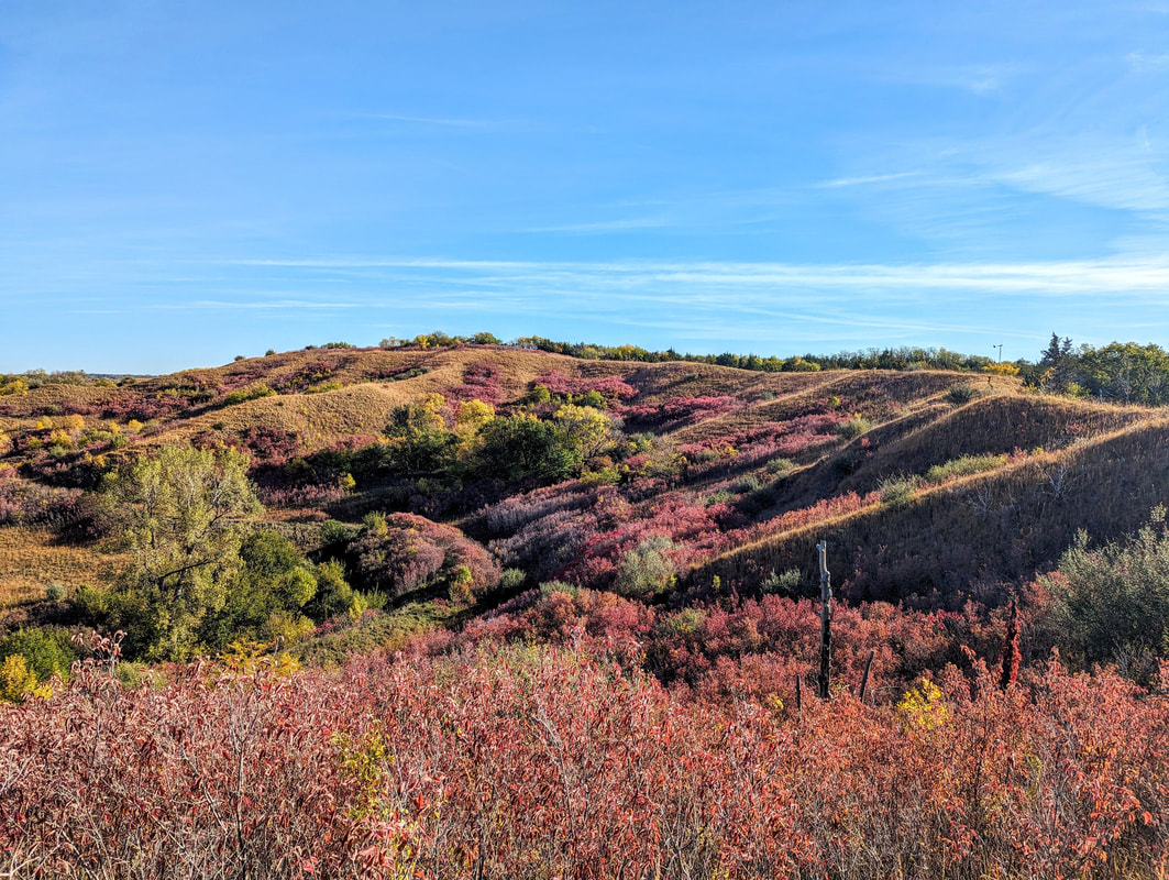
Folsom Point Preserve in Mills County (photo by Seth Brooks)
Glenwood Archaeological State Preserve - Located just outside Glenwood, the 900-acre preserve includes paved trails through woods and prairies. Formerly known as Foothills Park, the site is known to have numerous archaeological sites from the prehistoric Glenwood culture. Map to the Glenwood preserve.
Harrison County Welcome Center - In addition to an Iowa Welcome Center and historical village complex, this welcome center just outside Missouri Valley. Welcome Center map. 
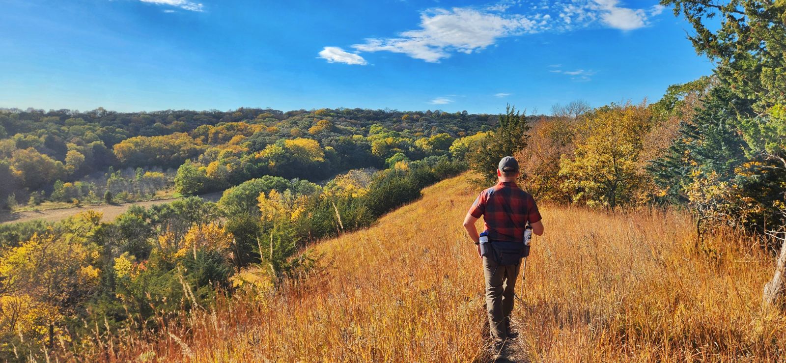
Hitchcock Nature Center (photo by Seth Brooks)
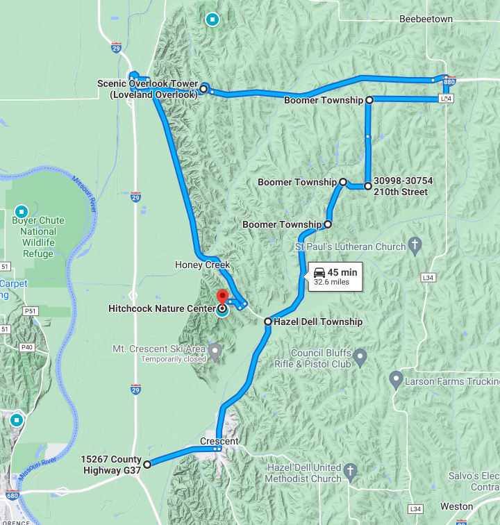
Hitchcock Nature Center is Pottawattamie County’s premier hiking destination located near Honey Creek. It has 10 miles of trails through Loess Hills prairies, woodlands and savanna. Hitchcock trail map.
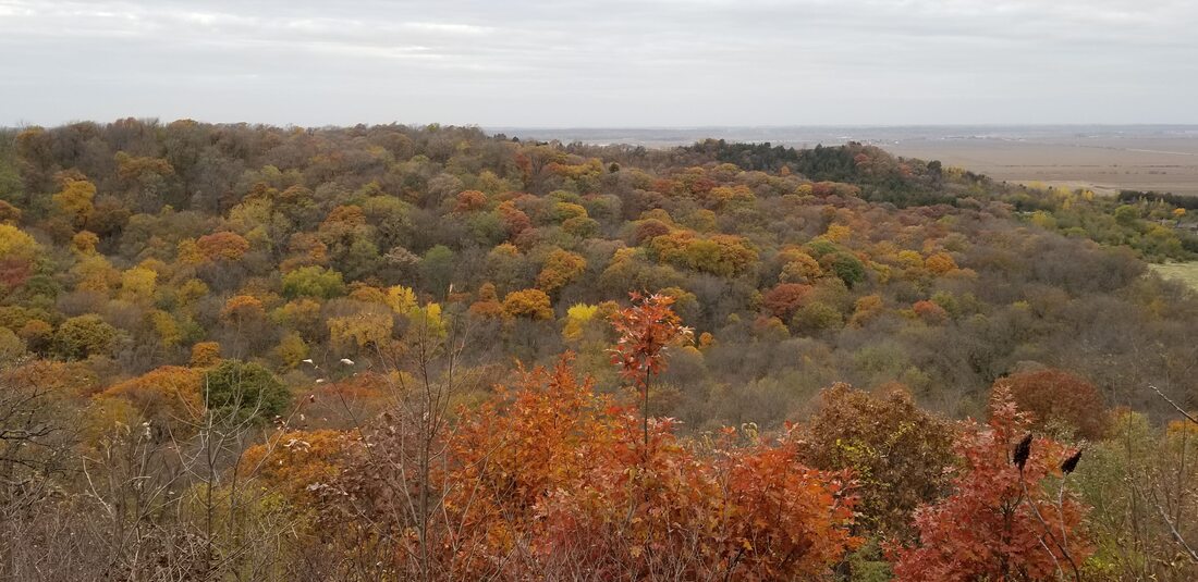
Lewis & Clark Monument Park - With five miles of trails over 80 acres, this Council Bluffs city park features commanding views of the Missouri River, Council Bluffs, and downtown Omaha. The trails are also popular for mountain biking. Lewis & Clark park trail map. Loess Hills State Forest (LHSF) & Preparation Canyon State Park - The state forest and park encompass nearly 12,000 acres over four units in Harrison and Monona counties, with dozens of miles of hiking-only trails.
Loess Hills State Forest (photo by Seth Brooks)
Mile Hill Lake - This park is located along Highway 34 near Glenwood and includes hiking paths through woods, prairies, and a marsh. The lake is popular for fishing and paddling. Map to Mile Hill Lake.
Milliman Park - Logan city park with a short hiking trail. Milliman Park trail map. Oakland City Parks - Oakland has three city parks with popular walking trails. Chautauqua Park includes flat, paved trails near the West Nishnabotna River. Map to Chautauqua Park. Old Town Conservation Area - This area has about 10 miles of hiking trails through prairies and woodlands overlooking the Boyer and Missouri river valleys as well as the community of Missouri Valley. Old Town trail map. 
Old Town Conservation Area in Harrison County (photo by Lance Brisbois)
Pleasant View Park - Dunlap city park with short, ADA-accessible walking trail around a smal pond. Pleasant View Park trail map.
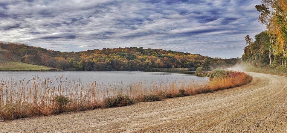
Pony Creek Nature Center - Pony Creek features a popular lake, nature center, campgrounds, and rugged Loess Hills hiking trails through woods and prairies. Map to Pony Creek. Ray Thomas Wildlife Preserve - Mills County Conservation Board’s Ray Thomas Preserve in has a mowed walking path through woodlands and restored prairies in eastern Mills County. Map to Ray Thomas preserve. Rock Island Old Stone Arch Nature Trail - This paved trail located primarily in Shelby County extends just into Pottawattamie County with a trailhead near the Shelby exit on Interstate 80. The trail runs west through woods, prairies, wetlands, and creeks and crosses Silver Creek on an historic Stone Arch Bridge. Map to trailhead. Sawmill Hollow Wildlife Area - Known best for a popular fishing hole, Sawmill Hollow has 155 acres of wooded Loess Hills and ridgetop prairie to explore. Sawmill Hollow map. 
Vincent Bluff State Preserve in Council Bluffs (photo by Lance Brisbois)
Schaben Park - Located near Dunlap in northeastern Harrison County, hiking trails surround a small pond through oak woodlands. Schaben Park trail map.
Smith Wildlife Area - This little-known wildlife area includes 175 wooded acres located immediately outside of Council Bluffs and is open to hiking throughout. Map to Smith Wildlife Area. Vincent Bluff State Preserve - A 42-acre remnant prairie in the middle of Council Bluffs with panoramic views of the city. A short footpath leads from the parking lot to the ridgetop. Map to Vincent Bluff. 
West Oak Forest in Mills County (photo by Lance Brisbois)
Wabash Trace Nature Trail - This crushed limestone trail follows a former railroad line from Council Bluffs to Mineola, Silver City, Malvern, and beyond. It’s also popular with bicyclists. Trailheads are located in each community. Wabash Trace trail map.
West Oak Forest - Hike up steep Loess Hills bluffs overlooking the Missouri River valley between Glenwood and Council Bluffs. More than three miles of trails through woodlands and remnant prairies. Map to West Oak Forest. 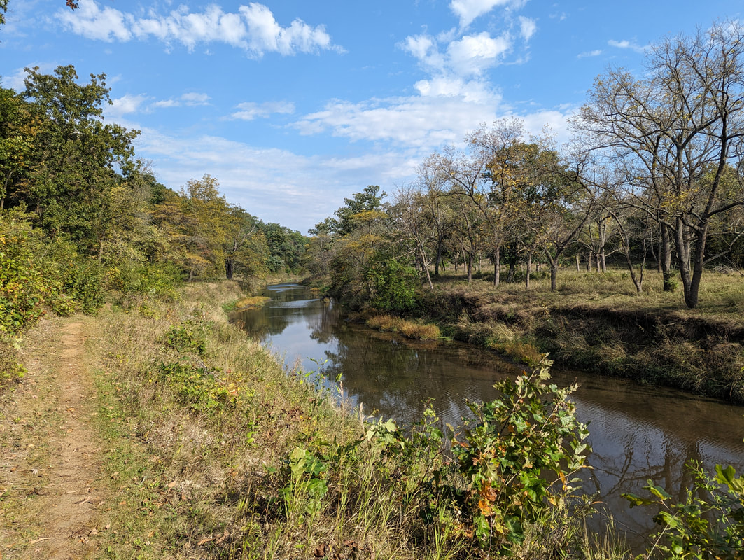
Whiterock Conservancy in Guthrie County (photo by Seth Brooks)
Wheeler Grove Conservation Area - This 247-acre wildlife area in eastern Pottawattamie County has prairies, oak savanna, and woodlands to explore along Jordan Creek. Map to Wheeler Grove.
Whiterock Conservancy - Whiterock Conservancy is a 5,500 acre, nonprofit land trust with more than 40 miles of multi-use trails, which take hikers through savannas, rolling pastures, native and restored prairies, wetlands, riverside bluffs, and fishing ponds. While not in the Loess Hills, exploring this Guthrie County gem is worth the drive. Willow Lake Recreation Area - 220-acre park near Woodbine, including popular lake and campgrounds. Hiking trails wind through Loess Hills prairies and around the lake. Willow Lake map. Wilson Island Recreation Area - Adjacent to Desoto refuge, this 544-acre state-managed area has trails winding through floodplain woodlands near the Missouri River. Wilson Island trail map. In addition to all these great places, take a hike through your yard, farm, or neighborhood. Stop and listen to birds and other wildlife. Look for wildflowers, mosses, and lichens. You’ll be amazed at how much there is to see and do right here in our region! 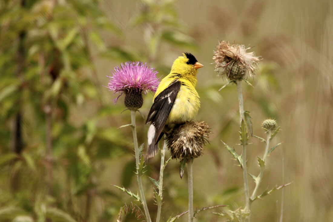
American Goldfinch at Loess Hills State Forest (photo by Carter Oliver)
0 Comments
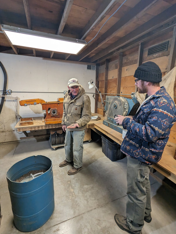
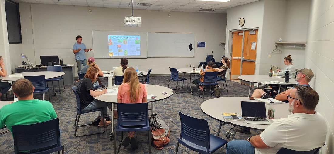
 Dream to Farm class visits Hidden Hollow Farm, Loess Hills, Pottawattamie County Our mission at Golden Hills RC&D is to collaboratively develop and lead community, conservation, and cultural initiatives to improve our quality of life in rural western Iowa. Our "official" territory from our original organizational bylaws is an eight-county region in the southwestern portion of Iowa (Cass, Fremont, Harrison, Mills, Montgomery, Page, Pottawattamie, and Shelby). In 2023, we added four more counties (Audubon, Carroll, Crawford, and Monona). Several projects extend beyond these 12 counties into more than 20 counties (learn more about where we work). Our goals are to develop industries in local communities that utilize local resources; ensure healthy natural resources that meet the needs of agriculture, industry, private use, and recreational facilities; promote and enhance art, culture and historic resources in rural communities; collaborate with local governments and organizations on projects that benefit the environment; and work on projects that fill gaps in community services to benefit people of southwest Iowa. We accomplish these goals by focusing our work in five program areas: outdoor recreation and tourism, land stewardship, water resources, local foods, and arts and culture. Today's Mission Monday focus is Local Foods.  Iowans are surrounded by fertile farmland, yet most of the food consumed in the state travels an average of 1,500 miles before landing on a dinner plate. Golden Hills strives to improve the southwest Iowa foodshed by building and maintaining alliances between regional producers and consumers. These alliances are further supported by raising awareness among southwest Iowans about the food that is available in this region. Golden Hills convenes the Southwest Iowa Food and Farm Initiative (SWIFFI), a multi-county coalition of individuals and organizations within the local food system. Golden Hills provides training, assists in navigating regulations, helps with grant writing, and offers other forms of support. The assistance provided by Golden Hills helps make local food more accessible to those living in southwest Iowa. The benefits of an active and local foodshed are felt by all involved. Revitalization of rural communities by boosting local economic development and improving the health of its citizens are just a few examples of the benefits of an active local foods system.  As part of our work in Local Foods, Golden Hills’ Dream to Farm program began in mid-September and ran weekly, on Thursday evenings, ending December 7th. The program, in partnership with Iowa Western Community College (IWCC), revived the original Dream to Farm series that was offered a decade ago and proved itself beneficial, assisting several past participants in getting their local food and farm businesses off the ground. 
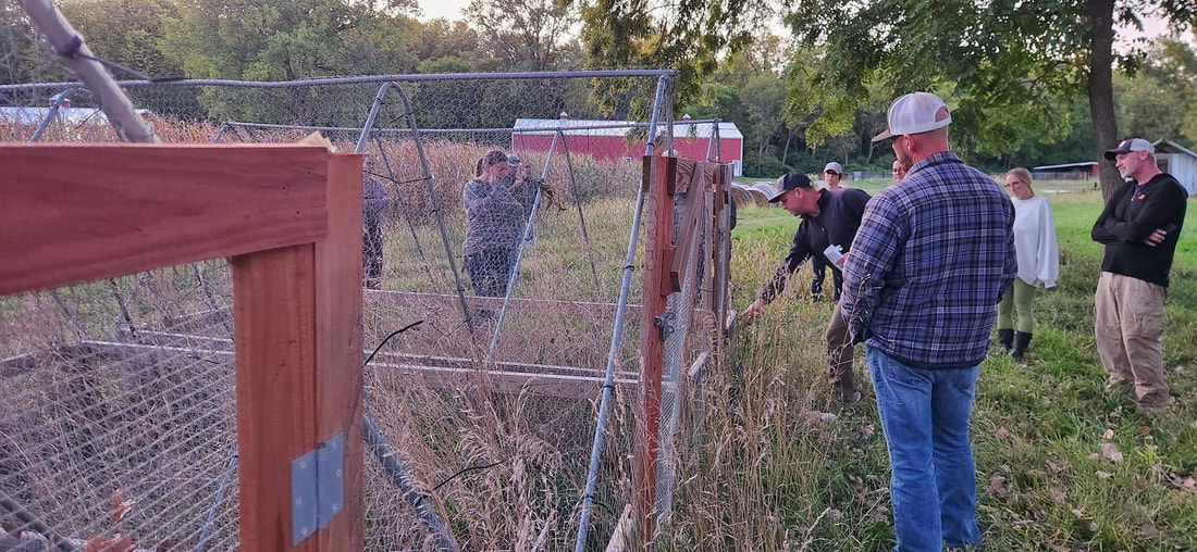
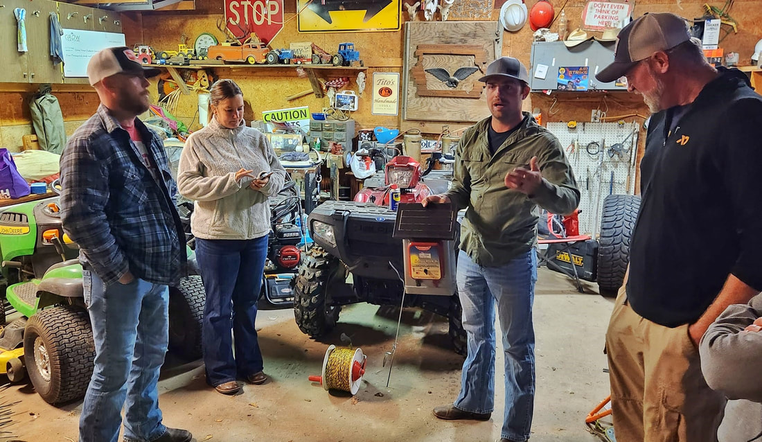 Matt Vermeersch, Mud Ridge Ranch, discusses fencing materials and techniques Enrollment was through IWCC and open to anyone interested. The class was designed to help those with ideas or aspirations, to start a local food or local food adjacent business, hone their idea and write a business plan. Classes were led by producers and professionals already working in the local food realm, such as Aaron French, Manager of Urban Farm Initiatives at City Sprouts, a multi-location urban farm in Omaha; Heath Hoppes, owner and farmer at Hidden Hollow Farm, a small family-owned operation focused on regenerative agriculture practices in the Loess Hills; and Matt Vermeersch, of Mud Ridge Ranch, first generation farmer, raising Scottish Highland cattle and running a goat grazing operation with his wife, Jocelyn. Topics discussed ranged from basic horticulture, soils and integrated pest management to raising livestock and business development. Business classes were led by Sue Pitts of the Small Business Development Center, an incredible resource located on the IWCC campus. Sue discussed market research and financial planning and led participants through the process of writing a business plan. The 12-week class culminated in a voluntary opportunity for class participants to pitch their business idea to Sue and the class. 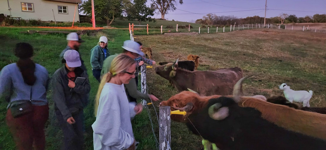 The class meeting the Highland cattle at Mud Ridge Ranch, definitely a class highlight. 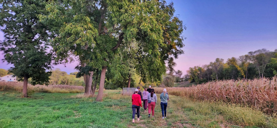 Dream to Farm class tours Hidden Hollow Farm Golden Hills had another successful season of prairie seed harvesting thanks to more than 100 volunteers who joined us throughout the Loess Hills. We hosted at least one volunteer opportunity in each of the seven Loess Hills counties from Akron down to Hamburg. Several events took place at Hitchcock Nature Center in Pottawattamie County. 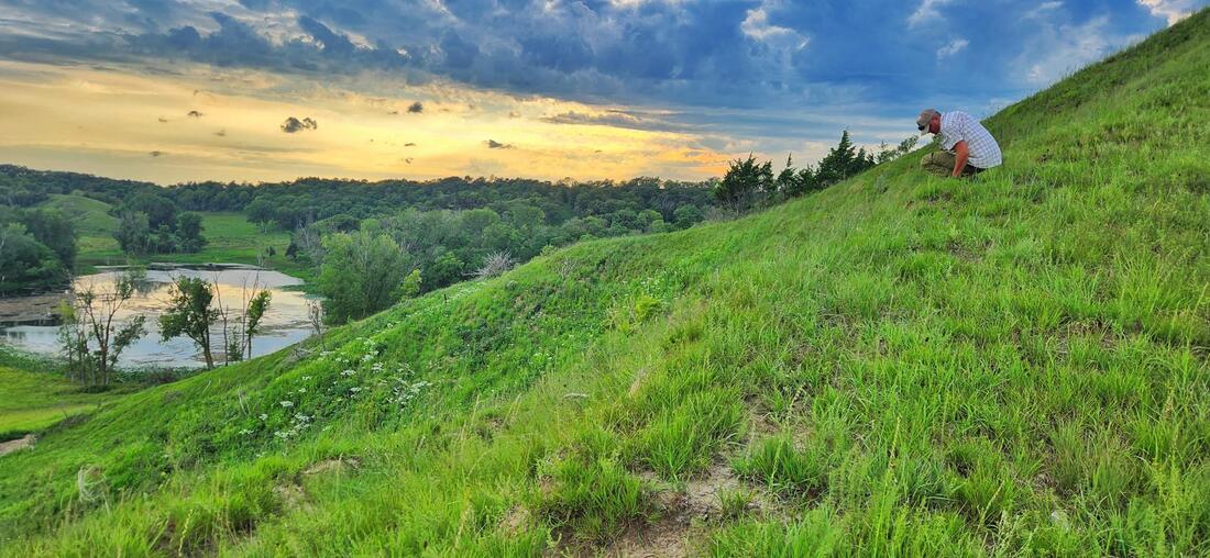 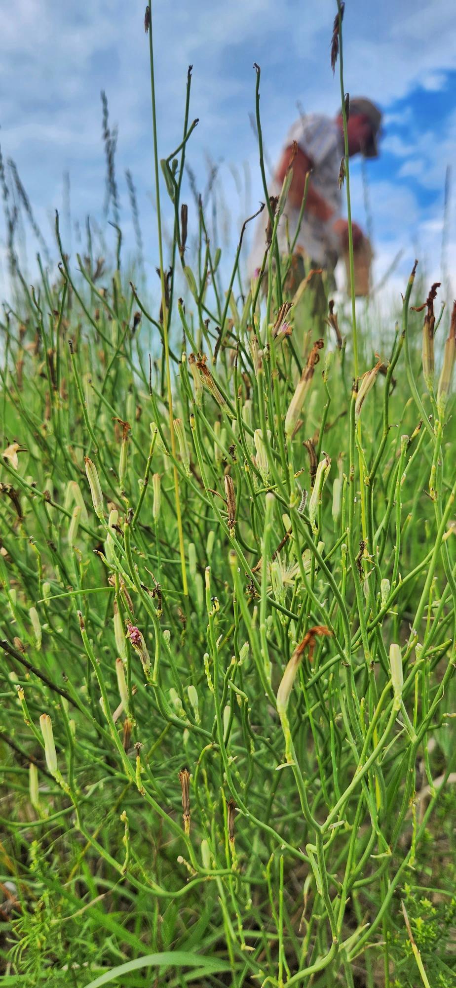 Skeleton weed (Chondrilla juncea) is a unique and rare species for Iowa, typically found much farther west in shortgrass and desert regions. Its fluffy seeds blow away quickly and often don't last long. The plant is easy to overlook surrounded by grasses and other forbs, so finding seed to pick from skeleton weed is always a pleasant surprise! 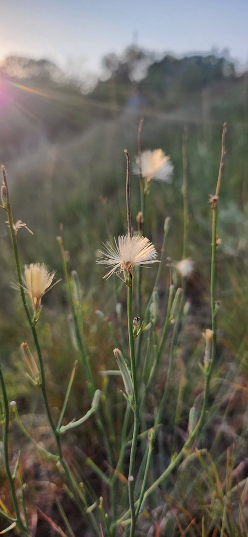 Leadplant, Amorpha canescens, is a common prairie flower. Its seed is often abundant and one person can easily hand-harvest a lot of its seed in a small area.  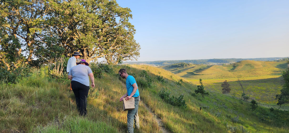 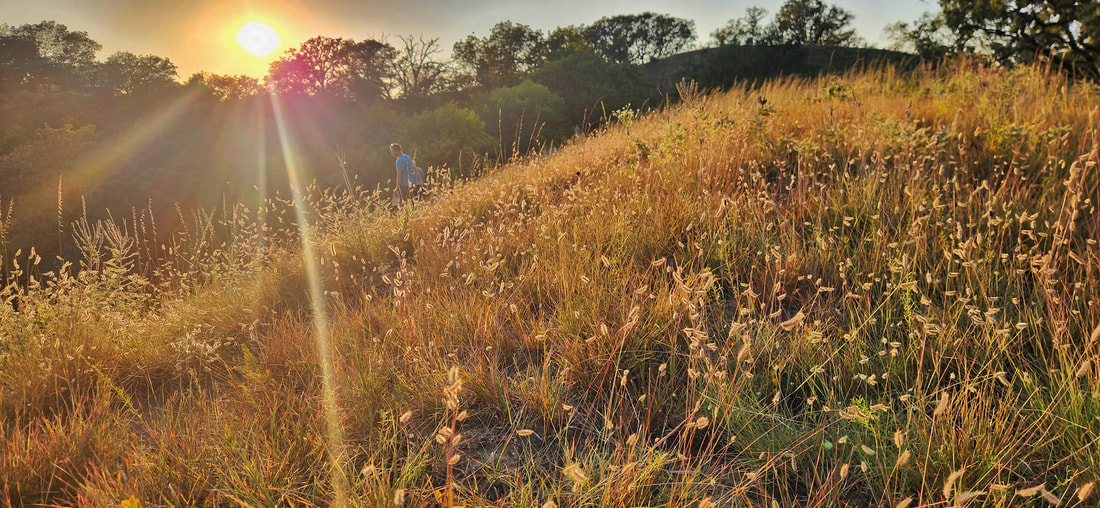 Most of our trips to Hitchcock Nature Center included a visit to Bouteloua Ridge, a spur ridge off of the popular Badger Ridge. This ridge is so named for the abundance of Bouteloua gracilis (blue grama) and Bouteloua curtipendula (side-oats grama). The blue grama seedheads resemble eyelashes, and side-oats look like small oats sticking out nearly perpendicular from the grass stems. 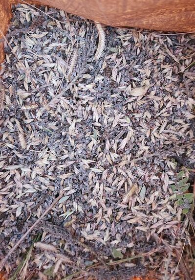 Our Harrison County event was at one of the most iconic Loess Hills spots, Murray Hill Scenic Overlook. Here we were able to harvest a significant amount of Yucca glauca. Like skeleton weed, yucca is more of a desert species not usually found east of the Loess Hills, as it prefers the well-drained soils found on only the steepest Loess Hills ridges. 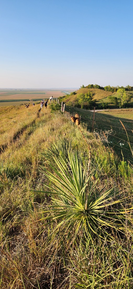 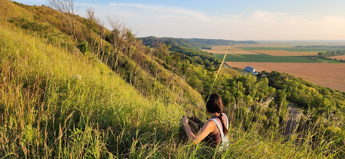 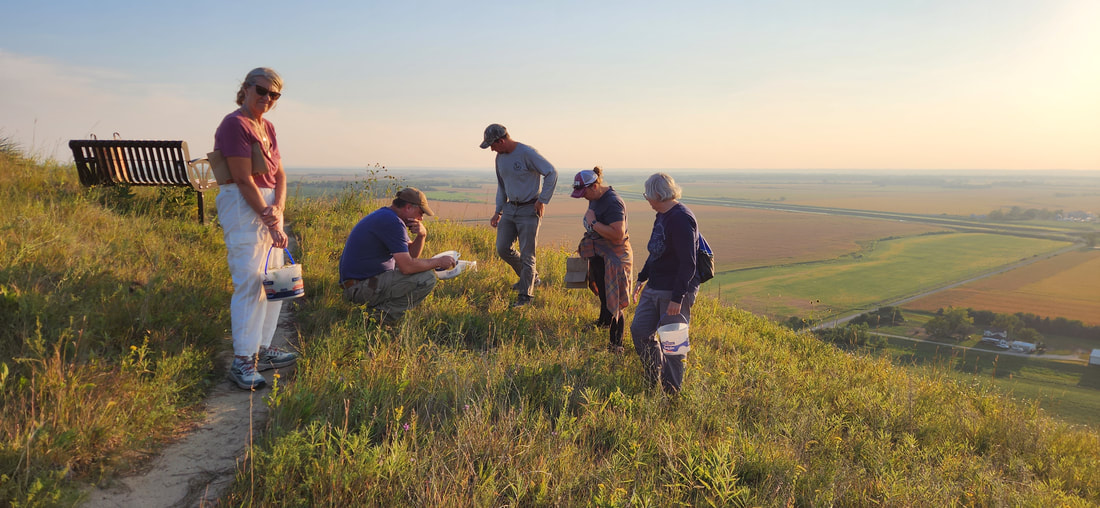 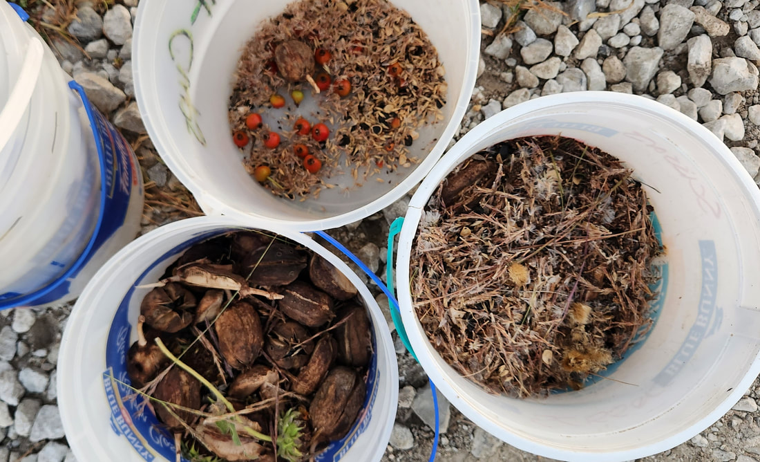 In Monona County, we explored an off-trail area in the Preparation Canyon Unit of Loess Hills State Forest. This event included some of the most rugged and challenging terrain, but our eager volunteers were treated to amazing views. 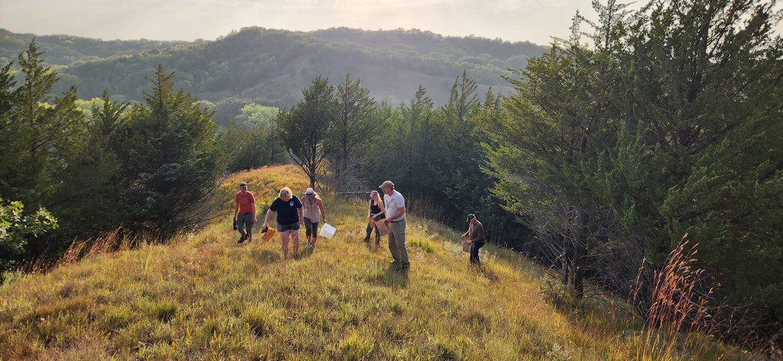 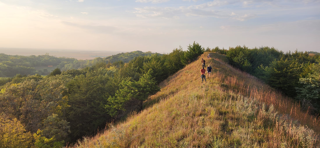  Fremont County's seed harvest featured Sunset Ridge, another popular hiking route, at Waubonsie State Park.  In Woodbury County we partnered with Woodbury County Conservation at Dorothy Peacut Nature Center. 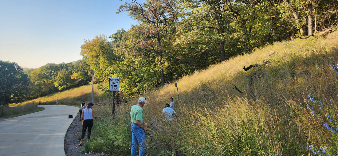 Plymouth County included Five Ridge Prairie in partnership with Plymouth County Conservation Board and Iowa Prairie Network. 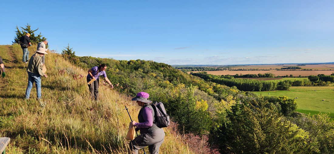 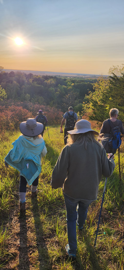 In Mills County, we worked with Iowa Department of Natural Resources at Green Hill Wildlife Management Area. This is one of the newest wildlife areas in the Loess Hills and overlooks Council Bluffs and Omaha. 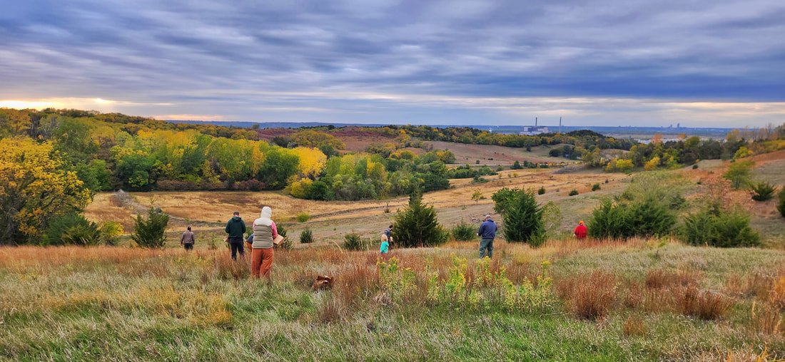 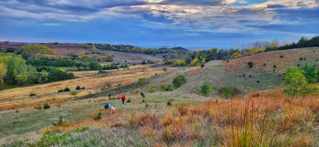 Despite a dry year, multiple seed harvests were canceled due to wet weather. Fortunately for the events we did have, most included beautiful weather with great fall prairie colors. 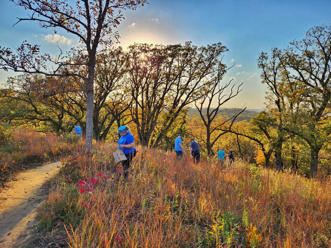 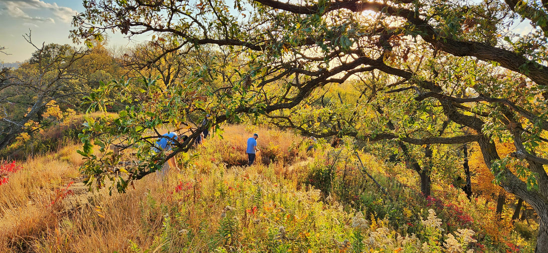 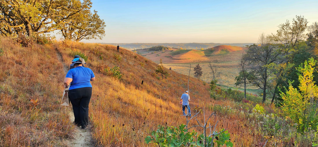 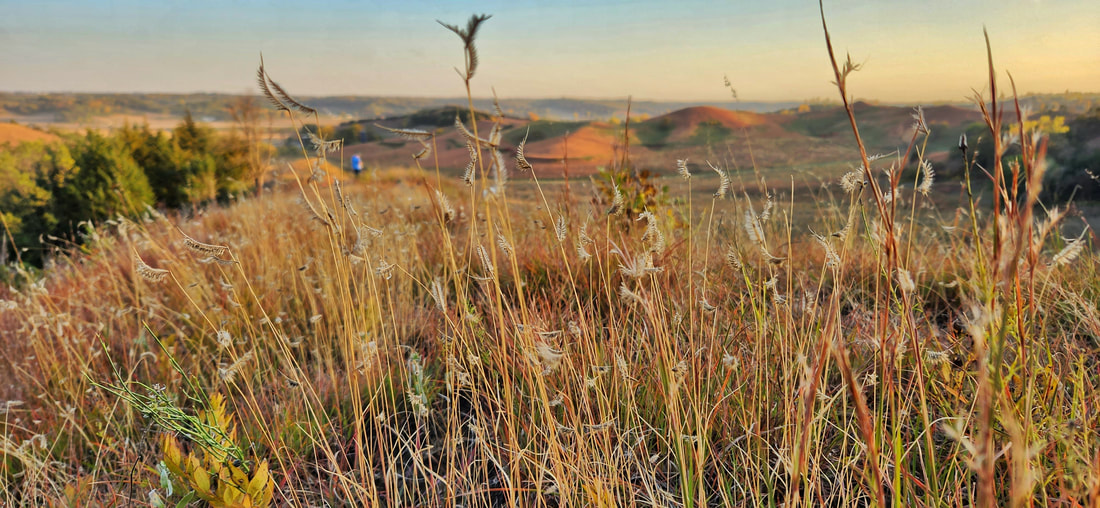  Our final event was another seed harvest at Hitchcock, where we again visited Bouteloua Ridge.
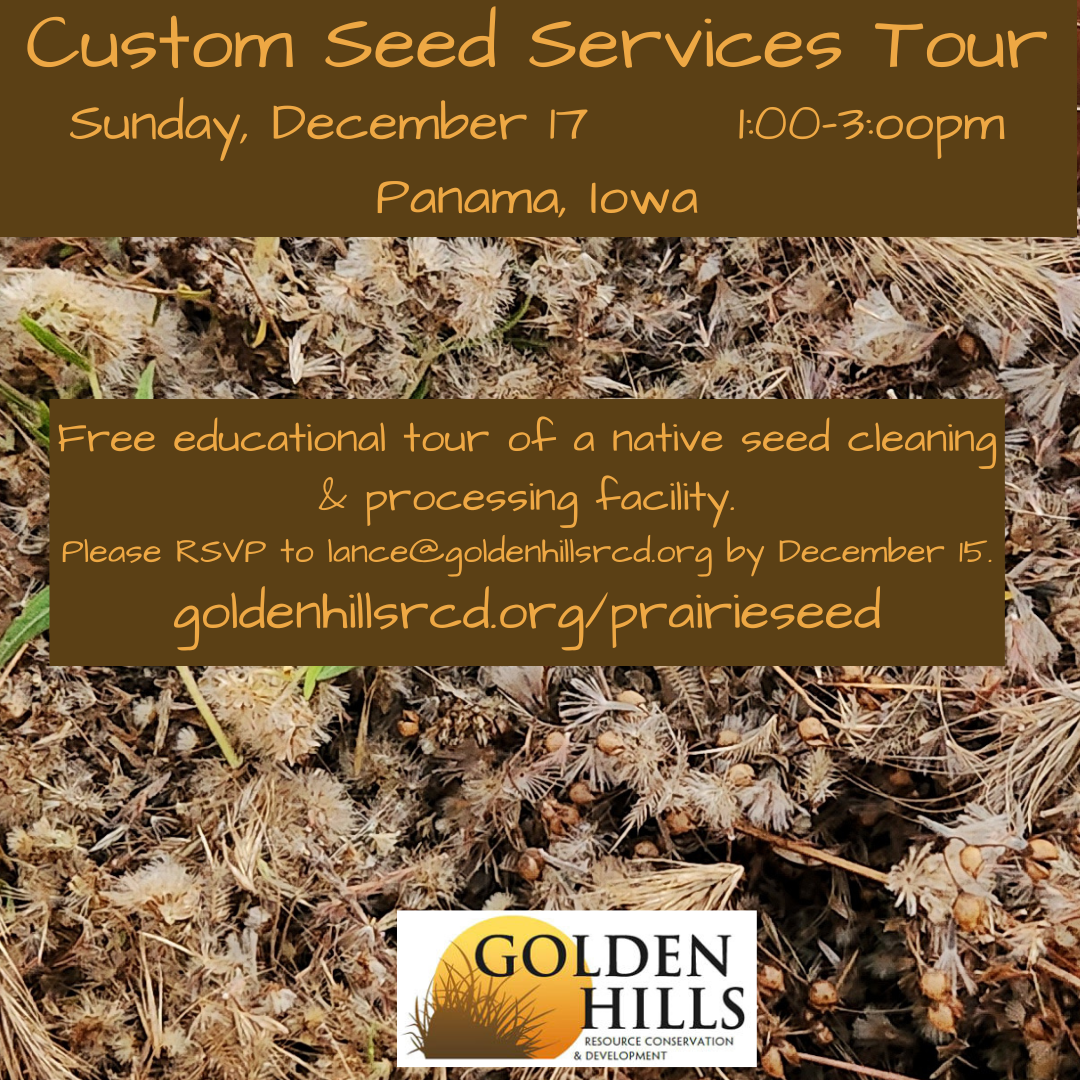
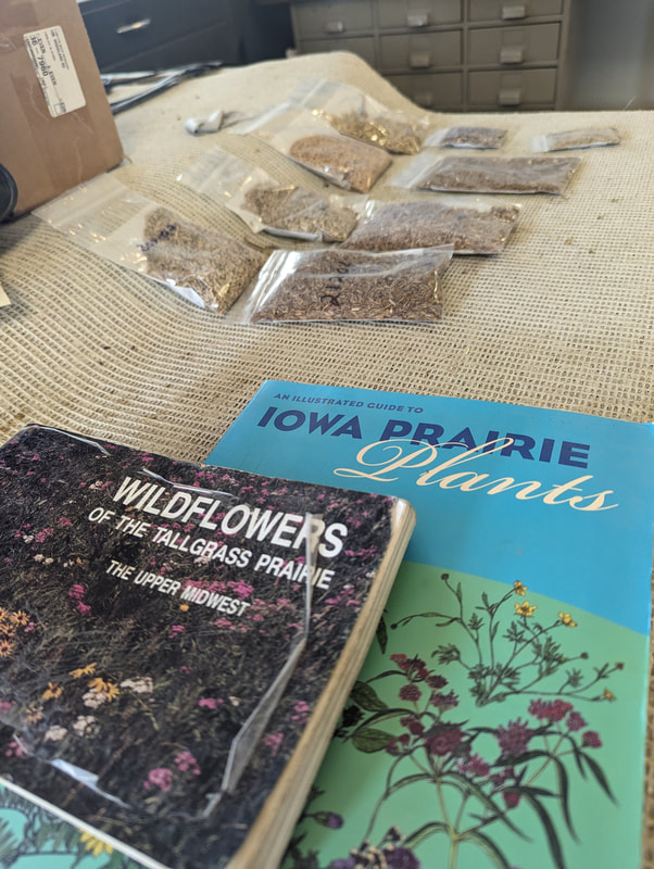
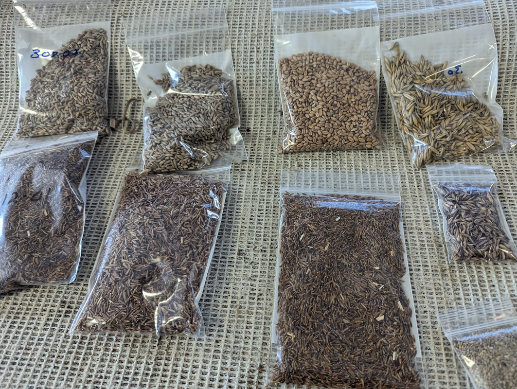
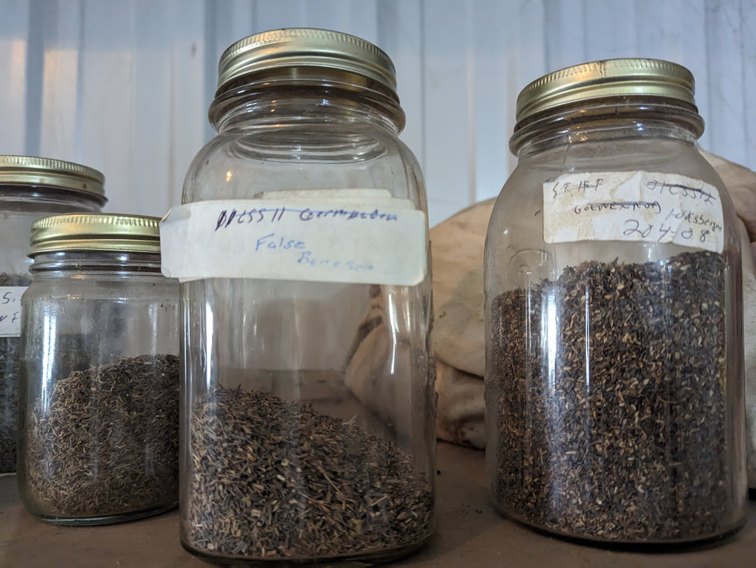
Some of the seed from Hitchcock and other county parks will be used with their permission to propagate plants in a greenhouse this winter for our native plant sale next spring. We have also made some seed packets to distribute at future events. All seed from DNR properties (state parks and wildlife areas) will stay with the DNR for prairie restoration and reconstruction projects. While we encourage the public to join us for these events, please note that seed-harvesting is generally not allowed without permission on public lands and is not allowed at all for personal use on state grounds. We teach several guidelines about sustainable harvesting, as it is possible to take too much. Make a plan to join us next year and help restore native ecosystems in western Iowa! Details will be posted at goldenhillsrcd.org/prairieseed
Our mission at Golden Hills RC&D is to collaboratively develop and lead community, conservation, and cultural initiatives to improve our quality of life in rural western Iowa. Our "official" territory from our original organizational bylaws is an eight-county region in the southwestern portion of Iowa (Cass, Fremont, Harrison, Mills, Montgomery, Page, Pottawattamie, and Shelby). In 2023, we added four more counties (Audubon, Carroll, Crawford, and Monona). Several projects extend event beyond these 12 counties into more than 20 counties (learn more about where we work).
Our goals are to develop industries in local communities that utilize local resources; ensure healthy natural resources that meet the needs of agriculture, industry, private use, and recreational facilities; promote and enhance art, culture and historic resources in rural communities; collaborate with local governments and organizations on projects that benefit the environment; and work on projects that fill gaps in community services to benefit people of southwest Iowa. We accomplish these goals by focusing our work in five program areas: outdoor recreation and tourism, land stewardship, water resources, local foods, and arts and culture. Today's focus in the new Mission Monday series is Outdoor Recreation and Tourism.
Scenic Byways
Golden Hills coordinates three scenic byways in western Iowa. Glacial Trail Scenic Byway is a 36-mile loop drive that takes some surprising turns through O'Brien, Clay, Buena Vista and Cherokee counties and the rural towns of Peterson and Linn Grove. Traveling through the corners of these four counties, the byway boasts more than its share of parks and wildlife areas. Some are rich with cultural history and natural resources. Visitors will find park structures built during the Civilian Conservation Corps era and log cabins from pioneer days.
Waterman Prairie near the Glacial Trail Scenic Byway
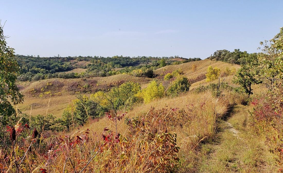
The Western Skies Scenic Byway, dedicated in 1998, is among the first state-designated scenic byways in Iowa. Western Skies offers travelers several easy opportunities to venture off the beaten path. The Byway is 142 miles long, traveling through Harrison, Shelby, Audubon and Guthrie Counties, including 14 rural towns. It is easily accessible to travelers from both Interstates 80 and 29. The byway allows visitors to explore and take in a scenic journey along Iowa’s landscapes of rolling hills, working farmsteads, and tranquil small town life.
Western Skies Scenic Byway
Situated along Iowa's western border, the Loess Hills National Scenic Byway passes through a unique land formation that is up to 15 miles wide and about 200 miles long from north of Sioux City, Iowa to near St. Joseph, Missouri. The Loess Hills National Scenic Byway began in 1989 as a grassroots effort by dedicated citizens in cooperation with Golden Hills Resource Conservation and Development, Inc. (RC&D) and the Western Iowa Tourism Region.
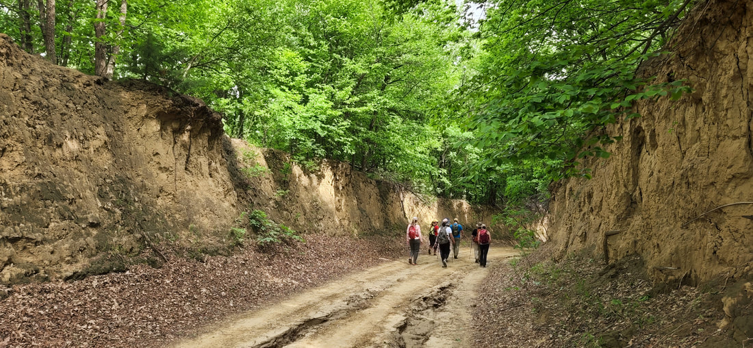
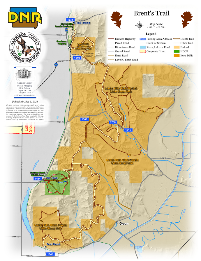
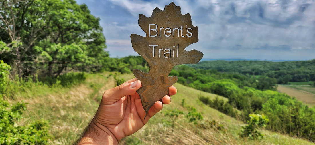
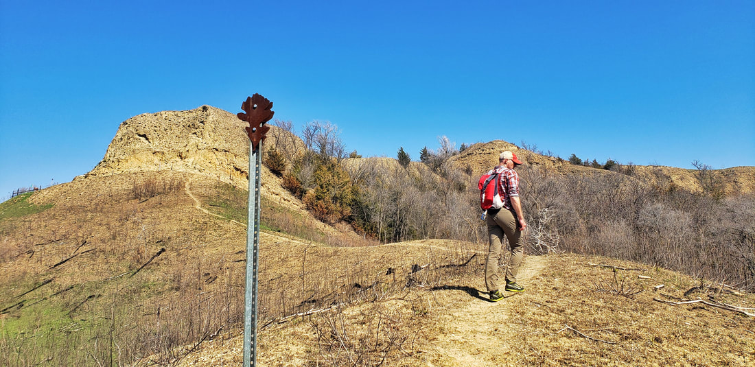
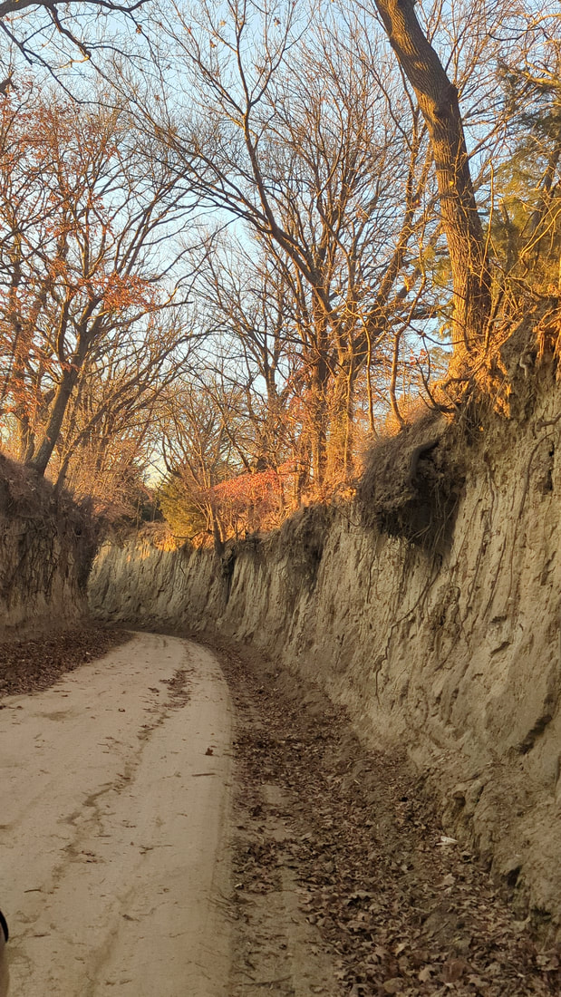
Brent's Trail
Golden Hills recently received a grant from the Harrison County Community Foundation to purchase and install trail counters on Brent's Trail. The counters will allow Golden Hills, Harrison County Conservation, and the Iowa DNR know approximately how many people are hiking Brent's Trail throughout the year.
Loess Hills Hiking Guide
Hiking is one of the best ways to explore the Loess Hills. Golden Hills has created an interactive Google Map with information about public hiking trails in the Loess Hills. Since its creation, the map has received over 100,000 views!
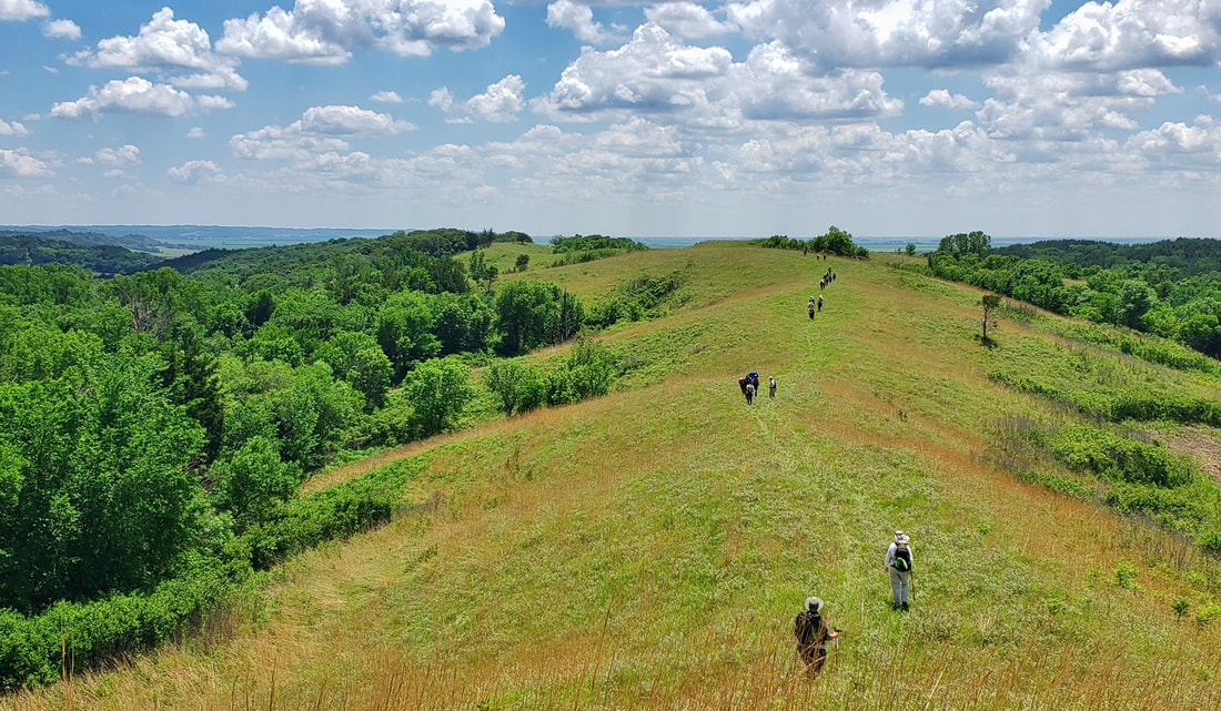
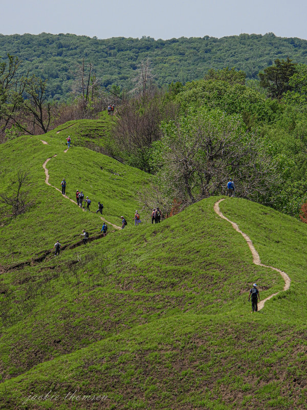
LoHi Trek
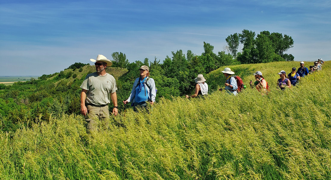
LoHi trekkers in 2021
LoHi trekkers in 2021
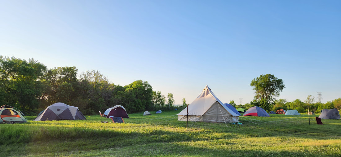
Campsite for the 2023 LoHi Trek
The previously mentioned projects are just a sampling of the work that Golden Hills does in the areas of outdoor recreation and tourism in western Iowa. We are always looking for innovative and collaborative projects to highlight the outdoor recreation and tourism opportunities in western Iowa. Read more about our work in this program area here.
Click to learn more about the Golden Hills' work in Outdoor Recreation and Tourism
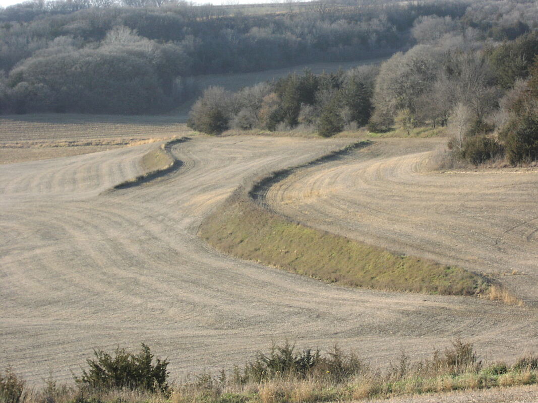
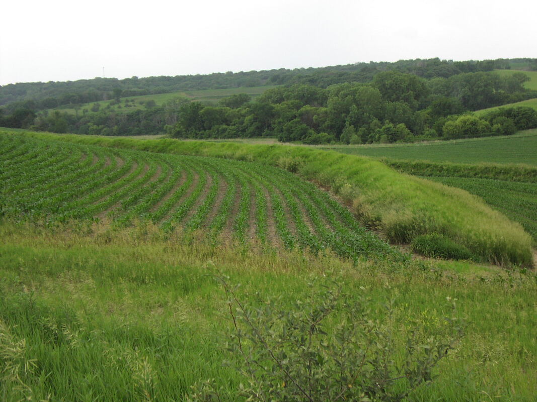
 Prairie strip As you drive one of western Iowa's scenic byways, you may be curious about the various modifications to the land that you see from the comfort of your car. If you grew up around agriculture, they might be familiar to you, however, if you are a city dweller you may be curious about the landscapes you encounter along the byways. The rolling hills along the Glacial Trail and Western Skies scenic byways, along with the rugged terrain of the Loess Hills National Scenic Byway, present various challenges to landowners as they seek to prevent soil erosion and improve water quality. Golden Hills RC&D is partnering with the USDA's Natural Resources Conservation Service on the Regional Conservation Partnership Program for the West Nishnabotna Water Quality and Infrastructure Partnership. The project will provide cost-share to landowners within the West Nishnabotna watershed to implement conservation practices that impact erosion and water quality issues. Below are short descriptions with photos of a variety of conservation practices that you can see while driving the Glacial Trail Scenic Byway, Loess Hills National Scenic Byway, or the Western Skies Scenic Byway. The RCPP program is designed to help landowners implement these conservation practices to improve water quality and prevent soil erosion. If you are a landowner within the West Nishnabotna watershed, consider attending one of several upcoming public information meetings about the program. Terraces
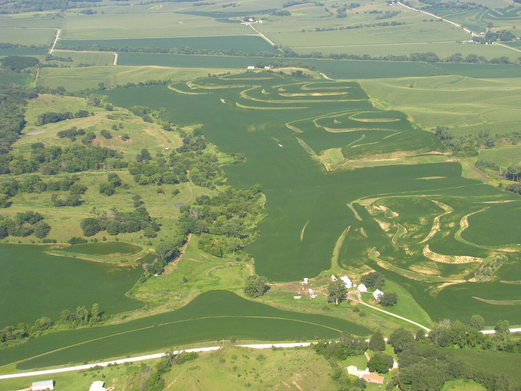 Terracing on the contour Prairie Strips
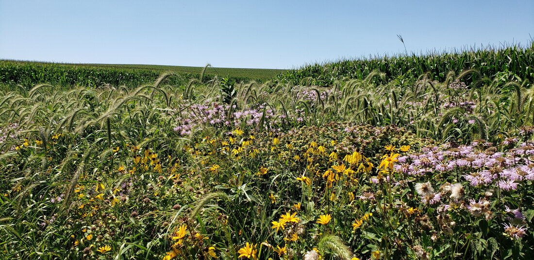
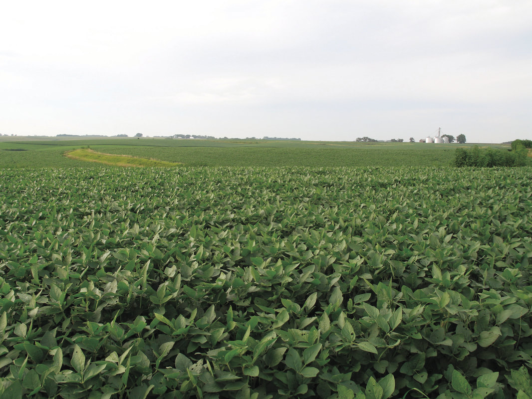
Research shows that by converting 10% of a crop-field to diverse, native perennial vegetation, farmers and landowners can reduce sediment movement off their field by 95 percent and total phosphorous and nitrogen lost through runoff by 90 and 85 percent, respectively. Prairie strips provide a win-win scenario for farmers and wildlife. (Source: What Are Prairie Strips? by Iowa State University) 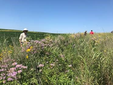 Prairie strips protect soil and water while also providing valuable wildlife habitat 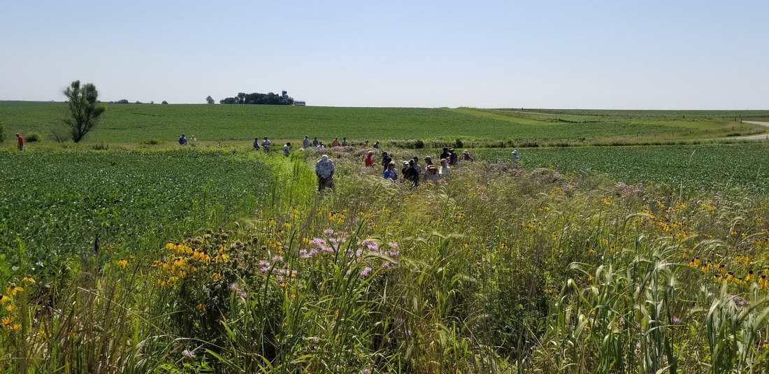 Prairie strip in a bean field 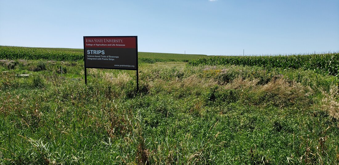 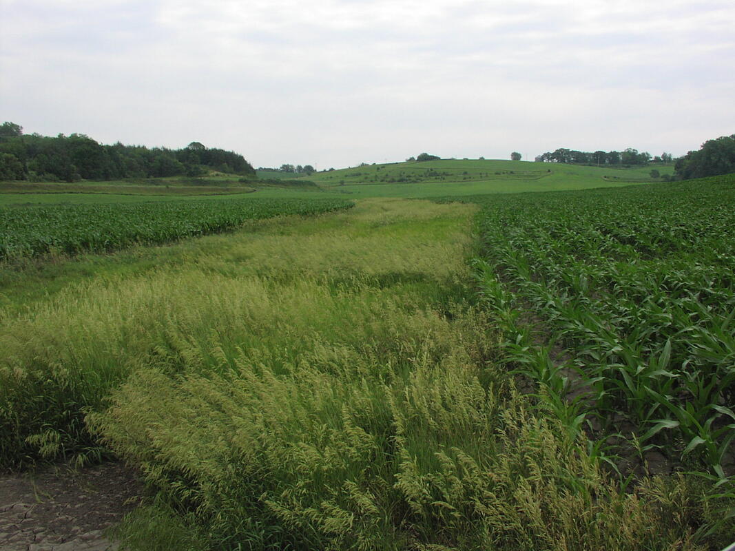 Contour buffer strips are similar to prairie strips but are usually of a fixed width, whereas prairie strips vary in width based on the amount of water they intercept Grassed Waterways
The most common areas for grassed waterways are in draws between hills, and other low lying areas on slopes where water concentrates as it runs off a field. Grassed waterways may also be used to convey runoff from terraces, diversions, or other sources of water concentrations to a stable outlet. 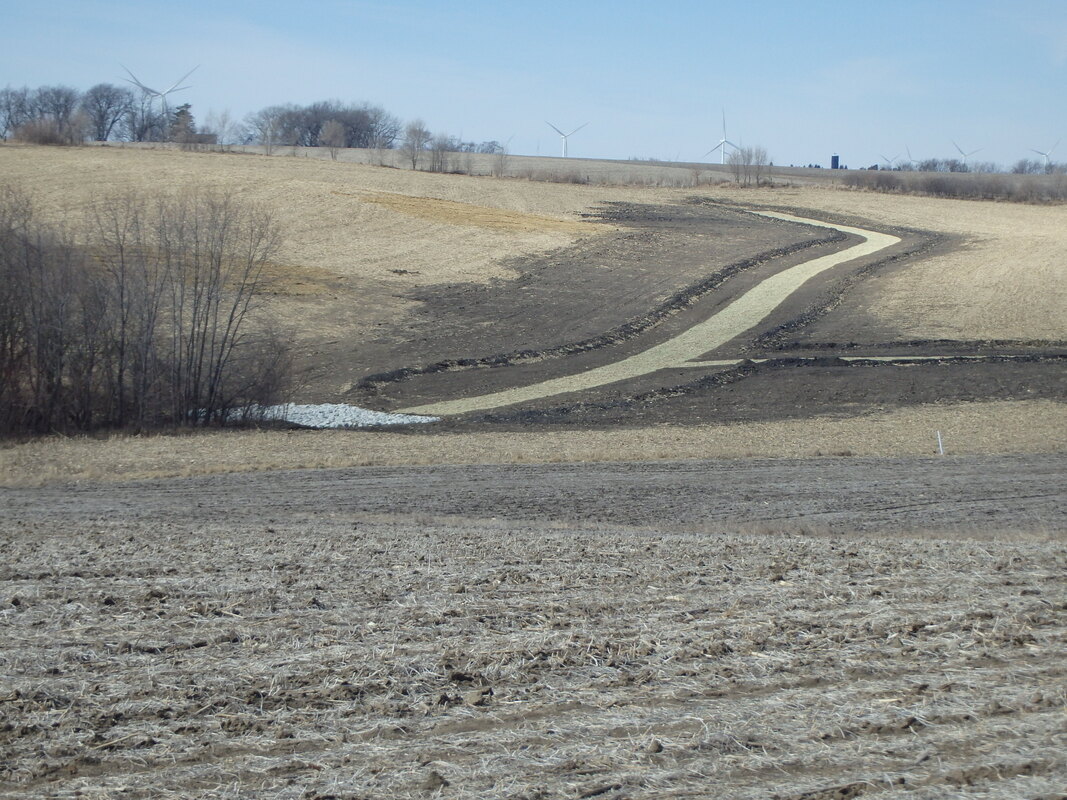 A newly constructed grassed waterway in winter 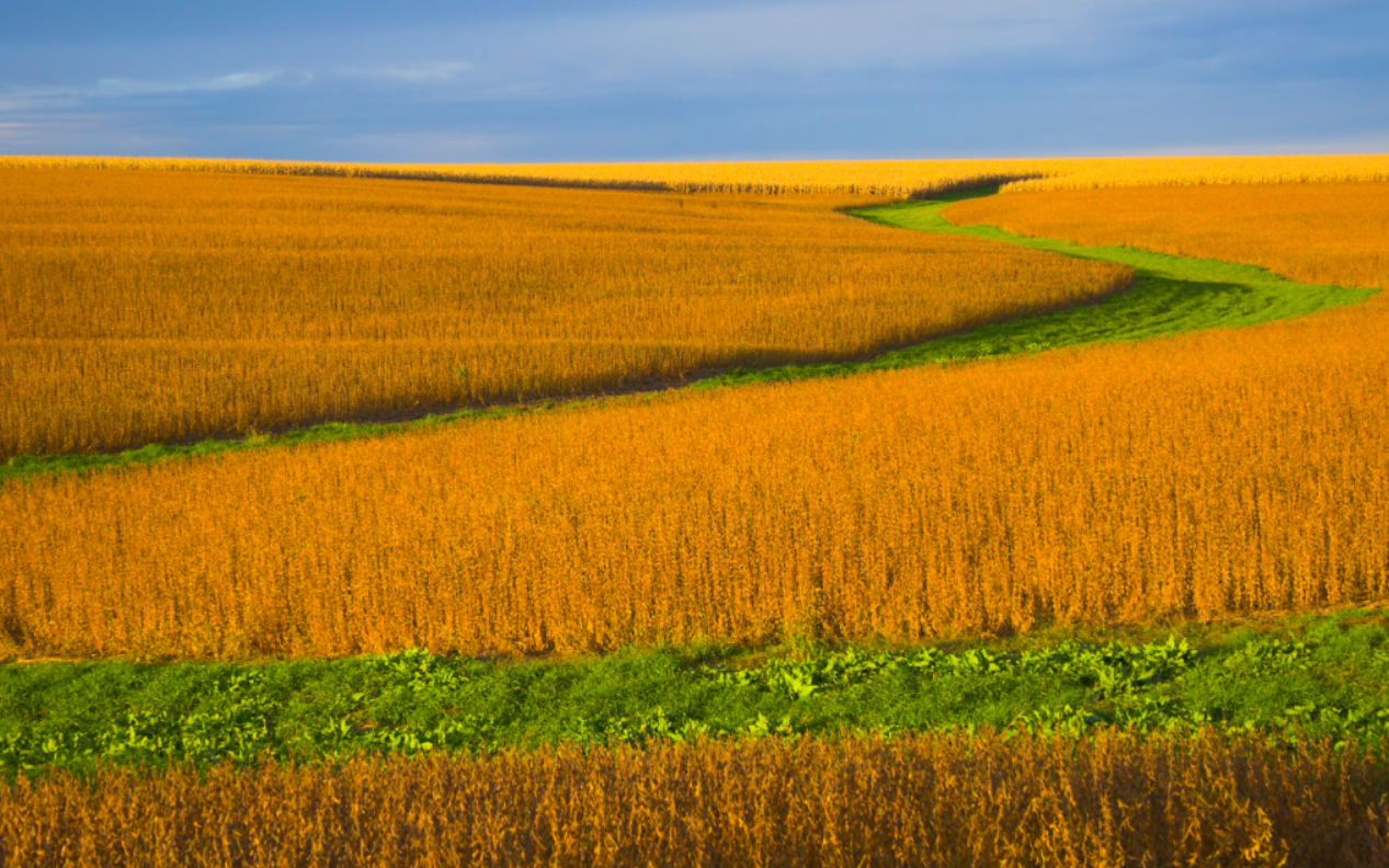 Grassed waterway 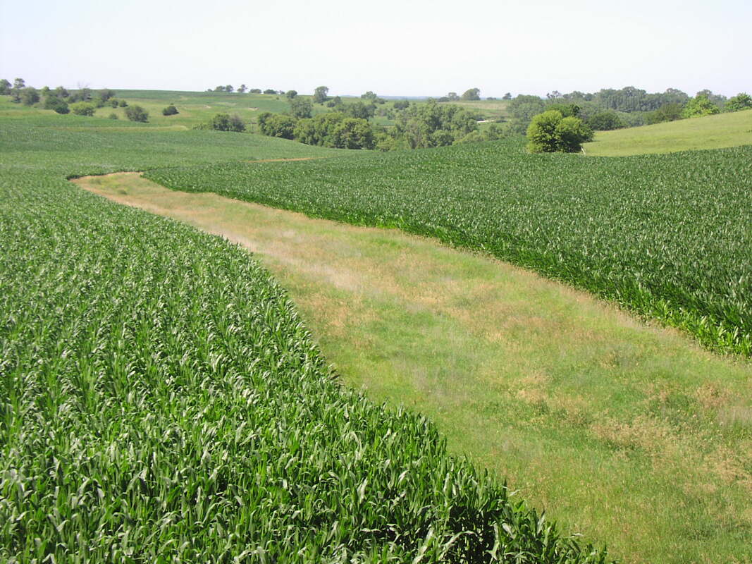 Grassed waterway Cover Crops
Common cover crops used in Iowa include winter hardy plants like rye and wheat. Other less common, but also effective, cover crops include oats, spring wheat, hairy vetch, red clover, sweet clover, turnips, rapeseed, radishes and triticale. 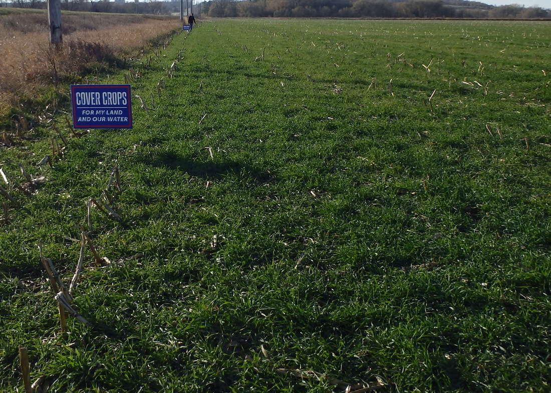 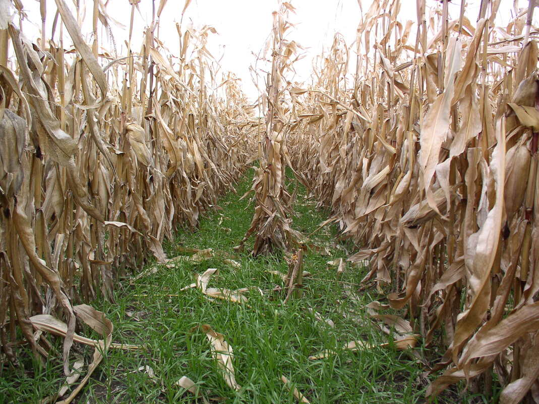 Water and Sediment Control Basins
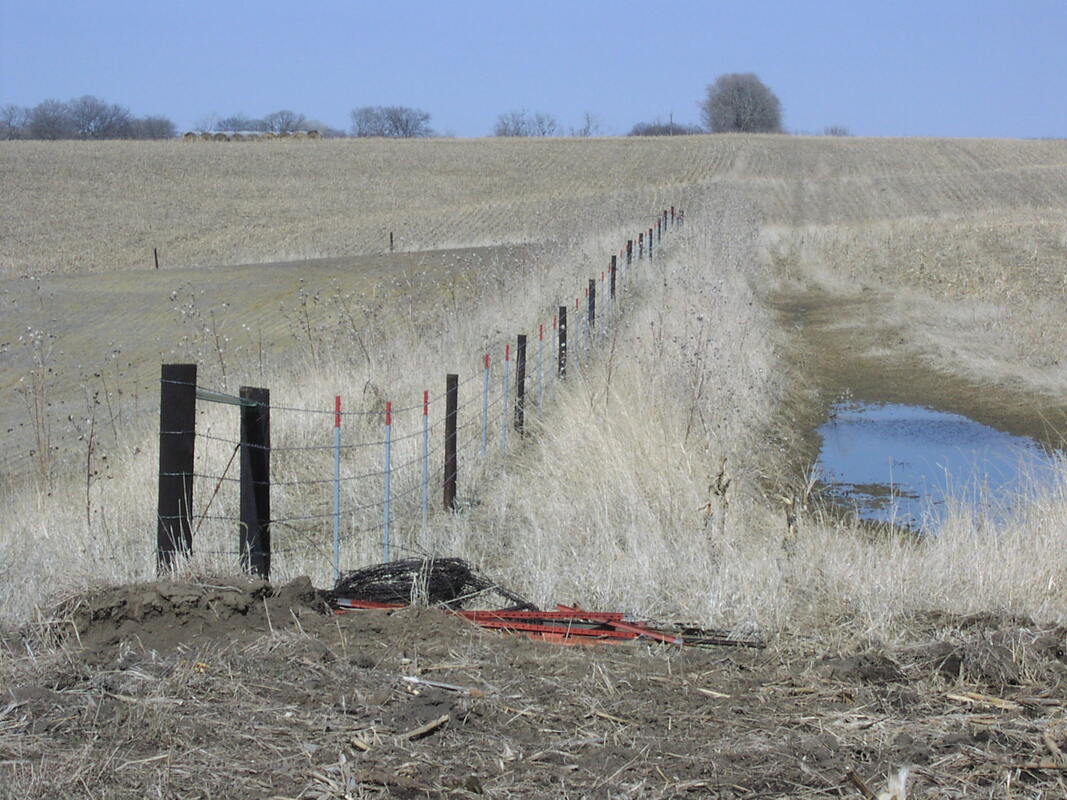 Water and Sediment Control Basin 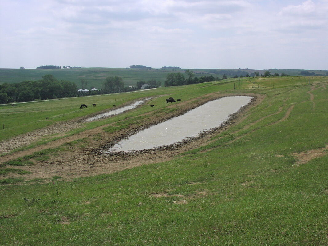 Basin terrace  Quentin (aka “Q”) and Tiffany Carritt are both Marine veterans, Q for 24 years and Tiff for 10. Q wasn’t sure what he wanted to do for a career, but that changed after hearing Joel Salatin on a podcast. While still living in California, they bought 17 acres in the Loess Hills near Crescent in 2019. They considered several states, but settled on Iowa because of family ties, as Q grew up in the western Iowa and Omaha areas. Much of the property had been conventional rowcrop for many years. One of the first things they did after buying the place was plant pasture where the crop fields had been. 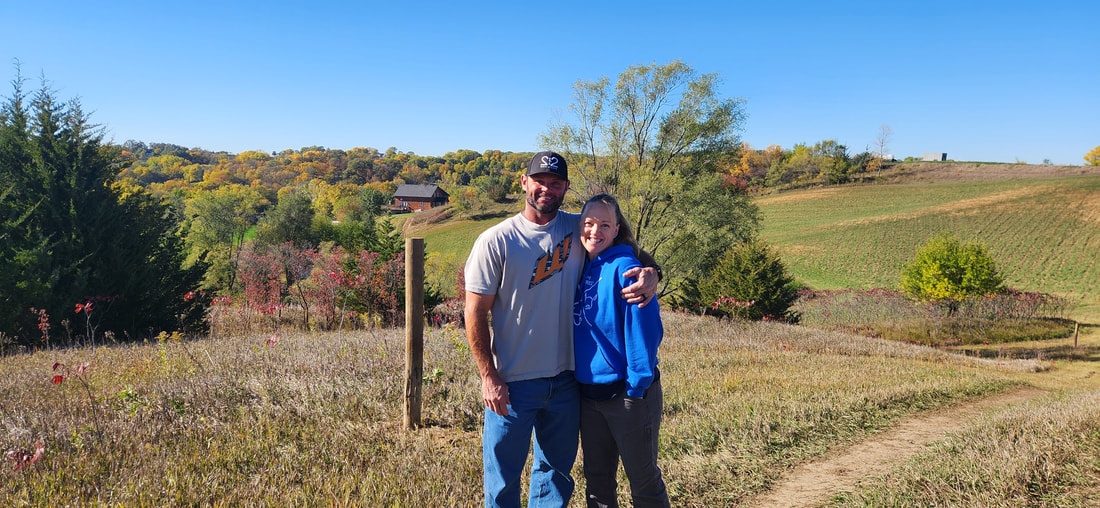 Soon after moving in, they built chicken tractors, and started with 25 meat birds in June 2019. They quickly sold out, primarily by customers advertising through word of mouth. They currently have 8 chicken tractors, with up to 30 birds in each. They process chickens once per month, spring through fall. They raise about 500 birds per year in 5-6 batches, plus one batch of turkeys ready just in time for Thanksgiving. They also have about 45 laying hens, and their eggs are often sold out. Q and Tiff were processing on-farm for a while, but now use Duncan’s Poultry. 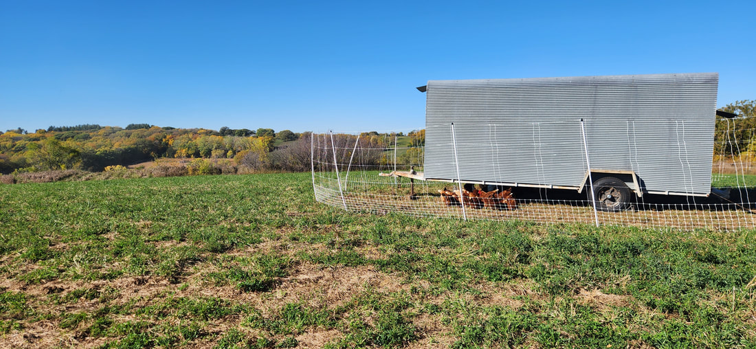 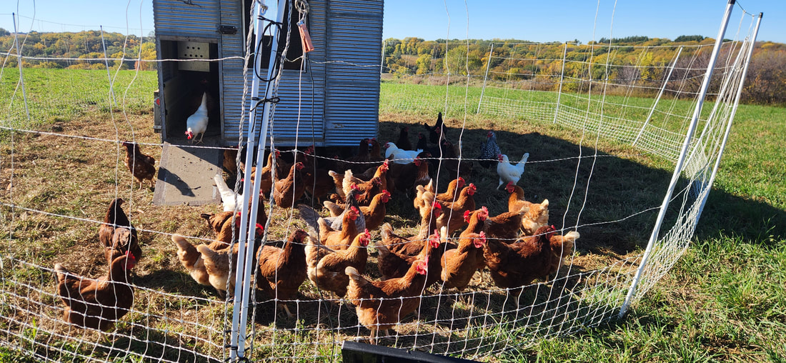 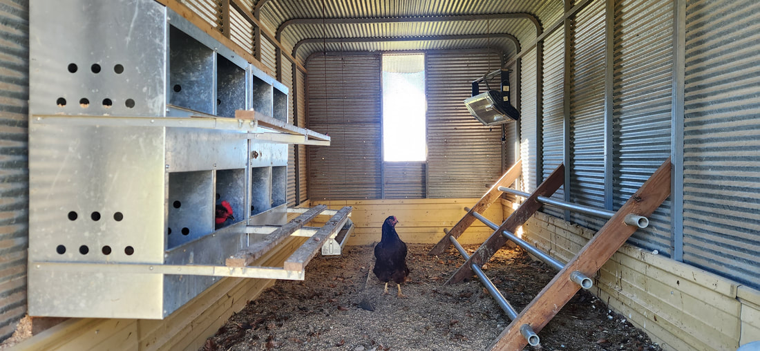 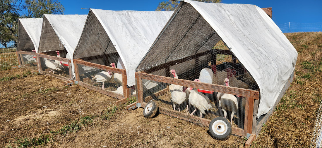 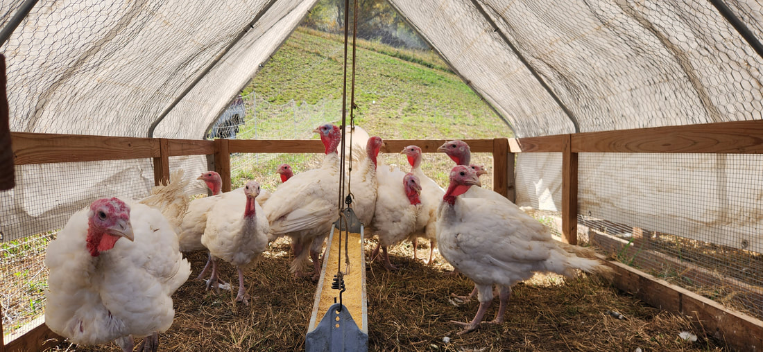 They have also spent significant time and resources on infrastructure on the farm. Besides their house, the property did not have other structures, fencing, or water for livestock. Tiffany started beekeeping and has scaled up to 5 hives, as well as mentoring several people nearby on how to keep bees. The name Paradigm Pastures comes from changing the paradigm of our modern agricultural and food systems, closer to what they used to be like. They are interested in ethical & humane animal treatment, healthy & local foods, and sustainable & regenerative agriculture. 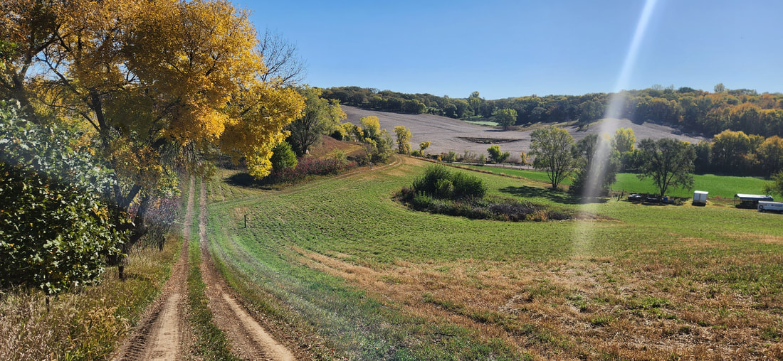 Paradigm Pastures plans to incorporate goats and pigs as soon as next year, and someday add fruit trees. In the future they would like to have an internship program too.  While primarily self-taught Q participated in the Salatin Semester program, and has attended a Grazing School with Greg Judy. He has read a lot of Salatin and Savory’s work. Tiff has participated in the Great Plains Master Beekeeper program.  The farm has some remnant prairie areas that Q & Tiff hope to restore. They also plan to add more native prairie species into the pastures.
They recently received EQIP cost-share from NRCS that is helping to build fencing and watering systems for their livestock. They are fencing in about 14 acres that will include multispecies rotational grazing. In addition to farming, Q puts his military experience to use by offering on-farm firearms training for the public. To learn more and shop Paradigm Pastures at their website and follow them on Facebook, Instagram, and YouTube.
Southwest Iowa is home to several spooky, scary sites that are popular destinations around Halloween. While some stories may just be folk tales, others are well-documented tragedies.
One of the most well-known and -visited sites is the infamous Villisca Axe Murder House in Montgomery County. In 1912, an entire family and two neighbor kids were killed overnight in their home. The killer was never caught. You can now stay in the house overnight, and many people who have done so report that the house is haunted. 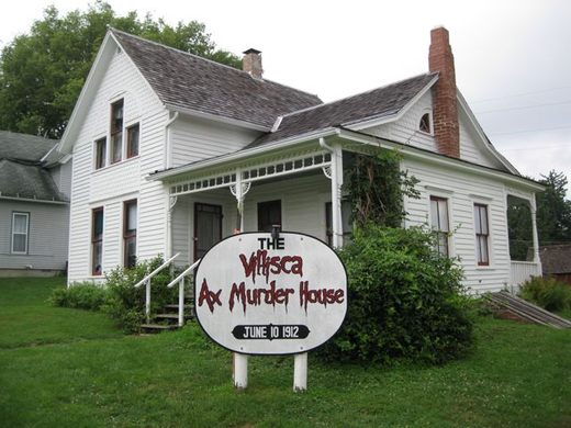
Villisca Axe Murder house. Image source: https://www.atlasobscura.com/places/villisca-axe-murder-house

Local 1912 newspaper article about the Villisca Axe Murders. Image source: https://www.atlasobscura.com/places/villisca-axe-murder-house
Earling, in Shelby County, is the site of a 1973 exorcism that has even inspired horror movies:
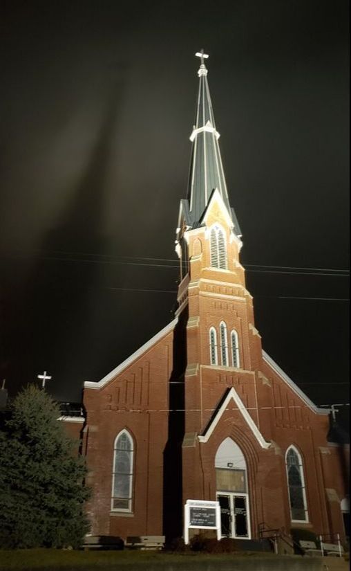
Saint Joseph Catholic Church in Earling, Iowa. photo by Lance Brisbois.
Council Bluffs has several reportedly-haunted sites, including the Squirrel Cage Jail and Black Angel Statue in Fairview Cemetery.
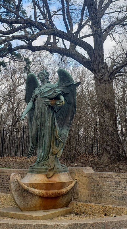
Black Angel statue in Council Bluffs. photo by Lance Brisbois.
In Mills County, Malvern Manor has been featured on two different paranormal TV shows. Serious paranormal investigators have spent significant amount of time at the Manor, and continue to host tours and overnight stays for those interested in learning more or ghost hunting.
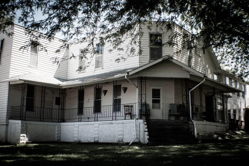
Malvern Manor in Malvern, IA. Photo from https://www.facebook.com/malvernmanoria
What are your favorite spots to visit around Halloween?
Tyler Bartley has been farming with Sown Local Foods farm in Malvern, Iowa for seven seasons. He was initially inspired to start by Jean-Martin Fortier and others, primarily online. Tyler took some small business classes with Iowa Western that helped with the business aspects of starting a small farm, and is currently enrolled in Golden Hills’ Dream to Farm program. Otherwise, most of his knowledge has been gained by experience. Tyler has a marketing and communications background, and has worked a variety of service-sector and manual labor jobs. These skills have come in handy for farming. Tyler started with Jeremy Davis as his business partner. Now Roger Johnson is his business partner, and the farm includes 5 acres are on Roger's land. Roger was previously Tyler’s father’s business partner for many years.  The farm is located on the west edge of Malvern, partly within city limits. Sown Local started with about one acre on east side of a road, and has now expanded to include an additional 5 acres across the road. The east side of road was once a chicken hatchery and the soil has a lot of gravel. The west side of the road was conventional corn/soybean fields until recently. The west side of the farm runs along Silver Creek and includes a buffer strip of CRP prairie. Due to its low-lying proximity to the creek, the farm is located on a floodplain and has experienced flooding in the past. The farm had four high tunnels then received Environmental Quality Incentives Program (EQIP) funding through the Natural Resources Conservation Service (NRCS) for an additional 115’ x 20’ high tunnel that used a Tunnel Vision kit. The farm uses a water wagon for watering. A new well was drilled in 2023 but haven’t tested water quality yet. 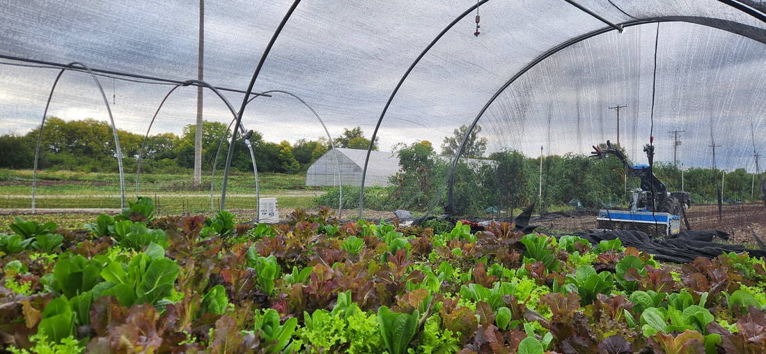 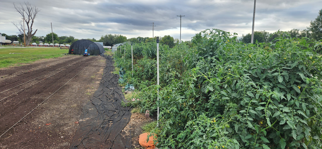 During the peak season, Tyler sells 60-100 pounds of greens to Clean Slate, a meal prep business based in Omaha. Sown Local also sells at the Malvern Farmers Market regularly. They used to do Aksarben Farmers Market in Omaha, but not in 2023. Tyler has occasionally sold at the Red Oak Farmers Market too. Sown Local has sold some to FarmTable Delivery, and in the past couple years has used the Local Food Purchase Assistance (LFPA) program to sell food to local school districts in rural southwest Iowa. Tyler is interested in adding a CSA (community supported agriculture), and is gaging interest in that as well. The farm, like many businesses, has had issues finding high-quality, reliable labor. Currently Tyler and Roger are the only employees. Tyler would like to be farming fulltime with no off-farm job, but still has an occasional part-time job to help pay the bills. 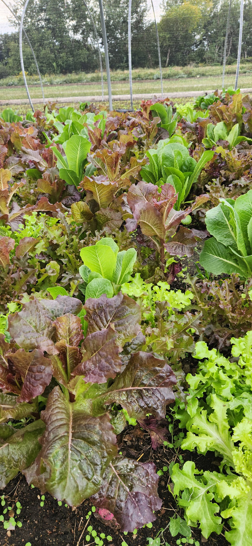 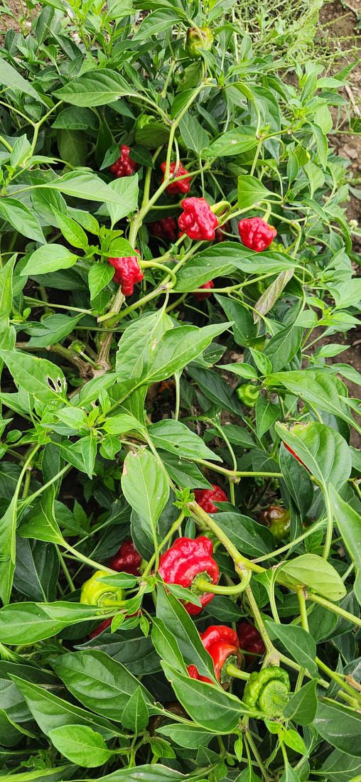  Sown Local uses organic practices but is not Certified Organic. Instead of herbicides, Tyler uses a flame weeder. He is interested in sustainability , and enjoys experimenting with new crops and practices. Tyler also has a foraging license and is interested in selling mushrooms in the future. Stay tuned on future updates from Sown Local by following their Facebook page and Instagram.
 Broken Kettle Grasslands (© 2016 Kenneth West) The Loess Hills National Scenic Byway offers over 200 miles on paved roads, plus over 150 miles of excursion loops on paved and gravel roads. Driving the entire byway and its loops will take more than one day. However, if you want a scenic fall drive to view the spectacular fall colors, we've compiled a list of six routes that take in various sites along the byways. Stop in the communities along the way for local flavor, from restaurants to shops. Fall is a wonderful time to explore the Loess Hills National Scenic Byway!  Click to open in a new window.  Waubonsie, Riverton, Sidney, and Thurman Click to open in a new window.
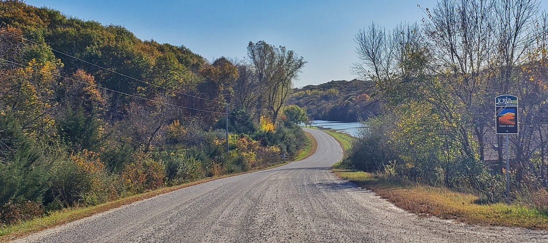
  Tabor, Glenwood, and Pony Creek Lake
Hitchcock Loop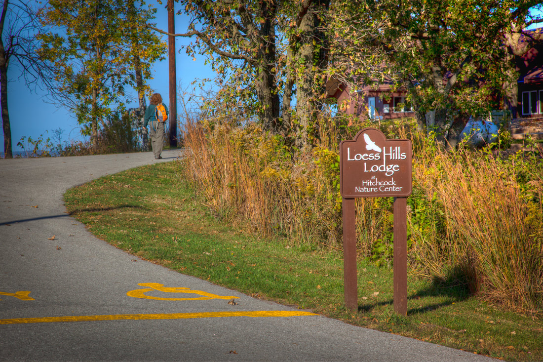
Loess Hills State Forest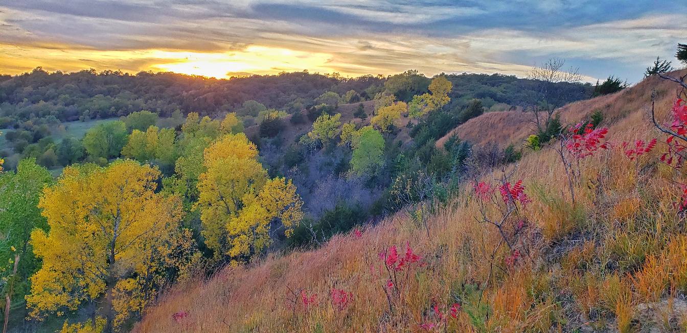
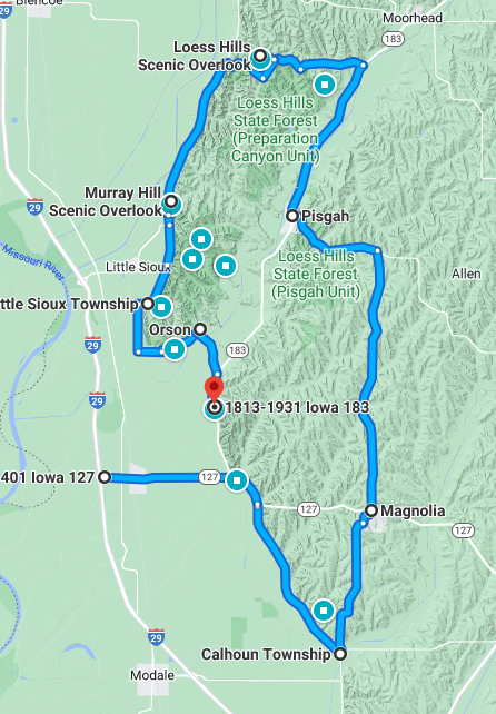
 Monona County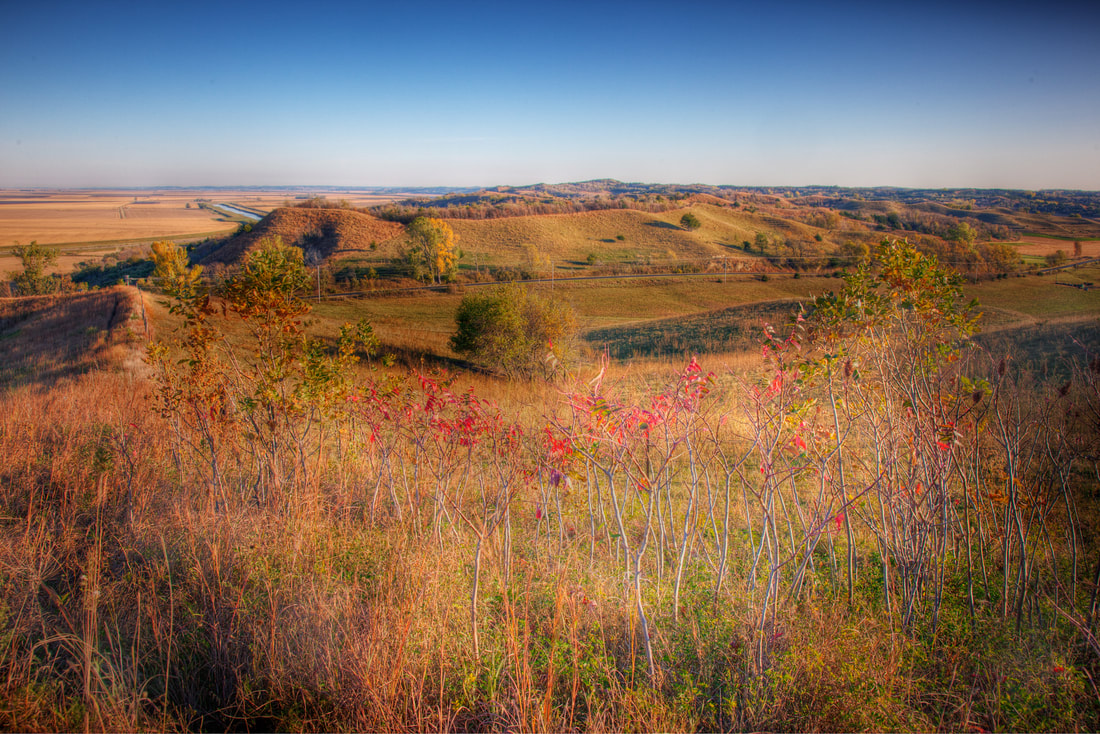
|
Archives
April 2024
Categories
All
|


 RSS Feed